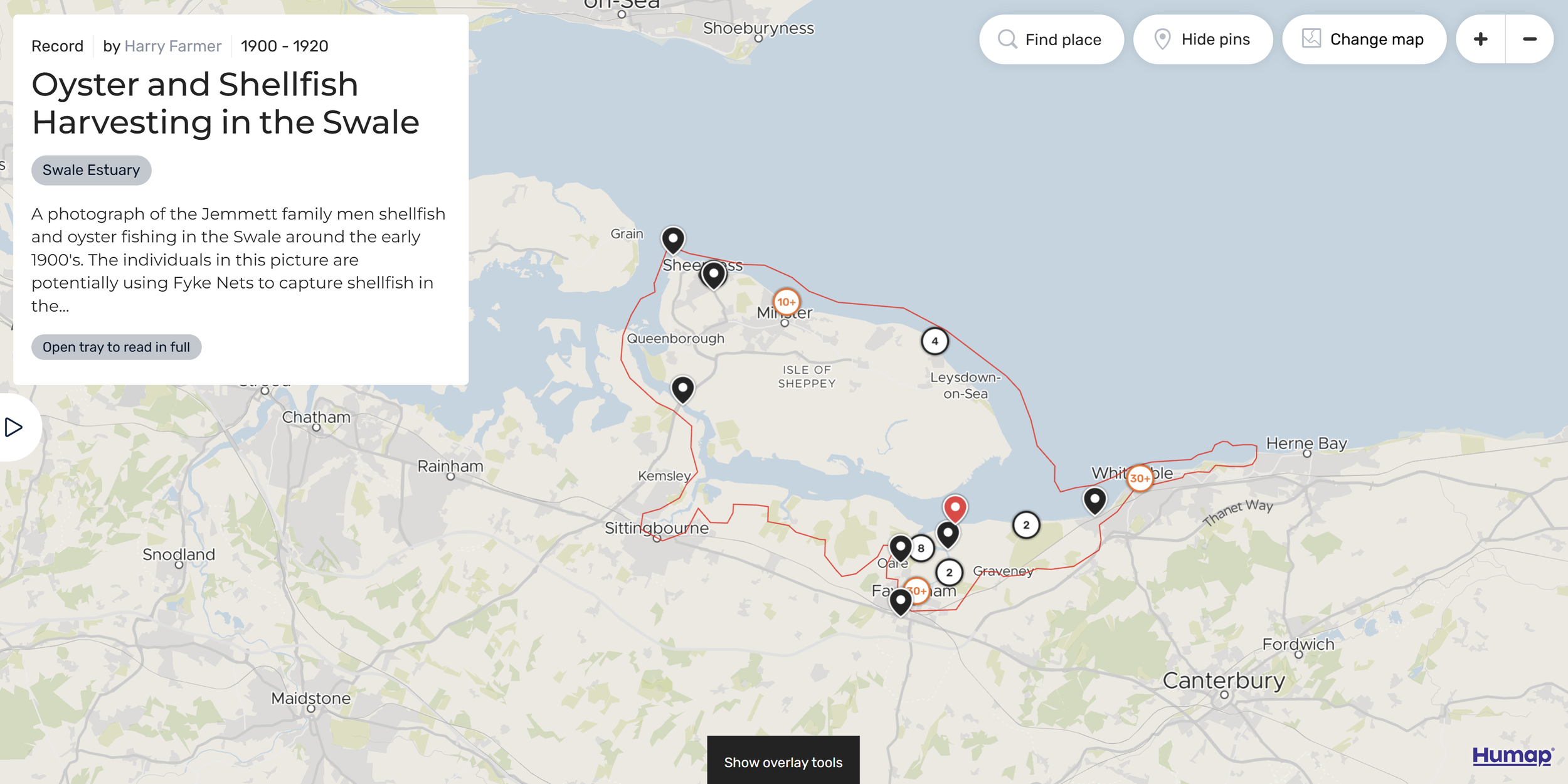
Oyster and Shellfish Harvesting in the Swale
The latest from the Coasts in Mind Swale Estuary team!
Over the Edge: Coastal erosion at Warden Point
Explore the collection of war-time archaeological remains at Warden Point and the effects of erosion along one of the most 'at risk' coastlines in England in Coasts in Mind’s new story map.
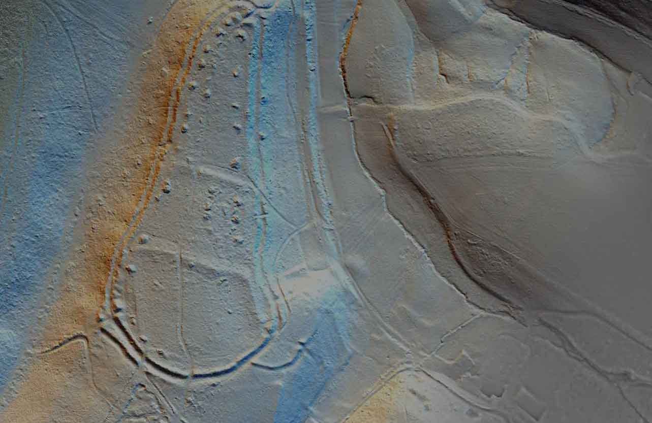
Kent LiDAR Portal
The Kent LiDAR Portal makes available imagery from various LiDAR datasets from across the county, including the recently obtained high resolution data covering over 190 square km along the Darent Valley and area of the Sevenoaks Commons, at the western end of the Kent Downs AONB.
Kent Maps Online
Kent Maps Online provides a set of themed essays about Kent, a county in South East England, which include interactive maps and images.

Kent Historic Environment Record
The Historic Environment Record is an extensive collection of information relating to Kent’s heritage. The database contains information about 40,000 archaeological discoveries and 18,000 listed buildings, landscapes, excavations and library sources. The HER also contains more than 6,500 archaeological reports as well as aerial photographs and maps.

Kent Landscape Information System
The Kent Landscape Information Sytstem (KLIS) contains details on countryside access, landscape character, identifies opportunities for habitat creation and landscape restoration, the Kent habitat survey as well as areas designated for their conservation value.

Ordnance Survey Maps
Maps published by Ordnance Survey and related bodies, including the War Office (ca. 1840s-1960s).
Categories
The Maps section of the Kent Archaeological Society website brings together a diverse and expanding collection of cartographic resources that explore the archaeology, history, and landscape of Kent. This includes historic maps, thematic mapping projects, and a growing range of interactive tools that allow users to engage directly with spatial data. Resources such as Kent Maps Online combine essays with interactive maps and images, while linked datasets like the Historic Environment Record provide access to thousands of archaeological sites, buildings, and landscapes across the county . Together, these materials offer both visual context and analytical insight, supporting research, education, and public exploration of Kent’s past.
We invite individuals, local societies, researchers, and digital practitioners to contribute mapping resources to help expand this section. Submissions may include historic or modern maps, GIS-based projects, geophysical surveys, site plans, and especially interactive maps that allow users to explore data dynamically. Contributions that link spatial information with archaeological interpretation—whether through web mapping platforms, annotated datasets, or visual storytelling—are particularly encouraged, as they enhance understanding of Kent’s heritage in new and engaging ways.
Selected contributions may be featured within the Society’s Maps section to support research, teaching, and wider public engagement. When submitting, please provide relevant details such as title, creator, date, geographic coverage, and a description of the content, along with any links or access requirements for interactive material. Our editorial team may make minor adjustments for clarity or presentation. By contributing, you help build a rich and evolving cartographic resource that maps the complexity and depth of Kent’s archaeological and historical landscape.