Archaeologia Cantiana, Volume CXLII (2021)

Covers

PDF Link

List of Officers and Members of Council vi-vii; Editorial Personnel vii; Committees, etc.

PDF Link

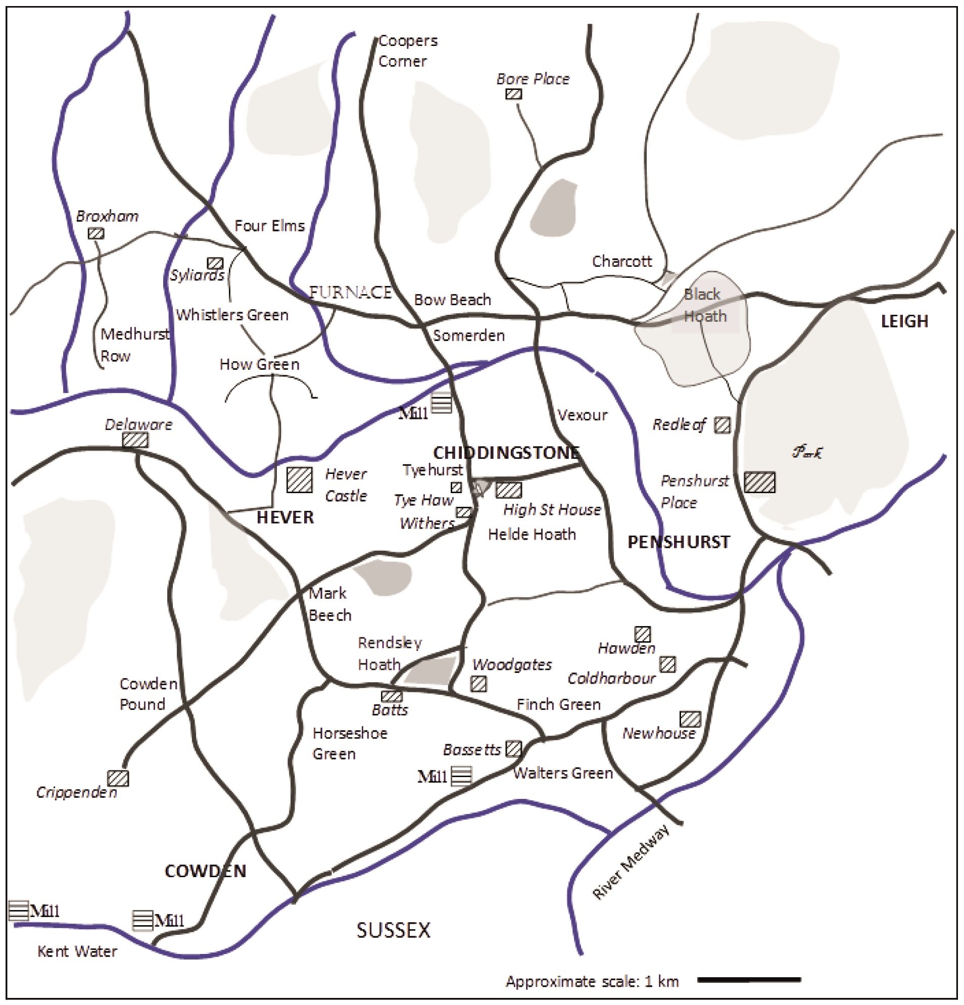
1. Gavelkind on the Ground, 1550-1700

Imogen Wedd

PDF Link

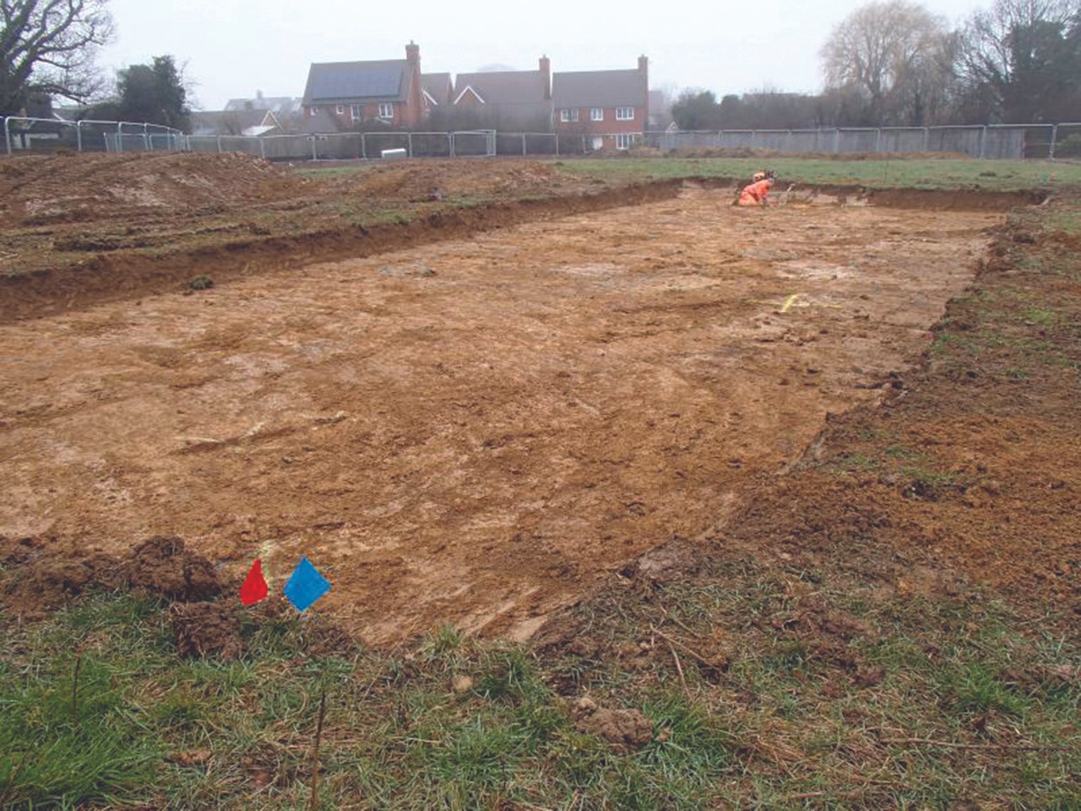
2. Bigbury Camp and its associated earthworks: recent archaeological research

Christopher Sparey-Green

PDF Link

3. William Clinton, Earl of Huntingdon, and the county of Kent: a study of magnate service under Edward III

Matthew Raven

PDF Link

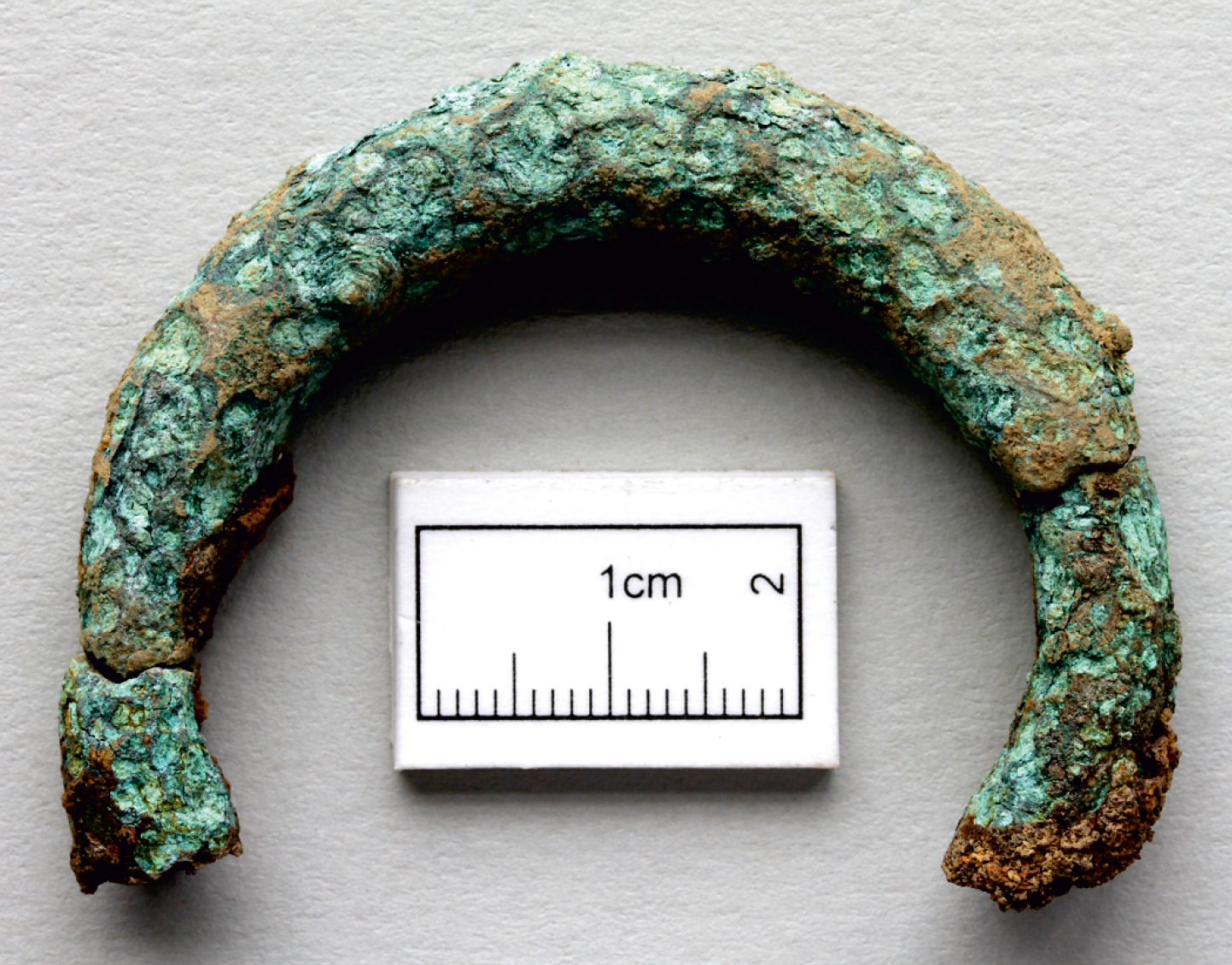
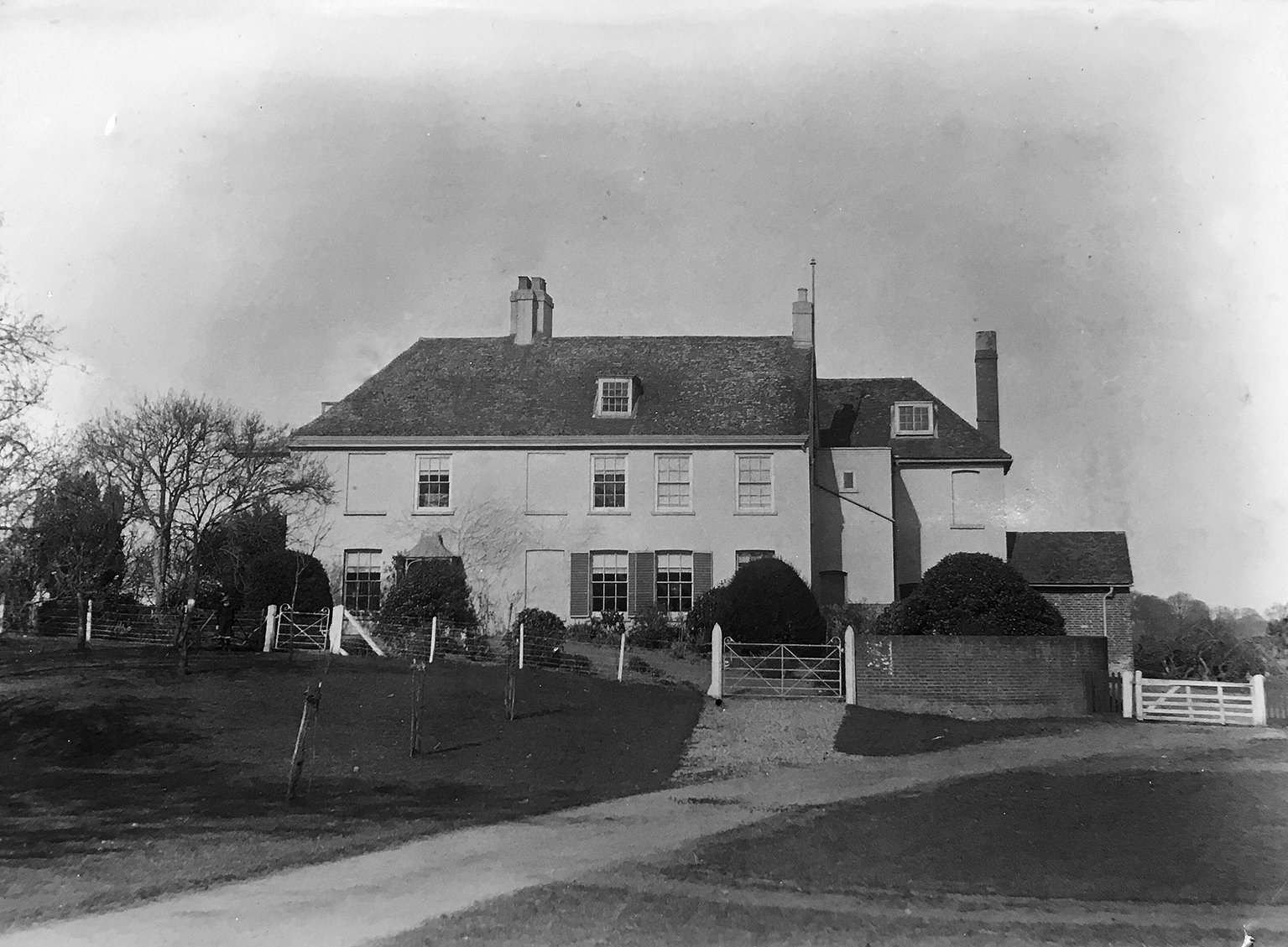
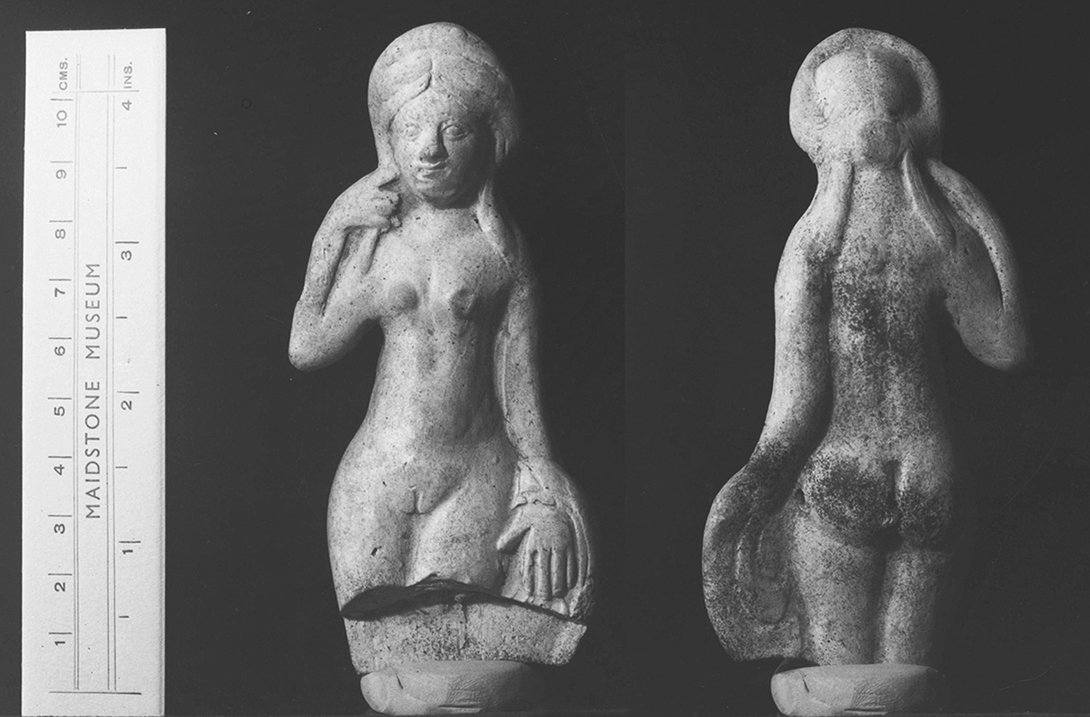
4. The middle/late Iron Age and Roman finds made by Antoinette Powell-Cotton

Vera and Trevor Gibbons

PDF Link

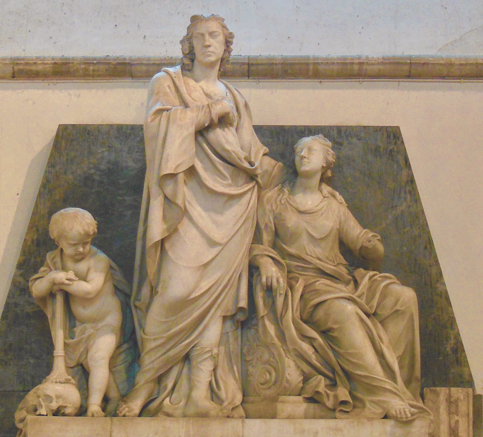
5. The Kentish associations of a great West Indian planter: Sir William Young (1725-1788)

P.J. Marshall

PDF Link

6. Evidence of a late Iron Age/early Roman settlement and an early medieval strip field system

Hayley Nicholls

PDF Link

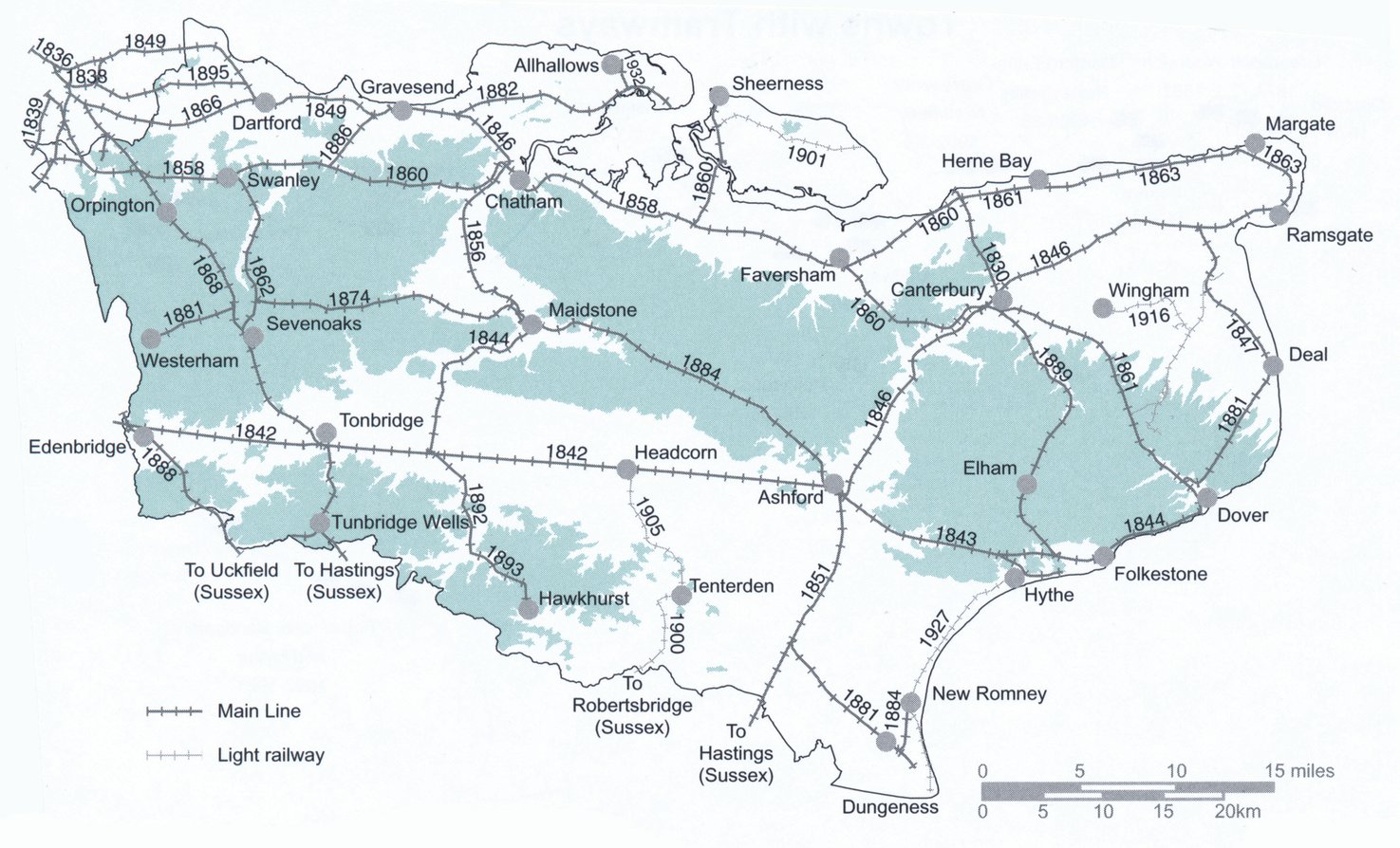
7. Rail, Risk and Repasts – The Dining Culture of the London, Chatham & Dover Railway, 1888-99

Iain Taylor

PDF Link

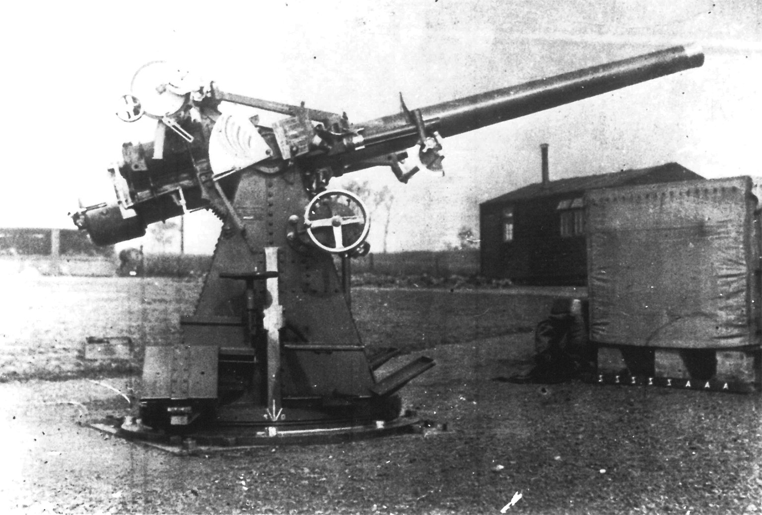
8. Kent’s twentieth-century Military and Civil defences. Part 5 – Swale

Victor T.C. Smith

PDF Link

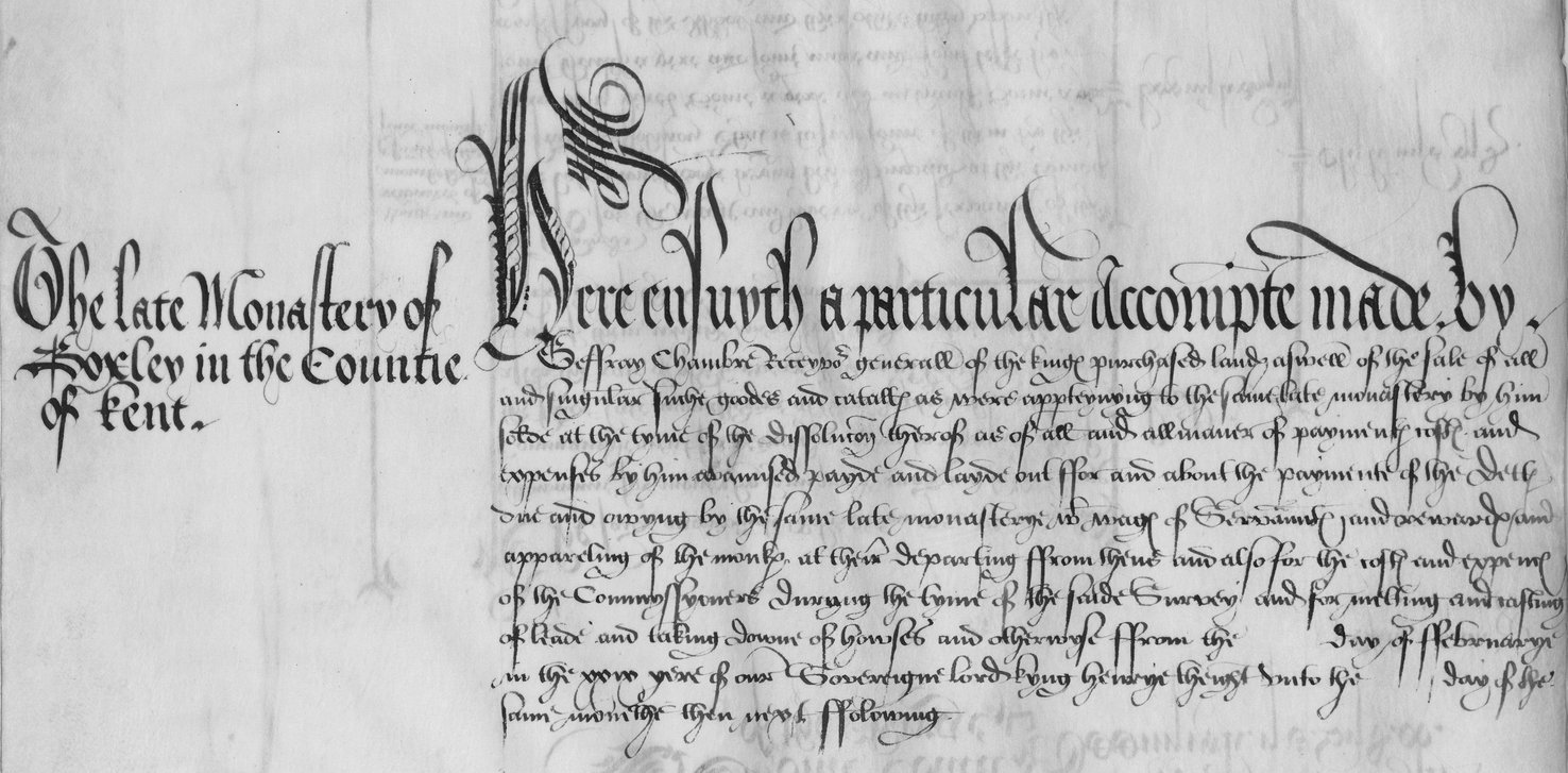
9. The Late Monastery of Boxley in the Countie of Kent

Michael Carter

PDF Link

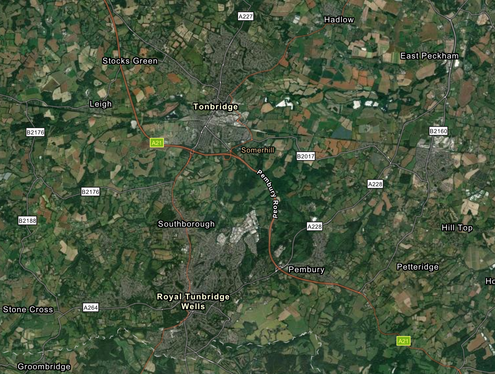
10. Prehistoric to Medieval Discoveries along the A21 Tonbridge-Pembury dualling scheme

Tim G. Allen

PDF Link

11. The Manor of Elverton in the parish of Stone next Faversham

Duncan Harrington

PDF Link

12. The Roman building at Chart Sutton revisited

Deborah Goacher

PDF Link

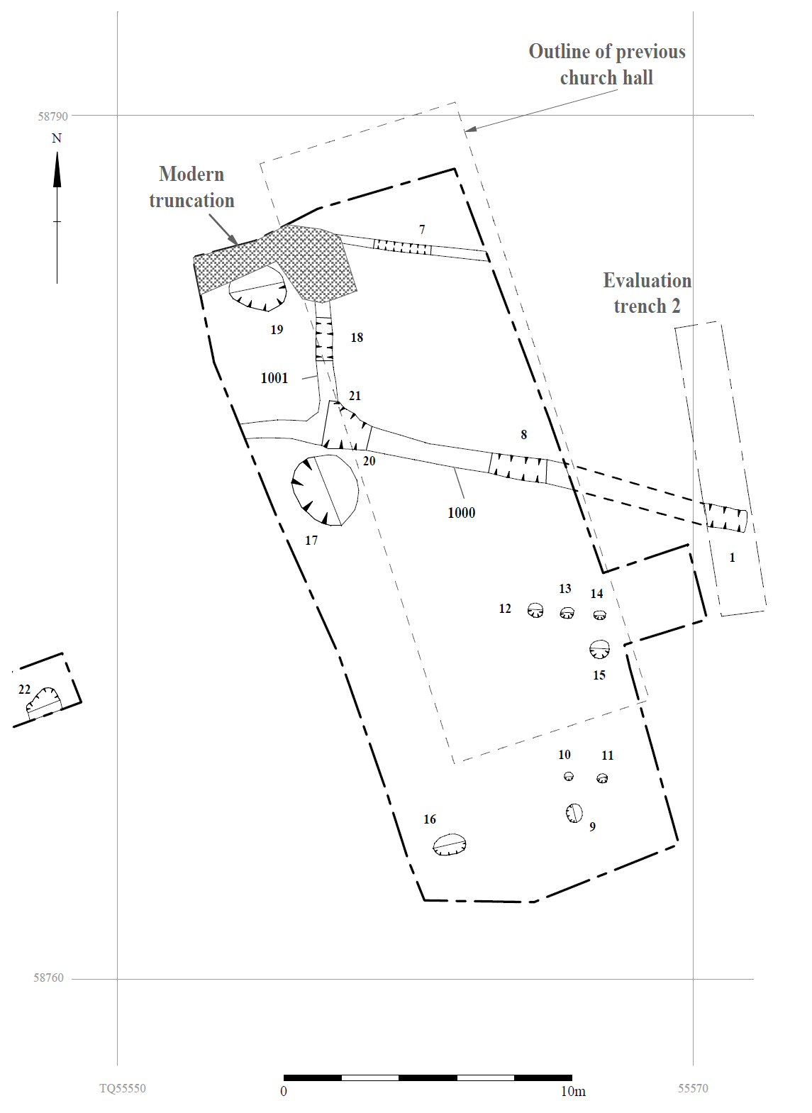
13. Evidence of Late Roman Settlement near the site of the Church Hall, Kemsing

Sean Wallis

PDF Link

14. Near the heart of Romano-British Durovernum: Excavations at 70 Stour Street, Canterbury

Damien Boden and Jake Weekes

PDF Link

15. Researches and Discoveries

Multiple contributions including on St Thomas Becket, Alexander Iden, and the ‘Hales Palace’ Estate Map

PDF Link

16. Reviews

Various reviews including works by Francis Wenban-Smith, Elizabeth Stafford, and others

PDF Link

17. Kentish Bibliography

PDF Link

18. Notes on Contributors

PDF Link

19. General Index

PDF Link
ARCHÆOLOGIA CANTIANA ‌CONTENTS Gavelkind on the Ground, 1550-1700. By Imogen Wedd . . . . . . . . . . . . . . . Bigbury Camp and its associated earthworks: recent archaeological research. By Christopher Sparey-Green . . . . . . . . . .. . . . . . . . .. . . . . . . . . . . . . . . . William Clinton, Earl of Huntingdon, and the county of Kent: a study of magnate service under Edward III. By Matthew Raven . . . . . . . . . . . . . . . The middle/late Iron Age and Roman finds made by Antoinette Powell- Cotton on the foreshore and cliff top at Minnis Bay, Birchington. By Vera and Trevor Gibbons . . . . . . . . . . . . . . . . . . . . . . . . . . . . . . . . . . . The Kentish associations of a great West Indian planter: Sir William Young (1725-1788) and his monument at Chartham. By P.J. Marshall . . . . . . . . . . . . . . . . . . . . . . . . . . . . . . . . . . . . . . . . . . . . Evidence of a late Iron Age/early Roman settlement and an early medieval strip field system at Shadoxhurst. By Hayley Nicholls . . . . . . . . . . . . . . . Rail, Risk and Repasts – The Dining Culture of the London, Chatham & Dover Railway, 1888-99. By Iain Taylor . . . . . . . . . . . . . . . . . . . . . . . . . . Kent’s twentieth-century Military and Civil defences. Part 5 – Swale. By Victor T.C. Smith . . . . . . . . . . . . . . . . . . . . . . . . . . . . . . . . . . . . . . . . . . The Late Monastery of Boxley in the Countie of Kent: Court of Aug- mentations accounts for the dissolving of Boxley Abbey. By Michael Carter . . . . . . . . . . . . . . . . . . . . . . . . . . . . . . . . . . . . . . . . . . Prehistoric to Medieval Discoveries along the A21 Tonbridge-Pembury dualling scheme. By Tim G. Allen . . . . . . . . . . . . . . . . . . . . . . . . . . . . . . . The Manor of Elverton in the parish of Stone next Faversham. By Duncan Harrington . . . . . . . . . . . . . . . . . . . . . . . . . . . . . . . . . . . . . . The Roman building at Chart Sutton revisited. By Deborah Goacher. Evidence of Late Roman Settlement near the site of the Church Hall, Kemsing. By Sean Wallis . . . . . . . . . . . . . . . . . . . . . . . . . . . . . . . . . . . . . Near the heart of Romano-British Durovernum: Excavations at 70 Stour Street, Canterbury. By Damien Boden and Jake Weekes . . . . . . . . . . . . . . . Researches and Discoveries . . . . . . . . . . . . . . . . . . . . . . . . . . . . . . . . . . . . . . Reviews . . . . . . . . . . . . . . . . . . . . . . . . . . . . . . . . . . . . . . . . . . . . . . . . . . . . Kentish Bibliography . . . . . . . . . . . . . . . . . . . . . . . . . . . . . . . . . . . . . . . . . . . PAGE 1 31 59 81 105 118 132 148 176 188 235 253 273 286 299 333 347 ARCHÆOLOGIA CANTIANA 2021 2021 VOL. 142 www.kentarchaeology.org.uk Kent Archaeological Society image ‌Archæologia Cantiana image Images of Kent No. 17. Lymne (Lympne) castle, dated 1773. From the KAS Library Collections ( Kent Drawings, Vol 2). Archæologia Cantiana Being Contributions to the History and Archaeology of Kent image VOLUME CXLII 2021 Published by the KENT ARCHÆOLOGICAL SOCIETY Charitable Incorporated Organization no. 1176989 © 2021 Kent Archaeological Society ISSN 0066-5894 Produced for the Society by Past Historic, Kings Stanley, Gloucestershire Printed in Great Britain CONTENTS List of Officers and Members of Council vi-vii; Editorial Personnel vii; Committees, etc. viii Gavelkind on the Ground, 1550-1700. By Imogen Wedd . . . . . . . . . Bigbury Camp and its associated earthworks: recent archaeological research. By Christopher Sparey-Green . . . . . . . . . . . . . . . . . . . . William Clinton, Earl of Huntingdon, and the county of Kent: a study of magnate service under Edward III. By Matthew Raven . . The middle/late Iron Age and Roman finds made by Antoinette Powell-Cotton on the foreshore and cliff top at Minnis Bay, Birch- ington. By Vera and Trevor Gibbons . . . . . . . . . . . . . . . . . . . . . . The Kentish associations of a great West Indian planter: Sir William Young (1725-1788) and his monument at Chartham. By P.J. Marshall . . . . . . . . . . . . . . . . . . . . . . . . . . . . . . . . . . . . . . Evidence of a late Iron Age/early Roman settlement and an early medieval strip field system at Shadoxhurst. By Hayley Nicholls . . . Rail, Risk and Repasts – The Dining Culture of the London, Chatham & Dover Railway, 1888-99. By Iain Taylor . . . . . . . . . . . . . . . . . . Kent’s twentieth-century Military and Civil defences. Part 5 – Swale. By Victor T.C. Smith . . . . . . . . . . . . . . . . . . . . . . . . . . . . . . . . . . . . The Late Monastery of Boxley in the Countie of Kent: Court of Aug- mentations accounts for the dissolving of Boxley Abbey. By Michael Carter . . . . . . . . . . . . . . . . . . . . . . . . . . . . . . . . . . . . . Prehistoric to Medieval Discoveries along the A21 Tonbridge- Pembury dualling scheme. By Tim G. Allen . . . . . . . . . . . . . . . . . . . The Manor of Elverton in the parish of Stone next Faversham. By Duncan Harrington . . . . . . . . . . . . . . . . . . . . . . . . . . . . . . . . . The Roman building at Chart Sutton revisited. By Deborah Goacher. Evidence of Late Roman Settlement near the site of the Church Hall, Kemsing. By Sean Wallis . . . . . . . . . . . . . . . . . . . . . . . . . . . . . . Near the heart of Romano-British Durovernum: Excavations at 70 Stour Street, Canterbury. By Damien Boden and Jake Weekes . . . . Researches and Discoveries . . . . . . . . . . . . . . . . . . . . . . . . . . . . . . . . St Thomas Becket and the pilgrim souvenirs in Canterbury’s collections Alexander Iden, captor of Jack Cade (1450): his family and the evidence of a memorial in Penshurst Church. . . . . . . . . . . . . . . . When was Canterbury Cathedral’s medieval library building de- molished? . . . . . . . . . . . . . . . . . . . . . . . . . . . . . . . . . . . . . . . . . . The ‘Hales Palace’ Estate Map (1715) recovered to Canterbury . . James Blackman’s letters to the governor of New South Wales on the illicit distillers, 1806 . . . . . . . . . . . . . . . . . . . . . . . . . . . . . . PAGE 1 31 59 81 105 118 132 148 176 188 235 253 273 286 299 299 311 321 326 330 16. Reviews . . . . . . . . . . . . . . . . . . . . . . . . . . . . . . . . . . . . . . . . . . . . . . Francis Wenban-Smith, Elizabeth Stafford, Martin Bates and 333 Simon Parfitt. Prehistoric Ebbsfleet. Excavations and Research in Advance of High Speed I and South Thameside Development Route 4, 1989-2003 . . . . . . . . . . . . . . . . . . . . . . . . . . . . . . . . . . 333 Keith Parfitt and Stuart Needham. Ceremonial Living in the Third Millennium BC: Excavations at Ringlemere Site M1, Kent, 2002-2006 . . . . . . . . . . . . . . . . . . . . . . . . . . . . . . . . . . . . . . . . . 334 James Holman et al. Medieval New Romney a Town Shaped by Water: The archaeology of the First Time Sewer Scheme . . . . . . 336 Paul Pattison, Stephen Brindle and David M. Robinson (eds). The Great Tower of Dover Castle – History, Architecture and Context . . . . . . . . . . . . . . . . . . . . . . . . . . . . . . . . . . . . . . . . . . . . 338 Paul A. Fox. Great Cloister: A Lost Canterbury Tale. A History of the Canterbury Cloister, Constructed 1408-14, with Some Account of the Donors and their Coats of Arms . . . . . . . . . . . . . . 340 Claire Bartram (ed.). Kentish Book Culture: Writers, Archives, Libraries and Sociability 1400-1660 . . . . . . . . . . . . . . . . . . . . . 342 Chris Rowley. ‘Just a Bit Barmy’. The Princess Christian Farm Colony and Hospital 1895-1995 . . . . . . . . . . . . . . . . . . . . . . . . . 345 Brendan Chester-Kadwell (ed.). Burnham Norton Friary. Perspect- ives on the Carmelites in Norfolk . . . . . . . . . . . . . . . . . . . . . . . . 345 Susan Pittman. The Miller Family, Farmers of Wested Farm; The Lee Family, Farmers at Crockenhill; John Wood and Family, 17 Farmers of the Mount, Crockenhill . . . . . . . . . . . . . . . . . . . . . . Kentish Bibliography . . . . . . . . . . . . . . . . . . . . . . . . . . . . . . . . . . . . . 346 347 18. Notes on Contributors . . . . . . . . . . . . . . . . . . . . . . . . . . . . . . . . . . . 353 19. General Index . . . . . . . . . . . . . . . . . . . . . . . . . . . . . . . . . . . . . . . . . . 356 Cover illustration: three of the artefacts featured in volume – prehistoric pebble hammer (bottom), see pp. 219-21; two-handled flagon of New Forest ware (above left), pp. 82-84; Rood of Grace pilgrim badge (above right), pp. 176-78. KENT ARCHAEOLOGICAL SOCIETY officers and members of the council, 1st january 2021 President PROF. K. BROWN, m.a. (cantab.), pg.dip.ch., ph.d., f.r.s.a. Patrons THE VISCOUNT DE L’ISLE, m.b.e. THE COUNTESS SONDES A.I. MOFFAT C.R. POUT, m.a. J. WHYMAN, ph.d., b.sc. (econ), assoc.cipd PROFESSOR D. KILLINGRAY SIR ROBERT WORCESTER, k.b.e., d.l. Vice-Presidents M.L.M. CLINCH, m.a. R.F. LEGEAR, m.c.i.f.a. S.H. WILLIS, b.a., m.a., ph.d. G. CRAMP, b.sc., ph.d. Editor T. G. LAWSON, m.a.(cantab), dip.kent.hist. honeditor@kentarchaeology.org.uk General Secretary A.C. DREW secretary@kentarchaeology.org Treasurer B. F. BEECHING, b.a.(hons), m.a. treasurer@kentarchaeology.org.uk Librarian MRS R. G. SMALLEY, b.a., grad. dip. lib. sci., m.sc, m.a., dip. arch. librarian@kentarchaeology.org.uk Membership Secretary MRS S. BROOMFIELD, f.s.a. membership@kentarchaeology.org.uk Curator Dr E.D. BLANNING, b.a., m.a., ph.d. curator@kentarchaeology.org.uk Elected Members of the Council H. Basford, b.a., m.phil. Canterbury F. Birkbeck, b.a., Canterbury C. Blair-Myers f.g.s., f.b.c.s. Maidstone P. Burton Charing S. Clifton Maidstone M. Curtis Sevenoaks K.H. Kersey, b.a Bearsted S.M. Sweetinburgh, ph.d Canterbury R.W. Taylor, b.a., m.a., pgce Gravesend P. Titley, b.a., m.a Maidstone C.P. Ward Otford Editorial Personnel Editor Terence Lawson Book Reviews Editor Dr Elizabeth Edwards [All enquiries, including those relating to book reviews, to honeditor@kentarchaeology.org.uk] All rights reserved. No part of this publication may be reproduced, stored in a retrieval system, or transmitted, in any form or by any means electronic, mechanical, photocopying, recording or otherwise without the permission of the Kent Archaeological Society. COMMITTEES OF THE SOCIETY chairman secretary contact email address Education E.A. Palmer M. Green lyn.palmer@kentarchaeology.org.uk Fieldwork K. Parfitt S. Oldham keith.parfitt@kentarchaeology.org.uk Finance Hon. Treasurer treasurer@kentarchaeology.org.uk Publications P. Clark peter.clark@kentarchaeology.org.uk special interest groups Brand and Communications F. Birkbeck (Manager) fred.birkbeck@kentarchaeology.org.uk S. Rogers simon.rogers@kentarchaeology.org.uk Ceramics G. Cramp ceramics@kentarchaeology.org.uk County Pottery Reference Collection C. Blair-Myers pottery@kentarchaeology.org.uk Churches Hon. General Secretary J. Scott secretary@kentarchaeology.org. Historic Buildings D.J. Goacher D. Carder deborah.goacher@kentarchaeology.org.uk Historic Defences V.T.C. Smith P. Cuming victor.smith@kentarchaeology.org.uk Industrial Archaeology J. Preston M.L.M. Clinch mike.clinch@kentarchaeology.org.uk Lees Court Estate Hon. General Secretary secretary@kentarchaeology.org. Lithics Research Group P. Knowles lithics@kentarchaeology.org.uk Marshes Study P. Jardine Rose paula.jardine-rose@kentarchaeology.org.uk Place Names Dr M. Bateson A.L. Thompson mark.bateson@kentarchaeology.org.uk Social Media [Facebook] F. Birkbeck fred.birkbeck@kentarchaeology.org.uk [Twitter and Blogs] M. Curtis michael.curtis@kentarchaeology.org.uk Members are invited to forward any enquiries regarding the activities of individual committees/ groups using the email address given. Any member who feels that his/her knowledge and experience would be useful to any particular committee(s)/group(s) is encouraged to make contact. ‌GAVELKIND ON THE GROUND, 1550-1700 imogen wedd In around 1570 Thomas Hayward of Tye Haw in Chiddingstone married his first wife, Joan. The parish registers record the christenings of four sons, Richard in 1572, Erasmus in 1574, Thomas in 1578, and Charles in 1580, but then the burial of Joan in December 1581.1 Trouble began when Thomas married Petronella Brightred from Sundridge, whose husband William had also died recently. Shortly after this they were arrested and charged with poisoning Joan and William with rat bane. Rat bane was a compound of arsenic which appears to have been freely available; Cockburn records a similar poisoning in 1622.2 The Maidstone assize of March 1583 recorded that both Thomas and Petronella were convicted and sentenced to death. Petronella, however, was found to be pregnant and reprieved.3 She may indeed have been pregnant, or this might have been a case of ‘pious perjury’ to save her from the draconian punishment which applied to the killing of a husband, held to be ‘petty treason’.4 Thomas’ execution was recorded in the court of Tyehurst Manor on 11th April 1583.5 The significance of this story is as a practical example of the value of gavelkind to Kentish families; it gave an exemption to the common law which ruled that the lands of a felon were forfeit, escheating to the manorial lord. Gavelkind is a well- known and distinctive feature in the history of our county but there has been much debate as to whether it was still of any practical significance by the early modern period. This article is an exploration of that question. The first part describes the principles of gavelkind and how they operated in the lives of landowners in the sixteenth and seventeenth centuries. The second looks at avoidance, through wills, settlements, conveyances, and disgavelling Acts. (A separate paper will examine the possible consequences for land ownership and the society and economy of Kent as a whole.) In addition to protection from forfeiture under the felony law the provisions of gavelkind included rules on wardship, the age of majority, dower, and on the disposal (‘alienability’) of land. It is best known, of course, for partible inheritance among sons, but of equal significance was that land was freehold, giving its owners status, voting rights, and access to the royal courts. Some other features had largely died out by 1500 or were no longer understood, not least where, as one local solicitor suggested, ‘the rule was expressed in a Kentish dialect of which the [London] clerks were ignorant’, a suggestion which the pronunciation of our place names renders not wholly unbelievable.6 Uniquely among local customs it was the default system of the whole county; manorial custom did not have to be demonstrated, it was ‘as a general law’, giving IMOGEN WEDD it the dignity of the title of the ‘Common Law of Kent’.7 For inheritance matters no special evidence of the custom (such as previous partition) was required, effectively this reversed the onus of proof onto anyone wanting to claim another tenure. Lands in Kent were presumed to be of the nature of gavelkind.8 This is significant in two ways, in giving it a higher status than other local customs, and in securing its perpetuation. In the medieval period, the influence of partible inheritance alone was probably significant. J.E.A. Jolliffe, writing in 1933, said: Gavelkind, the partible inheritance of land, which was the custom of the peasantry of Kent before the Norman Conquest, became the common law of Kent after it, and as such was pleadable in the king’s courts. So much is recognized in every law-book and is a commonplace of every economic history. Yet it is doubtful if the full impli- cations of the fact have been realized.9 In his mind were certainly some of the distinctive features of Kent: a landscape pattern of scattered settlements, small enclosed fields, and subsidiary farmhouses, a predominance of middle-sized yeoman estates rather than dominance by wealthy aristocrats, and the readiness of the men of Kent to defend their rights. However, by the early modern period changes in the law had provided landowners with the means to evade the inheritance rules: the establishment of the right to devise by will, the development of ‘uses’ (predecessors of the trust), and private disgavelling Acts (converting partible inheritance to primogeniture). Some historians argue that this had rendered gavelkind obsolete, or at best residuary. Peter Clark, writing of Kent in the period 1500-1640 has said: ... while partible inheritance was probably more widespread and important in Kent than any other county before 1640, it would be wrong to see it providing a central clue to other peculiarities of the county’s agrarian economy, even less to view it as a central motif in the community’s social or political life.10 However, Alan Everitt had a different view. Writing of the civil war, he saw gavelkind as a factor not only in the agrarian economy but in the political situation, and in forming, in Joan Thirsk’s words, ‘a socially distinctive county in which kinship and the rule of partible inheritance shaped local loyalties and significantly affected the course of events’.11 Which of these different views is nearer the reality? How we see the significance of gavelkind may depend not just on the period we study but on the sources we use. The documents most commonly available to investigate land are manorial records; the ground-breaking work of Jane Whittle and French and Hoyle were made possible by their survival and availability.12 However, they are most useful for customary tenants, and have limited value for freeholders where the role of the manor was reduced. Bruce Campbell has described the consequence for historical research as a ‘pronounced historiographical bias’ towards customary tenants.13 The second most commonly used, estate papers, are slanted towards the gentry and aristocracy, families whose papers are most likely to survive in the muniment rooms of country houses or in county record offices. This is a particular problem in Kent where small freeholders dominate, where the survival of records for lay manors is rather poor, and where estates are scattered and fragmented.14 GAVELKIND ON THE GROUND, 1550-1700 image Map 1: Sketch map of the Hundred of Somerden in the south-west corner of Kent. Based on E. Hasted’s History and Topographical Survey (1997), amended from title deeds and other sources. The research for this article used an alternative methodology: a reconstruction using all the available records, including title deeds. When historians have used title deeds this has generally been to investigate a type of transaction, such as Lloyd Bonfield’s research into marriage settlements, or a type of family, as in Laurence Stone’s investigation of the aristocracy.15 Here, they were used to draw up the history of a property, akin to family reconstitution but for land, and were supplemented with probate, parish, administrative and tax records to reconstruct the owners. The result could not provide a complete picture of all properties in the area, but it allowed a view of small freeholders which is difficult to achieve in other ways.16 The area investigated was the Hundred of Somerden (Map 1). IMOGEN WEDD image Map 2: Sketch map of Tyehurst (in Chiddingstone parish). Based on title deeds and other sources. Somerden is, as its name suggests, a former ‘den’ of wood pasture in the Weald. It was dominated by the large parish of Chiddingstone, with parts of Cowden, Penshurst, Hever, Leigh and Edenbridge. The Low Weald is here at its narrowest extent, broken here and there by hoaths, outcrops of sandstone amid the heavy clay. This is wet land; a tributary of the Medway winds its way through all but one of its parishes, and the Kent Water bounds it to the south. The den was originally attached to the upland manor of Sundridge, and the road from Sundridge still passes down the scarp of the sandstone hills into the Weald along the line of one of the ancient drove-ways.17 This road crosses the river at Chiddingstone Mill and reaches Chiddingstone at Gilwyns crossroads. Here the original road was realigned in the nineteenth century to divert traffic round the new park of High Street House (now Chiddingstone Castle). In Thomas Hayward’s time the ‘Quene’s highwaie’ continued south to Tyehurst, passing the small triangular Tye Green with its pound, to reach Hill or Helde Hoath at the top of the hill. There the old road divided, one lane going to Hever and Four Elms, the other to Rendsley Hoath and on to Finch Green and Penshurst.18 The village street, later partly subsumed into the new park, ran from Tye Green eastwards past the parish church to Vexour (Map 2). Thomas Hayward’s house, Tye Haw, faced the green, looking down the length of the village street, at right angles to High Street House. The Hayward family also owned a house called Helde House a short distance up the lane at Hill Hoath, and a larger farm, Lockskinners, on the Hever road. Opposite Helde House was Withers, the farmhouse for the land GAVELKIND ON THE GROUND, 1550-1700 at Hill Hoath. The families at these properties, the Haywards, Piggotts, Everests, and Streatfeilds, with their kinsfolk the Combridges, Ashdownes, and Woodgates, provide the examples which follow. Some of these yeoman families were Tudor newcomers, some had very ancient roots in the area indeed. The Common Law of Kent The earliest primary source for gavelkind is the Custumal of Kent, written down around 1300, when legal and administrative records were first being systematically recorded in writing.19 The sixteenth-century lawyer and antiquarian William Lam- barde copied a version which he thought dated from Edward I (1272-1307).20 Thomas Robinson of Lincoln’s Inn produced a treatise on gavelkind and Borough English in 1741, in which he reproduced Lambarde’s copy, with notes on the differences in two other texts, one from Tottel of 1556 and one from a copy in Lincoln’s Inn.21 In modern times the archivist Felix Hull found a total of eight texts up to the sixteenth century, of which the earliest dated from around 1300.22 The suggestion, incorporated into some versions of the custumal, that it was accepted as the ‘Common Law of Kent’ at the Eyre of Kent under John de Berwick in 1293, has not been confirmed from the original rolls, despite exhaustive searches by Robinson himself. However, Sinclair Williams thought it not unlikely to have emerged from Quo Warranto (‘by what authority’) proceedings instituted in 1290, and Hull found legal activity in the years immediately following, in particular at the Eyre of 1313/14, suggestive of additions and clarifications to a recent document.23 In 1925 Nellie Neilson analysed gavelkind as an example of local custom in the period before 1350, using the Year Books.24 In addition to the main rules she found occasional secondary customs which were only indirectly related to land such as rights in the dens and rights of way, customs of commoning and manorial services.25 Her evidence suggests that the law was being refined in the period immediately after 1300, with a particular focus on the ability of king and courts to alter the tenure, which fits the description of developments just after 1300 described by Hull. Much early interest in gavelkind was a search for its origins, on which there was no definitive conclusion. In 1998 Richard Smith described the historiography, so just a brief summary is appropriate here.26 Commentaries were written in the sixteenth and seventeenth centuries by William Lambarde (1570), William Somner (1647), and Silas Taylor (1663); but a detailed treatise on the law had to wait until that of Robinson (1741), and an analysis of the extent of the tenure to Charles Elton (1867).27 The Custumal of Kent, quoted here and elsewhere from the version given by Lambarde, says that the custom ‘furent devaunt le conquest’. Given the Anglo-Saxon etymology, the weight of evidence seems to lie in a Germanic origin, probably dating from the ‘Jutish’ settlement.28 Other forms of partible inheritance are found earlier, but these, like the Irish type, tend to be based on communal or clan ownership of land whereas the Kentish form is based on individual ownership and heritability.29 The ‘Invicta’ legend of the Moving Forest of Swanscombe by which the Men of Kent secured their customs from William the Conqueror, was given no credence by the antiquaries, but has not been wholly dismissed by Sinclair Williams, who points out that the Customs of London were ratified shortly IMOGEN WEDD after the Conquest, or by Hull, who quotes a reference to it as early as the 1280s.30 However, we only have documentary references from slightly after the Conquest. Paul Barnwell has dismissed a ‘Jutish’ origin for gavelkind, on the basis that the peculiarities were survivals from a pattern which was once more widespread.31 Partible inheritance is found in manors elsewhere, more common in some areas than others, and may once have been the dominant form of inheritance for free tenants.32 The Kentish custom occasionally extended into Sussex, particularly on the areas of reclaimed marsh which are across the county boundary.33 However, no other area had such a widespread and complete system; gavelkind was the default system of the whole county and it became the type by which partible inheritance was known generically.34 Perhaps even more curious to us today is the fact that gavelkind survived the imposition of military tenures after the Norman Conquest and the rise of primogeniture. There were attempts to abolish it, yet it survived until the re- codification of property law in 1925-26. Kentish writers like Everitt tend, atavistically, to attribute this to the singular independence of the men of the county and their sense of identity, fitting for a county which was once a kingdom in its own right.35 With much of the county nearer to France than London, its geography is peculiarly designed for independence, and before turnpiking parts of the Weald were isolated by the terrain and soils. Barnwell thought the answer to the survival of the custom lay in the ‘political geography’ of the county; its peculiarities were a survival in what became a political backwater.36 Yet this is hard to credit; its coast commands the narrow seas towards France and the Netherlands, the land and sea approaches to London and the east coast, and the high ground overlooking the Thames. Simon Keynes has argued that it was the very importance of Kent strategically which ensured the survival of gavelkind.37 Either way, the obvious deduction is that the men of Kent were attached to their ancient custom, evidence that for them it performed important social functions. William Somner suggested that this was because yeomen were less concerned than the knightly class to uphold ‘their name or house’ at the expense of their family.38 The features of gavelkind were significantly known as ‘privileges’, and were deemed to represent particular freedom, as Thomas Hayward’s case shows. GAVELKIND IN OPERATION IN SOMERDEN HUNDRED The Rule on Felony39 For a felon such as Thomas Hayward, the common law provided that his freehold lands escheated to the manorial lord, who in turn had to pay a year’s proceeds to the crown. In Kent the felony law was exempted as one of the privileges of gavelkind; this is described by the well-known couplet: The father to the bough The son to the plough This is a translation from the early English, whose meaning has been debated; in all probability the word ‘plough’ should read ‘logh’ or homestead.40 Whatever its origins and strict meaning, Thomas’ case shows that it was a principle which was GAVELKIND ON THE GROUND, 1550-1700 still in practical operation, and continued for some up to the abolition of escheat in 1870.41 Although the gavelkind lands of a felon went to the heirs, his goods and chattels were still forfeited to the crown. There was an exception to the rule where the culprit was convicted of treason. Sir John Isley of Sundridge was implicated in Wyatt’s Rebellion and executed; he lost his lands, although his son was later allowed to buy them back.42 Robinson held that even in such a case, when the land was regranted by the Crown inheritance would be partible.43 This was not a common situation; only one other instance is known for this area, a case recorded in Cowden in 1476 when Richard Wicking, of another ancient local family, was executed.44 There were other felonies and it was only too easy to hang, but for a freeholder to be in this position was less common. Nevertheless, if the occurrence was infrequent the value to the family was great. Eric Kerridge suggested that this rule alone was one reason for the Kentish resistance to the abolition of their custom.45 Wardship No more was heard of Thomas Hayward’s sons until they reached adulthood. They may have grown up with their kin at Lockskinners; it is suggestive that Lockskinners was sold by Richard Hayward senior in the year that the youngest came to adulthood. Certainly, they would have been in the wardship of a guardian. Under feudal law a minor who inherited under knight service tenure was in the wardship of the lord, who held the land and could arrange the ward’s marriage.46 For socage tenure, the next of kin not inheriting was the guardian. However, those who inherited even a small portion of land in chief came under the ‘Prerogative Wardship’ of the Crown. This was valuable for profit and patronage. The Tudors sought to revive the prerogative and its profits from the sale of wardships; the Court of Wards was set up in 1540. It was greatly disliked, was suspended by the Commonwealth in 1646, and abolished in 1660. The guardian was in a position to avail himself of the income of an estate, and if unscrupulous of the capital asset, and to arrange the marriage of the heir. Under gavelkind, as with common socage, the heir was in the guardianship of the nearest relative who could not inherit. At its best this was a significant protection against exploitation. Shortly before the trial of Thomas Hayward, little James Beecher of Brook Street Farm at Vexour was left fatherless, with his property mortgaged. His guardian, John Beecher of Wickhurst, was particularly conscientious in securing his future, and by the time James came of age thirteen years later he had redeemed the mortgages, and accounted to him in form for his management of the estate.47 Things were not always so satisfactory, even with gavelkind land. In 1680 Oliver Combridge, the heir to Hawden in Penshurst, sued his stepfather. Oliver had been left in the guardianship of his grandfather and uncle but his uncle had died and his grandfather was preoccupied by his own difficulties so that his affairs were left to his mother and her new husband who, he said, wasted the estate.48 The protection was therefore not certain, but must have been a significant safeguard against exploitation by a relative in the line of succession, or by a lord.49 As Oliver’s case shows, the wardship rule could be over-ridden by the appointment of a guardian by the father, known as ‘testamentary wardship’.50 Age of Majority IMOGEN WEDD Thomas Hayward’s sons could take over their land when they attained the age of majority. According to the Kentish custom, this was at fifteen.51 At this age a boy could both marry and sell his land, although he could not bring an action in the courts until he was twenty-one.52 The age of majority for gavelkinders was ratified in the reign of Edward II by a writ to the Justices in Eyre in 1313/14.53 In fact, there is little evidence in Somerden of holding to the old custom. By 1600 the commonly accepted age of majority had, in daily practice, become 21. However, there are examples elsewhere during the seventeenth century of boys selling land at the age of fifteen, looked on with a little suspicion, but nevertheless held to be lawful.54 There are also instances where a father left his property for his son to inherit at fifteen: in 1606 Richard Streatfeild of Penshurst did so, possibly adhering to old tradition, but more probably because this was the age in which he might need to buy an apprenticeship.55 Unless alternative provision was made, the default applied, so the Hayward sons reached their ages of majority between 1587 and 1596. Alienation In 1598, Thomas Hayward’s eldest son, Richard, now aged 26, sold his share of Tye Haw; by June 1606, the youngest son, Charles, ‘yeoman of Chiddingstone’, had done the same. The property passed to the Willoughbys, gentry landowners from Bore Place to the north. It was then sold to William Birsty of Hever, whose new wife, Anne, was the widow of the adjacent owner and Tyehurst manorial lord, Richard Streatfeild the ironmaster.56 The Custumal of Kent says ‘and that they may their landes and their tenements give and sell, without licence of their Lordes; Saving unto the Lordes the rents and the services due out of the same tenements’.57 This was a privilege; in some areas, family land in the Middle Ages was due to the next heir and could not be sold outside the kin. This is perhaps a hangover from the Saxon distinction between ‘folkland’ – land which was inherited – and ‘bookland’ – land which was granted. The latter was held by charter, and the former, by implication, under customary tenure.58 Bookland could be left away from the family, for example to endow the church. Sometimes this distinction was still to be found; Somner suggested that for inherited land, unlike purchased land, the heirs had to be included in a deed of sale.59 Customary land was very much under the control of the manor. It required permission of the lord for a holder to sell. After the fourteenth-century population crisis, unfree land was gradually converted into ‘copyhold’, held by a document which was an extract from the court rolls. By the seventeenth century the law was developing to allow copyholders to sell, as freeholders could, but this always involved a surrender and re-admittance in the manorial court. It is difficult to exaggerate the importance of the freedom to alienate. The debate on agrarian reform has often turned on the freedom or otherwise of copyholders to alienate; for gavelkind this was never in doubt. This is critical to the development of a market in land, and it is not hard to see that it would be a factor in the type of society which developed. Perhaps one reason for the difference between gavelkind in Kent GAVELKIND ON THE GROUND, 1550-1700 and European systems of partible inheritance where property was successively divided into ever smaller holdings is that freedom to sell counteracted partition, allowing for both geographic and social mobility. But what were they selling under a principle of partible inheritance? Partible Inheritance After Thomas Hayward’s execution, the manorial court duly affirmed the heirship of all his sons equally under gavelkind.60 By default, inheritance was as ‘coparceners’, that is in ‘undivided shares’, although these shares were inheritable, devisable and saleable rather than accruing to the survivor. In order to take possession in ‘severalty’ a partition would have to be made by legal deed, allotting to each son particular lands, a process known in Kent as a ‘shift’. If one of the parties did not want the partition, there was a writ to submit to the court.61 The Haywards sons sold their undivided shares to Thomas and Percival Willoughby one by one, until the Willoughbys owned the whole property. In 1597, Lockskinners was sold by Richard Hayward senior to Thomas Everest.62 It was inherited after his death by his son Thomas Everest junior, and in 1650 as coparceners by his two grandsons, who opted for immediate partition. In a partition, the eldest brother had the privilege of choosing his property; however, in the rare instances where the capital messuage itself was divided the youngest son got the part with the hearth, and then his brothers took their choice.63 This occurred at Lockskinners; William, the younger son, took the half with the chimney piece, and Thomas took the part behind the chimney.64 Every field and farm building was listed in detail, with the rails and divisions to be made and how the costs were to be paid. Practice varied with the circumstances, but commonly there was a very precise valuation, any discrepancy being adjusted by a cash payment. In the Somerden records there were twenty surviving partition deeds for the period 1550-1700 but the true extent of coparcenary is probably indicated by the fact that of 175 sale conveyances over the period 22% (39) were of divided or undivided shares.65 Many properties were held in common for decades, the coheirs sharing the rental value, or one farming and paying his brothers their share.66 It was perfectly possible for a shared property of this type to be invisible in the record for many years. The Lockyer brothers, both wheelwrights, held Butt House, a few yards from Tye Haw, as coparceners without any partition until it was sold.67 Such undivided shares were marketable, capable of providing a foothold on the property ladder. William Webb, a miller, purchased a three-quarters share of Edenbridge Mill, and two years later was able to purchase the remaining quarter. By the time he died twelve years later he had acquired a mill at Hadlow for his younger sons to share.68 Under gavelkind daughters had no rights to land where there were sons, but where there were not, they inherited as coparceners and could be desirable heiresses. Daughters could inherit a father’s share if he died before himself inheriting.69 The purchaser of Tye Haw was William Birsty who had married the widow of Richard Streatfeild the ironmaster of High Street House. His youngest stepson, Thomas, died in 1627 leaving four small daughters who inherited two manors and several freehold properties. In this case it was fifty years before a partition took place, IMOGEN WEDD by which time they had all been widowed. By contrast, in the Jemmett family of Edenbridge there were repeated partitions over a ten-year period as each of Timothea Jemmett’s unmarried daughters died.70 The position of daughters was in theory disadvantaged, but things were not quite as this seems. No daughter in the research was left entirely without provision, and although they received cash and goods more often than land, this provided a marriage portion, and as a widow a woman was entitled to dower. Gavelkind Dower Under the common law a widow was entitled to dower of a third of the property for life; under gavelkind this was half (a ‘moiety’), but only until she remarried or had a child, and this condition could not be avoided by the widow opting to take dower at common law instead.71 There were cases where the widow could live into very old age, which would be much to the disadvantage of the heir. When Sarah Streatfeild died in March 1693, she had been a widow for 39 years, her first husband, John Woodgate of Rendsley Hoath, having died at the age of 30 and her second husband, John Ashdowne of Hever, at 31.72 On occasions the widow would release her right to her sons; in 1648 Susan Lamb, widow of Henry Streatfeild, released her right of dower in return for a cash payment.73 Difficulties would be less likely to occur where, as here, the heirs were her own children. Dower of a half appears to date back to the early days of the English settlement. ‘If she bear a live child, let her have half the property if the husband die first. If she wish to go away with her children, let her have half the property’ say Chapters 78 and 79 of the Laws of Aethelberht of Kent (560-616), though it is a little uncertain if this is her husband’s whole property or merely the maritagium or marriage gift.74 Of particular significance is the rule that the right of dower was of all the husband’s lands held during the marriage, even if disposed of before his death; so that particular conveyancing practice was required to ensure that a purchaser had good title.75 Normally dower lands were specifically allotted to her by agreement and held in severalty, but in theory could be held in common with the heir if this suited both parties, or if the estate was held undivided in coparcenary by her husband.76 The widow under gavelkind was therefore more generously treated than under common law, but at the same time the heir was better protected. Manors elsewhere in the country could have a similar principle, but the generality was for dower of a third, a principle so entrenched that ‘her thirds’ became a synonym for a widow’s dower. The position for a widower was similar in some respects to that of the widow: under ‘curtesy’ he had a moiety of the wife’s estates until remarriage. Unlike common law, there was no requirement that children had been born of the marriage, and even if there were, he could only claim a half.77 Robinson, like Somner, described both dower and curtesy as ‘special customs incident to Gavelkind’; that is, they were not intrinsic to the tenure, but were ‘by immemorial Usage annexed to land of this Tenure’, remaining even if the land was disgavelled.78 This was partly to press gavelkind into conformity with legal theory (the doctrine of tenures), partly to emphasise that it attached to the land with no ‘personal prescription’, but it was also a legal ruse, separating the inheritance ‘law’ from the ‘special customs’, so that disgavelling did not cost the holders the advantages of their privileges.79 Freehold Land GAVELKIND ON THE GROUND, 1550-1700 Last, but most importantly, gavelkind land was freehold. Lambarde’s often-quoted comment that Kentish yeomen ‘rejoiced exceedingly’ in their condition was no exaggeration. There was an obvious financial advantage. The freeholder in Kent paid modest dues to the manor, but otherwise was at liberty to do as he wished, and freehold land carried with it not just personal freedom but status. After 1436 voting had a property condition of an annual worth of 40 shillings (£2) per annum; by 1500 a small yeoman farm would have met this qualification easily. In 1587 the demesne land of Tyehurst manor, 70 acres, was leased for 230 shillings (£11 10s.) per annum, about 3s. 4d. an acre, and by 1600 few rents were below 5s. an acre. Freeholders had access to the Royal Courts, whereas holders of customary land could only act through the lord, and leaseholders through the freeholder. This was a problem if the dispute was with the landlord himself, though the law developed in the sixteenth century to provide them with a remedy through the writ of ‘ejectment’.80 Because gavelkind was the default form of tenure, Kent was a county dominated by freeholders, and the significance of this should not be overlooked. Throughout history the people of Kent were found to be disproportionately involved in riot and rebellion, and often it was the middling sort who were the leaders in these risings.81 We should not, however, make the mistake of interpreting this as radicalism. It was the opposite: a readiness to defend their liberties, customs and privileges. Gavelkind and the Courts The Manor Courts: because the land was freehold, the duties of the manorial Court Baron were largely limited to establishing the heir and recording changes of ownership.82 Tye Haw was in the manor of Tyehurst; tenant lists show that the freeholder in 1612 was William Birsty, in 1656 his grandson Anthony Combridge, and in 1700 the lord, Henry Streatfeild.83 This is as much as we are likely to learn for most property. Recording is poor at best, where the rolls survive at all. Courts were for long periods held only annually, and changes are often recorded years after the event. The ownership of one Chiddingstone property, Gilridge, was between two and six years out of date throughout the seventeenth century, and in one instance misleadingly incorrect.84 The lord was entitled to charge feudal ‘incidents’ to the manorial tenants, but the charges in Kent were light.85 In addition to a small lord’s rent or ‘quit-rent’, there were sometimes additional dues: a heriot of the best beast or 3s. 4d. on inheritance, and relief, commonly one year’s quit-rent on entry. Henry Streatfeild the lawyer (d.1747), recorded the details of his property in twenty-two manors in Kent, for three of which he was himself the lord, and to the remainder of which he was a free tenant.86 In the manor of Tyehurst the liability was for quit-rent only. The dues were fixed by custom, so with inflation the real value was declining by the late sixteenth century, greatly to the advantage of the free tenant. For Tyehurst the quit-rents remained at 14s. 7½d. throughout the seventeenth century. The holder was still paying 8d. for Tye Haw in the 1690s, when the leasehold rent (with a 3 acre field) was £5 10s.87 Eventually the lord began to buy in the holdings; it must IMOGEN WEDD have been to his advantage to obtain the land and farm it out at market rent.88 By the early eighteenth century most of the land was being leased as Tyehurst Farm, and only quitrents of 2s. 10d. remained.89 Freeholders were not only liable for manorial charges. In the early sixteenth century, the owner of Bore Place, Sir Robert Rede, was paying ecclesiastical dues ranging from dues to the Archbishop and Priors at Canterbury to ‘Peter’s Pence’.90 Although the Reformation removed many of these dues, landowners now had to pay not only tithes but poor rates, and over the seventeenth century increasingly punitive land taxes. In 1655 John Evelyn noted that he had disposed of his Manor of Warley Magna in Essex, because ‘the taxes were so intollerable that they eate up the Rents etc’.91 By the end of the century the problem for small landowners had escalated: William Streatfeild, tenant of Delaware, recorded ‘An Account of what money I have disburs’d for my Cosen Streatfeild to be allowed out of Lady-Day and Michaelmas Rents in the Year 1704’. He had paid £61 7s. 3d., including tithes and four tax assessments, at a time when his lease rent was £190 per annum.92 In sum, the manorial court baron had an interest in listing the tenants, accounting for quit-rents, establishing whether heriot or relief were due, and establishing the heir, but not in resolving disputes about the minutiae of the law.93 For this the tenant in gavelkind had recourse to the king’s courts, a right which was clearly laid down in the nature of the tenure. The Royal Courts: there was no detailed legal treatise on gavelkind before Robinson. Littleton, the great authority on tenures, mentioned it only in passing, although much of what he said would be applicable both to the common law and to gavelkind. He did not, for example, draw out the distinctions between dower at common law and dower under the custom of gavelkind, but he did describe the methods of partition and the options for holding land jointly.94 Those wishing to establish the law would therefore have to search the court rolls. This was no simple matter. There was no control of reporting until 1865, and comprehensive publication had to wait until after 1900. Every lawyer would have kept a commonplace book, but would also have searched the private (‘nominative’) reports. Up to the mid seventeenth century there were less than a dozen of these; then within a few decades over fifty appeared.95 Quality varied, and the same case might appear in more than one report, perhaps even in conflict with one another. The 1858 edition of Robinson cites 166 cases of significance, scattered between a plethora of reports. The important case of Wiseman v. Cotton of 1662 is referenced on different pages to Hardres (1655- 1669), Siderfin (1657-1670), Levinz (1660-1690), and Raymond (1660-1684).96 Different reporters highlighted different elements of the judgement. By the sixteenth century property cases were heard in both the common law courts and the courts of equity, sometimes in competition with one another. Over thirty cases can be found for Somerden. Four cases were heard in King’s Bench and two in Common Pleas. These were generally day-to-day disputes about matters such as the removal of animals by way of distraint from disputed property, and disputes over payment of portions, dower and debt.97 The debts of Timothea Jemmett’s son- in-law, John Reddich, feature largely. A more interesting case occurred in 1680 about Princkham’s Farm, Chiddingstone. The purchaser, Richard Stevens, had taken the property by a long lease of 1,000 years to avoid heriot, but later changed GAVELKIND ON THE GROUND, 1550-1700 his mind and took a conveyance. In the confusion the tenant had been wrongly ejected.98 The equity courts saw 30 cases in Chancery with one in Exchequer, but they are not much more informative. The Exchequer case related to a mortgage.99 The Chancery cases include disputes about the title of a vendor to sell where there was a pre-existing conveyance, actions on legal obligations secured on property subsequently sold.100 Again the debts of John Reddich appear. The most common causes are allegations of waste, most often the felling of trees. In about 1600 Richard Ashdowne sued his sister-in-law for felling of trees on his brother’s property, Batts at Rendsley Hoath, and the alteration of the title deeds; her reply was that her husband’s will entitled her to fell a certain number of trees, and that she had had the title deeds read through by Thomas Willoughby, and copied by the scrivener Nicholas Hooper of Tonbridge.101 Other complaints were the failure of the landlord to repair farm buildings, and a claim in the Carter family to land in Leigh.102 For a brief period the Court of Requests provided a quick resolution to disputes over wills, marriage settlements, and the ownership of land, but few Kentish cases occur after 1550; the only one which relates to Somerden is just before this date.103 The Court of Wards and Liveries heard a local case concerning gavelkind, but argument and principle, as so often in this period, are sadly lacking.104 This concerned Wilderness in Seal whose owner had left it to his eldest son not wanting it to be divided, leading to conflict with a younger son. Inquisitions Post Mortem occur in small numbers. James Beecher, ‘late of Moreden in the parish of Leigh’ had left his lands between his sons. The Escheator for Kent issued a writ regarding the status of Beechers, a property in Hale Lands, which was found to be held in chief so that a new partition had to be made.105 In theory these cases might be helpful in establishing the nature of tenure, but ended 1640 and were finally abolished with the 1660 Tenures Act.106 Even here one cannot be entirely sure that the case was not prompted by enmity or cupidity. The story so far is one of gavelkind operating in its usual ways. It is a picture of freehold land, partible among sons, with privileges relating to felony forfeiture, generous treatment of widows, and the ability of owners to sell and devise, the former even from the ancient age of majority of fifteen. By the end of the seventeenth century a complex body of law had developed. However, this is only half the story, for the law had also developed ways in which the customary law could be evaded. It is the argument of those who downplay gavelkind that these ways were almost universally employed. The next section will examine how far we can draw conclusions from the evidence of this one area of Kent. AVOIDANCE It has been shown how the sons of Thomas Hayward of Tye Haw benefited from the exemption from felony forfeiture which gavelkind provided, inherited his property as coparceners, grew to adulthood and were able to sell their undivided shares. It has also been described how Lockskinners was sold by Richard Hayward to the Everest family, and partitioned in a subsequent generation, and how Tye Haw and IMOGEN WEDD Helde House were acquired by William Birsty of Hever and became the inheritance of daughters. In just this small area of Somerden Hundred around a single hoath there are examples sufficient to provide an illustration of the experience of default gavelkind provisions in the sixteenth and seventeenth centuries. But what of the argument that they were routinely avoided? Landowners who held gavelkind land had four options for avoiding the rules. The most drastic was to obtain an Act of Parliament to change the custom of the land permanently, to ‘disgavel’. Short of this, they could draw up a settlement determining the inheritance of widow and children. Alternatively, they could make a joint purchase of land with a named child. Finally, they could make a will at the end of life. This second part of the article looks at these tactics and how far they were utilised in practice. It then looks at the question of how much land in Kent was held in other tenures. Analysis of disposition of land has tended to emphasise gentry and aristocracy, giving them undue prominence in history. The reconstruction of land ownership in Somerden allows an insight to the yeomen who were the predominant gavelkind holders. Settlements Settlements are the devices most commonly thought to have been used to evade gavelkind. They were usually employed on the marriage of a son, sometimes on the landowner’s own marriage. This was a flexible device based on the use, whereby property was transferred to trustees for the benefit of others.107 It began in a simple way in the medieval period, but during the sixteenth century it developed in sophistication, and by the late seventeenth century had attained the form known as the ‘strict settlement’ which depended on a development in the courts which recognised the rights of children as yet unborn.108 A settlement could be used to provide for inheritance by a son, or for a widow in substitute for dower, or for a portion for a daughter on whom the custom was silent. In the strict settlement form, it could determine the succession by a type of heir, usually eldest male heir. Often a single settlement met multiple purposes. It could be drawn up at any time, but was commonly prenuptial when it was held to be a binding contract between the parties. From an examination of the data for Somerden it becomes evident immediately that bypassing partible inheritance was not the main purpose of most settlements. Of 157 provisions made in the 105 surviving deeds, 44% (69) were provisions for wives, 10% (16) provision for daughters, and 28% (44) provision for sons, 11% (17) were making provision for retirement, or separation, or for grandchildren; only 7% (11) were creating an entail to the eldest male heir. Of the 42 sons who received land 26% were only sons, 31% eldest sons, 31% younger sons, and 12% sons of unknown seniority. Even here, it would be a mistake to conclude that an eldest son receiving land was always benefiting from primogeniture. Younger sons could be provided for by other devices, including later settlements which might not survive. From the Streatfeild records we can see that Henry Streatfeild (1586- 1647) of High Street House, adjacent to Tye Haw, made settlements of land on his eldest son in 1636, his daughter in 1644, and his second son in 1646, as they married.109 GAVELKIND ON THE GROUND, 1550-1700 Settlements by the aristocracy and gentry were most likely to institute primogeniture, and at 40% of settlors they were disproportionately likely to settle a part at least of their estates, but even among the gentry and aristocracy, only 36% (16) were making provision for sons, and even fewer, 20% (8), were setting up an entail to male heirs. Typical of gentry is the Seyliard family of Hever, who had been owners of Seyliards (Syliards) at Four Elms in Hever parish since 1200, and had acquired a considerable estate over the centuries, in Hever and Edenbridge.110 Thomas Seyliard who died in 1536 provided each of his six sons with an estate; the eldest son received Delaware and other sons How Green, Brook Street, Gabriels, Syliards and Cords. John, the eldest son, died in 1559 leaving only a son, William. In the next two generations the younger sons received only money portions. In the fifth generation there was again only one surviving son. Two of five generations privileged the eldest son, in two it was irrelevant, in one there was division of the estate. If gentry and aristocracy, estimated at less than 5% of the Somerden population, were responsible for 40% of surviving settlements, nevertheless 40% were made by yeomen, and 20% by tradesmen and women. The settlements of yeomen were less likely to override partible inheritance and only 5% (2) set up an entail. An example of the yeomen is George Children of Hildenborough (d.1660), who settled Bough Beech Farm in Chiddingstone on his second son, George, when he married in 1652.111 George’s provisions for his sons, all of whom received land, are described in more detail later. From the analysis of settlements, it is clear that provision for wives was the primary purpose in most, overriding partition being secondary. By 1600 the right of dower was almost universally replaced with a ‘jointure’, the allotment of specific property to the widow, usually of lesser value than a half, especially where there were multiple sons. By the mid seventeenth century this had moved to a further stage; the provision of an annuity arising out of the land. This followed the pattern seen outside Kent; as far as settlements were concerned Kentish women were treated no differently, but of course where custom was left in place they were more fortunate.112 Jointure (settled land) had advantages for the both the widow and the heir, in that the property was agreed in advance, whereas dower land was unspecified. With annuity, the advantage is not so clear.113 The annuity was secured on a particular part of the property, but the widow was dependent on the heir to pay it. In principle, a widow could insist on her dower, but there was little evidence of this happening, and it would probably have required a suit in the courts. In addition, the custom developed for the annuity to be based not on the value of the husband’s property but on the value of the wife’s marriage portion, setting at nought any contribution she might have made to the economics of the family. The story of Timothea Newman, widow of Robert Jemmett of Edenbridge, is a case in point. The settlement in 1648 on her marriage to the younger son of Richard Jemmett and Margaret Seyliard, was worth £52 per annum. The early death of her brother-in-law a few years later would have entitled her to dower worth about £240 per annum, so this proved much to her disadvantage. Worse, through the successive deaths of her husband, father-in-law, son, and two unmarried daughters, the estate devolved on her married daughter and was lost through her son-in-law’s profligacy. Although the annuity remained secured on the land, she was dependent IMOGEN WEDD on the occupier to pay it, and had to assert her right to dower property. At one point her goods were seized to pay for her son-in-law’s debts, and after being bought in for her by a friend were seized again.114 Among the gentry, provision for widows was 51% (35) of purposes. When William Seyliard married Dorothy Crowmer in 1580 her father agreed to pay a portion of £1,000 in instalments over three years, and in return William settled land in the form of a jointure, that is for them both then for the lifetime of the survivor. When his eldest son Thomas married in 1608 the settlement was similar but a little more sophisticated, putting the land in the hands of trustees for him and trustees for her, to provide for her should she survive him, in return for her portion. Thomas (unlike his father and grandfather) lived to see his sons reach adulthood, and was a party to the settlement made by his eldest son John (later the first baronet), when he married Mary Glover in 1647. This was particularly detailed, in six documents. This time, Mary brought land to the marriage, and her inherited property was also settled on trustees.115 This type of settlement would typically use the wife’s property to provide for younger children, and the husband’s would go to the eldest son, but with a commitment to provide cash portions for other children. The Seyliard case illustrates the pitfall of entailing property. In 1699 the young heir to the estate, Thomas the 3rd baronet, was left with no way to pay the portions bequeathed to his sisters. It required an Act of Parliament to allow him to sell sufficient land to do this. The ancient estates in Somerden passed into new hands.116 For yeomen, provision for wives constituted 57% of settlement purposes. Typical of the yeomen was the settlement made in 1649 by Edward Beecher on his marriage to Joan, daughter of Robert Combridge of Walters Green. In a deed of 33 lines, this provided for Joan to receive an annuity if he died of £10 per annum for life, secured on Little Brownings in Chiddingstone, about half of his patrimony. It is not detailed in the settlement, but Robert would have given his daughter a cash portion in return for the jointure settlement. Edward died four years later, leaving his land to his small son, £200 to his daughter (who did not survive to receive it), and increasing his wife’s annuity by another 40 shillings per annum.117 Women were not always significantly disadvantaged. A number of husbands left their widows in full possession of their property. Some, like Edward Beecher, later increased the size of the widow’s settlement provision. When Henry Piggott of Withers died in 1595, his wife would have been entitled to dower of lands worth perhaps £12 per annum, but she gave this up in return for an annuity of £6 per annum in accordance with the terms of her husband’s will. Her three eldest sons increased this to £9 p.a., agreeing to pay an extra pound each. Daughters were usually provided for with goods in the sixteenth century, and in cash in the seventeenth, but it was not uncommon for them to receive a small portion of land. Once married, in theory this became the property of the new husband, but it was usually covered by a marriage settlement.118 There may have been no legal concept of ‘women’s property’, but in Somerden there was evidence of a traditional one.119 By 1612 Tye Haw had been acquired by William Birsty of Hever and it became the portion of his daughter when she married Anthony Combridge of Coldharbour. In 1684 it was bequeathed in the will of her son Francis Combridge, with his wife’s property, to his two daughters.120 They held it for thirteen years and it was only divided when one couple wished to sell.121 Joint Purchase GAVELKIND ON THE GROUND, 1550-1700 Once children were born of a marriage, there was a way of providing for them which is often overlooked but which emerges from the reconstruction method used here and proves to be surprisingly common. A father could purchase property and include the name of his son on the deed as joint tenant, which (unlike coparcenary) carried the right of survivorship.122 When the father died the property devolved onto the son by right, or the father could release his own right at any time during his lifetime, but he could not reduce his son’s rights once created.123 Of surviving purchase conveyances in the study, 6% were in this form. This method was often used to provide for younger sons, and it allowed the patrimony to pass to the elder son without disadvantaging the younger. The son could be, and usually was, a minor. In 1675 Francis Combridge, father of the daughters who inherited Tye Haw, purchased a five-acre plot, including on the deed the name of his younger son, at the time only three years old.124 It was not a method confined to younger sons, however. Henry Streatfeild of High Street House (d.1598) made purchases in 1567 and 1574 with his only son, Richard, who was aged eight on the first occasion.125 Once the son was established in life, a property could be purchased for him outright, but the joint purchase was preferable where he was young and might not reach adulthood. Fathers who prospered could make significant investments in purchases for their children. George Children bought Bough Beech Farm in Chiddingstone for his second son, property in Tonbridge and Kingsdown for his third son, and in Headcorn for his youngest son.126 Where an inter vivos gift was not possible, a will could be used to dictate the division of land and property. Wills Settlements and purchases could be part of a scheme of family provision; a will was a final disposition. When George Children died in 1660 he made a will in which he described the provisions he had already made, and made bequests of land recently purchased and his goods and cash.127 In addition to the land given to each son, his servants, his grandchildren, and his third son received cash, his youngest son a mortgage instrument, and eldest son John received furniture. Similarly, when Lockskinners passed to Thomas Everest in 1597, he left it to his eldest son, but he had other property in Chiddingstone, Seal, and Sutton at Hone to leave to his two younger sons.128 The ability of a landowner to decide to whom he would leave his land was a point of difficulty in the middle ages. Both tradition and ecclesiastical principle held that it was not acceptable for a man to leave his wife and children impoverished, and provision should be made for them, usually through goods and chattels. The Custumal of Kent is clear on the division of personal property. It says In like sort let the goods of Gavelkinde persons be parted into three parts, after the funerals and debts paied, if there be lawfull issue on live, So that the dead have one part, and his lawful sonnes and daughters an other part, and the wife the third part.129 The Statute of Distributions of 1670 clarified provision for division of goods under IMOGEN WEDD common law, but local custom such as gavelkind was specifically excluded. In practice, goods were left partly as personal gifts and partly as a means to adjust the value of children’s portions. However, the Custumal is silent on the question of devisability of real property. The position in the country at large prior to 1540 was that wills operated through the equitable principles of the ‘use’. This was stopped by the Statute of Uses of 1536, so the Statute of Wills was passed in 1540 to encode the ability to devise into common law, enforceable in the common law courts not just the courts of equity.130 Attempts were made to read into the Custumal provision for land to be devised. One view held that land which could be devised before the Statute of Wills was either described specifically to be devisable or was land devised through feoffees (trustees), and the second held that the ability to devise more generally was established by precedent. William Somner came down in favour of the former.131 Charles Elton thought that the devise of land was originally permitted but only if ‘not part of the inheritance of his ancestors’.132 The Statute of Wills was decisive; now all freehold lands were devisable, although with restrictions on land held in Chief of the monarch. The ability to devise applied only to individual transactions; Thomas Robinson was clear that gavelkind land could not be permanently altered to another tenure, ‘disgavelled’, by anything the holder did; only Parliament could do this. Neither grant nor devise would do away with the rights of future younger sons; these were valid transfers but could not alter the nature of the land. Moreover, the wording of a devise had to be careful; a small variation could alter the nature of the title.133 If gavelkind holders could devise their land so as to diverge from custom, it remains to be shown how frequently they actually did so. In Somerden 501 male wills and 91 female wills have been located for the period 1550-1700, of which 268 male wills made provision for land. Of the latter, 18% were gentry or aristocracy, 59% yeomen, 16% merchants or tradesmen.134 Three points need to be made at once. Firstly, wills were made widely, but by no means universally. Takahashi and others have estimated that will-makers were from a third of men dying to as little as a quarter.135 During the last twenty-one years of the seventeenth century when occupations were entered in the parish registers at Chiddingstone, of 76 men buried wills have been found for 32%: that is 17% of tradesmen, 21% of husbandmen, and 72% of yeomen; disposal of land clearly raised the need to make provision, but only to a point.136 Secondly, any land devised in a will was unsettled land. Not all testators were as kind to history as George Children and listed their inter vivos provisions. We have to read wills extremely carefully to be sure that apparent discrimination is all that it appears. Many are the sons who appear to have been ‘cut off with a shilling’ but had in fact already received a portion. Francis Combridge’s will divided all his goods between his younger sons and daughters and left his eldest son Anthony only £5; there is nothing in it to tell us that Anthony had received Coldharbour. Thirdly, of those making wills barely half had more than one son. Of the 268 will makers, 47% had no sons or only one son, so that the decision on whether to give preference to one did not arise. The evidence is that even of those who had such a decision to make, the emphasis was more on who received what land rather than evading partible inheritance. Where they had sons, 35% of Somerden men devising land left it to one son, GAVELKIND ON THE GROUND, 1550-1700 usually the eldest, 45% divided it among their sons, 10% included daughters, and 10% other members of the family. The proportion of dividers was highest among yeomen at 65%, as compared with aristocracy and gentry at 33%, indicating how misleading figures based only on gentry estates are likely to be. The figures for dividing property are generally higher than those found in other areas of England. Cicely Howell found that fewer than 10% of testators in Kibworth Harcourt (Leics.) left their land jointly.137 Barry Stapleton, in his study of Odiham, Hampshire, on the edge of the Weald and in many ways comparable to Somerden, found that only 40% of landowners made a will, and of those just over half had more than one son; but of these 45% left their property to the eldest son, 2% left their property to a younger son, and 34% divided their property.138 Amy Erickson found great regional variation, from 32% dividing in Cambridgeshire to 57% in Lincolnshire.139 A Somerden father might choose to keep his land together, especially if he had inherited it himself, but make cash bequests of similar value. The fathers who favoured primogeniture tended to be those with ancient holdings, gentry with ideas of status, or those with very small holdings. The Seyliard family provide a fifth of the wills leaving land primarily to the eldest son; four out of six bequests of this nature are among gentry.140 In the small holding category was Andronicus Jessup, yeoman, who left Mapletons in Penshurst with ten acres of land entirely to his eldest son Nathaniel in 1615, with portions of £20 to his younger sons.141 Even among those who left land to one son, there is no instance of younger sons being left totally unprovided for, although the degree of inequality varied. A number of fathers, while making a will, still left all or part of their land to sons jointly. Henry Piggott of Withers, who died in 1595, left his land to his three eldest sons, with bequests of £80 to each of his younger sons. The eldest sons were to maintain the family until the youngest was independent and to pay his portion, then to choose their shares. In 1602, when the youngest reached his majority they partitioned the land. The two younger sons were by no means disadvantaged by this. The youngest went to Cambridge University and became vicar of Meopham, the next son became a clothier in Biddenden. One of the elder sons became a mercer, but kept his land, which went down through two further generations of his family. It can be very hard to establish the value equivalence of dispositions in a will. The value of Withers can be estimated by comparison with nearby Lockskinners, sold the year after Henry Piggott’s death, to be around £400.142 By the time the youngest son’s portion was paid and their mother’s annuity capitalised, the sons with land received very similar value to their landless brothers’ £80. The apportionment was harmonious; the Piggotts remained close as a family and served as each other’s trustees and executors.143 However, there was considerable individuality and the provisions in wills varied greatly. In one, that of Richard Kettle of Moreden in 1658, seniority took precedence over gender. His second son received £100, his eldest unmarried daughter £80, the next £60 and his youngest son £66, including compensation for the fact that his payment was delayed and paid in instalments.144 Landowners could therefore override the customs of gavelkind by making joint purchases, through a marriage settlement, and making a will. Sometimes all three were used at different stages of life. There remained the nuclear option of disgavelling, which altered the custom for all time. Disgavelling IMOGEN WEDD The question arose early as to whether the nature of gavelkind could be altered. It appears that originally this could be done by royal charter. At first, this was to enable land to be granted in perpetuity to the Church, but it developed into more general use.145 Du Boulay gives an example where in 1201 Archbishop Hubert Walter asked King John for the privilege of transferring gavelkind into knight’s fee and was apparently granted it.146 In the reign of Edward II it was ruled that the king did not have the right to make this conversion, and it required an Act of Parliament.147 The decision in question was made in Gatewyk’s Case, 1313. The manor of Scotgrove in Ash (in Ash cum Ridley) was descendible according to gavelkind, but it had been granted as a fourth part of a knight’s fee, and the grant ratified by Henry III. The land was subsequently purchased by Richard de Gatewyk. His two younger and surviving sons sued for their share, as land in gavelkind, on the basis that the king could not alter its nature.148 By 1500 it was accepted that the land could only be changed in nature by Parliament passing Acts to disgavel particular estates. Such Acts date predominantly from the Tudor dynasty. One Act is recorded in the Statutes of the Realm for 1539/40.149 Private Acts were recorded, in 1495/96, 1523/24, 1549/50, 1558/59, 1565/66.150 An Act in 1623/24 Act was the last; a draft Act for Sir Thomas Twisden and Sir Norton Knatchbull was drawn up in 1670 but does not seem to have been implemented.151 The 1858 edition of Robinson records no further Acts after 1623/24.152 The property of 86 landowners are listed by Robinson as those disgavelling, which include most of the county aristocracy, the majority during the reigns of Henry VIII and Edward VI.153 Thomas Willoughby was the only landowner in Somerden included; it is notable that the Seyliards and Streatfeilds, with aspirations to gentry status but with deep Kentish roots, were not.154 Nor were the new gentry who rose to prominence in the eighteenth century, whether through acceptance of the custom, or reliance on wills and settlements and their more comprehensive effect, or simply through lack of funds required for a private Act. Even disgavelling could cause problems. The first related to record-keeping; the landowner and the lawyers needed to be aware of the Act; only the general Act of Henry VIII was ever printed, and no lands were listed in the private Acts. Edward Wootton of Boughton Malherbe, brother-in-law of Sir Thomas Willoughby, had the foresight to survey his estate, which has been digitised by KAS.155 Most landowners did not. As early as the 1570s, Lambarde (himself a lawyer) was commenting that it would be ‘right woorthie the labour’ to establish of what those estates consisted.156 The issue was that disgavelling operated only at a moment in time, and could not bind land acquired subsequently: Tye Haw, purchased around 1600, would not have been included in the Willoughbys’ disgavelled lands. A second problem was that from the phraseology of the Acts it was not clear whether the effect was to void all the customs which gavelkind comprised, or whether it only removed the obligations of partible inheritance. In Wiseman v. Cotton 1662 it was finally held that only the manner of descent was altered, so that devisability, alienability, wardship and the other customs remained. Otherwise, said Robinson significantly, ‘owners of Gavelkind Lands would suffer a great Prejudice by the loss of their former Privileges, as in the Case of Forfeiture for Felony and the like’.157 GAVELKIND ON THE GROUND, 1550-1700 Even the existence of an Act was not prima facie evidence of disgavelling; it was necessary to submit the Act itself as evidence, and the onus of proof was on the claimant.158 Cases did succeed: in south-west Kent, one of those who disgavelled his estates was Sir Henry Isley of Chevening.159 Hasted records that in 1709 the nieces of the then holder, Thomas Lennard, Earl of Sussex, claimed that the Manor of Brasted was gavelkind, but the verdict went against them, Thomas successfully demonstrating that the manor was in Isley’s possession at the time of the disgavelling Act. But such cases were rare. It was the land, not the holder, which had the benefit of the disgavelling, and in the climate of much buying and selling, dispersal and accumulation, it was likely that even disgavelled land would be absorbed back into the pool of gavelkind land over time. As Robinson put it: the presumption of law that all lands in this county are gavelkind is a great friend to the custom, and if we consider the difficulty complained of even in the last age, and now grown much greater, of proving what estates the persons comprehended in the disgavelling statutes were seized of at the time of makeing those acts ... I believe I should not seem much mistaken were I to assert that there is now near as much land in this country subject to the controul of the custom as there was before the disgav- elling statutes were made.160 By 1913 Percy Maylam was making an even stronger case, saying that in practice proving land to have been disgavelled was hopeless: ‘for all practical purposes these disgavelling Acts might never have been passed’.161 Extent of Gavelkind Lands in Kent Even before the disgavelling Acts, not all land in Kent was gavelkind, but that it predominated is indicated by a statute passed in 1439 which removed from gavelmen the privilege of not sitting as jurors in attaints, on the basis that this left ‘but 30 or 40 Persons at most who had any Lands or Tenements out of the Tenure of Gavelkind’.162 Outside the county a variety of local customs pertained, but the most common tenures were knight service, common socage, and copyhold. The owners of English manors before 1660 generally held as tenants in knight service. This was an institution which aimed to provide for mounted soldiers, obsolete long before 1500. Normally such property would be held in chief of the monarch, but there might be a mesne lord.163 The manors of Hever, Penshurst and Ensfield in Somerden Hundred are recorded as being so by Elton.164 Such manors would be subject to primogeniture, although this did not affect the tenure of the free tenants of the manor. Knight service was abolished by Ordinance of the Commonwealth, and by the 1660 Military Tenures Act converted into common socage.165 This was the main form of freehold tenure for yeomen outside Kent. It was comparable to gavelkind in that lord’s rent was fixed, and the holder was able to sell. However, it was commonly subject to greater manorial dues, inheritance was according to primogeniture, and property legislation applied to it as the common law, where the Custom of Kent was usually exempt.166 Kent, with its Continent-facing ports had localities where the manorial structure was overridden; for example, ‘castleguard’ of Dover and Rochester castles, or the Cinque Ports structure after the twelfth IMOGEN WEDD century. These forms were early commuted into scutage and by the seventeenth century remained only as a royal perquisite. It also had, rarely, areas where town burgage might apply, particularly in Dover and Canterbury.167 It is repeatedly said that land held by copy of court roll did not occur in Kent. It is true that copyholds for lives were ‘quite unknown’.168 However, there are rare examples of copyhold by inheritance, mainly where parts of the waste had been brought into cultivation at a late date, or where a cottage had been built at the roadside and the lord gave it title, sometime called ‘demesne copyhold’.169 Typical is Towers Cottage. In 1639 John Towers compounded for building a cottage on the road from Hill Hoath to Lockskinners, in breach of the legislation on building cottages. The manorial lord certified that he had granted it copyhold right.170 Elton held that if a property had not been disgavelled, establishing the tenure required finding first if the manor was originally gavelkind, second if the land in question was demesne (Lord’s land) and so followed the tenure of the manor. He suggested that it was not a major task to establish which manors were originally held by military or spiritual tenure, a confidence it is hard to share. The manorialisation of the country was never wholly successful in Kent with its extensive freehold land. Some property seems to have evaded the system; Waystrode in Cowden was an example of a property on its own where the manor could not be identified.171 With time, as manors were divided and amalgamated, detached from head manors, and in some cases had their obligations purchased out, the position became extremely complex indeed. Tenants in the manor of Cowden Lewisham bought freedom from quit-rents for their properties after a long dispute.172 On the second plank, even Elton admitted that establishing which land was demesne was a problem. He suggested that it was necessary to go back to the Conquest, and to Domesday Book where it was possible to find the proportion of a manor which was demesne land, estimated from the number of sulungs (the Kentish measure of area, similar to a ‘hide’).173 How this could identify a single field, perhaps altered in bounds and in name many times, probably never accurately surveyed, is not easy to see. There were additional sources which attempted to clarify the position such as Hasted’s A History and Topographical Survey of the County of Kent published in 1797. Although this is a tour de force, it is not without its errors and inaccuracies. Hasted took each parish of the county one by one and gave a history of each manor. This in itself raises problems, because there is a notorious discontinuity between the manors and parishes of Kent. Discussing Edenbridge, he recorded: There is a small part of it, called the Borough of Linckhill, comprehending part of this parish, Chiddingstone, and Hever, which is in the Hundred of Ruxley, and being a part of the manor of Great Orpington, the manorial rights of it belong to Sir John Dyke, bart., the owner of that manor.174 Even in well-documented Chiddingstone, Hasted failed to identify all the historic manors or ‘reputed’ manors. As to the use of court rolls, Hasted himself was not always clear as to what was a manor and what a mere estate. The courts might have declined. Even old seats which might originally have owed dues to the manor, had detached themselves; he instanced Combe Bank in Sevenoaks which still paid the fee farm rent to the manor of Sundridge, although prior to Tudor times it was an estate belonging to the Isley family.175 GAVELKIND ON THE GROUND, 1550-1700 Commonly, new manors were carved out from others: Hever Cobham and Hever Brocas arose when daughters inherited the manor of Hever as co-heirs, and they were divided into separate manors; Chiddingstone Cobham and Chiddingstone Burwash had similar origins. In many areas it was so complicated that ‘the continuing a series of them would afford no entertainment to the reader’ or broken up ‘since which it has been of no consequence worth mentioning’.176 In these circumstances, where no lord of the manor continued and the rolls were lost, it is not possible to establish the ancient custom of the manor, and each piece of land was likely to be absorbed into the tenure of the greater estate. Even where the sources exist and provide information they sometimes disagree. Hasted records Morant’s Case in 1292/3 in which the three sons of Morant established that their property was gavelkind; yet Elton records it as Knight Service.177 Given the different eras from which these sources come, it is difficult to establish the situation at one point in time. Altogether, everything militated against identifying the tenurial history even of a particular holding. In the absence of universal land registration, there was nowhere a definitive record of tenure and the impact must have been for gavelkind to be presumed. This absorption into gavelkind of other land was occurring from the earliest times: du Boulay describes the history from 1173 to 1285 of land in Gillingham that began as half a knight’s fee, showing that it was partitioned as gavelkind at least once and was also included in a survey of customary lands.178 Such cases tended to produce a fait accompli. New lands Significant areas in Kent were still unsettled at Domesday, including most of the Weald and Romney Marsh, so that new lands were steadily being created during the medieval period. The general rule was that land which was ‘inned’ from the marsh or ‘assarted’ from the native woodland, was gavelkind (in the former case, even if it was in Sussex). However, the privilege of gavelkind was later deemed to depend on having continued since ‘time out of mind’, taken as 1189, so in theory no new estates in gavelkind could be created.179 Manorial waste which was enclosed was therefore more likely to be deemed demesne copyhold, particularly in the eighteenth and nineteenth centuries. In addition to Towers Cottage, there are a small handful of examples. A rental of 1616 for the manor of Chiddingstone Burwash granted William Brooker a piece of waste land near Bourne Brook in Penshurst ‘to hold by copy of court roll’ and in 1638 a cottage at Stonelake in Chiddingstone is described as Copyhold of the Honour of Otford, ‘lately part of the manorial waste’, carrying with it ‘five dayworks of land’.180 A property at Vexour Bridge was recorded as copyhold of the Manor of Penshurst Halemote in 1812, and two copyhold properties of Penshurst Halemote were enfranchised (converted into freehold) in 1843.181 Of these one was apparently in the centre of Chiddingstone and the other in the south at Hill Hoath, making its presence in Penshurst Halemote to the north one of the puzzles of manorial Kent. IMOGEN WEDD CONCLUSIONS This paper has described the experience of gavelkind through particular families. Although partible inheritance is by far and away the best-known and most influential characteristic, it is a mistake to treat gavelkind purely as a system of inheritance.182 Almost as influential was the second major plank, the widow’s right of dower, and the other customs, alienability, devisability, no escheat for felony, treatment of chattels, wardship, age of majority, were still considerations in the early modern period. Importantly in comparison with customary tenures, the land was freehold. The evidence of Somerden is clear that gavelkind was more than a system of establishing the heir in cases of intestate inheritance. As society developed, some aspects became anachronistic. The age of majority of 15 was already becoming rare in practice in the seventeenth century, and the rights of copyholders caught up with those of freeholders, narrowing the advantages.183 Dower and the felony forfeiture provisions continued to apply into the late nineteenth century, and partible inheritance until abolition. Nor was it a system which was routinely bypassed in practice. Much of this perception arises because studies have concentrated on the aristocracy and gentry. Holders in gavelkind were predominantly yeomen. At this middle level of society, provision for each son – and, indeed, each child – usually outweighed the desire to build an estate. Where the estate was small, or where other property could be provided, a father might leave his patrimony to the eldest son, but it was common to divide. Joint purchases, settlements, and wills were entered into, but by no means universally, and these were not primarily a means of establishing primogeniture. The rights of widows were usually commuted, often but not invariably to their disadvantage. Nellie Neilson argued that in Kent gavelkind was not just a survival, but a living and developing system.184 The last edition of Robinson, updated by J.D. Norwood in 1858, illustrates this. Although most of the fundamentals of the custom were established, common law systems ceaselessly amend and modify.185 The important case of Wiseman v. Cotton was heard in 1662. Gouge v. Woodwin in 1734 discussed the identification of gavelkind lands.186 The Kent Assize in 1845 considered a question as to whether exhibiting an attested solicitor’s copy of a disgavelling Act was admissible.187 It seems cavalier indeed to suggest that this had no impact on the society of Kent. In the seventeenth century there was still a preponderance of small freeholders in Kent, a product of gavelkind among other influences. That they were declining there is no doubt; the owners of land in Somerden in 1600 were many, by 1841 they were considerably fewer. But that is another subject. endnotes KHLC U908 P89. J. Cockburn, ‘Early Modern Assize records as historical evidence’, Journal of the Society of Archivists, 5:4 (1975), p. 219. Murder by poison incurred a traitor’s death under an Act of 1531/2 [22 Hen. VIII c.9] but not treason forfeiture. J. Cockburn, Calendar of Assize Rolls Elizabeth I (HMSO, 1985), 1687, $1200. J.H. Baker, An Introduction to English Legal History, 4th edn (2002), pp. 517, 528. She lived to marry again. KHLC U908 M50. GAVELKIND ON THE GROUND, 1550-1700 6 P. Maylam, The Custom of Gavelkind in Kent (Canterbury, 1913), p. 3. For example, the place name Vexour on the border of Chiddingstone and Penshurst, is rendered ‘Backsover’ on one well-known early map. This applied only to rules relating to land: H. Kingsford and W. Beale, Address to the Freeholders of the County of Kent on the Subject of Gavelkind by the Law Society of Kent, 1836 (Maidstone, 1907), p. 9. It has been suggested with some cogency that gavelkind cannot really sustain the title ‘Common Law of Kent’ frequently given it: C.L. Sinclair Williams, ‘The codification of the customs of Kent’, Archaeologia Cantiana, 95 (1979), p. 69. The term ‘Common Law’ has various meanings; generally it describes the national rules, to which gavelkind provided an exception. T. Robinson, The Common Law of Kent or the Customs of Gavelkind (London, 1741), pp. 38- 44, says ‘all land in Kent shall be presumed to be gavelkind’, no ‘special pleading’ was required. However, pleading differed in matters other than inheritance. By the same token, absence of partition could not be used to assert another tenure: p. 50. For Thomas Robinson, see note 21. J.E.A. Jolliffe, Pre-Feudal England: The Jutes (Oxford, 1933), p. 2. P. Clark, English Provincial Society from the Reformation to the Revolution: Religion, Politics and Society in Kent 1500-1640 (Sussex, 1977), p. 7. J. Thirsk, ‘Obituary: Alan Everitt’, Archaeologia Cantiana, 129 (2009), 435; A. Everitt, The Community of Kent in the Great Rebellion, 1640-1660 (Leicester, 1973). J. Whittle, The Development of Agrarian Capitalism: Land and Labour in Norfolk 1440-1580 (Oxford, 2000); H.R. French and R.W. Hoyle, The Character of English Rural Society, Earl’s Colne 1550-1750 (Manchester, 2007). B.M.S. Campbell, ‘The agrarian problem in the fourteenth century’, Past & Present, 188.3 (2005), pp. 23-24. Jane Whittle comments on the inconsistency of records of freeholders in court rolls: J. Whittle, ‘Individualism and the land-family bond: A Reassessment of Land Transfer Patterns among the English Peasantry’, Past & Present 160 (1998), p. 29. Michael Zell makes the same point in Industry in the Countryside: Wealden Society in the Sixteenth Century (Cambridge, 1994), p. 13. L. Bonfield, Marriage Settlements 1601-1740 (Cambridge, 1983); L. Stone, Crisis of the Aristocracy 1558-1641 (London, 1965). An article on the virtues and pitfalls of this methodology is in preparation. Alan Everitt suggests that Sundridge itself was originally attached to Lewisham and Woolwich and severed in the early middle ages, the very name Sundridge meaning ‘sundered’: A. Everitt, ‘The making of the agrarian landscape of Kent’, Archaeologia Cantiana, 92 (1975), p. 19. By the seventeenth century it was divided into the manors of Sundridge Upland and Sundridge Weald. Rendsley Hoath is now known as Chiddingstone Hoath. Baker, Introduction to English Legal History, Chapter 11; J.M. Kaye, Medieval English Conveyances (Cambridge, 2009), Introduction. The written Lex Scripta was distinguished from the traditional Lex Non-Scripta before 1189, deemed ‘time immemorial’, although systematic rolls began only in the time of Edward III; M. Hale, The History of the Common Law (London, 1713), Chapter 1. W. Lambarde, A Perambulation of Kent (1576), p. 519. T. Robinson, Common Law of Kent or the Customs of Gavelkind (1741), pp. 279-298. Thomas Robinson (c.1715-1747) had links with Kent through his mother’s family property at Monks Horton. A second edition of his treatise was produced in 1788, and updated editions in 1822 edited by John Wilson, 1858 edited by John Norwood, and 1897 edited by Charles Elton. [Hereafter references are to the 1741 edition, except where there are important differences.] F. Hull, ‘John de Berwicke and the Consuetudines Kanciae’, Archaeologia Cantiana, 96 (1980), 8. See also his ‘The Custumal of Kent’, Archaeologia Cantiana, 72 (1958), pp. 148-159. Robinson, Common Law of Kent, p. 279; Sinclair Williams, ‘Codification’, pp. 65-80; F. Hull, ‘John de Berwicke’, pp. 1-15. N. Neilson, ‘Custom and the common law in Kent’, Harvard Law Review, 38.4 (1925), pp. 482-498. Robinson, Common Law of Kent, Book II, Ch. VIII lists obsolete customs, those relating to trees receiving particular attention. R.J. Smith, ‘The Swanscombe Legend and the historiography of Kentish Gavelkind’, in R. Utz and T. Shippey, Medievalism in the Modern World (Brepols, 1998), pp. 85-103. IMOGEN WEDD Lambarde, Perambulation; W. Somner, A Treatise on Gavelkind both Name and Thing, 2nd edn (London, 1660); S. Taylor, The History of Gavelkind with the Etymology Thereof (London, 1663); Robinson, Common Law of Kent; C.I. Elton, Tenures of Kent (London, 1867). K.P. Witney, The Jutish Forest: A Study of the Weald of Kent from 450 to 1380 A.D. (London, 1976); G.C. Homans, ‘The rural sociology of medieval England’, Past & Present, 4 (1953), pp. 35-7; Jolliffe, Pre-Feudal England. Robinson, Common Law of Kent, p. 15. Irish land was held, in modern terminology, by joint tenancy: C. Lennon, Sixteenth-Century Ireland (Dublin, 2005), p. 49. Thomas Sprott’s story, recorded in the eleventh-century chronicle of St Augustine’s Abbey, in which the Kentish Men confronted the Conqueror and secured their customs, repeated by William Thorne and Michael Drayton: W. Bell, Thomas Sprott’s Chronicle of Sacred and Profane History (Liverpool, 1819); A.H. Davies, trans., William Thorne’s Chronicle of Saint Augustine’s Abbey (Oxford, 1934); M. Drayton, Polyolbion (London, 1612); Williams, ‘Codification’, p. 73; Hull, ‘John de Berwyke’, 15. See Robinson Common Law of Kent, p. 22, although at p. 28 he questions whether at that time the common law had diverged from the Kentish custom sufficiently far as to warrant separate recognition. P.S. Barnwell, ‘Kent and England in the Early Middle Ages’, Southern History, 16 (1994), pp. 1-2. Robinson thought that primogeniture became the default in the reign of King John, Common Law of Kent, p. 26. D.R. Clarke found it the custom in Brede: ‘The ‘Land-Family Bond’ in East Sussex c.1580- 1770’, Continuity & Change, 21.2 (2006), pp. 341-369. Robinson, Common Law of Kent, p. 6 shows this usage of the word to be late, not a hangover from an earlier convention. A. Everitt, Continuity and Colonisation, the Evolution of Kentish Settlement (Leicester, 1986), p. 21. Barnwell, ‘Kent and England’, p. 15. S. Keynes, ‘The Control of Kent in the Ninth Century’, Early Medieval Europe, 2.2 (1993), pp. 111-131. Somner, Treatise on Gavelkind, p. 90. For an exposition of the complex law on felony forfeiture, see K.J. Kesselring, ‘Felony forfeiture in England, c.1180-1870’, Journal of Legal History, 30 (2009), pp. 201-226, and ‘Felony forfeiture and the proceeds of crime in early-modern England’, The Historical Journal, 53.2 (2010), pp. 271- 288. Kesselring found at least two instances of customary exemption outside Kent, but very local in effect. She did not accept that forfeiture had ceased to be enforced by the eighteenth century, a view which was based on a misreading of jury verdicts. Sinclair Williams, ‘Codification’, p. 75. This is one of the ‘Three Old Saws’ of Kentish custom recorded in the Custumal in English rather than the Anglo-French of the courts or the Latin of treatise. Forfeiture Act 1870 [Statute 33&34 Vict c.23]. E. Hasted: History and Topographical Survey of the County of Kent, vol. 3 (1797), p. 126. He had, in fact, disgavelled his estate as of 1539/40, but this only altered the inheritance custom of gavelkind not felony forfeiture: see section on avoidance. There was lengthy discussion of this in the 1741 edition of Robinson, Common Law of Kent, pp. 55-71. Guy Ewing: The History of Cowden (1926), p. 17, from Cowden Leighton Court Baron. E. Kerridge, Agrarian Problems in the Sixteenth Century and After (Cambridge, 1969), p. 34. For common law wardship, see J.H. Baker, The Oxford History of the Laws of England (2000), vol. 2, pp. 453-454; S.F.C. Milson, ‘The origins of prerogative wardship’, in Law and Government in Medieval England and Normandy: Essays in Honour of Sir James Holt (Cambridge, 1994), pp. 223- 244; S. Painter, Studies in the History of the English Feudal Barony (1943), pp. 65-66. The Church also had a de facto role in guardianship under its probate jurisdiction: R. Helmholtz, ‘Roman law of guardianship in England 1300-1600’, Tulane Law Review, 52.2 (1978), pp. 223-257. KHLC U908 T136. TNA C9/417/81. 1535 Re Lord Dacre of the South demonstrates this: Baker, Introduction to English Legal History, p. 255. GAVELKIND ON THE GROUND, 1550-1700 Robinson, Common Law of Kent, 1858, p. 116 fn. This footnote does not appear in earlier editions, but it was clearly the case. Common Socage tenure was similar, but inheritance was at 14: Kingsford and Beale, Address, p. 9. Robinson, Common Law of Kent, Ch. III, in particular pp. 193, 221. Statute 7 Ed. II 1314, quoted by Neilson, ‘Custom’, p. 492. See also Hull, ‘John de Berwyke’, on the Eyre. For example, KHLC U1590 T32. An example of a deed for sale by a ‘minor’ is given in the conveyancing precedent book E. Henden, W. Noy, R. Mason and H. Fleetwood, The Perfect Conveyancer (1650), p. 190, and three precedents in Robinson, Common Law of Kent (1858). TNA PROB11/108. KHLC U908 M50, U908 M51, U908 T74. Lambarde, Perambulation, p. 515. J.E.A. Jolliffe, ‘English Book-Right’, English Historical Review, 50, 197 (1935), pp. 1-21; T.F.T. Plucknett, ‘Revisions in Economic History III: Bookland and Folkland’, The Economic History Review, 6.1 (1935), pp. 64-72. Somner, Treatise on Gavelkind, p. 39. He cited Glanvil, Coke and Blackstone, and other examples. KHLC U908 M50. Abolished in 3-4 Wm IV: Robinson, Common Law of Kent (1858), p. 61. In 1577 Lockskinners was owned by John Hayward, perhaps Richard’s father: Nottingham University Library (NUL) Mi5 162-29. Lambarde, Perambulation, p. 519; Robinson, Common Law of Kent, p. 112. KHLC U908 T60. A partition was not required by law to be a signed document until the Statute of Frauds in 1677 [Statute 29 Car.2 c.3]. The obligations were also shared, but this was a complicated area of the law: Robinson, Common Law of Kent, pp. 113-116, and was still being refined in the nineteenth century: Robinson, Common Law of Kent (1858), p. 66. KHLC U908 T95. KHLC U908 T171. Robinson, Common Law of Kent, p. 91. KHLC U908 T22. See also, H.L. Somers-Cocks, Edenbridge (1912), reprinted 1995, Ch. 8. For regional variations in common law and practice see A.L. Erickson, Women and Property in Early Modern England (1993); Staves, S., Married Women’s Separate Property in England, 1660- 1833 (Harvard, 1990). Parish Registers, Society of Genealogists (SoG) KE/86. Her will is at KHLC U908 T264. KHLC U908 T260. Her sons had already received part of the estate on their respective marriages. Medieval Sourcebook: The Anglo-Saxon Dooms, 560-05, [www.fordham.edu, accessed 13 July 2012]. Robinson cites Davis v. Selby (Cro.Eliz.825). Robinson: Common Law of Kent, Bk. II, Ch.2. Robinson: Common Law of Kent, Bk. II, Ch.1. Robinson: Common Law of Kent, p. 136. Susan Reynolds gives Henry Spelman (c.1561-1641) a critical role in giving tenure a technical meaning: ‘Tenure and property in medieval England’, Historical Research, 88.2 (2015), pp. 563-576. Robinson, Common Law of Kent, p. 42, quotes Wiseman v. Cotton 1662 as a precedent. One of the justices was Thomas Twisden of East Malling. A.W.B. Simpson, A History of the Land Law (Oxford, 1986), pp. 163-4. A. Fletcher and D. MacCullough, Tudor Rebellions, 5th edn (2004); H. Falvey, Custom, Resistance and Politics, Local Experiences of Improvement in Early Modern England (University of Warwick thesis, 2007), p. 222. Lloyd Bonfield discusses the role of manor courts in customary law in more detail in ‘What did English villagers mean by customary law?’, in Z. Ravi and R. Smith, Medieval Society and the IMOGEN WEDD Manor Court (Oxford, 1996), Ch. 3. Courts Leet, in this area held at Hundred level, are even less informative than Courts Baron, being predominantly concerned with neighbourhood disputes and highway maintenance: KHLC U1000/M14. 83 KHLC U908 M50, T74. 84 KHLC U908 M52, T178. H.W. Knocker, Kentish Manorial Incidents, The Manorial Society, No. 7 (1912). KHLC U908 E2. KHLC U908 T75. Benge Land, next door to Tye Haw, was in the manor of Bore Place three miles away, a typical example of the sometimes inexplicable dispersal of Kentish manors. KHLC U908 M63, M64, M65. KHLC U908 T8, T10, L35-6, P3. NUL Mi6 161-1-43. R. Strong (ed.), The Diary of John Evelyn (2006), p. 329. KHLC U908 E7, T48. Bonfield, ‘What did English villages mean by customary law?’. Littleton: Tenures (1482/1903), §210 on partition, §265 on parceners by custom, and §736 on warranties binding heirs. Van Vechten Veeder, ‘The English Reports,1292-1865’, Harvard Law Review, 15.1 (1901), pp. 1-15. A useful list of reports is available from Leicester University Library. Of these, only Thomas Hardres (1610-1681) was from Kent himself. KHLC U908 L3, L35, L37, L38, L40, L41, L42. KHLC U908 L37. The long lease transferred possession without ownership, evading dues on transfers of title: Baker, Introduction to English Legal History, p. 303; Simpson, History of the Land Law, p. 252 n.42. KHLC U908 L48. KHLC U908 L43,44, 45. TNA C2/Eliz/14/58. KHLC U908 L1, L32, L33, L63, L64, TNA C2/Eliz/C15/26. REQ/2/6/120 Leigh 1538. West Sussex Record Office: WISTON/5044-5047, TNA WARD/7/96/111 1642. KHLC U1986 T26-1, TNA C142/161/83 1571. Statute 12 Car.II c.24. Bonfield, Marriage Settlements; A.L. Erickson, ‘Common law and common practice: the use of marriage settlements in early modern England’, Economic History Review, 43.1 (1990), pp. 21-39; Women and Property; E. Spring, Land, Law and Family: Aristocratic Inheritance in England 1300- 1800 (Chapel Hill & London, 1997). Colthirst v. Bejushin (1550); Baker, Introduction to English Legal History, p. 284; Spring, Law, Land and Family, pp. 132-139; A.W.B. Simpson, A History of the Land Law, 2nd edn (Oxford, 1986), pp. 212-215. KHLC U908 T155, T257, T258. KHLC U908 Z20-1. KHLC U908 T184. Bonfield, Marriage Settlements, pp. 117-118; Staves, Married Women’s Separate Property; Erickson, Women and Property, Part III. An annuity was encompassed under the term ‘jointure’ but for clarity the latter has been limited to its original meaning of land settled jointly, i.e. with the right of survivorship. KHLC U908 L39-L46, T21-T41; Somers-Cocks, Edenbridge, Ch. 8. KHLC U908 T47. KHLC U184 T2; 10&11 Will. III c.39: An Act for the vesting certain Lands of Sir Thomas Seyliard Baronet in the County of Kent in Trustees to be sold for the Payment of his sisters’ portions, charged thereon. KHLC U1986 T26. GAVELKIND ON THE GROUND, 1550-1700 S. Staves, ‘Resentment or resignation? Dividing the spoils among daughters and younger sons’, Chapter 10 in J. Brewer and S. Staves, eds, Early Modern Conceptions of Property (London, 1995). Erickson, Women and Property, pp. 106-113. TNA PROB11/394. KHLC U908 T74. The undivided share could have been sold, but sharing out multiple properties was unproblematic. In theory this could apply to daughters, but was most applicable to sons. E. Coke, First Part of the Institutes of the Lawes of England, or A Commentary of Littleton, 12th edn (London, 1738), §287. See also J.V. Orth, ‘The perils of joint tenancies’, Real Property, Trust and Estate Law Journal, 44.3 (2009), pp. 427-440. KHLC U908 T160. KHLC U908 T1, T2. One can, of course, perceive other legal advantages to this method of acquiring land. KHLC U908 T184; TNA PROB11/302. TNA PROB11/302. TNA PROB11/131. Lambarde, Perambulation, p. 521. Statute of Distributions [Statute 22 & 23 Car. II c.10]; Statute of Wills [Statute 32 Hen.VIII c.1]. Somner: Treatise of Gavelkind, pp. 152-170. Elton, Tenures, pp. 39-40. Robinson, Common Law of Kent, pp. 70-76. Will makers were taken on their own evaluation of their status. For a discussion of the difficulties of any other assessment, not least change over time, see M. Campbell, The English Yeoman (London, 1942), Ch. 1. M. Takahashi, ‘The Number of Wills Proved in the Sixteenth and Seventeenth Century’, in G.H. Martin and P. Spufford, The Records of a Nation (Woodbridge, 1990), p. 213; J. Whittle, Development of Agrarian Capitalism, p. 130. Chiddingstone Parish Registers transcript, Society of Genealogists KE/86. Over such a short period the numbers are small and can only be indicative of the social structure. Occupations are seldom given before 1695. C. Howell, Land, Family and Inheritance in Transition: Kibworth Harcourt 1280-1700 (Cambridge, 1983), p. 155. B. Stapleton, ‘Family Strategies: patterns of inheritance in Odiham, Hampshire 1525-1850s’, Continuity and Change, 14.3 (1999), pp. 385-402. Erickson, Women and Property, p. 75. TNA PROB11/39, 87, 145, 211, 214; KHLC U908 T162. Lambeth Palace Library (LPL) VH96/4884. KHLC I908 T60. TNA PROB 11/85, KHLC U908 T157. TNA PROB11/295. K.E. Digby, An Introduction to the History of the Law of Real Property, 5th edn (Oxford, 1897), p. 11; T.F.T. Plucknett, ‘Bookland and Folkland’, Economic History Review, 6.1 (1935), pp. 64-72; Jolliffe: ‘English Book-Right’, p. 11. F.R.H. du Boulay, ‘Gavelkind and Knight’s Fee in Medieval Kent’, English Historical Review, 77.304 (1962), pp. 504-511. C.I. Elton, Origins of English History (London, 1882), Ch. VIII, ‘Customs of Inheritance and Family Religion’, pp. 205-6. 9 Edw. II (1315/16). Elton, Tenures, pp. 369-372. Elton notes some exceptions accepted in that case. Parliamentary Archives, HL/PO/PU/1/1539/31H8n3. Another was drafted in 1597. Parliamentary Archives, HL/PO/PB/1/1558/Eliz1n28; HL/PO/PB1/1566/8Eliz1n30; HL/PO/ PB/1/1623/21J1n70. IMOGEN WEDD KHLC U274-E7. Robinson Common Law of Kent (1858), p. 40. Robinson, Common Law of Kent, pp. 299-300. Lambarde, Perambulation, p. 531; Robinson Common Law of Kent (1858), p. 40. http://www.kentarchaeology.ac/wottonsurveys. Lambarde, Perambulation, p. 533. Robinson, Common Law of Kent, p. 77. As late as 1845 exhibiting a disgavelling Act was discussed: Robinson, Common Law of Kent (1858), pp. 44-45. Statute 2&3 Ed.VI. Robinson, Common Law of Kent, p. 88. Maylam, Custom of Gavelkind, p. 6. Statute 18 Hen.6 c.2 Jurors in Attaints Act: Robinson, Common Law of Kent, p. 262; Somner, Treatise on Gavelkind, p. 145. The interposition of mesne lords and the break-up of knights’ fees was blocked in 1290 by Quia emptores inhibiting subinfeudation: Baker, Introduction to English Legal History, p. 242; Simpson, History of the Land Law, p. 22. Elton, Tenures, pp. 411-419. Statute 12 Car. II c.24. As in the Statute of Distributions [Statute 22 & 23 Car.II c.10]. F.W. Hardman, ‘Castle-guard of Dover Castle, Archaeologia Cantiana, 49 (1937), pp. 96-107; Hasted, History, vol. 9 (Canterbury, 1800), ‘The town and port of Dover’, pp. 475-548. H.W. Knocker, ‘Kentish Manorial incidents’, The Manorial Society No. 7 (1912), p. 4. As manorial steward, Herbert Knocker had knowledge of over a hundred manors in Kent. H.R. French and R.W. Hoyle, The Character of English Rural Society: Earl’s Colne 1550-1750 (Manchester, 2007), Ch. 1 n.23. KHLC U908 T87. Guy Ewing, held that it was allodial, or a manor in its own right. G. Ewing, A History of Cowden (Tunbridge Wells, 1926), p. 46. However, it is possible that it had originally owed dues to a head manor. Ewing, Cowden, pp. 51-53. Elton, Tenures, pp. 122-134. Hasted, History, Hever, p. 190. Hasted, History, vol. 3, Sundridge, pp. 126-145. Hasted, History, vol. 2, p. 504. Hasted, History, vol. 3, pp. 105-126: Chevening; Elton, Tenures, p. 413. F.R.H. du Boulay: ‘Gavelkind and Knight’s Fee in Medieval Kent’, English Historical Review, 77:304 (1962), pp. 504-511. Robinson, Common Law of Kent, p. 51. Hence the rule that former knight service land did not become gavelkind after 1660. However he argues, somewhat opaquely, that former gavelkind land granted out as knight service would be subject to partible inheritance. KHLC U908 M48, T216. KHLC U908 T169, T199. Eric Kerridge uses the terms interchangeably, and applies the name gavelkind to systems of partible inheritance outside Kent: E. Kerridge, Agrarian Problems in the Sixteenth Century and After (Cambridge, 1969). Baker, Introduction to English Legal History, p. 308; Simpson, History of the Land Law, pp. 162-164. Neilson, ‘Custom’, p. 498. ‘Common law’ is here used in the sense of being based on precedent. Robinson, Common Law of Kent (1858), p. 27. Robinson, Common Law of Kent (1858), p. 45. ‌BIGBURY CAMP AND ITS ASSOCIATED EARTHWORKS: RECENT ARCHAEOLOGICAL RESEARCH christopher sparey-green Over the last decade research in the area of Bigbury Camp, Harbledown and Rough Common, west of Canterbury, has identified a wide range of sites in the vicinity of the known hillfort, proving this to be only one element of a wider complex of earthworks in and around the woodland of the South Blean and extending north of the A2 (Fig. 1).1 Fieldwork undertaken by the writer in 2008-2010 for the Kent Wildlife Trust at Bigbury and in the South Blean reserves was complemented by a LiDAR survey which confirmed the linear earthworks extending from the hillfort into the South Blean, west of Chartham Hatch. A community project on behalf of the Wildlife Trust followed this with a more detailed study of woodland history (Bannister 2013). These surveys also confirmed the existence of earthworks north of the A2, extending from Manson Wood east to the major enclosure in Homestall Wood, the focus of fieldwork in 2015-18.2 The Blean is an extensive area of woodland interspersed with pasture and hop fields occupying high ground west of the Stour valley and the city of Canterbury. The major known monument is the Iron Age hillfort of Bigbury Camp on the western side of the valley, other earthworks beyond to the west and north-west setting the hillfort in a landscape with a long and complex history predating the woodland cover. This paper summarises recent research within areas of the parishes of Harbledown and Rough Common, Thanington Without, Chartham and Dunkirk. Aerial survey and recent fieldwork suggests the complex extends even further north-east along the Stour valley to St Thomas Hill and Sturry, and south to earthworks along the south-facing scarp of the Chartham Downs, in the parishes of Chartham and Petham, east of the valley. The earlier elements of a palimpsest landscape are outlined here, concentrating on earthworks of later prehistoric or early Roman character mostly west of the Stour. The sites will be described in a clock-wise direction starting at Bigbury before considering the woodland west of Chartham Hatch and then moving to the areas either side of the A2 and the woodland above Upper Harbledown. Lastly, outlying features in the area of Rough Common and St Thomas Hill will be briefly considered, as well as sites on Chartham Downs.3 CHRISTOPHER SPAREY-GREEN Manson A2/ line of Watling Street 159 Canterbury 10km 500m Fishpond Wood 158 Major earthworks: (other than Bigbury Camp) Earthworks referenced in text: I-XIX XII 157 156 XI 50m Selling Railway Tunnel Joan Beech Wood X IX Bower Wood Denstead Wood VIII Nickle Wood VII 607 608 609 Fig. 1 General plan of the earthworks in the area of Bigbury Camp, the South Blean and the woodland north of the A2 (Watling Street); the Stour valley to the bottom right. image Wood XV XIV BIGBURY CAMP AND ITS ASSOCIATED EARTHWORKS: RECENT RESEARCH Church Wood b o u r n e T h e C r a n XVI ‘Denstead Bowl’ Primrose Hill XIII 50m VI Bigbury Camp Peat bog Hunstead Wood No Man’s Orchard Chartham Hatch Howfield Wood 50m II I III IV Fright Wood The Stour Valley Great Stour 50m 50m V 610 611 612 Chartham Based on an Ordnance Survey map with the permission of the Controller of Her Majesty's Stationery Office, © Crown Copyright. Licence No. AL100021009 image Fig 5 XIX XVIII XVII CHRISTOPHER SPAREY-GREEN The Topography and Landscape History of the Stour Valley south-west of Canterbury The Blean occupies an irregular plateau projecting north-east from the North Downs, west of the Stour. The area under consideration extends over almost 17 sq. km within the southern section of the massif, centred on the bowl of land now occupied by the hop fields and orchards around Denstead Farm (NGR 6101 1579) (Fig. 1). This is here termed the ‘Denstead Bowl’, and is bounded on the south by the high ground extending south-west from Bigbury to Chartham Hatch and west to Rhode Common near Selling. Earthworks within the woods here overlook a scarp slope to the Stour, further linear features on the Chartham Downs on the opposite bank perhaps also enhancing that south-facing barrier. West of the river the high ground rises to 120m aod at Dunkirk with a steep drop beyond to the distant Medway valley and the Graveney Marshes.4 From Dunkirk a ridge descends east, bounded by a wide valley on the north dropping towards the village of Blean, the ridge occupied by earthworks extending from Church Wood to Willows and Homestall Woods. Beyond Rough Common, St Thomas Hill overlooks St Dunstan’s and the original crossing of the Stour at Canterbury. Springs on the perimeter of the Denstead Bowl have created steep-sided streams which feed the river Cranbourne as it leads east to the Stour below Harbledown. The earthworks in Willows Wood and Homestall Wood are partly defined by these gullies. The topography reflects a varied geology with, on the west, the underlying Chalk overlain by sands and gravels of the Thanet and Woolwich beds which extend into the Denstead Bowl. To the west and north these are overlain by the London Clay, in turn covered by areas of River Terrace gravels. East of the Stour the Chartham area is Chalk with superficial deposits of sand, gravel and clay. The prehistory of the Blean woodlands remains to be researched but the earliest documentary references date to the middle Anglo-Saxon period (Holmes and Wheaten 2002).5 The origin of the name may derive either from a root referring to the existence of a boundary or descriptive of rough ground (Wallenberg 1934). Settlements such as Chartham Hatch and Upper Harbledown were established as assarts carved out from the wood in the former case, or by settlement along the Roman road line in the latter. The medieval Pilgrims’ Way, in origin probably a prehistoric ridgeway, approaches Bigbury from the south-west, before converging on this route descending to the river crossing at St Dunstan’s. Extensive old- established woodland also covers the area south of Chartham on the east bank. History of research in the area The identification of the Canterbury area with events recorded in Caesar’s commentaries is a topic beyond consideration here but the local tradition that Chilham Castle was a Caesarian camp and that Julliberrie’s Grave on the opposite bank of the Stour was the burial place of Q. Laberius Durus, the only named casualty of the second expedition, was recorded by Camden in 1586.6 The earliest reference to ancient earthworks in the vicinity of Canterbury was made a century later by Dr Robert Plot of Oxford who, while visiting Canterbury in 1693, reported visiting a double entrenchment 3 miles from the city, presumed by him to be the stronghold attacked by Caesar in 54 bc (Rawlinson 1714).7 This is perhaps an early identification of Bigbury but during the following one and a half BIGBURY CAMP AND ITS ASSOCIATED EARTHWORKS: RECENT RESEARCH centuries the site was lost and is not marked on maps of the eighteenth century, both the first edition one-inch Ordnance Survey maps and the Tithe Apportionment map referring only to Bigberry Wood.8 The existence of a major archaeological site was revealed by the groups of iron work and other finds recovered during gravel digging on the hilltop in the period 1861 to 1902 and at later dates. The entrenchments were first recognised as those of a hillfort by Hussey in 1874 and later by Rice Holmes as a camp conforming to Caesar’s definition of a woodland stronghold and the likely site of the assault described.9 In the same period, Vine promoted the complex earthworks on Barham Down above Bridge on the Lesser Stour as the site of the first major encounter with British forces and the location of both British strongholds and a major Roman base, but without reference to Bigbury.10 Following the nineteenth-century finds, the site was the subject of two major campaigns of excavation, the first in 1933-4, the second in 1978-80, the latter providing the first radiocarbon dating (Jessup and Cook 1936; Thompson 1983; Clark and Thompson 1989). Important work on the defences near the putative site of the east gate was also undertaken in 1962-3 while sections of the south-eastern defences enabled further radiocarbon dates to be obtained (Jenkins 1963; Blockley and Blockley 1989). During 2008-11 the writer conducted walk-over surveys of specific compartments within the South Blean reserves of the Kent Wildlife Trust and observed fence construction within the hillfort defences (Sparey-Green 2010a and 2012).11 This was followed up by a more extensive landscape history project, studying the later history of the woodland, its ownership and management (Bannister 2013). Further survey of the hillfort and excavation within its environs identified early prehistoric occupation on the eastern hillside below the camp.12 The Homestall Wood earthworks have since been the subject of survey and limited excavation during 2014-7, the results of this fieldwork summarised here.13 Bigbury Camp hillfort: defences and finds Only major features of the hillfort will be highlighted here with a re-assessment of the main defences and the context of the metalwork and other finds recovered from the site in the late nineteenth and early twentieth centuries. The earthworks comprise three main elements, the early cross-ridge dyke, the main contour-following en- closure on the spur overlying this earlier boundary and the annex descending to lower ground on the north, close to a stream originating in Hunstead Wood (Fig. 2). The cross-ridge dyke has been confirmed by geophysical survey on the north of the spur; it remains to be traced south of the Bigbury Road and the Pilgrims’ Way. It can be dated to the second or third centuries bc on pottery from the ditch fill (Thompson 1983, 246). The inner hillfort defences encompass 10.7ha of the ridge and spur and follow an almost figure of eight outline. These defences have been considerably damaged, presumably by quarrying and agricultural activity, obscuring much of the circuit on the south and south-east where the deep hollow-ways of the Pilgrims’ Way occupy the site of what had probably been the east gate. Survival is best on the north side where the inner defences were sectioned at five points in the central re- entrant and on the north-east spur, firstly by Jessup and Cook and later by Thompson. Here the defences look north towards Homestall Wood (Plate I). The damaged 50m CHRISTOPHER SPAREY-GREEN image 578 Based on an Ordnance Survey map with the permission of the Controller of Her Majesty's Stationery Office, © Crown Copyright. Licence No. AL100021009 Pit 37 Pit 36 577 100m Pit 35 SAM K51 576 Undated linear earthwork SAM K51 ? Northern Gateway (site of) 575 Pit 2 SAM K51 ? 1895 1861 574 Areas of pitting Previous excavations Edge of scheduled area Find spots of metalwork & other finds SAM K51 573 Line of possible outwork 113 114 115 116 117 118 119 120 e n a L d r o f n o T r o d a o R h s i r a 50m P Bigbury Road Fig. 2 Bigbury Camp, the earthworks as surviving showing the recorded metal findspots, the main areas of quarrying and the sites of excavations between 1936-1981. south-western side, south of the putative west gate, was also investigated at four points by Jessup and Cook and later by the Blockleys. The defence varied between bivallate on either side of the putative eastern and western gates and univallate along the steep slope to the north. The northern annex of 3.3ha is univallate but image Plate I View north from Bigbury Camp; the Cranbourne valley and Upper Harbledown in middle ground and Homestall Wood on the skyline (photo by C. Sparey-Green). BIGBURY CAMP AND ITS ASSOCIATED EARTHWORKS: RECENT RESEARCH image Plate II Copper alloy ring with iron core, a (?) baldric or harness fitting from beneath the Bigbury northern inner defence (photo by the late A. Savage © CAT). with a substantial counterscarp on part of the circuit. The south and south-eastern margins are now largely destroyed but may have been univallate, perhaps pierced by another entrance; recently identified outer works are described below. Where the hilltop defences are best preserved on the north side of the circuit the bank of sand and gravel appeared to be 3.5m wide and 0.8m high but was fronted only by a steep scarp (Thompson 1983, 242-5). To the north-east, in Jessup and Cook’s cuttings 1, 2 and 8, a spread of gravel from the rampart sealed a shallow scoop filled with occupation and burning debris, the natural scarp at its front cut in a marked step and fronted by a rounded V-cut ditch 3.6m wide and 1.5m deep filled with gravel and sand (Jessup and Cook 1936, 156-8). Cutting 12 also produced burnt debris of a similar character at the rear of the bank (op. cit. 160-162). Further north-east in cutting 14 the spread gravel bank sealed a mass of burnt debris 0.7m deep (op. cit., 162-165).14 Pit 35 of the 2010 fencing operation, close by, encountered a similar destruction deposit apparently sealed by the rampart, finds here including a copper alloy and iron harness ring (Plate II), pottery and charcoal which provided a radio-carbon date in the late fourth or early third century bc.15 Of the four sections dug on the damaged south-west defences, Jessup’s cutting 6 and the Blockleys’ trench XII revealed an inner ditch 3.5m wide and 1.4m deep of asymmetric profile with steeper outer face, as in a ‘Punic’ ditch of Roman type (Jessup and Cook 1936, 158; Blockley and Blockley 1989, 244). In the latter case a possible palisade trench was identified on the inner edge, recalling the marked step cut in the front of the north-east defences. The bank survived in Blockleys’ trench I as a 4m wide band of clean gravel, the front overlapped by burnt deposits in turn sealed by loam and pebbles (op. cit., 241). This site produced pottery similar Northern Inner Defences k c a r T g n i t s i x E 60m CHRISTOPHER SPAREY-GREEN image Based on an Ordnance Survey map with the permission of the Controller of Her Majesty's Stationery Office, © Crown Copyright. Licence No. AL100021009 Northern Inner Defences Eroded scarp to track Pit Vehicle ruts Tr.5 (1978) Gate Pits Pit Tr.5&8 (1980/1) Tr.4,7&9 (1978) Tr.1&2 (1978) Tr.6&10 (1978) ? 0 25m 70m B igb u ry R o a d 70m Old Track Fig. 3 Bigbury Camp, the northern entrance to the Inner Defences, showing the existing earthworks, recent sandpits and the excavation trenches 1978-1981 to that from the earlier excavations and datable to the fourth to first centuries bc (Thompson 1989, 248). The entrances have not been explored but a western access onto the ridge and the ancient route south-west is now destroyed or inaccessible beneath the Bigbury Road. A corresponding access to the east probably lay in an area now heavily intersected by hollow-ways on the line of the Pilgrims’ Way. The section cut by Frank Jenkins in the grounds of Woodside, immediately to the north, identified a ‘glacis’-style bank, the face of which yielded clay sling bullets, the ditch containing settings for timber posts, suggesting some defensive structure perhaps associated with that entrance.16 On the north side a re-entrant in the main defence is likely to be the site of a gateway giving access to the interior from the annex (Fig. 3). Below this, one of the two gaps in the lower northern earthwork served as an exit to the lower ground and the River Cranbourne, the eastern breach favoured in recent survey work, although the western is preferable as occupying a shallow re-entrant in the defences. The levelling of the long southern side may well have erased an entrance giving onto the postulated annex and an outer defence towards the Stour, now obscured by the Parish Road. The interior is known from the casual finds in gravel digging and the limited excavations within the northern and south-western defences, the following summarising the settlement evidence before re-appraising the metalwork finds. The 1978-80 excavations revealed a water hole and traces of one or possibly BIGBURY CAMP AND ITS ASSOCIATED EARTHWORKS: RECENT RESEARCH two circular huts in the lee of the northern defences, these features producing a ploughshare and copper alloy harness link associated with burnt debris (Thompson 1983, 246-51). Investigation of the annex produced traces of a burnt timber structure and an ironworking site with an anvil remaining in situ (op. cit., 251) suggesting this may have served as a work area, animal corral with water source and trading area with controlled access to the main hilltop settlement. The finds-groups from the interior The exact context of the finds groups from quarries within the southern defences is uncertain but at least three groups of material were recovered between 1861 and 1895.17 Of the 1861 finds one group was buried in a cut at least 7ft (2.1m) deep by at least 12ft (3.7m) in extent and filled with ‘deep gravel’, the floor of the pit covered in approximately 1-1.5ins (40mm) of black soil, interpreted as ‘a layer of turf which had become decomposed’.18 Further finds in 1866 ‘at the same locality’ comprised a mass of iron, one copper alloy buckle, and fragments of a ‘Roman cinerary urn’, ‘the whole ... deposited about 3½ft (1.2m) below the surface and upon a layer of burnt wood or earth’.19 The Maidstone Museum collection holds other objects including two shackles, three ‘vase-headed’ iron and bronze lynch- pins and one ring-headed pin besides other delicate bronze and iron fittings which recall items recovered from burials of this period.20 The finds from 1895 were recorded as from an area approximately 25m to the north of the original find spot, this collection comprising mostly agricultural iron work, often pairs of implements and, notably, shackles and a complete slave chain.21 At a later date, the find of a single shackle with barb-spring padlock is notable as of Roman type and, if part of the main finds group, might question the origin of this equipment (Jessup 1938, 175-6; Manning 1972, 230). In the Canterbury Museum are also a spear head and socketed adze, while pieces of iron plate with copper alloy plate coating on the convex face, are perhaps fragments of a helmet. A small bronze nail cleaner, similar to others found in IA burials, should also be noted. A whetstone of fine- grained iron-stone in the form of an animal head is likely to be a touch stone for the testing of gold.22 Outer works of the hillfort On the east side of Bigbury, the line of the Parish Road/ Tonford Lane may obscure outworks which extended both north-east to Faulkner’s Lane and south-west into Bigbury Wood where they survive as a double or triple bank and ditch approximately following the 35m contour (labelled (I) on Figs 1 and 2). On the next bluff to the south-west, below Howfield Wood Farm, the LiDAR shows a curving triple earthwork (II) following the 50m contour, this interrupted by a possible entrance 50m wide defined by banks. A single bank linked to the northern terminal descends to the Victoria to Dover railway line, reappearing below it as a prominent terrace (III) following the 25m contour for 500m south-westward to Howfield Lane. The northern section of this triple work and the descending linear are followed by the parish boundary between Chartham and Harbledown and Rough Common, this boundary continuing to the floodplain. Here it follows the southern side of an old oxbow in the Stour, within the curve of which air photographs indicate growth CHRISTOPHER SPAREY-GREEN marks of features now lost in quarrying.23 The terrace is traceable further south to Langdane Wood, before possibly turning to follow the steep north-eastern side of the combe to The Rough and New Town Street (IV).24 Close to the river an isolated section of double bank (V) on the 15m contour survives in pasture between the A28 and the Ashford to Canterbury West railway. These earthworks are un-dated but the sections coinciding with the parish boundary suggest an early origin for at least the triple earthwork and an origin as outworks of the hillfort. On the high ground beyond the hillfort, a track heading west to No Man’s Orchard adjoins a linear earthwork (VI) which heads to a prominent bluff before descending to the stream north of Chartham Hatch. A section across this for drainage purposes at TR 1128 5749 revealed a dump construction over traces of a de-humified old ground surface, suggestive of a work of some age. The Pilgrims’ Way follows the ridge, earthworks here erased by farming activity and the extensive quarrying. Three early Roman pottery jars and the separate find of a glass jug are likely to be grave-goods and evidence for later settlement here.25 Earthworks in the South Blean Earthworks in the woodlands beyond the hillfort and its associated outer works can be traced over 7 sq. km of the high ground west of Chartham Hatch, through Hunstead, Denstead and Joan Beech Woods (Fig. 1).26 The primary features are substantial banks and ditches which precede other works recognisable as wood banks or hollow-ways linked to the exploitation of the woodland. The first and most extensive earthworks are a double bank and ditch (VII) following the sinuous ridge for approximately 1,500m between the 100m points in Fright Wood and Nickle Wood and the 105m spur above Bower Wood.27 This substantial bivallate earthwork, 15m wide overall, with ditches to the south, is interrupted by a possible entrance at the highest point of Fright Wood. At one point it is crossed by an embanked trackway, this clearly stratigraphically later and similar to the medieval Radfall further north in the Blean. This track approaches from Chartham Hatch and continues through Fright Wood before descending a combe towards the North Downs Way and the Pilgrims’ Way. The southern spur, above Nickle Farm, is surmounted by a slight rectilinear enclosure. To the north-west, the 100m spur within Denstead Wood is bounded on the south- east by an earthwork (VIII) which extends for 500m between two water courses. Below Primrose Hill this terminates at the source of a stream feeding north-east to the Cranbourne while to the south-west it descends to the stream which feeds the peat bog in Hunstead Wood before draining north-east past Bigbury.28 Near the mid-point this earthwork is a bank 3m high from the much-silted ditch on the south-east, the whole work 18m wide and adjacent to an early iron working site (Plate III).29 Beyond the Hunstead stream this earthwork appears as a slighter boundary adjoining the present track which heads south-west before it crosses the previously mentioned linear (VII) and skirts the 105m spur above Bower Wood. At this point VII ascends the spur and follows the ridge west for at least 500m, petering out near the boundary with Joan Beech Wood. The lower boundary (IX) continues westward on the uphill side of the existing track close to the 80 or 85m contour, the north-south boundary between Denstead and Joan Beech Wood, crossing its line. BIGBURY CAMP AND ITS ASSOCIATED EARTHWORKS: RECENT RESEARCH image Plate III View south-west to main earthwork at Denstead Wood, South Blean; the figure is standing in the silted ditch with bank to the right (photo by C. Sparey-Green). Beyond this woodland boundary slight earthworks adjoin the track while another follows the 100 and 110m contours.30 The latter (X) may then turn sharply south to skirt the prominent triple-lobed spur south of Joan Beech Wood, dropping down to the 80m contour and continuing on a tortuous route for another 1,000m before rising to the 105m contour at a point above the Selling Railway tunnel.31 Here the earthwork bank and ditch (XI) is interrupted by an extensive post-medieval quarry, beyond which a further 600m can be traced close to the 100m contour towards Rhode Common.32 The open pasture and orchards on the hillside below Joan Beech and Bower Wood may preserve traces of terraces from ancient fields and there is also record of a Roman burial from this area. The earthwork enclosure in Perry Wood 2.5 km to the south-west, occupies an outlying block of high ground with commanding views south and west and may be an outpost of this boundary system. Earthworks west of the ‘Denstead Bowl’ and north of the A2 To the north, numerous features of post-medieval date near the source of the Cranbourne are omitted from this survey. One earthwork (XII), however, starting close to the headwaters in South Bishops Den is notable for its construction in linear CHRISTOPHER SPAREY-GREEN sections for 1.5km, extending through Fishpond Wood to the junction of Denstead Lane and the A2 and thence north-east into Church Wood.33 Of a markedly different character, this is formed of straight sections with angled junctions, the sections approximately 200 or 400m in length, the south-western end at approximately 70m aod dropping to the 60m contour to the north-east. Set on the gently sloping western side of the ‘Denstead Bowl’, where best preserved in woodland adjacent to Denstead Lane, it consisted of a bank 8m wide with a similar width of ditch on the downhill, south-east side. An irregular track or hollow-way crosses it aligned on the junction of the lane and the A2. To the east, past identification of a barrow near the Roman road line draws attention to two prominent mounds (XIII) visible on LiDAR south of the Cranbourne and immediately north of Denstead Farm.34 Within the southern margin of Church Wood a linear earthwork (XIV) continues the alignment of that south of the road, the angled north-eastern return possibly abutting the uphill side of a rectilinear enclosure, now partly lost.35 Upslope, in Manson Wood and the eastern edge of Church Wood, a complex bank and ditch system (XV) extending for a distance of 600m on the 95m contour is cut by the New Road track. To the west, the double bank and ditch appears to be reinforced with a third, short returns at either end overlying it. A gap to the east may be an original entrance. East of the New Road there is again a triple profile, the slight bank on the south 4.5m wide fronted by traces of a ditch, the middle bank 5m wide fronted by a 2m wide ditch. The third and northern bank is 4m wide fronted by a 2m wide ditch, separated by a 5m wide berm on which quantities of iron slag indicate an earlier smelting site. East and south of the sharply-defined triple terminal a series of hollows or water-filled pits may well be the source of iron-stone nodules in the River Terrace gravels.36 To the east, a section of earthwork (XVI) on the southern edge of Church Wood may be a remnant of a more extensive system, partly erased by activity along the woodland margin north of the A2. Earthworks in Homestall and Willows Wood The two major earthworks, XVII and XVIII, within these woods are separated by a major linear boundary XIX (Figs 4 and 5).37 Earthwork 1 in Homestall Wood (XVIII) is the largest element in the complex, the 35ha polygonal enclosure occupying a spur at between 80 and 60m aod and bounded to north and east by a stream linking to the Cranbourne.38 Defined by a single bank and external ditch, the bank is 8m wide, the ditch of similar width. The circuit of 2,300m appears regular in profile, laid out in ten sections each varying between approximately 100 to 450m, with no surface indications of internal quarry pits. Seven interruptions to the bank suggest original entrances, in five cases without sign of causeways in the external ditch, suggesting access by wooden bridges or the later removal of any solid causeway. Excavation at Site A on the north-west side revealed a bank of alternate layers of clay and gravel, without obvious trace of revetment and sterile of finds or debris. Traces of two ovens or fire pits to the rear of the bank produced only charred plant remains, unfortunately not suitable for dating purposes. A very limited investigation of the ditch revealed its upper fill was derived from the slighted rampart, this overlying an apparent metalled surface on which lay a BIGBURY CAMP AND ITS ASSOCIATED EARTHWORKS: RECENT RESEARCH image LIDAR data co. Forest Research based on the Unit for Landscape Modelling & the Blean Partnership Data Fig. 4 The LiDAR survey of the Willows and Homestall Woods earthworks showing Earthworks 1-5. LIDAR data Co. Forestry Research based on Unit for Landscape Modelling and the Blean Partnership Data. sherd of native grog-tempered pottery of first-century bc date. The outer edge was ill-defined, the lower fill un-excavated but the section suggested a double profile. On the south-west side, at Site E, the defence was masked by the woodland boundary, the silted ditch visible in the pasture beyond, only its inner lip falling within the excavation. A remnant of the bank within the wood sealed an old ground surface and bank make-up containing first-century bc native pottery. The rampart front had been truncated by a compacted surface, the overlying soil producing both native wares and imported amphorae, Terra Rubra and Gaulish White Wares of the late first century bc or early first century ad. A notable find here was an iron, socketed projectile, possibly a ballista bolt. At the highest point within the interior, on Site B, a rectangular enclosure, the 22ha Earthwork 2, had sides 160 by 140m, with well-defined corners except on the damaged north-east side. Investigation close to an apparent interruption of the eastern side showed it to be defined by a ditch with external bank. Beneath the latter was a metalled surface sterile of finds, sealed by soil in which wheel- ruts could be traced. The bank material above contained a range of pottery of the late first century bc or early first century ad (Plate IV). The interior is largely inaccessible but a depression outside the south-east corner is the source of a stream draining north-east to the encircling stream. Over the whole interior of Earthwork 1 tree-throw holes have produced several groups of pottery of late Iron Age date, including sherds of amphorae of uncertain origin.39 The lack of terra sigillita/ Path 611000m. 612000m. Path Based on an Ordnance Survey map with the permission of the Conotrller of Her Majesty's Stationery Office, © Corwn Copyright. Licence No. AL100021009 Track 159000m. 100m. image image image image Willows Wood Earthwork Complex Track Earthwork 4 Track ? Entrance SITE A SITE D ? Entrance SITE L SITE K Path Stream SITE O ? Entrance SITE N Rough Common SITE F Earthwork 2 SITE B ? Entrance Earthwork 5 85 80 ? Entrance SITE E Enclosure ? Entrance SITE J 44 Pit groups Homestead Site ? SITE G Track Path Pit groups Path Earthwork 1 75 70 65 HOMESTALL WOOD Profile recorded 80 SITE C ? Widened Entrance 75 Profile recorded 70 Fig 6 SITE M ? Main Entrance CHRISTOPHER SPAREY-GREEN Path 65 60 50 60 55 Stream Path Harbledown Lodge SITE H 45 Outer works ? 35 Earthwork 3 40 55 60 55 50 40 45 50 55 Fig. 5 Plan of Earthworks 1-5 in Homestall and Willows Woods, based on LiDAR survey, ground survey and excavations at Sites A, B and E. LIDAR data Co. Forestry Research based on Unit for Landscape Modelling and the Blean Partnership Data. BIGBURY CAMP AND ITS ASSOCIATED EARTHWORKS: RECENT RESEARCH image Plate IV Homestall Wood Earthwork 2 east side, looking north-west, showing (in foreground) the truncated external bank and underlying wheel ruts; in the middle distance the internal ditch is shown by the dip in the fence-line (photo by C. Sparey-Green). samian imports from excavated contexts and surface collections is notable. A geophysical survey of a strip within the western earthwork revealed a complex pattern of features, many on a diagonal alignment, but without further survey these are difficult to interpret. On the south-east side of Earthwork 1 an external funnel-like entrance, Earthwork 3, linked to an outer earthwork following the 50m contour. Survey of the inner image Area of disturbed Earthwork 1 bank Earthwork 1 bank North Bank 0 25m South Bank Path CHRISTOPHER SPAREY-GREEN Earthwork 3 continues downhill Fig. 6 Homestall Wood, Earthwork 3, outer south-east entrance to Earthwork 1. section showed this to be off-set 10m to the north of a gap in the inner rampart, its northern terminal truncated to accommodate it, suggesting Earthwork 3 was an addition (Fig. 6). The outer works were 50m wide overall with external banks 15m wide and 1.5m high with slight internal ditches. These works extend downhill for 80m and increase in scale, a central bank creating a steeply-graded double access which continues into open ground as a much-denuded, splayed outer entrance. Outer works extend on either side, that to the north-east dropping to the encircling stream, the other continuing round to the south-west as a substantial bank for 300m, crossing a re-entrant to gain higher ground to the west and continuing as a boundary to Homestall Wood, before linking with Earthwork 1 on its south side. A hollow-way, much altered by quarrying, cuts this and descends from the wood to the line of Watling Street in Upper Harbledown. Slight earthworks on the open hillside above the road line may be field terraces associated with the village. Later activity within Earthwork 1 is marked by a wood bank running east-west through its centre and continuing westward, also by quarries for gravel and a settlement plot within the eastern interior. The latter adjoined a track from the hollow-way to Rough Common, the existence of a homestead indicated by the wood’s name. On the next spur to the west, Earthwork 5 (XVII) defined an irregular oval area of approximately 10ha on a spur above the 75m contour. It is best-preserved on the north-west where a double bank and external ditch can be traced, the remainder of the incomplete circuit marked by a single defence. This can be identified on the west, and the north and east sides where it follows a stream dropping towards the BIGBURY CAMP AND ITS ASSOCIATED EARTHWORKS: RECENT RESEARCH Cranbourne. The south, down-slope side may be marked by two lines of single bank, 100m apart. Other than calcined flint in the northern stream bed no finds have been recovered from this site. Between this enclosure and Earthwork 1, a single bank and ditch, Earthwork 4 (XIX), extends from the eastern side of the stream for at least 600m northward before being lost on the high ground. Where best preserved this is a prominent bank 4m wide with a ditch 5m wide on the west. The northern margins of the plateau extending from Dunkirk to Homestall have not been closely surveyed, the only nearby site being the extensive Iron Age settlement at Seasalter, 6km to the north on the edge of Graveney marsh.40 North-east of Homestall, excavations on St Thomas’s Hill at St Edmund’s School and Turing College on the University of Kent campus, 1.5km distant, have revealed extensive prehistoric and late Iron Age occupation, hut circles and substantial boundary ditch on sites overlooking the Stour Valley to the south-east. Nearer Homestall, traces of levelled earthworks may be identifiable in the Rough Common area.41 South of Bigbury, but on the opposite bank of the Stour, the Chartham Downs forms a significant barrier to traffic and may have been enhanced by defensive works.42 These overlook the type-site of the Swarling Iron Age cemetery which can now be seen to adjoin an extensive enclosure to the south.43 discussion In the following, the hillfort defences will first be considered followed by an interpretation of the finds groups from the interior and an overview of the wider earthwork complex, including those within Homestall and Willows Woods, without describing the elements of the complex in a strictly chronological sequence. Detailed survey and the dating of many elements, especially the linear features, is still required and this must remain a preliminary overview of the historical setting. Bigbury Camp has received most attention and has long been recognized as a native stronghold set astride the ancient route represented by the Pilgrims’ Way. Of its inner defences, the north-west rampart showed major destruction deposits were incorporated beneath the clean gravel of the extant bank, the adjacent ditch sections cut back to a steeper inner profile and free of burnt debris. On the south- west, burnt debris was interleaved between a truncated gravel bank topped by further clean material, the nearby ditch section devoid of burnt debris. In both cases the debris of burnt structures included first century bc pottery, consistent with the date for the interior occupation and all but one of the C-14 determinations from the defences.44 As suggested by the Blockleys, the composition of the inner bank questions the circumstances of its construction, since on both the north-west and the south-west it incorporated fresh destruction debris and gravel from a re- cut ditch. Of the five ditch sections, three suggested a stepped or asymmetric V-cut profile of Roman ‘Punic’ type. On the north-eastern side the ‘glacis’ bank, fronted by obstacles set in the ditch, was of a markedly different pattern and may have remained from the original east gate.45 The destruction of interior settlement structures and the re-modelling of the defences are seen here as almost contemporary events related to an attack and rapid re-occupation of the site in the mid first century bc. Such a re-profiling of the ditches and incorporation of destruction debris in the rampart would allow the CHRISTOPHER SPAREY-GREEN interpretation of these works as part of a larger temporary over-night camp, created by Roman forces in haste.46 The collections of finds from the hillfort are derived from two locations, those from the 1860s and 1870s distinct from the 1895 collection.47 The 1861 account allows restoration of the original funerary interpretation, this collection the goods accompanying a high-status burial of late Iron Age type. The large pit containing a wide range of gear including horse harness, lynch-pins and iron tyres supports the existence of a chariot within it, the soil layers the decayed organic grave-goods or the rotted timber revetment.48 The fire dogs, pot hangers and cauldron equipment would be consistent with a furnished grave, the clay bricks, if from a fire place, suitable accompaniments to cooking equipment. The possible presence of two slave shackles is problematic in view of the later finds.49 The date of this potential burial can only be gauged from the style of the metalwork, unless the decorated vessel was an unfamiliar import, such as a Gallic butt-beaker. That would then accord with an interment of the post-Caesarian period.50 Few context details are available for the 1895 collection of tools and agricultural equipment but these are here seen as distinct and items lost during the destruction of the hillfort rather than interred as grave goods at a later date.51 The slave chains and animal hobbles within this group may be equipment from native trading activity but, as noted above, the reported inclusion of two shackles amongst the 1860s finds prevents a definitive interpretation. The identification of a Roman-style shackle amongst later reported finds also questions the date and origin of the equipment. The touchstone and the copper alloy nail cleaner are intrinsically significant, the former used for the testing of coin, the latter an item of toilet equipment associated with burials. The possible fragments of a helmet are now of increased interest in view of the discovery of the Bridge helmet.52 Beyond Bigbury Camp, the finds of complete pottery and glass vessels from the Chartham area are further evidence for burial, perhaps associated with later Roman settlement in the area. The potential barrow sites in the ‘Denstead Bowl’, admittedly only prominent and symmetrical features visible on LiDAR, and another barrow reported near Watling Street, have received no detailed appraisal but would be comparable to the barrow group and other evidence for early high status burials on the site of the city itself (see below, endnote 59). The system of earthworks identified in the surrounding landscape extends over 17 sq. km north-west of the Stour but also extend east of the valley; outlying crop or parch mark sites and native settlements extend north-east towards the University of Kent campus. Within this complex three groups of defensive features and strong points can be identified, exploiting open ground and utilizing areas of existing woodland, this perhaps the very landscape and defensive system described by Caesar (B. Gall. V, 9, 4-5). The first group comprises Bigbury Camp and its out- works, Monuments I-VI (Fig. 1). The second would comprise the linear defences on the South Blean ridge, Monuments VII-XI. The third the more regular linears and the defensive enclosures on the north, XII-XIX. Site XIII denotes the potential burial mounds in the Denstead Bowl. The first is a series of contour-following enclosure boundaries on the west bank below the hillfort, perhaps annexes close to water but also controlling the use of river crossings. The second consisted of a system of sinuous and sometimes multiple banks and ditches along the scarp BIGBURY CAMP AND ITS ASSOCIATED EARTHWORKS: RECENT RESEARCH of the South Blean, these varying in scale and of more than one phase. This perhaps long-lived system could have controlled access from the south along a predecessor of the Pilgrims’ Way and from the Stour headwaters. On the east bank, the Chartham Downs, reinforced by linear defences along its scarp face, could have complemented this as a ‘stop-line’ on the east bank. While not closing a circuit around Bigbury, these could have been part of a ‘territorial oppidum’ incorporating the hillfort within a defensive system facing south and south-east. This is the native element of the defensive system, its focus, Bigbury Camp, a site destroyed and crudely re-defended as outlined above. The third group would comprise the regular linear boundaries west and north of the ‘Denstead Bowl’ and the defensive earthworks in Willows and Homestall Woods, these seen here as of a different character. The linear earthworks extending north-east onto the high ground, although much denuded, comprised a south-facing bank and ditch in regular straight alignments and extending for almost 2.5km to Church Wood where a small rectilinear enclosure marked its termination. That Watling Street crosses it at an acute angle suggests the road is later and unrelated, the system perhaps impeding access from the south before its existence.53 The triple earthwork on the scarp above would have duplicated one section of the linear and occupied the site of an earlier bloomery site perhaps within an area of woodland area cleared for fuel.54 A further, now much truncated boundary may have continued east along the present woodland margin, such a system defending the western flank of Earthworks 1 and 5.55 As already noted, the major 35ha Earthwork 1, one of the largest in Kent, has been recently listed as a presumed successor to Bigbury, an oppidum constructed in the aftermath of the Caesarian campaign. While Bigbury and its outworks can be characterised as a native hillfort or oppidum, Homestall is different and strategically placed to overlook this native stronghold to its south, its regularly-constructed defences and polygonal plan pierced by entrances without solid causeway entrances, its primary defences provisionally dated to the period of Bigbury’s destruction. These works follow a Roman pattern of construction but, as already noted, are too substantial to be the hastily constructed temporary camp on Day 2 of the campaign, here suggested as being improvised by a re-occupation of Bigbury itself.56 Homestall 1, however, would correspond with the camp reported as under construction at the start of the renewed inland campaign, following the repair of the fleet and the construction of the expanded coastal base.57 Earthwork 5 may either be an outer guard-post during the earlier temporary works at Bigbury or ancillary to the construction of Homestall 1. The intervening linear 4 seems tactically superfluous unless a pre-existing cross-ridge dyke retained as an outer western defence to the latter, on its completion. The re-use and adaptation of Homestall can be more certainly placed in the period between the Caesarian and Claudian campaigns, the central Earthwork 2 datable to the late first century bc or early in the next, this distinctive enclosure comparable to Late Iron Age sacred enclosures recently discovered in Kent and elsewhere in South-East Britain.58 The outer entrance, Earthwork 3 is then suggested as a remodelling of the south-east entrance providing an elaborate and formal entrance from the valley to this focal site. As to the proposed high-status burial in Bigbury Camp this would necessarily fall in the aftermath of the failed campaign, preceding the foundation of Canterbury and its own cluster of early funerary monuments.59 CHRISTOPHER SPAREY-GREEN As noted above, since at least the late sixteenth century attempts have been made to identify sites in the Canterbury area as associated with Caesar’s inland campaign. Dr Plot was possibly the first to recognise Bigbury, but it was not until 1967 that Shepherd Frere recognised both the significance of Bigbury for the Caesarian account and anticipated, plausibly, a Caesarian camp nearby in the Harbledown area. Hugh Thompson was later convinced of Bigbury’s ‘special place in British History’, this echoed by the Blockleys who were tempted ‘to see the burnt deposits in front of the rampart as evidence of a conflagration after Caesar’s attack on Bigberry in 54 B.C.’.60 This paper builds on this earlier work using the results of as-yet limited fieldwork over the last decade, aided by new techniques, particularly remote survey with the aid of LiDAR, but also dependent on the writer’s close reading of the ancient literary sources. The sequence of events outlined here is a hypothesis, setting the archaeological sequence as far as that can be reconstructed within the historical record of Caesar’s campaign and, hopefully, advancing the study of Canterbury’s origins.61 acknowledgements The study of Bigbury Camp and the South Blean grew out of the author’s involvement in a survey of woodland compartments in the Bigbury to South Blean reserve of the Kent Wildlife Trust, this commissioned of the Canterbury Archaeological Trust (CAT). The author is indebted to these bodies for their support and to the latter body for assistance in preparing this publication. The author is grateful to Simon Pratt of CAT for processing enhanced print- outs of the LiDAR survey. The staff of Canterbury City Museum kindly provided access to the records and finds from past work at Bigbury Camp. The writer must acknowledge the kind permission of the landowner John Wilson Haffenden and the assistance of the woodland manager, Rick Vallis of Silva Woodland Management, in the conduct of fieldwork here, funded by the late Hugh Toller and other anonymous donors. Neil Morris initially identified the earthworks in Homestall and Willows Woods and has been a mine of information about the sites and their environmental context. The fieldwork was supported by Professor Paul Bennett, the excavation carried out by individual staff members of CAT, supported by Keith Parfitt and members of the Dover Archaeology Group and other volunteers. He is grateful to Dr Andrew Bates for carrying out the geophysical survey in 2017 and to the University of Kent for the loan of equipment. Nick Watts has assiduously checked the woodland for finds from tree-boles. The writer also acknowledges the assistance of Roger Goodburn and Sally Stow for their hospitality and in arranging a meeting with Professor Shepherd Frere to discuss Homestall in 2014. The author is very grateful to the Roman Research Trust and private donors for funding the preparation of illustrations by Canterbury Archaeological Trust. bibliography Allen, T. and Willson, J., 2001, ‘Sunset Caravan Park and Church Lane East, Whitstable’, Canterbury’s Archaeology 1998-1999, 10-11. Andrews, P., Booth, P., Fitzpatrick, A.P. and Welsh, K., 2015, Digging at the Gateway, Archaeological landscapes of south Thanet, The Archaeology of East Kent Access (Phase BIGBURY CAMP AND ITS ASSOCIATED EARTHWORKS: RECENT RESEARCH , Volume 1: The Sites; Volume 2: The Finds, Environmental and Dating Reports, Oxford Wessex Archaeology, Monograph No. 8. Bannister, Nicola R., 2013, South Blean Woods Landscape History Project, Kent Wildlife Trust, Full report 2010-2013, May 2013, available via:- http://www.kentwildlifetrust. org.uk. Barclay, A.J. and Stevens, C.J., 2015, ‘Radiocarbon Dating’, in Andrews et al. 5, Vol. 2, 569-581. Bates, A, 2017, ‘Making the invisible visible; New Survey and investigation of the Iron Age Hillforts of Bigbury and Oldbury in Kent’, unpubl. ph.d. thesis, https://kar.kent. ac.uk/66317/ (accessed 18.7.2019). Bayard, D., 2018, L’occupation des oppida gaulois par l’armée romaine à la fin de la Repub- lique: L’example du “Camp César” de la Chausée-Tirancourt, in Reddé 2018, 157-178. Black, E.W., 2015, A Survey of Selected Late Iron Age and Roman Sacred Sites in Eastern England, with particular reference to Essex, The Essex Society for Archaeology and History, 6, 106-163. Blockley, K. and Blockley, P., 1989, Excavations at Bigberry, near Canterbury, 1981, Archaeologia Cantiana, cvii, 239-251. Booth, P., 2009, ‘Roman Britain in 2008, Southern Counties, Kent’, Britannia, 40, 276. Booth, P., 2012, ‘Roman Britain in 2011, Southern Counties, Kent’, Britannia, 43, 350-1. Booth, P., 2014, ‘Roman Britain in 2013, Southern Counties, Kent’, Britannia, 45, 393 and fig 26. Booth, P., 2016, ‘Roman Britain in 2015, Southern Counties, Kent’, Britannia, 47, 358-9. Bowman, S.G.E., Ambers, J.C. and Leese, M.N., 1990, ‘Re-evaluation of British Museum radiocarbon dates issued between 1980 and 1984’, Radiocarbon 32(1), 59-79. Boyd Dawkins, W., 1902, ‘On Bigbury Camp and the Pilgrims’ Way’, Archaeological Journal, 59, 211-218. Brent, J., jnr., 1861, ‘Roman cemeteries in Canterbury, with some conjectures concerning its earliest inhabitants’, Archaeologia Cantiana, iv, 27-42. Bronk Ramsey C., 2014, ‘Bayesian Analysis of Radiocarbon Dates’, Radiocarbon 51(1) 337-360. Last updated 5th September 2014. https://c14.arch.ox.ac.uk/oxcal/OxCal.html. Bushe-Fox, J.P., 1925, Excavation of the Late-Celtic Urn-Field at Swarling Kent, Report of the Research Committee of the Society of Antiquaries of London, V, London. Canterbury Archaeological Trust, 2015, Canterbury’s Archaeology 2013-2014, annual review of the Canterbury Archaeological Trust. Clark, A.J. and Thompson, F.H., 1989, ‘Revised radiocarbon dates for three hillforts in Kent and Surrey’, Antiquaries Journal, LXIX, pt II, 303-307. Copley, G.J. (anntd and ed.), 1977, Camden’s Britannia, Kent, edition of 1789, ed. R. Gough, Hutchinson, London. Cunliffe, B.W., 1972, ‘The Late Iron Age metalwork from Bulbury, Dorset’, Antiquaries Journal, LII, 293-308. Farley, J., Parfitt, K. and Richardson A., 2014, ‘A Late Iron Age Helmet Burial from Bridge, near Canterbury, Kent’, PPS, 80, 379-388. Fitzpatrick, A.P., 2019, ‘Caesar’s landing sites in Britain and Gaul in 55 and 54 BC: Critical places, natural places’, in Fitzpatrick and Haselgrove, 135-158. Fitzpatrick, A.P. and Haselgrove, C., 2019, Julius Caesar’s Battle for Gaul, New Archaeological Perspectives, Oxbow, Oxford and Philadelphia. Flinders Petrie, W.M., 1880, ‘Notes on Kentish Earthworks’, Archaeologia Cantiana, xiii, 8-17. Frere, S.S., 1999, Britannia, Folio Society, London. Goodburn, R., 2015, ‘A Personal Memoir’, in ‘Sheppard Sunderland Frere, Historian and Archaeologist’, Britannia, 46, 1-5. CHRISTOPHER SPAREY-GREEN Gould, N., 1862, ‘Proceedings of the Association’, Journal of the British Archaeological Association, 18, 272-3. Hoffman B., 2013, The Roman invasion of Britain, Archaeology versus History, Pen and Sword, Barnsley, S. Yorks. Hogg, A.H.A., 1975, A Guide to the Hill-Forts of Britain, London. Holmes, W. and Wheaten, A. (eds), 2002, The Blean: The Woodlands of a Cathedral City, The Blean Research Group. Hussey, R.C., 1874, ‘The British Settlement in Bigbury Wood, Harbledown’, Archaeologia Cantiana, ix, 13-15. Jenkins, F.J., 1963, ‘Interim Report by Mr. Frank Jenkins, F.S.A. on Excavations at Bigberry Camp, Harbledown , near Canterbury, 1962-3, Reports, 1963, Appendix 1, Archaeologia Cantiana, lxxvii, xlvii-xlviii. Jessup, R.F., 1932, ‘Bigberry Camp, Harbledown, Kent’, Archaeological Journal 89, 87- 115. Jessup, R.F., 1938, Objects from Bigberry Canp, Harbledown, Kent, Antiquaries Journal, XVIII, No. 2, 174-176. Jessup, R.F., 1939, ‘Further excavations at Julliberrie’s grave, Chilham’, Antiquaries Journal, XIX, no. 3, 260-281. Jessup, R.F. and Cook, N.C., 1936, ‘Excavations at Bigberry Camp, Harbledown’, Archaeo- logia Cantiana, xlviii, 151-168. Lane, R., 2012, ‘Interim report on archaeological works undertaken on land adjacent to Giles Lane, St Edmund’s School, St Thomas Hill, Canterbury, Kent’, unpubl. client report, CAT, 2012/39. Lane, R., 2014, ‘An Archaeological excavation at Turing College, University of Kent, Canterbury, Kent: interim report’, unpubl. client report, CAT, 2013/176. Legendre, R.-M. and Piechaud, S., 1985, ‘’Une sepelture á outils du debut de La Tène á la Chaussee-sur Marne (Marne)’, Prehistoire et Protohistoire en Champagne-Ardenne, 9, 57-66. Lock, G. and Ralston, I., 2017, Atlas of Hillforts of Britain and Ireland, available at https:// hillforts.arch.ox.ac.uk. Mackinder, T., 2005, ‘Furfield Quarry Finds’, KAS Newsletter, 66, Autumn 2005, 14-15. Manning, W.H., 1972, ‘Iron work Hoards in Iron Age and Roman Britain’, Britannia, 3, 224-250. Margary, I.D., 1973, Roman Roads in Britain (3rd edn), London. Morris, N., n.d., ‘Hunstead Wood. Its history explored through physical features of the wood’, unpubl. mss. Morris, N., 2010, ‘Homestall Wood, Stock Wood and Willows Wood at Harbledown: Earthworks recorded’, unpubl. mss. Niblett, R. et al., 1999, The Excavation of a Ceremonial Site at Folly Lane, Verulamium, Britannia Monograph 14, London. Parfitt, K., 1998, ‘A late Iron Age burial from Chilham Castle, near Canterbury, Kent’, PPS, 64, 343-351. Payne, 1893, Collectanea Cantiana. Philp, B.J., 1960, A Romano-British Villa site at Swarling, Archaeologia Cantiana, lxxiv, 74, 186-190. Pilbrow, J., 1871, ‘Discoveries during excavations at Canterbury’, Archaeologia, XLIII, 151-164, Society of Antiquaries of London. Poole, C., 2015, ‘Fired Clay and Briquetage’, in Andrews et al., 289-323 at 304. Rady, J., 2010, Thanet Earth, Monkton, Canterbury’s Archaeology 2008-2009, 33rd annual report of the CAT, 1-16. Rawlinson, R. (ed.), 1714, ‘A copy of a letter from Robert Plot, Ll.D., Keeper of the BIGBURY CAMP AND ITS ASSOCIATED EARTHWORKS: RECENT RESEARCH Ashmolean Museum in the University of Oxford: design’d to be sent to the Royal Society in London’, Miscellanies on several curious subjects: Now first Published from their RESPECTIVE ORIGINALS, 44, London. Reddé, M., 2018, L’armée romaine en Gaule a l’époque républicaine. Nouveaux témoignages archéologiques, Glux-en-Glenne, Bibracte, 28. Reddé, M., 2019, ‘Recent archaeological research on Roman military engineering works of the Gallic War’, in Fitzpatrick and Haselgrove, 91-112. Rice Holmes, T., 1907, Ancient Britain and the Invasions of Julius Caesar, Oxford. Roberts, G., 1999, Woodlands of Kent, Ashford. Smith, C.R., 1868, Collectanea Antiqua, Etchings and Notices of Ancient Remains, VI, 262. Sparey-Green, C., 2010a, ‘Preliminary survey of earthworks in the vicinity of Bigbury Camp and the Blean Woods’, Canterbury’s Archaeology 2008-2009, 33rd annual report of the CAT, 32-35. Sparey-Green, C., 2010b, ‘Homestall Wood Earthworks, Harbledown, Kent’, KAS Newsletter, 86, Winter 2010, 14-15. Sparey-Green, C., 2012, ‘Bigbury Camp, Harbledown, Canterbury’, Canterbury’s Arch- aeology 2010-2011, 35th annual report of the CAT, 27-28. Sparey-Green, C., 2016, ‘Archaeological Evaluation of Earthworks in Homestall Wood, Harbledown, Kent, Interim report on 2015 season and proposal for 2016’, unpubl. client report. Stead, I., 1967, A La Tène III Burial at Welwyn Garden City, Archaeologia, CI, 1-62. Thompson, F.H., 1983, ‘Excavations at Bigberry, near Canterbury, 1978-80’, Antiquaries Journal, LXIII, 237-277. Thompson, F.H., 1993, ‘Iron Age and Roman Slave-Shackles’, Archaeological Journal, 150, 57-168. Thompson, I., 1989, ‘The Iron Age Pottery’, in Blockley and Blockley, 246-250. Vine, F.T., 1887, Caesar in Kent, An Account of the Landing of Julius Caesar and his Battles with the Ancient Britons; with some Account of early British Trade and Enterprise, London. Watson, S., 2017, ‘Roman Britain in 2016, Southern Counties (East), Kent’, Britannia, 48, 424-5. Wallenberg, J.K., 1934, The Place-Names of Kent, Uppsala; Lundequistska Bokhandein. Wheaten, A., 2016, Short Wood, otherwise known as Church Wood, KAS Newsletter 104, 40-45. Wheeler, R.E.M., 1943, Maiden Castle Dorset, Reports of the Research Committee of the Society of Antiquaries, London, XII. Woolley, C.L., 1925, ‘The Iron-smelting Works’, in Bushe-Fox, 49-53. endnotes Work previous to 2008 is referenced elsewhere in this paper. More recent study of Bigbury and Homestall Wood is covered by Morris n.d. and 2010; Sparey-Green 2010a, 2010b and 2012; the LiDAR survey covering both sites was conducted by Peter Crow of the Forest Research Unit for Landscape Modelling and the Blean Partnership http://www.the blean.co.uk/blean-lidar-project/ lidar-map/accessed 1.7.2020. Only some images appear accessible. In Fig. 1 sites other than Bigbury Camp are indicated as Monuments I-XIX, this designation specific to this paper and including Earthworks 1-5 in Homestall and Willows Woods as XVII-XIX. While the majority of sites are shown the Chartham Downs to the south-east and Rough Common or St Edmund’s Hill area to the north-east are beyond its limits. This research, initiated in a private capacity, has been supported by Canterbury Archaeological Trust (CAT) and the University of Kent. CHRISTOPHER SPAREY-GREEN Sections of the South Blean west of Chartham Hatch and Bigbury Camp are Kent Wildlife Trust reserves. The A2 follows Roman Watling Street, Road 1b from Canterbury to Rochester (Canterbury UAD MKE 4004; NMR TQ 96 SE 44; Margary 1973, 43). The earthworks in Homestall, Willows and Church Woods lie within woodland managed by Silva Woodland Management Ltd but also extend west into Manson Wood, part of the RSPB reserves. From this high point the Thames Valley, Isle of Sheppey and even the hills of Essex near Billericay, 55km to the north-west, are visible. image A charter of ad 785/791 records the grant of Blean woodland by Offa, King of Mercia to Ealdbeorht and his sister Selethryth, https://esawyer.lib.cam.ac.uk/ viewed 4.11.2019; charters 123, 125 and 1614. Camden’s Britannia, anntd and edt. Copley, 1977, 39 and 42. The derivation of the place name from Jul-ham is seen by Copley as a fictitious ‘lead-in’ to the association with Caesar. Excavation of the Neolithic long barrow showed that burials of late Iron Age or Early Roman date had been inserted in the east end (Jessup 1939, 264-8). More recent finds from the area south of the Castle include the mirror burial dated to the mid first century bc (Parfitt 1998). The author is grateful to Colin Flight for providing this reference. The term -bury denoting a defended earthwork is derived from OE burh but often appears in the form borough, berry or perry, the latter seen in the name Perry Wood in Selling to the south-west. First edition OS 25 inch map; Hussey 1874, subsequently listed in Flinders Petrie 1880, 9; Rice Holmes 1907, 256-7, 337 and 685. For the description of the woodland strongholds see Caes. B. Gall. V, 9, 4-6; 21, 3. Vine 1887, 165-176 and 178-198. Vine refers to ‘the strongly defended oppidum at Durovernum’ (op. cit. 216-7) but makes no specific mention of Bigbury Camp. His favoured site on the Barham Downs outside Bridge is now seen as a palimpsest of prehistoric to post-medieval earthworks. In 2008 Neil Morris and Tony Nuthall surveyed the known earthworks and other outworks. For the work by CAT in 2008-9, see endnote 1 above. The cross-ridge dyke was confirmed in a geophysical survey of the western interior of the hillfort undertaken by Lloyd Bosworth of the University of Kent. Survey of the northern annex was undertaken in 2016 by Adrian Oliver as part of Leicester University’s ‘Footsteps of Caesar project’. Andrew Bates 2017, chapters 2, 5-7. His fieldwork showed lengthy prehistoric occupation of the hillside below the camp and identified the extent of recent activity which has truncated the eastern defences. Other than references in endnote 1, investigations to date are summarized in Booth 2014 and 2016 and Watson 2017. Bigbury Camp is site EN 3771 in the Oxford University Hillforts Atlas (Lock and Ralston 2017). Surviving sections of the defences and the interior of Bigbury Camp are listed as a Scheduled Ancient Monument Kent 51, the whole site entered as HER Number TR 15 NW 33. The initial Cuttings 1 and 2 in 1933 show an ‘occupation layer’ sealed by gravel and truncated by the stepped, inner edge of the ditch. In 1934 the adjacent cutting 8 identified a more pronounced burnt layer uphill of the ditch, this described as ‘more than the remains of an ordinary domestic fire’ and sealing no structural traces other than a hearth. In cutting 12 the mix of pottery, charcoal and burnt debris including sherds of a pear-shaped jar scattered throughout the 0.3m deep deposit (Jessup and Cook 1936, 157; 160, fig. V, 11). Significantly, in situ structural remains other than the hearth were absent; these deposits were simply spread destruction debris. Sparey-Green 2012, 12. The contractor’s pit adjoined the site of Jessup and Cook’s trench 14. The harness ring would have parallels in the late Iron Age while the pottery from here would be of similar date and consistent with the 1933-4 finds. The single C-14 date was, however, considerably earlier and may represent residual material or old timber. A fuller report of the 1963 excavations by Frank Jenkins will appear in a future volume of Archaeologia Cantiana. The records of the finds groups and the accounts of the circumstances of their discovery are difficult to reconcile, the collections in Canterbury, Maidstone and Manchester Museums neither closed groups nor complete, the former Museum containing additional material from the 1930s and 1950s. Jessup (1932, 90, 95-111) summarised finds to 1932, Thompson producing the first detailed catalogue of the three major groups (1983, 265-275, figs 13-20 and plates 32-39). The initial finds were located at Hussey’s point E (1874, 15) within the quarry behind the southern defences (approximately TR 1168 5747, south of Bigberry Farm). For the 1895 findspot, see endnote 21. The 1902 finds were recovered in 1895. BIGBURY CAMP AND ITS ASSOCIATED EARTHWORKS: RECENT RESEARCH The first report (Brent 1861, 33) saw the finds as from burials, the list including a share, coulter, cattle goad, ‘the iron tire of plough or chariot wheels’, horse bit and iron links or traces (? pot hangers). He also reports another Roman grave containing iron fire-dogs. Gould (1862, 273) then provides context details of the main find and describes the six triangular clay bricks laid close together ‘in a circle’, elements of a tripod and pot-hangers, the ‘bail-handle’ of a cauldron, a ‘large knife’ (? one of the extant sickles), a ‘powerful snaffle-bit’ and an urn which ‘points to a sepulchral interment’ ... the ‘paste bespeaking a Celtic origin, though the ornamentation is peculiar’. Significantly, Brent again refers to ‘wheel tires’ before describing new finds from 1866 (Smith 1868). This group comprised sickles, iron rings, part of an iron rod, a ferrule, and a small engraved bronze buckle. The 1861 and 1866 finds are now shared between Canterbury City Museum and Maidstone Museum. Possibly fittings from harness or game boards and similar to objects from Iron Age burials such as at Welwyn Garden City (Stead 1967, 27-38). The origin of these is unknown but the shackles are similar to those in Manchester (see endnote 21). It is possible that these, and perhaps the firedog, were amongst the thirteen iron objects from ‘Harbledown’ donated by R. Howard White to Maidstone Museum in 1870 and part of the 1861 find (Jessup 1932, 98). Further iron work and pottery finds were donated in 1887 but details are lacking. Boyd Dawkins 1902, fig. 1, at point A, approximately TR 1169 5749, and not close to Bigbury Cottages as on later OS maps. This collection, found in or before 1895, and held in Manchester City Museum, comprised two spear heads and a short sword or dagger, iron and wood-working tools, two billhooks and two sickles, rusted together, a coulter and two plough shares, horse harness including two snaffle bits and bronze plated ring, five pot hooks and chains, two slave shackles and a slave chain (op. cit. 213-216). Amongst the ironwork Thompson recognised two animal hobbles (Thompson 1993, 136-8, ill. 108-110). Reference is also made to ‘brown pottery’ and ‘flat bottom of a vessel in greyware’ recovered from the spoil in 1896. The spearhead (Cat. No. 1153) and socketed adze (271b) are unpublished additions to the collection. The form of the copper-alloy coated iron fragments suggest they were fragments of a helmet rather than a vessel (Canterbury City Museum 1950/120). Nail cleaners have been found in late Iron Age burials at Welwyn Garden City and the ‘War Cemetery’ at Maiden Castle, Dorset (Stead 1967, 27, fig. 15; Wheeler 1943, fig. 92, 7). A toilet-set is associated with a burial from Deal (Bushe- Fox 1925, 18-19, Pl IV, Fig 3). The author is grateful to the late Andrew Savage for the suggestion that the whetstone of fine-grained iron-stone is similar to the material of a medieval touchstone from Canterbury (Jessup 1938, 175-6; City Mus. 1952, 120.1/8234). Pottery sherds of Late Iron Age type include one base-ring (registered as 1952.120. 2) and others marked 6927. The collections and records in Canterbury, Maidstone and Manchester deserve further research. HER TR 15 NW 328. An early prehistoric site close on the south (TR 15 NW 641) produced important environmental material. Bates (op. cit., 198-199, fig. 23) draws parallels with field lynchets but out-turns either side of the gap in the triple earthwork and the dog-leg in the parish boundary suggest an entrance out-work. A profile and enhanced LiDAR print, kindly provided by Simon Pratt of CAT, shows the earthwork below the railway is 30m wide with a much denuded but substantial uphill bank. Jessup 1932, 99-101, 114-5; Payne 1893, 130. Few details of the origin of this material are available but burials are recorded from Nickhill Farm and Hatch Green, south-west of Chartham Hatch (HER TR 05 NE1-2). The earthworks were initially identified during survey of specific compartments within the Kent Wildlife Trust reserve and later confirmed by LiDAR survey (Sparey-Green 2010a; Booth 2009 and Booth 2012). Reference to the catalogue accompanying Bannister 2013 is included here but omitting most features associated with woodland and re-interpreting some entries. The complex is also included in Bates (2017, Chapter 7). The first linears would correspond with, from east to west, Bannister Features 8 and possibly 100, 4 and 10, 5 and 6. In Nickle Wood the earthworks are interrupted by a gravel pit of some age. The main bank and ditch, Bannister earthwork 18 and 92. Iron working debris has been recorded from the low hill immediately south-east of the main earthwork (MKE 3986). TR05 NE 7, the ironworking debris of Iron Age to early medieval type includes cinder and burnt clay from a bloomery site. CHRISTOPHER SPAREY-GREEN Bannister 14 but also traceable on the uphill side of the existing track. Close to the 100m contour above, 176 and 177 may represent sections of a parallel contour-following linear. The LiDAR also shows a substantial earthwork on the east side of the Bower Wood spur, this extending for over 400m to the 100m contour. The spur is flanked by ancient stream lines on either side. Bannister 30-33 and 37. The quarry is earthwork 40 and is occupied by a veteran oak. Bannister 24-26 and 29 which may continue along the northern side of the grounds of Woodlands Cottage. Traces of two rectilinear enclosures may be recognized on the high ground to the north. The linear earthwork here may be masked by re-use as footpaths or hollow-ways and quarrying visible on the LiDAR to either side of it. Bannister 97 and 147. The central section has been levelled by agriculture but can be traced in grassland and on some air photographs. A sinuous and irregular feature extending east-west across the stream line and heading up slope westward, Bannister 72, 88-90, 93, is visible on Google Earth continuing towards Winterbourne Wood and may be a hollow-way linking with Boughton under Blean. The line of Watling Street, Margary route 1b, is likely to have had some antecedent westward from the high ground. The mounds or hillocks lie above the 65m contour north of Denstead Farm at TQ 1002 5786 and TQ 1008 5780. The LiDAR suggests other mounds may exist to the west, on the south side of the Cranbourne. See endnote 53. Bannister 149 and 150. Bannister 143; Booth 2014, 393. The ironworking site and triple earthwork in Manson and the west end of Church Woods is recorded in the Canterbury UAD MKE 3987, NMR TR 05 NE 8. Monument XVII is Earthwork 5, XVIII comprises the linked Earthworks 1-3 and XIX the intervening linear 4, to conform with the order here. For details of this complex see Figs 4 and 5. Holmes and Wheaten (eds, 2002, 126) had originally suggested a geological origin but the LiDAR survey confirmed Neil Morris’s (2010) identification of the polygonal enclosure. Documentary sources do not indicate the earthworks as those of a medieval deer park or as boundaries within the Blean woods (Wheaten 2016). Initial results were summarised as Sparey-Green 2010a and 2010b; Booth 2014 and 2016; Watson 2017). The site is not scheduled but has double entries in the HER as TR 15 NW 1599 and 2399, referencing the LiDAR survey in 2010 and an unpublished document by Neil Aldridge. Earthwork 1 has been classed as a hillfort and listed as site EN 3823 in the Oxford Hillforts Atlas (Lock and Ralston 2017). Nick Watts and the writer have assiduously checked ground disturbances, resulting in both the recovery of pottery finds and the observation of structural details from the earthworks. The Seasalter site is now classed as a potential oppidum in the Hillforts Atlas (Lock and Ralston 2017, EN 3997). The marshes may have been partly open water, finds of briquetage suggesting it was a centre of salt winning (Allen and Willson 2001). Lane 2012 and 2014. Amongst the most significant finds at Turing College were fragments of Dressel 1 amphorae of the mid first century bc. Google Earth images from 2003 and 2011 suggest the presence of boundaries and enclosures on playing fields of Canterbury College and possible field terraces on the valley-side to the south. Google Earth images confirm the steep south-facing scarp is occupied by two sinuous linear features, impracticable as trackways and presumably earthwork barriers which extend from Shalmsford Street east to Perry Hill (HER TR 15 SW 45; 47 and 49). Several rectilinear enclosures lie on the high ground including an Iron Age/early Roman enclosure below Iffin Wood (Philp 1960). Crop marks of rectilinear enclosures centred at TR 128 524, visible on Google Earth 4/21/2007. For Swarling see Bushe-Fox 1925. The traces of ironworking are exceptional for the apparent mine in the iron-bearing gravels; the burnt floor described by Woolley may have been used for ore-roasting. Bates 2017, 47-53 quotes the original Thompson determinations (BM 1530 and BM 1768), now revised by Barclay and Stevens 2015, 579. These samples, from the interior settlement, are set at 2080 ±45 bp and 2060±50, 175 to 85 cal bc and 160-60 cal bc, respectively. The archaeomagnetic date for the same context was revised to 300-90 cal bc (Clark and Thompson 1989). Sample (HAR-5030) from the south-west defences, at 1930± 70 bp provides a date of 100 cal bc-cal ad 250 (Blockley and Blockley 1989, 250; revised by Bronk Ramsey 2014). A single sample of wood charcoal from below the northern rampart (UBA-18135) is considerably earlier, with a date of 2245 ±26 bp, 390 -348 cal bc, this single sample recovered during contractors’ work (Sparey-Green 2012, 33). All at 95.4% confidence. BIGBURY CAMP AND ITS ASSOCIATED EARTHWORKS: RECENT RESEARCH The clay sling bullets from the Jenkins’ 1962 excavation are paralleled at other British hillforts, their use as incendiary weapons by the Gauls described by Caesar in his account of the attack on Quintus Cicero’s camp in 54 bc (B. Gall. V, 43, 1). As with other weapons of the period their use does not need to be limited to one side, the scatter of projectiles representing the attacker’s ‘expended munitions’. Caesar makes specific reference to the urgent need to create an overnight camp (B. Gall. V, 9, 7). The hilltop alone would not have accommodated four legions and the cavalry, but its occupation would have denied the site to the enemy, the annexes giving additional space and access to water. The scale of Earthwork 1 suggests this could not have been constructed in the time scale but it is possible that 5 might have been an adjunct to these works. This is discussed further below. The two groups of finds from the 1860s, now shared between Canterbury and Maidstone, and the 1895 collection in Manchester, are one of the most important collections of late IA artefacts in the country, complementing the evidence for ironworking in the area, activity itself worthy of detailed research. The pit would be paralleled by other Late Iron Age burials, such as the chamber at Folly Lane, St Albans (Stead 1967, 44, fig 28; Niblett 1999, 30-45). A funerary context was most recently suggested by Hogg 1975, 133, but dismissed by Thompson (1983, 252) who saw all the equipment as lost in the destruction of the hillfort (op. cit., 256). With the interpretation offered here both may have been right. The soil descriptions given by the gravel-diggers are likely accurate since they would seek clean aggregate and thus be discountenanced by archaeological deposits, organic deposits or calcined bones. Such bricks have often been seen as loom weights, as at Thanet Earth, Monkton (Rady 2010, 7), but, at Ebbsfleet, they could serve as ‘heat sinks’, oven floors or supports for salt-boiling vessels (Poole, 2015, 304). The Bigbury bricks were described as clustered in a similar manner to those at Ebbsfleet. A slave chain and fire dog from near a barrow at Lord’s Bridge in Cambridgeshire could show that such equipment was placed in native burials, but any symbolism is obscure (Thompson 1993, 60, ill. 1). Finds from the interior of Bulbury Camp, Dorset, can be cited as possible gravegoods and a metal-working hoard (Cunliffe 1972). The copper alloy fittings, fragments of a mirror, glass beads, a sword, firedogs, and copper alloy bowls were grave goods, the tools, including a lump hammer, axe and a ship’s anchor and chain, as a blacksmith’s hoard. A late Iron Age burial at Chaussée-sur-Marne, near Rheims in north-east France, has also produced a set of iron woodworking tools as grave goods (Legendre et Piechaud 1985). Thompson encountered lost equipment within destruction deposits elsewhere on the site (1983, 250-1). Thompson’s 1993 study of slave-shackles shows that such equipment was in common use by Romans and Britons. In Britain, shackles were also recorded in the case of Caesar’s envoy Commius who, arrested by the Britons on landing in 55 bc, was brought to him in chains (B. Gall. IV, 27, 3). Caesar records the taking of British obsides during both British campaigns (B. Gall. IV, 27, 5; 38, 4; V, 20, 3; 22, 4) but these hostages are unlikely to have been so restrained. Later in the century, slaves, presumably of native origin, are recorded as a British export (Strabo IV, 5, 1-2). The Bridge helmet, dated to the mid first century bc was entirely of copper-alloy (Farley et al. 2014). See notes 34 and 35. A post-Roman barrier, such as the Faesten Dic in open country in west Kent, would here be set across Watling Street at right angles linking the high ground. Notes 29, 36 and 43 above. The earthwork post-dates the metal working since the bank incorporates bloomery debris. The juxtaposition of earthwork and bloomery site would be arch- aeologically significant for C-14 dating of the sequence here. Caesar’s observation of the limited iron resources in the coastal region may even be a reference to an industry dependent on the iron-stone within the gravels, as here (B. Gall. V, 12, 4). Such a linear defence (bracchium) could form a corollary to Republican camps of polygonal or oval plan and sometimes linking with outposts (Reddé 2019, 93-5, figs 6.1-6.3). Homestall Earthwork 1 would be compatible with such defences, the linear perhaps a ‘stop line’ set up against chariot action (B. Gall. V, 15). The use of native defences by Roman forces is exemplified in Northern Gaul, most notably at Chausée-Tirancourt where geophysical survey and excavation has identified the tent-lines from a republican army encampment within the oppidum (Bayard 2018). CHRISTOPHER SPAREY-GREEN From its first edition in 1967 Shepherd Frere’s Britannia suggested that Caesar’s first inland camp was ‘still to be located. It must occupy some 150 acres (60.7 ha), perhaps at Harbledown’ (Frere 1999, 23). See also now Goodburn 2015, 4-5. Frere was right to identify the location but, as postulated here, Homestall 1 is too substantial to be the temporary camp but could be the works referred to as under construction during the two-day battle on day 13 and 14 of the campaign (B. Gall. V, 15,3; 16,1; 17,1). The western linear boundaries, the proposed bracchium, would have acted as a defence on the western flank. Black 2015. Similar enclosures have recently been found in Kent at Cheeseman’s Green, Ashford and at Furfield Quarry (Mackinder 2005). Canterbury’s early origin was most recently exposed by discoveries at the Marlowe Arcade where more of a late Iron Age triple-ditched enclosure was recorded (Canterbury Archaeological Trust 2015, 10-11 and 18). Attention should also be drawn to the exceptional copper alloy krater of Mediterranean origin from Palace Street, inverted over cremated bone and other grave goods, evidence for an early high-status burial subsumed within the later Roman city (Pilbrow 1871, 11-12, Site 63). From Thompson 1983, 237 and 254-9; Blockley and Blockley 1989, 241. As recently as 2013 Birgitta Hoffman (p. 21), stated that no physical trace existed for Caesar’s presence in Britain. The potential form of that evidence, however, is shown by the continental sites (Reddé 2018) and the British situation must now be reviewed in the context of sites such as Ebbsfleet, on the east coast of Kent, proposed as the naval camp for Caesar’s campaign, in competition with the long-standing claims for the traditional site at Deal and Walmer (Fitzpatrick 2019). We are now on the cusp of identifying the traces of the British campaign of 55 and 54 bc. ‌WILLIAM CLINTON, EARL OF HUNTINGDON, AND THE COUNTY OF KENT: A STUDY OF MAGNATE SERVICE UNDER EDWARD III matthew raven The long reign of Edward III (1327-77) has often drawn notice for marking the beginnings of a distinct shift in the distribution of noble titles. A trend observable since the end of Stephen’s reign was reversed as elevations to the title of ‘earl’ (Latin: comes) abounded, with eleven English earls receiving comital title from Edward.1 As David Crouch has noted looking forward from an earlier period, ‘Edward III belonged to a newer generation, and the fear of titled magnates was not on him’.2 The question of why Edward III created so many earls and what the roles of these earls were in the Edwardian polity has not proved easy to answer. In 1965, the great historian of the English nobility in the late middle ages, Bruce McFarlane, asked his audience: If creation also involved endowment one may well ask, why did the king wish to create new earls and other peers? If the members of the higher nobility were such obviously bad things, obstacles to good government, natural enemies to the royal authority, why didn’t sensible kings let them die out? Why multiply a conspicuous evil, why create obstacles to one’s own exercise of power? Was it just blind folly that led Edward III to reverse his grandfather’s policy of limitation? … If not, then what were his reasons?3 The questions raised by McFarlane remain important, not least because McFarlane died before being able to supply his own answers to them. Views on the political place of the titled nobility under Edward III depend to a considerable extent on whether we assume, as the historians of the nineteenth and early twentieth centuries did, that the interests of the nobility in the late middle ages naturally pushed against the ‘centralising tendencies’ of the crown.4 Royal government grew in the fourteenth century and historians differ over the place of the nobility within this intensification, and how nobles themselves reacted to the institutional and ideological articulation of royal power.5 The present author would put forward two ways in which our understanding of noble power under Edward III can be enhanced. The first (not pursued further here) is an investigation into contemporary perceptions of the nobility in political thought. The second is an investigation into the ‘dynamics’ of noble service under Edward III which – crucially – integrates studies of local politics and local structures of power into an exploration of what Edward III’s nobles actually did. The MATTHEW RAVEN local perspective has not been prominent in studies of the Edwardian nobility, as compared to earlier and later periods of English history.6 It is, however, important, since the power of the nobility was based in the localities, in the relationships and wealth bound up in their massive landholdings. Christine Carpenter and Sam Drake have recently added a great deal to our understanding of noble power under Edward III through regional studies of Warwickshire and Cornwall respectively, which link these localities to our knowledge of Edward III’s kingship more generally.7 The following study is framed by a desire to explore the dynamics of noble service under Edward III and uses a local perspective to illuminate the career of William Clinton (d.1354), made earl of Huntingdon in 1337 (Fig. 1), by exploring how his power and status in Kent underpinned the workings of royal authority in the region. William Clinton: Marriage, Lands, and Legacy William Clinton was born in the early fourteenth century (c.1304) to John Clinton, lord of Maxstoke (Warwickshire), and Ida Odingsells of Maxstoke.8 By 1324, Clinton had been knighted and was serving as a banneret of the royal household. In 1328 he was catapulted up the ladder of social standing by marriage to Juliana Leybourne (d.1367), who had previously been married to John, Lord Hastings (d.1325), nephew of Aymer de Valence, Earl of Pembroke, and to Thomas Blount (d.1328), then steward of the royal household.9 Clinton then played a key part in a coup at Nottingham Castle on the night of 19 October 1330 which saw Edward III seize the reins of government from his mother, Queen Isabella, and Roger Mortimer, Earl of March. He was a trusted friend and supporter of the young king, part of a discernible group linked together by their relative youth, careers in the royal household, and proven ability in royal service. On 16 March 1337, Clinton and four other figures within this group were the beneficiaries of royal largesse as Edward III created six new earls in a single day. Clinton’s title was ‘earl of Huntingdon’ and he was given 1,000 marks (£666 13s. 4d.) per annum to support his newfound station near the apex of aristocratic society.10 Clinton’s ride on the Wheel of Fortune to date had been smooth. But bumps on the road appeared in the late 1330s, when he headed a series of important councils along with John Stratford, Archbishop of Canterbury, and Richard FitzAlan, Earl of Arundel, which were tasked with ruling the realm while Edward III himself was abroad.11 As a member of the council blamed by the king for lack of financial supply, Clinton was in an unfortunate and uncomfortable position in the political crisis of 1340-1. But he continued to serve his king frequently after 1341 and was especially prominent in diplomatic negotiations. After a period of illness, Clinton died on 25 August 1354. He was buried at Maxstoke Priory in Warwickshire, which had enjoyed the benefits of the earl’s largesse during his lifetime. Clinton’s patrimonial estates were centred in the West Midlands but his marriage made him a major landowner in Kent, since Juliana held twenty-six manors there (Map 1).12 In October 1328, the king ordered that Juliana’s estates be delivered to William Clinton.13 This heralded his arrival into landed Kent society and contributed a great deal to his income. The local eminence brought to Clinton by Juliana’s Kent estates can be glimpsed in the bland statements of the Kentish list WILLIAM CLINTON, EARL OF HUNTINGDON, AND THE COUNTY OF KENT image Fig. 1a William Clinton’s seal as earl of Huntingdon: TNA, PRO 23/1731 – a plaster mould cast from an original seal dating to 1344-5 (the original document is TNA E 43/217). Reproduced with permission. image Fig. 1b Sketch of Clinton’s seal from an original of 1347, found in The Bodleian Library, Oxford, MS Ashmolean 1137, fol. 144. Reproduced with permission. MATTHEW RAVEN image Map 1 The distribution of Juliana de Leybourne’s estates in Kent. (NB Her Bromsmythe manor unlocated.) of those assessed for the traditional aid levied to support the knighting of Edward III’s eldest son in 1346/7, which assessed the earl of Huntingdon at well over £20, the county’s highest sum.14 William and Juliana were certainly able to enjoy the trappings of a substantial fortune: when Juliana died in 1367, she had almost £1,250 in cash at her favoured manor of Preston (by Wingham) and chattels worth over £700 at some of her other Kent manors.15 Clinton’s horizons were not, of course, centred wholly on Kent and it would not do to portray him as a resident ‘Kentish’ magnate: his chosen burial site of Maxstoke reminds us that Clinton’s interests went beyond Kent’s borders and that his primary residences seem to have been in Warwickshire. But, be this as it may, Kent loomed large in the tenurial geography of William Clinton’s landed interests. It loomed equally large in the story of his career in royal service. This career is interesting in part because Clinton has been placed into the historiographical shadows by some of his contemporaries. The extraordinary military careers of some of Edward III’s nobles in the Hundred Years War have tended to monopolise the attention of modern historians, and understandably so.16 While William Clinton died in 1354 with a substantial military career behind him, he was not one of the great military figures of the age. He spent much of the years 1338-40 in England serving on the domestic council, he missed the battle of Crécy (1346), he died before the great campaigns of the mid-1350s, and he was not a member of the Order of the Garter. This did not stop the great antiquarian William Dugdale (d.1686) writing that Clinton was: WILLIAM CLINTON, EARL OF HUNTINGDON, AND THE COUNTY OF KENT ‘amongst the chiefest Worthies of that age’, ‘a person of great eminency’ whose ‘prudence grew so conspicuous, he was thought worthy to be ranked among the superior nobility [i.e. summoned to the Lords]’, and whose elevation to the rank of earl meant he was ‘honoured and inricht, and also advanc’t to such places of power and trust [that he built Maxstoke Castle]’.17 Where they have considered him, modern writers have been less sure about how to characterise Clinton’s place in mid fourteenth-century England. McFarlane positioned Clinton as one of the ‘new’ earls who ‘served Edward III hard and faithfully both before and after 1337 until they died’.18 Richard Partington has noted that Clinton’s service in office holding and on the council means he can be viewed as one of ‘the two great comital administrators of [Edward III’s] reign’.19 On the other hand, James Bothwell and Richard Barber have drawn attention to the tensions between Clinton and his king arising from the crisis of 1340-1 and have noted his omission from the membership of the Order of the Garter.20 Bothwell in particular has suggested that Clinton and Richard FitzAlan ‘though not officially banished … were gradually left out of events at the centre, usually through acts of omission by the king and administrators than anything more active. Nonetheless, it was fairly evident that these men were no longer “on the inside”’. Clinton’s political life, then, has been open to various plausible interpretations. It is certainly multifaceted and generalising is therefore not an easy task. Nonetheless, an assessment of William Clinton’s career which looks beyond his part in the crisis of 1340-1 and examines his relationship with Kent opens up a number of insights into the dynamics of noble service. This can then be tied into a wider intensification of noble power, which was situated in localities across England (not to mention Ireland, Wales and Gascony) to underpin the operation of English kingship. Warden of the Cinque Ports and Constable of Dover Castle On 13 December 1330, William Clinton was appointed warden of the Cinque Ports and constable of Dover Castle.21 He held this post for just under thirteen years, a period which spanned Edward III’s attempts to consolidate royal authority within England as well as the beginnings of war with Scotland and – more presciently for the inhabitants of Kent’s vulnerable ports – with France.22 This position was one of great regional importance: as Murray showed in her pioneering work ‘in the fourteenth century the Warden was the sole channel of communication between the central government and the ports and performed all the duties of a sheriff’.23 Holding the wardenship was both a recognition and an empowerment: it depended on the landed presence within the county Clinton owed to Juliana; it recognised the trusted position Clinton held after the coup in Nottingham; and it gave him extensive military and judicial responsibilities, including the holding of the warden’s court of Shepway at Dover Castle.24 These responsibilities were such that Caroline Burt suggested that Stephen Pencester’s wardenship (c.1268-99) formed an important part of a more general assertion of order in Kent under Edward I before 1294: ‘Edward [I] had clearly appointed a man to the Wardenship whom he conspicuously trusted, and to whom he was prepared to offer support whenever it was needed, and his policy seems to have paid off’.25 Again, in the final years of the reign, ‘the new Warden, Robert MATTHEW RAVEN Burghershe of Kent and Sussex, was trusted by the crown in the same way as Stephen de Pencester had been. Many of the best features of pre-1294 royal policy in Kent had now been restored’.26 Edward III’s use of William Clinton as warden can be seen as continuing (whether consciously or unconsciously) the policies of his grandfather. Clinton’s extensive official and unofficial influence as warden cannot and should not be wholly divorced from his more general role in Kent’s military and judicial experiences. These were all interrelated, doubtless in ways that often cannot be fully recovered. For the sake of convenience, however, some of Clinton’s responsibilities and actions in his role as warden as a distinct area of his career will be delineated. This can then be read alongside expansions into his military role and his appointment on judicial commissions pursued in subsequent sections. The royal chancery directed a stream of writs to William Clinton as warden of the Cinque Ports. A few examples culled from this flood of parchment dating from 1331 can illustrate its nature. The warden had the responsibility of returning the names of the barons of the Cinque Ports elected to represent their fellows in parliament and, as such, orders addressed to him were sent early in 1331, when the king summoned a parliament to meet at Westminster.27 At the same time, Clinton was ordered ‘not to permit earls, barons, knights or other men-at-arms to pass to ports beyond the sea from the port of Dover’.28 In May, he – or his deputy – was to make an exception and allow Mary Saint-Pol, widow of Aymer de Valence, Earl of Pembroke, to pass through Dover.29 The warden was also responsible for the dissemination of fiscal policy: in April, Clinton was ‘to order proclamation to be made prohibiting any merchant from bringing into the realm any manner of money counterfeiting the king’s money, on forfeiture of life and limb’; and in May he was to prohibit merchants from exporting wool through ports other than Sandwich.30 Such orders could each be multiplied many times. Generally, the implementation of these administrative tasks on the ground was probably the responsibility of Clinton’s deputy.31 Sometimes, however, the particular importance of an order stands out. In 1335, for instance, Clinton was ordered to arrange surveillance to observe the arrival of Philip VI’s diplomatic envoys and to inform Chancellor John Stratford of their arrival.32 We may suspect that Clinton saw fit to direct this task in person, rather than through the agency of his deputy. The actual identity of Clinton’s deputies (let alone what exactly they did on his behalf) remains frustratingly obscure. We lack the evidence of his own archives and, although the deputies of wardens begin to be named in royal records by the clerks of the chancery with greater regularity later in the century, between 1330 and 1343 they were generally content with the vaguer specification of orders sent ‘to William Clinton, constable of Dover Castle and warden of the Cinque Ports, or to him who supplies his place’. Doubtless this had much to do with the fact that deputies were in the pay of the warden himself, not of the Crown. However, a scattering of evidence from shortly after William Clinton’s period in office suggests the existence of a series of local deputies each responsible for a port.33 They perhaps reported to a lieutenant of greater local substance, as appears to have been the case in the last quarter of the century, and who may have been one of those gentry figures who served with Clinton on commissions and on campaign.34 Dover Castle was, of course, of great strategic importance. As constable, Clinton WILLIAM CLINTON, EARL OF HUNTINGDON, AND THE COUNTY OF KENT was responsible for its upkeep and garrisoning. In May 1331, he received 100 marks (£66 13s. 4d.) by the hand of Peter Barde, bailiff of Sandwich, and Ralph de Saint Laurence, sheriff of Kent, for repairs and works on the castle.35 These military duties became increasingly important from 1338, when French raids hit England’s south coast. In November, the barons of the exchequer were ordered to fund defensive measures to be put in place by Earl William: they were to pay him £50 for repairs on the castle and to pay the earl for a garrison of 20 men-at- arms, 40 armed men and 40 archers.36 Later that month, Clinton was ordered to stock up the castle’s supply of victuals.37 Clinton’s first bill for the wages of this garrison came to £160 10s., the final £100 of which was assigned upon the tax collectors of Kent.38 Subsequently, Clinton’s dues for the payment of the garrison were worked out at regular intervals corresponding with prominent dates in the medieval calendar (for instance from the Gule of August (1 August) to Michaelmas next (29 September)).39 Some of these payments were still outstanding at the end of 1347.40 They prove that Earl William met his responsibilities as constable at this time of genuine threat to the coastline of southern England by maintaining a substantial garrison in Dover Castle. By the time he left the office of constable in December 1343, the castle was certainly well stocked for defence.41 Along with a wide range of military and administrative tasks, the warden also played an important part in legal process in Kent. The loss of the relevant plea rolls prevents a full analysis of the role of the warden’s court.42 Despite this, we know from Clinton’s accounts covering the period 1334 to 1337 that the proceedings of the pleas held at the castle of Dover raised not inconsiderable sums: £6 19s. 4d. from Michaelmas 1334 to Michaelmas 1335, £5 0s. 3d. for 1335-6, and £4 6s. 3d. during 1336-7.43 Beyond this, the general prevalence of piracy and maritime disorder in the region ensured the warden played a prominent role in the transnational process of mercantile restitution.44 William Clinton was therefore tasked with making inquisition or giving judgments on a number of complaints during his time as warden. In 1334, it was ordered that writs should be issued to Clinton so that he could hear the complaints of any persons bringing forward allegations of piracy.45 But perhaps more pressing were allegations by alien merchants that they had suffered acts of piracy at the hands of men from Cinque Ports or from Kent more generally. Peter Seseres, an Aragonese merchant, petitioned the king and his council to claim that Salomon Yok and Ellis Condy were among other men of Sandwich who robbed him.46 Clinton was ordered to make an inquiry and arrest those responsible.47 In June 1336, a mandate addressed to Clinton ordered him to ‘go in person and cause the stolen goods to be arrested forthwith and restored to the owners’ after the robbery of a ship called the Dromund by men of the ports.48 In c.1336-7, John Alfonso de Tanyle, merchant of Portugal, twice petitioned Clinton to ask for redress, alleging robbery and injury done to him by men of Sandwich.49 It does not seem that Clinton responded and, by March 1337, Alfonso had petitioned the king and his council and William Clinton and John Hampton were commissioned as justices of oyer and terminer to find out whether men of Sandwich had ‘carried away 300 couples of figs and grapes, worth £90 … imprisoned him and compelled him by fear of death to give £30 to the master of the ship and to seal with his own seal divers letters of acquittance to them of all actions real or personal’.50 Subsequently, at least one ‘man of Sandwich’ had to receive mainprise MATTHEW RAVEN from friends and family as surety for appearance in court.51 A final example can illuminate how Clinton as warden – an office of mediation between centre and locality – might be caught between the ties of this locality and the orders of the king. In a petition to the royal council, Peter de Saint John, merchant of Bayonne, stated that he had sued for redress for three years for compensation for a robbery committed against him at sea in the port of Dartmouth (Devon) apparently by men of the Cinque Ports.52 He went on to say that he still required redress, although the King had often written to the earl of Huntingdon, constable of Dover and warden of the Cinque Ports, asking him to give Peter justice. Indeed, after he received the king’s most recent order, Earl William had then been persuaded to abandon proceedings by the bailiff of Winchelsea and John Seaman, one of the (alleged) malefactors. A writ was then sent to Earl William, noting that despite the King’s commands no justice had been done ‘to the ruin of the merchant and to the great scandal and contempt of the King’.53 Clinton was ordered to provide justice swiftly or to appear before the council to explain his negligence. Clinton’s role as warden and constable of Dover Castle, then, positioned him on the interface of administrative, judicial and political interactions between the king and the people of Kent. From Edward III’s point of view, appointing William Clinton as warden enabled him to follow in Edward I’s footsteps and fill this important office with a favoured servant, whose local status in the region combined with his official role in the pursuit of good governance. From a local point of view, the appointment of a warden with extensive local holdings and connections allowed a dialogue to be established with the personnel of central government and, at times, enabled the burden of royal justice to be deflected or delayed. The fact that the warden was required to swear an oath to select men of the ports promising to uphold their liberties when he assumed office was only the most symbolic representation of the responsibilities the warden held towards protecting the interests of those he presided over.54 Both of these impulses can be seen in the choice of Clinton’s replacement, Bartholomew Burghersh, another local figure favoured by Edward III. Burghersh had served as warden in the early years of the reign and his father Robert had occupied the office in the early fourteenth century. Before Burghersh became warden on 3 December 1343, he had been ‘Keeper’ of the royal forests south of the river Trent, another important position of favour and trust. It was this keepership and its stipend of £100 which William Clinton received on 4 December 1343, as his own long spell as warden came to a close.55 Clinton and Burghersh essentially swapped offices. This may even have been due to a private agreement between them, although no evidence has survived to prove this suspicion. But whatever logic lay behind Clinton’s shift in role, his lengthy tenure of the wardenship formed a key part of both his wider career and his relationship with the people of Kent. William Clinton’s Military Service and Kent’s Military Community William Clinton had a respectable military career, even if he lacked the subsequent fame attached to the highest echelons of England’s chivalric elite. The following section will explore the interconnectivity between Clinton’s military life and Kent by focusing on two areas in particular: his role in the defence of the county, WILLIAM CLINTON, EARL OF HUNTINGDON, AND THE COUNTY OF KENT positioned as it was on the ‘front line’ of war with France, and the presence of Kent men in his military retinue during campaigns. Both of these areas offer interesting avenues of exploration. The first can supplement the traditional focus on the role of nobles on campaign with the role of the nobility in what H.J. Hewitt called the ‘organisation of war’.56 It also serves to integrate the maritime sphere into the history of noble service, an area rather neglected until recently.57 For the defence of coastal areas, levies of adult males were raised by royal commissioners along a coastal zone termed the ‘maritime lands’ (terre maritime) usually extending from 6-12 leagues inland (with a league – ‘leuga’ or ‘leuca’ – probably reckoned at one and a half miles), regions which were not precisely charted but were ‘conventionally and traditionally understood’.58 The ‘keepers of the maritime lands’ were responsible for arraying men within these coastal areas.59 This was military service in the defence of the realm in the most literal sense. Throughout the initial phase of the Hundred Years War, a number of earls were prominent as keepers of the maritime lands in regions in which they had substantial landholdings. As John Alban has suggested, this met the pressure for the keepers to be embedded within local relationships while also ensuring a certain degree of military power stiffened the muster.60 Geographically, of course, the coastal regions of Kent were part of an area of particular vulnerability in the thin line of surveillance and defensive manpower which stretched along the southern and eastern coasts of England.61 A significant number of William Clinton’s extensive manorial holdings were situated near or in the maritime lands: for instance, Preston (east of Canterbury), Westgate (on the coast east of Margate), Ripple (north of Dover), and Ham (south of Sandwich) (Map 1); and we know, for instance, that he was staying at Preston when he left the manor to travel abroad in the king’s service in August 1341.62 This proximity, combined with his prior experience in the royal household, made him an obvious choice to be included on commissions of maritime lands and of array in the county. In March 1337, Earl William was one of three magnates appointed to select archers from Kent and to bring them to Winchelsea ready to campaign with the king.63 In June, the system of maritime defence in the coastal shires was mobilised. Clinton’s priorities were now expanded to include the defence of the Kent coast: he was appointed at the head of a commission ‘to keep the ports and coast and the coastal land in Kent and to strongly resist the king’s enemies if they should presume to come …’.64 As was usual, this order had provision for the appointment of deputies: as with many appointments to commissions in the late middle ages, it was often unnecessary for magnates to carry out day-to-day duties in order for their influence to be felt.65 There is, however, evidence that Clinton was one of three commissioners who carried out their duties in person by conducting an inspection of ‘watch and ward’, reporting on the numbers of armed men keeping watch at coastal beacon sites.66 In 1338, Clinton’s service was again orientated towards the defence of Kent’s coast. This was carried out within a revised administrative system which had been modified in response to a series of French raids and the fear they produced: Portsmouth and the Isle of Wight had been attacked in the spring of 1338, the Channel Islands were occupied, and Southampton would be burned in October.67 The crown responded by arranging the English counties into seven large groups, MATTHEW RAVEN with overseers of each group appointed to supervise the array.68 Archers raised in Hampshire for a proposed expedition to Gascony under Earl William were instead sent to defend the coastline of Norfolk.69 Clinton himself was appointed along with John Warenne, Earl of Surrey, as overseer of the counties of Southampton, Berkshire, Wiltshire, Surrey, Sussex, Oxfordshire and Kent ‘to be ready to repel invasions of the French at the request or summons of the keepers of the coast’.70 This revised system of keepers and magnate overseers was further modified in August. The earls of Huntingdon and Surrey were joined by the earl of Arundel and entrusted with supervising the defensive arrays of Southampton, Berkshire, Wiltshire, Surrey, Sussex, Oxfordshire and Kent.71 Unsurprisingly, of these three earls Clinton appears to have taken particular responsibility for Kent: in October 1338, in his position as overseer in the county, he was ordered not to compel the Abbot of Battle to find men-at-arms, since the Abbot claimed these had already been raised.72 Clinton’s involvement in array and defence in Kent as facilitated and formalised through such commissions continued for the rest of his life. He headed Kent commissions in 1339, 1344, 1345, 1351 and 1352; and in 1350 he and Bartholomew Burghersh the elder were ordered to take the ports and maritime lands at the mouth of the Thames into their protection because of the threat of piracy.73 Once again, there is evidence to suggest that Earl William took an active part in at least some of these posts. An undated petition to the royal council from the commune of Kent, probably datable to the 1340s or 1350s, requested that the earl of Huntingdon be ordered to allow those arrayed for the defence of the maritime lands to go home and rest (a request which was duly accepted).74 The frequency of Clinton’s service in guarding Kent’s coasts paralleled his role in the war at sea itself.75 Noblemen often served as admirals, since it was a role that depended on authoritative status with the day-to-day tasks usually undertaken by deputy.76 Clinton was twice appointed admiral. On 16 July 1333 he was made admiral of the Western Fleet, the portion of England’s fleet containing ships raised from ports between Kent and Cumbria, and remained in this role until January 1335.77 While information on his activities as admiral is scarce, it may be that expenses of £40 granted to Clinton in 1337 for the time when he was at sea off Kent and Sussex ‘defending the coast of these places’ relate to his admiralty.78 In February 1340, Clinton was appointed as admiral of the vessels of the Cinque Ports gathering at Winchelsea.79 Following this, the earl actually implemented comital leadership in the war at sea and sailed to Boulogne with the fleet of the Cinque Ports, after four captured burgesses of the city had been interrogated at Sandwich.80 Complete surprise was achieved as the English ships approached under the cover of foggy weather. Although there were casualties on both sides, the men of Boulogne took more losses and Clinton and the portsmen burned around twenty enemy galleys and a number of other vessels before the earl led his ships back to their home ports. This engagement formed a precursor to Clinton’s notable and lauded service at the bloody naval battle of Sluys (24 June), which saw Edward III wounded but victorious.81 Along with the earls of Derby, Northampton, and Gloucester, Earl William was repeatedly singled out for praise in his martial conduct by contemporary chroniclers.82 The poet Laurence Minot lauded the ship commanded by the earl as one of the first to engage the enemy.83 The well-informed writer Adam Murimuth told how one large French ship, the WILLIAM CLINTON, EARL OF HUNTINGDON, AND THE COUNTY OF KENT James of Dieppe, attempted to capture a ship owned by the prior of Canterbury and crewed by men of Sandwich only to be defeated by the Kent portsmen, who were aided in their battle by the earl of Huntingdon.84 Such service must have bolstered Clinton’s military reputation, for the battle of Sluys was a victory much heralded by the English.85 Even in 1847, Sir Nicholas Harris Nicolas proclaimed ‘No year was more memorable in the Naval history of England than 1340’.86 Clinton had certainly fulfilled a local military role during through the 1330s and 1340s, two decades ‘which witnessed the apogee of the involvement of Kent’s ship-board community in the wars of the fourteenth century’.87 His service in the less glamorous side of warfare represented by defensive commissions and naval battles may not fit our assumptions of the role of an earl at war under Edward III but it does show how local noble status could be integrated with the gritty realities of fourteenth-century warfare. Indeed, the battle of Sluys perhaps comprised the high point of his military career. An analysis of William Clinton’s military retinue allows a welcome shift of focus towards his relationship with the people of Kent themselves. As Andrew Ayton has stressed, armies were social and political organisms and were underpinned by social relationships.88 In the world of paid military service becoming the norm in mid fourteenth-century England, magnates acted as ‘recruitment hubs’ for the service of the lesser gradations of the aristocracy.89 This meant that the ‘dynamics of recruitment’ were intimately tied up in the exercise of noble lordship, for the raising of armies depended to no small extent on noblemen exploiting the reach of the networks inherent in their landholding, personal connections and reputations. In turn, this meant that the military retinues fielded by some of Edward III’s great nobles often had a regional flavour to them which corresponded with areas of landholding.90 Although the sources for the recreation of military retinues are patchy in the mid fourteenth century, there is enough evidence to reveal something of Kent’s contribution to the manpower Clinton was able to muster to accompany him on campaign.91 As a knight banneret, Clinton had served in the Scottish campaigns of 1333 and the summer of 1335.92 It is, however, only in the 1340s that it becomes possible to penetrate beyond the bland veneer of his retinue size as given in army payrolls and establish who some of his men-at-arms actually were. Earl William was one of many members of the titled nobility who landed on the Norman coast on 12 July 1346, at the start of the Crécy-Calais campaign.93 Although he was part of the first stages of this expedition, he returned home to England after the sack of Caen (26 July), bringing with him over 300 prisoners and a widely publicised French invasion plan.94 Clinton’s return before the battle of Crécy itself (26 August) and before the start of the siege of Calais in September 1346 was, as Edward III stressed in royal letters issued for the earl, due to a ‘grave and perilous illness’.95 Earl William must, however, have recovered from this illness to a certain extent, since he re-joined his king outside the walls of Calais in April 1347 and was apparently one of a number of prestigious judges who heard disputed claims outside the town under the law of arms.96 Thanks to the evidence of protection warrants and enrolled letters of protection, which provided legal security for those travelling abroad in the king’s service, the MATTHEW RAVEN names of a number of men who probably served in Clinton’s retinue at various points across the period 1346-7 can be recovered.97 James Hegham, a member of a wealthy Kent gentry family, served with Clinton at this time.98 This was his second stint of service with Earl William.99 Similarly, two members of the St Laurence family of Kent (John and Thomas) served with Clinton.100 Other representatives from Kent gentry families who took out protections to serve with Clinton in the years 1345-7 included Robert Cheyne, Sir John Kyriel, who like James Hegham had probably served with Clinton before, John and William Setnautz, and no fewer than three members of the Pecche family (John, a knight, Edmund, and Thomas).101 The presence of numerous Kent figures is confirmed by exonerations made in later years from the military assessment of 1345, which included orders for the sums assessed in Kent to be ‘allowed’ for William Orlaton and Simon Hanley because they had been in the company of William Clinton, Earl of Huntingdon, in 1346- 7.102 So, although the evidence for Clinton’s retinue in 1346-7 is far from complete, the surviving records make it clear that Clinton’s status within Kent enabled him to draw on county society in order to field a retinue. Another snapshot into the service of Kent’s military community under the earl of Huntingdon can be seen in 1351, when the earl travelled to Calais for diplomatic negotiations. Such negotiations demanded a measure of pomp and ceremony and it was expected that noblemen would be accompanied by a retinue commensurate with their elevated social status.103 Clinton received pay from 11 June 1351 for an initial retinue of himself, three bannerets, nine knights, 88 men-at-arms and 132 archers.104 The composition of this retinue then fluctuated in size as negotiations continued through the following months until the earl returned to Dover on 29 August. Unusually – and usefully – a list of those men who served with the earl has survived.105 Two of Earl William’s three bannerets – John Kyriel and Roger Northwood – were from established Kent families, and Kyriel was a repeat server. Another Northwood, John, ranked among Clinton’s knights, as did Robert Cheyne, Stephen Valoyns and Nicholas Sandwich, who can all be numbered amongst the Kent gentry. Members of the Higham, Culpepper and St Laurence families contributed to the ranks of Clinton’s men-at-arms. This, in turn, raises the question of how we should view the relationship between Earl William and the military community of Kent. While it is clear that Clinton’s military followers in the mid- 1340s and in 1351 contained a strong cohort of men hailing from Kent, it would be precipitate to conclude that Clinton dominated the service patterns of the military community of the region throughout the first phase of the Hundred Years War. He did not serve with the regularity of some of the age’s greatest comital campaigners – William Bohun, Earl of Northampton, for instance, or Thomas Beauchamp, Earl of Warwick. Nor does the evidence permit us to confirm beyond doubt the presence of a core group of Kent figures who campaigned with the earl on numerous occasions.106 However, it is possible to conclude that the military community of Kent provided the earl of Huntingdon with a fertile recruiting ground when he needed to raise a full military following and, when combined with his integral role in the defence of the county in commissions and at sea as both warden of the Cinque Ports and admiral of the king’s fleets, that the military experience of the inhabitants of Kent in the 1330s, 1340s and early 1350s was tightly bound up with William Clinton’s career of military service under Edward III. WILLIAM CLINTON, EARL OF HUNTINGDON, AND THE COUNTY OF KENT William Clinton and the Governance of Kent Service in war was far from the only duty Edward III expected his nobles to perform. Law and order had deteriorated in the reign of Edward II and one of the major tasks facing his son and successor was the redress of grievances and the reestablishment of judicial and extra-judicial peacekeeping norms.107 The challenge of securing internal peace faced by Edward III was greater in some parts of his realms than others. The densely populated and – in parts – vibrantly wealthy county of Kent was one of the less stable regions, as had been the case under Edward I and as would be the case in 1381.108 Unlike most of England, Kent continued to feel the imposition of the general eyre, the traditional juggernaut medium of royal justice, long after it had declined elsewhere, with five visitations ordered under Edward III.109 The power of the king’s nobles as adjuncts to the authority of the crown and its common law had an integral part to play in enabling Edward III to meet the challenge of enforcing order, as Christine Carpenter has shown in a detailed study of Warwickshire.110 What follows will be less detailed but, nonetheless, should demonstrate how the position William Clinton held in local society was used by Edward III to help govern Kent. On 18 February 1331 Clinton headed a general commission of oyer and terminer – to ‘hear and determine’ crimes – appointed to inquire into misdeeds by the king’s ministers (but in practice with a more general criminal role) in Kent, Surrey, Sussex, Wiltshire and Southants.111 This formed part of a wider series of such commissions which spanned much of England. These were issued across February, March, April, and May, so the commission in which Clinton was involved was one of the earliest. A new commission was issued in May with altered personnel but Clinton still headed this revised group of justices.112 Unfortunately (although not unusually) the roll of cases heard by Clinton has not survived. However, it is clear from the rolls of the court of King’s Bench, which heard cases directed to it by allegations of error (such as false indictment), that Clinton and his fellow justices did indeed hear cases. From these entries, we know that Clinton and his fellows had found in the favour of the Prior of the Hospital of St John of Jerusalem (seised of various lands and rights in Kent) that John Lyle, then under-sheriff of Kent, had unjustly distrained the priory’s livestock.113 We know, too, that Clinton was charged to inquire into misdeeds committed by a number of men in Edward II’s reign and that Hugh Audley, who later shared the parliamentary stage with Clinton on 16 March 1337 as he was made earl of Gloucester, was one of these men and was subject to distraint on the justices’ orders.114 The reign of Edward III saw a number of experiments with the mediums of royal justice, in part in response to the increasingly vocal demand for more royal law articulated by the localities. The ‘keepers of the peace’ – ad hoc commissioners assigned to particular regions – were increasingly given powers to determine felonies as ‘justices of the peace’, drawn from a combination of local landowners and legal experts.115 This expansion and delegation of the crown’s judicial reach in the ‘quarter sessions’ was a process of great long term significance. An important series of peace commissions was issued in February 1332 and was supplemented in March by larger commissions of ‘keepers of the counties’ with orders to ‘arrest all disturbers of the king’s peace and to hear and determine the trespasses whereof MATTHEW RAVEN they are indicted’.116 William Clinton headed the February commission sent to Kent along with three resident Kent figures in John Cobham, John Segrave, and Thomas Faversham. In the March commission, these men were appointed ‘keepers’ of the county of Kent along with Geoffrey Say (later constable of Rochester castle from September 1354 to July 1359) and Otto de Grandison. Clinton, then, headed a series of important judicial commissions in Kent in the wake of Edward III’s assumption of personal power in 1330 which formed part of the slow and uncertain evolution of local justice. Clinton’s service on Kent commissions continued periodically, perhaps in part because his relative lack of regular campaigning compared to some of Edward III’s other earls increased his availability to serve in other areas. In October 1336, after parliament had requested the appointment of royal justices, Clinton headed a general commission of oyer and terminer sent to Kent.117 And, as with his service on a similar commission in 1331, incidental evidence suggests that Clinton was himself involved in the work of this commission as it unfolded.118 He was not, however, named on the Kent branch of the great oyer and terminer commissions empowered to enquire into the conduct of the king’s ministers in 1341.119 Instead, he was named at the head of the commission assigned to Herefordshire, Worcestershire and Gloucestershire, none of which were areas of particular landed interest for him.120 The commission to Kent, Sussex, Southampton and Wiltshire was headed by John de Vere, Earl of Oxford, whose estates were centred in Essex. Generally, it seems that – unusually – an effort was made to divorce some of the noblemen named on the 1341 commissions from their primary geographical areas of interest, presumably to try and ensure that local sympathies and connections did not lessen the impact of the justice Edward III wished to impart. It was not long, however, before Earl William’s presence within Kent was once again being used to support the workings of royal justice. In August 1343, Clinton headed a powerful commission of oyer and terminer inquiring into felonies and misdemeanours in Kent which included both local potentates and royal judges; and in February 1344 he led another group of local gentry figures and royal justices in an inquiry into allegations that men of Canterbury had raised support in the town and the county more broadly, intimidated jurors and prevented them from appearing before the justices of assize, and committed numerous crimes including murder.121 The following year, Clinton led two more special commissions inquiring into the rape of Agnes de Charnels at Woolwich and the abduction of Joan, late the wife of Sir Henry Garnet.122 Finally, along with his associates John Cobham and Otto de Grandison, Earl William was named at the head of a large peace commission issued in 1351 which had responsibility for hearing cases arising from the implementation of the recent labour legislation enacted in the wake of the Black Death of 1348-9, as well as other cases of felony and trespass.123 These commissions displayed the blend of local influence and judicial expertise characteristic of the changing system of royal justice in the localities which emerged during the fourteenth century. William Clinton was perhaps the most conspicuous lay magnate appointee to Kent commissions, along with John Cobham. His service in this role suggests that he was, in effect, Edward III’s right hand man in Kent, the figure whose power and authority was repeatedly used to try and make the wheels of royal justice turn. Clinton’s landed position in Kent embedded him in the social fabric of the county; WILLIAM CLINTON, EARL OF HUNTINGDON, AND THE COUNTY OF KENT simultaneously, his position in the king’s inner circle and on the royal council gave him access to the innermost workings of England’s personal monarchy. Clinton could, therefore, span both the ‘centre’ and the ‘localities’ and act as an intermediary between regional concerns in Kent and the wishes of Edward III and his council. In 1333, following the death of Stephen Mepham, Archbishop of Canterbury, the county was visited by an eyre.124 After the justices in eyre had begun to hear pleas, the commune of Kent entered into negotiations for the cessation of the eyre in return for the payment of a collective fine and, after an initial proffer of £500 had been rejected by the king, a compromise of 1,000 marks (£666 13s. 4d.) was agreed at the request of John Stratford, archbishop-elect.125 The payment of this was subsequently disputed and the claim of those who consented to the fine to represent the ‘community’ of Kent contested.126 On 18 March 1334, William Clinton was empowered along with William Morant, Ralph Savage and Thomas Faversham to assess and collect the fine after complaints ‘that many men of the county refuse to pay their portions of the fine’.127 But even Clinton’s status within the region was insufficient for the task: in August, Clinton and his fellow collectors were reprimanded for their ‘lukewarmness and negligence’ in collecting the fine, which the king blamed as much as resistance from the people of Kent, and ordered to compel payments.128 Letters dated 1 September doubtless made even more alarming reading: if payment was not made by All Souls (2 November), Clinton and the other collectors would themselves be liable for the 1,000 marks.129 Clinton himself – although a favoured royal servant – was thus exposed to the wrath Edward III habitually displayed towards those ministers and officials who he considered to have failed in their duties. William Clinton’s role as an intermediary between Kent society and the Westminster government continued after his elevation to the titled nobility. In 1337, as the diplomatic tension between Edward III and Philip VI deteriorated into war, the English king made every effort to convince his subjects of the righteousness of his cause and by extension of the demands of taxation and supply he heaped upon them. On 28 August, John Stratford, Archbishop of Canterbury, and the earl of Huntingdon – perhaps the king’s two most powerful local magnates in Kent – were tasked with conveying the contents of a remarkable cedula (schedule) to the clergy and the lay people of the county, to induce them ‘to aid the king to the extent of their ability, as it will be necessary to incur great expenses for the public defence (pro defensione publica)’.130 The French text of this cedula contains lengthy justifications setting out Edward III’s attempts to avoid war and listing his grievances against Philip VI. This was probably to be communicated to the people of Kent by the archbishop and the earl in English, as Mark Ormrod has suggested.131 Clinton was therefore placed at the heart of the interface of negotiation and financial supply connecting the people of Kent with their king. An intermediary role was once again his burden to bear after another Kent eyre had been called in 1348.132 Once again, this eyre was cancelled in return for a large communal fine. This was the result of negotiations between the community of Kent on the one side and Earl William, Bartholomew Burghersh, the royal chamberlain and warden of the Cinque Ports, and Geoffrey Say on the other.133 These men negotiated with representatives of the community at a ‘colloquium’ and agreed (admittatur) fines of £1,000 payable to the king and 200 marks payable to the eyre MATTHEW RAVEN justices and officials. Subsequently, an investigation into payment made in 1349 by the barons of the exchequer found that the sheriff had accounted for £120 of this and that he had distrained lands and chattels in the community to the value of a further £100, while the 200 marks had been portioned out between the king’s judges in varying amounts.134 These examples show how William Clinton interacted with the inhabitants of Kent on behalf of his king, who used Clinton’s local status to make him into a powerbroker between the royal government and local concerns. The weighting of the surviving sources towards the royal archives mean it is easier to uncover Clinton’s activity in interactions initiated by the royal government than it is to see him articulate local concerns at ‘the centre’. Alongside his role in the negotiations accompanying eyres, we have seen that Clinton filled the post of warden of the Cinque Ports, which acted as a channel of communication between the royal government and the locality. Two further small instances can be used to supplement this picture of a genuine dialogue facilitated by Clinton. The first instance dates to 1347. William Langley, recently sheriff of Kent, had been summoned before the King’s Bench to answer an accusation of writ-tampering made by Joan Glover of Godmersham. The king pardoned Langley ‘at the special request of William Clinton, earl of Huntingdon, who has testified that the said William [Langley] is guiltless of the fault aforesaid and that Joan was not damaged by reason of the erasure’.135 The second instance is a letter from Earl William to the chancellor of England, which cannot be dated precisely but which may date to the early 1350s, requesting a commission of gaol delivery (comprising a group of touring royal justices charged with placing prisoners on trial) for Middleton (Milton) prison.136 This was, presumably, a stage in a chain of communication that had originated in Middleton. If this request does date to the 1350s it may even have been successful, since justices of gaol delivery toured Kent in June 1353.137 Conclusion The processes of royal governance in the late middle ages were by necessity processes of mediation. As Gerald Harriss wrote in 1993: Government was moulded more by pressures from within political society than by the efforts of kings or officials to direct it from above. It was these pressures which shaped the institutions of government, the conventions of governing, and the capac- ity of kings to govern effectively.138 Altogether, an understanding of Clinton’s role within the military and governmental life of Kent provides a microcosmic view into the patterns of noble service which were situated within this ‘moulding’ of government and which helped shape noble life in a period of rapid societal and institutional change. This perspective has something to offer if we return to the questions raised by McFarlane noted at the start of this article, which focused on the relationship between Edward III and his nobles and asked why he endowed them with lands and status. William Clinton’s marriage to Juliana Leybourne gave him the resources needed to exert a considerable influence in Kent society. This was, in turn, harnessed by Edward III both before and after Clinton’s elevation to the title earl of Huntingdon in 1337. From 1330 to WILLIAM CLINTON, EARL OF HUNTINGDON, AND THE COUNTY OF KENT 1343, his role as warden of the Cinque Ports gave him an important part to play as a local provider of law and arbitration and the defender of Dover Castle. His wider actions in the county in defence and governance complemented this role. Clinton was a frequent appointee to defensive commissions in Kent between 1337 and 1352, served in the associated role of admiral and, at his most militarily active period in the 1340s, provided military leadership both to the gentry of Kent and to the mariners of the ports. Paralleling this service in the defence of the county from external foes was Clinton’s role on judicial commissions and occasions. This brings out the mediatory nature of Clinton’s position as one of Edward III’s favoured magnates: his power was imposed by the king’s order on sections of Kent society through his heading of judicial inquiries but Clinton also negotiated with the inhabitants of Kent and acted as a channel for their concerns, a dynamic which also characterised his relationship with the Cinque Ports during his wardenship. As a great magnate, Clinton was embedded in both local networks and in the designs of the king and his government, which were in turn enmeshed in local events. Clinton’s landed status and, after 1337, his comital title pushed responsibilities onto him. The demands made on William Clinton both by his king and by the people of Kent were real and they were heavy. Both king and community expected the performance of noble service by those who enjoyed the privilege brought by nobility of blood and elevated social gradation. It is within this pressure for service that Clinton’s public life must be placed and, in no small part, this life was played out in Kent. acknowledgements The author would like to thank Andrew Ayton for his comments on a draft version of this article and the Economic History Society for funding a fellowship which enabled it to be finished. endnotes See C. Given-Wilson, The English Nobility in the Late Middle Ages: The Fourteenth-Century Political Community (London, 1987), pp. 29, 33-46. A useful table of creations and restorations is provided in S.L. Waugh, England in the Reign of Edward III (Cambridge, 1991), p. 121. D. Crouch, The Image of Aristocracy in Britain, 1000-1300 (London, 1992), p. 55. K.B. McFarlane, The Nobility of Later Medieval England: The Ford Lectures for 1953 and Related Studies (Oxford, 1973), p. 156. See, for example, T.F. Tout, Chapters in the Administrative History of Medieval England, 6 vols (Manchester, 1920-33), III, pp. 37-8. The key work is G.L. Harriss, ‘Political Society and the Growth of Government in Late Medieval England’, Past & Present 138 (1993), pp. 28-57. Also useful is W.M. Ormrod, Political Life in Medieval England 1300-1450 (Basingstoke, 1995). This point is explored in C. Carpenter, ‘Bastard Feudalism in England in the Fourteenth Century’, in Kings, Lords and Men in Scotland and Britain, 1300-1625: Essays in Honour of Jenny Wormald, ed. S. Boardman and J. Goodare (Edinburgh, 2014), pp. 59-92. C. Carpenter, Bastard Feudalism in Fourteenth-Century Warwickshire, Dugdale Society Occasional Papers, 52 (2016); S. Drake, Cornwall, Connectivity and Identity in the Fourteenth Century (Woodbridge, 2019). Prior to these works, Nigel Saul had published two pioneering books which spanned the mid fourteenth century: N. Saul, Knights and Esquires: The Gloucestershire Gentry in the Fourteenth Century (Oxford, 1981); N. Saul, Scenes from Provincial Life: Knightly MATTHEW RAVEN Families in Sussex, 1280-1400 (Oxford, 1986). The key work on the reign and Edward III himself is W.M. Ormrod, Edward III (London, 2011). Information on William Clinton and his family can be found in G.E. Cokayne, The Complete Peerage of England, Scotland, Ireland, Great Britain and the United Kingdom, rev. V. Gibbs et al., 13 vols (London, 1910-59), sub nom. ‘Clinton’ and ‘Huntingdon, earldom of’. Two insightful blog posts on Juliana have been published by Kathryn Warner: http:// edwardthesecond.blogspot.com/2007/03/alice–de–toeni–and–juliana–de–leyburne_17.html; http:// edwardthesecond.blogspot.com/2007/06/de–leyburne–and–de–sandwich.html (both accessed 14/4/2020). Reports from the Lords’ Committees Touching the Dignity of a Peer of the Realm: With Appendixes, 5 vols (London, 1829), V, pp. 28-9; Calendar of Patent Rolls Preserved in the Public Record Office: Edward III, 16 vols [hereafter CPR] (London, 1891-1916), 1334-1338, p. 415. For this period, see Ormrod, Edward III, pp. 186-246. Calendar of Inquisitions Post Mortem, Edward III, 8 vols (London, 1909-52), X, no. 193. See also Calendar of Close Rolls Preserved in the Public Record Office: Edward III, 14 vols [hereafter CCR] (London, 1896-1913), 1354-1360, pp. 51-3. CCR 1327-1330, p. 326. Inquisitions and Assessments Relating to Feudal Aids… AD 1284-1431, 6 vols (London, 1899- 1920), III, pp. 20-53. This is noted in P. Fleming, ‘The Landed Elite, 1300-1500’, in Later Medieval Kent, 1220-1540, ed. S. Sweetinburgh (Woodbridge, 2010), pp. 209-33, at p. 215. L.B. Larking, ‘The Inventory of Juliana de Leyborne, Countess of Huntingdon’, Archaeologia Cantiana, i (1858), pp. 1-8. For example, K. Fowler, The King’s Lieutenant: Henry of Grosmont, First Duke of Lancaster, 1310-1361 (London, 1969). W. Dugdale, The Baronage of England, 3 vols (London, 1676-7), I, p. 530; W. Dugdale, The Antiquities of Warwickshire, 2 vols (London, 1730), II, pp. 992-3. McFarlane, Nobility, p. 160. R. Partington, ‘The Nature of Noble Service to Edward III’, in Political Society in Later Medieval England: A Festschrift for Christine Carpenter, ed. B. Thompson and J. Watts (Woodbridge, 2015), pp. 74-92, at p. 89. R. Barber, Edward III and the Triumph of England: The Battle of Crécy and the Company of the Garter (London, 2013), p. 303; J. Bothwell, ‘Internal Exiles: Exclusion from the Fourteenth-Century English Court and Kingdom’, in Absentee Authority across Medieval Europe, ed. F. Lachaud and M. Penman (Woodbridge, 2017), pp. 132-152, at pp. 143-4 (for this and the next sentence). Calendar of the Fine Rolls Preserved in the Public Record Office: Edward III, 5 vols (London, 1913-24) [hereafter CFR], 1327-1337, p. 204. Clinton was to receive £300 yearly for this office: £146 from castle guards, 100 marks (£66 13s. 4d.) from issues of the ports, and £87 6s. 8d. at the exchequer. The exchequer portion was ordered by writs of liberate, which were enrolled on the Liberate rolls (The National Archives UK, C 62). All references to unpublished documents refer to manuscripts held by The National Archives UK. K.M.E. Murray, The Constitutional History of the Cinque Ports (Manchester, 1935), pp. 84-5. Ibid., pp. 102-19. C. Burt, Edward I and the Governance of England, 1272-1307 (Cambridge, 2013), pp. 104- 5. For Pencester’s career, see Richard Eales, ‘Pencester [Penchester, Penshurst], Sir Stephen of (d. 1298), administrator’, Oxford Dictionary of National Biography, online edn. (Oxford, 2004) (https://0-www-oxforddnb-com), sub nom. ‘Pencester’ (accessed 04/04/2020). Burt, Edward I and the Governance of England, p. 230. CCR 1330-1333, p. 287. CCR 1330-1333, p. 289. CCR 1330-1333, p. 305. CCR 1330-1333, pp. 303, 318. Murray, Constitutional History of the Cinque Ports, pp. 132-3, 136-7. Note, however, that the executive role of the deputy is seen by Murray as increasing significantly after the fourteenth century. WILLIAM CLINTON, EARL OF HUNTINGDON, AND THE COUNTY OF KENT 32 CCR 1333-1337, p. 364. SC 8/47/2321 (endorsement): petition dated between 1349-54, endorsed with an order for inquiry by ‘the Warden of the Cinque Ports or his lieutenant in Winchelsea’. For example, John Culpepper of the local gentry family was Lord William Latimer’s deputy in 1374: CPR 1370-1374, p. 491. E 403/256, m. 7; E 159/115, rot. 90; E 372/183, rot. 10. CCR 1337-1339, pp. 556-7. CCR 1337-1339, p. 568. E 159/115, rot. 103; E 404/501/45, 46. It is possible that such payments acted as a guide for the fee of £160 set to support a garrison under Henry VIII: F.W. Hardman, ‘Castleguard Service of Dover Castle’, Archaeologia Cantiana, xlix (1937), pp. 96-107, at p. 105. CCR 1339-1341, pp. 22, 69, 150, 174, 285, 368; E 159/115, rot. 172; E 159/116, rot. 39. E 403/340, m. 20. As appears in the inventory sewn on to his account: E 101/23/32. F. Hull, ‘The Archival History of the Cinque Ports’, Journal of the Society of Archivists, 3 (1965), pp. 15-19, at p. 16 and n. 1. E 101/19/5. See D.G. Sylvester, ‘Communal Piracy in Medieval England’s Cinque Ports’, in Noble Ideals and Bloody Realities, ed. N. Christie and M. Yazigi (Leiden, 2006), pp. 163-77; T. Heebøll-Holm, Ports, Piracy, and Maritime War Piracy in the English Channel and the Atlantic, c.1280-c.1330 (Leiden, 2013), pp. 40, 45-7, 49-50, 62-9, 84-9, 195-200; F. Cheyette, ‘The Sovereign and the Pirates, 1332’, Speculum, 45 (1970), pp. 40-68. C 47/28/3/43. SC 8/74/3672. SC 8/74/3672 (endorsement). CPR 1334-1338, p. 297. SC 1/37/64; SC 1/41/165. CPR 1334-1338, p. 443. CCR 1337-1339, p. 130. SC 8/238/11892A for this and the following sentences. SC 8/238/11892B. Murray, Constitutional History of the Cinque Ports, 73-4, 77-8. A sense of the drama involved in this occasion can be gleaned from J. Lyon, The History of the Town and Port of Dover and of Dover Castle, 2 vols (Dover, 1813-14), I, pp. 250-52. CFR 1337-1347, p. 354; C 62/122, m. 3. H.J. Hewitt, The Organisation of War under Edward III, 1338-1362 (Manchester, 1966). A particularly salient contribution on Kent and maritime warfare is A. Ayton and C. Lambert, ‘A Maritime Community in War and Peace: Kentish Ports, Ships and Mariners, 1320-1400’, Archaeologia Cantiana, cxxxiv (2014), pp. 67-103. Hewitt, Organisation of War, pp. 6-7. For this reckoning of the ‘league’, see J.B.P. Karslake, ‘Further Notes on the Old English Mile’, The Geographical Journal, 77 (1931), pp. 358-60; F.W. Maitland, Domesday Book and Beyond, new edn (Cambridge, 1987), p. 371. The best account of coastal defence is J.R. Alban, ‘National Defence in England, 1337-89’ (University of Liverpool unpublished ph.d. thesis, 1976). See also J.R. Alban, ‘English Coastal Defence: Some Fourteenth-Century Modifications within the System’, in Patronage, the Crown and the Provinces in Later Medieval England, ed. R. Griffiths (Gloucester, 1981), pp. 57-78. Alban, ‘National Defence’, p. 110. This subject can be approached through the case studies in R.A.L. Smith, ‘Marsh Embankment and Sea Defence in Medieval Kent’, Economic History Review, 10 (1940), pp. 29-37. E 101/311/40. See also e.g. E 40/11734 (16 January 1349); E 40/11954 (30 September 1352). After Clinton’s death, Countess Juliana chose Preston as her primary residence. CCR 1330-1333, p. 487. MATTHEW RAVEN C 61/49, m. 26 (accessed via http://www.gasconrolls.org/en/). This seems especially prominent in the fifteenth century: see, for example, J. Ross, John de Vere, Thirteenth Earl of Oxford (1442-1513): ‘The Foremost Man of the Kingdom’ (Woodbridge, 2011), p. 153; P. Maddern, Violence and Social Order: East Anglia, 1422-1442 (Oxford, 1992), pp. 60-63. Printed in T. Hearne, ed., Textus Roffensis (Oxford, 1720), pp. 236-42. The author owes his knowledge of this to Alban, ‘National Defence’, pp. 140, 222. J. Sumption, The Hundred Years War, 4 vols (London, 1990-2015), I, pp. 226-7, 246-51. CPR 1338-1340, p. 134; Alban, ‘English Coastal Defence’, p. 64. C 61/50, m. 10. CPR 1338-1340, p. 134. CPR 1338-1340, pp. 141–2. CCR 1337-1339, p. 542. T. Rymer, ed., Foedera, Conventiones, Litterae etc., 4 vols in 7 parts (London: Record Commission, 1819-69), II.ii, p. 1071; III.i, pp. 200-1, 217-19; C 76/19, m. 8; C 76/30, m. 4. SC 8/207/10318. Two key works are C. Lambert, Shipping the Medieval Military: English Maritime Logistics in the Fourteenth Century (Woodbridge, 2011); A. Ayton and C. Lambert, ‘Navies and Maritime Warfare’, in The Hundred Years War Revisited, ed. A. Curry (London, 2019), pp. 169-202. G. Cushway, Edward III and the War at Sea: The English Navy, 1327-1377 (Woodbridge, 2011) should be used with caution. For examples of the appointment of deputies, see CPR 1343-1345, p. 533; CPR 1350-1354, p. 521. See also Cushway, Edward III and the War at Sea, pp. 31-2, 104; Lambert, Shipping the Medieval Military, p. 29 n. 98. Rotuli Scotiae, 2 vols (London, 1814-19), I, p. 254. CCR 1337-1339, p. 47. C 76/15, m. 32. For this and the following sentences, see Chronica Monasterii de Melsa, ed. E.A. Bond, 3 vols (London, 1866-68), III, pp. 43-4; Adam Murimuth, Continuatio Chronicarum, ed. E.M. Thompson (London, 1889), pp. 103-4. See Ormrod, Edward III, pp. 221-3. For instance, The Anonimalle Chronicle, 1333-1381, ed. V.H. Galbraith (Manchester, 1927), p. 16; Henry Knighton, Knighton’s Chronicle, 1337-1396, ed. and trans. G.H. Martin (Oxford, 1995), p. 29; Jean Froissart, Chroniques, ed. S. Luce et al., 15 vols (Paris, 1869-1975), II, pp. 37-8. Political Poems and Songs Relating to English History, ed. T. Wright, 2 vols (London, 1859- 61), I, 70-71. Murimuth, Continuatio Chronicarum, p. 107. This story was reproduced by Joshua Barnes, The History of That Most Victorious Monarch Edward III (Cambridge, 1688), p. 183. Ormrod, Edward III, pp. 223-4; K. DeVries, ‘God, Leadership, Flemings, and Archery: Contemporary Perceptions of Victory and Defeat at the Battle of Sluys, 1340’, American Neptune 55 (1995), pp. 223-42. N.H. Nicolas, A History of the Royal Navy, 2 vols (London, 1847), II, p. 44. Ayton and Lambert, ‘A Maritime Community’, p. 93. Recently, see A. Ayton, ‘The Carlisle Roll of Arms and the Political Fabric of Military Service under Edward III’, in Ruling Fourteenth-Century England: Essays in Honour of Christopher Given- Wilson, ed. R. Ambühl, J. Bothwell and L. Tompkins (Woodbridge, 2019), pp. 133-62. A. Ayton, ‘Armies and Military Communities in Fourteenth-Century England’, in Soldiers, Nobles and Gentlemen: Essays in Honour of Maurice Keen, ed. P. Coss and C. Tyerman (Woodbridge, 2009), pp. 215-39; A. Ayton, ‘Military Service and the Dynamics of Recruitment in Fourteenth- Century England’, in The Soldier Experience in the Fourteenth Century, ed. A. Bell, A. Curry, A. Chapman, A. King and D. Simpkin (Woodbridge, 2011), pp. 9-59. For instance, William Bohun, Earl of Northampton, and Essex: A. Ayton, ‘The English Army at Crécy’, in The Battle of Crécy, 1346, ed. A. Ayton and P. Preston (Woodbridge, 2005), pp. 159-251, at pp. 204-11. WILLIAM CLINTON, EARL OF HUNTINGDON, AND THE COUNTY OF KENT A. Ayton, Knights and Warhorses: Military Service and the English Aristocracy under Edward III (Woodbridge, 1994) is indispensable. Foedera, II.ii, pp. 864-5; Rotuli Scotiae, I, p. 253. See The Battle of Crécy, 1346, ed. Ayton and Preston; Barber, Edward III and the Triumph of England. Murimuth, Continuatio Chronicarum, p. 205; Knighton, Knighton’s Chronicle, p. 59; Ormrod, Edward III, pp. 282-3. The text of this letter is given in J. Delpit, ed., Collection generale des documents francais qui se trouvent en Angleterre (Paris, 1847), p. 72. M. Keen, Origins of the English Gentleman: Heraldry, Chivalry and Gentility in Medieval England, c.1300-c.1500 (Stroud, 2002), p. 40. Letters of protection signify intent to serve in the future, rather than service performed in the past, but should be considered reasonably reliable. C 81/1728, no. 111; C 76/22, m. 12. C 81/1728, no. 112; C 76/16, m. 13. C 81/1728, no. 111; C 76/22, m. 12. C 81/1728, nos. 109, 111, 112, 127; C 76/20, m. 18; C 76/22, mm. 12, 13. E 159/130, brevia directa baronibus, Hilary term, rot. 3; E 159/132, brevia directa baronibus, Easter term, rot. 3. P. Chaplais, English Diplomatic Practice in the Middle Ages (London, 2003), p. 179 n. 134. E 372/196, rot. 41 for this and the following sentence. E 101/26/16. Cf. N. Gribit, Henry of Lancaster’s Expedition to Aquitaine, 1345-1346 (Woodbridge, 2016), pp. 218-44. For recent studies, see C. Burt, ‘Local Government in Warwickshire and Worcestershire under Edward II’, in Political Society in Later Medieval England, ed. Thompson and Watts, pp. 55-73; Drake, Cornwall, Connectivity and Identity, pp. 116-34. Kent is one of three counties integrated into Burt, Edward I and the Governance of England. A pioneering account of the 1381 revolt was W.E. Flaherty, ‘The Great Rebellion in Kent of 1381 illustrated from the Public Records’, Archaeologia Cantiana, iii (1860), pp. 65-96. C. Burt, ‘The Demise of the General Eyre in the Reign of Edward I’, English Historical Review [hereafter EHR], 120 (2005), pp. 1-14; D. Crook, ‘The Later Eyres’, EHR, 97 (1982), pp. 241-68, at p. 264 n. 1. Carpenter, Bastard Feudalism in Fourteenth-Century Warwickshire, pp. 28-58. CPR 1330-1334, p. 138. CPR 1330-1334, p. 139. KB 27/290, rot. 183, 183d. For other examples, see KB 27/286, rot. 173d; KB 27/290, Rex side, rot. 38. A number of pardons were also issued to those indicted before the justices: CPR 1330- 1334, pp. 219, 243. For the Order in Kent, see J.F. Wadmore, ‘The Knight Hospitallers in Kent’, Archaeologia Cantiana, xxii (1897), pp. 232-75. KB 27/298, Rex side, rot. 14. A. Verduyn, ‘The Politics of Law and Order during the Early Years of Edward III’, EHR 108 (1993), pp. 842-67; A. Musson, Public Order and Law Enforcement: The Local Administration of Criminal Justice, 1294-1350 (Woodbridge, 1996); A. Musson and W.M. Ormrod, The Evolution of English Justice: Law, Politics and Society in the Fourteenth Century (Basingstoke, 1999), esp. pp. 50-74. A useful synthesis can be found in C. Carpenter, ‘War, Government and Governance in England in the Later Middle Ages’, in The Fifteenth Century VII, ed. L. Clark (Woodbridge, 2007), pp. 1-22, at pp. 16-21. CPR 1330-1334, pp. 287, 294. The relationship between these commissions has been revised in Musson, Public Order and Law Enforcement, pp. 63-5. CPR 1334-1338, pp. 370-1. CCR 1337-1339, p. 52 MATTHEW RAVEN Ormrod, Edward III, pp. 231-3, 240 and studies cited there. CPR 1340-1343, pp. 111-12. CPR 1343-1345, pp. 166, 278, 284. CPR 1343-1345, pp. 583, 584. CPR 1350-1354, p. 85. Mepham’s career has been explored by Roy Martin Haines, whose evaluation of the archbishop can be gleaned from his chosen titles: ‘An Innocent Abroad: The Career of Simon Mepham, Archbishop of Canterbury, 1328-33’, EHR, 112 (1997), pp. 555-96; Archbishop Simon Mepham, 1328-1333: A Boy Amongst Men (Bloomington, Indiana, 2012). JUST 1/389, rot. 1; Crook, ‘The Later Eyres’, pp. 265-6. J.G. Edwards, ‘Taxation and Consent in the Court of Common Pleas, 1338’, EHR, 57 (1942), pp. 473-82. CFR 1327-1337, p. 395. CFR 1327-1337, p. 414. CFR 1327-1337, p. 458. In the end, Clinton and Faversham were discharged by a letter of 3 January 1338: E 159/114, rot. 58; allowed in E 372/182, rot. 9. Foedera, II.ii, pp. 994-5 (trans. in English Historical Documents: IV, 1327-1485, ed. A.R. Myers (London, 1969), pp. 61-2). See also J.F. Willard, ‘Edward III’s Negotiations for a Grant in 1337’, EHR, 21 (1906), pp. 727-31. Ormrod, Edward III, p. 193. JUST 1/393; Crook, ‘The Later Eyres’, pp. 265-6. JUST 1/393, rot. 10d for this and the following sentence. E 368/121, rot. 50, 50d. CPR 1345-1348, pp. 533-4. SC 1/41/25. JUST 3/138. Harriss, ‘Political Society and the Growth of Government’, p. 33. ‌THE MIDDLE/LATE IRON AGE AND ROMAN FINDS MADE BY ANTOINETTE POWELL-COTTON ON THE FORESHORE AND CLIFF TOP AT MINNIS BAY, BIRCHINGTON vera and trevor gibbons This is the third (of four) reports on Antoinette Powell-Cotton’s findings at Minnis Bay. The first (Gibbons 2017) provided a general overview of her lifetime’s work there; the second focused on the Late Bronze Age and Early Iron Age finds (Gibbons 2019). This paper covers discoveries of the Middle Iron Age to Late Roman period (400 bc to ad 400) made in the 30 foreshore (intertidal) pits and 23 cliff edge excavations. Analysis of Antoinette’s field books, photographs and card index information allows a clearer understanding of the historic rate of cliff erosion at Minnis Bay and the occupation of the east headland above Goresend Creek 2,000 years ago. In prehistoric times the cliffs at Minnis Bay and Grenham Bay extended at least a quarter of a mile further out to sea. The pits discussed in this paper were found in three areas, of which two are now intertidal, located on the eroded chalk foreshore. The first intertidal group of 18 pits on the foreshore, 250m to the north east of the Bronze Age site and 100m from today’s promenade, covers an area about 125m by 100m (Fig. 1). The second intertidal group, pits 20-30, is 250m further to the east along the foreshore by the headland between Minnis Bay and Grenham Bay (Fig. 2). There is no doubt from their contents that these pits were situated inland during their period of use. However, 8 of these seabed pits contained relatively modern animal remains. In an entry in her 1954 field book Antoinette recounts how a fellow beachcomber told her that coastguards used to bury cattle lost from ships. For convenience of referencing the pits on the foreshore all were all given a ‘Well’ prefix (be they shaft bases or modern animal pits), given in sequence as found. The third group lay at the cliff edge opposite Sea View Avenue and Hereward Avenue, about 9m above the second group. Antoinette’s excavation of these pits was largely a rescue operation prior to the Borough engineers cutting back and reinforcing the cliff face and the construction of a new promenade at beach level to prevent further erosion. Of the recorded 23 pits or pit groups on the cliff top only six remained after this work was completed. VERA AND TREVOR GIBBONS image Fig. 1 Plan of the First Group Wells 1-18. The First Group of 18 pits Eight of this group (Wells 1-8) were originally discovered by young Jimmy Beck in 1938. Antoinette revisited these in 1957 to fully excavate them and to gain further measurements. Of these 8 pits, all bar Well 6, the first of the modern animal burial pits to be found, contained Mid-Late Iron Age to Roman sherds. In Well 2 a Mid Roman North Kent Thameside ‘Olla’ with rim, upper body and near complete profile was found, dated ad 175/200-250 (Monaghan 1987 Type 3J9 3-4). From Well 3 Antoinette excavated a two-handled flagon of New Forest ware in perfect condition with a brown colour-coat and white slip decoration (Fig. 3a). The pot THE MIDDLE/LATE IRON AGE AND ROMAN FINDS FROM MINNIS BAY, BIRCHINGTON image Fig. 2 Plan of the Second Group on sea bed and Third Group on cliff top. stands 27.3cm high with a diameter of 18.8cm. This was the only whole pot to be found on Minnis Bay. Besides sherds, Wells 2 and 3 yielded wood fragments of withy and parts of bucket staves. Other finds included a metal ring and a bone antler tool in Well 4 (Fig. 3b) and a small ‘V’-shaped whorl carved from chalk with an orange stain in Well 7 (Fig. 3c). Between 1954-1959 Antoinette found a further ten pits in this first group (of which 3 were ‘modern’ animal burial pits). Excavation of Well 9 started in September 1954. It contained a Mid/Late Iron Age group of sherds consisting mainly of flint- tempered coarseware and fine silty ware, dated to 150-50 bc (Fig. 4). The two adjacent pits, Wells 10 and 11, contained much grog-tempered ‘Belgic’ ware (Thompson 1982). Well 11 was of particular note; besides containing the many sherds and wood pieces of a tusk-tenon joint, the upper part of a 3cm bronze brooch was amongst the fill. It has a 2-coil spring but the pin is missing. In 1958 image A VERA AND TREVOR GIBBONS image image B C Fig. 3 (a) Well 3 two-handled flagon. (b) Well 4 antler tool. (c) Well 7 chalk whorl. Professor Hawkes dated it as pre-Roman, c.50-0 bc. It has recently been identified as a Nauheim Derivative type brooch. Typically, Antoinette spotted Well 12 in a rock pool when she was beachcombing. Once the surface water had drained away it was possible to excavate the well base. On this occasion it was 107cm in diameter with straight sides 61cm deep. THE MIDDLE/LATE IRON AGE AND ROMAN FINDS FROM MINNIS BAY, BIRCHINGTON image Fig. 4 Sherds from Well 9. image image Fig. 5 Antoinette locating Well 12 and right the excavated pit. It contained a small collection of pottery sherds, bone fragments, small pieces of wood, eggshells and stone (Fig. 5). The artifact contents of Well 13 were studied by Nigel Macpherson-Grant in 2016 who felt that the initial excavation of this well was unlikely to have been any earlier than c.150 bc. Its main use appears to have been between c.150-75 bc, or slightly later. The dating of the LIA ‘Belgic’ grog-tempered component (25 bc-ad 50) may be conservative and therefore earlier, from c.75 or 50 bc. If so, and no other material was lost during erosion of the upper well levels, this final infill is possibly no later than c.50 or 25 bc. VERA AND TREVOR GIBBONS image Fig. 6 Large timber plank with hole from Well 13. Fashioned timber items Timber remains are a feature of Well 13 with the largest piece being a plank measuring 35.5cm in length by 12.2cm wide with an average thickness of 6cm. It has a 15.8cm diameter hole in the centre. The function of this plank, has never been established although one suggestion was made that it may have been the mast tabernacle of a small boat (Fig. 6). Other wooden finds in this well base included stake tips and two pieces of a wooden channel (Fig. 7), the section of which is incomplete with cross cuts from THE MIDDLE/LATE IRON AGE AND ROMAN FINDS FROM MINNIS BAY, BIRCHINGTON image Fig. 7 Stake tips and wooden channel from Well 13. image Fig. 8 Roman brick and tile from Well 14. pith removal at the broad end. The resultant slot narrows to a ‘v’ section at one end. One third of the tree section was used with two outward facing facets. Indications are that Wells 14 and 15 (approximately 30m apart) were in use at the same time. Both were dug and in use from ad 150/200 until closure and infill c.ad 400. Well 14 contained Roman building materials of brick and tile, both tegula and roof, dated to 2nd/3rd centuries (Fig. 8). Leather footwear VERA AND TREVOR GIBBONS Well 15 also contained Roman building material and a large amount of pot sherds, but more significant are the leather footwear and weaving tools found, measured, drawn and preserved at the Powell Cotton Museum. The remains of leather sandals/slippers, a probable hobnailed boot and a shoe were found. These were of great interest to Antoinette as she had spent two years studying under Henry Balfour at the Pitt Rivers Museum, Oxford, at the end of her formal education. One of her tasks was to catalogue part of its shoe collection. She was therefore able to assess and describe the important features of the leather remains. Two small pieces of a sandal, 11.2cm long by 2.5cm wide, of similar shape were found in good condition. One piece is plain apart from having serrated edges, the other has serrated/rouletted edges, with a central panel of incised decoration in a cable pattern, inside an incised line coming to point at one end (Fig. 9). image Fig. 9 Two small pieces of tooled leather. THE MIDDLE/LATE IRON AGE AND ROMAN FINDS FROM MINNIS BAY, BIRCHINGTON One slipper of Roman date has the toe and cap area complete with the majority of the sole but the heel area is detached from the sole. It is edge flesh-stitched around the toe area where some reinforcement to the sole may have occurred. It has a wide V-shaped throat with serrated edges. This appears to be clumsily designed but well executed. Along the sole there are two medial tie thong holes 1cm and 1.5cm left and right respectively. The separated back heel area has a thong hole. The stitch holes are spaced at an average of 3cm intervals. The slipper’s fullest extant is 13cm long and 11cm wide. The ‘hobnailed’ boot/shoe is in a very fragile condition. The toe area of the sole is made up of two pieces of leather about 1mm thick with a lump of much corroded iron attached on the left side; 2cm down on the same side there is some iron staining. In the sole area there are 2 definite cut holes, 0.7cm in diameter and 2.3cm apart, possibly for hobnails. The rest of the footwear discovered is very fragmentary. The photograph and associated composite drawing (Fig. 10) show the right sole of a slipper/sandal. Width 7cm tapering to 3.5cm at heel, a single piece of leather probably originally 2mm thick now about 1mm. No apparent stitch holes around extant sole. However apparent notches, two per side, approximately opposite and roughly central may indicate sandal straps. Reinforced central leather strip 2mm thick, 1.5cm in width at heel expanding to 3.7cm has been attached to the wider sole. At heel end, three definite and 1 or 2 presumed stitch holes; these do not however go image image Fig. 10 Right sole of Roman slipper/sandal. VERA AND TREVOR GIBBONS through to lower sole which suggests possible use of leather off-cuts. Central row of stitches in pairs about 3cm to 4cm apart. One surviving piece of thong at heel end is 3mm wide. Left hand side reinforcing leather has knife cut 3mm in from edge. Weaving implements In the last 15cm of the fill of Well 15 two bone shuttles were found. Both are polished from use with two holes at the knuckle end. One shuttle is decorated with dot & ring cut/punched circles to top and sides (Fig. 11). image Fig. 11 Bone shuttles. The Second Group of 12 pits [Wells 19-30] The second area of pits at seabed level were identified and excavated between 1954 and 1967. Of these Wells 20 and 25-30 are shaft bases (see Fig. 2). ‘Wells’ 19 and 21-24 were more animal burial pits. Well 29 is at some distance to the north of the group and appeared to have been excavated by others (unknown). In August 1954 Antoinette began work on Well 20 close in to the cliff face. This pit was 2.45m deep with a roughly circular base 86.5cm by 76cm. This was the deepest surviving section of the wells to be found and had an unusual channel running into the pit (Fig. 12). This led Antoinette to think that she may have come across the remains of the shaft excavated by Roy Carr and Major Burchell in 1947. It was after a very heavy storm in 1947 a cliff fall revealed a shaft in the cliff face. Roy Carr, a local amateur archaeologist, thought it of great interest and he, together with his wife and Major Burchell of the British Museum excavated the shaft (Gibbons 2017, 262). Severe storm damage along the east coast in the winter of 1953-54 eroded the cliff face even further destroying this shaft. The presence of the unusual channel running into Well 20 could be explained by the breaking through from one shaft into an adjacent shaft by the Borough engineers during the excavation of the cliff face shaft in 1947. Several oyster shells were found by Antoinette in the pit which had been a feature of the 1947 excavation. Due to the further erosion of the cliff face it was impossible for Mr Carr and the Borough engineer, Mr. Sewell, to definitely confirm that Well 20 was the base of the 1947 shaft, but agreed that it was in the same locality. Amongst the grog-tempered ‘Belgic’ pottery and pieces of quernstone in Well 25, was an interesting small piece of worked wood (Fig. 13). It is 16.2cm in length THE MIDDLE/LATE IRON AGE AND ROMAN FINDS FROM MINNIS BAY, BIRCHINGTON image Fig. 12 Base of Well 20 as excavated 1954. image Fig. 13 Photo and drawing of piece of worked wood from Well 25. VERA AND TREVOR GIBBONS with an extant width of 4.5cm and an average thickness of 1.1cm. It has rounded edges with four graded holes 0.8cm in diameter in the thickness. These holes measure from the broken side 9.3cm, 10.2cm, 11.6cm and 9.2cm in depth. The wood is decorated on both faces with dot and ring punch in one complete circle plus the outer ring of another. Just over halfway along the length there are three incised semi-circles based on a straight line, which coincides with the actual cut shape at the hole end. X-rays show traces of iron impregnation. Another large plank of timber was found in Well 27. It was thought that this could be part of the wellhead worn by ‘rope’ action. It is 62cm long with a maximum width of 25cm and is 5cm thick (Fig. 14). The back is flat with a convex surface on the other side giving a cambered section. The plank showed signs of wear which image Fig. 14 Photograph and isometric reconstruction of assumed wellhead timber. THE MIDDLE/LATE IRON AGE AND ROMAN FINDS FROM MINNIS BAY, BIRCHINGTON was lost when a wax preservative coating was applied. In one end of the plank is a slot, maximum width 7.5cm, with one thick and one thin tongue framing the slot and projecting beyond the squared end cut of the plank. A dome headed nail is on the thicker tongue. There is a similar cut one side at the other end of the plank. The tongue this end is broader with a dome headed nail. The other edge of the plank was broken away. Quernstones Well 27 confirmed Roman grain processing in the Minnis Bay settlements. At the base was a large Sussex Lodsholm stone quern (Fig. 15). This is only the fourth example so far to be found in Kent and is the largest, according to Ruth Shaffrey (who visited the PCM in 2018). Well 25 also had a substantial piece of a smaller quern with central hole and a recess in the scored surface. In addition to Beck’s first pit millstone (Gibbons 2017, 259), small pieces of broken quern or millstone were in Wells 10 and 15. image Fig. 15 Sussex Lodsholm stone quern from Well 27. The Sealed ‘Time Capsule’ Well 30 The last of the foreshore pits was Well 30 excavated in 1966 (Gibbons 2017, figs 10 and 11), considered by Antoinette to be the representative example of this group. The shaft base was topped with a 10cm crust of very dry and compacted material, which required careful action with a pick to break open the shaft (Gibbons 2017, 268). The shaft base was ‘D’ shaped, cut alongside a natural crack in the chalk seabed giving a straight side to the well running from the land out to sea. VERA AND TREVOR GIBBONS This fissure may have facilitated the original construction of the shaft, although presumably incidental, and aided the ingress of water into the well. The shaft base was (in 1966) 1.1m deep and approximately 1m in diameter. The flat side of the shaft base had a marked yellow-coloured rust stain just below the 1966 surface which corresponded with a mostly predominately rusty layer in the top filling. Below the hard crust was a 25.5cm layer of mainly dark, moist, smelly mud with rusty chalk and sandy patches. There was little or no primary silting to the base but there was a silt lining adhering to the walls and the surfaces of larger objects. The silt was grey, pale to black and varied in consistency from tenacious to sticky to watery. It appeared that the water flowing down the side of the natural crack in the chalk caused a thicker deposit of silt especially in the corners. From 36cm down from the top of the compacted crust of the well large pottery sherds were found. Eight pots were partially reconstructed, six of which had a complete profile making this the most productive shaft of grog-tempered ‘Belgic’ pottery. Amongst the last to be excavated were the three pots illustrated (Figs 16- 18). The Powell Cotton Museum display in Gallery 4, depicts Well 30 with the pots in sequence of excavation in 1966. The pit diameter is full size. The pot location is as found, but double height for ease of display (Fig. 19). Excluded from the above display was a piece of knotted withy ‘rope’ that lay in Well 30 on a piece of wood with a larger piece of wood beneath it. One end had been frayed into two strands the other end doubled back onto the larger piece of wood (Fig. 20). image Fig. 16 Pot ref. PCM274/1966 [Thompson 1982, ref. 1319] THE MIDDLE/LATE IRON AGE AND ROMAN FINDS FROM MINNIS BAY, BIRCHINGTON image Fig. 17 Pot ref. PCM277/1966 [Thompson 1982, ref. 1313] image Fig. 18 Pot ref. PCM278/1966 [Thompson 1982, ref. 1321] VERA AND TREVOR GIBBONS image Fig. 19 Well 30 display PCM 2017. Bronze/Gilt Brooches in Well 30 and cliff top ‘O’ pits At a depth of 70cm a gilded bronze brooch was found. The 4.2cm long brooch is of Langton Down form and is complete apart from a broken tip to the pin (Fig. 21). The bar is rectangular with a straight wedge section tapering to the foot with two longitudinal bands of zigzag and dotted lines decoration bounded on either side by a ridge. This is attached to a cylinder, which wraps the spring with a centre cut to allow for the movement of the pin. The brooch is believed to date from the late first century bc to the first century ad. THE MIDDLE/LATE IRON AGE AND ROMAN FINDS FROM MINNIS BAY, BIRCHINGTON image Fig. 20 Withy rope in Well 30. image image Fig. 21 Brooch found in Well 30. VERA AND TREVOR GIBBONS A further five brooches were found in the cliff top ‘O’ pits. Two were of the Nauheim Derivative type generally dated to the first century ad. These were found in Pits O:1. and Pit O:5 (Fig. 22). Two brooches, one each in Pit O:9 and O:10 (Fig. 23) belong to Colchester (Kent Group), a subtype primarily found in Kent. These are also dated as being from the first century ad. A Nertomarus- type brooch, a distinctive sub-type of the Langton Down brooches, lay in Pit O:9 (Fig. 24). image image Fig. 22 Nauheim Derivative type brooches from pits O:1 and O:5. image image Fig. 23 Colchester subtype brooch finds from pits O:9 and O:10. image Fig. 24 Nertomarus-type brooch from pit O:9. THE MIDDLE/LATE IRON AGE AND ROMAN FINDS FROM MINNIS BAY, BIRCHINGTON image Fig. 25 Antoinette cleaning out ‘oven’ in 1959. The sea, to left, 9m below. The Third Group, the Cliff Top pits Cliff-top pit M.S.1 was identified in 1957 and work finished on it in 1959. The prefix M.S. probably refers to ‘Mill Stone Bay’, a name given by Antoinette to one of the many inlets in the cliff face at that time where many pieces of millstone had been found on the beach below. This pit was literally on the cliff edge (Fig. 25). A small pit, about 1m in diameter and 30cm deep, was found at the end of a ditch with a larger similar pit inland. The small pit became known as the oven as it was lined with burnt clay except on the entrance to the larger pit and was sooty beneath. The sherds in this pit have been dated to between 50 bc and ad 175. Amongst the finds were a near complete Early Roman pot of Thanet silty ware, 11 tile fragments and some grog-tempered sherds. The subsequent cliff-top pits became prefixed with an ‘O’, starting at ‘Oyster Bay’, named by Antoinette who had noted oyster shell dumps. During the five years of keeping ahead of the promenade project Antoinette excavated, cleaned and stored thousands of sherds. Amongst the collection of Late Iron Age to Mid Roman sherds in Pit O:2 was an unusual cluster of 16 extremely thin-walled rim and body sherds of Middle Bronze Age pottery (Fig. 26). They are very crude, slightly finger fluted with a row of pierced holes beneath the rim. Pit O:6 was on the top of a narrow jutting out section of the cliff. This pit was excavated in 1960 as a series of small pits working their way out to the tip (Fig. 27). Of interest, amongst the many sherds were two pottery spindle whorls, a pot or stone loom weight and a small Iron Age square-shaped mould or container (Fig. 28). Antoinette noted that this was ‘possibly a salt mould, may have had a lid. VERA AND TREVOR GIBBONS image Fig. 26 Middle Bronze Age sherds found in Pit O:2. image Fig. 27 Cliff-top pit O:6. image THE MIDDLE/LATE IRON AGE AND ROMAN FINDS FROM MINNIS BAY, BIRCHINGTON Fig. 28 Square-shaped (salt?) mould. See W.J. Varley excavation report 1939, Castle Hill, Almondbury … quadrangular vessel with lid 56 bc to ad 43, Bricantean’. image Two Iron Age pots could be reconstructed from the sherds. One was a 30cm high urn of coarse gritty red brown clay. The other was a much smaller pot, 11.4cm high with a diameter of 14.6cm with holes in the base to form a strainer (Fig. 29). Fig. 29 Small Iron Age pot with base holes (strainer). VERA AND TREVOR GIBBONS Inhumations Exposed on Cliff Edge Amongst the cliff-top pits one grave and the surviving half of another were excavated. The first burial, Pit O:10, discovered in 1960, was in a ditch, about 3.65m in length, 45.72cm wide at base (Fig. 30). The ditch was on the edge of the cliff face above Minnis Bay. The overall depth was 1.37m to turf with about 60cm dug into the chalk. It appeared that the skeleton was of an old male (Gibbons 2017, 265). A 5.5cm long bronze brooch (Fig. 23) in this ditch lay in the RB layer above the skeleton about 60cm away. Whilst beachcombing after stormy weather and more cliff falls in 1961 Antoinette spotted the existence of a possible second grave in the cliff face to the east of the central steps in Grenham Bay. She noticed a piece of a platter or dish with part of a long bone beside it protruding out of the topsoil layer of the cliff. Excavating a trench on the cliff top (Pit O:12), 76cm southwards back from the cliff face Antoinette found a cranium in poor condition, upright and facing east at the south end of the grave. The skull had collapsed with no lower jaw or face, although a few teeth remained. Of the long bone that had stuck out of the top of the cliff only a fragment remained on the east side of the grave with the nearly complete dish of Thanet Silty ware, dated ad 25-75 (Fig. 31). The dish was plain and handmade but interestingly crude. Its diameter at the rim is 17cm with a height of 4.5cm. Above and behind the skull and resting on the end wall of the grave was a little jar. At the image Fig. 30 Skeleton in burial pit O:10. THE MIDDLE/LATE IRON AGE AND ROMAN FINDS FROM MINNIS BAY, BIRCHINGTON image Fig. 31 Burial bowl pit O:12 back of the head and below the jar was a large iron nail; two more nails, pointing diagonally forward, were positioned one on the south side and the other to the west. There was another pit, O:13, east of pit O:12. This contained a few sherds inc- luding a small piece of samian ware and some grog-tempered Belgic ware. It has not been possible to comment fully on every pit in this report. However, a full listing illustrated with drawings, photographs and notes giving the contents and context of these pits can be found on the website pcmresearch.org/archaeology. acknowledgements The authors wish to thank Dr Inbal Livne (Head of Collections), Hazel Basford (Archivist) and the rest of the Powell Cotton Museum team for their encouragement, professional expertise and guidance over recent years, enabling us to research Antoinette Powell-Cotton’s ‘Minnis Bay’ records. Also for granting permission to photograph the artefacts for publication. The authors again wish to put on record their gratitude to (sadly now late) Nigel Macpherson-Grant and Paul Hart for the reappraisal, in 2017, of the Late Iron Age and Roman period pottery. The fourth and final article on Minnis Bay ‘The Mediaeval Pits’, will also be greatly enhanced by Nigel’s research (carried out in 1969-1971 under Antoinette Powell-Cotton’s guidance). bibliography Beck. G.J.D’A., 1938, Report in Cantuarian, vol. XII, No. 1, Dec., p. 54. Gibbons, V. and T., 2017, ‘The remarkable multi-period finds at Minnis Bay, Birchington: the major contribution to inter-tidal zone archaeology made by Antoinette Powell-Cotton (1913-1997)’, Archaeologia Cantiana, 138, 257-278. Gibbons, T. and V., 2019, ‘Late Bronze Age/Early Iron Age site on the banks of the Goresend Creek, Minnis Bay, Birchington’, Archaeologia Cantiana, 140, 72-88. Mackreth, D.F., 2011, ‘Brooches in Late Iron Age and Roman Britain.’ Oxford: Oxbow. Macpherson-Grant, N., 2016, ‘Powell-Cotton Museum archives’ – unpubl. report. VERA AND TREVOR GIBBONS Powell-Cotton, P. and G.F. Pinfold, 1940, ‘The Beck Find: Prehistoric and Roman site on the foreshore at Minnis Bay, Report and Catalogue’, Archaeologia Cantiana, 51, 191. Ross, A., 1968, ‘Shafts, pits, wells – sanctuaries of late Belgic Britons’, in J.M. Coles and D.D.A. Simpson (eds), Studies in Ancient Europe, Leicester University Press, pp. 255- 285. Thompson, I., 1982, Grog-tempered ‘Belgic’ Pottery of South-Eastern England, iii, BAR British Series, 108, p. 617. ‌THE KENTISH ASSOCIATIONS OF A GREAT WEST INDIAN PLANTER: SIR WILLIAM YOUNG (1725-1788) AND HIS MONUMENT AT CHARTHAM p.j. marshall William Young was born in 1725 on the small West Indian island of Antigua. He was the eldest son of another William Young, a Scottish doctor who, as was quite common in the eighteenth century, had turned from medicine to become a sugar planter. Antigua planters enjoyed boom conditions in the first half of the eighteenth century and Dr William prospered there greatly. On his father’s death in 1740, the fifteen-year old William inherited plantations which in 1780 extended over 655 acres and were worked by 325 enslaved people.1 In 1752 he was reported to have boasted that £6,000 was only one-third of the income that he could then expect to derive from his estate.2 When he was appointed to the Council in Antigua in 1761, William Young was described as a ‘Gentleman of polite Education’.3 He had, as was customary with rich planters’ children, been sent to school in England to get such an education. A notice in 1778 that he was to be one of the Stewards for the Anniversary Meeting of the ‘Gentlemen Educated at Hackney School’4 indicates that he had been at Newcome’s school at Hackney. This was ‘the largest and most fashionable of all eighteenth-century private schools’ and had many aristocratic alumni.5 At Newcome’s school he acquired the conventional polite accomplishments of facility in Latin and an interest in experimental science. At the early age of 23 Young was elected to the fellowship of the Royal Society as ‘a Gentleman well versed in Natural and Experimental Knowledge and alwaies ready to promote whatever may tend to the Improvement of Arts and Sciences’.6 During his minority, Young’s Antigua estates were managed by his guardians resident there. Although his mother continued to live in Antigua until a great age, William Young seems initially to have had no intention of returning to the West Indies, putting his property under the care of attorneys, while he lived on the income from it in England. As was not uncommon with people of Scots descent who had prospered overseas, he seems not to have identified himself with Scotland and there is no evidence that he ever went there. He was a young man determined to make his way into the highest ranks of English society. He was soon to strike Sir Horace Mann, the fastidious British Consul in Florence, as a ‘roaring rich West Indian, who talks of his money and swaggers in his gait as if both his pockets were full of it’.7 His boisterous exuberance, love of ostentatious display and reckless extravagance are well documented, but so too are his generosity to many and his P.J. MARSHALL boundless hospitality. In a poem to his memory, his daughter Mary, a published poet at a very early age,8 wrote: Thy generous kindness glows within my breast! Thy sweet benevolence, thy friendly worth Thy spotless honour, thy ingenuous truth.9 His verdict on himself, when trying later in life to explain to the Lords of the Treasury why he lacked the resources to pay an enormous sum he owed to the public, was entirely characteristic of him. ‘I am afraid, my Lords, the Fault is in my Constitution; I have Compassion and Liberality beyond the Measure of strict Discretion; and with all my Imperfections, I think I possess some qualities I would not exchange for Gold’.10 Did his compassion and liberality extend to his slaves, whose total number had grown to around 1,100 by the early 1770s?11 This increase followed a great expansion of William Young’s plantation interests away from Antigua, the productivity of whose overworked lands was by then in sharp decline,12 to islands not previously cultivated for sugar, which had been ceded to Britain in 1763 after the end of the Seven Years War. Young’s appointment in 1764 as the chief commissioner of a body appointed to sell land in these new islands on behalf of the British government gave him great advantages, including access to public money, in making new acquisitions for himself. The most valuable of his plantations were now three in St Vincent and one on Tobago. How slaves were treated on Young’s plantations was largely determined by the managers that he appointed. Young, who seems to have been benevolently inclined to his slaves, was reputed to have taken care that they were men of ‘known humanity’.13 His will, however, suggests that what he was prepared to do for those who laboured for him was in practice circumscribed within conventional limits. He ordered that, to mark his passing, a handful of people of mixed race should be freed and that extra ‘good herrings’ be distributed to all his slaves, who were also to have an additional day off work to cultivate their own plots.14 Even if he urged humanity on them, his managers knew that they were required to drive their labour force to maximise the output of sugar in order to provide the funds sent to Britain to finance Young’s increasingly extravagant lifestyle. Slaves on St Vincent and Tobago were subject to particularly heavy labour in clearing virgin woodlands for planting cane. Those on Young’s plantation on Tobago, an island on which violent slave resistance was endemic during early British settlement, rebelled in 1774. They killed three whites. Seven of the captured rebels were burnt alive.15 A very different story was told of the Calliaqua plantation in St Vincent, where Young was obliged to live out the last years of his life with as much grandeur as he could muster in a ‘manor house’, which he called The Villa. On Young’s death in 1788, the Calliaqua slaves were said to have petitioned that ‘the remains of their dear master might be interred in the plantation’. When his corpse was shipped off to England, ‘the negroes who could not obtain boats to accompany it on board, swam after it as far as the ship’. Some were even said to have drowned in the attempt.16 At some point presumably during his schooldays, but quite when or under what circumstances remains uncertain, the young William Young came to live near THE KENTISH ASSOCIATION OF A WEST INDIAN PLANTER: SIR WILLIAM YOUNG Canterbury. It was customary for planters to entrust the care of their children at school in England to their London merchants or to other planter families who had returned home. There were a considerable number of such people living in Kent during the eighteenth century.17 It may be that the residence there of William’s guardian initially drew him to eastern Kent, which was to be his home until 1751. On 18 July 1746, he was married at Chartham, a village close to Canterbury, to Sarah, daughter of the late Charles Fagg (or Fagge), sister of Sir William Fagg, the 5th baronet, whose ‘unsullied Excellence’ is commemorated by a monument in Chartham church. His marriage brought William Young into a highly respected, if probably not a very affluent, landed family. Although he owned ‘a handsome and well built seat’ a mile-and-a-half from the centre of the village of Chartham in a hamlet called Mystole,18 Sir William had not inherited the greater part of the Fagg estates in Sussex and Kent with his title. A rich West Indian as a brother-in- law might therefore have been an attractive prospect for him. At the time of his marriage, William Young was 21 and his wife was in her teens. After his first marriage, Young lived for some five years in villages around Canterbury. A deed relating to his property in Antigua describes Chartham as Young’s residence in August 1748.19 Most of his time in Kent seems, however, to have been spent at Charlton in the village of Bishopsbourne, four miles south-east of Canterbury. In his application for the fellowship of the Royal Society, Young wrote of his ‘residing at Chalton [sic] near Canterbury’.20 His eldest son was born at Charlton on 4 December 1749.21 When he left England to travel in Europe in 1751, Young was glad ‘to hear of the great Care my successors at Charlton take of my possessions’.22 It seems highly probable therefore that Young’s principal residence in Kent was Charlton Place, now known as Charlton Park, described in the early nineteenth century as ‘a handsome house situated in a small park’ (Fig. 1). He presumably rented it from its owner, Elizabeth Corbet or Corbett.23 William Young’s first marriage lasted only a few months. Still only 18, Sarah died on 24 January 1747.24 She was buried in the south aisle of St Mary’s Church at Chartham. Her distraught husband had a tribute inscribed to her ‘on a flat stone’ placed in the church. She had, he related: afforded a Short but most illustrious Example, in the Beauty of her Person, the Virtuous Accomplishments of her Sex, and the Lovelyness of her Disposition. She was so truly excellent, that here perhaps could be no Room for flattery, even tho’ the Affection of a grateful Husband should represent Her in the most Romantic Terms. Reader – in her Life She was Boloved [sic]; and at her Death, universally lamented. Wouldst Thou resemble Her and be Happy, blest be Thy Divine Pursuit; And mayst Thou Live virtuously, and die well.25 The Chartham memorial A version of this tribute was to appear on a much more elaborate memorial that was to follow shortly afterwards. This was the work of one of the most distinguished sculptors practising at the time, the Flemish artist Michael Rysbrack. Since he had emigrated from Antwerp to England in 1720, Rysbrack had acquired many illustrious patrons, including Queen Caroline, wife of George II, Frederick Prince of Wales, Lord Burlington and Viscount Cobham of Stowe. There are three figures P.J. MARSHALL image Fig. 1 Charlton Place, from Christopher Greenwood, An Epitome of the County History ... vol. 1, County of Kent (London, 1838). in his striking design for Chartham (see Plates I, II and III) – Sarah and her grieving husband ‘in Roman habits’ together with a putto [a little boy] extinguishing the torch of life on a skull. Behind them was ‘a lofty pyramid of grey marble, ornamented near its apex with a handsome shield bearing the arms of the families, viz Young impaling Fagg’.26 The monument is signed on its base ‘Michl. Rysbrack fecit. 1751’,27 A group of William Young, Esqr; and his Lady was included in the sale of Rysbrack’s models in 1766.28 When and where the monument was initially installed is unclear. It is not mentioned in a list of monumental inscriptions at Chartham made in 1757. Contemporary accounts say that it had been ‘laid by’ or had ‘lain by for many years’ in the church until 1789.29 Then, following the death on 8 April 1788 of William Young, now Sir William (the first baronet since 1769), in St Vincent in the West Indies, new lettering was added to Rysbrack’s monument and it was given a new position. It was now to be a memorial for both William and Sarah. William THE KENTISH ASSOCIATION OF A WEST INDIAN PLANTER: SIR WILLIAM YOUNG image Plate I The Young Memorial in Chartham Church, by Rysbrack. P.J. MARSHALL image Plate II The Young Memorial – Figures. had stipulated in his will that his body should be ‘decently interred at Chartham near Canterbury in the County of Kent in the former grave with my former dear Wife’. He hoped that his second wife might be willing to be buried there too. Were he to die in the West Indies, which was indeed the case, he ordered that his body should be sent home to Kent.30 His remains were landed at Deal in June 1788 and duly interred in the church at Chartham near those of his wife.31 His eldest son then applied for a faculty for permission to erect a monument in memory of both his father and of Sarah. This monument, clearly Rysbrack’s work of 1751, said to have been ‘some times since prepared’ and described as ‘Pyramidical’, was now to be placed against the south wall and under ‘the great south window’ in Chartham church.32 New lettering was put on it, commemorating William as well as his first wife. Six lines of verse by ‘E. Y’ (presumably Young’s second wife, Elizabeth, see below) were added to the earlier inscription in tribute to Sarah together with a new inscription describing William as ‘the Ornament and Delight of Society’ and praising his ‘Benevolence’, which ‘Relieved Distress where It could and Consoled where it could not relieve’. THE KENTISH ASSOCIATION OF A WEST INDIAN PLANTER: SIR WILLIAM YOUNG image Plate III The Young Memorial – Rysbrack’s signature. Work was completed on the monument in 1789. It has suffered considerable damage since then. The pyramid has disappeared and with it the arms of Young and Fagg, which were reported to be lying on the floor of the church in 1950. The base and the figures remain, although Sarah’s left hand has been broken off. Even so, it can be rightly called ‘a handsome monument’.33 Horace Walpole thought that Rysbrack was too fond of pyramids, but that ‘his figures are well disposed, simple and great’.34 That seems to be true of those on the Young memorial. They indeed form ‘a noble group’.35 William Young’s legacy from a relatively short sojourn in Kent was thus a fine work by a great sculptor, albeit one to be admired with a full awareness that Young’s memorial was made possible by the wealth generated for him by enslaved people in the Caribbean. The Chartham monument is an example of how the fruits of such wealth spread out widely from London and the great Atlantic ports, Bristol, Liverpool and Glasgow, even to a village near Canterbury. P.J. MARSHALL Within a few months of Sarah’s death, William Young married another young bride from a Kentish gentry family living near Canterbury. This was Elizabeth Taylor, aged 17 at her wedding. The seat of the Taylors was Bifrons in the village of Patrixbourne, but they also owned Bridge Place in the parish of Bridge, where Elizabeth lived before her marriage. She was the daughter of the distinguished mathematician Brook Taylor, described by William Young, the second baronet and Taylor’s grandson, as one ‘of a circle of luminaries ... who threw a new and clear light on the operations of nature and on the mind of man’. He was the friend of the great astronomer Edmond Halley and of Sir Isaac Newton.36 Elizabeth’s male kin sought preferment in the Church of England or in government offices.37 Horace Mann, who took a dim view of William Young, very much approved of Elizabeth. He thought her ‘a rather fine young lady of Kentish breed, refined in France from which she brought the newest modes. She is young and rather pretty’.38 Elizabeth was evidently the devoted friend of Sarah Young, to whose memory she wrote an elegy that was set to music by William Flackton, the Canterbury bookseller, musician and composer.39 As well as a shared devotion to the memory of Sarah Young, William and Elizabeth were united by a common passion for music. William Young was throughout his life an avid collector of music, promoter of concerts and performer on the cello.40 He professed that what he most wished for on his grand tour was to hear Scarlatti ‘play five Barrs that I may not seem to Have Travelled thro’ Italy and lost the greatest Curiosity In It’.41 William Flackton told Elizabeth that, while the musical taste ‘of most of our Ladies and Gentlemen’ ran to little more than ‘a Country Dance or a Ballard’, her taste had been formed by ‘hearing a Diversity of Compositions of the greatest Masters of the most Musical and Politest Courts of Europe’.42 Both William and Elizabeth were very active in encouraging the musical life of Canterbury, which, in the manner of other English provincial centres, revolved around clubs at which gentlemen sang catches and glees and subscription concerts with the annual celebration of the day of St Cecilia, patron saint of music, as its high point.43 William Young was evidently part of a group of musicians who regularly played together. William Flackton was the inspiration for much of this endeavour. The Youngs were closely associated with him as customers and patrons. William declared himself to be his ‘Old and affectionate Friend’.44 On his European travels, Young collected music for Flackton, who later dedicated to him his Six Sonatas, Three for a Violincello and three for a Tenor [a viola], published in 1770.45 In 1760 Flackton also dedicated what he called his ‘Lessons’ to Elizabeth.46 William Young and Elizabeth left Kent for Europe in 1751. After prolonged stays in Paris and Marseilles, they were in Florence in August 1752, buying pictures and collecting music. His grand tour seems to have ended William Young’s direct connection with Kent, at least until his remains were brought back to Chartham in 1788. On his return home from Europe, he moved first to Wiltshire, paying £14,200 for a house at Standlynch near Salisbury, which has been called ‘a triumph of English Palladianism and neo-classicism’.47 In 1767 he moved from Wiltshire to Buckinghamshire, paying £18,300 for ‘the manor and mansion house’ of Delaford. This was to be his home in England for the rest of his life. He also rented houses in fashionable parts of London. THE KENTISH ASSOCIATION OF A WEST INDIAN PLANTER: SIR WILLIAM YOUNG Whereas material about William Young’s years in Kent is scarce, his life from 1752 until his death in 1788 is very fully documented. It can be briefly summarised as years of fame and fortune in the 1750s and 1760s and years of crisis and retrenchment in the 1770s and the 1780s.48 In the 1750s Young and his wife seem to have enjoyed a prominent place in Wiltshire society. William became a Major in the Wiltshire militia and took a leading role in the annual Salisbury St Cecilia’s day music festival. Yet it is clear that sales of sugar from his Antigua plantations were failing to deliver resources on a scale that he needed to sustain his English life-style. In 1760 William returned to Antigua, no doubt with the intention of taking measures to increase the yield of his estates. By January 1762 he had evidently conceived a much more ambitious plan for boosting his West Indian income. He then enlisted as a volunteer officer in the great British expeditionary force that conquered the French colony of Martinique and cleared them out of some other islands. He and other Antigua planters were hoping that new conquests would enable them to develop plantations on islands that would be much more productive than their own long over-cultivated one.49 What he saw on his campaign seems to have impressed Young with the possibilities for sugar planting on the islands that were retained by Britain at the peace. In July 1762 he returned to England where decisions would be taken about the future of the West Indian conquests. There he achieved the great coup of getting himself appointed chief of a commission to sell lands in the new Ceded Island colonies on behalf of the government. For the next few years William was mostly in the West Indies. Much land was sold at generally high prices, while William secured for himself estates on St Vincent and Tobago. He won recognition for his services from the government, being appointed in 1768 Governor of Dominica, another of the islands annexed in 1763. In 1769 he was made a baronet. In Kent, William Young had established himself in gentry society around Canterbury. In Wiltshire and Buckinghamshire, he gained entry into the circles of great territorial aristocrats, the Earl of Pembroke of Wilton House and Lord Temple, later the Marquis of Buckingham, of Stowe. The final seal on his rise into the highest levels of British society came in 1781, when King George III and Queen Charlotte, accompanied by the Prince of Wales, rode from Windsor Castle to visit the Youngs’ house at nearby Delaford, even though neither William, then in the West Indies, nor Elizabeth, at Bath, were there at the time. ‘Their Majesties’ were said to have gone over ‘every part of the house’, even closely scrutinising the books in the library, and to have conversed with the Young children. As a consequence, Mary, the published poet, was invited back to Windsor to present ‘a few occasional verses’.50 Such an honour suggests that there were no limits to the social recognition that conspicuous West Indian wealth, if accompanied by pleasing manners, could not hope to attain. William Young seems to have developed a persona much more ingratiating than that of a ‘roaring rich West Indian’ that had marked his youth. ‘Conversation, talent and magnificence of temper are interesting to every body’, a newspaper wrote of him.51 By 1781, however, William’s good fortune had run out. The turning point came in the early the 1770s when the British Treasury felt it could no longer ignore the disparity between the large nominal sums raised for land sales in the new islands and what was actually being received in Britain. In response to their inquiries, P.J. MARSHALL image Plate IV The Family of Sir William Young by Johann Zoffany, Walker Art Gallery 2395. © National Museums Liverpool, Walker Art Gallery, reproduced with permission. Young resigned the Governorship of Dominica in 1773 and returned home, admitting that he owed the public £156,763. He put the value of his assets, mostly his West Indian plantations, at nearly twice that, but in a period of falling values for West Indian property he could not realise them. He therefore agreed to place his property in the hands of trustees, stipulating for a limited income for his family, until his debt was paid off. His debt to the government was not to be settled in his lifetime, but Young regained control over his property, returning to the West Indies in 1780 to manage it and to ward off the ill effects from French occupation of St Vincent and Tobago during the American Revolutionary War. Nearly all the rest of Young’s life was spent at St Vincent. He complained in 1784 that ‘nursed in the Lap of Fortune, he has grown old in Distress’. He was now suffering humiliations which ‘depress his Nature and make Life almost a burthen to him’.52 He died in 1788 in St Vincent, aged 64. His eldest son, Sir William Young, the second baronet, seems to have inherited his father’s determination to cut a great figure, albeit in a rather different way, as a long-serving Member of Parliament and weighty participant in public affairs, rather than as the flamboyant adventurer, socialite and aesthete that the first Sir William had been. The second baronet is likely to be better known to historians than his father is, chiefly because of the leading role he played in opposing the abolition of the slave trade. He, but not his father, appears in the Oxford Dictionary of National Biography. He inherited from his father debts of over £100,000, the THE KENTISH ASSOCIATION OF A WEST INDIAN PLANTER: SIR WILLIAM YOUNG major part of which were secured by mortgages on the West Indian plantations.53 Like his father, the second baronet was a big spender. Eventually nearly all the West Indian estates were to pass to his creditors and he was to sell Delaford. Sir William Young, first baronet, left his mark on St Vincent. A mountain and a small island are called after him. His great house at Calliaqua, The Villa, gives its name to a beach resort. Some legends about him are still current, such as the almost certainly untrue story that he obtained Young Island from the Carib chieftain Chatoyer in exchange for a horse. In Britain, however, little survives of the first baronet beyond a magnificent portrait of the family at Delaford, now at the Walker Art Gallery, Liverpool, painted by Johann Zoffany (Plate IV), with him in the centre, holding a cello and surrounded by his wife, holding a mandolin, and their children in what was known as Van Dyck costume, and a fine, if damaged, monument at Chartham in Kent. acknowledgements The author wishes to express his warmest gratitude to Hugh Carson for the photographs used for Plates I, II and III. Plate IV is reproduced by permission of the Walker Art Gallery, Liverpool. Canterbury Cathedral Archives most helpfully provided digital versions of material in the Flackton Scrapbook, Add MS 30. endnotes R.B. Sheridan, ‘The Rise of a Colonial Gentry: A Case Study of Antigua’, Economic History Review, new ser., 13 (1961), 356. Sir Horace Mann to Horace Walpole, 31 August 1752, W. S. Lewis, ed., The Yale Edition of the Correspondence of Horace Walpole, 48 vols (New Haven, CT, 1938-83), 20, 331. V. L. Oliver, History of the Island of Antigua, 3 vols (London, 1894-9), 3, 282. General Evening Post, 10-17 February 1778. T.F.T. Baker, ed., The Victoria County History – Middlesex, vol. 10, Hackney Parish (Oxford, 1995), pp. 161-2. Royal Society MSS, EC/1747/18. Mann to Walpole, 31 August 1752, Walpole Correspondence, 20, 330. Her Horatio and Amanda, a Poem by a young Lady appeared in 1777. Poems by Mrs G. Sewell (Egham and Chertsey, 1803), pp. 152-3. Memorial to the Treasury, 14 December 1773, T[he] N[ational] A[rchives], TS 11/214. The chief source for this estimate is the newspaper advertisements for the sale of most of his properties which appeared in the London press at intervals in 1774-5. Accentuated by a long succession of dry seasons. See, A.J. George and G. Enfield, ‘Drought and Disaster in a Revolutionary Age: Colonial Antigua during the American Independence War’, Environment and History, 24 (2018), 209-35. J. J. Dauxion Lavaysee, A Statistical, Commercial and Political Description of Venezuela, Trinidad, Margarita and Tobago (London, 1820), p. 390. See TNA, PROB 11/1168250 and St Vincent Deed Book, 1787-8, Endangered Archives Project, https:/eap.bl.uk/archive-file/EAP688/1/1/34. J-C. Nadin, La Mise en Valeur de l’Isle de Tabago (1763-1783) (Paris and The Hague, 1969), pp. 265-6. Dauxion Lavaysee, Statistical Description, pp. 390-1. D. Killingray, ‘Kent and the Abolition of the Slave Trade: A County Study, 1760s-1807’, Archaeologia Cantiana, 127 (2007), 109-14. P.J. MARSHALL Edward Hasted, A History and Topographical Survey of the County of Kent, 12 vols (Canterbury, 1797-1801), 7, 311. Microfilm of fragments of Records of the Court of Common Pleas, Antigua, TNA, https://www. familysearch.org/catalog/16517. See note 6. William Young (1749-1815); see, R.A. Austen-Leigh, ed., The Eton College Register 1753- 1790 (Eton, 1921), p. 583. Letter to W. Flackton, 2 August 1751, C[anterbury] C[athedral] A[rchives], Add MS 30/3. C. Greenwood, An Epitome of the County History ... vol. 1, County of Kent (London, 1838), pp. 399-400 with plate; see also, https//www.charlton-park.org/history. Kent History and Library Centre, Maidstone, Dcb/BTI/62/109. Inscription recorded in 1757, www.kentarchaeology.org.uk/monumental-inscriptions/ Chartham. [Z. Cozens], A Tour through the Isle of Thanet, and some other parts of East Kent (London, 1793), pp. 217-18. R. Gunnis, ‘Signed Monuments in Kentish Churches’, Archaeologia Cantiana, 62 (1949), 80. A Catalogue of the ... Collection of Models &c. of Mr Michael Rysbrack ... which will be sold by Auction ... on 24th 25th January 1766 (British Library, C 119, b. 3, part ii, no. 62). Hasted, History of Kent, 7, 316; P. Parsons, The Monuments and Painted Glass of upwards of One Hundred Churches: Chiefly in the Eastern Parts of Kent (Canterbury, 1794), p. 97. For Young’s will, see note 14. Kentish Gazette, 4 July 1788. Allegation of Sir William Young, 14 August 1788, Kent History and Library Centre, Maidstone, Dcb/E/F Chartham St Mary/2. M.I. Webb, Michael Rysbrack, Sculptor (London, 1954), p. 175. Anecdotes of Painting in England, 4 vols in 2 (London, 1782), 4, 208. J. Newman, The Buildings of England, Kent: North-East and East (New Haven, CT, and London, 2013), p. 276. The Young monument is shown in plate 94. William Young, ed., Contemplatio Philosophica ... to which is prefixed a Life of the Author (London, 1793), p. 5. W.A. Scott Robertson, ‘Patricksborne Church and Bifrons’, Archaeologia Cantiana, 14 (1882), 251-2. To H. Walpole, 11 August 1752, Walpole Correspondence, 20, 327. See her letter to Flackton, 28 February 1747 (CCA, Add MS 30/2) and the draft of her verses endorsed, ‘This elegy set by WF 1747’ (CCA, Add MS 30/13). For Flackton, see Sarah Gray, ‘William Flackton, 1709-1799, Canterbury Bookseller and Musician’, in P. Isaac and B. McKay eds, The Mighty Engine. The Printing Press and its Impact (Winchester, 1999), pp. 121-30 and her biography of him in the Oxford Dictionary of National Biography, https://doi.org/10.1093/ref:odnb/72298. There is a small collection of his papers in Canterbury Cathedral Archives, Add MS 30. There is much on Young’s musical interests in D. Burrows and R. Dunhill, Music and Theatre in Handel’s World: The Family Papers of James Harris 1732-1780 (Oxford, 2002). Harris was a close friend of Young’s at Salisbury. Letter to W. Flackton, 2 August 1751, CCA, Add MS 30/3. Letter of 28 February 1760, CCA, Add MS 30/5. Tickets for the St Cecilia celebration of 1750 in ‘the Concert Room in the Dancing-School Yard’ could be obtained from William Flackton’s shop (Kentish Post or Canterbury News-Letter, 14- 17 November 1750) There is a valuable chapter on music in eighteenth-century English provincial centres, including some material on Canterbury at a later period, in J. Brewer, The Pleasures of the Imagination: English Culture in the Eighteenth Century (Chicago, 1997), pp. 531-72. Letter of 26 January 1770, CCA, Add MS 30/9. Exchange of letters, 10, 26 January 1770, CCA, Add MSS 30/8, 30/9. Letter of 28 February 1760, CCA, Add MS 30/5. THE KENTISH ASSOCIATION OF A WEST INDIAN PLANTER: SIR WILLIAM YOUNG J.M. Kelly, ‘Making a Palladian Country House: Trafalgar Park and its First Owners’, https:// www.jasonmkelly.com/2014/07/08making-a-palladian-country-house-trafalgar-park-and-its-first- owners. For a fuller account see, P.J. Marshall, ‘A Polite and Commercial People in the Caribbean: The British in St Vincent’, in E. Chalus and P. Gauci, eds, Revisiting the Polite and Commercial People: Essays in Georgian Politics, Society and Culture in Honour of Professor Paul Langford (Oxford, 2019), pp. 173-90. For the expansionist ambitions of Antigua planters, see the address of the Assembly, 15 April 1762, TNA, CO 9/26. F.M. Bladon, ed., The Diaries of Robert Fulke Greville (London, 1930), pp. 51-2; ‘Bon Ton Intelligence’, Whitehall Evening Post, 8-12 January 1782. World, 26 September 1787. Printed Narrative, Case and Memorial, 28 June 1784, TNA, TS 11/214, ff. 146-8. The second baronet set out the debts he inherited in a Memorandum of his dealings with his British merchants of 20 March 1810, Bodleian Library, Oxford, Young collection, MS W. Ind. t. 1(6), cols. 2-3. EVIDENCE OF A LATE IRON AGE/ EARLY ROMAN SETTLEMENT AND AN EARLY MEDIEVAL STRIP FIELD SYSTEM AT SHADOXHURST hayley nicholls Archaeological investigations on disused, overgrown agricultural land adjacent to the King’s Head, Woodchurch Road, Shadoxhurst, revealed evidence of Late Iron Age/Early Roman activity, comprising a small, possibly unenclosed settlement of short duration, specifically a ring gully along with evidence of metalworking. Following this, an abandonment of the site seems probable, with a return in the twelfth century. No evidence for settlement was recovered for this latter period, instead the data indicates a system of narrow strip fields laid out around a central spinal boundary with possible small associated agricultural structures, set some distance from the settlement core. Archaeology South-East (UCL Institute of Archaeology) was commissioned by CgMs Consulting Ltd (now RPS Group), on behalf of their client Pentland Homes, to carry out a series of archaeological investigations in advance of residential development of a 1.4ha plot of land adjacent to the King’s Head, Woodchurch Road, Shadoxhurst (NGR TQ 971379; Figs 1 and 2). The site lies within the Low Weald, roughly equidistant from the North Downs and the High Weald, on low- lying land at around 36-38m aod. The British Geological Survey (BGS 2019), records the underlying geology of the site as Wealden Group Mudstone, siltstone and sandstone. Superficial deposits are not recorded. Archaeological and Historical Background The site is located just beyond a rich archaeological landscape skirting the south of Ashford, 6.5km south-west of the confluence of the East and Great Stour Rivers, and 3.5km south-west of the juncture of two major Roman roads, providing access to Canterbury, London, the coast and continental Europe. Whilst this area just south of Ashford has in recent years been identified as an important focal point of settlement, evidence for early prehistoric activity remains limited to residual finds rather than in situ deposits. By the Bronze Age, however, particularly towards the latter stages of the Bronze Age/early Iron Age, considerable efforts to organise the landscape are evidenced by early field systems and trackways from sites to the east of Ashford in the Blind Lane area (Booth et al. 2011, 495) and to the west at Brisley Farm (Stevenson 2013, IRON AGE/EARLY ROMAN SETTLEMENT & MEDIEVAL STRIP FIELDS AT SHADOXHURST image Fig. 1 Site location, plan of evaluation trenches and subsequent Mitigation Areas HAYLEY NICHOLLS image Fig. 2 Photograph of Mitigation Area 3 looking east 27) (Fig. 3). There is little to suggest that this activity extended as far south as Shadoxhurst and the centre of the Low Weald, Stubbs Cross appearing to represent the southernmost edge of Bronze Age activity (KHER Ref: MKE78509). Whilst activity is seen to extend from the Bronze Age into the Middle Iron Age in the Chalk Downlands, with extensive evidence of occupation, there is only sparse evidence for the continuity of sites in the Weald, a notable exception identified at Park Farm East (KHER Ref: MKE44591). Within the region, a comparative lack of Early Iron Age sites is currently the case, whereas there appears to have been a renewal of Wealden settlement from the Middle Iron Age with new colonisation based on population dispersal (Margetts 2018, 36-38). Widespread occupation of the landscape is evident in the Late Iron Age with settlements recorded at Chilmington Green (KHER Ref: MKE111060), Brisley Farm (Stevenson 2013), and Park Farm East (KHER Ref: MKE44591), potential settlements recorded at Cheeseman’s Green and Blind Lane (KHER Ref: MKE44593; MKE17440) and field systems extending from Blind Lane and Mersham in the East, Stubbs Cross in the south, to Chilmington Green in the west (Booth et al. 2011, 493-495; Stevenson 2013, 8; ASE 2017). It is of note that the sites of later Iron Age date show little correlation to the locations and layouts of predecessors, and the society which emerges, one of regional ‘kings’, Caesar mentions four in Kent, and an increasing adoption of coinage is considered to be more influenced by growing contact with the Continent and Rome, than a development of Middle Iron Age society (Stevenson 2013, 6). Once again, however, there was little to suggest the later Iron Age/early Roman activity extended as far south as the Shadoxhurst site. IRON AGE/EARLY ROMAN SETTLEMENT & MEDIEVAL STRIP FIELDS AT SHADOXHURST image Fig. 3 Archaeological sites and the Roman road network in the south Ashford area. Roman sites are abundant in the area south of Ashford, many showing continuity from the later Iron Age, with the scheduled Roman roadside settlement of Westhawk Farm the most significant (Sched. Mon. Ref.: 1017645). Once again, however, the activity appears to extend only marginally beyond the fringes of the Low Weald, and not as far as Shadoxhurst. The only suggestion otherwise is a single findspot 60m west of the site, where a Roman copper alloy coin of second-century date is recorded (KHER Ref: MKE 78953). The Roman Road running from Benenden to Canterbury via Westhawk Farm runs from west to east approximately 450m north of the site (KHER Ref: MKE44618). No sites or finds of Anglo-Saxon or medieval date are recorded within the immediate vicinity of the site although once again, significant sites are recorded in the area immediately south of Ashford, including two moated sites (Sched. Mon. Ref.: 1009006, 1013948). Shadoxhurst was first mentioned in 1239 and means a ‘wooded hill’ with an uncertain first element, possibly from a personal name or older place name (Mills 1991, 413). Chronological Narrative Detailed analysis of the sequence of deposits at Woodchurch Road, Shadoxhurst, has led to two periods of activity being recognised, confidently assigned as: Period 1 – Late Iron Age/early Roman (ad 10-60) Period 2 – medieval (twelfth century ad) HAYLEY NICHOLLS Excavations in all parts of the site revealed a variable superficial head deposit ranging from a firm mottled yellow/grey/orange clay in the north-east of the site to a firm mottled mid grey-orange/orange sandy clay in the south-west. Although there was little visible disturbance to the site, other than occasional land drains, many archaeological features were very shallow, suggesting that the site had been subject to a significant degree of horizontal truncation. There is no suggestion that the site was under arable from the tithe to modern mapping, hinting at an alternative process for loss of overburden other than ploughing and subsequent wind erosion. Just three pieces of residual worked flint were recovered, comprising a blade, a flake and a retouched flake, demonstrating only very limited activity in the vicinity during the earlier Prehistoric period. The blade is likely to be Mesolithic or Early Neolithic, but no date could be confidently attributed to the other two pieces. Period 1: Late Iron Age/Early Roman (ad 10-60) This first phase of visible human activity was also the more concentrated period of occupation of the site, with 280 sherds of pottery (2.72kg by weight) recovered from deposits of this date. The vast majority of the pottery was recovered from a single pit, G2, and the whole assemblage was almost entirely composed of grog-tempered wares, with just a single sherd in a fine sandy hand-made fabric. The range of forms was fairly limited and entirely in keeping with c.mid first-century ad groups from Brisley and Westhawk Farms. The very substantial size of the assemblage, together with its freshness, and the fact that it produced some large portions of individual vessels, indicated that it represents refuse from settlement activity in the immediate vicinity, being characterised by a ring gully, RG1, sat within what appears to have been an open clearing, OA1, within a wooded landscape (Fig. 4). Open Area 1 (OA1) Evidence from the area to the north of the site, in the South Ashford region, indicates early landscape division dating from the Bronze Age, with enclosures most likely given over to grassland with little surrounding woodland (Stevenson 2013, 27-31). However, the evidence from the Shadoxhurst excavation suggests an alternative landscape may have persisted in the central Low Weald into the first century ad, with widespread woodland clearance not occurring until considerably later. No ditches identified within the site area could be securely dated to this period, and whilst there remained a handful of undated boundaries, their alignments were mostly in keeping with the later medieval field system and consequently the features have largely been attributed to Period 2. The Period 1 settlement is therefore considered to have most likely remained unenclosed (but see caveat entered below). Charred plant macrofossils were absent in bulk soil samples from the ring gully, RG1, and associated internal features, whilst just a single barley caryopsis was recovered from the associated pit feature, G2. Wood charcoal fragments were present in each of the six samples taken and were moderately abundant in two. Only fragments of oak (Quercus sp.), including some roundwood were recorded in the initial assessment of both, no further analysis being deemed necessary on the basis of the limited significance of the site assemblage. Given the apparent lack of woodland margin, light-demanding tree species within the charcoal assemblage, IRON AGE/EARLY ROMAN SETTLEMENT & MEDIEVAL STRIP FIELDS AT SHADOXHURST image Fig. 4 Period 1 plan; Late Iron Age/Early Roman. HAYLEY NICHOLLS and the very limited nature of the charred plant macrofossils, it is suggested the settlement may have been located within a largely unmodified woodland landscape. It should be noted, however, that it is also possible that they indicate a high degree of fuel selection rather than a true image of the local environment, and a further caveat should also be added to the interpretation of the settlement as unenclosed given the limited size of Mitigation Area 3. Ring gully (RG1) A single penannular ring gully was located towards the centre west of the site, in the northern half of Mitigation Area 3 and has been interpreted as the remains of a roundhouse. The structure had an internal diameter of 6.6m, and a break in the ring was visible in the north-east portion, most likely indicating an entrance in this location (Fig. 5). Two postholes sat internally to the ring gully, and were most likely associated with the structure; the smaller of the two, [1130], supporting one of an outer ring of structural posts, the larger, [1128], most likely supporting a larger post bearing a greater load, in keeping with a doorway. A small assemblage of pottery, a piece of smelting slag, and small quantities of fire-cracked flint were recovered across RG1 deposits, along with two pieces of fired clay exhibiting a single flat, bleached surface. The pieces probably derive from hearth lining. Pit G2 was notable in that it contained a large assemblage of pottery and image Fig. 5 Photograph of ring gully RG1 looking east. Feature highlighted for clarity. IRON AGE/EARLY ROMAN SETTLEMENT & MEDIEVAL STRIP FIELDS AT SHADOXHURST metalworking waste, along with a single general-purpose nail. The head form was obscured by corrosion product; the stem is square in section. Whilst the relationship between ring gully RG1 and the pit was uncertain, the finds assemblage, the location of the pit on the curvature of the ring – close to the potential entrance – indicated the two were most likely contemporary. Whilst the function of the pit remained uncertain, it may have been excavated to accentuate the southernmost of the ring gully’s terminals. The pit produced 16 fresh pieces (468g) of smelting waste, 3 pieces (86g) of hearth lining and one piece (184g) of undiagnostic iron slag, along with potential ore. The assemblage all appears to relate to a short-lived period of iron smelting – perhaps a single attempt. Whatever the case, the complete absence of hammerscale from any of the magnetic fractions demonstrated that no smithing activity was undertaken alongside the primary metalworking process. Undated features Multiple small pits and postholes were located external to RG1. Whilst their location suggested a relationship with the Period 1 settlement, their predominantly sterile fills and total absence of finds, surprising given their proximity to a domestic structure, left some significant doubt in this regard. The features could be of any date and could have been a result of any period of use of the site. Period 2: medieval (twelfth century ad) Following the demise of the Late Iron Age/early Roman settlement (no later than ad 60), it is possible the landscape around Shadoxhurst was once more abandoned. At the very least, the human presence surely changed to a more transient one, leaving no archaeological footprint. It is not until the twelfth century that a presence within the landscape becomes visible once more with a large assemblage of pottery recovered across 21 contexts (256 sherds in total, weighting 2.71kg), only marginally smaller than that from Period 1. Overall, early/high medieval wares totally dominate the assemblage, with a chronological range predominantly covering c.ad 1150/75-1250/75. Negligible quantities of later pottery were present. The early and high medieval assemblages can best be viewed as one relatively short-lived period of activity ending soon after the mid thirteenth century. The data suggests agricultural activity with possible small associated agricultural structures on the periphery of the settlement core. The archaeology of this period appears to represent an organised system of enclosures bounding narrow strip fields, or selions. Four larger boundaries were identified, G3 and [8/004] (Fig. 1 and Fig. 6) orientated on north/north-east to south/south-west alignments, G4 and G8 roughly perpendicular, similar alignments to that of the surrounding existing field system, with smaller more ephemeral boundaries further sub-dividing the landscape (Fig. 6). The earliest dating from within these boundaries would indicate an inception in the second half of the twelfth century, with much of the system, particularly the smaller boundaries no longer maintained by the mid thirteenth century. The pottery assemblage from G3 is notable in its diversity of fabrics suggesting a slightly longer period of use and loss/deposition of material than for the other features, in keeping with a trackway. HAYLEY NICHOLLS image Fig. 6 Period 2 plan; medieval. IRON AGE/EARLY ROMAN SETTLEMENT & MEDIEVAL STRIP FIELDS AT SHADOXHURST Although given the apparent continuation of boundary G4 through Trench 10, it is more likely that G3 functioned solely as a field boundary, and was retained in use whilst smaller boundaries were infilled to create larger fields. It also contained (broadly dated) mid fifteenth- to nineteenth-century tile from a basal fill and post- medieval floor tile from its upper fill. The widths between the boundaries could suggest strips or selions between 4m and 6.6m, or alternatively should the perpendicular boundaries, G4-G9 not have been in use concurrently, the 9m width between G5 and G8, or the 12m width between G6 and G9 may have been closer to the reality. No direct evidence for settlement was recovered. Three groups of postholes were located across the field system, each in separate strip fields. The postholes G14 (Fig. 5) were the largest by diameter, c.0.5m, and represent the only structural evidence certainly of this period, with a small assemblage of pottery recovered from the north-westernmost of the three. The second two groups have been assigned to this period based on their location in relation to the surrounding boundaries, and the similarity of the bulk environmental samples from G12 to those from Period 2 ditches. G12 comprised eight small postholes. Post-pipes survived intact within three, where posts had rotted in situ. No clear form was identifiable but the posts most likely supported a small structure. Two postholes were assigned to G13, and were situated parallel to and most likely associated with one of the smaller strip field boundaries. A single group of pits, G15 lay to the east of spinal boundary, G3. Their sterile fills and very limited finds retrieval, just a single small sherd of pottery across both features further indicated distance from settlement. The bulk soil samples taken from deposits of Period 2 date contained a small quantity of charred plant macrofossils. These included infrequent cereal caryopses of oat (Avena sp.) and wheat (Triticum sp.), caryopses and seeds/fruits of stinking chamomile and wild radish (Anthemis cotula; Raphanus raphanistrum), and poorly preserved unidentifiable cereals and grass seed. A poorly preserved probable oat grain retaining some adhering chaff, was also recovered. Unfortunately, it was too poorly preserved to determine whether it was of a wild or cultivated variety. Wood charcoal fragments were moderately abundant with a much wider selection of species evident than for Period 1, including oak, field maple (Acer campestre), hornbeam (Carpinus betulus), beech (Fagus sylvatica), willow/poplar (Salix/Populus sp.), birch (Betula sp.) and possible privet (cf. Ligustrum sp.). Many of the hornbeam and willow/ poplar fragments were from small roundwood with up to 15 growth rings displayed. discussion Period 1 Whilst the site is located close to the significant South Ashford region, an area with abundant evidence of a later Iron Age expansion in activity, much of which continued into the Roman era, the southern edge of this activity lies some distance away, roughly 1.5km to the north-east in the region of Stubb’s Cross. Inversely, the Shadoxhurst settlement identified as part of this project, is currently isolated within the central Low Weald with no known similarly dated sites in the vicinity. As such, it is tempting to suggest that the site supports the historic image of the Wealden landscape, certainly that of the inner Low Weald as a largely untouched and HAYLEY NICHOLLS unoccupied wooded landscape at this point in history. However, when considering recently published works on the western Weald, which illustrate how the growth of developer-funded excavations have led to an everincreasing number of Late Iron Age and Roman rural Wealden settlement sites being identified (Margetts 2018), a similar situation is surely likely to be the case at the Weald’s eastern end. Certainly, the correlation of identified sites and monuments to the extent of archaeological events recorded within the Kent HER in the region south of Ashford is striking. This strongly suggests that the current distribution of known sites relates to recent development, rather than providing a good overall image of the landscape (Fig. 6). Interpretation of the density of rural settlement within the Low Weald and its dispersal in relation to sites such as Brisley and Westhawk Farm must surely wait until further investigation and fieldwork has been undertaken in the vicinity. The short duration of the settlement at Shadoxhurst is interesting, and ties into similar data from Brisley Farm, specifically Period 4, phases 1 and 2. At Brisley, the end of this period of activity, concluding in the second and last warrior burial shortly after the Roman Conquest, was considered to link with the inception of the Westhawk Farm site, highlighting a change in the focal point in activity, quite possibly as a result of the creation of at least one of the known Roman roads in the area, joining Benenden and Canterbury (KHER Ref: MKE44618; Stevenson 2013, 211). How this catalyst affected the Shadoxhurst settlement is unclear. It might be assumed that small, isolated settlements would be little affected by a change of focal point from Brisley to Westhawk Farm. It is evident however, that whilst some settlements south of Ashford declined shortly before or after the Roman invasion, others endured into the second and third centuries, Park Farm East being an example of one which endured, Stubbs Cross one which did not. It could be assumed that the construction of the Roman road (KHER Ref: MKE44618), which passes the Shadoxhurst site at a distance of 400m to the north, would have led to the expansion of the settlement, or at least it’s continuity as the road opened up access to the interior of the Low Weald. As this was not the case, it seems compelling that it was perhaps the construction of the road that led to the demise of the settlement, with its residents moving on to find a more remote or alternative location. This must remain a very tentative suggestion, however, given the still very limited data for settlements of this type and period in the region. An alternative view could be the effect of Romanisation – that is people abandoning their old way of life and moving to more Romanised settlements (such as roadside settlements, e.g. Westhawk Farm). Period 2 The return of visible activity within the site in the twelfth century accords well with current understanding of the Weald as becoming much more widely colonised in the mid 11th and 12th centuries (Margetts 2018). The nearest settlement recorded in the 1086 Domesday Survey lies c.3.8km to the north from the study site (Great Chart), whilst the historic core of Shadoxhurst village and the church is known to date from the thirteenth century (CgMs 2017). However, the evidence from this site, combined with that of similar strip field systems to the south in the region of Shadoxhurst village clearly visible on current LIDAR data (Fig. 7), surely suggests the village or at least the church originated earlier. This is perhaps unsurprising, IRON AGE/EARLY ROMAN SETTLEMENT & MEDIEVAL STRIP FIELDS AT SHADOXHURST image Fig. 7 LIDAR Model: Sky View Factor showing probable strip fields to the south-east of the site. Public sector information under the Open Government Licence v3.0. HAYLEY NICHOLLS as noted by Margetts (2018) in his work on the Weald, evidence from Domesday Book can be misleading. The very sparsely settled perception is not corroborated by documents such as the Domesday Monachorum or Textus Roffensis which indicate that some Kent and Sussex churches did in fact exist at that time (ibid.). The LIDAR demonstrates that some of the medieval landscape remains extant today, if only barely. It similarly identifies that much of the current field system in the Shadoxhurst area most likely dates back to the twelfth century, given how the strip fields relate to and respect current boundaries. The medieval decision to cultivate this area may have been encouraged by the lighter nature of the revealed geology in comparison to the surrounding Weald Clay. The head deposits may have favoured for the growing of crops in the region where early arable cultivation is known to have been difficult. In regard to the dimensions of the strips or selions identified within the site, there is no standardised extent for the great fields of the medieval open-field systems, the furlongs within, or the strips internal to those. Both furlong size and shape varied across the UK and also varied at a local scale. The furlongs of open fields can be as long as 700m in length, whilst the width of individual ridges may reach as much as 20m, with more recent ridge-and-furrow rarely exceeding 5m (Historic England 2018, 8). Consequently, both the smaller and larger internal widths between the perpendicular boundaries at Shadoxhurst could be representative of strip width, with the larger the earlier, and the narrower the later. In general, a striking contrast has been evident in Kent between the small irregularly-shaped blocks of conjoined strips of the Weald and the larger, more rectangular, examples in east Kent (Historic England 2018, 8). However, the LIDAR data in the region of Shadoxhurst suggests at least localised exceptions to this rule exist. acknowledgements Archaeology South-East (ASE) would like to thank CgMs Consulting Ltd. (now RPS Group) for commissioning the work and Wendy Rogers of Kent County Council for her guidance throughout the project. At ASE, Paul Mason, Jim Stevenson, Dan Swift and Andrew Margetts provided site and post-excavation management. Hayley Nicholls directed the excavation with assistance from Sophie Austin, Nick Lawrence, Hannah O’Loughlin-Tapp and Gemma Ward (Archaeologists) and Naomi Humphreys and Rob Kaleta (Surveyors). Lucy Allott, Luke Barber, Isa Benedetti-Whitton, Trista Clifford, Anna Doherty, Karine Le Hégarat, and Emily Johnson carried out initial specialist assessments contributing to this publication, whilst Fiona Griffin prepared the illustrations. Andrew Margetts edited the report for publication. bibliography ASE, 2017, ‘Archaeological Evaluation Report: Land at Chilmington Green, Ashford, Kent’, Archaeology South-East unpubl. report no. 2017017. BGS 2019, Geology of Britain viewer, Accessed on 08/08/19. http://mapapps.bgs.ac.uk/geologyofbritain/home.html. Booth, P., Champion, T., Foreman, S., Garwood, P., Glass, H., Munby, J., Reynolds, A. (ed. Smith, A.), 2011, On Track: The Archaeology of High Speed I Section I in Kent, Oxford Wessex Archaeology Monograph No. 4. IRON AGE/EARLY ROMAN SETTLEMENT & MEDIEVAL STRIP FIELDS AT SHADOXHURST CgMs, 2017, ‘Archaeological Desk-Based Assessment: Land adjacent to The King’s Head Woodchurch Road Shadoxhurst Kent’. Historic England, 2018, Field Systems: Introduction to Heritage Assets, Swindon. Margetts, A., 2018, Wealdbaera; Excavations at Wickhurst Green, Broadbridge Heath and the landscape of the West Central Weald, Spoilheap Monograph Series No. 18. Mills, A.D., 1991, A dictionary of British place names, Oxford: OUP. Stevenson, J., 2013, Living by the Sword; The Archaeology of Brisley Farm, Ashford, Kent, Spoilheap Monograph Series No. 6. RAIL, RISK AND REPASTS – THE DINING CULTURE OF THE LONDON, CHATHAM & DOVER RAILWAY, 1888-1899 iain taylor It was clearly a most convivial occasion. In January 1891 the South Eastern Gazette gave its readers its regular and (by then) extensive report on the annual dinner of the Maidstone employees of the London, Chatham & Dover Railway (LCDR). Staff from several different grades were joined by the political and commercial elites of the town, including the borough coroner and town councillors, for a ‘very excellent repast’, which was followed by a series of toasts and speeches. It all ended with songs at the pianoforte rendered ‘in capital style’.1 But the dinner was much more than a pleasant social occasion. Councillor (and subsequently mayor and alderman of the town) Joseph Barker, in proposing the ‘Success to the LCDR’ toast, was lauded as he voiced the no doubt widespread view amongst local traders that demanded further improvements to the Kent rail network, in particular to ‘the seaside and the continent of Europe’. As significantly, Mr [William] Rose, stationmaster at Barming near Maidstone, responded by expressing his hope that the recent ‘railway strike in Scotland would not in any way disturb the … Company; he thought where there were any supposed griev- ances the proper plan for the men to adopt was to approach the heads of depart- ments, and not to listen to paid agitators’. His comment was also greeted with applause.2 At one level, this dinner represents yet another paternalistic example of the contemporary ritual dining culture which was so prevalent in late Victorian England. So this article will examine what additional light the function, which was held every January until 1899 and which was attended by up to 100 employees, shines on that particular culture. On another level, as will become apparent, this broader review will reveal a hitherto unrecognised extra dimension to the LCDR dinner. This is that the Company adapted existing banqueting culture in order to present itself in the best possible light to its guests, both traders and employees. Specifically, it wished to create in their minds a reservoir of goodwill towards it, as it sought to obviate or minimise some of the very considerable business risks the Company faced at the end of the nineteenth century. Two of the most pressing issues surfaced during that single toast in 1891, firstly the opinions of an important customer base, Maidstone businessmen, about the shortcomings of the network, that implied criticism of the LCDR and which could in time have significant regulatory and cost implications for the Company. Secondly, it reveals the company’s attitude to the prospect of its employees taking RAIL, RISK AND REPASTS – DINING CULTURE OF THE LCDR industrial action, in particular seeking to dissuade them from aping their Scottish counterparts in what could have proved a prolonged, costly stoppage. Late Victorian public banquets were examples of highly ritualised performances that were ‘centrally concerned with the delineation of the boundaries of gender, status and class’, all three factors being prominent at this male-only function.3 Middle class guests had long enjoyed an established dining culture, since their political, church, charity and other dinners, and the toasts and speeches they made afterwards, were regular features of polite local society in provincial English towns such as Maidstone. They were covered extensively in the main (but not the only) source for this enquiry, the local newspapers of the period.4 These occasions could ‘highlight the importance of exclusivity and exclusion in the performance of bourgeois identity’ such that ‘the excluded “other” was as important as the member or subscriber in giving meaning to the meal’.5 That ‘other’, historically, included working class men. But by the later nineteenth century skilled workers (including railwaymen) were benefiting from significantly increased disposable incomes and leisure time. Eating out, both at formal dinners and at restaurants, was very much part of this development as it ‘became associated with leisure, pleasure, entertainment and holidays’ and was ‘integral to the pleasure of the occasion’.6 The trend is seen in how those lower orders, too, attended the LCDR dinners. But these were never democratic occasions, since they represented another aspect of Victorian workplace ‘top-down’ paternalism. Some of the more junior employees may have been physically present but they were still ‘excluded’, since they were never invited to propose a toast, nor had they any right to speak. Such disarticulated exclusion was a common phenomenon within contemporary Kentish (and national) dining culture generally. Additionally, the LCDR dinners challenge current understandings of the late Victorian industrial workplace in general and paternalism in particular. There, any paternalistic generosity (such as invitations to these dinners) was, we are told, balanced by sectionalism and extraordinarily levels of military-style discipline in the rail industry, especially, where ‘order, duty and respect were all reinforced at every opportunity, to leave little space for an alternative perspective on the world’.7 But, one might reasonably ask, if its workers were so regimented into behaving as the LCDR wanted, why did it allow an annual event to take place at which some of its employees, at least, could – and sometimes did – receive messages from the commercial and political elites of the town which had the potential to harm the Company’s financial interests? And why did it simultaneously provide a platform from which that elite could – and sometimes did – criticise it, in stringent terms? And why was the company prepared to compound that risk by allowing local journalists to report on the dinners, as lengthy accounts of the proceedings disseminated to a county-wide readership? There was no mistaking the powerful ritual element that permeated the dinners, which is seen most clearly in the traditional sequence of toasts that was followed. After the Queen, the Army, Navy and Reserve normally featured but the most important were those celebrating the success of the LCDR and the town, trades and corporation of Maidstone. This is because they provided opportunities for speakers IAIN TAYLOR to vent their opinions about the states of both the county’s rail service and the town itself, chiefly, but not always, its current economic position. The other toasts included the visitors, the subscribers, the chairman and the hosts. Every event concluded with singing.8 All this was revealed in the press reports, together with occasional details about the luxurious ambience of the event, such that ‘the spacious dining room was specially decorated for the occasion and the many miniature table lamps on the tables had a very pleasing effect’.9 However, readers were never told what was on the menu, presumably because the editors believed they were more interested in the toasts and, especially, the speeches. Other railway function menus have survived, however, and they illustrate how keen provincial middle class diners in late Victorian England were to copy the tastes and manners of Metropolitan civic banquets. British rail operators, generally, faced three main types of risk in the later nineteenth century. Failure to deal successfully with any was likely to increase costs and/or decrease revenues, leading to reduced profitability and/or adverse cashflow. This would in turn impact both on present shareholder value and even, ultimately, the future survival of the company.10 First was competitive risk, which was a major concern for the LCDR in particular. Both it and its rival South Eastern Railway (SER) ran lines from London through Kent to the coast and both had stations in Maidstone (Map 1), so local passengers and freight customers generally had a viable choice of carrier. Both companies ran boat services to Belle Époque Paris, too. Although the competitive instincts of most rail operators ‘remained vigorous’ until 1914, the LCDR and SER’s rivalry ‘attained legendary proportions’ before the companies effectively merged in 1899. Not only did they fight hard for every customer on the revenue side but those competitive pressures meant that much of their capital expenditure, in terms of additional track mileage constructed, was not commercially viable and the LCDR in particular suffered further financial weakness as a result.11 As its chairman told shareholders in August 1887, it ‘was a very small railway as regarded length, but enormously large as regarded actual cost’. Competition also came from steadily increasing ‘omnibus and tram traffic’, which in 1891 he blamed for causing ‘a declension in their passenger returns’.12 So bad had the LCDR’s finances become by the early 1890s that it regularly had to impart bad news to its shareholders. In August 1891 it announced that 250,000 fewer passengers had been carried compared to the same half-year period in 1890, with obvious implications for the revenue account; two years later trading was ‘so unsatisfactory’ that ‘a balance of £30,000 less [had been] carried forward’.13 Second was regulatory risk, for whilst the later Victorian period might be seen as the apogee of laissez-faire capitalism, the central position of railways in the national economy meant that the ‘industry was monitored by and bound into state institutions’. It thus became heavily regulated, at least by the standards of other industries of the period, bearing in mind that government regulation is itself an attempt to manage industry-wide risk.14 From its inception, the new lines the LCDR wanted could only be delivered via statute, so companies needed to maintain good relations with parliamentarians. But regulatory pressures could image RAIL, RISK AND REPASTS – DINING CULTURE OF THE LCDR 135 Map 1. The dates of construction of the main railway lines of Kent. The LCDR lines serving Maidstone run east-west while those of the SER are north-south. (Reproduction of map in An Historical Atlas of Kent, 2004, p. 125.) IAIN TAYLOR affect revenues as well as the capital account. Most relevant was the setting up of the Railway Commission in 1873, since that quasi-judicial body functioned mainly to hear grievances against train operators by traders, who ‘stood a fair chance of getting something’, i.e. concessions, when they did.15 The LCDR’s often highhanded attitude to its customers, such that it was ‘frequently deaf to numerous complaints about many of [its] … trains’, would not have endeared it to them either and would have made complaints to the Commission more likely.16 Regulation hit a high point in the early 1890s, with the long campaign to reduce railway rates, since traders felt that the charges of what they believed were, to all intents and purposes, monopolies should fall in line with other prices in that deflationary period. Rates were frozen and operators needed the permission of the (renamed) Railway and Canal Commission before they could be raised. Needless to say, in the eyes of the industry ‘Regulation was seen as interference and was opposed on this basis alone’.17 This meant that it was wise for the LCDR and other train operators to court politicians, who had their own motives for returning the favour, too. Were a local MP seen to be frustrating a company’s expansion plans, its employees might well vote against him, en bloc, at elections, a prospect rendered more likely after the extensions of the franchise in 1867 and 1884.18 It comes as little surprise, therefore, that a Maidstone MP would regularly be willing to speak at LCDR dinners, that he would say positive things about the company and its workforce (especially given that the Kent railway companies ‘were large employers of labour’), and undertook to assist it operationally wherever possible, by for example ‘using his official position to get the train service between London and Maidstone accelerated’ – or influencing the Commission, in other words.19 But regulation was a regional issue as well as a national one, for local councils could and did refer rail operators to the Commission. Councils were largely representative of the local business community, many of whose members were major customers of and suppliers to British train companies and a local trader could easily lose sales if he complained too vociferously about their freight rates, for example. But the local business interest could combine to exert pressure on operators through local government; unsurprisingly in such circumstances the LCDR developed complex and multi-faceted relationships with Kent councils, especially those in larger towns such as Maidstone. Its council took an active interest in railway issues and was quite prepared to refer the LCDR and SER to the Commission whenever it deemed it necessary. Although in November 1887 the Council supported the LCDR’s application ‘for running powers over the SER from Ashford to the seaside’, in March 1890 it submitted a complaint to the Commissioners, seeking to obtain ‘improved facilities and arrangements between Maidstone and Canterbury and Dover’. This was granted and in January 1891 the LCDR’s Board was forced to resolve ‘that the next steps be taken for complying with the order of the Commissioners’.20 The LCDR’s poor financial situation largely dictated how it dealt with such imperatives and extensive press reports revealed how costly such compliance might be. In June 1894 the Commission oversaw two separate applications, by Maidstone and Folkestone councils, against the LCDR and SER jointly. They demanded better co-operation over joint running arrangements, through ticketing, faster trains, more efficient timetabling and more. Local traders, such as ‘Mr. RAIL, RISK AND REPASTS – DINING CULTURE OF THE LCDR Jones, a fruiterer and newspaper proprietor at Folkestone’ gave evidence alongside the mayors of Folkestone and Chatham against the companies. Although the SER’s responses to such pressure could be somewhat belligerent, the LCDR’s financial weakness made it much more willing to compromise, for example proposing ‘to run, as an experiment, an express train between Maidstone and London, as has been promised to the Maidstone Town Council’.21 Although on both occasions the Commission thought the evidence insufficient to make an order in the councils’ favour, hoping instead to solve issues through self- regulation, such that ‘the Companies would do their utmost to meet the demand’, those legal processes must have taken up a large amount of management time. And even if they did not lose their case at Tribunal they could still face the vexed issue of costs. Here, the Commission ruled that Maidstone ratepayers should bear the entire financial consequences of their Council’s failed action, but although the Folkestone ‘applicants had failed on the main points … having obtained substantial concessions, the fair order would be that each side should bear its own costs’.22 The prospect of falling revenues from increased competition and regulatory constraint pressurised the LCDR to control its costs, which included wages. This implied possible industrial action, so the final area to be considered is employee risk. The ‘large scale vertical integrated structure, commercial size and geographical extent’ of the late Victorian rail industry differentiated it from other sectors. It was distinct too in imposing ultra-strict codes of discipline (many managers wielded ‘near-military control’ – revealingly, the total labour force was often called the ‘railway army’) which included ‘an elaborate system of fines and punishments’, uniforms, hierarchical career structures, weighty rule books and ‘endless exhortations to comply … for the sake of safety and efficient operation’. This in turn led to a distinct brand of paternalism that was ‘distinguished by its comprehensiveness and complexity’.23 Its more positive side, however, included the provision of housing and welfare measures such as friendly societies, savings banks and hospitals; pensions were available for long serving employees.24 However, the strength of and loyalty to that paternalistic industrial model was severely tested in the late 1880s, as concerted industrial action became commonplace across many sectors of the British economy. This was the so-called ‘New Unionism’, or a ‘broader movement advocating more positively aggressive … policies [that] sought to appeal in class terms to all grades of labour’.25 Legendary examples (all from London, so not lost on the LCDR) included the Annie Besant-led match girls’ strike at the Bryant & May factory in 1888. The following year, gas workers at Beckton won the eight-hour day and London dock workers successfully struck for higher wages. Furthermore, rail unions were recruiting heavily in this period. The Amalgamated Society of Railway Servants (ASRS), for example, ‘opened a new section in the early 1890s for the less skilled and lower paid grades’, clearly seeking to boost its membership.26 This was a clear and present danger to the rail industry in general and the LCDR in particular. The eight-hour working day, for example, had serious potential operational and financial implications, where the standard train company response to increased traffic volumes was not to employ more staff or to invest in better equipment, but simply to lengthen its employees’ hours. In February 1893 a shareholder made precisely that point to the LCDR’s directors, drawing their IAIN TAYLOR attention to the company’s Faversham Junction workplace, where amongst ‘269 signalmen – men having more responsible duties than the others – there were nineteen instances of men being employed as long as eighteen hours’.27 Had the LCDR’s Faversham signalmen, or any other over-worked and disaffected group of its employees, downed tools in furtherance of an eight-hour day the cost to the Company would have been huge. It is within this crucial context that we must see the LCDR’s dinners, since their enhanced importance and profile (from 1889 onwards) coincided almost exactly with this increased union militancy. The SER, too, might have been concerned about radical industrial views within its Maidstone workforce, since it held an annual supper for them from 1851, although there is no record of it continuing after 1887.28 However, the LCDR responded by successfully ‘checking the rise of operating costs’ (including wages); being ‘particularly mean’ it proved able to ‘stave off a serious wage escalation until the 1890s at least’.29 This was not achieved through confrontation, for both its Board and Finance & General Committee minutes show that the Company received relatively few wage demands and tended quickly to acquiesce to those they did receive. So it conceded a rise of 3d., to 3s. 9d. a day (or just over 7%) to its platelayers in October 1889, together with providing great- coats for the ‘men whilst fog-signalling’; the following March its signalmen were ‘granted the concession of Sunday pay’. In June 1890 shareholders were told of ‘the advance in the cost of coal, materials and labour’, but the Board was generally far more concerned with increased taxes and rates than wage demands.30 In August 1896, for example, it complained about ‘£3,500 of additional taxation … which had now become a very serious burden’.31 Even though there were ‘few industrial disputes on the LCDR’, the possibility of labour unrest nevertheless remained very real, especially at militant Maidstone.32 During the National Railway strike of 1911, the first ever such dispute in Britain, whilst ‘all the men remained loyal’ to the LCDR elsewhere, those at the county town proved far more resistant.33 The ASRS’s Railway Review, which unsurprisingly portrayed the strike in heroic terms, reported that the whole works withdrew their labour to attend a ‘magnificent mass meeting’ on 18 August. Intriguingly, the following day the town’s Mayor gave the ASRS the use of a meadow for another meeting, which attracted ‘an attentive and sympathetic audience’.34 It is however unclear whether the political and commercial establishment of the town supported the strikers out of principle, fear - or self-interest, dreading lost sales to rail workers were they perceived to be opposing legitimate industrial action. Whatever the reason, this provides yet another illustration of the complex web of economic, political and social relationships that prevailed in the town in the later nineteenth and earlier twentieth centuries. Running a Victorian railway therefore involved assuming a substantial burden of actual and contingent risk, with large concomitant financial penalties for getting it wrong in the eyes of its various audiences. The most serious were its workforce, if it took exception to the wages and conditions it was expected to labour under, and local traders and councils, should they feel that prevailing operational arrangements were not up to the mark, thus prompting them to refer them to the regulator or to choose an alternative carrier. Overcoming, or at least neutralising, such risks was clearly essential – but how could that be done? RAIL, RISK AND REPASTS – DINING CULTURE OF THE LCDR Effectively ‘excluded’ many of its staff might have been, but in 1888 the LCDR guests all ‘dined together’, implying at least the fiction of an egalitarian assembly of senior staff, plebeian workers and middle class traders; this was emphasised in 1892 when a speaker drew attention to ‘the value of gatherings of this description … they did much to unite all in one common bond or feeling’.35 Diverse ranks of white and blue collar employees attended, from long-serving (and senior) Locomotive Superintendent G. Winnell (who had joined the company in 1875) to various grades of clerk to the two foremen, Mancktelow and Relf, who appeared in 1897.36 Booking clerk T. Matthews and passenger foreman J. Smith served as vice-chairs for the 1889 event.37 The event must also have served as a motivational exercise, since invitations aimed to promote future or (more likely) reward past good behaviour in the workplace. Not every employee was deemed respectable or safe enough to be part of the gathering, too, because even lower ranking worker- guests had to act as ambassadors for the LCDR to the others. This meant they were obliged to display something of the ‘restraint, uprightness and … mastery of the composite range of gestures which designated respectability’, since they were in the presence of both important customers of their employer – and their immediate bosses.38 Those present also had an example, or role model, to aspire to. The LCDR dinner was first reported in 1883 but the 1889 event was chaired by the recently-appointed Maidstone stationmaster, Edward Gratwick, and was marked by a decisive change in the Gazette’s reporting of it, since it suddenly merited an entire column rather than a single short paragraph, as before. This was largely due to the presence of a high-profile guest of honour for the first time, Fiennes Cornwallis, the newly-elected MP for Maidstone and Gratwick may well been behind the decision to invite him. A rapidly rising star in the LCDR firmament, Gratwick was born in Camberwell, Surrey in 1849 and the 1881 census records him as a junior stationmaster at Bat & Ball station, Sevenoaks, on the LCDR’s branch line from Swanley. His duties there included giving evidence in court against some men caught stealing coal from a station siding. From Sevenoaks he went to Maidstone via Gravesend and when the LCDR and the SER merged in 1899 he ran all four stations in the town, before moving to the Great Western Railway in 1906 as superintendent of Reading station. He died in Camberwell in 1928.39 Gratwick either chaired or held senior positions at every dinner he attended and they undoubtedly gave him, as he propelled himself up the corporate hierarchy, the opportunity to proclaim and cement his higher status within the Company, as well as his burgeoning middle class credentials. Organising a successful event such as this would have done his future job prospects no harm at all, either. But his career path, and its subtle celebration at the dinners, also sent out an important corporate statement to those LCDR employees who attended. They had reached at least the second to bottom rung of the rigidly hierarchical ladder of the contemporary rail industry (for even someone with Gratwick’s abilities was aged in his late fifties before he made superintendent, and he had to change employer to achieve that) and his very public new status may have inspired them to set their sights on their own career progressions. The implicit message they received was, therefore, that hard work would, in time, pay off for them, too, in terms of better pay and enhanced social status. Instilling ambitions such as that in its workforce was far preferable, IAIN TAYLOR in the LCDR’s eyes, to them seeking to make names for themselves as agitators within the ASRS or other rail unions.40 One of the main reasons why the LCDR held its annual dinners was to help generate a store of goodwill towards it, in the minds of both local traders and its Maidstone employees, encouraging both groups not to worsen its financial position by supporting its rival or complaining to the regulator, or by withdrawing their labour, respectively. That goodwill would be magnified both by allowing a diverse group of guests to rub shoulders with the town’s MP or other commercial and political dignitaries (such as, on one occasion, local Conservative agent Mr C.W. Hardy) and by the dinner being covered extensively in the press.41 This would further heighten its importance and serve to confer select status and respectability upon those present, including those workers deemed worthy enough to receive invitations. It may, however, be objected that nowhere in the company’s extensive extant records does any director or manager explicitly state that the dinners were held with the particular purpose of disseminating those messages to those audiences in that way. In fact, the only evidence for these functions taking place at all is the various press reports. Against that, however, rail operators such as the LCDR undoubtedly sought to exert strict control over every significant aspect of their employees’ working lives. It is therefore inconceivable that an event of this scale and stature, that became a high profile annual event in the town and which was covered extensively across the regional media, could have taken place without company approval, even if its most senior managers did not take part and the LCDR neither funded nor subsidised it directly. Moreover, the company’s strong imprimata is also visible in how middle managers delivered corporate information directly to the diners, for example in 1891 when stationmaster Rose revealed the schemes the company already had ‘in hand … as to the improvement of the communication between Maidstone and London’. It beggars belief he did so without the full, if tacit, approval of his superiors.42 ‘Old servant’ Rose (1842-1900) was regularly asked to respond to the toasts. He had worked for the Company since 1860, and his privileged status would have resulted as much from his long service record and his senior position as his concern to promulgate approved corporate lines on both industrial relations and customer care. The previous year, for example, he had reminded his audience that the LCDR’s ‘employees had always been taught from the first to be civil and courteous to the public’.43 Sadly, nothing else may be gleaned about the life of this employee who was so hostile to trades union activity. Taking competitive risk first, preventing strikes and referrals to the regulator sought to reduce costs. But the LCDR did not ignore the revenue implications either for – in an early example of what is now called corporate entertainment – the positive perception of the company the dinners (hopefully) generated could also persuade guests to use the LCDR, as passengers or freight customers, as opposed to the SER. Getting this message across required some subtlety, however, so it would doubtless have approved of how borough coroner R.T. Tatham (a regular guest, presumably because he was such a fulsome apologist for the company) stressed the competitive advantage of the service offered by its employees: ‘It might be that the London, Chatham, and Dover servants were better than others but he could speak RAIL, RISK AND REPASTS – DINING CULTURE OF THE LCDR of their general courtesy’.44 The importance of this reason for holding the dinners may also be seen in how they were ended in the same year the merger with the SER took place. They were no longer required because there was, by then, no challenger railway operator to worry about. From customers to suppliers, from at least 1877 Maidstone traders had thanked the town’s railway workers by paying for their annual treats. By 1888 the subsidy had become institutionalised, for ‘the cost of the feast [was] defrayed from a fund principally subscribed by the tradesmen of the town and others using the line’.45 And it was reasonable that those paying the piper should call the tune, or at least share in the feast. Kent firms represented included carriers Harry Tyrer & Co and cherry brandy makers Thomas Grant & Sons in 1893; suppliers also came from further afield, such as (in 1888) Hyde, Archer & Co, a London firm of leather saddlers.46 The dinner also was a major opportunity to court and/or reward its suppliers; by inviting them the LCDR was making it clear that it was ready to do business with them, or some of them. So Tyrers was awarded cartage contracts in March 1893 and January 1894 and Grants sold the company almost £20 of brandy in 1893, but there is no record of Hyde Archer in the Company’s bought ledger account.47 The company also needed to deliver appropriate and compelling messages to Maidstone Council as it sought to neutralise or obviate the regulatory risk. One way to do this, positively, was to ensure it recognised the economic benefits the LCDR brought to the town. So in 1895 it would have welcomed Mayor George Baker’s ‘approval at the action of the London, Chatham, and Dover Company in running their line into Maidstone, and said that he did not know that there had been anything more conducive to the town and trade of Maidstone, or a greater boon to the inhabitants’.48 But the concomitant danger of allowing councillors and traders the floor was that it let them relay their own messages back to the company on rail operations in general, and their regulation in particular. Not only could the LCDR then find itself on the receiving end of some pointed criticism, even if some of it was cloaked it in humour, to any perceived deficiencies in the service, but such censures were also communicated to a much wider public, or customer/passenger, sphere through the newspaper reports. So in 1898 the radical Liberal Mayor Barker (doubtless with his own political agenda and constituency in mind) sarcastically remarked that ‘it was a Company which endeavoured to serve the public well, and he had no doubt they would, in future, try and serve the Maidstone people a little better than they had in the past’.49 Loose resident Barker (1841-1931) was ‘closely identified with the municipal and political life of Maidstone’ for many years, being lauded in the press as ‘A true economist … [who] studied the reduction of the rates in the borough’. Originally in the family brewing business (which made him ‘a man of independent means’ after it was sold), he served as a County magistrate for 35 years, sat on the Maidstone Board of Guardians for four decades and was elected Mayor of Maidstone in both 1895 and 1897. Revealingly, he said ‘railway facilities’ were first on his to-do list when he was first elected.50 During his second term in office he was confronted with the largest ever typhoid epidemic in the UK, when 132 of Maidstone’s 34,000 population died and outsiders ‘were afraid to come to the town’. Containing that ‘unprecedented calamity’ required building ten emergency hospitals with 400 beds and 140 nurses; IAIN TAYLOR afterwards Barker wrote to The Times to launch a special fund ‘to mitigate the sufferings of the afflicted’ and which raised over £30,000 (a huge sum then) for the survivors and the victims’ families.51 Their speeches also reveal that the council was more than prepared to prod the LCDR and the SER into doing this, since in 1891 ‘the corporation had done what it had done without favouring any railway company’. This had meant a referral to the Commission, which made an order ‘under which the two companies were to give better facilities, and the inconvenience so long experienced at Ashford was to continue no more’. That was not the end of it, however, for if the companies failed to ‘do all they could to carry out the undertaking … the representatives of Maidstone would have to take another journey up to London to learn the reason why’, a statement which was greeted with ‘laughter and applause’. The threat was clear: if the operators’ performance did not improve, the Council would go back to the Commission, risking them both suffering potentially heavy compliance costs which, to the LCDR in particular, would have been a most unwelcome extra financial burden.52 Two years later, at the height of the railway rates controversy, speaker after speaker rose to take aim at rail operators generally and the LCDR by implication. Even the normally supportive Tatham iterated a widespread feeling that the companies ‘were taking advantage of the tariffs allowed to them’, whilst ‘Mr. Clark took the opportunity of thanking, on behalf of those whom he represented, the Corporation of Maidstone, for the energetic way in which they acted in obtaining the necessary powers from the Commissioners in relation to the through connection at Ashford’. Since that had happened two years previously, Clark’s subtext is clear – we took you to the regulators before and we will do so again, if needs be.53 In an unusual move, for he normally only mouthed platitudes, Gratwick responded by pinning the blame firmly on government and regulators for the rail industry’s contemporary problems of perception: Railway Companies at the present time were not in very good odour with the public, but he ventured to think … that it was a good deal the fault of ill-advised legislation … [they] had done their very best under the old regime to serve the districts through which they passed. Certain restrictions had been put upon them now which had rendered necessary to some extent the state of things that had come to pass.54 The message to the council here was clear – don’t blame us, it’s not our fault. But the more important question is why the LCDR provided the traders of Maidstone with this open forum in the first place, one where they were so free to criticise the performance of the company – and in such lively terms. That might in turn have prompted another expensive referral to the Commission, or its customers to depart to its rival operator. It seems strange because it represents the antithesis of the top-down, controlling hierarchy which, we are led to believe, was the prevailing mindset within rail operators of the period. By contrast, this evidence points to a much more nuanced approach from the LCDR to its key audiences. Its message to its trader-guests was instead one based on active trust. It said, in effect, that the Company both appreciated their contribution and commitment to the prosperity of the town and acknowledged their select status as existing or potential customers and suppliers. RAIL, RISK AND REPASTS – DINING CULTURE OF THE LCDR So it was happy to provide them with a platform from which they might freely say what they believed to be most important at the time, even if that enabled them to criticise its operational performance, in public. The LCDR’s broader cost-benefit calculation (if it was as premeditated as that) was that the upside, in terms of the goodwill generated from the event, more than made up for any potential downside. The format of the event was, in other words, well worth the risk. The final audience was the LCDR’s workers and the dinners disclose the full extent of its three-pronged industrial relations strategy. This might be described as a velvet fist in an iron glove, since the company sometimes talked tough at these events but otherwise acted in a far more conciliatory manner. Firstly, unlike the traders, the workers were never allowed to express their opinions. They may have been privileged to have been invited but, once there, they were subjected to a series of subtle and not-so-subtle – and this time very explicit – industrial relations messages from various different speakers over the years, all of which aimed to reinforce Gratwick’s implicit counterpart analysed earlier. Rose favoured the iron glove. In 1891 he urged them not to ‘listen to paid agitators’, or imitate the Scottish ASRS members’ failed strike, since that would ‘disturb’ the LCDR – and their jobs, too, potentially, was his subtext. Instead, anyone with any ‘supposed grievances’ (author’s italics) should instead ‘approach the heads of departments’, such as himself, for redress. That sentiment had been echoed, the previous year, by Tatham who warned them – again in an unsubtle tone – that it ‘would ill become them that evening … to say anything but good of the company’ and ‘they must realise that everyone employed must do his best’.55 Gratwick, secondly, normally took a less confrontational approach. His velvet fist was to tender ‘his thanks to the staff … employed at Maidstone, from the highest to the lowest, for the manner in which they had co-operated with him during the past year’.56 Although gentler in tone, the intention was the same, to discourage them from striking and to be content with what they were paid, although the company’s weak financial position was such that those workers who did complain tended to be bought off, piecemeal and quickly, which was the third part of its strategy. The Chairman also sometimes imitated Gratwick’s approach, for example showing his appreciation of their efforts at the August 1897 shareholders meeting by emphasising ‘how much was owing to the devotion of every grade of servant they employed, who worked at all times, in all weathers … in conducting the traffic’.57 The Company did not mind, therefore, whether glove or fist was used as long as its workers were encouraged and/or browbeaten not to strike. What was totally unacceptable, however, was for a leading light in the Maidstone business/political community to suggest improved terms and conditions for the workforce, since that might encourage them in very much the wrong direction, from the Company’s perspective, of requesting – or even agitating – for them. That was a rare event, but it did happen, for example in 1893, when Barker neatly and humorously conflated regulatory and employee risk, wondering: why such a great increase had taken place in railway rates. It had struck him … that the Railway Companies must be beginning to see what excellent men they had in their staff and were going to nut up their rates in order to give better wages to their employees.58 IAIN TAYLOR Encouraging, even jokingly and implicitly, the LCDR’s workers to press for more money proved too much for Gratwick. So, speaking on the Company’s behalf and giving the clearest possible put-down to any incipient wage ambitions, he too unequivocally pulled on the iron glove of dismissal, for: if no alteration took place in the present state of affairs, and he hoped there would be, he thought instead of getting an increase of wages, as suggested by Mr. Barker, they would get the other thing’.59 In a similar way to its trader audience, therefore, the LCDR took a risk when it exposed its employees, even the better-behaved ones, to financially-subversive remarks such as these. They were especially unwelcome when espoused by the mayor, since his high social and political status made it highly likely they would both be taken seriously at the dinner – and receive widespread media coverage, as they did. Again, however, the Company was delivering, both implicitly and explicitly, a nuanced set of messages to its workers. On the one hand it said – work hard, don’t complain, be content and (by implication) don’t join a trade union. Those who did as they were urged could, as Gratwick did, enhance their social standing and their economic benefits, although it could well take them their whole working lives to do so. On the other, those who refused to abide by those strictures, by proving difficult to work with or – worst of all – by going on strike, were threatened with losing their jobs. Another dimension was that those workers had, as had the traders, not only been invited by the LCDR but had also been permitted to hear a range of potential viewpoints, some of which – such as Barker’s whimsical call for higher wages – were not approved by the company. This suggests that they too were trusted (but only passively, unlike the traders, since they were seen at the event but were never permitted to contribute to the debate), neither to echo those sentiments in their own wage demands nor, perhaps worse, to encourage their less respectable and possibly more militant absent colleagues to do the same. It all represented a level of maturity and openness of discourse in the 1890s that illustrated a somewhat different (and much more flexible, even open) approach to paternalism in general and industrial relations in particular than is often appreciated. By contrast, this series of dinners had a meaning far beyond an annual free meal. The velvet fist approach also allowed some, at least, of the LCDR’s workers both to participate in Maidstone’s middle class dining culture and, as they did so, to listen to (if not to engage with) a range of opinions potentially far removed from the normal range of industrial relations messages they might expect to receive from their managers. Importantly, too, it indicated a degree of trust in (that part of) its workforce and makes it hard to describe these functions as merely another example of a systematic strategy of workplace domination. It instead formed part of a different approach entirely, whereby its industrial relations effort sought to combat the potentially disastrous consequences of militant behaviour by generating such goodwill towards it, from its employees, that they would forebear from striking or otherwise compromising the LCDR’s operations. Trusting its employees, as well as its customers, was also well worth the risk, therefore. Coinciding at the start exactly with the rise of New Unionism and terminating RAIL, RISK AND REPASTS – DINING CULTURE OF THE LCDR exactly with the SER merger, the high profile (i.e. post 1888) variant of the LCDR’s January Maidstone employees’ dinners adds to our knowledge of how it sought to present itself to and manage its relationships with both its workers and the town’s business community. It also reveals a new dimension to late nineteenth-century English dining culture. Beyond that, however, the final question is: did the dinners succeed in their aim of reducing – to whatever degree – the risks the company faced from those audiences, in particular from higher wage demands or from an increased regulatory burden? It is impossible to quantify, from the evidence available, the extent to which the latter was defrayed. However, traders (and councillors) not only enjoyed the hospitality but were prepared to pay for it. Partly it gave them another opportunity to burnish their respectable credentials, by participating in the town’s established middle class dining culture, which also featured its business and political elite. Partly, too, it gave speakers a public platform, from which they could air their views both to the other guests and also to a county-wide audience, via the media. They were free to use those opportunities however they chose, within reason, either to congratulate the LCDR’s efforts to improve its network, or to criticise or be sarcastic about its performance. Occasionally they might even elect to disseminate messages (such as suggesting further regulation or increased wages) that the company was none too keen to have broadcast. Either way, it is reasonable to conclude that the trust shown in them by the company generated a measure of goodwill towards it from the trader-guests. And this goodwill may have played a small part, at the very least, in encouraging its customers to choose it over the SER, in local councillors referring it to the Commission only when it was absolutely necessary and – from their particular perspective – in its workers choosing to be quiescent. Again, it is impossible to quantify exactly what difference ‘soft’ welfare capitalism, such as these dinners, made to restraining wage demands. But it may be important that, throughout the 1890s, the LCDR kept their wage costs, as a percentage of gross revenue, to roughly the same levels as those of the SER, even though the company was an inherently more expensive operation to run.60 On balance, therefore, they seem to have served their purpose well. endnotes South Eastern Gazette, 20 Jan 1891 (henceforth SEG). SEG, 20 Jan 1891. Simon Gunn, The Public Culture of the Victorian Middle Class – Ritual and Authority in the English Industrial City 1840-1914 (Manchester, 2000), p. 77. The (recently digitised) South Eastern Gazette is the main source for this article, together with the LCDR’s records at The National Archive, grouped under heading RAIL 415. Rachel Rich, Bourgeois Consumption – Food, Space and Identity in London and Paris, 1850- 1914 (Manchester, 2011), pp. 187, 189. John Burnett, England Eats Out – A Social History of Eating Out in England from 1850 to the Present (Harlow, 2004), pp. 51, 63. Mike Richardson and Peter Nicholls, A Business and Labour History of Britain: Case Studies of Britain in the Nineteenth and Twentieth Centuries (Basingstoke, 2011), p. 19. See for example SEG, 18 Jan 1890. At the SER dinners, the Company was the ‘toast of the evening’ (for example on 24 Jan 1881). IAIN TAYLOR 9 SEG, 18 Jan 1890. For the sake of simplicity, reputational risk has been ignored in this discussion, since it has implications for almost every area of corporate activity. Henry Parris, Government and the Railways in Nineteenth Century Britain (London, 1965), p. 221; Gerald Crompton, ‘Transport’, in Kent in the Twentieth Century, ed., Nigel Yates, (Woodbridge, 2001), p. 123. The ‘calamitous feud between the companies’ is explored in more detail in H.P. White, A Regional History of the Railways of Great Britain, vol. 2, Southern England (London, 1964), chapter 3. SEG, 15 Aug 1887; 8 Aug 1891. SEG, 8 Aug 1891; 8 Aug 1893. George Revill, ‘Liberalism and Paternalism: Politics and Corporate Culture in ‘Railway Derby’, 1865-75, Social History, 2, 1999, 196-214 (204); Bridget Hutter, Regulation & Risk: Occupational Health & Safety on the Railways (Oxford, 2001), p. 4. Parris, Government and the Railways, p. 222. T.R. Gourvish, ‘The Performance of Railway Management after 1860 – the Railways of Watkin and Forbes’, Business History, 2, 1978, 186-200 (193). Hutter, p. 34. In Derby, for example, the Midland Railway’s ‘station constituency’ rose from under 100 to over 1,000 after Disraeli’s Reform Act, or 12% of the town’s electorate. Revill, Liberalism, p. 200. Terence Lawson and David Killingray (eds), An Historical Atlas of Kent (Chichester, 2004), p. 125; SEG, 15 Jan 1889. RAIL 415/18. SEG, 23 June 1894. SEG, 23 June 1894. Revill, Liberalism, p. 197; Richardson and Nicholls, Business and Labour History, pp. 18, 20, 21, 24. Revill, Liberalism, p. 197. Keith Burgess, The Challenge of Labour – Shaping British History 1850-1930 (London, 1980), p. 65. Alastair Reid, United We Stand – A History of Britain’s Trade Unions (London, 2004), p. 205. Revill, Liberalism, p. 201; SEG, 14 Aug 1893. SEG, 15 Jan 1877; 10 Jan 1887. Gourvish, ‘Railway Management’, p. 197. RAIL 415/70; 415/18; 415/3. SEG, 8 Aug 1896. Adrian Gray, The London, Chatham & Dover Railway (Rainham, 1984), p. 187. Whitstable Times, 26 Aug 1911. Railway Review, 25 Aug 1911. SEG, 23 Jan 1888; 19 Jan 1892. RAIL 415/110; SEG 19 Jan 1897. SEG, 15 Jan 1889. Gunn, Public Culture, p. 77. http://www.theweald.org/P2.asp?PId=Se.BatBallS (accessed 15 Nov. 2015); Sevenoaks Chronicle, 21 Oct. 1881; SEG, 7 Nov 1905; http://www.freebmd.org.uk/cgi/search.pl. (accessed 15 Nov 2015). Another good example of how railway companies rewarded talent was the LCDR’s Chairman and General Manager James Staats Forbes, who began his career as a manual worker on the Great Western Railway, aged 17. SEG, 1 Feb 1898. SEG, 20 Jan 1891. SEG, 18 Jan 1890; www.familysearch.org; SEG, 15 Jan 1889. SEG, 20 Jan 1891. RAIL, RISK AND REPASTS – DINING CULTURE OF THE LCDR 45 SEG, 15 Jan 1877; 23 Jan 1888. 46 SEG, 17 Jan 1893, 23 Jan 1888. RAIL 415/74; Kent History and Library Centre, U2749/B23. The link to Maidstone ran from Swanley via Otford and Borough Green; SEG, 22 Jan 1895. SEG, 1 Feb 1898. SEG, 2 Sept 1930; Maidstone Journal, 14 Nov. 1895 (henceforth MJ); Loose Ends – the Journal of the Loose Area History Society, vol. 13, 2013; MJ, 14 Nov 1895. The Times, 10 Nov. 1897; The Nursing Record and Hospital World, 14 May 1898. SEG, 20 Jan 1891. SEG, 17 Jan 1893. SEG, 17 Jan 1893. SEG, 20 Jan 1891, 18 Jan 1890. SEG, 19 Jan 1892. SEG, 7 Aug 1897. SEG, 17 Jan 1893. SEG, 17 Jan 1893. Gourvish, ‘Railway Management’, p. 197. KENT’S TWENTIETH-CENTURY MILITARY AND CIVIL DEFENCES. PART 5 – SWALE victor t.c. smith With contributions by Alan Anstee This Defence of Kent Project study presents an overview of the findings for Swale District made in 2013/14 by Victor Smith and Alan Anstee for the Heritage Conservation Group of Kent County Council. Additional information discovered later by the Historic Defences Committee of the Kent Archaeological Society has been included. Some 400 sites have been discovered and the information generated by this project is in the process of being added to the Kent Historic Environment Record. The purpose of the Defence of Kent Project and the context of the county’s defences may be found in Part 1.1 Boundaries and physical characteristics Swale District, formed of Swale Borough Council, has an area of 364 square kilometres. It is bounded to the north by the coast of the Isle of Sheppey and the River Thames, to the west by Medway Council, to the south by Maidstone and Ashford councils and, to the east, by that for Canterbury. The district is divided by the Swale Channel into two ‘blocks’, comprising the mainland and the Isle of Sheppey. The North Downs, from 60-140m high, occupy the southern and central areas of the mainland, diminishing north and giving way to marshlands cut up with drainage channels, which border the Swale and the Medway. Other than the rising ground of the Isle of Harty, the southern parts of Sheppey are also marshland or low-lying, from which, in the north, rise 15-45m high clay hills, terminating in friable coastal cliffs overlooking the Thames, with low, marshy ground at the Sheerness and Shellness ends of the island. Much of the district was, in various ways, agricultural but there was also brewing, fishing, boat and sailing barge building and repair, brickmaking and paper and cement manufacture. An explosives industry served both government and civilian sectors and there was the naval/industrial complex at Sheerness. The district entered the 20th century with a developed system of roads and railways, of use not only for the movement of defenders but potentially for the advance of an invader. Chief among the roads on the mainland was the strategic Watling Street which, via Canterbury to the east, connected London with the Kent coast. It also provided the historic spine for the evolution and development of Newington, Sittingbourne and Faversham, the latter two connected to the Swale by KENT’S TWENTIETH-CENTURY MILITARY AND CIVIL DEFENCES. PART 5 – SWALE Milton, Oare and Faversham creeks, with port functions. Conyer Creek connects with the hamlet of Conyer, also having been a port. Roads from Sittingbourne and Faversham connected south with Maidstone, Hollingbourne and Ashford while, just east of Faversham, a turning from the Watling Street ran north-east to Whitstable and Herne Bay, then east towards Thanet. Networks of smaller roads formed nodes in villages on either side of the main roads and, in turn, joined with them, more strategically so in the towns. The road network of Sheppey, reached by a route across the Iwade Peninsula and via the Kingsferry crossing, served Queenborough and Sheerness as well as communities as far east as Leysdown and Harty to the south-east. There was, until the 1940s, a ferry between Harty and the mainland at Oare. Like the Watling Street, the north Kent railway joined London to the coast, dividing at Faversham north-east to Whitstable, Herne Bay and Margate and, south-east, through Canterbury to Dover, Hythe and Folkestone as well as north-east again to Ramsgate. A branch line from Sittingbourne ran via Queenborough to Sheerness and, from this in 1901, continued east to Leysdown, this extension being discontinued in 1950. On both the mainland and Sheppey there were also lines connecting to and serving certain of the industries. Strategic significance Although interrelating, the strategic significance of the district was influenced by whether it was north or south of the Swale channel, the latter being a strategic factor on its own account. The mainland was a possible corridor for invading forces advancing west, whether from a landing on the north or East Kent coast, from the Swale and/or across that channel from the Isle of Sheppey, with, as its objective, the capture of Chatham and its dockyard and/or a drive on London. Axes of advance would primarily have been along the Watling Street and, perhaps even the nearby parallel railway, as well as – depending on the period and the point of main landing in the county – other roads entering the district from the south. These factors were, in varying degrees, to influence the strategy of defence.2 Sheppey’s strategic importance lay in the presence of the naval base on the promontory known as Garrison Point at Sheerness and the nearby Nore anchorage as well as the relationship of the island with the Medway and the Thames. Collectively these waters and those into which they flowed outside the estuary were embraced within the naval Nore Command. Sheerness and its partner upstream at Chatham were, until the establishment before and during the First World War of new bases at Rosyth, Cromarty and Scapa Flow far to the north, Britain’s only naval bases facing the North Sea, retaining their role against the German threat in the two world wars. The importance of Sheerness naval base meant that it had to be strongly defended as well as for the Sheppey coast to the east to be secured against a landing force intent on its capture. Sheerness also added its firepower to that at Grain to bar the Medway upstream and, in cooperation with the guns at Shoeburyness, had a vital role to play in denying penetration of the Thames estuary. In consequence, it was also at risk of an attack from across the Swale to silence its defences from the rear.3 Finally, the Swale itself represented a theoretical vulnerability for Sheerness and for Chatham Dockyard against a raiding form of attack by small boats, VICTOR T.C. SMITH demonstrably exposed in 1887 by two Royal Navy torpedo boat commanders who, during Jubilee Year manoeuvres, raced along its course from Shellness.4 There was also the vulnerability of the earlier-mentioned creeks between the Swale and Sittingbourne and Faversham to small landing forces. Perceived threats to Swale from Sea and Air Before the Twentieth Century the Thames and Medway defences were generally regarded as separate entities. However, the increasing ranges of artillery pushed heavy gun defence further downstream, in time enabling both rivers to be covered from riverbank positions in the estuary. Parallel with this was a contraction of second line batteries upstream. Control of the Thames by an enemy, whether by naval blockade or penetration, would have applied a stranglehold to the throat of the nation. Entered from the North Sea, an advance up its wide and then narrowing estuary would, however, in varying degrees have been impeded by shoals and sandbanks on to which, without coordinated use of charts, buoys and pilots, vessels of any draught risked running aground. As in earlier periods, the defences on land were a second line behind the Royal Navy. The assumed primacy of the latter, including flotillas of local forces was, until the era of airpower, the defensive guarantor.5 In the new age of military aviation and the potential for air bombing, shipping, naval shore assets and civilian communities in and around the defended ports of the Thames and Medway were easily identified from the air within the distinctive riverine geography in which they were set. The Thames was also effectively a route-marker for enemy aircraft intent on bombing London. The Sheerness naval base – and its counterpart at Chatham – were key targets requiring dedicated air defence. As well as point defence being deployed in these and other locations within the district, the latter became embraced within regional and national systems of active and passive air defence. Experience gained during the First World War gave cause for belief that air power now ranked alongside – some said would supplant – the threat of navies as a primary arm to attack (and to defend) Britain. Post-war grew the threat that enemy troops might be landed by parachute or glider to seize particular targets.6 DEFENCES IN PLACE BEFORE THE FIRST WORLD WAR In 1900 home defence remained focused on a perceived threat from France but there was recognition of the rise of imperial Germany and a possible future challenge. Indeed, as early as 1896/7, staff studies by Admiral Von Knorr highlighted the Thames and Sheerness as possible places for a German attack and landing.7 Until the First World War, Swale’s mainland did not have defences but the district in general played host to drill halls for the army volunteers (from 1908 the Territorial Force), whose role on mobilisation was primarily to be home defence although individual soldiers could volunteer to serve overseas. Drill halls were established in Sittingbourne and Faversham (with a training gun battery in the marshes at Oare) as well as at Sheerness.8 At the latter there was also, on account of the dockyard and its defences, a significant regular military and naval KENT’S TWENTIETH-CENTURY MILITARY AND CIVIL DEFENCES. PART 5 – SWALE presence. Sheerness remained in use until the Cold War. Indeed, Sheerness and Chatham ranked alongside Portsmouth and Plymouth in their importance as did the fortifications that grew around them. The naval base at Sheerness and its defences, threats At the start of the 20th century Sheerness was a destroyer base against the rising threat of the torpedo boat in the fleets of potential enemies.9 The dockyard became prominent for the refitting of British destroyers and torpedo boats. The naval base at Sheerness was the sum of successive building, development and extensions since its origins in the later 17th century, presenting an extensive footprint of basins, docks, timber yards and smithies and an array of other buildings as well as barracks. Including the civil settlement of Blue Town, it was fronted to the north by forts and batteries facing the Thames, and enclosed to landward with 18th century and later bastioned lines. At a distance, embracing Mile Town and Marine Town, was an advanced mid 19th-century defensive barrier between West Minster and Barton’s Point, called Queenborough Lines, to be manned by infantry forces with moveable guns.10 Like British coastal defences generally, the north front defences at Sheerness were modernised from muzzle-loading to breech-loading guns from the end of the 1880s and 1890s to the first few years of the 20th century. This included the mounting of heavy 9.2-in. guns, medium 6-in. weapons and light quick-firers, the latter especially against the threat of incursions by fast torpedo boats. Just outside the 18th century lines, Ravelin Battery was added for heavy guns (Fig. 1).11 The scheme of artillery defence later included the building of two concrete Martello- like towers in Centre Bastion for quick firing guns, as well as arrangements for river minefields and the positioning of searchlights for night firing.12 Fixings for a boom defence across the entrance to the Medway were made at Garrison Point and Grain tower. At Garrison Point an installation for the wire-guided Brennan Torpedo was continued for several years. Further to the east at Barton’s Point, near the northern extremity of Queenborough Lines, an outlying battery was built image Fig. 1 A 9.2-in. breech-loader as mounted at Ravelin Battery, Sheerness (Victor Smith). VICTOR T.C. SMITH for heavy and medium guns. Next to this a rifle range was built for the use of the services in 1899. Collectively, these improvements transformed the defences of Sheerness, giving their weapons up to 7 miles (11km) range and the ability to cover a wide arc of the Thames approaches. At the same time, the earlier-mentioned vulnerability of the Medway river approaches to Chatham dockyard against a flank attack by torpedo boats from the Swale was countered by preparations for a boom defence between Burntwick Island and south Grain, secured by the construction of permanent batteries.13 Except for Ravelin Battery, demolished in the 20th century, in varying degrees, traces of these various defences remain. From 1895-1904 the battleship HMS Sans Pareil, armed with massive 16-in. guns, became guardship for Sheerness.14 After this, and as part of a general strategy for providing local naval patrol forces for naval and other east coast ports, the force for the Greater Thames consisted of light and fast vessels based at Sheerness and Chatham. There were also several naval signal stations and contingency planning for many more to be rapidly established in wartime. One of the permanent sites was a Port War Signal Station at Sheerness, operated by naval personnel, to regulate the navigation of the river under war conditions.15 The defence plans of 1904 and 1906 Protective measures were encapsulated within defence plans of 1904 and 1906.16 These described the expected forms of attack and set out a range of counter-measures. The threat of bombardment by battleships and cruisers from either off Southend Pier or from the Kentish Knock, was to be countered by the cross-firing heavy and medium guns at Sheerness, Grain, Allhallows and Shoeburyness. As well as this there was the danger of raids on individual points such as the coastal batteries or of landings in force and invasion. In the event of the latter, Shellness, Harty Ferry and Elmley (added to which was Warden Bay/Leysdown) were places where an enemy could land troops with artillery, although much of the coastline of Sheppey and of the mainland was, to some degree, vulnerable to landing forces. The object of an invasion of Sheppey would have been to seize Sheerness, neutralising the naval base and its batteries. The role of the high ground along and behind the north coast of Sheppey was paramount to command or block such advances, whether by offering physical obstruction, positions from which to direct artillery fire on enemy troop movements or as tactical pivots for ground operations by defending infantry. Plans provided for the rising ground across Sheppey to be entrenched in some of the same areas proposed for fortification in 1860 by the Royal Commission for the Defence of the United Kingdom. Across the marshes, cut with drainage channels, the ways for an attacker were limited, known about and could be defended against. On the mainland other plans for a line of fieldworks from Iwade, curving west to Bluebell Hill, were to act as a support for a field force to block the way to an invader advancing towards Chatham and London. The Owen Committee’s review of coastal defences No sooner had extensive national modernisation of the permanent coastal defences KENT’S TWENTIETH-CENTURY MILITARY AND CIVIL DEFENCES. PART 5 – SWALE taken place than the Owen Committee of 1905 signalled a reassertion of Naval influence in home defence planning. This followed decades of, at time acrimonious, debate between the military or ‘bolt from the blue’ lobby, contending that no amount of expenditure on the fleet could guarantee immunity from invasion and the naval or ‘blue water’ school, which argued that large expenditure on the army and fortifications should be re-directed at expanding and modernising the fleet which, they asserted, could prevent invasion in the first place. The findings of the committee expressed confidence in the new and more powerful ships of the Royal Navy as guarantors against invasion, placing a lesser emphasis on the need for large numbers of coastal batteries and guns. This led on to a raft of recommendations for swingeing reductions in coastal artillery nationally. In this connection, heavy guns were withdrawn from Centre Bastion at Sheerness and from Barton’s Point but were retained at Ravelin Battery, with medium and light guns at Garrison Point and in the Indented Lines. In combination with the heavy guns at Grain and at Allhallows, this reduced armament was still thought adequate to close the Thames estuary with their long-range fire.17 Protection against surface attack began to be supplemented by consideration of the risk of assault from the air. This gave rise, by 1908, to the creation of a government committee to study this and to predict future defence needs.18 Meanwhile, the district saw the creation of a civil airfield at Eastchurch on Sheppey in 1910, which led in 1911 to the site becoming a naval air training wing, followed by a period of important experimentation and development of military aviation. In the summer of 1913, the Medway naval bases and other local strategic assets were subjected to several British ‘dummy’ bombing raids to test the possibility of enemy air action. This was to help develop defensive tactics.19 It might have been these trials that gave rise to rumours, enduring to this day, that the Germans had mounted secret air reconnaissance missions over the Medway and which they might well have done. THE FIRST WORLD WAR The defence scheme of Feb 1914 set out the air threat for the first time and the measures initially taken against it in the form of the placement of a number of a new generation of light high-angle (anti-aircraft) guns. Their initial deployment was not on Sheppey itself, but on the Hoo Peninsula at Lodge Hill and Beacon Hill, protecting important ammunition magazines, as well as at Port Victoria to defend the naval oil stores and at Chatham Dockyard. On the north side of the Thames were other guns to protect the Thames Haven oil stores. It was also thought that the port might, in some degree be subject to the attack of submarines which had emerged as a menacing weapon of war.20 There were adjustments to earlier proposals for anti-invasion fieldworks on Sheppey, with systems to be made just behind the coast between Garrison Point and Barton’s Point, with further defences at and near Minster. Other fieldworks, with some use of pre-existing civilian buildings being made defensible, were to be established at key places inland, including at Kingsferry Bridge over the Swale. Such field defences were to be formed in two phases, first in the Precautionary Period leading to war and immediately war was declared.21 On the outbreak of War VICTOR T.C. SMITH Some years before war with Germany was joined in 1914, the Admiralty had become less sure of the ability of the Royal Navy to prevent invasion, a descent of 70,000 men being thought possible.22 Indeed, Sir Charles Douglas, the Chief of the Imperial Staff, stated in a report of September 1914 to Lord Kitchener, that Germany had the shipping to transport a more substantial force and, under some circumstances, might well risk a larger landing. The sinking of three British cruisers by a single German submarine in under two hours that same month was especially corrosive to confidence in the navy’s ability to prevent invasion. The perceived threat of invasion became greater when Germany seized Ostend, seemingly poised to capture the Channel ports, more perilously close to England. Defences on land were strengthened while, at the same time, a coastal defence fleet, eventually totalling 260 vessels, was created nationally.23 In the Thames a local force of destroyers, torpedo boats and submarines was soon supplemented by several battleships. Tragically, and with great loss of life, the battleship HMS Bulwark blew up in an accidental explosion, soon after its arrival and mooring off Sheerness. The other battleships were then redeployed elsewhere, it being considered at this stage of the war that such valuable assets were too much at risk from submarine attack. There was an equally devastating explosion of the mine layer Princess Irene in the river off Sheerness, also thought to have been an accident.24 The coastal defences Initially, the coastal defences of Sheerness remained substantially ‘post-Owen’, with adjustments to the Centre Bastion and the Indented Lines. There were now also coastal watchers on bicycles to report sightings of suspected enemy vessels to the Coastguard.25 Later, in 1917, a major addition to the permanent defences was the building of the still surviving Fletcher Battery at Swanley Farm on the coast north of Eastchurch, armed with guns withdrawn from Slough Fort at Allhallows.26 With the guns at Shoeburyness, this greatly extended the heavy gun coverage of the Thames estuary to the east, as far as a line of fire north across the river from Seasalter, also allowing defence of the approaches to the eastern entrance of the Swale. Offshore were controlled anti-shipping minefields, individual mines being exploded electrically from the shore. The Brennan torpedo station at Garrison Point had been taken out of service. Spanning the waterway between Sheerness and Grain was the boom defence to close the Medway against penetration. This had a fixed timber section from the beach at Grain, angling around Grain Tower to a moveable section supported on floats, to be opened and closed by a boom defence vessel.27 In February 1915 the coastal batteries of the Thames and Medway district (the outer and inner line defences) mounted 6 x 9.2-in. breech-loaders (BL), 10 x 6-in. Mk VII BL, 4 x 4.7-in. Quick firers (QF) and 12 x 12 pr. QF guns. Of these, 2 x 9.2-in., 3 x 6-in., 2 x 4.7-in. and 6-12-pr. guns were at Sheerness.28 This armament seems small given the importance of the Thames as a route to London, the presence of naval dockyards and other defensive assets and the fact that there were rarely KENT’S TWENTIETH-CENTURY MILITARY AND CIVIL DEFENCES. PART 5 – SWALE heavy warships nearby. Those which were stationed there from time to time were usually pre-Dreadnought ships, a lesser match for the German ships they were likely to encounter. Ultimately though, the defence of the Thames and Medway and of the country more widely depended upon the balance of sea power remaining in favour of Britain, with the presence of friendly naval forces, including heavy- gun monitors, in the estuary and beyond. The anti-invasion fieldworks – Sheppey and south of the Swale Early in the war, formations of the 2nd Home Defence Army were deployed to the district, on the Isle of Sheppey, mainly reserve battalions of the Rifle Brigade and the King’s Royal Rifle Corps. Eight infantry battalions were stationed on the island and in and around Sittingbourne in September 1914, adding a total of the 12,076 men to the normal garrison of Sheerness and the Thames and Medway. The forces on the mainland were the Middlesex Brigade, (four battalions of the Territorial Force). Numbers fluctuated but a full infantry brigade seems to have been stationed around Sittingbourne throughout the war. These numbers did not include troops under training in the area. Reserves were available on call from elsewhere, as part of a strategy for local forces to meet an initial attack, to be followed by deployment of a Central Force to deliver a counter-blow once the enemy’s intentions became clear.29 Soon after the outbreak of war, the earlier planning for the anti-invasion defences of Sheppey was implemented. As incrementally extended, fieldworks stretched the entire length of the island from Sheerness to Shellness, designed and partially constructed by Royal Engineer units, assisted by the resident infantry on the island. Similar new measures were adopted on the mainland south of the Swale in the formation of a stop line to impede an advance west through Chatham and towards Woolwich Arsenal and London. The system along the Stockbury Valley was begun in late 1914/very early 1915. Works to the west of this would have been started at about the same time. These fieldworks were similarly designed and built by Royal Engineer Fortress Companies, with infantry initially from the Royal West Kent Regiment (Territorial Force) providing the labour.30 Along the north coast of Sheppey, especially occupying the commanding hills, the fieldworks formed an elaborate system, in some ways resembling the British Western Front defences in France and Belgium. Deployed along the cliff and beach line, machine-gun pillboxes, some field guns and lines of barbed wire were to offer initial resistance to a landing. Behind were further entanglements and trenches between, and connecting with, a line of redoubts supported by further pillboxes and blockhouses and field artillery to provide a second or main line of resistance. Lines of wire and trenches turning inland, similarly supported, were further physical blocks and, collectively, acted as a tactical pivot for a counter-attack against enemy forces advancing on Sheerness, whose Queenborough Lines were also put into a condition of defence. There was also a network of signal stations and observation posts. The latter were likely to have both controlled the fire of the 15-pr. breech-loading field artillery, which was concentrated between Scrapsgate and Warden Point and, depending upon tactical circumstances, of the larger coastal defence guns which could fire both to seaward and inland. At Warden Point was an VICTOR T.C. SMITH especially strong complex of field defences formed of successive lines of barbed wire, trenches and pillboxes. The high ground commanded the lower ground and the marshes to the south and the roads that crossed it. There were outposts at Scocles Farm, Wallend and Straymarsh between the main line and Queensferry, the bridge at the latter being enclosed with wire as a point of resistance. A short distance north of the latter was a pontoon bridge across the Swale, provided as a tactical communication. The East Kent Gazette in November 1914 published an official notice by the Chief Constable of Kent that passes were to be introduced and movement restrictions imposed on the island, arrangements later renewed and reinforced. So visible was the military presence and that of barbed wire that in the words of Sheppey historian David Hughes, ‘Sheppey was … effectively one huge army base … popularly known as Barbed Wire Island’.31 On the mainland the defence line ran south from Kemsley, then south-west to Detling, before swinging west to Boxley Hill. Layouts and component parts were similar to Sheppey but more substantial and with reinforcement of rectangular and oval pillboxes at a number of places. There were, however, differences. Some of these were also probably due to different RE units working on Sheppey and the mainland for much of the war having a large degree of autonomy. There were small earth and timber redoubts, usually with fire positions on two levels and at times with observation posts nearby, some in trees. As on Sheppey, whole sections of trenches were formed into larger redoubts, such as the ‘Ginger Beer Redoubt’ at Detling airfield, which incorporated the small ‘Upton Redoubt’, which was similar to those mentioned above.32 Command and control would have been exercised via four buildings/groups of buildings selected to act as Brigade headquarters, one of which at least, from anecdotal evidence seems to have been substantially strengthened. These would have been needed as the area lacked permanent defences such as those found on Sheppey, which included such facilities. These HQs may indicate that a full division plus a brigade could have defended these works. Where the geology allowed it there were submerged machine gun emplacements, entered via or in tunnels. ‘Tunnel Hill’ above Chestnut Street is a good example, although they appear all along the line. With their earlier mentioned mission to block the invasion corridor west, the fieldworks were as important as those on Sheppey. Between the London Road west of Newington and Boxley were four prepared reinforcing positions for heavy long-range guns (6-in. MK IV BL or Mk VI naval pieces), with further prepared positions for lighter pieces in among the trenches. The northern part of this line could also be fired upon by the coastal guns on Sheppey (Fig. 2). As early as 1903/4 an extension along the scarp of the Medway Valley to Blue Bell Hill was also envisaged, some of which seems to have been constructed during the war.33 The line running around Detling Village differed from the rest of the works south of the Swale and consisted of a series of machine-gun emplacements linked by short trenches, some covered or short tunnels, rather than the intricate trench systems along the valley. Some formed strongpoints consisting of groups of two or three machine-guns. Most were at least semi-underground. These are reminiscent of the works constructed by Germany in France and Belgium in the latter stages of the war, perhaps indicating that the above works were completed during that period. Possibly because these works lacked the permanent defences that Sheppey image KENT’S TWENTIETH-CENTURY MILITARY AND CIVIL DEFENCES. PART 5 – SWALE 157 Fig. 2 Map of the arcs of fire of the coastal guns traversed to landward over Sheppey (Victor Smith). VICTOR T.C. SMITH enjoyed, 37 sites designated for mobile artillery were proposed, some at least as early as the planning of 1903. These were intended for field guns, including the 6-pr., and howitzers, possibly including the 9.45-in. None of these appear to have been prepared in any way: the majority of these were visited during this study and no sign of trenches or any other works were observed.34 The fieldworks in Swale were mapped in an earlier volume of this journal.35 Eleven of thirteen pillboxes remain on the mainland and several on Sheppey. Miles of infilled trenches might be identified archaeologically but surface traces also exist. Naval defences Afloat Naval defences (now 18 destroyers, 20 torpedo boats and 9 submarines) against riverine incursion by submarines or surface craft were supplemented with, in the estuary and beyond, anti-submarine and torpedo nets (including indicator nets) and minefields. There was also daily sweeping of enemy mines in the estuary to maintain clear channels, a force of minesweeping trawlers having been earmarked for this purpose. Added to these were minesweeping drifters and paddle steamers. In 1916 another battle squadron, the 3rd, consisting of pre-Dreadnought battleships led by the famous HMS Dreadnought herself, became based at Sheerness for a time. With the added power of the naval squadrons based at the flanking harbours of Harwich and Dover and a medley of defensive preparations including the availability of capital ships elsewhere, there was a dissuading presence of British naval power covering the waters from the North Sea to the English Channel. Despite the available enemy naval firepower, a German attack on the Thames and Medway would have been a risky undertaking. As part of a wider naval strategy, ‘Q’ ships for use in the oceans beyond and vessels for the Zeebrugge Raid in 1918 were fitted out at Sheerness and Chatham.36 Air defence The air defences were strengthened, with the encircling of military and naval assets at Sheerness with anti-aircraft guns, three positions being along Queenborough Lines and two close to Garrison Point at Albemarle Battery and the Naval Recreation Ground. Elsewhere on Sheppey further AA batteries appeared at Scrapsgate, Neats Court, Eastchurch for defence of the airfield (Fig. 3), at Harty Hill as well as on HMS Blazer at Kingferry and HMS Acteon at Burntwick Island. Along the south side of the Swale other batteries were added at Lower Halstow, Conyer, Oare and at Graveney. Traces may survive. Similarly, further batteries were provided at Grain, Allhallows and Chatham Dockyard. However, the situation remained dynamic, with some guns disappearing and others appearing. Added to the land-based guns were many others on naval vessels in the estuary. There were ground observation posts to report sightings of enemy aircraft for the alerting of the air defences.37 An early experimental sound mirror for detecting aircraft at a distance from their sound was built in 1915 at Binbury Manor, near Detling, just outside the district to the south.38 Just as AA gun protection from the ground evolved, so did defence by aircraft. Even before the outbreak of war, seaplanes KENT’S TWENTIETH-CENTURY MILITARY AND CIVIL DEFENCES. PART 5 – SWALE image Fig. 3 A 3-inch anti-aircraft gun at Eastchurch on the Isle of Sheppey during the First World War (David Hughes Collection). had been assembled at the Isle of Grain and aeroplanes at Eastchurch on Sheppey. These Royal Navy air stations, which had originated pre-war, were the setting for nationally important pioneering work in aviation and experimentation. Both became patrol and interceptor bases for the Thames estuary, joining their efforts with airfields at Westgate and Manston, as well as with others. An emergency landing ground existed at Leysdown and there was a kite balloon base at Sheerness where, also crammed in, was another landing ground for home defence aircraft. On the mainland a landing ground was established at Throwley, south of Faversham, with a patrol line to the Thames estuary and there was another field at Detling. The wider objectives of Nore Command at the extremities of the estuary and beyond were served not only from the deployment of winged aircraft but by patrol airships, mostly of the SS (Submarine Scout) type, from Kingsnorth on the Hoo Peninsula and elsewhere, which could spot and signal the presence of surfaced submarines threatening ships or convoys in the estuary.39 Additionally, by 1917/18 planning for the contingency of invasion envisaged the employment of aircraft to strafe and bomb enemy troop transport vessels approaching the shore and landing forces on the beaches, over 500 aircraft being earmarked nationally for this purpose.40 Absorption into the London Air Defence Area (LADA) As air defence evolved and strengthened, the batteries locally became absorbed into the London Air Defence Area (LADA). This consisted of concentric belts VICTOR T.C. SMITH of anti-aircraft guns, searchlights, balloon barrage aprons and fighter zones, from which a limb from the Medway and the Thames estuary extended north to the River Blackwater. There were also outer air defence shields running through Swale south from Faversham to Romney Marsh and, further to the east, along the coast between Margate and Folkestone.41 By 1917 LADA was well organised and came to be used as an experienced-based frame of reference for post-war air defence planning. Air activity and raids Air activity reports for Nore Command show that the Thames estuary was frequently crossed and re-crossed by enemy airships and bomber aircraft, sometimes in a dance of death with interceptor aircraft and shaken by the burst of shells fired from the ground.42 Although their prime targets were London, its docks and Woolwich Arsenal, there were raids in the Thames estuary itself, with bombing of some ships, the defences and dockyard at Sheerness and of Chatham Dockyard, as well as attacks on Thames Haven, Southend, Shoeburyness, Grain, Whitstable, Sittingbourne, Faversham and elsewhere. Bombing of Chatham Dockyard in 1917 proved lethal to 136 sailors. Other bombs fell on the Chatham Lines and the town of Chatham. But this did not seriously disrupt key dockyard or industrial operations. Following earlier raids, the same may be said of the raids on Sheerness and Sheppey in the same year as for other raids into 1918. Despite the fatalities and injuries caused by air raiding this was, at a strategic level, a nuisance rather than a critical blow, not least because of the growing effectiveness of the air defences.43 But bombing was, at times, a painful and salutary rehearsal for that which was to come in the Second World War, when more powerful and faster enemy bombers delivering greater destructive payloads were used. Civil defence Air raids were a danger to soldier and civilian alike. On Sheppey the Commanding Royal Engineer at Sheerness advised the civil authorities of his arrangements for notifying the start of an alert or a raid by sirens and other means, and for lowering or eliminating visible lights at night and giving an all-clear. Generally, lighting restrictions of several kinds were introduced to inhibit enemy night navigation whether in the air or at sea off the coast, heavy fines being imposed on malefactors. In 1916 concerns were expressed about visible lighting at Queenborough railway station and the flashes of light from tramcars seen on the occasion of an air raid on Sheerness. Discussions also took place about providing military, naval and civilian populations with air raid shelters, where communities were close to the military assets likely to be attacked. There were counterpart preparations for mainland communities, including designation of cellars for shelter. First aid parties stood by for dealing with the casualties of air raids.44 The civilian presence and schemes for their evacuation Although some left, civilians remained present in the defended ports of the Thames and Medway but, at or near military assets, were subject to security restrictions KENT’S TWENTIETH-CENTURY MILITARY AND CIVIL DEFENCES. PART 5 – SWALE such as those mentioned earlier for Sheppey. From the outset and seen as legitimate security and defence concerns, German shop keepers, traders and other residents became objects of suspicion as possible spies and could be monitored by the Police, arrested, expelled or imprisoned. It was an easy next step to paranoia, with the spotting of any rogue light at night being liable to be interpreted as signalling to an enemy, whether at sea or in the air. There was a checkpoint on the Watling Street west of Sittingbourne and towards Chatham, perhaps several of them, to guard against the possibility of traitors using car headlights to signal the location of bombing targets.45 Extensive and detailed arrangements were put in place by local Emergency Committees such as those at Sittingbourne, Faversham, Queenborough and Sheerness to prepare civilian populations for the effects of invasion and clearing them from the affected areas. Evacuation routes that did not impinge on military priorities were identified for the population, their livestock and machinery. Members of the community and officials were found to organise evacuation, collect and requisition horses and livestock, provisions and other portable assets such as cars, bicycles and tools, bullion and money, as well as to carry out acts of destruction to deny assets and facilities to an advancing enemy. Volunteer forces were in place to provide immediate labour for trench digging and other works as soon as the emergency of invasion was realised. Voluntary Aid Detachment (VAD) hospitals were established in the district and the Historical Research Group of Sittingbourne have discovered that some VAD personnel who were in the Red Cross also played a part in the local air raid warning process.46 THE INTERWAR YEARS After 1918 the possibility of a new European war seemed unlikely for some years. With the restrictions placed on Germany’s military capacity by the Treaty of Versailles in 1919, a North Sea threat ceased. Instead, defence planning was against France as the nominal or notional enemy but more on the basis of a balance of power prudency in an effort to ensure equality with or, if possible, superiority over that country as then the next most powerful in Europe.47 The naval threat against Sheerness, the Medway and the Thames envisaged in the event of war with France was chiefly that of cruiser raids, incursions by torpedo boats and to an extent submarines, with perhaps long-range bombardment by a battleship. Added to this was the possible use of block ships to close and disrupt the river channels that the Royal Navy and British merchant vessels would need to use. This required the maintenance of adequate defences. But with slight adjustments, the armament of Sheerness and the entrance to the Medway remained much as it had been at the end of the war. Re-organisation against France was also the focus for air defence, but expansion and modernisation was challenged by cuts in government finance. This struck most of all at anti-aircraft gun defence which, nationally, nearly reached vanishing point, with guns being mostly removed from defensive positions and placed in store. There was a vast number of military aircraft left over from the war but many were unserviceable or rapidly becoming so. Moreover, they were in need of replacement VICTOR T.C. SMITH with more modern types. A scheme to revitalise the air force to achieve parity with the French struggled slowly forward, hindered by under-funding. The Steel- Bartholomew Scheme of 1923 envisaged Sheerness and the Swale being protected by a localised pocket of anti-aircraft guns within the outer fringe of a large new London Air Defence Area.48 Observer posts were to report incoming aircraft which were to be engaged either by guns or by interceptors based in an aircraft fighting zone. This was mostly a paper scheme but in the 1920s observer posts, at least, were established across Swale district, at Eastchurch, Oare, Faversham and Sittingbourne.49 The airfields at Throwley and Sheerness had been abandoned but Eastchurch was retained for flight training and Leysdown continued as an emergency landing ground.50 Sheerness Dockyard and Naval Base Like Chatham, the naval base at Sheerness may have contributed sailors and other resources to the maintenance of port operations elsewhere during the General Strike of 1926. Then, as at other dates, fear of Bolshevik-type disturbances may also have resulted in the creation of contingency plans for securing this national asset. By this date the dockyard was operating at a reduced level and in 1928 closure was announced by government although this was rescinded.51 Reorientation of the defences against Germany Consideration was given in the later 1920s and opening of the 1930s to diminishing the role of coastal artillery in favour of the use of air bombers to defend against the attack of seaborne raiders or invaders. However, by 1932 this idea had been set aside. Planning against a theoretical attack from the French continued into the first few years of the 1930s, distances to Sheerness from France being quoted in defence plans as late as 1934.52 This was not on account of the possibility that the French coast might one day be occupied by another state hostile to Britain, then to be used as a base of operations but was directly related to the theoretical threat from France itself. However, by this date the German menace had begun to re- assert itself, leading to a reorientation of the strategy of defence to face a revived North Sea threat.53 This emphasised the importance of the role of Sheerness and the Medway as a possible base for fleet operations. Both received a new lease of life. The vulnerability of Sheerness and the Swale district and the revised defence requirements were now set out. Threats included not only bombardment of the naval base but attacks by torpedo boats and, to a lesser extent, submarines, as well as landings. In the two years before the outbreak of the Second World War plans were laid for reviving and strengthening the defences, including arrangements for re-established boom defences, with a new long one planned between the coast of Sheppey and the Essex shore. Following construction of a new battery on Canvey Island in 1938 (where there was to be another boom) work began at Garrison Point on new defences against torpedo boats, as well as provision for mining of the approaches to Sheerness and the entrance of the Medway. The period also saw the invention of the new and more advanced Fortress System of range finding and gun control for coastal artillery which was incorporated KENT’S TWENTIETH-CENTURY MILITARY AND CIVIL DEFENCES. PART 5 – SWALE within the district. Reorientation also applied to air defence, with national plans providing for a shield of defences from Portsmouth, round the east side of London and north to the Tees to protect the industrial Midlands against an attack from across the North Sea. Swale was to be partly within an intended aircraft fighting zone and partly within an outer artillery zone.54 The naval base at Sheerness was again given a special focus for defence. A strategic map of 1935 showed that Swale was within range of bombers from Germany, even with their having to avoid the Low Countries, a limitation which was not to exist after the occupation of Holland, Belgium and France in 1940.55 Some land purchases and construction of anti-aircraft batteries at named locations may have taken place in the district by 1938, as elsewhere. In 1935/6 there had been proposals for establishing a system of air defence early warning sound mirrors at various places to cover the Thames estuary. A mirror existed at Warden Point on Sheppey.56 However, fixed sound mirrors were soon seen as a technological blind alley, to become set aside against the promise of the new radio-direction finding, expressed in the building in 1938 of a new Chain Home radar station just inside the district at Dunkirk. Meanwhile, the system of ground observers was enhanced in 1937/8, with the posts in the district originating from the 1920s upgraded and others added, for example at Sheerness. The airfield at Eastchurch continued in use for training with – at this period – fighter protection for the district being provided from fields outside. Air defences generally were put on standby and partly activated during the Munich Crisis of 1938, when the first of the air raid shelters which proliferated during the Second World War were constructed.57 Civil defence Civil defence became more prepared, having been incrementally developed following planning begun by central government in 1935. An air raid precautions map of April 1939 shows Sheerness and Queenborough to have had a high likelihood of bombing attack, attracting priority for shelter protection.58 The re- maining part of the district had a lesser perceived vulnerability. By then and in the several months to the outbreak of war, the basic infrastructure of civil defence had been established, including the first civil defence control centres, warden posts, first aid, rescue and gas decontamination posts, war mortuaries, emergency feeding centres and air raid sirens. There were curfew zones for the district and restricted coastal areas.59 THE SECOND WORLD WAR As in the First World War, the Thames, which was embraced by Nore Command, again became a nationally important two-way artery for the receipt of foodstuffs and the dispatch of assets needed for the war effort. This required the same mix of land, sea and air defences for its protection. At the outbreak of war defence planners had little expectation that Britain would be invaded, reliance being placed on the navy to prevent this although attention was given to the protection of naval bases and key anchorages against attack by cruisers and battleships. The navy had been activated in the days before war, action VICTOR T.C. SMITH at sea characterising the first six months of the war. The dispatch of the British Expeditionary Force to join their French allies on the Continent acted, it was hoped, to impede any attempted German land advance west. In 1940 several cruisers became based at Sheerness and Chatham, with destroyers later, in a changing mix of naval vessels according to operational needs. The two bases were important for carrying out repairs and fitting out of warships as well as some ship-building, more so at Chatham, and especially of submarines. In 1940 Chatham saw the return of HMS Ajax for repairs after having been in the successful action in the South Atlantic against the Graf Spee, the most prominent commerce raider of her day.60 A constant throughout the war was the need to escort convoys from the Thames by warships joining them from Sheerness. There was also the requirement to carry out continuous minesweeping against contact, acoustic and magnetic mines, dropped into the Thames estuary by German aircraft. Sheerness and Queenborough, with its pier, became bases for minesweeper operations. There was a mine watching organisation on shore and on barges to spot and report mines as soon as they were dropped. As well as this there was German bombing and strafing of British vessels in the Thames. As in the First World War there was the protective use of mines by the British in the approaches to the estuary against German naval incursions. At Sheerness itself there were defensive torpedo tubes on land and on moored barges.61 The 7-mile (11km) long Sheppey-Shoeburyness boom, formed at the end of 1940, was operated by the Royal Navy, with possible fixing points for it to be seen just to the east of Barton’s Point, as well as an apparently related line of beached barges. There was a boom blocking the Swale at its eastern end.62 Air defence Air attack was considered a greater probability and more immediate prospect than invasion, resulting in exertions to carry forward the defensive measures begun in the later 1930s. Airfields were brought to readiness for the stationing of fighters, although the main defence by interceptors was mostly based outside the district, the nearest field being at Detling. For a time, Eastchurch became a training centre for Polish pilots and in the spring of 1940 it was used as a base for Blenheims to fly coastal patrols. Intermittently, Spitfire interceptors were based there. Although in a vulnerable location, fighters based there were well-placed to intercept enemy aircraft approaching London and along the Thames.63 Leysdown continued as a range for bombing practice and Throwley became an emergency landing ground.64 Parallel with this was completion of the network of anti-aircraft guns (Fig. 4). Within the district these covered the strategically important Sheerness naval base and also formed part of the wider gun barrier known as the Thames and Medway South Gun Defended Area. This included heavy batteries with a distinctive site layout centred on a battery command post. There were also light guns to protect localised vulnerable points. During this period the district had heavy batteries at Wetham Green, Iwade, Scrapsgate, Bell Farm and Warden Point with light batteries at Sheerness, Eastchurch, Warden Point, Shellness and Dunkirk,with other sites to be identified. Further guns defended searchlight sites.65 Although fixed sound locators were no longer used, mobile ones were and the system of ground-based observers was strengthened and better organised. Strategic KENT’S TWENTIETH-CENTURY MILITARY AND CIVIL DEFENCES. PART 5 – SWALE image Fig. 4 Simplified map of the anti-aircraft gun batteries in Swale District during the two World Wars (Victor Smith). long-range detection of aircraft was achieved by use of the Chain Home radar system with, in addition to the station at Dunkirk, others north of the Thames and along the south coast. Gun laying radar was also introduced.66 Searchlights illuminated the night sky, especially along the routes which enemy aircraft might be expected take across the district. Sheerness was given special attention. These lights were, from time to time, redeployed according to the revision of the air defence strategy and it should be possible to reconstruct the layouts at different dates. Likewise the arrays of barrage balloons, of which many were based on vessels moored in the lower Thames and the estuary.67 Another device for protection was the use of decoy sites to distract raiders from bombing their intended targets. Such methods of deception could include false structures on the ground and the employment of lights, flame and smoke emissions. Decoys for Chatham are known to have been placed within the district at Harty VICTOR T.C. SMITH Ferry and Cleve Marshes. There may have been others, which might have left traces in the form of bomb-proof control buildings and other features. Smoke emitters could also be used at real targets to obscure them to the view of bomb-aimers.68 Civil defence The earlier-mentioned civil defence infrastructure was enhanced and upgraded in the first 12-15 months of the war.69 This included the multiplication of air raid warning sirens and of air raid warden posts with, for the most part, the discarding of impromptu locations for the latter in private homes and public houses in favour of purpose-built structures. There was also a proliferation of static water tanks for fire-fighting purposes. Control Centres were improved and supplemented by reserve centres to be brought into use in the event of the primary one being rendered inoperative by bombing. Rest Centres and emergency feeding centres increased in number, most usually being located in schools whose kitchens were given additional facilities. Emergency hospitals were designated on Sheppey and at Faversham. Above all, the tentative steps taken to construct air raid shelters during the Munich Crisis were succeeded by a massive programme of provision, including a proliferation of domestic Anderson and Morrison shelters, brick and concrete garden shelters and community, public and industrial shelters of varied design. Some shelters in schools were rented for use by the public outside school hours. ‘Blitzemerge’ arrangements were made for the reinforcement of civil defence services when needed and assembly places for the related mobile columns were designated. At numerous places on Sheppey and on the mainland were dumps of materials for the repair of roads which might come to be damaged by enemy action.70 Medway Group civil defence (which embraced Swale) came under the Command of the Commander in Chief of Nore Command. Within Swale, the council areas embraced were Sheerness, Queenborough and Sheppey on the Isle of Sheppey and, on the mainland, Sittingbourne and Milton, Swale as well as Faversham. In time, Milton, Faversham and Swale reverted to the control of Kent County Council. Nationally from mid 1942, as the frequency and scale of air raids diminished, the civil defence services began to contract. Some of its full-time employed staff were released to fill manpower shortages in industry or the services.71 Evacuation In 1939 Queenborough station became a railhead for the evacuation of children to Sheppey. Others had been evacuated to Sittingbourne, Swale and Faversham. By mid 1940 and because of the vulnerability of the area to air attack, this was seen as a mistake. Both indigenous children and those who had arrived in 1939 were evacuated or re-evacuated to Wales and the Midlands. Many of those in the latter had to be further re-evacuated when those areas also became more subject to air raiding.72 Anti-invasion defence As late as November 1939, the Chief of Staff assured that with air cover and the KENT’S TWENTIETH-CENTURY MILITARY AND CIVIL DEFENCES. PART 5 – SWALE navy at sea, ‘a full scale invasion was not a serious danger’.73 Such confidence began to be eroded by German occupation of Norway and Denmark in April 1940 and of Holland in early May, from which it was initially thought that an invasion might be launched. It was shredded by the allied defeat in France and the evacuation from Dunkirk in late May/early June. Sheerness had an important role both in the assembly of the small ships which were to help in the retrieval of troops from the French beaches and in receiving some of the evacuees.74 After Dunkirk, invasion seemed likely, especially given the evidence of the build-up of an invasion fleet along the Continental coast where French, Belgian and Dutch airfields had been taken over by the Germans and from which attacks on Britain might be expected and raids were soon to come during the Battle of Britain including on Eastchurch. General Kirke had already undertaken some modest anti-invasion works but the tempo of defensive preparation dramatically increased with the vast programme initiated by General Ironside who succeeded him on 25 May.75 This required construction of a network of anti-tank obstacles, road blocks, trench systems, minefields, barbed wire obstacles, concrete pillboxes and gun emplacements. The scheme consisted of (a) a coastal crust of defences (b) in rear of this, stop lines to delay and channel an invader into prepared battlefields and (c) where roads important to an enemy converged in towns, the creation of nodal point defences or anti-tank islands (of limited numbers initially), with lesser defended villages and hamlets. As part of the anti-invasion strategy, vulnerable and key points, such as air fields (e.g. against parachute landings) and elements of the country’s infrastructure needed to be defended. Areas suitable for the landing of enemy troop-carrying aircraft and gliders were to be obstructed with various types of obstacles.76 All of these features were, in varying degrees, provided within the district. Linked with this was surveillance of the coast and key points against the possibility of the activity of feared Fifth Columnists. Reports survive of the spotting of suspicious persons. A number were detained and questioned. Some intruders into the radar site at Dunkirk were fired upon.77 On the mainland, the coastal crust defences ran along the North Kent Coast securing, at the same time, access from the creeks of the Swale and, as in the First World War, there were defences along and immediately behind the north shore of Sheppey, especially on the high ground. There were Defended Locations at Swanley Farm, Eastchurch (two) and Queenborough as well as at Kingsferry to control the crossing of the Swale, although one report of November 1939 had suggested that the capture of Sheppey might not have been worth the enemy’s effort because it had ‘singularly inadequate communications with the mainland’. Later reports were less dismissive. Village defences existed at sites near Sheerness, at Halfway Houses, Minster and Eastchurch, with road blocks at numerous places. Collectively, these obstructed the road infrastructure and the routes on and off the island. One of the line of new coastal emergency anti-invasion batteries was built at Shellness near the eastern entrance of the Swale, which was blocked by a boom. The Swale was also protected by another emergency battery just outside the district at Whitstable. A concrete control post for an anti-shipping minefield stands at Shellness, presumably with the possibility of boom-smashers in mind.78 On the mainland, Watling Street was impeded by a succession of blocking positions, of which major ones were the important nodal points of Faversham and VICTOR T.C. SMITH image Fig. 5 Simplified map of the anti-invasion defences in Swale District during the Second World War. (Main locations only.) (Victor Smith.) Sittingbourne. These were joined by road blocks along two grid lines, reaching out to the south of the district as far as Stalisfield, Milstead and beyond.79 A map of anti-invasion defences (to which additional sites will need to be added as they are discovered) is at Fig. 5.There is anecdotal evidence that as part of the defences one, at least, of the First World War trenches was re-dug, for example at Parsonage Farm, Stockbury.80 As with Sheppey, there was a multiplicity of Defensive Locations and points of resistance covering subsidiary and connecting roads, their junctions and villages on either side of the Watling Street including Upchurch, Hartlip, Bobbing, Bredgar, Doddington, Teynham, Oare, Newington, Iwade, Borden, Newbury, Bapchild, Newnham, Eastling, Town Place, Norton Ash, Luddenham Court and elsewhere.81 These defences will have included road blocks, fougasses (improvised explosive devices and flame projectors) and positions for small arms and, perhaps in some cases, light artillery. Both on the mainland and on the Isle of Sheppey, there were blocks to deter movement along railway lines. KENT’S TWENTIETH-CENTURY MILITARY AND CIVIL DEFENCES. PART 5 – SWALE Under the 12 Corps plans to defeat invasion, the Home Guard was to have had a vital part in the first line defence of the country. They were to man the points of resistance to restrict and prevent enemy road movements. The Home Guard were not to be entirely static but were to harass the enemy, fighting to the last man, without thought of surrender, and so provide the conditions for counter-attack by the field army. Soon however, there was a lesser emphasis on stop lines and the earlier- mentioned grid lines were left incomplete, and then dispensed with. Defence concentrated on the two nodal points which, by February 1941, were to be made powerful enough to withstand a prolonged siege. With the availability of increased military resources, defence was to depend more and more on the use of strong mobile forces, partly using the nodal points as tactical pivots for counter-attacking. This vigorous approach was exemplified in the arrival of the energetic General Montgomery as the Commander of 12 Corps in April 1941.82 In the event of invading forces occupying territory there was also a covert army of Home Guard partisans whose task was to commit sabotage behind enemy lines, secret hides for them having been established in the district. Fieldwork will be certain to discover more evidence of the infrastructure of anti-invasion defence. Triumvirates Under invasion conditions some communities were to be administered by Trium- virates of civil, police and military authorities. Within the district these were formed at Sheerness, Queenborough, Eastchurch, Upchurch, Newington, Teynham, Lynsted and at Boughton-under-Blean, as well as at the nodal points of Faversham and Sittingbourne.83 Throughout the war the defences were improved or amended. An armoured train became designated for the district as part of the arrangements for a counter-attack. Chemical weapons were available to anti-invasion forces. Exercises were held to test the arrangements for defence. A third emplacement was added to Fletcher Battery in 1941 and, on the cliffs close to the defunct sound mirror at Warden Point, a combined coast defence/Chain Home Low radar station was built to detect surface targets in the estuary and low-flying aircraft, especially minelayers.84 East End House, nearby, was a Fire Command Post for the coastal artillery. By 1941/2 new offshore anti-aircraft forts positioned in the estuary (still visible at a distance from the shore) provided not only gun defence against mine laying aircraft but also enhanced general gun defence across the estuary and facilitated important additional radar cover.85 D-Day and V-weapons Eastchurch airfield had varied employment during the remainder of the war, being used intermittently for air defence of the estuarial approaches to London, for testing the 3-squadron mobile airfield system, as a base for air cover for the Dieppe Raid of August 1942, for air gunnery practice against towed targets and to support the D-Day landings of June, 1944.86 VICTOR T.C. SMITH In preparation for D-Day, military training and accommodation camps were established at various places in the district. In the several days before and immediately after D-Day, convoys totalling over 300 ships left the Thames laden with thousands of troops and vast amounts of military supplies and vehicles destined for France.87 Moreover, as the allied armies advanced inland, the river continued to be a supply base for them. From June 1944, the complexion of air defence changed as Britain became subjected to the V1 flying bomb offensive, mostly aimed at London. This was reacted to not only by reorientation of interceptor aircraft to shoot them down (including some based at RAF Detling) but by the transfer of barrage balloons closer to the capital and by the mass Diver deployment of anti-aircraft guns into new defensive barriers, consisting of the Coastal, Kentish and Thames estuary Box systems.88 This involved the relocation of selected existing anti-aircraft weapons and the provision of many new ones. Within the Diver Box, some existing batteries (including the offshore forts) were redesignated for the purpose, added to which was a profusion of light anti-aircraft guns, particularly on the north coast of Sheppey, and especially in a concentration at Warden Point. Within the district were some sites on the fringe of the Kentish gun belt.89 There was no defence against the V2 rocket offensive other than by the overrunning and elimination of their launching sites by advancing allied forces. Even before D-Day, the improbability of having to face a German invasion led to some of the coastal and other military defences being either abandoned or relegated to lesser preparedness. This began with the national Floodtide orders of 1943. Under the Neaptide orders of September 1944 many of the coastal defences were placed into care and maintenance. By November 1944 there was a further reduction and, from January and February 1945 some batteries began to be abandoned.90 Prisoner of War camps might have been established in the district for Germans taken captive in France after D- Day, as well as in earlier phases of the war. Official figures for bombing of the district were as follows: High explosive bombs dropped 1,978 Oil bombs 31 Incendiary bombs 20,113 Killed by bombing 58 Injured and admitted into hospital 86 Others injured 200 Flying bombs 39 V2s n/a Mines 73 Properties totally destroyed 96 Properties severely damaged 226 Other properties damaged 9,095 91 There were also instances of strafing attack. Remarkably, the potential for serious and disruptive attacks on the dockyard and the naval base at Sheerness was little exploited. POSTWAR The district came to incorporate both military and civil defences during the period from 1946-1989/90 which became known as the ‘Cold War’. The naval bases at Sheerness and Chatham remained important into the first half of the Cold War. KENT’S TWENTIETH-CENTURY MILITARY AND CIVIL DEFENCES. PART 5 – SWALE Sheerness was recognised as a target for an attack by the Soviets, its albeit reduced coastal artillery armament being maintained (as was that of its partner at Grain in the Hoo Peninsula). The Home Guard was reactivated for a time, with units being formed in the district. The Sheppey/Shoeburyness boom was also renewed. A fear in 1950 was of a Russian freighter loaded with an atomic bomb being sailed into the Thames before hostilities and detonated at a predetermined time. Later it was thought that a high-yield air-dropped bomb might be exploded in the waters of the estuary to create a tidal wave and a massive cloud of radioactive fallout.92 In 1956 the government announced that the coast artillery component of the British Army was to be abolished. For the future it was considered that a threat from the sea could be defended against by the air force and the navy, with other types of artillery brought in, according to the need of the time, for seaward defence. The coastal defences were disarmed.93 Although the possibility of invasion was recognised, it was also understood that any such war could, after opening moves, rapidly come to be fought with the use of nuclear weapons, whether delivered by bombers or strategic missiles. Sheerness was a possible target. For the reinforcement and re-supply of NATO forces opposing any Soviet land offensive on the Continent, Sheerness was one of the convoy collection and departure points. A command centre for this purpose was established in the magazines of Garrison Point Fort and used until at least the later 1970s/early 80s, and perhaps beyond, although the naval base itself had been discontinued in 1960.94 There was, for a time, a small associated flotilla of auxiliary vessels. Elements of the Home Service Force (1985-92) might have been designated for the protection of the facilities at Sheerness. Any suitable jetty or landing stage reachable by a road or track in southern England was earmarked as a re-supply port for British forces on the Continent, should the usual main ports have been destroyed. About this period electronic warfare detection measures were placed across the Thames.95 Air defence of Sheerness and of the district was supported by the continued use of the radar station at Dunkirk and the other stations of the Chain Home system and, until the demise of Anti-Aircraft Command in 1955, gun batteries, which included an extant new one at Capel Farm on Sheppey.96 Fighter protection was provided from airfields elsewhere. The Royal Observer Corps was reactivated post-war, with new surface observation posts being built in the early 1950s, later succeeded by underground radiation monitoring posts, an arrangement discontinued after the end of the Cold War in 1990.97 Civil defence had been reactivated from 1948 with a revival of the wartime organisation of control centres, warden and first aid posts, rescue and emergency feeding and rest centres. Sometimes this involved re-use of wartime structures, where remaining, but there was a small amount of new building. Overall, however, this was all on a smaller scale than in the Second World War and public air raid shelters for civilians hardly featured. There is voluminous information about actual and planned infrastructure and modifications to it.98 After government expenditure cuts, the Civil Defence Corps was discontinued in 1968, a limited emergency communications network being retained. A revival of civil defence in the later 1970s and 80s was faltering, its only substantial achievement being an upgraded communications network. Included might have been involvement of the RAYNET group of radio amateurs. By then, under an ‘all-risks’ strategy, VICTOR T.C. SMITH emergency communications were as much about responding to civil contingencies in peace as war planning.99 A potential blast from the past? A threat from the Second World War remains in the form of the wreck of the SS Richard Montgomery, just offshore of Sheerness, and which is still laden with part of its cargo of shells and bombs. Its situation is monitored and its location is subject to restriction of navigation. DISCUSSION This report is the result of the examination of a broad range of documentary and other sources as well as of some field investigation. In this short space the vast amount of information discovered can only be summarised. As with earlier research of other districts, the purpose of the report is to reveal and to trace the evolution of the themes of home defence encountered in Swale in the 20th century. Swale had a strategic identity whose defensive signature was, in the 20th century, written upon it as never before. From modest beginnings in the 16th century, by the 17th Sheerness itself, its naval base and defences, with its nearby counterpart upstream at Chatham, had become important to the security of the nation, both being enlarged and elaborated upon in successive centuries. The 20th century brought very extensive anti-invasion provision in the coastal hinterland, some urban centres and the countryside, supplemented by burgeoning arrangements for military and civil defence against air attack. Indeed, pre-Second World War, governmental assumptions were that air attack in a future war would be catastrophic in its scope and effects on populations and that many parts of the country might have to face something like a total war, in which soldier, civilian and communities were, on a large scale, expected to be more or less collectively in the front-line of conflict. British landscapes and towns, including of the Swale district, became militarised, often visibly so. This text outlines the overall scope of the defences across Swale district, of which many sites have been found in contemporary documents and/or from the location of physical remains. These sites are in the process of being logged in the Kent Historic Environment Record. Yet there is considerable scope for further work. This might focus on continued research into papers in the War Office (WO), Admiralty (Adm), Air Ministry (AIR) and Home Office (HO) papers at the National Archives, civil defence and council papers at the Kent History and Library Centre as well as other documentary sources. This would be used to guide an extensive examination of the ground, both physically and through the use of LIDAR and aerial photographic evidence (including Second World War German intelligence images) to more completely establish the extent of defensive provision and the survival of structures, perhaps suggesting the possibilities for conservation and public access. Coastal and riverine defences have far from reached the end of their investigatory and survey possibilities, not least in the need to record the First World War Fletcher Battery on Sheppey. Ideas for the continued study of the ground defences of the First KENT’S TWENTIETH-CENTURY MILITARY AND CIVIL DEFENCES. PART 5 – SWALE World War have been set out by the writers elsewhere.100 Anti-invasion defences of the Second World War offer large potential for mapping and an increased understanding of the pattern of provision. So too, air defences, whether active (by aircraft and guns) or passive (civil defence). The varied and changing character of defences also offers scope for archaeological investigation. The results from all of this could be promoted and embraced within a range of educational and public engagement outputs. There is a huge opportunity for the voluntary sector to carry forward a journey of discovery to make this possible. acknowledgements The authors thank the offshore wind farm London Array for their funding of the Defence of Swale Project (managed by Simon Mason of the Heritage Conservation Group of Kent County Council) as well as English Heritage for their support. They also appreciate access to documents and images held by Mark Harrison of the Forgotten Frontline Project, the National Archives, the Kent History and Library Centre and the Royal Engineers Library and Museum. Richard Emmett and David Hughes kindly provided helpful comments on a draft of this study. endnotes Victor Smith, 2010, ‘Kent’s Twentieth-Century Military and Civil Defences: Part 1 – Thameside’, Archaeologia Cantiana, cxxx, 1-33. [Part 2, Medway was published in 2011; Part 3, Canterbury 2012; Part 4, Thanet (though unnumbered) 2018.] Victor Smith, 2014, ‘Barbed Wire Island: Sheppey and the Defended Port of the Thames and Medway during the First World War’, Fort, 42, 141-175. Ibid. TNA 33/671. A recollection of the 1887 incident is given in the Daily Telegraph for 31 August 1910. A.J. Marder, 1961, From Dreadnought to Scapa Flow: the Royal Navy in the Fisher Era, 1904- 1919, I, London. Colin Dobinson, 1996, Twentieth Century Fortifications in England, I.1, Anti-aircraft Artillery, 1914-46, CBA. H.R. Moon, 1968, ‘The Invasion of the United Kingdom’, ph.d. thesis, University of London. Kelly’s Directory of Kent, 1907. From numerous memoranda in the papers of Nore Command, TNA ADM/151. Andrew Saunders, 1989, Fortress Britain, Liphook, 128-129. Victor Smith, op. cit. (see note 2). Ibid. Ibid. David T. Hughes, 2002, Sheerness Naval Dockyard and Garrison, Stroud, 52-53. TNA ADM 151/81. TNA WO33/311 (1904); TNA WO33/395 (1906). Colin Dobinson, 1996, Twentieth Century Fortifications in England, V.I, Coastal Artillery, 1900-1946 CBA, 20. Colin Dobinson, 1996, Twentieth Century Fortifications in England, I.1, Anti-aircraft Artillery, 1914-46, CBA, 14. Victor Smith et al., 2016, ‘If the Kaiser should come: defending Kent during the Great War’, Archaeologia Cantiana, cxxxvii, 63-106. TNA WO 33/671. VICTOR T.C. SMITH Ibid. TNA CAB3/2/1/44a. H.R. Moon, op. cit. (see note 7). Philip MacDougall, 1981, The Chatham Dockyard Story, Rochester, 138-139; KHLC, UD/Sh/ Am1/20. TNA WO33/671. TNA WO192/222. TNA WO33/874. TNA WO33/706. TNA WO153/425; Alan Anstee, pers. comm. 2019. See the map in Victor Smith, op. cit. (see note 2), 151. David T. Hughes, op. cit. (see note 14), 65. Victor Smith, op. cit. (see note 19), 85-86; Alan Anstee, pers. comm. 2019. TNA WO33/311; Alan Anstee, pers. comm. 2019. Surveyed by Alan Anstee. Victor Smith, op. cit. (see note 19), fig. 8 on page 78 and fig. 14 on page 86. TNA ADM151/84; ADM1/8409/15. Colin Dobinson, 1996, Twentieth Century Fortifications in England, 1.2, Anti-aircraft Artillery – Site Gazetteer, WW1, CBA, 148 et. seq. Richard N. Scarth, 1999, Echoes from the Sky, Hythe, 16-17. TNA ADM151/82. TNA ADM137/866/366; H.R. Moon, op. cit. (see note 7). Derek Wood, 1992, Attack Warning Red, Portsmouth, 9-20. See also Victor Smith, op. cit. (see note 19), fig. 20. TNA ADM151/83 and 84. Ibid. Numerous entries in the minutes of Sheerness Urban District Council, 1915-1919 in KHLC, UD/Sh/AM1/20. KHLC, C/A2/6/10, 11, 15, 26 and TNA ADM1/8410/31. See note 44; KHLC C/A2/5/2; Richard Emmett, pers. comm. 2019. Basil Collier, 1957, The Defence of the United Kingdom, HMSO, 1-21. Ibid., 14-16. Derek Wood, op. cit. (see note 41), 295-297. Ken Delve, 2005, The Military Airfields of Britain: Southern England, Ramsbury, pp. 82-86, 260 and 264. David T. Hughes, op. cit. (see note 14), 75; Clive Holden, 2017, Kent – Britain’s Frontline County, Stroud, 28. TNA WO33/1349. Basil Collier, op. cit. (see note 47). Ibid., 32-34. Ibid. Richard N. Scarth, op. cit. (see note 38), 199 et seq. Basil Collier, op. cit. (see note 47), 66 et. seq. KHLC, ‘Map of Air Raid Precautions – Vulnerable and Shelter Areas, 1 April, 1939’. Colin Dobinson, 1996, Twentieth Century Fortifications in England, VIII, Civil Defence in WWII, CBA, 31 et seq.; W.L. Platts, 1946, Kent – the County Administration in War, 1939-1945, Maidstone. Philip MacDougall, op. cit. (see note 24), 151. TNA WO199/2056; 2479; recollections of George Bagshaw, Gravesend Library, L920B BAG. TNA WO166/2056. See also German aerial photographs of the cross-Thames boom (at the time of search, uncatalogued) in the collection of the Imperial War Museum, Duxford. Ken Delve, op. cit. (see note 50), 81-86. KENT’S TWENTIETH-CENTURY MILITARY AND CIVIL DEFENCES. PART 5 – SWALE 64 Ibid., 260 and 264. 65 TNA WO166/2168. Colin Dobinson, 1996, Twentieth Century Fortifications in England, VII, Acoustics and Radar, CBA, 11, 41 et seq. TNA AIR16/53. Colin Dobinson, 1996, Twentieth Century Fortifications in England, III, Bombing Decoys of WWII, CBA, 119. W.L. Platts, op. cit. (see note 59). Ibid.; KHLC CC/MC/66/1/3, UD/SM/AM/4/12; TNA WO166/351 and 3549. W.L. Platts, op. cit. (see note 59); Alan Anstee, pers. comm. 2019. W.L. Platts, op. cit. (see note 59), 43-49. Colin Dobinson, 1996, Twentieth Century Fortifications in England, II, Anti-invasion Defences of WWII, CBA, 1-16. L.M. Bates, 1980, The Spirit of London’s River, Old Woking, 108-109, 111; Richard Emmett, pers. comm. 2019. Colin Dobinson, op. cit. (see note 73), 14 et seq.; TNA WO166/535. Dobinson, Ibid. TNA WO166/71. TNA WO166/72, 344, 351, 1195, 1304 and 2056. Ibid.; TNA WO166/1216 and 4317. Alan Anstee, pers. comm. 2019. Ibid.; see note 79. Colin Dobinson, op. cit. (see note 73); TNA WO166/1216 and 10438. KHLC, untitled map of Kentish Nodal Points and Blitzemerge Areas, 22 October 1942. Colin Dobinson, op. cit. (see note 66); TNA 166/344 and 7279. Andrew Saunders, 1989, op. cit. (see note 10), 220-222; Frank R. Turner, 1995, The Maunsell Sea Forts, Gravesend. Ken Delve, op. cit. (see note 50), 82-86. L.M. Bates, op. cit. (see note 74), 42, 127, 133 and 135. Colin Dobinson, 1996, Twentieth Century Fortifications in England, IV, Operation Diver, CBA, 65 et seq. and Richard Emmett, pers. comm. 2019. Ibid.; TNA WO 199/527. Colin Dobinson, op. cit. (see note 18), 15, Colin Dobinson, op. cit. (see note 73), 194 et seq.; KHLC UD/SM/AM/4/15. W.L. Platts, op. cit. (see note 59), 40-41. 29 November 1950, Ministry of Defence Imports Research Committee: ‘Examination of problems in periods of Tension: Note by Chairman’, 1, 11-15, reproduced in Peter Hennessy, 2002, The Secret State, London, facing xxi. K.W. Maurice-Jones, 1959, The History of Coast Artillery in the British Army, Woolwich, 277. Visited by the writer during its period of operation. Pers. comm. of a former involved officer of the Royal Navy. Colin Dobinson, op. cit. (see note 18), 231 et seq. and note 8 ((Cold War)), 36. Derek Wood, op. cit. (see note 41). For example in KHLC, CC/MC/166/1/14, 15, 16, 17 and 18. Described in Victor Smith, 2018 and 2019, ‘Preparing for Armageddon: the Cold War bunker at Gravesend’, Subterranea, 49, 30-43; 50, 27-41. Victor Smith et al., op. cit. (see note 19). THE LATE MONASTERY OF BOXLEY IN THE COUNTIE OF KENT: COURT OF AUGMENTATIONS ACCOUNTS FOR THE DISSOLVING OF BOXLEY ABBEY michael carter On 29 January 1538 Abbot John Dobbes and his brethren at Boxley Abbey signed the deed surrendering their monastery to King Henry VIII. The dissolution of this Cistercian monastery is well described in contemporary sources, especially the letters of the royal commissioners to Thomas Cromwell, the King’s vice-regent in ecclesiastical affairs. The discovery during the abbey’s suppression of the mechanisms operating its famous Rood of Grace, an animated wooden sculpture of the crucified Christ and the focus of pilgrimage and popular veneration, became a cause célèbre of the evangelical cause, providing evidence of the role of the monasteries in fostering ‘superstition’ and thereby further justifying their dissolution, which was then in full swing.1 This article provides an analysis and transcription (see Appendix) of an apparently hitherto overlooked source for the suppression of Boxley, financial accounts submitted to the Court of Augmentations by the dissolution commissioner, Geoffrey Chamber. These add significantly to what is known about the suppression of Boxley in the early months of 1538, providing new information about the people involved, the sale of the abbey’s goods, including its plate, the contents of the church, household furnishings and agricultural implements, the livestock and grain, and also the costs associated with dispersal of the community, paying off the servants, the settling of debts, melting the leads and the commissioners’ own expenses.2 Boxley Abbey The monastery was founded in 1143/46 by William of Ypres, who held extensive estates in Kent, for a community of Cistercian monks sent from Clairvaux Abbey in France, the home of St Bernard, the Order’s greatest saint.3 Boxley was always a mid-ranking monastery and had buildings to match. There are now only scanty remains of the main claustral buildings, and the most significant survival from the abbey is its barn, which is largely thirteenth- and fourteenth-century in date (Fig. 1).4 The services of its abbot were, nevertheless, called upon by his own Order, the wider Church and the secular authorities. The Kent gentry were benefactors of the monastery, and well into the fifteenth century sought burial within its church.5 Boxley is most famous for the Rood of Grace, a sculpted image of Christ THE LATE MONASTERY OF BOXLEY IN THE COUNTIE OF KENT image Fig. 1 Boxley Abbey’s surviving thirteenth-/fourteenth-century barn. (Photo courtesy of Maidstone Museum Collections.) on the Cross which was believed to possess the power of miraculous movement and speech.6 This was the focus of veneration from the mid fourteenth century and badges sold to pilgrims testify to its popular appeal (Fig. 2).7 This extended well into the sixteenth century; the young Henry VIII prayed before and made an offering to the image in 1510.8 However, the monastery was soon to be caught up in the King’s reformation. In 1535 its income was assessed in the Valor Ecclesiasticus at a little over £208 net,9 just above the £200 threshold used to define the ‘lesser’ monasteries, the suppression of which was approved by act of parliament the following year. The ‘greater’ monasteries started to fall in 1537 and Boxley’s inevitable end came on 29 January 1538 when its abbot and ten monks formally surrendered their monastery to Walter Hendley, solicitor to the Court of Augmentations, which was founded in 1536 to administer the monastic properties and revenues confiscated by the Crown. Hendley, assisted by the Geoffrey Chamber and John Assheton, also officials of the Court, immediately set about surveying the monastery and inventorying its possessions.10 Chamber was entrusted with defacing its images, and it was during these duties that he discovered the mechanisms used to operate MICHAEL CARTER image Fig. 2 Rood of Grace pilgrim badge, fifteenth-century (private collection). the Rood of Grace (though by his own admission these were much decayed). Also active during the abbey’s dissolution was Ralph Fane or Vane, a servant of Thomas Crowell of Kentish origin.11 The commissioners were still active at Boxley in early March when Richard Southwell, attorney to the Court of Augmentations,12 wrote to Cromwell concerning a jewel of the abbey which was on pledge, leases granted by the monks in the run up to the dissolution at knock-down rates and the sale of the abbey’s moveables.13 Additional information about the activities of these individuals and the abbey’s suppression is provided by the document that forms the subject of this article. THE LATE MONASTERY OF BOXLEY IN THE COUNTIE OF KENT ‘Accounts for the Dissolving of Boxley Abbey’ Now at the National Archives, the document is written over three membranes and occurs among a collection of miscellaneous papers, many relating to the activities of Geoffrey Chamber, the Receiver General of the Court of Augmentations.14 The preamble states that it was made by Chamber himself and represents the financial accounts for the dissolution commissioners active at the abbey between February and March 1538 (Fig. 3). The precise dates have been left blank, but the letters sent by the commissioners to Thomas Cromwell suggest they were present at the abbey from 1 February to at least 3 March. The first item concerns the sale of the abbey’s silver plate. This was divided into three categories according to the value, and included 190 ounces of gilt plate (valued at 4s. per ounce), 187 ounces of parcel-gilt plate (appraised at 3s. 8½d. per ounce) and 120 ounces of white silver at (3s. 4d. an ounce). A total of £94 4s. was raised from the sale of the plate, which was sold to ‘sondy persons’, the details recorded in ‘a book of particulars’, more detailed accounts which are not known to survive. A ‘mas’, possibly a quantity of unspecified metal or alternatively a mazer (drinking bowl), was bought by Ralph Vane for 13s. 4d. The accounts provide no information about the specific previous metal items in the possession of the abbey, but this would doubtless have comprised both liturgical and domestic silver. Nor is the inventory of the abbey’s possessions, which the commissioners were instructed to prepare, extant.15 Many monasteries had plate on pledge at the time of their suppression and Boxley was no exception. Southwell’s letter to Cromwell of 3 March mentions a relic of St Andrew’s finger encased in silver that the monks had pawned for £40, a sum which Southwell clearly regarded as excessive, stating that as he did not intend to redeem the item unless instructed to do so by Cromwell.16 The sale of the abbey’s vestment and ‘ornaments’ of the church raised £17 16s. Two suits of vestments (a suit included a chasuble for the priest, a dalmatic for the deacon and a tunicle for the subdeacon), together with copes, altar cloths, screen work and even gravestones are mentioned. An appendix to the accounts states that an unsold suit of vestments remained in the custody of the commissioners. This was made of velvet embroidered with ‘boxtres’ (box trees) of silk,17 a pun on the abbey’s name. The seal used by the abbey in 1336 was likewise decorated with box trees and there are many instances of monasteries using heraldic motifs that punned on their names.18 Other sources can leave little doubt about the sumptuousness of the vestments in the possession of Boxley. In 1373, the monastery spent £22 on the purchase of vestments and altar cloths, their materials including cloth of gold, green muslin, blue spangling and gold fringing.19 The Boxley dissolution accounts also mention the sale of ‘other necessaries and imploments of the churche’. Precisely what these consisted of is suggested by contemporary Dissolution-era inventories, including that from Rievaulx Abbey (North Riding) which describes altarpieces and images of saints.20 The contents of the church at Sawtry Abbey (Cambridgeshire) included a lectern, lamps, censers and candlesticks, all of base metal, and also a pair of organs.21 The next item concerns the sale of the ‘implements of the house’. These included furnishings, brass and pewter vessels, harnesses and other ‘necessaryes for husbandory’.22 Their sale realised a total of £22 2s. 11d., a value consistent with a comment by Southwell in his letter to Cromwell about the poorness of the abbey’s image MICHAEL CARTER 180 Fig. 3 Preamble to the Court of Augmentations accounts for the dissolving of Boxley Abbey (The National Archives (TNA): Public Records Office (PRO), SC 6/Henry VIII/6119). THE LATE MONASTERY OF BOXLEY IN THE COUNTIE OF KENT ‘moveables’.23 The accounts then move onto the sale of the monastery’s barley, wheat and hay, which made over £65,24 and its stock, which included cattle, oxen, bulls, calves, hogs and horses, all of which were sold for £36 19s. 6d. Materials recovered from the demolition of the abbey’s buildings included timber from the church, cloister and dormitory, tiles, and also stone, ironwork and glass from the church and cloister. These were sold to ‘sondry persons’ for £22 8s. 4d. The buildings were clearly worth plundering. There had been significant investment in the fabric of the monastery in the century and a half before its dissolution. In 1373, the abbot and convent entered into a contract with the mason Stephen Lomherst to rebuild their cloister.25 Payments recorded in the bursars’ accounts show that these works were still underway six years later, and also that renovations to the dormitory and church were carried out in the late fourteenth and early fifteenth century. New tiled pavements were also laid and in 1385, the abbey was bequeathed £20 for the glazing of the ‘great window in front of the choir’.26 The total obtained from the sale of the abbey’s possessions came to £257 12s. 4½d. However, set against this were the expenses incurred while extinguishing monastic life at Boxley. The first of these was the £19 15s. 2d. distributed among the monks to facilitate their departure from the monastery. This sum was on top of the pensions awarded to the community by the Court of Augmentations on 12 February.27 The accounts record that £14 12s. 6d. was divided between the abbot and his brethren to buy ‘certayne necessarye apparell’, the secular clothes without which they were forbidden to leave the precincts of the monastery. A further £5 2s. 8d. was disbursed between them as a cash reward for their compliance, doubtless useful pocket money to help them on their way. Paying off the servants accounted for £11 17s. The accounts note that their wages were between three and six months in arrears. The precise number of servants employed by the monastery at the time of the Dissolution is not recorded. However, among the servants mentioned in the abbey’s accounts from the fourteenth and fifteenth century are cooks, bakers, kitchen staff, gardeners, pages, grooms, and also a tailor and barber.28 A little over £8 was needed to settle the monastery’s debts. This figure is consistent with the amount of debt quoted three years earlier in the Valor Ecclesiasticus, the great assessment of ecclesiastical wealth. At this time the total income of Boxley was £218 19s. 10d., which was reduced by approximately £10 to take account of the monastery’s outstanding liabilities.29 A plumber from nearby Maidstone was paid £4 10s. 6½d. to melt the abbey’s lead which he cast into thirty-eight fothers (large bars). Notes appended to the accounts state that the lead was unsold and remained in the custody of the commissioners. In his letter to Cromwell, Southwell suggested the abbey’s lead was worth the enormous sum of £400 or £500.30 The additions to the accounts also note that five bells, four large and one small, also remained unsold and in the care of the commissioners.31 The bursars’ account for 1364 record a payment of £50 for the casting of four bells. These were the ‘Great’, or Jesus bell, which cost £9 6s., the ‘High Bells’ called Mary and John, on which £8 12s. 4d. and £15 14s. was spent, respectively, and the ‘Quarter Bell’ called Catherine, on which £14 5s. 4d. was dispersed. An additional £2 17s. 4d. was paid to two carpenters and a smith to make the frame and chains needed to hang the bells.32 The bells would have been 181 image MICHAEL CARTER 182 Fig. 4 Boxley Abbey layout traced by excavation 1971-2; surveyed and drawn by J.E.L. Caiger. From P.J. Tester, ‘Excavations at Boxley Abbey’, Archaeologia Cantiana, lxxxviii (1973), opp. p. 130. THE LATE MONASTERY OF BOXLEY IN THE COUNTIE OF KENT hung in the bell tower, which can be plausibly identified as the small extension added to the west front of the church sometime after the mid-fourteenth century, its foundations uncovered during excavations in the twentieth century (Fig. 4).33 Finally, there are the costs of the commissioners who were given the task of surveying and dissolving the monastery. They are identified as Walter Henley, John Assheton and Geoffrey Chamber, all known officials of the Court of Augmentations, together with the aforementioned Ralf Vane and ‘diverse’ other unnamed individuals. Their expenses claim came to £10 10s. 8d. A total of £54 13s. 5½d. was thus spent during the dissolving of Boxley, leaving a clear profit of £202 18s. 11d., approximately the abbey’s annual income. The King and Thomas Cromwell doubtless regarded the time and money expended terminating monastic life at Boxley as a wise investment: another monastery been brought down, a significant cash sum been netted for the Crown and the discrediting of the Rood of Grace provided powerful ammunition for religious reformers during their ongoing campaign against the monasteries and traditional religion. APPENDIX The Late Monastery of Boxley in the Countie of Kent Here ensuyth a particular accompte made by Geoffray Chambre receyvor generall of the kings purchased lands aswell of the sale of all and singular suche goodes and c[h]atalls as were appteyning to the same late monastery by him sold at the tyme of the dissolving therof as of all and allmaner of payments costs and expenses by him avanised [advanced] payde and layde out ffor and about the paymente of the detts due and owyng by the same late monasterye wth wag[e]s of servants and rewards and appareling of the monks at their departing ffrom there and also the costs and expens of the commyssyoners durying the tyme of the saide survey and for melting and casting of leade and taking downe of howses and otherwise ffrom the [blank] day of ffebruarye in the xxix yere of our sovereigne lord kyng henrye the eight [1538] unto the [blank] day of the same monthe then next ffolowing Plate The saide accomptute is charged aswell for ciiijxxx oz of plate all gilt at iiijs jd le oz as for ciiijxxvij oz d[itt]o of plate p[ar]cell gilt at iijsviijd ob. le oz and for cxx oz of plate sylver all white and not gilt at iijs iiijd le oz and for xiijs iiijd for the peice of one mas solde to mr Vane co[nve?]yng of the ornaments and goods of the saide late monastery by hym sold to sondry p[er]sons at the tyme of the saide dissolvyng as by a boke of p[ar]ticulars thereof it dothe appere iiijxxxiiij li. iiijs vd ob. [£94 4s. 5½d.] Vestime[n]ts and orname[n]ts of the church Also he is charged wth the peyre of certayne vestyments cops altar clothis Gravestones percloses of tymber for chappells and other necessaries and imploments of the churche there sold by the same accomputis as by the saide boke of p[ar]ticulers it may appere xviij li xvjd [£18 16d.] MICHAEL CARTER Sale of sondry goods and catalle app[er]teynyng to the same late monast[ery] that is to say … Of Impleme[n]ts of household Also he is charged wth the sale of certayne bedyng naperye brasse pewter brewyng vessells and other implements of household for meltyng and other wyse and for certayne carte harneyse ploughharneys yocks chaynes and other necessaryes for husbandory as by the sayde booke of p[ar]ticulars it may appere xxj li. ijs xjd [£21 2s. 11d.] Corn and hay Also he is charged wth the sale aswell of lxx quarters of barlye at iijs iiijd le quarter as of lxij quarters of wheate at vs le quarter remaynyng in the barnes there and also for the sale of xxvj quarters and vj bushels of wheate at vs le quarter and xvj quarters of malt at iijs iiijd le quarter remayning redye thresshen in the Garners there and lxxij acr[e] of wheate redye some upin the ground at viijs le acre viij lodys of haye remaynyng in the barnes there xxxs by hym sold to sondry p[er]sons at the tyme of the saide dissolucion as by the sayde booke p[ar]ticulars it may appere lxvj li. xvjs vd [£66 16s. 5d.] Cattell Also he is charged wth the sale of certayne cattall oxen bulls calves hoggs horses and other catell ffatt and leane app[er]teynying to the same late monasterye by him lykewise sold at the saide tyme as by the forsaide booke of p[ar]ticulers it may appere xxxvj li. xvijs vjd [£36 17s. 6d.] Olde howsing wth tyle yron and glasse Also he is charged aswell wth the tymbr worke of the roff of the church cloyster and dorter of the saide late monasterye as for dyvers p[ar]cells of tyle stone yron and glasse in the saide churche and cloyster sold by the same accomp[u]tante to sondry p[er]sons as by the foresaide boke of p[ar]ic[u]ll[ar]s more p[ar]icularly it dothe appere xxij li. viijs iiijd [£22 8s. 4d.] Some totall of the charge of this accomp[u]t cclvij li xijs iiij d ob. [£257 12s. 4½d.] Of the whiche … Money payde ffor … Rewardes and certrayne necessary apparell geven to the monks at their departing ffurste avannsed and paide by the saide Accomputing aswell for certayne necessarye xiiij li xijs vjd ob. apparell bought and provyded for thabbot and monks of the saide late monasterye at the dissolucon of the saide house as for certayn redye money v li ijs viijd gyven in rewards emong them at theur departing from thence as by the foresaide boke of particulars more at large dorth appere xix li. xvs. ijd ob. [£19 15s. 2½d.] THE LATE MONASTERY OF BOXLEY IN THE COUNTIE OF KENT Wagis of serv[a]nts Also paide for the wage of the s[er]v[a]nts of the saide late monastery beyng behynde u[n]payde at the tyme of the saide dissolucon some of them for haulf a yere some for a quarter and some more as by the foresaide boke of p[ar]ticlers more playnly at large it dothe appere xj li xvijs [£11 17s.] Dettis owyng by the saide monast[ery] Also paide unto sondry p[er]sons for detts owyng unto them by the saide late monasterye at the said tyme as by the saide accomputings book particularly it may appere viij.li.ob. [£8½d.] Melting of leade Also paide to the plumber of Maidestone aswell for melting and casting of xxxviij ffuddere of leade as for taking downe of the same of the saide monasterye iiij. li. xs. vj d ob. [£4 10s. 6½d.] Expensis of the Commiss[ioner]s Also for the costs and expensis of Walter Henley Esquyer John Assheton and Geffrey Chamber Commyssyoners appointed for the dyssolvyng of the saide late monastery and surveying of the lands and possessyons belonging unto the same ryding thither and there tarying during the tyme of the Survey and retorning to london againe and for the costs of Raufe Vane and diverse other to them resorting during the tyme of the saide survey as by a boke of p[ar]ticulers therof made By the sayde accomputings here upon […] it may appere x li xs viijd [£10 10s. 8d.] Some of all the sayde payments liiij li. xiij s. vd.ob. [£54 13s. 5½d.] And so remayneth ccij li. xviijs xjd [£202 18s. 11d.] in comp Galfridi Chamber de officio suo rec. general que cron’als [coronatores?] hic eo quod onerantur superius in compoto supradicti Galfridi Chambre de officis suo [scriptor?] general terr[arum] domini regis pro quibus prout in titulo Ffor[yto] in eodem compoto apparet (the account of Geoffrey Chamber in his office as Receiver General which are not charged here because they are charged above in the account of the aforesaid Geoffrey Chamber of his Office of Receiver General of lands of the lord king as profits as appears under the heading Foreign Receipts in the same account) acknowledgements MICHAEL CARTER With thanks to Jeremy Ashbee, Elizabeth Eastlake and Tom Olding for their comments and assistance. endnotes Letters and Papers Henry VIII (L&P Henry VIII) 13 (I), 173, 195, 231, 407. The use of the Rood of Grace to further the case of the reformers is discussed by P. Marshall, ‘The Rood of Boxley, the Blood of Hailes and the Defence of the Henrician Church’, Journal of Ecclesiastical History, 46 (1995), 689-96. For the role of monasteries at this time as custodians of relics, see M. Heale, ‘Training in Superstition? Monasteries and Popular Religion in Late Medieval and Reformation England’, Journal of Ecclesiastical History, 58 (2007), 417-39. The National Archives (TNA): Public Records Office (PRO), SC 6/HenryVIII/6119. For a summary of the abbey’s history, see ‘Houses of Cistercian Monks: The Abbey of Boxley’, in A History of the County of Kent: Volume 2, ed. William Page (London, 1926), pp. 153-155. British History Online http://www.british-history.ac.uk/vch/kent/vol2/pp153-155 [accessed 21 April 2020]. There are now only scanty remains of the main buildings, for which see, F.C. Elliston-Erwood, ‘Plans of, and Brief Architectural Notes, on Kent Churches’, Archaeologia Cantiana, 66 (1953), 45-51; P.J. Tester, ‘Excavations at Boxley Abbey’, Archaeologia Cantiana, 88 (1973), 129-58; P. Fergusson, Architecture of Solitude: Cistercian abbeys in twelfth-century England (London, 1984), pp. 114-15; and D. Robinson (ed.), The Cistercian Abbeys of Britain: far from the concourse of men’, pp. 73-74. For discussion of which, see the excellent doctoral thesis on the abbey by E. Eastlake, ‘Redressing the Balance: Boxley 1146-1538. A Lesser Cistercian House in Southern England’, unpubl. University of Winchester ph.d. thesis, 2014, esp. pp. 67-71, 149. Sculptures of this type were found across medieval Europe; see K. Kopania, Animated Sculptures of the Crucified Christ in the Religious Culture of the Latin West (Warsaw, 2010), with discussion of the Rood of Grace at pp. 284-85. Eastlake, ‘Redressing the Balance’, p. 123, noting that financial evidence for veneration of the image first emerges in 1361. For pilgrim badges, see B. Spencer, Pilgrim Souvenirs and Secular Badges, Medieval Finds from Excavations in London, 7 (Woodbridge, 2010), pp. 164-66. G.W. Bernard, The King’s Reformation: Henry VIII and the remaking of the English Church (London, 2007), p. 233. Valor Ecclesiasticus Temp. Henr. VIII Auctoritate Regia Institutis, I, ed. J. Caley (London, 1825), 79. Letter from Hendley to Thomas Cromwell, dated 1 February 1538, L&P Henry VIII, 195. For Chamber’s role at the Court of Augmentations, see W.C. Richardson, History of the Court of Augmentations, 1536-1554 (Baton Rouge, 1961), pp. 53, 453. Assheton was a Lancashire gentleman and an auditor at the Court of Augmentations; see C. Haigh, Reformation and Resistance in Tudor Lancashire (Cambridge, 1975), p. 105. L&P Henry VIII, 13(I), pp. viii, 229. See also, J.A. Löwe, ‘Fane, Sir Ralph (b. before 1510, d. 1552)’, Oxford Dictionary of National Biography (ODNB), online edition, https://doi.org/10.1093/ ref:odnb/9141 [last accessed, 21 April 2020]. For details of Southwell’s career, see J.H. Baker, ‘Southwell, Sir Robert (c.1506-1559)’, ODNB, online edition, https://doi.org/10.1093/ref:odnb/26063 [last accessed, 21 April, 2020] and Richardson, History of the Court of Augmentations, pp. 42-43, 44, 50, 79, 492. L&P Henry VIII, 13 (I), 407. In July 1540 the site of the monastery and its manors at Boxley, Hoo and Newnham Court were granted to Sir Thomas Wyatt (1503-42), the courtier and poet; see L&P Henry VIII, 15, 942 (49). The accounts immediately preceding those under discussion here are for the dissolution of Furness Abbey in the spring and summer of 1537, for which see M. Carter, ‘The Dissolution of Furness Abbey: the Court of Augmentations accounts’, Transactions of the Cumberland and Westmorland Archaeological and Antiquarian Society, 3rd series, XXI (2021). THE LATE MONASTERY OF BOXLEY IN THE COUNTIE OF KENT The inventory of Sawtry Abbey (Cambridgeshire) gives an idea of the type and range of silver plate at a smaller Cistercian monastery at this time; see M.E.C. Walcott, ‘Inventories and Valuations of Religious Houses at the Time of the Dissolution’, Archaeologia, 43 (1871), 239-40. L&P Henry VIII, 13 (I), 407. ‘Sute vestiments de le velvet embroidered cum lez boxtres de serico’. W. de G. Birch, Catalogue of Seals in the Department of Manuscripts in the British Museum (London, 1887), I, 453-54. The use of punning heraldry by monasteries is discussed by M. Carter, ‘Azure, three horseshoes or’: the arms of Fountains Abbey, an enduring puzzle’, Notes and Queries, 64 (2017), 234-42 and J.A. Goodall, ‘The Use of the Rebus on Medieval Seals and Monuments’, Antiquaries Journal, 83 (2003), 448-71. Eastlake, ‘Redressing the Balance’, p. 133. G. Coppack, ‘Suppression Documents’, in P. Fergusson and S. Harrison, Rievaulx Abbey: community, architecture, memory (London, 1999), pp. 226-31. Walcott, ‘Inventories and Valuations of Religious Houses’, 239-40. An inventory of the office of the abbey’s sub-cellarer in 1351 mentions large brass pots, saltcellars and mortars. Harness, halters and collars for horses and other draught animals are mentioned elsewhere in the obedientary accounts; see Eastlake, ‘Redressing the Balance’, pp. 79, 148, 151. L&P Henry VIII, 13(I), 407. The abbey’s assessment in 1535 specifically mentions 25 quarters of barley; see Valor Ecclesiasticus, I, ed. Caley, 79. A translation of the contract is printed in Tester, ‘Excavations at Boxley Abbey’, 153-55. For discussion of the cloister within its wider Cistercian context, see D.M. Robinson and S. Harrison, ‘Cistercian Cloisters in England and Wales Part 1. Essay’, Journal of the British Archaeological Association, 159 (2006), 149, 169-70. Eastlake, ‘Redressing the Balance’, p. 133. For tiles from the monastery, see Tester, ‘Excavations at Boxley Abbey’, 133, 134, 144-46, 148. L&P Henry VIII, 13 (I), p. 583. Eastlake, ‘Redressing the Balance’, pp. 133, 137, 139, 153, 156, 158, 173, 177. Valor Ecclesiasticus, I, ed. Carley, 79. L&P Henry VIII, 13 (I), 407. ‘v campanis iiij magnis et j p[a]va’. Eastlake, ‘Redressing the Balance’, p. 132. Tester, ‘Excavations at Boxley Abbey’, 134-35. Early Cistercian legislation forbidding elaborate bell towers had ceased to apply by c.1300. For a discussion of their presence and uses at late medieval Cistercian monasteries, see M. Carter, The Art and Architecture of the Cistercians in Northern England, c.1300-1540 (Turnhout, 2019), pp. 16-18, 93-100. PREHISTORIC TO MEDIEVAL DISCOVERIES ALONG THE A21 TONBRIDGE-PEMBURY DUALLING SCHEME tim g. allen With contributions by Enid Allison, Hugo Anderson-Whymark, Michael Donnelly, Julia Meen, Rebecca Nicholson, Ruth Pelling and Mairead Rutherford. Excavations along a 4km stretch of the A21 between Tonbridge and Pembury uncovered evidence of activity from the early prehistoric period to the Middle Ages. Earlier prehistoric results comprise two Mesolithic flint scatters (one little-disturbed) and an isolated pebble hammer, a Neolithic pit, a widespread but sparse spread of other struck flints and a middle Bronze Age burnt mound with two rectangular pits. Late Bronze Age and early Iron Age activity was absent. In the middle Iron Age, and broadly contemporary with the Castle Hill hillfort 1.5km to the north, a sub-circular ditched enclosure some 50m across was constructed, with traces of a former house enclosure inside, and occasional pits and ditched boundaries to the north. Associated finds were very few. Scattered along the scheme, south of the hillfort, circular shallow features with in situ burning and much oak charcoal suggest exploitation of the wooded landscape, possibly for charcoal production. The ditch of the circular enclosure was still partly open in the Roman period and was used for smithing. In the medieval period a further scatter of circular features burnt in situ, now with mainly beech or birch charcoal, was found, and probably indicate a resumption of charcoal production, presumably for local industries based in Tonbridge. Environmental evidence from a medieval channel downstream of Bourne Mill indicates a reduction in tree cover at this time and that, un- usually, spelt wheat was being grown locally in the late 13th or 14th century, while synanthropic beetles suggest that the mill was occupied from at least the twelfth century. Oxford Archaeology (OA) was commissioned by Balfour Beatty Plc to undertake the archaeological mitigation for the construction of the A21 Tonbridge to Pembury Dualling Scheme for Highways England running between NGR TQ 5960 4480 and 6115 4200 (Fig. 1). The scheme is 4km long, and rises from 45m aod at the north- west to around 116m aod in the centre, dropping again to around 99m aod at the south. The north-western end of the scheme sits upon the Ashdown Formation – sandstone, siltstone and mudstone. The central part of the scheme is underlain by the Wadhurst Clay Formation – mudstone, with the Tonbridge sand formation at PREHISTORIC TO MEDIEVAL DISCOVERIES ALONG THE A21 TONBRIDGE TO PEMBURY 145000 560000 Bournemill stream Somerhill Park Sevenoaks Tonbridge and 561000 Malling Bournemill A21 Carriageway Sevenoaks Tonbridge Tunbridge Wells 144000 Castle Hill Wood Tunbrigde Wells Burgess Hill Farm Potters wood Scheme limits 143000 North Lodge Pembury way Longfield road Middle Lodge wood 142000 Robingate wood Middle Lodge Tunbridge Wells 0 1:20,000 1 km Fig. 1 The location of the dualling scheme showing relief shading and topographical features. image TIM G. ALLEN the south end, and in outcrops in the centre (BGS nd). Archaeological mitigation involved the stripping and recording of seven predetermined excavation areas (IA1-IA7) and strip mapping and sampling of other Woodland Creation (WC) areas, totalling over 20ha, took place between October 2014 and October 2017. Post-medieval findings, including a brickworks and discoveries made while recording Burgess Hill Farm during and following demolition, will be published as a separate Oxford Archaeology monograph. This article summarises the discoveries made up to the early post-medieval period, and includes eight Specialist Reports: on the lithic finds (1-2), radio-carbon dating (3-4) and various environmental aspects (5-8) – see pp. 216-31. Afull account of the discoveries, including the supporting data and methodological details for the specialist reports, can be found in the full report (OA 2020) available both in the Kent HER and as a digital download from OA’s online library (https:// library.thehumanjourney.net/). Archaeological background Prior to the scheme, known archaeology within a 1km-wide study area was limited. A small assemblage of struck flint of Mesolithic date, together with body sherds of decorated middle or late Neolithic pottery, were found on Castle Hill during investigation of the Iron Age hillfort (Money 1975, appendices 1 and 2). Further Mesolithic flints had previously been recovered from Castle Hill and are in Tonbridge Museum (ibid.). A few findspots of struck flints of probable Mesolithic date were also recorded by the Kent HER in the south-eastern half of the scheme. The scheduled Iron Age hillfort at Castle Hill (132m aod) lies adjacent to the A21 on the south-west side, and the ramparts and ditches have produced radiocarbon date ranges of 410-200 cal bc (BM-810; 2265±50 bp) and 390-50 cal bc (BM-809; 2178±61 bp) at 95% confidence (ibid., 64). No Roman or Saxon archaeology was known previously, although Tunbridge Wells has Roman remains. Tonbridge has the remains of an important castle and adjacent medieval town, but only a couple of possibly medieval hollow-ways cross the area of the scheme. Geophysical survey along the route provided little clear evidence, although a poss- ible metalworking site was suggested at the north-west end. Nevertheless, potential archaeological features were identified in many areas, and so archaeological mitigation was agreed for most of the scheme. Research objectives were focused on determining the environment and use of the area around the hillfort at Castle Hill, both for settlement and industrial activity, and the transition from the late Iron Age to early Roman period, during which it was abandoned (WSP 2015, section 2). Other objectives were to look for Saxon activity, to investigate the origins of the Norman and later medieval landscape and its development, and to look for evidence of later medieval settlement, industrial activity (particularly metalworking) and woodland management. In the event, discoveries spanned a wider range of prehistoric periods, and the main interest of the archaeology lies in the evidence for exploitation of the landscape and the associated evidence for the environment over time. PREHISTORIC TO MEDIEVAL DISCOVERIES ALONG THE A21 TONBRIDGE TO PEMBURY MESOLITHIC AND NEOLITHIC EVIDENCE Mesolithic: worked flints were found in a variety of contexts across the site (Fig. 2). (A selection is illustrated in Specialist Report 1, where the flints are labelled by catalogue number.) A burin on a backed blade from pit 2505 in IA3 (c.314) is of early Mesolithic or late Upper Palaeolithic date, and some pieces are dated to the later Mesolithic, but struck flints were rarely recovered in concentrations, and with much of the material a distinction within the Mesolithic, or between the later Mesolithic and the early Neolithic, was not clear. The clearest evidence of Mesolithic activity was found in the north-west part of Area IA4 (Fig. 2), where a flint scatter was found in the layer overlying the natural geology (Fig. 3). The material is fresh in appearance, with no significant wear or plough-damage, so is unlikely to have moved far from where it was originally deposited. The first flints from the scatter were recovered during surface cleaning. This area was then laid out in a grid of 1m squares, which were excavated in spits 0.05m deep. All pieces more than 10mm long were surveyed in by GPS, while small chips and burnt unworked flint were bagged by the metre square and retrieved later by sieving. The main deposit containing struck flints was a firm yellowish grey silty sand with occasional inclusions of manganese, which may represent the remains of an ancient land surface. Only a couple of worked flints (carried down in root holes) were recorded in the underlying geology, and as a result, the scatter was only a maximum of three spits thick. In total, 42 squares containing a total of 68 spits were excavated by hand, producing 235 pieces of hand-recovered worked flint. Another 3 worked flints were also recorded on the surface of the natural geology just west of the main scatter. The focus of the scatter covered approximately 9.0m x 5.0m and was centred upon feature 2753, a slight hollow in the natural that was filled with the yellowish grey silt deposit (Fig. 3). Tree-throw hole 2750, just to the north of the gridded area, was also excavated completely in spits, retrieving 2 hand-recovered flints and 9 flint chips. Another 5 flints were scattered to the north, and a further patch of relict soil (2756) found 3m north-north-east of the main scatter was also excavated in metre squares, recovering 7 seven more pieces of worked flint. A second concentration of Mesolithic flint was found against the north edge of Area IA4 as residual finds in three features: cut 359 of an Iron Age enclosure ditch (34 flints), tree-throw hole 329 (13 flints) and pit 341 (33 flints). (See Iron Age enclosure plan below.) No other finds were recovered from the pit or tree-throw hole, but charcoal from the lower fill (340) of the pit was dated to 1650-1500 cal bc (SUERC-90238; 3287±23 bp). The flint from all three features, which lay only 7m apart, was of similar earlier prehistoric blade technology and included flints refitting between them, strongly suggesting that they derived from the same surface scatter. Another small assemblage of twelve residual struck flints was recovered from medieval feature 1415 and from the surrounding topsoil and subsoil at the east edge of Area IA4. These may have been of either late Mesolithic or early Neolithic date. TIM G. ALLEN image Fig. 2 Plan of excavation areas (IA1-IA7) and Woodland Creation (WC) areas together with phased discoveries discussed in the text. PREHISTORIC TO MEDIEVAL DISCOVERIES ALONG THE A21 TONBRIDGE TO PEMBURY Archaeological feature Flint chips Type of flint implement Blade Bladelet Core fragment Core, levallois flakes Core, multiplatform flakes Core, rejuvenation flake Core, single platform bladelets Crested blade Irregular waste Microburin Microlith Notch Flake N 2756 561325 143326 561330 143326 2750 2753 2753 Inset Inset 561325 143313 561330 143313 0 1:50 1 m 2742 0 5m 1:125 Fig. 3 Plan of in situ struck flint scatter (with key). image TIM G. ALLEN Neolithic: area IA5 was excavated in a series of plots for woodland translocation (Fig. 2), and revealed a scatter of pits and tree-throw holes. Circular pit 435 was around 0.6m in diameter and 0.14m deep, with steep sides and a flat bottom. The single fill (434) was a mottled grey sandy silt with much charcoal and some small burnt sandstone, but no finds. Oak heartwood charcoal produced a radiocarbon date of 3630-3370 cal bc (SUERC-73962; 4693±30 bp). All radiocarbon dates are quoted at 95% confidence unless stated otherwise. Even allowing for the possibility of an offset of up to 300 years for the heartwood, the date must fall in the early or middle Neolithic period. Analysis confirmed that the charcoal assemblage is exclusively oak, mostly heartwood, and some fragments have very closely grown rings, indicating slow growth. Slow growth can result from restricted access to soil nutrients, light and water caused by competition from neighbouring trees in closed woodlands, or by climatic factors. Several other features within Area IA5 contained struck flints and could also have been earlier prehistoric but were not securely dated. A large shallow pit 467 had a crested flint blade (c.263) of Mesolithic or early Neolithic date in the middle fill. A large deep pit 415 had three fills, with 2 flint flakes in the basal fill and 7 struck flints (4 of them chips) in the middle fill. The condition of the flints was, however, variable and as all three fills were disturbed by tree roots, this may not be a coherent assemblage. Oval pit 438 had a flint denticulate of early prehistoric date in its fill. Features in Area IA7 to the south also produced occasional early prehistoric struck flints. A blade and two flakes came from pit 1849, a bladelet from pit 1808 and a backed knife (probably early Neolithic) from ditch 1804, while a denticulate was found in ditch 1863 and a flake in pit 1806. Details of all of these features can be found in the full report. Pebble hammer: a residual stone pebble hammer was recovered from the subsoil (context 1009; SF4) during stripping in Area IA6, but no archaeological features were seen in this area. (See Specialist Report 2.) Bronze Age burnt mound: on the lower slope of Castle Hill in Area IA3 two large pits and a gully containing much charcoal and burnt stone were uncovered (Fig. 2 and Fig. 4). The charcoal and burnt stone deposit extended above the limits of the features and was first exposed within the lower part of the subsoil, but this part was removed by machine because the reddened sandstone closely resembled the patches of modern and Victorian ceramic building material also found close to Burgess Hill Farm. The more northerly pit (2045) was sub-circular in plan, measuring 2.32 by 2.34m, with almost vertical sides 0.68m deep, a gradual break of slope and a flattish base (Fig. 4). There were four fills but no finds. The basal fill (2046) was a firm, light grey silt with brownish yellow mottles, charcoal flecks and burnt, round and angular pieces of sandstone. This was sealed by deposits 2047 and 2062. Fill 2047, which was confined to the centre of the pit, was a friable, blackish-red sandy silt with very frequent charcoal flecks. Hazel charcoal from this layer produced a radiocarbon date of 1400-1200 cal bc (SUERC-73970 (GU44329); 3034±30 PREHISTORIC TO MEDIEVAL DISCOVERIES ALONG THE A21 TONBRIDGE TO PEMBURY NE Section 1528 SW 2501 NNE 2098 2500 Section 1529 2505 2517 SSE 113.29mOD SW Section 1513 NE 113.63mOD 2042 2041 2099 2517 2504 Charcoal Section 1515 2502 2503 NNW 113.69mOD SSW 2511 2513 2099 2089 2088 2098 Section 1527 2087 2086 Section 1531 2506 NNE 112.67mOD SSE 2509 113.19mOD W E 2070 2507 2510 2048 1077 2050 2062 2514 2512 2513 2516 2046 2045 2047 1074 2049 0 2m 1:50 Fig. 4 Bronze Age burnt mound plan and sections. image TIM G. ALLEN bp). (See also Specialist Report 3.) Fill 2062 formed the main fill of the pit and consisted mostly of burnt and cracked pieces of sandstone and charcoal flecks in a matrix of firm silty clay and small patches of sand. This fill was reddish-black with blueish grey patches. Fill 2062 was cut by recut 2049, which was sub-circular, 0.88 in diameter and 0.37m deep. The re-cut had a firm, dark grey silty clay fill (2050) with very frequent poorly sorted angular pieces of burnt sandstone and much charcoal. Betula charcoal from this fill was dated to 1395-1220 cal bc (SUERC-90233; 3045±22 bp). Both fills 2062 and 2050 were sealed by deposit 2070, which covered the whole of the pit to a depth of 0.10m. This deposit was similar to fill 2062 but had fewer sandstones. About 0.5m south of pit 2045 was the larger pit 2099/2513 (Fig. 4). This was sub-oval in plan, 5.1m long, 3.5 wide and 0.9m deep, with steep, stepped sides, gradual breaks of slope and a flattish base. From the south-eastern side shallower ditch 2041 ran east down the slope. The eastern half of the pit was exposed first and had several fills. The basal fill (2503/2512) was a firm, dark grey to black silty clay with patches of charcoal and burnt sandstones and was 0.15m thick. Betula charcoal from this was dated to 1450-1300 cal bc (SUERC-90228; 3125± 22 bp) (See also Specialist Report 3.). Around the sides a thin layer of eroded natural (2517), consisting of yellowish-brown, slightly sandy clayey silt, overlay 2503, and it and layer 2503 were sealed by fill 2502/2510, which consisted of burnt sandstones, patches of charcoal and whitish (burnt?) pieces of mudstone in a matrix of firm greyish-brown silty clay. This was 0.35m thick. Layer 2502/2510 was overlain by fill 2501/2507, a firm, very dark brownish- black silty clay with very frequent charcoal flecks, frequent burnt pieces of sandstone and weathered (burnt?) mudstone. This was 0.45m thick, and acer charcoal from this was dated to 1440-1300 cal bc (SUERC-90232; 3113±22 bp). This was overlain by deposit 2500/2506, which consisted of a firm, bluish yellow clayey silt with occasional small-sized angular burnt sandstones and occasional patches of manganese. A residual flint burin on a backed blade and a sherd of pottery weighing 13g, tentatively dated to the late Iron Age or early Roman period, came from this layer, which had a diffuse boundary with the overlying deposit 2098, a firm, brownish-yellow slightly silty clay some 0.1m thick, very similar to the natural clay into which the pit was cut, but somewhat lighter in colour and slightly siltier. Because of the similarity of the top fill to the surrounding natural the western limits of this pit were unclear, and as time was pressing, the western part of the pit was largely excavated by machine and uncovered an identical sequence (Fig. 4, Section 1531) with the addition of a deposit resulting from a localised collapse (2509). In this part of the pit, the northern side had only one clearly defined and long step. No finds were recovered from any of the fills, but (as in pit 2045) environmental samples were taken from key deposits, and the pollen and charcoal from these are reported upon in Specialist reports 4 and 5. Ditch or gully 2041 ran down the slope from the south-east corner of pit 2099. It was 1.3m wide, with steep sides, gradual breaks of slope and an undulating base, but was only 0.53m deep (Fig. 4, Section 1513). A section excavated at the junction of the pit and the ditch did not show any cut, suggesting that they were PREHISTORIC TO MEDIEVAL DISCOVERIES ALONG THE A21 TONBRIDGE TO PEMBURY contemporary. The single fill of the ditch was a friable, greyish black silty clay with charcoal (possibly also ash) and rounded and angular pieces of burnt sandstone (2042) and was equivalent to 2501 within the pit, but again there were no finds. The ditch shallowed as it ran downhill, and 1.6m to the south-east it forked into two. The southern arm (2088) was 1.53m wide and 0.22m deep, with symmetrical, sloping sides and a concave base; the northern arm (2086) was 0.65m wide and only 0.13m deep (Fig. 4, Section 1527). The single fills of both (respectively 2089 and 2087) were very similar and consisted of a firm, dark greyish-brown silty clay with very frequent angular pieces of burnt sandstone, but 2087 also included pieces of burnt/weathered mudstone and a residual early prehistoric flint blade. Both ditches shallowed as they ran south-eastwards and petered out after c.3m. Adjacent to pit 2045 was a circular feature 0.17 across (2084). It had symmetrical steep sides and a pointed base and was 0.16m deep. It was filled with a firm, dark brown silty clay and charcoal and occasional pieces of burnt sandstone, but no finds. This is interpreted as a stake-hole related to the pits. Just north of the forking ditches and close to pit 2045 was a similar circular feature (2082), 0.21m in diameter and filled with dark brown clayey silt with frequent charcoal flecks and frequent pieces of angular burnt sandstone. No finds were visible in the surface, and this feature was not excavated. LATER IRON AGE AND ROMAN ACTIVITY In Area IA4 a large part of a sub-rectangular enclosure was found against the northern baulk (Fig. 2 and Fig. 5). This was exposed in several phases. A haul road along the north-west edge of the area, which involved levelling the natural slope, did not find the north-west arc, although this was visible in the north section afterwards. Stripping of the rest of the excavation area exposed the ditch circuit from the north-east around to the south and the west, and revealed two entrances, one 6m wide on the east and a narrower one 3.7m wide on the south-west. Clearance for a service beyond the north edge of the area exposed the western part of the north side. The enclosure measured 57m east-west and the ditch varied from 1.2m to 2.5m wide. The eastern side was represented by two curvilinear ditches. To the north the ditch was generally about 1.8m wide and was 0.74m deep in cut 359 (Fig. 5, Section 174). Here, the ditch contained four fills. The lower three fills consisted of light grey silty sand (360-2), while the upper fill was a firm brown silty clay (363). Residual struck flints were recovered from the fills, which also contained charcoal flecks and sandstone fragments, but no other finds. At the terminus (312) the ditch shallowed rapidly, and although 2.2m wide was only 0.15m deep. A similar shallowing was observed at the south-west entrance. The southern terminus of the east entrance (322) was 0.32m deep, and the fill 323 was a firm, dark brown/grey clay silt with stone fragments. Pomoideae charcoal from this fill gave a date range of 350-50 cal bc (SUERC-73969 (GU44328); 2130±30 bc) at 95% confidence, or 200-50 cal bc at 85% confidence. The ditch was shallow along the south-east side, varying between 0.22m and 0.32m deep in Sections 356 and 351 (Fig. 5, Section 171), although it was 0.58m deep and 1.8m wide in cut 558 at the south-western entrance (Section 720). A smithing hearth TIM G. ALLEN W Section 167 348 347 E 121.41mOD Section 171 S N 121.40mOD 352 353 351 WSW Section 174 363 ENE 120.95mOD 362 361 360 359 Charcoal Manganese deposit NNE Section 719 579 SSW121.58mOD 575 578 577 N Section 720 S 121.55mOD 574 573 559 581 re-deposited 560 582 natural 503 558 0 2m 1:50 Fig. 5 Plan and sections of Iron Age enclosure in IA 4 and detail of internal structure 306/373. image PREHISTORIC TO MEDIEVAL DISCOVERIES ALONG THE A21 TONBRIDGE TO PEMBURY bottom and a sizeable quantity of oak charcoal were found in cut 351 (fill 353) on the south-east side. Oak heartwood charcoal from this deposit gave a date range of cal ad 80-250 (SUERC-73964 (GU44327); 1826±30 bp) at 95% confidence. South of the haul road the western side of the enclosure was followed south from where it was cut by pit 320, and here again it appeared to be only 1.2m wide and 0.24m deep (Fig. 5, Section 167). The ditch appears to have increased in size significantly towards the south-west entrance, to a maximum of 1.8m wide and c.0.8m deep in cuts 573 and 567 close to the southern terminus (Fig. 5, Section 719). A single worked flint was recovered from fill 319 in cut 318 of the ditch. The western part of the northern arc of the enclosure ditch was visible in section in the northern side of the haul road, where it was 0.85m deep and 2m wide and was traced during excavation of a water main. It is possible that the intervening stretch of ditch across the haul road was truncated during machining before the feature was recognised, as weather conditions were difficult during this work and there was ground-water flooding. Alternatively, it may indicate that there had been a third entrance gap here. The fills of the enclosure ditch were generally similar in character, sandy lower down with no finds and little charcoal, suggesting initial rapid silting from the ditch sides. The laminations and banding observed suggest standing water on occasions and in-washing following rainfall, all of which is consistent with natural silting. At one point a deposit on the inner side of the ditch may indicate the collapse of an up-cast bank, perhaps suggesting a bank on the inside. The upper fills were more clayey, consistent with slower natural silting and again with periodic standing water from rainfall. The presence of charcoal indicates activity in the vicinity, and possibly that the ditch was no longer a significant boundary. Other than the residual struck flints, the only find from the ditch was the smithing hearth bottom from Roman layer 353, which suggests only very limited or occasional use of the enclosure. There were few archaeological features in the interior, most of the soilmarks being tree-throw holes of unknown date. Gully 306/373, which was up to 0.47m wide and 0.19m deep, consisted of two arcs forming an approximate semi-circle some 12m in diameter with a gap 2.5m wide between them on the east-south-east, and lay just north-east of the centre of the enclosure (Fig. 5). The gullies were filled with dark brown clay with sandstones, except on the northern side of the entrance, where an upper fill was darker and contained more charcoal. There were no finds. Set back 1.5m west of the gully termini were postholes 369 and 371 (Fig. 5, inset), 1.8m apart centre to centre, which were respectively 0.37m and 0.34m in diameter and 0.14m and 0.09m deep. Their fills were identical with the upper fill of the gully terminus. A third possible posthole (not investigated) lay on the line of the gully in front of 369, just 0.4m from the northern terminus. The gully entrance was aligned upon the eastern enclosure entrance, so despite the lack of finds, they are likely to have been contemporary. A short length of undated gully (551/553) was aligned roughly along the line between the eastern terminal of the south-western enclosure entrance and the west ends of enclosure 306/373 to the north, so may mark part of an internal division. A short gully just outside the west side of the south-western entrance (565), also undated, may have been associated, intended to constrain access from the south. TIM G. ALLEN The only other archaeological feature was an undated pit 364 on the east side, 4.6m from the enclosure ditch. Between this enclosure and the Castle Hill hillfort, pit 2063 in Area IA3 south was ovoid in plan, measuring 2.80m x 2.30m and 0.52m deep, with symmetrical sloping sides curving to a flat base (Fig. 6, Section 1520). Three-quarters of the pit were excavated, and five fills were distinguished. Basal fill 2075 was a firm brown silty clay 0.16m thick, with blueish grey patches of clay and frequent pieces of charcoal. On the north this fill was sealed by deposit 2073, similar to the basal fill but without charcoal. Both deposits were overlain by a firm, compact, brown clayey silt 0.42m thick, containing very frequent flecks and larger fragments of charcoal (2065/2072). Fill 2065 contained the base of a coarse pottery vessel, and Corylus (hazel) charcoal from this fill gave a date range of 400-230 cal bc (SUERC-90237 (GU53057); 2280±21 bp). Fill 2065 was overlain by 2064, a firm, light brownish-grey silty sand. Pit 2116, which was found 70m to the north-east, was oval, measuring 0.63 x 0.56m, and was 0.16m deep, with steep sides and a flat base (Fig. 6, Section 1605). It was filled by deposit 2117, a friable, greyish silty clay with charcoal but no traces of burning in situ. There were no finds, but quercus (oak) charcoal from the fill gave a date range of 360-100 cal bc (SUERC-90242 (GU53059); 2145±21 bp). Running north-south between the two right across BP2 and for 45m across Area IA3 south was ditch 2066. This was up to 0.55m wide and 0.3m deep (Fig. 6), but varied along its length, and petered out at the south end, probably due to truncation by ploughing. The single fill was a light, yellowish grey, slightly silty clay with occasional charred pieces of roundwood (2067). No finds were recovered from any of the seven interventions, but at the south, Quercus (oak) roundwood charcoal produced a radiocarbon date of 170 cal bc-cal. ad 20 (SUERC-73971 (GU44330); 2048±28 bp ). IRON AGE AND MEDIEVAL FIREPITS A class of circular shallow features whose primary fill consisted of charcoal, and which had reddened natural at the base and sides from burning in situ, but which did not contain any finds, were classed on this scheme as ‘firepits’. These occurred on several of the first sites to be examined, and in order to clarify whether they were of recent or ancient date charcoal from two of them was radiocarbon dated and proved to be Iron Age. All subsequent examples of these firepits within the main excavations were excavated, and most were sampled. Analysis of the charcoal has shown a general difference between those containing exclusively or mainly oak charcoal and those with a mix of species in which beech or birch predominated (Meen 2019). Charcoal from a further selection of these pits was submitted for radiocarbon dating, and they proved to be of either middle to late Iron Age or medieval (mainly eleventh to thirteenth century) date. All of the six samples in which beech or birch predominated, or were nearly as common as oak, were dated as medieval, while five of the six containing predominantly oak charcoal that were dated proved to be Iron Age (Table 1). The sample containing very similar frequencies of oak and beech and birch was very heavily mineralised, resulting in the preferential survival PREHISTORIC TO MEDIEVAL DISCOVERIES ALONG THE A21 TONBRIDGE TO PEMBURY image Section 1519 Section 1602 SW NE108.13mOD E W104.50mOD 2067 2066 2108 Section 1605 2107 E W 101.64mOD 2117 2116 Section 1520 NNE 2071 SSW ENE WSW 106.19mOD 2074 2064 2072 2065 2073 2075 2091 2063 Charcoal 0 2m 1:50 Fig. 6 Iron Age ditches and pits in relation to IA 4 enclosure and Castle Hill hillfort. TIM G. ALLEN TABLE 1. RADIOCARBON DATES FOR FIREPITS Lab. No. Sample Context and Type Material δ13C Radiocarbon Calibrated date location (‰) Age (bp) (at 95.4%) SU- ERC-75173 1051 1320 (IA7) Firepit 1318 Quercus charcoal -25.3 2249±30 400-200 cal. bc Beta- 405802 1020 909 Robin gate Wood Firepit 908 Quercus charcoal -26.1 2240±30 390-200 cal. bc Beta- 405801 1016 416 (IA5) Firepit 415 Quercus charcoal -27.0 2210±30 380-190 cal. bc SU- ERC-73963 1041 74005 (IA7) Firepit 74004 Quercus tree bud charcoal -26.7 2068±30 180 cal. bc – cal. ad 10 SU- ERC-73959 1039 66004 Pot- ters Wood Firepit 66005 Pomoideae charcoal -27.0 2063±28 170 cal. bc – cal. ad 10 Beta- 565026 1001 321 (IA4) Firepit 320 Hedera charcoal -28.8 910±30 cal. ad 1030- 1210 SU- ERC-74743 1068 2029 (IA7) Firepit 2028 Betula char- coal -25.2 899±26 cal. ad 1040- 1210 SU- ERC-90234 1019 454 (IA5) Firepit 453 Betula char- coal -26.3 857±26 cal. ad 1050- 1260 SU- ERC-73960 1042 1408 (IA4) Firepit 1407 Betula char- coal -25.8 843±30 cal. ad 1050- 1080 (2.3%) 1150-1270 (93.1%) SU- ERC-73961 1114 2746 (IA4) Firepit 2745 Fagus char- coal -27.6 827±27 cal. ad 1160- 1270 SU- ERC-74085 1010 701 (IA2) Firepit 702 Fagus char- coal -26.8 782±29 cal. ad 1220- 1300 SU- ERC-90236 1182 1511 (IA7) Firepit 1510 Fagus roundwood charcoal -26.0 777±32 cal. ad 1200- 1290 of the larger oak heartwood samples over other species. The same mineralisation was present in the charcoal from firepit 321, but here no evidence of beech or birch charcoal was found. The difference in composition of the charcoal in the dated samples shows a broad chronological separation, although oak also appears in the later period of charcoal production. To test whether this distinction was restricted to firepits, two undated pits, one each dominated by oak and beech charcoal, were also radiocarbon dated, and these too proved to be Iron Age and medieval respectively. Whether this reflects a change in character of the woodland landscape between the different periods, or strong differences in the preferred wood for burning between the two periods, is discussed further below. PREHISTORIC TO MEDIEVAL DISCOVERIES ALONG THE A21 TONBRIDGE TO PEMBURY In the following discussion, the undated firepits in which oak charcoal clearly predominates (other than the exceptions mentioned above) are described as ‘provisionally Iron Age’, and all of those in which beech or birch clearly predominate as medieval. The very few samples that contain similar proportions of both oak and beech or birch are treated as probably medieval. Before the first radiocarbon dates were received, excavation of these firepits had followed the agreed excavation procedure, which involved only excavating (and sampling) a proportion of those revealed. In addition, during the final watching brief phase of the fieldwork, there was not always sufficient time to obtain environmental samples. As a result, a number of the firepits that have been plotted cannot be phased. These are included on the plans for both periods (see below). Iron Age firepits: a total of 12 firepits have been attributed to the later Iron Age. Detailed plans and sections, together with their distribution, are shown in Figs 7 and 8. The timespan covered by the dated examples is 400 bc to ad 10, with three examples securely middle Iron Age (400-200 cal bc) and two dating between 180 cal bc and cal ad 10. The size of these features varied from 0.64m to 2m in diameter, and they survived from 0.07m to 0.25m deep; the undated but provisionally Iron Age examples had a very similar size range, except that the largest was 2.38 x 2m across. Most were circular or very nearly so, and were between 1.4m and 1.6m in diameter and under 0.2m deep. All of the dated Iron Age firepits, and all of the undated examples containing predominantly oak charcoal, occurred south of the Castle Hill hillfort (Fig. 8), with the greatest density towards the southern end of the scheme in Areas IA5 and IA7. Even if all of the undated firepits were Iron Age, this would not affect the predominance of Iron Age firepits in IA7. Medieval firepits: a total of eight firepits are considered to be medieval. Detailed plans and sections, together with their distribution, are shown in Figs 9 and 10. Seven of these firepits have radiocarbon dates (Table 1), and the eighth has an equal mix of oak and beech charcoal and so is also likely to be of this date. A selection of these features is illustrated in Fig. 9. As with the Iron Age firepits, most were circular or nearly so. The firepits range from as little as 0.79m by 0.58m to just over 3m by 2.8m, and from 0.1m to 0.22m deep, though all of the dated examples are over 1.2m across, and they cluster at around 1.6m and most are less than 0.16m deep. The medieval firepits occur along almost the entire length of the scheme, with a concentration in Area IA4 (Fig. 10). Taking the undated firepits into consideration, there would still be a low level of activity at the south end of the scheme. If the undated firepits from the other sites were all medieval, but none of those from Area IA4, then the numbers in other sites could equal those in IA4, but the probability is that were the undated firepits to have been dated, the same concentration in IA4 would be evident. Undated firepits: there are eleven of these, spread from the north end of the scheme as far south as Area IA5. The range of size and depth of these features is very similar to that of both the dated groups of firepits, but includes the smallest firepit, TIM G. ALLEN Section 1202 WSW ENE 1809 94.71mOD 66005 S.66000 1810 1808 Roothole? N Section 66000 SW NE 66003 66004 66005 112.22mOD S.207 S.238 SW Section 207 420 421 419 NE 105.21mOD Section 238 NW SE 95.12mOD 1319 1318 1320 Section 503 S N 910 95.00mOD 909 911 0 sections 1m 1:25 908 Charcoal Area of burning Burnt sand stones Fire-scorched 0 plans 2m 1:50 Fig. 7 Detailed plans and sections of Iron Age firepits. image PREHISTORIC TO MEDIEVAL DISCOVERIES ALONG THE A21 TONBRIDGE TO PEMBURY image Fig. 8 Distribution of Iron Age firepits in relation to Castle Hill hillfort. TIM G. ALLEN N Section 106 SE NW 703 701 702 704 703 NE 65.86mOD Section 219 SW 107.98mOD Section 1509 SE NW 2029 2030 2028 102.38mOD 454 455 453 455 Section 466 NW SE 95.14mOD 1510 1512 1182 1512 N 1408 1409 Section 1002 S 120.26mOD Charcoal Fire-scorched 1407 0 0 sections 1m 1:25 plans 2m 1:50 Fig. 9 Detailed plans and sections of medieval firepits. image PREHISTORIC TO MEDIEVAL DISCOVERIES ALONG THE A21 TONBRIDGE TO PEMBURY image Fig. 10 Distribution of medieval and undated firepits and other features. TIM G. ALLEN at only 0.6m across, and the deepest, at 0.31m deep. Four of the firepits under 1m in diameter, or half of the total, are included in this group. In the absence of samples of the charcoal they contained, there is nothing to suggest to which of the dated groups they belong. OTHER MEDIEVAL FEATURES The only other features of medieval date were located at the east side of Area IA4, and comprised either a very large tree-throw hole or more likely one or more pits later overlain by a large tree (Fig. 2) This feature contained much charcoal and also produced four joining rim and shoulder sherds together weighing 73g from a medieval cooking pot in North-west Kent shelly ware (Kent Fabric EM35, c.1050- 1225). Charcoal was submitted for radiocarbon dating, and gave a date range of cal ad 1050-1260 at 95% confidence (SUERC-73972; 850±30 bp). Medieval channel of the River Bourne Test-pits dug in advance of the excavation of a balancing pond in IA1 revealed waterlogged deposits at depth, and stripping under archaeological supervision uncovered two palaeochannels of the River Bourne (Fig. 2 and Fig. 11). The western channel ran along the western edge of the area and was substantial, continuing beyond the western limit of excavation, although up to 8m of its width was exposed within the site. The eastern edge of the channel was investigated by two machine-dug slots (Trench 1 and Trench 2, Fig. 11). In Trench 1 the cut (20009) was steep, and was not bottomed, despite being exposed to a depth of more than 1m. Six fills were exposed, the sequence (lowest to highest) being 20008, 20007, 20006, 20005, 20004, 20003 and 20002 (Fig. 11). No finds came from any of the fills. The earliest context (20008) was a deposit along the edge of the channel and was very similar to the natural, perhaps indicating erosion of the side. Overlying this, layer 20007 was a bluish-grey clay more than 0.26m thick that included both lenses of sandstone and some organic material, suggesting a fluvial deposit of moderate flow. An acorn cup from this deposit was dated to cal ad 1050-1270 (SUERC- 75175(GU45043); 849±31 bp), with a 90% chance that the date lies in the later twelfth or thirteenth century. Deposit 20006 was a dark grey silty clay 0.32m deep, again with lenses of sandstone, but with more organic material including wood, probably indicating deposition in slower-moving water. A twig with buds from this was dated to cal ad 1220-1390 (SUERC-75176 (GU45044); 718±31 bp), and a sample of glume bases of charred spelt wheat was dated to cal ad 1280-1400 (SUERC-94076 (GU55251); 642±24 bp). Pollen, waterlogged plant remains and insects from 20007 and 20006 are reported upon in Specialist Reports 6, 7 and 8). Deposit 20006 was followed by two thin layers of clay (20005 and 20004), both probably representing flooding and fluvial deposition close to the edge of the active channel. Layers 20003 and 20002 overlay 20004 and probably represent deposition above the level of permanent water level, although the blueish-grey colour of layer 20002 and the preservation of occasional organic material within it PREHISTORIC TO MEDIEVAL DISCOVERIES ALONG THE A21 TONBRIDGE TO PEMBURY 1162 Column samples for pollen and sediment studies 0 50m 1167 Incremental samples for waterlogged plant remains 1:800 W Section 20000 0 2m 1:50 E 20002 20003 20004 20005 11641160 1165 20006 1166 1167 1161 20008 20009 30.00mOD 20007 11681162 1169 W Section 20100 1163 1170 31.28mOD E 20100 20109 1174 20104 1175 20103 1176 1171 20100 20102 11771172 Fig. 11 Plan and sections of exposed palaeochannels of the River Bourne. image TIM G. ALLEN perhaps indicate that this was under water for much of the time at the margins of the channel. In Trench 2 the cut (20105) was again steep, but as the exposed fills were not visually rich in organic material, they were not sampled. The eastern palaeochannel (20101) was only 3.8m wide and its full width was exposed within the IA1 excavation. This channel had steep sides and a flat bottom and where sectioned was just over 1m deep. There was a sequence of four fills (20102-20104 and 20109). Layer 20102 was eroded material deposited once the scouring of the original channel had ceased and was followed by a phase of slow deposition under standing water represented by organic layer 20103. This was followed either by a reactivation of the channel or by flooding, which deposited eroded natural from upslope (20104), following which there was a further phase of slow accumulation in standing water (20109). Waterlogged material from both 20103 and 20109 gave similar post-medieval date ranges, the greater probability being after ad 1800, indicating that this channel was silting up relatively recently. For this reason the samples taken from the two waterlogged fills were not analysed. DISCUSSION The later Mesolithic flintwork from the A21 widening scheme is provisionally dated to the latest part of the Mesolithic due to its similarity to assemblages recently recovered and dated from Bexhill in Sussex (Donnelly et al. 2019). Radiocarbon dating of charcoal from a tree-throw hole in which some of this flintwork was found demonstrated only that the flint had been redeposited in the early-middle Bronze Age. The reduction sequence of these assemblages is unusual for the Mesolithic, and has not previously been recognised in Kent, although some elements have strong similarities to the specialist assemblages from Finglesham and Darenth, which have good evidence of axe manufacture (Specialist Report 1, below). The late Mesolithic activity took place close to the edge of a slightly elevated plateau with valleys to the north, south and west (Fig. 2), views from which may have influenced the choice of this site. In broader terms, it is part of a pattern of relatively widespread activity in Kent. In a recent review Garwood stated that ‘the evidence to date suggests concentrations of late Mesolithic activity along the Greensand Ridge, with a thin presence on the chalkland to the north and the high Weald areas to the south’ (Garwood 2011, 48 and fig. 3.9). The South East Research Framework for the Upper Palaeolithic and Mesolithic periods (Pope et al. 2018) notes a concentration of activity associated with the rock shelters of the Tunbridge Wells sandstone of the Central Weald, notable examples including hearths being sites at High Rocks and Eridge south-west of the A21 scheme (Money 1960; Greatorex and Seager Thomas 2000). These sites include evidence of late Mesolithic activity, broadly contemporary with the proposed date of the scatters at the A21, and it is possible that, separated by only 7km, both were part of the territory of the same hunter-gatherer groups. More locally, Mesolithic flints have been found at Castle Hill (Wymer 1975) only 800m to the north-west, and occasional Mesolithic flints have also been found in and around Tudeley Woods, the nearest only 800m south of the scatters in Area IA4, while residual struck flints PREHISTORIC TO MEDIEVAL DISCOVERIES ALONG THE A21 TONBRIDGE TO PEMBURY have also been recovered from excavations in Tonbridge itself, some 2.2km to the north-west (Wragg et al. 2005). Open sites revealing in situ material, in contrast to disturbed plough scatters or individual findspots, are still however very rare in Kent, and this is one of the most important aspects of the A21 main scatter. The pebble hammer (or macehead) was an isolated find but is an important addition to the corpus of these artefacts in Kent. Another example of a macehead with an hour-glass perforation was found only 10km to the north at Shipbourne (ARCHI Maps). Earlier Neolithic activity is rare in this part of Kent; the nearest significant monuments lie at least 15km to the north-east (Garwood 2011, figs 3.10 and 3.11). Away from such major sites, activity in Kent follows a wider pattern of small- scale episodes that leave only limited below-ground features and artefacts (ibid., 59-60), but in the absence of diagnostic artefacts, such sites remain unconfirmed. Radiocarbon dating of undated features where earlier prehistoric flintwork is present would doubtless reveal more such sites. Locally, a few sherds of middle or late Neolithic pottery were found during the excavation at Castle Hill hillfort (Money 1975), but not in contemporary features. Bronze Age burnt mounds are common in much of Britain, and significant numbers are known in East Sussex, particularly near to the coast at Bexhill (Oxford Archaeology 2019), but they are currently rare in Kent. A small example from Deptford was dated to 1690-1520 at 95% confidence (Hammond 2010, 265), and a shallow hollow containing burnt flint and pottery of late Bronze Age date was found at Dartford (Simmonds et al. 2011, 68-71). There is also a much more extensive burnt spread (30m x 15m) alongside the Loose stream currently under excavation at Langley near Maidstone (Masefield pers. comm.) but the example found alongside the A2 is the first in this area of Kent. A pair of pits like those at the A21 is fairly common, although these are particularly large; such pits are very common at Bexhill to the south-west (Oxford Archaeology 2019), but there they are only up to 2.5m across. Previous reports have generally considered both pits to be contemporary, rather than successive as the radiocarbon dates from the A21 strongly suggest; even here, however, the dates do not entirely exclude the possibility that the pits were contemporary, and that rather than indicating a change in preferred type of wood over time, the difference may indicate the desire for a different intensity of burning in the two pits. Burnt mounds are usually closely associated with water, and in this respect the location of the A21 example is unusual, as it is partway up a hillside, and not close to an obvious water course. The same was true of the large shallow pit at Dartford (Simmonds et al. 2011, 69), but no pits were found there, and the feature contained significant numbers of finds, so its use may have been very different. During the A21 excavation it was noted that a natural gully, one of a number created by water erosion down the sides of Castle Hill, was cut by the larger pit, and even though it had silted up by the time the pit was dug, it is possible that such gullies still channelled water underground in times of wet weather, providing a source of water on occasions. The presence of burnt flints at most examples provides good evidence that their function involved the immersion of heated stones in water. At the A21 it was the local sandstone that was burnt, which is more likely to have disintegrated in water, TIM G. ALLEN and so have been less suitable if water was involved. Nevertheless, the gullies leading downslope from the larger pit also suggest the likelihood that water was draining away downslope, and one burnt mound at Bexhill apparently had one pit draining into another. At the A21 the base of the gully is much higher than that of the pit, so could only have acted to prevent overflow, suggesting that a large volume of water was involved. It is alternatively possible, however, that the gullies were used to assist in manual emptying of rainwater from the base of the pit prior to use. The absence of finds from burnt mound sites is usual, indicating that the activities they represented were not closely associated with settlement activity. In this case, the only other evidence of Bronze Age activity on the scheme was a pit of somewhat earlier date in Area IA4, and a very few struck flints of potentially later prehistoric character. Bronze Age sites are not common in the wider landscape, but cinerary urns were found only 3km away at High Brooms north-east of Tunbridge Wells, and at Parker’s Green 5.5km to the north (ARCHI Maps). The environmental evidence is consistent with wood pasture rather than extensive arable cultivation, and so perhaps indicates a relatively mobile population. The two radiocarbon dates from the ditch of the enclosure in Area IA4 are not consistent. Although not roundwood, the Pomoideae charcoal giving a middle Iron Age date would allow an offset of only up to 100 years for ‘old wood’ effect, and the same effect for the oak heartwood charcoal giving a Roman date could indicate a date in the very late Roman period. It is therefore likely either that that the Pomoideae charcoal was residual, or that the fill from which the Roman date was obtained was not primary, and that a deeper enclosure ditch cut, or a later feature cut, was missed here. On balance, the latter seems more likely. The deeper lengths of ditch were not confined to the terminals at the entrance, so this was not a consistent pattern, and although following hand-excavation a machine-cut sondage was dug to check that the ditch on the south-east had been bottomed, the natural and fills were clayey here, and distinctions much less clear than in the areas of more sandy natural around the circuit, where a deeper profile was identified. A localised cut containing the slag could also have been missed in the wet midwinter excavation conditions. The Iron Age enclosure is one of relatively few middle-late Iron Age enclosures excavated in Kent. Comparable enclosures include the D-shaped or sub-rectangular example at Farningham Hill, which was 52m by 43m externally with a V-profiled ditch surviving up to 1.5m deep and three entrances, two close together on the south and south-west, respectively 6.3m and 5.4m wide, and one on the north-east only 2.9m wide (Philp 1984, fig. 4).It had one possible house inside, marked by one arc of curving gully 7m long and a scatter of postholes, which lay north-west of a line between the north-east and south-west entrances, and is unlikely to have marked a building more than 7m in diameter. Another possible roundhouse, also poorly preserved, was found at Darenth and was marked by two short arcs of gully with a gap 4.1m wide between them, suggesting a circle up to 12m across (Philp et al. 1998, fig. 12). Other enclosures were found during the HS1 excavations. The inner of the concentric middle Iron Age enclosures at Beechbrook Wood was sub-rectangular and of similar dimensions, 54m x 50m across, but had only one entrance on the PREHISTORIC TO MEDIEVAL DISCOVERIES ALONG THE A21 TONBRIDGE TO PEMBURY south-east just under 5m wide (Champion 2011a, fig. 4.15). The only surviving internal features were two lengths of gully, a four-post structure and a single large pit, although Champion suggested that this was largely due to truncation. This enclosure was however surrounded by one enclosing nearly 1ha, and the ditch was much more substantial, leading Champion to interpret this as a heavily defended site similar to the hillforts of the north side of the Weald (ibid., 212-213). Three late Iron Age enclosures were also possibly of similar size, although none was completely uncovered. That at Hockers Lane was originally D-shaped and 48m by at least 35m across, but was extended to a sub-circular shape measuring over 60m by at least 35m, and a more substantial enclosing ditch was dug in the late Iron Age-early Roman period (Booth 2011, fig. 5.14). There were entrance gaps on the north-west and on the south, none being wider than 4m. A pair of linked enclosures was found at Northumberland Bottom south of Gravesend, and formed an hour-glass shape (ibid., fig. 5.13). The larger enclosure was sub-rectangular and 57m by at least 72m in size, with an entrance some 7m wide on the north and one 4m wide halfway down the east side. More regular was the rectangular enclosure at Thurnham, which measured 55m by at least 50m. No certain entrances were present in the revealed north-east portion, although an early Roman recut on the south-east side had probably removed gaps on this side. The interior contained one penannular enclosure gully and one semi-circular gully, two four-post structures and a pit. Champion (2011a, 188-90) remarked on the rarity of domestic settlement sites, and particularly enclosed settlements, of middle Iron Age date in Kent, and although there are more examples in the late Iron Age, these still remain relatively rare in the South-East generally (Taylor 2007, 24). What distinguishes the enclosure at the A21 from all these other examples is the absence of domestic debris, even though several of the other enclosures similarly lack many internal features. This difference strongly suggests that the enclosure was not permanently, or even seasonally, occupied as a settlement, but was instead a space created for particular seasonal activities that required the occasional use of the single house in the interior. This difference may perhaps be due to the close spatial relationship between the enclosure and the contemporary hillfort at Castle Hill, such that it was used by the inhabitants of the hillfort, who returned to Castle Hill at the end of the day. Not all hillforts were used as permanent settlements, and the evidence for Castle Hill remains unclear, but the survival of the enclosure at Area IA4 into the Roman period, and its use for smithing then, certainly implies that it was maintained in some way over a reasonably long time by a community close by. Another significant discovery is the firepits scattered throughout the landscape in the later Iron Age and medieval periods. The size range and character of these features is similar in both periods, although the very largest example is medieval, and the common factor is charcoal, mostly in the form of heartwood. Illustrations of charcoal production on the Continent from the late medieval and early post- medieval periods, for example De la Pyrotechnia by Vannoccio Biringuccio 1540, indicate that this was commonly carried out using circular stacks of timber up to 3m in diameter, and this seems the most likely interpretation of the use of these features at the A21. The wood was stacked around a central chimney through which the stack was TIM G. ALLEN set alight, and covered with turf or earth to ensure slow burning (Kelley 1986). Various methods were used to create the chimney, including central posts, groups of upright stakes and horizontal timbers interlocking around a central cavity, and the absence of a central posthole at the A21 suggests that the last method was preferred here. The Iron Age date range appears broadly to match that of the hillfort, and the distribution of firepits appears to indicate a focus to the south of the hillfort, in the same general area in which other broadly contemporary features have been found. This is important evidence for the exploitation of the hinterland of a Wealden hillfort, even if no ironworking sites have yet been found in the vicinity to which to link the charcoal production. The presence of firepits of small diameter, as well as those over 2m across, suggests that charcoal-burning was carried out on an as-need basis, rather than always on a larger scale, and possibly for smithing and other purposes than for iron smelting. In the medieval period the spread of firepits is larger and may be focussed further to the north; the fact that most of the medieval examples are larger may indicate the growing demand from the iron industry around Tonbridge. Recent excavations have demonstrated the presence of iron-working on some scale from the later twelfth century onwards there (Swift and Blackmore 2010), and this timeframe appears to fit with the probable restart of the exploitation of the surrounding landscape for charcoal. The change in preferred wood between the two periods is also evident in pits of other types, and an overall shift in the composition of woodland between the Iron Age and the medieval period is also known from pollen from several sites near Rye in Kent (Waller and Schofield 2007), and was interpreted by them as a change to wood pasture during the Saxon period. It is therefore likely that the change was not principally due to a change in the timber species preferred, and the oak-dominated medieval firepits support this. Beech is known to have been favoured for the production of potash (Charleston 1991), but there is no physical or documentary evidence for glassmaking in the area at this time, so this is unlikely to have influenced the types of wood selected. The environmental evidence from the former channel of the River Bourne exposed at WC1 consisted of samples from two successive waterlogged deposits, the lower (20007) radiocarbon dated to cal ad 1050-1270 and the upper (20006) to cal ad 1220-1390 and cal ad 1280-1400 at 95% confidence. There is however a 90% chance that the sample from 20007 dated between cal ad 1150 and 1270, so the activity they represent is very likely to belong to the later twelfth to later fourteenth centuries. The insect remains from both samples from the upper deposit show that the sediments contained significant quantities of occupation waste from human settlement upstream, including wood-boring beetles normally found in houses. Bourne Mill lies only 100m upstream and is most probably the source of this domestic evidence. The evidence therefore confirms that the mill was active from the late thirteenth or fourteenth century onwards. There was also evidence of occupation waste from the lower layer (20007), suggesting that the mill may have been present earlier, starting between the later twelfth and earlier thirteenth century. PREHISTORIC TO MEDIEVAL DISCOVERIES ALONG THE A21 TONBRIDGE TO PEMBURY The evidence for the cultivation of spelt wheat in the late thirteenth and/or fourteenth centuries is the first evidence confirmed by direct dating for England in the high medieval period. The significance of this important discovery is discussed in more detail by Meen and Pelling in Specialist Report 7. It was cultivated in Europe at this time, and its presence here was probably due to contacts with Europe. While the precise mechanism remains uncertain, there was certainly heightened direct contact between Englishmen and a variety of European peoples during the Hundred Years War in France from 1337 onwards, and between then and 1360 English victories resulted in the ceding of much land in France to England, and the construction or embellishment of a number of houses and estates in the south-east of England by the victors. This might have been the context in which this crop was adopted, at least for a time, in Kent. The earliest documentary evidence for Bourne Mill is Newefrith juxta Bourne- melne in a document concerning the lease of an ironworks there by Robert Springet in 1340 (Guiseppi 1913, 145-64; SC6/891/5 National Archives). This environmental evidence therefore provides important, if indirect, evidence of the medieval mill considerably earlier than its documented existence. The pollen from the channel indicates a significant reduction in woodland in the wider landscape between the later eleventh (or more likely the mid-twelfth) century and the fourteenth century (more likely early in the century). This is the period that corresponds to the medieval firepits, and charcoal production may therefore have been a factor in the changing character of the landscape. Microcharcoal was also noted, increasing towards the top of the sequence, and this may have derived from charcoal-burning, although it could equally have come from domestic activity at Bourne Mill close by. The reduction in tree pollen was, however, predominantly of hazel and alder pollen, and neither was a large component of the charcoal from any of the dated medieval firepits, so there were clearly other factors involved as well. The A21 excavations have demonstrated a pattern of intermittent use of this Wealden landscape from the later Mesolithic to the medieval periods. For the late Bronze Age and Iron Age periods, this fits Champion’s view of recolonization of the Weald in the middle Iron Age after a period of very little activity (Champion 2011b, 9-13), although it needs to be remembered that the scheme constitutes only a narrow slice through this landscape. Although limited by the distribution and date range of suitable deposits, the A21 scheme has also shed light on the past environment of this part of the Weald in the earlier Neolithic, the middle Bronze Age, the later Iron Age and the medieval period. acknowledgements The OA team was responsible to Julia Baker, A21 Scheme Environmental Manager for Balfour Beatty, who were Principal Contractor for Highways England. Monitoring of the archaeological work for Balfour Beatty was entrusted to Tony Hanna of designers WSP, and technical assurance and site supervision for Highways England were provided by Jenny Wylie of HHJV. The archaeology was also monitored by Wendy Rogers for Kent County Council Archaeological Services. The project was managed for Oxford Archaeology by Tim G. Allen and the TIM G. ALLEN fieldwork was directed on a day-to-day by Mariusz Gorniak, who also drafted most of the on-site reports. Survey, digitizing and much of the watching brief were carried out by David Jamieson. Thanks are due to all of the field team, to the specialists who assessed and analysed the finds and environmental remains, and to the geomatics/graphics staff who prepared the illustrations and plates. Lisa Brown identified the few prehistoric pottery sherds, Paul Booth the Roman sherds and John Cotter the medieval ones. The author is grateful to Deborah Cole of the Tonbridge Historical Society for drawing attention to the documentary evidence regarding Bourne Mill. EIGHT SPECIALIST’S REPORTS Specialist Report 1. Struck flint by Michael Donnelly The excavations recovered an assemblage of 814 flints made up of 264 flakes, 98 blades and bladelets, 15 cores and rejuvenation flakes, 5 microburins, 22 assorted retouched tools, 380 chips (324 of them sieved) and 28 pieces of irregular waste. The majority of the assemblage came from Area IA4, most from flint scatter 2753, with much of the remainder originating from three adjacent features (329, 341 and 359) containing residual pieces that probably derive from a second, disturbed scatter. Away from this area flint was scarce, and mostly residual, but was also early in date. However, period-specific artefacts were very rare in this assemblage, so much of the dating is based on technological indices. In the following report, the term ‘early prehistoric’ is used to describe blade technology, which can apply to the late Upper Palaeolithic, Mesolithic or early Neolithic periods. The assemblage was generally in good condition with fresh or lightly edge- damaged lateral margins and light cortication. Unsurprisingly, the in situ scatter was better-preserved than the remainder of the flints, which displayed heavier levels of edge damage and are more corticated. Even these, however, were mostly relatively well-preserved, suggesting that the flintwork had not moved far from its original depositional contexts, and that some of the flints from pits and tree-throw holes across the scheme may be contemporary with those features. Cortex included chalk (69), weathered chalk (19), weathered/thin (47, North Downs flint most likely), thermal (9, clay with flints), rolled (5), indeterminate (4) and three examples of Bullhead Beds cortex (Dewey and Bromehead 1915), showing that the flint was recovered from a wide range of sources. All the thermal pieces were from scatter 2753. The in situ scatter and its immediate vicinity produced 630 flints, which comprised 268 significant pieces (more than 10mm long), 329 chips (281 sieved) and 23 pieces of larger irregular waste. This assemblage had a moderate blade index of 25.90% (65/251), contained mostly flake cores (e.g. Fig. 12, c.1, c.25 and c.356) and had a very low tool count at just three pieces: two microliths (c.50 and c.503) and a notch (c.29). The assemblage also contained four microburins, indicating microlith production on site, of which three are illustrated (c. 5, c.107, and c.509). There were no direct refits, but several groups of near refits were identified. The assemblage displayed high levels of burning (30.95%) and breakage (38.81%), but there was no obvious pattern to the spread of burnt or broken material. PREHISTORIC TO MEDIEVAL DISCOVERIES ALONG THE A21 TONBRIDGE TO PEMBURY c29 c121 c356 Calcite inclusions c247 c244 c245 c263 c314 c25 c509 c503 c50 c5 c107 c235 0 5cm c1 1:1 Fig. 12 Struck flint. image TIM G. ALLEN Levels of fine chips also showed great variety but little pattern, and no correlation between squares with more significant pieces and the numbers of chips (hence chips are not shown on Fig. 3). This may suggest that the scatter was disturbed, although the fresh condition of the material suggests that this is likely to have been during prehistory rather than more recent reworking or truncation. Alternatively, the scatter may have been made up of a series of very small knapping events whose patterning is not observable at the scale of the 1m grid. There are several points of interest in the flints from scatter 2753. In terms of the debitage, the length:breadth ratios show a very low percentage of material defined as narrow, that is with blade dimensions and ratios greater than or equal to 2:1, and a far larger percentage of broad/squat flakes with a ratio of less than 1:1. Similar ratios were also obtained from the smaller assemblage from features 329, 341 and 359. Such figures are very far removed from typical late Mesolithic assemblages such as Streat Lane in Sussex (Butler 2011) and more nearly resemble later prehistoric assemblages such as the middle Bronze Age Site A on the A2 excavations in North Kent (Anderson-Whymark and Donnelly 2012). The ratios are, however, very similar to those from the Mesolithic axe/adze working site of Finglesham in east Kent (Butler 2014). They are also very comparable to several late Mesolithic flint scatters from Bexhill (Sussex) some 40km to the south-east. The main reason for the low length:breadth ratio would appear to be that blade cores were mostly converted into Levallois-style cores in their final stages of reduction. The site contained significant assemblages from three or four cores/ nodules, with a single final, Levallois core from each group, all of which had earlier blade removals from proper prepared single-platform blade cores. Slightly higher levels of complex, faceted and dihedral platforms (8.25%) were also evident in this and other similar assemblages than would be expected in a typical narrow- blade late Mesolithic site. The method of working a Levallois core is actually quite similar to the preparation and shaping that went into creating axe/adzes, so the technique was clearly known to late Mesolithic groups. Adze-working would also generate very squat debitage such as that found at Finglesham, Kent (Butler 2014) with a blade index of just 9.4% and a very similar length:breadth ratio figures to those at the A21, but there were no adzes here and the cores that were recovered suggest that the nodules were not large enough for adze production. Some of the illustrated worked-out adzes from the late Mesolithic site of Darenth, in north-west Kent, actually look very much like Levallois cores (Philp et al. 1998, fig. 11:47) and that site also saw the use of probable anvil-knapped bipolar cores (ibid. fig. 11:55), another method of maximising returns from a flint core more commonly found in northern Britain where flint is generally far more scarce. Tree-throw hole 329, pit 341 and ditch 359: these three features, all located within 7m of each other, together yielded 80 pieces with low levels of tools, clear Mesolithic material and a blade-based industry. Tree-throw hole 329 contained 13 hand-recovered flints comprising eight flakes and five blade forms but was not sampled. It had a high blade index of 38.46% and lacked formal tools or tool debitage. Pit 341 lay south-east of 329 and contained 33 flints, the vast majority of which originated from an environmental sample, but was not fully excavated. The assemblage consisted of 7 flakes, 4 blades and 22 sieved chips for a blade index of 36.36%. Again, there were no tools present. PREHISTORIC TO MEDIEVAL DISCOVERIES ALONG THE A21 TONBRIDGE TO PEMBURY Ditch slot 359 contained 34 hand-recovered flints, which came from all four fills, but was not sampled for microdebitage. The flints from this feature were clearly part of the same technological industry and share many features in common, such as colour, inclusions and cortex type. The assemblage consisted of 19 flakes and 10 blades, giving a blade index of 34.48%, together with a broken awl formed on a large blade, a retouched blade with an awl-like tip (Fig. 12, c.244) and a classic proximal/right microburin (c.235). The assemblage also contained one core rejuvenation flake (c.247), a piece of irregular waste and a small chip. The flints from features 329, 341 and 359 share many similarities in colour and cortex, and there is a probable near refit between blade segments from ditch 359, with a blade and a flake from tree-throw hole 329, so they probably formed part of the same scatter, now dispersed. This scatter is clearly late Mesolithic in character but is noticeably more blade-based than scatter 2753. However, it displays a more complex platform typology (dihedral/faceted percentage 18.18%), suggesting that many of these pieces were knapped from complex multi-platform and Levallois- type cores similar to those in the scatter. Moreover, the length:breadth ratio was also very similar (although many of the blade forms were broken, this is quite common for blade-based assemblages and would factor into most of the statistics presented). The likelihood is that despite the differences in blade percentages between these features and scatter 2753, these two scatters are probably part of the same industry and may well have been contemporary or closely related in date. The differences in technology may relate to different activities being carried out between the two scatters. Pit 1415 and topsoil/subsoil 1401/1402: medieval tree-throw hole/pit 1415 contained a small assemblage of residual flint, comprising four flakes, a bladelet and an awl on a preparation flake. One flake was of Bullhead Beds flint (Dewey and Bromehead 1915) and another piece of Bullhead flint, a core rejuvenation flake, was recovered from the topsoil, one of six pieces from the topsoil and subsoil here including a notch. The assemblage lacked fully diagnostic pieces, but the general character suggests an early prehistoric date. Bullhead Beds material saw increased favour in the early Neolithic period and was very often used in the production of regular blades for use as microdenticulates. If not of similar date to the larger Mesolithic scatters, it is therefore possible that these flints may be of (early) Neolithic date. Nearly all the flints were from Area IA4 (753/814, 92.51%). Outside this area the numbers of flints were low, the largest groups coming from IA3-WC5 (18/814, 2.22%) and IA5 (14/814, 1.72%). Specialist Report 2. Pebble Hammer by Hugo Anderson-Whymark A residual stone pebble hammer was recovered from the subsoil (context 1009; SF4) during stripping in Area IA6, but no archaeological features were seen in this area. The artefact, which measures 72.8mm long, 50.3mm wide by 20.2mm thick and weighs 106g, was manufacture from a well-rounded flattened ovoid pebble of mid grey quartzite with a thin buff-coloured surface staining (Fig. 13). Although comparatively rare, quartzite pebbles can be found in gravels across southern TIM G. ALLEN image Fig. 13 Pebble hammer. PREHISTORIC TO MEDIEVAL DISCOVERIES ALONG THE A21 TONBRIDGE TO PEMBURY Britain, including Kent. The pebble exhibits a centrally located circular hourglass- shaped perforation measuring 22-3mm in diameter at its mouth and 12.9mm by 13.9mm at its centre. The surface of the perforation has been ground smooth, but slight traces of pitting remain visible, suggesting that the perforation was produced by pecking with a hammerstone rather than boring. The centre of the perforation exhibits a polished band probably caused by friction against a handle. The surface of the artefact has a low to moderate polish, which is not unusual for unworked quartzite pebbles, but the surface sheen has been enhanced by handling and use, particularly toward the ends; no striations were observed to indicate deliberate surface grinding and polishing. Occasional surface marks and iron- stained streaks indicate contact with agricultural machinery. Both narrow ends of this artefact exhibit use-wear that takes the form of finely pecked facets c.22mm long by 8mm wide, which probably result from delicate use as a hammer. These areas of use-wear exhibit a slight asymmetry indicating the orientation of hafting (i.e. the bevel is on the lower edge facing the handle). About 710 examples of pebble hammers have been recorded in Britain, with examples widely distributed across England and Wales, extending as far north as Aberdeenshire (Roe 1979, 40). The majority of these tools were manufactured from quartzite pebbles, although some were made from raw materials commonly used for axeheads. Rankine (1949) demonstrated Mesolithic associations for quartzite pebble hammers with hourglass perforations, comparable to the current example, found in South-East Britain. The dating of this class of artefacts is, however, not entirely straightforward and typologically similar artefacts may also have been used in the Neolithic or Bronze Age. Roe (1979, 36) highlights examples manufactured from raw materials sourced from Neolithic axe quarries and notes the recovery of fragments from Neolithic sites such as Durrington Walls and Windmill Hill. However, no secure Neolithic or Bronze Age associations have been identified. Specialist Report 3. Radiocarbon dates from burnt mound pits 2045 and 2099 by Rebecca Nicholson The radiocarbon dates from two fills in each pit provide combined date ranges of 1450-1300 cal bc for pit 2099, and 1400-1220 cal bc for pit 2045. Although the date ranges overlap, the more likely range for 2099 is 1450-1370 cal bc, whereas the emphasis of the dates from pit 2045 is on the later half of its range (Fig. 14). Specialist Report 4. Pollen from pit 2099 by Mairead Rutherford Sample 1085 from the base of the pit was analysed for pollen. Tree and shrub pollen comprise approximately 54% of the total pollen counted, herbs 26% and ferns approximately 20%. Tree pollen is dominated by oak (Quercus; 35% of the total pollen sum), followed by hazel-type (Corylus avellana-type; c.10% total pollen count) with fewer counts of birch (Betula), pine (Pinus), alder (Alnus), lime (Tilia), holly (Ilex), ash (Fraxinus), ivy (Hedera) and heather (Calluna). A diverse herb assemblage is also recorded, including abundant grasses (Poaceae, c.10% of the total pollen count), ribwort plantain (Plantago lanceolata), docks/sorrels (Rumex-type), goosefoot family (Amaranthaceae, formerly Cheno- podiaceae, including taxa such as good king henry, fat-hen and many-seeded TIM G. ALLEN image SUERC-90228 Pit 2099 lower fill SUERC-90232 Pit 2099 upper fill SUERC-73970 Pit 2045 main fill SUERC-90233 Pit 2045 recut fill OxCal v4.3.2 Bronk Ramsey (2017); r:5 IntCal13 atmospheric curve (Reimer et al 2013) 1600 1500 1400 1300 1200 1100 1000 Calibrated date (calBC) Fig. 14 Radiocarbon determinations from the two pits associated with the burnt mound in IA 3. goosefoot), dandelion-type (Taraxacum-type), daisies (Asteraceae, a large group including taxa such as hawkbits, oxtongues and sow-thistles), carrot family (Apiaceae, including diverse plants such as cow parsley, pignuts and water- dropworts), buttercup-type (Ranunculus-type), pinks (Caryophyllaceae), mugworts (Artemisia), meadowsweets (Filipendula), cinquefoils (Potentilla-type), pea family (Fabaceae, including vetches, clovers and peas) and redshank (Persicaria maculosa). Several grains of cereal-type pollen/large grass pollen were recorded. Fern spores were also recorded and include, in particular, bracken (Pteridium aquilinum), with fewer counts for common polypody (Polypodium vulgare) and monolete ferns (Pteropsida). Microscopic charcoal particles were commonly recorded. The pollen data from this sample suggests a mosaic of landscapes. Pollen from trees is overwhelmingly dominated by oak. Although this pollen type is dispersed by wind, the abundance of oak (when compared with other wind-dispersed tree pollen such as alder and hazel-type) suggests that oak was a significant component of the arboreal landscape, or that stands of oak existed close to the site. Oak may have occurred as a dominant constituent of mixed deciduous woodlands; other trees/shrubs probably included hazel-type, alder, birch, ash, lime and holly. Coniferous pine trees were also present, but in view of its relative scarcity probably not very locally, as the pollen of pine is very easily transported by wind. The openness of the woodland is indicated from pollen of ash and holly, trees that takes advantage of open spaces, and the occurrence also of ivy, which may possibly indicate opportunistic presence in a more open woodland (Garbett 1981). Heather is derived from acid moorland, suggesting either the existence of moorland nearby or deliberate collection of heather, perhaps for specific purposes such as bedding and roofing. Pollen of herbs accounts for just over a quarter of the total pollen count and is dominated by grasses, indicative of open areas including, for example, along field PREHISTORIC TO MEDIEVAL DISCOVERIES ALONG THE A21 TONBRIDGE TO PEMBURY edges or hedgerows, trackways, on rough or waste ground, as well as, potentially of cleared areas within or adjacent to woodlands. A wide variety of other herbs is also recorded, including those associated with disturbance, such as ribwort plantain, docks/sorrels, mugworts and the goosefoot family. Ribwort plantain has been interpreted as an indicator of grazing pressure (Tipping 2002) and is commonly found in grassy areas (Stace 2010) and may be indicative of wet meadows/pastures (Behre 1981). However, no fungal spores associated specifically with grazing animals were recorded. Low numbers of cereal-type pollen grains, the dimensions of which include probable occurrences of barley (Hordeum-type) as well as wheat/oats (Triticum/ Avena-type), are also recorded. Cereal-type pollen may be indicative of arable agriculture in the vicinity or local cereal processing, or cereal-type pollen grains may have entered the sequences along with straw or animal dung. The dimensions of cereal-type pollen overlap with those of wild grasses, such as sweet-grasses (Glyceria spp.), which are known to occur in damp areas (Stace 2010), but can be distinguished with careful identification and within the context of the overall pollen assemblage (Andersen 1979, Tweddle et al. 2005, Joly et al. 2007). The occurrence of pollen of redshank and goosefoot family, which grow on waste, open or cultivated ground, and mugworts, found on waste/grassy places, support an interpretation of open ground that may have been suitable for small-scale arable cultivation. The assemblage also includes fern spores, comprising bracken, common polypody and monolete ferns, all of which are common components of understory woodland and epiphytic on woodland trees. Bracken is known as an aggressive invader of open spaces (Wiltshire 2008) and may thrive in woodland edge locations, from where it might have been collected, potentially for use as bedding for people or litter for animals. Bracken is also known to grow preferentially in areas subject to burning (Innes 1999). Moderate to common counts of microcharcoal particles also suggest wood burning, as is evident from the macro-charcoal reported upon below (see Specialist report 5). Specialist Report 5. Charcoal from pits 2045 and 2099 by Julia Meen One of the aims of the analysis was to look for differences in the composition of the assemblages between the two pits, radiocarbon dates from which suggest they may have been successive rather than contemporary. The four samples contain taxa in varying proportions, but the variations are probably not great enough to be considered significant. Oak, field maple (Acer campestre), hazel, birch (Betula sp.), willow/poplar (Salix/Populus) and Maloideae charcoal were found in samples from both pits, although a sample from pit 2099 additionally contained blackthorn (Prunus spinosa) and lime (Tilia sp.) While oak was abundant in all four samples, however, the two from pit 2045 were mostly heartwood, yet heartwood is rare in the oak from one of the samples from pit 2099 and absent from the other. This is the opposite trend to what would be expected if there was increased pressure on the availability of mature oak, and is in agreement with the pollen evidence that oak woodland was extensive in the local landscape in this period (Rutherford, above). It may simply reflect the earlier fuelwood collector’s preference for using easily TIM G. ALLEN obtained smaller branches. However, this distinction between the two pits perhaps supports the suggestion that they were not in use simultaneously. Also of note is the use of lime, which was also present in the pollen from pit 2099 (ibid.). Lime tends to be underrepresented in both pollen and charcoal assemblages, being insect-pollinated, and having charcoal that tends to crumble easily, as well as being a poor fuelwood. Its presence as pollen and charcoal therefore suggests it was growing locally and was probably quite common. Lime struggles to recolonise secondary woodland but was a significant element of mid-Holocene primary woodlands (Grant et al. 2011), and its decline across lowland Britain during the late Neolithic to the late Bronze Age is generally attributed to clearance of primary woodland. Elsewhere in the Weald, the lime decline has been dated to 2000 bc at both Brede Bridge and Pannel Bridge, but both Peasmarsh and Lea Farm show continuing high values for lime pollen after this date, indicating variations in the extent of clearance across the area (Waller and Schofield 2007). Specialist Report 6. Pollen from the channel by Mairead Rutherford Taphonomy: the taphonomic processes leading to the accumulation and preservation of pollen in alluvial sediments are complex and pollen may derive from a variety of sources. For instance, it may represent airborne pollen or water-transported pollen, pollen derived from pastoral and arable environments, from fen-carr woodlands, from aquatic and mire communities, from wet meadows or from grassland areas subject to flooding. Pollen could be derived from upstream and/or downstream, eroded from older alluvial sediments or derived from anthropogenic activities, such as coppicing or pollarding or crop processing, or as a result of animal trampling. Despite these difficulties, valuable palaeo-environmental data can be obtained from alluvial deposits and palaeochannel sequences, especially, in an archaeological setting, when layered deposits are available for analysis. Pollen analysis is of particular value, as regularly spaced samples through continuously deposited sediments provide a more coherent picture of palaeo-environmental change. The pollen assemblages: from the profile analysed for pollen from the palaeochannel, tree pollen accounts for just under 70% of the total pollen counted at the bottom, and approximately 30% at the top. The deepest sub-sample is dominated by hazel- type (Corylus avellana-type) pollen, with significant counts also for pollen of alder (Alnus). Other tree types represented include oak (Quercus), birch (Betula), heather (Calluna) and pine (Pinus) with occurrences only of beech (Fagus), holly (Ilex) and ivy (Hedera). Following a gap in sub-sampling of c.0.4m, the pollen profile shows a decrease in overall tree pollen, to approximately 40% of the total pollen counted, declining to 30% in the topmost sub-sample analysed. This decrease in tree pollen may be attributed largely to a decrease in hazel-type and alder. Values for pollen of oak and beech increase towards the top of the profile and there are sporadic occurrences of ash (Fraxinus), honeysuckle (Lonicera), willow (Salix), lime (Tilia) and walnut (Juglans). Pollen of herbs includes primarily pollen of grasses (Poaceae), dandelion-type (Taraxacum-type), daisies (Asteraceae, a large group including taxa such as hawkbits, oxtongues and sow-thistles), ribwort plantain (Plantago lanceolata), PREHISTORIC TO MEDIEVAL DISCOVERIES ALONG THE A21 TONBRIDGE TO PEMBURY common knapweed (Centaurea nigra), sedges (Cyperaceae), cabbage family (Brassicaceae, a large group including plants such as garlic mustard, cabbages and radishes) and goosefoot family (Amaranthaceae, formerly Chenopodiaceae, including taxa such as good king henry, fat-hen and many-seeded goosefoot). Other herbs include occurrences of the pollen of pinks (Caryophyllaceae), the pea family (Fabaceae, including vetches, clovers and peas), hoary/greater plantain (Plantago media/major), knotgrass (Polygonum aviculare), docks/sorrels (Rumex-type), willow-herbs (Epilobium-type), buttercup-type (Ranunculus-type) and mugworts (Artemisia). Cereal-type pollen, the dimensions for which suggest grains of both barley (Hordeum-type) and wheat/oats (Triticum/Avena-type), or large grass pollen, is absent from the deepest sub-sample but present consistently through the rest of the analysed section. Fern spores are also recorded and include decreasing levels of common polypody (Polypodium vulgare), increasing spores of bracken (Pteridium aquilinum) and varying quantities of monolete ferns (Pteropsida). Sphagnum moss spores are present in low numbers and there is a record for pollen of the aquatic lesser bulrush (Typha angustifolia). Fungal spores of Cercophora (HdV-112) are present in small quantities within deposit 20006. Microcharcoal particles increase from low levels to moderate levels through the sequence sub-sampled. Pollen grains that are unidentified through deterioration (crumpled, concealed or broken) represent c.10% of the total pollen count. Interpretation of pollen assemblages: the arboreal pollen data suggests declining woodland abundance from the bottom to the top of the section analysed from the palaeochannel deposits. In particular, values for pollen of hazel-type fall significantly through deposit 20007. However, the overall composition of woodland taxa increases to include a range of trees and shrubs, in particular, beech and oak, with occurrences also of ash, honeysuckle, willow, lime and walnut. Pollen from several of these taxa may have been derived from managed woodland or ornamental gardens and may have arrived at the site via fluvial transport from elsewhere in the catchment. Overall declining numbers of tree/shrub pollen are matched by increasing values of herbs, in particular grasses. These data suggest increasing openness in the surrounding landscape, with evidence of both possible arable and pastoral cultivation. Cereal-type pollen, which is absent in the deepest sub-sample but present in the remaining overlying sub-samples, may be indicative of arable agriculture or cereal processing in the catchment; the pollen grains may have been fluvially transported. Cereal-type pollen, the dimensions for which suggest pollen of barley as well as wheat/oats, may alternatively be attributable to wild grasses of similar dimensions, such as sweet-grasses (Andersen 1979, Tweddle et al. 2005, Joly et al. 2007), which are aquatic or marsh plants that grow on mud or in shallow water, marshes and wet meadows (Stace 2010). That some cereals were present is shown by the waterlogged seeds (Meen, below). Pollen of the goosefoot family, which potentially includes many species of waste or cultivated ground, for example, many-seeded goosefoot, fat-hen (Stace 2010), and pollen of knotgrass, are also consistent with cereal cultivation, although knotgrass is also known from fallow land, footpaths and ruderal communities (Behre 1981). TIM G. ALLEN The pollen data suggest an increasingly open environment, supporting herb- rich grassland. Ribwort plantain, for example, is commonly found in grassy areas (Stace 2010) and may be indicative of wet meadows/pastures (Behre 1981). Wet fields and meadows adjacent to a channel may have been used as pasture-land; the occurrence of low numbers of the coprophilous fungal spore Cercophora (HdV- 112), may support animals grazing; however, these fungal spores can also occur on decaying wood (van Geel and Aptroot 2006). Sedge pollen, also present in the assemblage, derives from plants of aquatic or wet areas, and willow-herbs are largely known from damp ground, although they can also occur on cultivated or waste land (Stace 2010). There is an isolated occurrence of pollen from the lesser bulrush, known to grow in or by reed-swamps, slow rivers and ponds (Stace 2010). Pollen of plants that grow in grassy places, rough ground and waysides are also well represented and include common knapweed, dandelion-type and buttercup- type. Ferns, including common polypody and bracken, are common components of understory woodland but also occur on woodland edges. Bracken is known as an aggressive invader of open spaces (Wiltshire 2008) but is also known to grow preferentially in areas subject to burning (Innes 1999). Bracken may possibly have been used as bedding for people or litter for animals. Microcharcoal particles suggest burning episodes, with some evidence for an increase in such events towards the top of the section. These particles could have originated from wood burning (possibly of hazel-type and alder, as values for the pollen of these tree types decreases towards the top of the diagram, coincident with increasing levels of microcharcoal) as a product of using domestic hearths or ovens, or could possibly have been derived from an industrial source, for example, from iron or pottery industries. The particles may have been wind-derived or may have arrived at the site via fluvial transport. Pollen from the profile available through the medieval palaeochannel suggests a reduction in woodland cover (from c.70% to 30%) between the later twelfth and the end of the thirteenth centuries ad. The pollen study also provides evidence for expansion of more open, grassy environments with potential for both arable and pastoral farming. There is evidence also for woodland management, including increases in oak and beech trees, while hazel-type and alder decline. The small irregular fields typical of the Weald are generally thought to date from the twelfth and thirteenth centuries (Harris 2004, 49-50), and while no fields have been identified at the A21, the medieval environmental sequence is in keeping with this. The few other sites recording pollen sequences during the medieval period show that the landscape of the Weald comprised a mosaic of open ground, fields and woodland, and indicate a diversity of trees including oak, elm, beech, hornbeam and ash, all managed and exploited for the iron industry (Rippon et al. 2015, 133). This is also consistent with the sequence observed at the A21, and although there is no clear link between the changes at this site and the iron industry, the evidence from Tonbridge itself shows that iron working was well- established in the thirteenth century there. The medieval woodland economy of Kent included the conversion of wood pastures to enclosed woodland, to address the demand for wood around the coast of Kent and East Sussex (Witney 1990). PREHISTORIC TO MEDIEVAL DISCOVERIES ALONG THE A21 TONBRIDGE TO PEMBURY Specialist Report 7. Waterlogged plant remains from the channel by Julia Meen Medieval date ranges of 1050-1270 cal ad and 1220-1390 cal ad have been obtained for samples of waterlogged seeds from the bottom and top of the waterlogged fills in the western palaeochannel. Any changes in composition of the waterlogged plant assemblages between these two samples thus reflect local vegetation change during the medieval period and can be directly compared with the pollen record from the same sequence (Rutherford, above). More than one sample was taken from each of the two main waterlogged fills, but only the richest, which were the lowest within fill 20007 (sample 1170) and the uppermost within fill 20006 (sample 1166), were fully analysed. Full quantification of the waterlogged plant remains identified from both samples can be found in the full report. Fig. 15 shows the relative proportions of plant taxa (calculated from absolute counts of seeds) that are associated with distinct ecological groupings. In this case, almost half of the macrofossils from the channel belong to taxa which are habitat specific. As is to be expected from a channel, the most strongly represented grouping is of aquatic and damp ground taxa, with the proportion at around 17% of the total in both samples. Sedges (Carex spp.) and rushes (Juncus sp.) are the most common taxa in both assemblages, and presumably would have been growing at the margins of the channel. Fig. 15 also illustrates a large rise in the number of plants associated with cultivated, waste or open ground habitats, with overall seed numbers in this category almost doubling by the top of the sequence. This rise is mostly accounted for by the increase in two plants, nettle (Urtica dioica) and knotweed (Persicaria sp), which, together with a rise in grasses (Poaceae), indicates an expansion of waste ground. However, there is also a greater diversity of arable weeds, including image 1166 1170 0% 20% 40% 60% 80% 100% Plants of waste, cultivated or open ground Grassland plants Wood, scrub and hedgerow plants Wet ground and aquatic plants Plants from broad ecological groupings Fig. 15 Relative proportions of charred and waterlogged plant taxa associated with distinct ecological groupings from the two medieval channel samples. TIM G. ALLEN corn marigold (Glebionis segetum), wild radish (Raphanus raphanistrum) and scarlet pimpernel (Anagalis arvensis). In parallel with the rise of open ground taxa is a decline in tree, scrub and hedgerow taxa. The basal sample includes fruits of birch (Betula sp.), alder (Alnus glutinosa), whole immature nuts of hazel (Corylus avellana) and, as noted above, a fruit scale of beech (Fagus sylvatica). While birch seeds disperse on the wind and may have come from further afield, the heavy hazelnuts and beech scale must have been growing close to the channel, whether on the site itself or further upstream. Only two alder seeds and a single seed of birch are present in the upper sample. These trends agree with the results of the pollen from this sequence (Rutherford, above). While the two forms of evidence have different sized catchments, both point to extensive woodland cover in the early part of the sequence. Arboreal pollen is dominated by hazel and alder, with birch and beech also represented. As the pollen sequence progresses, there is a drop in hazel and alder pollen, while grass and cereal pollen increases. The waterlogged plant remains provide further evidence that the local environment became increasing open through the medieval period, with areas of waste ground and arable cultivation. Discussion of spelt wheat (by Julia Meen and Ruth Pelling): sample 1066 from channel deposit 20006 also contained evidence of cereal cultivation in the form of 182 spelt wheat glume bases (Triticum spelta). No glume bases were found in context 20007, but a scan of sample 1167 from lower fill 20006 found three further examples. The majority of the glume bases are waterlogged, with 17 preserved through charring. These 17 charred glume bases were all submitted for radiocarbon dating to ensure there was sufficient material. The analysis confirmed that the glume bases themselves date to the fourteenth century, 1280-1400 cal AD (642±24BP SUERC 94076 (GU55251)), and are not residual. This medieval date for spelt wheat is highly significant. Spelt is a glumed or hulled wheat, the grains of which are enclosed in hulls which need to be removed before the grain can be processed further, and the discarded glume bases are extremely common on later prehistoric and Roman sites in Britain, usually charred. While the cultivation of spelt wheat may have continued locally following the withdrawal of Roman administration, by the Saxon period glumed wheats had been largely replaced by free-threshing bread type wheat (Triticum aestivum) (Van der Veen and Palmer 1997; Carruthers and Hunter-Dowse 2019) or, by the late Saxon period, free-threshing rivet wheat (Triticum turgidum) (Carruthers and Hunter-Dowse 2019, 213-6). Charred spelt wheat grains or glumes have been recorded in a number of Saxon and medieval contexts across Britain, but in most cases the quantities are very small, and may have been residual from earlier phases of activity. There are, however, a few instances of directly dated glume bases or grains that show that hulled wheats were locally cultivated in these periods. Spelt wheat has been recorded from two mid-Saxon coastal sites in south east England: Bishopstone, Seaford, East Sussex (Ballentyne 2010) and Lyminge, Kent (McKerracher 2017). A 12th-century assemblage of emmer grain and glume bases was recorded from the site of the Olympic Park close to London in the Lea Valley, a tributary of the lower Thames (Wyles et al. 2012, 321). Elsewhere in Britain PREHISTORIC TO MEDIEVAL DISCOVERIES ALONG THE A21 TONBRIDGE TO PEMBURY there are also a few dated examples; at Stansted near Southgate in Essex, for example, spelt-type grain was dated to 960-1040 cal ad (1022 ± 30 bp; NZA23235) (Carruthers and Hunter Dowse 2019). At Lyminge the author interpreted the presence of spelt as evidence for continued cultivation. In contrast, emmer wheat (Triticum dicoccum) has been found at sites of Saxon date in the Thames Valley (Pelling and Robinson 2000) and has been attributed to the influx of settlers from Saxony, where emmer continued to be cultivated; emmer wheat had largely disappeared from the Thames Valley by the Iron Age and its occurrence in Saxon deposits with an otherwise ‘Saxon’ suite of cereals including free-threshing wheat and rye (Secale cereale) suggested reintroduction rather than continuation of cultivation. The long gaps in the record for spelt wheat in Britain also suggests importation and reintroduction rather than continuing cultivation: both mid-Saxon sites in Kent are coastal, and the Olympic Park sits close to the trading centre of London. Hulled wheats including spelt were certainly being grown in mountainous parts of mainland Europe during the medieval period, known from both archaeological and historic sources (Peña- Chocarro et al 2019; Peña-Chocarro and Zapata 2014). Following the Norman conquest, connections to the continent through trading, migration and military campaigns increased, and the evidence from the current site adds another century during which spelt was brought to England by landowners, farmers or merchants and cultivated for a period of time. Specialist Report 8. Insects by Enid Allison The methodology for the analysis of the insect remains is provided in the full report, as are the main statistics for the two assemblages that contained over a hundred individuals and the lists of insects recorded from each sample. Insect remains were present in low concentrations in context 20007 (sample 1170). A small assemblage of 29 beetles and bugs of 25 taxa (six individuals per litre) was recovered. Four of these were water beetles, including Ochthebius bicolon, found in damp mud by running water. Occasional water flea ephippia were also present. Terrestrial insects included two species of weevil with leaf- mining larvae (Orchestes spp.), indicating the presence of trees beside the channel, and Ocys harpaloides, a ground beetle found under bark or stones on damp soils. Orchestes quercus is specifically associated with oak (Quercus). Microplontus melanostigma, found on mayweeds (Matricaria and Tripleurospermum), is suggestive of disturbed ground. Several synanthropic beetles were suggestive of the introduction of occupation waste into the stream at some point (Coprophilus striatulus, Oxytelus sculptus and Cryptophagus). Ptilinus pectinicornis, which has wood-boring larvae and often infests structural timber, may have arrived with this material, although it frequently attacks deciduous trees in natural situations. Two samples from later parts of context 20007 (samples 1169 and 1168) produced only occasional undiagnostic water beetle leg segments. Considerably larger assemblages of beetle and bugs (100-200 individuals) were recorded from context 20006, sequential samples 1167 and 1166. In sample 1167 aquatic beetles accounted for 11% of the whole assemblage and they included two species of riffle beetles (Elmis aenea and Oulimnius), suggesting clean, clear TIM G. ALLEN running water, while Ochthebius dilatatus and Heterocerus are typical of waterside mud. The aquatic weevil Eubrychius velutus lives on water milfoil (Myriophyllum), Conomelus anceps, a small planthopper, on rushes (Juncus), and Notaris acridulus is primarily associated with reed sweet-grass (Glyceria) and perhaps other semi- aquatic grasses. Contacyphon, found on waterside plants near shallow water, was quite common. Several taxa were indicative of the presence of trees close to the channel. The most numerous of these, accounting for 10% of the terrestrial fauna, were Orchestes weevils: Orchestes quercus is associated with the foliage of oak. An oak pinhole borer Platypus cylindrus was also recorded; this beetle makes tunnels initially into oak sapwood and subsequently into the heartwood (Bevan 1987, 42). The red-legged shield bug Pentatoma rufipes is usually associated with oak and elm (Ulmus). There were suggestions of disturbed or cultivated ground from Phyllotreta spp. and Ceutorhynchus, which predominantly feed on crucifers (Brassicaceae), and hints of grassland habitats from taxa such as Sitona, which is associated with Fabaceae, Longitarsus, apionid weevils, and perhaps some of the click beetles (Elateridae) that were not closely identified. Aphodius dung beetles made up 3% of the terrestrial fauna. A range of synanthropic beetles indicated the introduction of occupation waste into the channel, at least some of which was from within buildings. A typical ‘house fauna’ (Kenward and Hall 1995; Carrott and Kenward 2001) consisting of Xylodromus concinnus, Crataraea suturalis, Ptinus, Cryptophagus spp., Atomaria and Latridius minutus group, together accounted for 8% of terrestrial insects. Woodworm (Anobium punctatum) and powder-post beetles (Lyctus linearis) were probably associated with this component as both can be serious pests of structural timber. The assemblage from later sample 1166 was very similar to that from 1167. Aquatic insects were proportionally better represented (20% of the whole assemblage), but this appears to be because Eubrychius velutus, found on water milfoil (Myriophyllum), was notably common with nine individuals. Other water beetles included Hydraena pulchella or pygmaea associated with clean, running water habitats. Duckweed (Lemna) growing on the water surface in places was indicated by the tiny aquatic weevil Tanysphyrus lemnae. Donacia simplex is usually associated with bur-reeds (Sparganium) and Chaetocnema arida group with rushes (Juncus) and grasses. Evidence for trees, including oak, growing close to the channel came from Orchestes species and bark beetles (Scolytini). One of the latter, Dryocoetes villosus, will attack several tree species but is most commonly associated with oak. Scarabaeoid dung beetles (Geotrupinae, Aphodius spp.) made up 5% of the terrestrial fauna. A small house fauna (3% of terrestrial insects) and other synanthropes typically associated with occupation waste suggest that limited amounts of such material, including litter from within buildings, was entering the stream. Discussion of the insect assemblages: the samples are from a water channel and there may have been transport of some insect remains and other biological material along its length; any transported material would tend to settle out in places where the water was flowing more slowly. The evidence obtained from these samples therefore potentially pertains to conditions upstream of the sampling point. PREHISTORIC TO MEDIEVAL DISCOVERIES ALONG THE A21 TONBRIDGE TO PEMBURY Evidence from the lowermost fill (20007) was limited by the small size of the assemblage, although there were good indications for the presence of trees, including oak, growing close to the channel, and for the limited entry of occupation waste at some point. Aquatic beetles from the two larger assemblages from later fill 20006 included species indicative of clean, clear, running water, and several taxa suggesting waterside mud. Water milfoil was specifically indicated by the aquatic weevil Eubrychius velutus and there were indications of tall vegetation at the water margins that included bur-reeds, rushes and semi-aquatic grasses such as reed sweet- grass. Duckweed was probably present on the surface of slower-moving water or in backwaters. There was good evidence for the presence of trees alongside the channel, and specifically for oak. Evidence for other habitats was limited however, although there were suggestions of disturbed ground and grassland, mainly in sample 1167. Scarabaeoid dung beetles made up 3-5% of the terrestrial fauna, suggesting low-level grazing on adjacent land (Smith et al. 2010, 2014), although some species overwinter in flood debris (Jessop 1986, 19-25). Decomposer beetles with synanthropic associations were recorded in small numbers from all three samples. Significantly, both samples from context 20006 included ‘house faunas’ characteristically associated with litter in ancient buildings. This component made up 8% of terrestrial insects in sample 1167 and 3% in sample 1167, suggesting that limited amounts of occupation waste had regularly entered the channel, perhaps upstream. The insect evidence was insufficient to suggest direct dumping of significant amounts of organic occupation waste at the sampling point. bibliography Allen, T., Donnelly, M., Hardy, A., Hayden, C., and Powell, K., 2012, A road through the past: archaeological discoveries on the A2 Pepperhill to Cobham road-scheme in Kent, Oxford Archaeology monograph 16. Andersen, S.Th., 1979, ‘Identification of wild grass and cereal pollen’, Danmarks Geologiske Undersogelse, 1978, 69-92. Anderson-Whymark, H., and Donnelly, M., 2012, ‘Struck flint’, in Allen et al. 2012, 48-62. Ballantyne, R., 2010, ‘Charred and mineralised biota’, in G. Thomas (ed.), The Later Anglo-Saxon settlement at Bishopstone, CBA Research Report 163, 164–176 (York). Behre, K.E., 1981, ‘The interpretation of anthropogenic indicators in pollen diagrams’, Pollen et Spores, 23, 225-245. Bevan, D., 1987, Forest insects: a guide to insects feeding on trees in Britain, Forestry Commission Handbook 1 (HMSO). Booth, P., Champion, T., Foreman, S., Garwood, P., Glass, H., Munby, J. and Reynolds, A., 2011, On Track: the archaeology of High Speed 1 Section 1 in Kent, Oxford Wessex Archaeology Monograph 4. Butler, C., 2011, ‘Prehistoric flintwork’, in Riccoboni, P. and Swift, D., 2011, ‘A Mesolithic site at Tong’s Meadow, West Street, Harrietsham’, Archaeologia Cantiana, 131, 291-303. Butler, C., 2014, ‘Struck flint’, in Parfitt, K. and Halliwell, G., 232-254. Carrott, J. and Kenward, H., 2001, ‘Species associations among insect remains from urban archaeological deposits and their significance in reconstructing the past human environment’, Journal of Archaeological Science, 28, 887-905. Carruthers, W.J. and Hunter Dowse, K.L., 2019, A Review of Macroscopic Plant Remains from the Midland Counties, Historic England Research Report Series no. 27. TIM G. ALLEN Champion, T., 2011a, ‘Later Prehistory’, in Booth et al., 151-241. Champion, T., 2011b, South East Research Framework Resource Assessment and Research Agenda for the Middle Bronze Age to Iron Age periods (2011 with additions in 2018 and 2019), downloaded from https://www.kent.gov.uk-data/assets/pdf 3/12/19. Charleston, R.J., 1991, `Vessel Glass’, in J. Blair and N. Ramsey (eds), English medieval industries (London). Dewey, H., and Bromehead, C.E.N., 1915, The geology of the country around Windsor and Chertsey (London). Donnelly, M., Grant, R., Kennard, L., Lawrence, T. and Souday, C., 2019, ‘The flint scatters (Palaeolithic to Bronze Age): factual data’, in Oxford Archaeology 2019. Garbett, G.G., 1981, ‘The Elm Decline: the depletion of a resource’, New Phytologist, 88, 573-585. Garwood, P., 2011, `Early Prehistory’, in Booth et al., 37-150. Grant, M.G., Waller, M.P. and Groves, J., 2011, ‘The Tilia decline: Vegetation changes in lowland Britain in the mid and late Holocene’, Quaternary Science Reviews, 30, 394- 408. Greatorex, C. and Seager Thomas, M., 2000, Rock Shelter Stratigraphy: Excavations at Eridge, Sussex Archaeological Collections, 138, 49-56. Hammond, S., 2010, ‘Bronze Age features, including a burnt mound, at Deals Gateway (former Deptford Pumping Station), Deptford’, Archaeologia Cantiana, 130, 259-276. Harris, R.B., 2004, The making of the High Weald. Informing the High Weald AONB Management Plan (High Weald AONB Joint Advisory Committee). Innes, J.B., 1999, `Regional vegetational history’, in D.R. Bridgland, B.P. Horton and J.B. Innes (eds), The Quaternary of north-east England Field Guide (Quaternary Research Association). Jessop, L., 1986, Dung beetles and chafers. Coleoptera: Scarabaeoidea (Royal Entomolog- ical Society, London). Joly, C., Barille, L., Barreau, M., Mancheron, A. and Visset, L., 2007, ‘Grain and annulus diameter as criteria for distinguishing pollen grains of cereals from wild grasses’, Review of Palaeobotany and Palynology, 146, 1-4. Kelley, D.W., 1986, Charcoal and charcoal burning, Shire Album 159 (Shire Publications Ltd, Haverfordwest). Kenward, H.K. and Hall, A.R., 1995, ‘Biological evidence from 16-22 Coppergate’, The Archaeology of York, 14 (7), 435-797 (York). McKerracher, M., 2017, ‘Seeds and status: the archaeobotany of monastic Lyminge’, in G. Thomas and A. Knox (eds), Early medieval monasticism in the North Sea Zone, 127-134 (Oxford: University of Oxford School of Archaeology). Meen, J., 2019, ‘Wood charcoal from the prehistoric and medieval fire-pits’, in Oxford Archaeology, A21 Tonbridge to Pembury Dualling Scheme, Kent: post-excavation assessment and updated project design, 101-111. Money, J.H., 1960, ‘Excavations at High Rocks, Tunbridge Wells, 1954-1956’, Sussex Archaeological Collections, 98, 173-221. Money, J.H., 1975, ‘Excavations in the two Iron Age hill-forts on Castle Hill, Capel, near Tonbridge, 1965 and 1969-71’, Archaeologia Cantiana, 91, 61-85. Oxford Archaeology, 2019, ‘A259 Bexhill to Hastings Link Road: post-excavation assessment and updated project design’. Oxford Archaeology, 2020, ‘A21 Tonbridge to Pembury Dualling Scheme, Kent: Final report on Archaeological Discoveries’, unpubl. report prepared for Highways England on behalf of Balfour Beatty. Parfitt, K., and Halliwell, G., 2014, ‘Exploiting the Wildwood: evidence from a Mesolithic activity site at Finglesham, near Deal’, Archaeologia Cantiana, 134, 221-262. PREHISTORIC TO MEDIEVAL DISCOVERIES ALONG THE A21 TONBRIDGE TO PEMBURY Peña-Chocarro, L., Pérez- Jordà, G., Alonso, N., Antolín, F., Teira-Brión, A., Pedro Tereso, J., Montes Moya, E.M. and López Reyes, D., 2019, ‘Roman and medieval crops in the Iberian Peninsula: A first overview of seeds and fruits from archaeological sites’, Quaternary International, 499, 49-66. https://doi.org/10.1016/j.quaint.2017.09.037 Peña-Chocarro, L. and Zapata, L., 2014, ‘Versatile hulled wheats: farmers’ traditional uses of three endangered crop species in the western Mediterranean’, in Chevalier, A., Marinova, E. and Peña-Chocarro, L. (eds), Plants and People: Choices and Diversity through Time (Oxford: Oxbow Books), 276-281. Pelling, R., 2003, ‘Early Saxon cultivation of emmer wheat in the Thames Valley and its cultural implications’, in Robson Brown K.A. (ed.), Archaeological Sciences 1999. Proceedings of the Archaeological Sciences Conference, University of Bristol, 1999, British Archaeological Reports (Oxford), 103-110. Pelling, R. and Robinson, M., 2000, ‘Saxon emmer wheat from the Upper and Middle Thames Valley, England’, Environmental Archaeology, 5(1), 117-119. Philp, B., 1984, `The Iron Age farmstead on Farningham Hill’, in Philp, B., Excavations in the Darent Valley, Kent, Fourth Research Report in the Kent Monograph Series (KARU), 7-71. Philp, B., Garrod, D. and French, D., 1998, Neolithic and Iron Age sites at Darenth, Kent (KARU). Pope, M., Wells, C., Scott, B., Maxted, A., Haycon, N., Farr, L., Branch, L.N. and Biddulph, E., 2011 (revised 2019), ‘The Upper Palaeolithic and Mesolithic Periods’, in South East Research Framework Resource Assessment and Research Agenda, 1-42. Rankine, W.F., 1949, ‘Stone “maceheads” with Mesolithic associations from south-eastern Britain’, PPS, 15, 70-76. Rippon, S., Smart, B. and Pears, B., 2015, The fields of Britannia (OUP). Roe, F.E.S., 1979, ‘The typology of implements with shaftholes’, in T.H.M. Clough and W.A. Cummins (eds), Stone Axe Studies, 23-48 (London). Simmonds, A., Wenban-Smith, F., Bates, M., Powell, K., Sykes, D., Devaney, R., Stansbie, D. and Score, D., 2011, Excavations in North-West Kent 2005-2007: One hundred thousand years of human activity in and around the Darent Valley, Oxford Archaeology monograph No. 11. Smith, D., Whitehouse, N., Bunting, M.J. and Chapman, H., 2010, ‘Can we characterize “openness” in the Holocene palaeoenvironmental record? Modern analogue studies of insect faunas and pollen spectra from Dunham Massey deer park and Epping Forest, England’, The Holocene, 20(2), 215-229. Stace, C., 2010, New flora of the British Isles, third edn (CUP). Swift, D. and Blackmore, L., 2010, ‘Archaeological investigations at the site of the former Capitol Cinema, High Street, Tonbridge, Kent’, MOLA report, http://www.kent- archaeology.ac/archrep/archrep.html. Taylor, J., 2007, An Atlas of Roman Rural Settlement in England, Counc. Brit. Archaeol. Res. Rep. 151 (York). Tipping, R., 2002, ‘Climatic variability and “marginal” settlement in upland British landscapes: a re-evaluation’, Landscapes, 19, 333-348. Tweddle, J.C., Edwards, K.J. and Fieller, N.R.J., 2005, ‘Multivariate statistical and other approaches for the separation of cereal from wild Poaceae using a large Holocene dataset’, Vegetation History and Archaeobotany, 14, 15-30. van der Veen, M. and Palmer, C., 1997, ‘Environmental Factors and the Yield Potential of Ancient Wheat Crops’, Journal of Archaeological Science, 24, 163-182. van Geel, B. and Aptroot, A., 2006, ‘Fossil ascomycetes in Quaternary deposits’, Nova Hedwigia, 82(3-4), 313-329. Waller, M., 2002, ‘The Holocene vegetation history of the Romney Marsh region’, in A. TIM G. ALLEN Long, S. Hipkin and H. Clarke (eds), Romney Marsh: Coastal and Landscape Change through the Ages, OUSA Monograph 56, 1-21. Waller, M.P., and Schofield, J.E., 2007, ‘Mid to late Holocene vegetation and land use history in the Weald of south-eastern England: multiple pollen profiles from the Rye area’, Vegetation History and Archaeobotany, 16, 367-384. Wiltshire, P.E.J., 2008, ‘Palynological analysis of sediment from Roman water holes’, in Booth, P., Bingham, A-M. and Lawrence, S., The Roman Roadside Settlement at Westhawk Farm, Ashford, Kent, Excavations 1998-9, Oxford Archaeology Monograph no. 2, 337-343. Witney, K.P., 1990, ‘The woodland economy of Kent 1066-1348’, Agricultural History Review, 38:1, 20-39. Wragg, E., Jarrett, C. and Haslam, J., 2005, ‘The development of medieval Tonbridge reviewed in the light of recent excavations at Lyons, East Street’, Archaeologia Cantiana, 125, 119-150. WSP, 2015, ‘Archaeological Mitigation Design for the A21 Tonbridge to Pembury Dualling Scheme’, unpubl. document prepared for Highways England on behalf of Balfour Beatty. Wyles, S.F., Stevens, C.J. and Grant, M.J., 2012, ‘Economic plants: charred and waterlogged remains and pollen’, in Powell, A.B. (ed.), By river, fields and factories: the making of the lower Lea Valley. Archaeological and cultural heritage investigations on the site of the London 2012 Olympic and Paralympic Games,Wessex Archaeology Report 29, 313- 326 (Salisbury). Wymer, J., 1975, ‘Flints’, in Money, J.H., 81-85. ‌THE MANOR OF ELVERTON IN THE PARISH OF STONE NEXT FAVERSHAM duncan harrington In his history of Kent, under the account Stone parish in the hundred of Faversham, Edward Hasted describes ‘Elwerton’ as follows:1 In Domesday, Ernolton, and in antient deeds Eylwartone, by which name it was given by King Edmund, son of Queen Ediva, to the monks of Christ Church in Canterbury, for the use of their refectory,2 and it was confirmed to them in the time of K. Stephen, and Archbishop Theobald, in the shrievalty of Ralph Picot, to be possessed by them without any additional burthens to be laid on it.3 The Canterbury Cathedral Archives, Register D, contain an amazing number of deeds relating to Elverton between the confirmation, noted by Hasted, dated 1153,4 and concluding with a licence from Edward II dated 27th October 1313,5 in all 148 documents on 25 folios. Many of the original documents enrolled in this Priory register have survived in the Chartæ Antiquæ.6 For instance in 1252 there is a perpetual grant and confirmation from Henry FitzWilliam to the Prior and convent of Christ Church Canterbury of 1¼ acres of land in Eylwartune.7 In 1329 Christ Church was granted a further licence to hold lands in Aylwarton.8 There is a listing of the lessees of the manor from the surviving counterpart leases from 1253 to 1895. (See Appendix 1: the full set of appendices is published on the KAS website.) A complete list would involve a thorough search of the Priory Registers, Chartæ Antiquæ, Dean and Chapter Registers and lease books.9 Accounts and views of the manor are to be found from 1272/3.10 This paper does not deal further with the Elverton’s lessees during its early history but concentrates on those of the eighteenth and early nineteenth centuries. The second half of the paper provides descriptions of the manor itself made at various times between 1571 and 1824. The manor house is shown in a photograph taken in 1902 (Fig. 1). The Irby deposit in the Cathedral Library provides a contemporary account of the manor at the time that Hasted was writing in the 1790s. The account11 of Stone next Faversham in the Hasted Papers is not signed but the writer says that he is possessed of an estate in Luddenham, Davington and Murston called Nashes and, in an account of the descent of the property, he recounts that it was, ‘conveyed to my mother’s father Isaac Jones in 1734 who devised it to his daughter Elizabeth wife of Anthony Ingles of Ashford gent, of whom I purchased it in 1776’ (not listed in Appendix 1). DUNCAN HARRINGTON image Fig. 1 Photograph (1902) of Elverton manor house. (Maggee Johnson collection, reproduced with permission.) Edward Hasted,12 whilst leaving out much interesting material, does say that the manor was ‘in 1776 conveyed by sale to Mr James Tappenden gent. of Faversham, the present owner...’.13 Tappenden features in the leases from 1774 (see Appendix 1) and had this to say about ‘Stone next Faversham:14 The manor of Elverton was demised by the Dean and Chapter of Canterbury in 1729 or 1730 to Dr Edward Tenison, Prebendary of Canterbury and afterwards Bishop of Ossory, who devised it to his wife and daughters; afterwards the Dean and Chapter by indenture dated 29th June 28 George 2 demised it to Peter St Eloy of Doctors Commons, London Esquire and Samuel Smith of London merchant executors of Ann Tenison widow and their heirs during the lives of three persons and the survivors and survivor of them. By indenture dated 10th October 1760 the said Peter St Eloy and Samuel Smith assigned the said premises to Thomas Tenison of Sysonby in Leicestershire Esquire. By indenture dated 24 June 1762 the said Thomas Tenison (eldest son of Thomas Tenison Doctor of Laws and Archdeacon of Carmarthen who was the only son of Edward thentofore Lord Bishop of Ossory) assigned the said manor to Samuel Smith and William Smith of London Merchant. By indenture dated 19th November 1774 the said Samuel and William Smith assigned the same to John Waller of Faversham, gentleman who is now in possession. This lease is renewable as other Chapter Leases are by payment of a fine upon the drop of a life although nothing of that kind is expressed in the lease. Stone is THE MANOR OF ELVERTON IN THE PARISH OF STONE NEXT FAVERSHAM a parish district and separate from all others. The Church has been in ruins many years. The Archdeacon of Canterbury is Patron of this church and that of Teynham and I suppose they go together. It does not pay tithes to Teynham. Elverton Marshes reach to the Swale, which is the boundary of the parish. Whilst the customary rent for Elverton was modest the Dean and Chapter derived substantial benefit from the renewals of the leases and the fines that were then imposed (see below). For instance, the seal register15 shows that on the 9th December 1729: we then sealed a lease of Elverton Manour to the Earl of Leicester for his own life and the lives of Edward Tenison DD Prebendary of this church and Anne his wife. The 2 last lives added in the room of two that are dead for six hundred and thirty pounds. On the 18th March 1729 the Chapter then also sealed a lease of Elverton Manour to Dr Tenison assignee of the Earl of Leicester for the same lives as are in the lease sealed to his Lordship the 9th of December last.16 On the 30th June 1736 a further life was added for £180.17 And a further life and exchange was made on the 6th December 1737 at a fine of £260.18 The next entry in the seal books then shows how the leases move over to the Eloy family.19 The system of fines is rather complicated,20 as this account illustrates: 21 June 1727: I take it for granted that Mr Waldron is at liberty (as other Land Lords are) to set what fine he thinks reasonable. The usual rate in this country is two years value of the extended rent for adding one life to two sometimes more according to the age and state of health of the lives in being ... Whilst the Dean and Chapter granted leases for lives they later turned to granting leases for years as the former were difficult to calculate and caused them endless problems.21 Examining the Chapter minutes and the Dean’s notebooks it appears that the main business was the renewal and sealing of leases of Chapter property. The estates were the source of almost all its income. Let on long leases at low and static annual rents, termed customary rents, they rarely represented more than a tiny percentage of the actual annual value of the property. The Chapter was able to derive substantial benefit between these low rents and the real annual value of the property by taking a fine from each lessee when his lease was renewed. The fine was calculated on the difference between the customary rent and the gross annual value and made allowances for the investment potential of the money paid at the beginning of the lease. Thus, on taking up a 21-year lease the lessee would pay a fine of just over seven and three-quarter times the customary rent and the full annual value of the property. However, if the lessee followed the usual practice and renewed his lease for 21 years after only seven years of the original 21-year lease, his fine would be equal to one year’s difference between the customary rent and the full annual rent. This seems small because the renewed 7 years follow the 14 years still in hand and allowance is made for the interest rate on this money received. There are various tables in the records but in most cases it is exceedingly DUNCAN HARRINGTON difficult to ascertain how the final sum was obtained because it was subject to so many conditions: the inability, or unwillingness, of the lessees to pay the stipulated fine, real or simulated hardship; the state of repair of the buildings and the number of years the fine was in arrears. The leases also show a change over the years of the conditions and covenants, some of which are shown in the appendices. Some counterpart leases of the manor at one time became part of the records of the Dean and Chapter of Rochester due to their involvement in 1890 (see Appendix 1) and are amongst their collection now housed at the Medway Archives. Amongst these is a fascinating collection of surveys and which provides details about the Eloy and Tenison connection: An ACT for Vesting a Lease granted by the Dean and Chapter of Canterbury to Ann Tenison, Widow, deceased, of the Manor of Elverton, with the Appurtenances, in the County of Kent, in Peter Saint Eloy, Esquire, and Samuel Smith, Merchant, in Trust, for Thomas Tenison, an Infant, and his Heirs; and for other Purposes therein mentioned.22 Of this illustrious lessee we learn that Edward Tenison (1673-1735), Bishop of Ossory,23 was grandson of Philip Tenison, Archdeacon of Norfolk, and first cousin of Thomas Tenison, Archbishop of Canterbury (1636-1713). Bound apprentice to his uncle, Charles Mileham, an attorney at Great Yarmouth, he abandoned the law for the church, and was ordained deacon and priest in 1697, being presented the same year to the rectory of Wittersham, Kent. This he resigned in 1698 on being presented to the rectory of Sundridge in the diocese of Rochester, which he held conjointly with the rectory of Chiddingstone. On 24 March 1704/05 he was made a prebendary of Lichfield, resigning 1708 on being appointed archdeacon of Caermarthen. On 19 March 1708/9 he became a prebendary of Canterbury. In 1715 he acted as executor to his cousin the archbishop. In 1730 he became Chaplain to the Duke of Dorset, lord-lieutenant of Ireland, who in 1731 nominated him to the bishopric of Ossory. He died in Dublin 29 November 1735. He married a second cousin, Ann (d.1750), daughter and co-heiress of Nicholas Sayer of Pulham St Mary, Norfolk; her mother was sister of Archbishop Tenison. By her, the bishop had one son and five daughters. His son Thomas (1702-1742) became a prebendary of Canterbury in 1739. Whilst it seems unlikely that Tenison ever stayed at Elverton we do know of at least one celebrated 19th-century writer who did. William Cobbett penned a letter from Elverton Farm near Faversham on Friday morning 5th September 1823. Amongst many other remarks, he says, In 1821 I gave Mr William Waller, who lives here, some American apple-cuttings; and he has now some as fine Newtown Pippins as one would wish to see. They are very large of their sort; very free in their growth; and they promise to be very fine apples of the kind. Mr Waller had cuttings from me of several sorts, in 1822. These were cut down last year; they have, of course, made shoots this summer; and great numbers of these shoots have fruit-spurs, which will have blossom, if not fruit, next year. This very rarely happens, I believe; and the state of Mr Waller’s trees clearly proves to me that the introduction of these American trees would be a great improvement. When the present writer first visited Elverton many years ago it was generally THE MANOR OF ELVERTON IN THE PARISH OF STONE NEXT FAVERSHAM understood that the enormous mulberry tree (Morus nigra) at the back of the house was planted by Queen Elizabeth. Elizabeth did indeed visit Faversham in 157324 but perhaps not Elverton. The foundation for the story may derive from the fact that Elizabeth leased the manor ten years later and her signature appears on the counterpart lease still held in the Canterbury Chapter Archives.25 The lease to Queen Elizabeth26 by the Dean and Chapter lays great stress on the written records and requires in the term of the lease to have: six terrors and bookes distynctlie written parchment conteyninge in them and everie of them the names of the tenantes of the aforesaid mannour ... and to cause the courts of the saide mannour in due forme to be kepte and the rolls of the same manor to be ingrossed in parchment ... At least one court roll27 does survive for 1616 and there are probably others. At this time silk was principally obtained from the mulberry-feeding moth, Bombyx mori.28 Although there must have been encouragement to plant and grow these trees in the area around Canterbury in the 1560s with the great influx of foreign Protestant refugees capable of weaving silk, it was James I who really encouraged the planting of mulberry trees. The black mulberry (Morus nigra), from its having a purplish-black fruit, a native of western Asia, spread westwards in cultivation at an early period; it was cultivated by the Greeks and Romans in northern Europe by the 9th and 10th centuries. Up to the 15th century it was extensively grown for rearing silkworms but has been superseded by Morus alba, so called for its nearly white fruit. Various descriptions of the manor 1571-1824 What sort of property was Elverton Manor Farm? Fortunately, in order to ascertain the gross annual value of the property, the Chapter surveyed its holdings from time to time. The earliest surviving survey29 so far located is dated 1571 and provides the following information: The terrour of the maner of Elverton in the parish of Stone besyde Faversham in the county of Kent conteynyng the nomber of acres of ereable land marssh land and meadowe grounde to the same maner belongyng made and bounded the xth daye of September in the xiijth yere of the reigne of our sovereign lady Elyzabeth by the grace of God Quene of Ingland Fraunce and Ireland defender of the fayth and so forth by Anne Okeden wydowe fermour of the same maner John Dewer Clement Snothe Robert Morton and John Rooper tenantes to the seid maner and exhybyted by the seyd Anne Okeden First the seid maner with the maner house with the kechyn gatehouse stables barnes dovehouse and the gardens to the same adioynyng with one pece of grounde called the Forstall there conteyne foure acres and lye together to the feld called Elverton feld agenst the East South and West to the marsheland of the same maner called Home mershe agenst the North and to the landes of the same maner called Estbyn agenst the East iiij acres The seid feld called Elverton feld contenyth fyftie acres of areable land and lyeth to the seid maner house of Elverton and to the Forstall there agenst the East and North to the kynges Hyghwaye there agenst the East and North the landes late belongyng DUNCAN HARRINGTON to the Measendiewe of Osprynge30 the lands of John A See gentylman and the comen hyewaye there agenst the South the garden and landes of John Rooper agenst the West and South And to the marshe land of the same maner ageyst the West and North L acres One pece of land called Southfeld conteyneth sevyntene acres and lyeth to the comen path ledyng from Tenham to Faversham agenst the North to the lands of Sir Henry Crysp knyght agenst the East and North and to the landes of Clement Snothe ageynst the South and West xvij acres One other pece of land called Cokcroft conteyneth thre acres and lyith to the landes of John Dewer agenst the West the kynges hygh strete there agenst the North the landes of John Dyerton agenst the East and the comen path ledying from Tenham to Faversham agenst the South iij acres One other pece of land with a chery garden enclosed within the same called Eastbyn conteyneth elevyn acres and lyeth to the barne of the same maner and to the forstalls there agenst the West to a pece of medowe grounde parcell of the seyd maner agenst the North the marsshe called Wellmarshe agenst the East and the Kynges Hyghwaye there ageynst the South xj acres One pece of medowe grounde called the medowe conteynyth foure acres and lyeth to the marshe land to the seyd maner called Home Marshe agenste the West to the marshe called Well marshe agenst the North and East and to the seid pece of land called Estbyne agenst the South iiij acres One pece of marshe land called the further marshe lying next unto the sea wall conteyneth fyftie acres and lyeth to the sea wall there agenst the North to the marshe land of Thomas Copynger gentylman the marshe land of Richard Dryland gentylman and to a parcell of Well marshe agenst the East to the marshe land of the seyd maner of Elverton called Myddell marshe agenst the South and to the lands of the heires of Rauff Johnson lying in Tenham marshe agenst the West L acres One other pece of marshe land called the Myddell marshe and next adjoynyng to the seyd marshe called the Further Marshe lyith to the seyd pece of marshe called the Further Marshe agenst the North, to the marshe called Well Marshe agenst the East, to the marshe land of the seyd manor of Elverton called Home Marshe agenst the South, to the marshe land of William Fynche gentleman to the marshe land of Thomas Marvyn gentleman called Newe Land marshe And to the marshe land of the heires of Robert Grenestrete agenst the West L acres One other pece of marshe land called Holme Marshe conteynyth fyftie acres adjoyneth to the seid marshe called Myddell Marshe and lyeth to the same Myddell Marshe agenst the North, to the marshe land called Well Marshe and to foure acres of medowe parcell of the seyd maner agenst the East, to the forstall and to the seyd felde called Elverton felde agenst the South, and to the marshe land of the seid maner called the Out marshe agenst the West L acres One other pece of marshe called Out Marshe conteyneth seventene acres and lyeth to the flete called Elverton Flete agenst the Northwest to the marshe land of the seyd maner agenst the North and East, And to the seyd feld called Elverton felde and to a parcell of marshe land of the seyd maner called the Lytyll Hope agenst the Southe xvij acres One other pece of marshe land called the Lytyll Hope next unto Roopers conteyneth three acres lyeth to the seyd flete called Elverton flete agenst the West, to the seid THE MANOR OF ELVERTON IN THE PARISH OF STONE NEXT FAVERSHAM marshe called the Out Marshe agenst the North, to the felde called Elverton felde and to the land of John Rooper agenst the East and South iij acres The total was 259 acres of land. And then follows a rental of the manor of Elverton made on the 10th September 1571. In 1635 there is a record written in the most appalling script recording the following details about ELVERTON in Stone parish:31 A faire house of brick and tymber all; whereof some part seems to be ancient and the rest but lately done. There wanted two new doores about the house. As alsoe, the payling before it, was weake and decayed. A hen and hogg house (party farre from the mansion house) was lately falne downe. The barnes wanted here and there some boarding and underpinning. But the stables and other edifices adjoyning, (which are next to the house) are much out of repaire. There was a pidgeon house there standing within these 6 yeares which is now downe and soe clearely carried away, that scarce the place thereof can be seene. Yet I saw it, and hold it most unfitt, that it should suf- fered decaye soe long; the place doubtles being very fitt for pidgery. Goody Terry32 As for the royalties, it seems by the woman’s report, that Mr Moulton (who had it of Sir John Sidley, by exchange for a place called Sincklett, 2 miles of Wroutam) chal- lengeth them as his and uses them. And the woeman knew not otherwise but that they are his. Such tymber as is there alsoe the woeman doth think to belong to her landlord, without whose permission shee saith, shee dares not at any time cutt downe any tree; but now expected that he would shortly come, and so appoint her out one or two. Goody Terry, payes 214£ for it yearly, and is bound to reparation, only tymber excepted. Shee hath it so for 20 years whereof 3 are already expired, and shee will not be raised, she saith but rather lett it run out. Strangely, we can confirm the mention of Mr Moulton in that the assignment of the lease has survived, dated 28th October 1634, between Robert Multon of Ightham Esq. and William James of Ightham Esq.33 In 1770 Doctor Carly (representative of the Dean and Chapter) commented:34 that [the] most likely way to do ourselves justice is to procure a good survey and a reasonable estimate of the whole, piece by piece and to be guided by that without paying the least regard to the tales of the tenant and undertenant, who have probably laid their heads together and amused us for near a century past. A new terrar and a new rental are much wanted ... He presumably was listened to for in 1776 another surveyor John Smith provides the following descriptions (extracts):35 Elverton Manor the name of the farm house and lands lying in the parish of Stone long since, no parish, the church or chapple down – belonging to the Dean and Chapter of Canterbury Christ Church a lease for three lives – and ’tis surmised two or more of the lives are gone – I think certificates of the lives should be demanded – or by what rule the church finds out that the lives of such persons as are put in the lease are living or dead I cannot tell – but the lease has been assigned, as I am informed, several times and now, and for about three years last past: is come to John Waller of Feversham gentleman about three miles from the farm.36 Here follows a terrier or abbutting and bounding of the lands in the year 1776 also a rack rent valuation as being all tithe free. Now in the occupation of Mr Law Cobb, an old man. DUNCAN HARRINGTON The buildings called Elverton Manor: the manor house – a very good one with conveniences tiled in good repair, two barns, one stable, a graniry and other outhouses all in tenantable repair. Have been no chapel for many years. A Little orchard and flower garden together about 0a 2r with fruits 1£ 10 0d. Formerly to the same manor belonging one large close called Great Elverton field of by estimation twenty eight acres, one other close formerly called Little Elverton of by estimation twenty two acres now in 1776 are both one field called Elverton Field containing fifty acres and is bounded by own church land being marsh land on the North and on the West, by Mr Eves land in part and Mr Gillards land in part on the South, Church – manor house and yards adjoining on the East Tithe free and every year sown land one year with beans, the next with wheat – a strong rich soil. 50a 0r at 26s an acre 65£ 0s 0d. The account continues at some length. In all there was found to be 88 acres and 1 rood of upland and 152 acres of marshes, exclusive of bogs, ditches etc. and the whole was valued at £266 14s. 6d. Thomas Pettman in his survey37 undertaken in 1796 says of Elverton, …consisting of a house brick and tiled, barns, stable and lodge timber and thatched. and eighty four acres of arable land described by the tenant including a yard and small orchard, and one hundred and sixty one acres of Marsh land, part of which is wet. The whole being tythe free is estimated at three hundred and eleven pounds per annum.38 N.B. this farm receives no tythes nor pays none, receives no quit rents nor pays none, there is about twenty elm trees computed at six or seven ton, there is a short length of wall the spring tide flows against and which is attended with some expence to secure. This was followed in 1803 by another survey accompanied by a map of Elverton manor Farm which is reproduced here (Fig. 2): Survey and Valuation of Copton and Selgrove Manors, Copton Manor Farm, Little Ham Farm and the Brents in the parishes of Faversham, Preston, Sheldwich and Ospringe and Elverton Manor Farm in the parish of Stone in the county of Kent belonging to the Very Reverend The Dean and Chapter of Canterbury by Kent Pearce and Kent.39 This was that the buildings consist of a good brick and tile farm house, two barns, stable and cowhouse, all stone, board and thatch – a good brick and tile granary, bullock lodge, cattle sheds and pigsties all in a fair state of repair. 1 Yards Garden etc. acre r[ood] gratis £ s 2 Orchard 2 Orchard 80/- 2 3 Cherry Ground Piece 3 Wheat 34/- 5 2 4 East Binn 16 Beans 34/- 27 4 5 In South Field 16 Wheat 34/- 27 4 6 The Fifty Acres 48 Wheat etc 34/- 27 4 7 Brickland Meadow 3 Meadow 30/- 4 10 8 Buckland Marsh 7 Pasture 33/- 11 11 9 Marsh adjoining East 8 Pasture 33/- 13 4 10 Ten acre marsh 10 Meadow 30/- 15 THE MANOR OF ELVERTON IN THE PARISH OF STONE NEXT FAVERSHAM image Fig. 2 The map of Elverton manor farm appended to the 1803 survey. CCA: U63/70394, copyright of the Dean and Chapter of Canterbury Cathedral. Reproduced with permission. DUNCAN HARRINGTON 11 Eight acre marsh 8 Pasture 30/- 12 12 Ten acre marsh 10 Pasture 33/- 16 10 13 Thirteen acre marsh 13 Pasture 35/- 22 15 14 Rushy Marsh 10 Pasture 27/- 13 10 15 Bleat Marsh 26 Pasture 35/- 45 10 16 Twenty acres 20 Pasture 36/- 36 17 Thirteen acres 13 Pasture 34/- 22 2 18 Further Marsh 18 Pasture 34/- 30 12 19 Reed Bed Marsh 8 Pasture 33/- 13 4 20 Wall Marsh 7 Pasture 28/- 9 16 21 The Salts and Walls 16 Pasture 4/- 3 4 Acres 261 2 412 10 (Many of the field names are still being used today.40) The surveyors remark, This is a most compleat and desirable farm consisting of some of the finest land in the country – it is free both of great and small tithes and conveniently situated within 3 miles of Faversham. The quantity of the salts is taken from the tenant’s account as well as the other part of the farm. We are inclined to think they would fall short upon admeasurement, even including the walls, as to the profitable part of them, but have no doubt if they are estimated down to the side of the creek at low water mark but they may contain as much as is stated. We have considered this in the value fixed upon them. In some ancient documents relative to this estate it is said Elverton is a manor to which quit rents were paid amounting to £1 7s 10d. Also it is stated that tithes of certain lands were paid to it, neither of which appears to be the case at present, as the tenant declares he receives no profit but those arising from the farm, neither does he recollect a Court ever being held. This matter should be full investigated, by searching the Court records, to see whether and further papers can be found so as to establish again both the tithes and quit rents. We can compare the 1803 survey with a later survey and valuation taken of Elverton Manor farm in the parish of Stone in 1824.41 A R P £ s d 13 0 37 New enclosed salts at 5s per annum ) 3 6 0 - 3 39 Wall ) 1 0 11 1 14 Reed Bed Marsh ) 2 2 1 Hammel Marsh ) 8 1 1 Roundabout Marsh ) 17 2 27 18 Acres ) 12 0 19 14 Acres ) 23 1 34 20 Acres ) 24 3 12 Great Marsh ) THE MANOR OF ELVERTON IN THE PARISH OF STONE NEXT FAVERSHAM 4 - 5 New Marsh ) 8 - 33 Hogbrook Marsh ) 9 0 22 Buckland 10 acres ) 10 2 33 Walletts ) 11 1 23 Middle 10 acres ) 13 0 7 Horse Marsh ) 8 0 15 Rush Marsh ) 173 1 19 Total 364 1 0 3 2 19 Little Field Arable 16 2 23 South Field Arable 51 3 22 East Field Arable 20 Garden in Field 72 1 4 total at 50s 180 12 6 1 1 22 Gardens - 1 19 Orchard 19 3 1 East Bins 21 2 2 total at 50s 53 15 0 Premises not in admeasurement 5 281 1 21 Total 607 14 6 On this estate is a large house, 2 barns with three floors stables and cart lodges in very bad repair gardens etc., free from all kind of tithes Annual value 607£ Reserved rent 32£42 575£ .0.0. John Waller lessee There has been an enclosure made from the sea which will in time be much improved in value but as it has been done at the expence of the tenant is not valued at more than it remained open to the tides. The admeasurement is made by Wm Styles of Greenstreet. Conclusion The dust of time has been lightly brushed from these documents, to reveal their beauty and it is hoped that further work will reveal yet more interesting aspects of the history. The rich survival of documentation for this manor will hopefully provide a basis for research into its early history.43 Neither has any attempt been made at this stage to look at the wealth of probate records44 nor the civil court records that have survived to expand our knowledge not only of the lessees but also perhaps more importantly the tenants of the manor of Elverton and their belongings in the house. acknowledgements Compilation of this article would not have been possible without the co-operation and assistance of archivists and staff at both Canterbury and Maidstone and this DUNCAN HARRINGTON is greatly appreciated. The author is also grateful to the Dean and Chapter of Canterbury and the Kent History and Library Centre for permission to quote from copyright material in their collections and for allowing the reproduction of the ‘Eye sketch’ of the manor of Elverton. endnotes Edward Hasted, The Historical and Topographical Survey of the County of Kent, Folio edn, Vol. 2 (1792), p. 735. Et est de victu eorum, Dugdale Monasticon (1846 edn), vol. i, p. 21. Edmund was eldest son of K. Edward the elder, by his second wife Ediva, or Edgiva as she was sometimes called. He succeeded to the throne on the death of his half-brother K. Æthelstan in the year 942 and, dying in 948, was succeeded by his brother Edred. Rapin, vol. I, p. 99 et seq. Bib. Cot. Faustina, b. vi. 20, by the name of Elwardintune, Pope Urban III, 7 kal. April, 1187, confirmed to them, among their other possessions, the manor of Eylwarton, with the tythes of it. [The reference is given as Register of Christ Church, Canterbury, presumably Register D]. Canterbury Cathedral Archives (hereafter CCA): DCc Register D folio 431. The original survives in the CCA: Chartæ Antiquæ (Ch. Ant.) E121. Unless otherwise stated all further references are to Canterbury Cathedral Archives. Another 132 Elverton documents exist in the Ch. Ant. series between 1251 to 1382, and two documents 1422, 1455. DCc/Ch. Ant. E2 and Register D folio 432. British Library, Department of Manuscripts (hereafter BL), Add. MS. 16358. For detailed study see D.A. Heaton, ‘A study of the structure and corporate estate management of the lands of the Dean and Chapter 1640-1760’, Kent m.a. thesis, 1971. James A. Galloway, Margaret Murphy and Olwen Myhill, Kentish Demesne Accounts up to 1350 (1993) and for a listing, see Patricia Hyde and Duncan Harrington, Faversham Hundred Records Volume 1 (1995) and P. Hyde, Faversham and District Bibliography: Primary Sources (1993). CCA: U11/6 Box 436, Letter 185. Hasted (1798), p. 390. Much of the correspondence seems to be dated at the beginning of the year 1782. John Boyle (in his notes U84) has suggested 1779. Boyle gives J. Tappenden as an attorney concerned with the enquiry about Eastling. He appears in the Hasted letters as (II) [now CCA:U11/6 box 436] letters 123, 184, 185, 198, 200, 204 (III) [now box 433] 101, 109, 110, 113 and loose letter 21 June 1798. 436/123 is dated at Faversham 16 Mar 1783 and signed James Tappenden. James Tappenden was a pillar of the local community: influential attorney, scrivener, Town Clerk, Clerk to the Justices, Officer of the Cinque Ports, engaged in the iron and wood trades, man of property in the town and the surrounding villages. See, Peter Tann, ‘James Tappenden, Town Clerk of Faversham 1742-1841’, Archaeologia Cantiana, cxv, 1995, 213-230, which gives a detailed account of the family and fortunes of the Tappendens. The spellings have been retained but the abbreviations have been expanded. CCA:DCc/SB 3 1709-1740. These are not indexed and have only just been folioated. Folio 104v, ‘St Katherines Chapter 1729 the seals of this Chapter and such as may happen before the next chapter are to be divided between Mr Dean and such of the Prebendaries as attend the greatest part of the Chapter; that is to say, Dr Holcombe Vicedean, Dr Blomer, Dr Tenison, Dr Wilkins, Dr Wake, Dr Ayerst and Dr Egerton’. CCA:DCc/SB 3 folio 106v. CCA:DCc/SB 3 folio 134v, ‘Also a lease of Elverton Manour to Mrs Tenison for her own life and the lives of the Earl of Leicester and Michael Stephenson clerk; the last life added in the room of the Lord Bishop of Ossory deceased for a fine of one hundred and eighty pounds’. CCA:DCc 3 folio 142v ‘We then sealed a lease of Elverton Manour to Anne Tenison for her own life and the lives of Thomas Tenison LD her son and Margaret Tenison her daughter, which two are put in the room of the late Earl of Leicester deceased and Michael Stevenson clerk whose life is exchanged. The fine was two hundred and sixty pounds’. THE MANOR OF ELVERTON IN THE PARISH OF STONE NEXT FAVERSHAM CCA:DCc 4 folio 9 26 June 1742 ‘we then sealed a lease of Elverton Manour to Mrs Ann Tenison for her own life and lives of her daughter Margaret St Eloy and Edward Marshall; the last life put into this lease in stead of Dr Thomas Tenison deceased, the fine was one hundred and ninety five pounds’. CCA:BB 29/30. CCA:DCc:BB 29/34 and 35. Medway Archives: Church Commissioners Deposit CCRc T282/276760. See Appendix IV. DNB, p. 536. J. Nicholas, The progresses and public processions of Queen Elizabeth I (1788); ‘Charges laid out when the Quene came to the towne’, 1572, KHLC:Fa/FAc 3/2 folio 1. CCA:Ch. Ant. E132. CCA:Ch. Ant. E132 16 Feb 1583. CCA:U15/15/19 Court Baron 16 Jly 1616. VCH, Kent, Vol. 3 (1932), p. 412; Encyclopedia Britannica (1926). Medway Archives: CCRc T282/276810/2. Maison Dieu of Ospringe. CCA:DCc Surveys S3, 21 Jly 1635. The many abbreviations have been expanded but the spelling retained although the punctuation and capital letters have been changed. There is a Probate account for William Terry of Stone in 1632, KHLC:PRC 2/31/158. [PRC. Probate Registry Canterbury: Archdeaconry and Consistory Courts of Canterbury Probate Records. Records now held at KHLC with PRC Reference.] KHLC: U55.T397, H.W. Knocker deposit; other assignments dated 28 Oct 1635 and 10 May 1636. The deposit also includes 10 Oct 1760 Peter Saint Eloy and Samuel Smith Esq to Thomas Tenison Esquire, assignment of Elverton Lease; 24 Jne 1762 Thomas Tenison to Mrs Samuel and William Smith lease for a year. Medway Archives: CCRc T282/276810: 1/5. Medway Archives: CCRc T282/276810: 5/5 Dean and Chapter of Canterbury, Elverton Manor near Faversham surveyed 1776. [Bunce John Smith’s Survey and valuation of Elverton Manor 1776.] (Note in margin) The surmise arises only from what the tenant Cobb says. N.B. Lives are said if living – not in this kingdom. Medway Archives: CCRc T282/276810: 4. Surveyed the 26th of April 1796. Elverton Manor in the parish of Stone, Mr Waller lessee. The lease of Elverton Manor 30 June 1796 by John Waller of Faversham gentleman is recorded in the Chapter Lease Register Vol 50, p. 467. CCA:U63/70394 folios 10-13. Nathaniel Kent is given as a surveyor in 1801 DCc/BB 34/147 as also Kent, Pearce and Kent, surveyors in 1801 BB 93/39; in 1803 they are given as of Craig’s Court, Westminster BB 33/38. The other partner may have been J.W. Pearce of Craig’s Court, London in 1807 BB 34/150. By 1829 the firm was Pearce, Kent and Thynne of Craig’s Court, London (BB 34/155 and 49/45-49). Mrs M. Johnson says that in 2020 the following field names are still the same Hog Brook, Buckland Marsh is Old Buckland, Brickland Meadow is Brickyard Hut. 52 Survey and valuation books CCA:U63/70310 1808 to 1833: Surveys June Audit 1824 70310/50. This was the farm of the manor at the time of the dissolution as is evidenced by CCA:Ch. Ant. DCc/C161. Reprise is given as none. For a listing, see Patricia Hyde and Duncan Harrington, Faversham Hundred Records Volume 1 (1995); P. Hyde, Faversham and District Bibliography: Primary Sources (1993). An abstract of one will contemporary with the rental is given in Appendix VIII. Appendix I DUNCAN HARRINGTON 248 Counterpart leases relating to Elverton Manor in the Parish of Stone granted by the Priory of Christ Church Canterbury and, after the new foundation, by the Dean & Chapter of Canterbury. The collection returned from the Church Commissioners is now in the class U63 at Canterbury and CCRc at Medway Archives (MAS). The first number (the present reference) represents the Church Commissioners’ number and the second number in brackets is that of the Ecclesiastical Commissioners. Term Years Rent £ Fine £ 276713 (64897) 14 Dec 1400 Robert William & Johanne his wife1 L2 20 30 276714 (64898) 12 Mch 1436 John Dyerton John Melleman &William atte Well of Teneham yeomen3 L 14 28 276715 (64899) 28 Jan 1445 William Braylys & L 7 28 276716 (64900) 18 Jly 1455 Simon de Sethe & L 7 28 276717/8 (64901) 8 Jan 1487 Thomas Frognale Esq L & C4 20 28 276719 (64902) 1 May 1499 William Sede &5 L 12 31 276720 (64903) 20 Mch 1510 Richard A Seade6 L 15 30 276721 (64904) 2 Apr 1524 Peter Grenestrete L 11 32 276722 (64905) 12 Oct 1531 Thomas Dodyngton of Teynham, husbandman L 30 32 29 Sep 1540 Richard Darryngton grant from the Court of Augmentations for 21 years 276723 (64906) 1 May 1543 John Okenden of the City of Canterbury7 L 30 32 276723 (64906) 06 Jly 1563 John Okenden of Lenham bond 16 Feb 1583 Queen Elizabeth8 L 63 276724 (64907) 18 Aug 1597 Humphry Clarke gentleman9 L 276737 (64917) 20 Nov 1598 Walter Clarke L 276725 (64908) 06 Jly 1615 Mary Clarke widow10 3 lives 32 & fine 28 Sep 1649 Sold to Cadwallder Wynne and Daniel Cornellys for 1234£ 6s 8d11 276726 (64909) 3 Jly 1661 Miles Smith, gentleman12 L & C 3 lives 32 276728 (64910) 30 Jne 1682 The Hon. Henry Sydney13 L 3 lives 32 200£ 276738 (64918) 24 Jun 1704 The Hon. John Sydney Surrender 276729 (64911) 30 Jun 1704 The Hon. John Sydney L 3 lives 32 250£ 276740 (64920) 20 Nov 1729 The Earl of Leicester Surrender 276731/2 (64913) 1 Dec 1729 John Earl of Leicester L 3 lives 32 276739 (64919) 10 Mar 1729/30 Edward Tenison Surrender 276730 (64912) 17 Mar 1729/30 Edward Tenison, D.D. L 3 lives 32 630£ 276741 (64921) 26 Jun 1736 Ann Tenison Surrender 276733 (64914) 28 Jun 1736 Ann Tenison widow L 3 lives 32 1 life 180£ 276742 (64922) 10 Nov 1737 Ann Tenison Surrender 276734 (64915) 26 Nov 1737 Ann Tenison widow L 3 lives 32 1 life 260£ 276743 (64923) 21 Jun 1742 Ann Tenison Surrender 276735/6 (64916) 23 Jun 1742 Ann Tenison widow L & C 3 lives 32 1 new 195£ 276744 (64924) 28 Jun 1754 Peter St Eloy Esq. & Samuel Smith Surrender 276745 (64925) 29 Jun 1754 Peter St Eloy Esq. & Samuel Smith14 L 3 lives 32 2 new 888£ 276746/7 (125412) 5/6 Dec 1774 John Waller to James Tappenden & another L & R15 176748 (125413) 6 Dec 1774 John Waller to James Tappenden & another B16 276749 (64926) 14 Sep 1789 James Tappenden, John Smith Barling & John Waller Surrender U63/64856 26 Jun 1789 John Waller gentleman17 L 21 32 1100£ 276750 (125414) 26 Sep 1793 John Waller to James Tappenden & another M18 276751 (125415) 26 Sep 1793 John Waller to James Tappenden & another A19 276752/3 (69009) 30 Jun 1796 John Waller20 L & C 21 32 335£ 276754 (125416) 19 Dec 1798 John Waller Office copy Land Tax Certificate 276755/6 (69010) 30 Jun 1803 John Waller L & C 21 32 THE MANOR OF ELVERTON IN THE PARISH OF STONE NEXT FAVERSHAM 249 Term Years Rent £ Fine £ 276757/8 (125417) 5/6 Apl 1809 Giles Morgan to John Waller L & R 276759 (125418) 6 Apl 1809 Giles Morgan & John Waller Bond of Indemnity 276760/1 (69011) 30 Jun 1810 John Waller21 L & C 21 32 739£ 16s 276762/3 (69012) 30 Jun 1817 John Waller22 L & C 21 32 739£ 16s 276764 (125419) 24 & 25 Giles Morgan & others to John Barnes Copy L & R & Exemplification of Recovery 276765/6 (69013) 30 Jun 1824 John Waller23 L & C 21 32 862£ 10s 276767/9 (125422) 24/25 Mar 1825 John Waller to William Bland & another L & copy & R 276770 (125420) 20 Jun 1825 J. Waller to the Trustees of William Waller Deed of Confirmation 276771 (125421) 11 Oct 1825 William Bland & another to David Collard & George Collard Counterpart L 276772/3 (69014) 09 Dec 1825 William Bland & Robert Hosking24 L & C 20 32 seal fees 276774 (125423) 25 Oct 1826 William Bland & another to G.W. Gravener Attested copy L 276775 (125424) 26 Oct 1826 William Bland & others to Thomas Waller Attested copy Appointment 2767751* (125424) 27 Oct 1826 William Bland & others to Thomas Waller Attested copy R & Assignment 276776 (125425) 25 Dec 1829 William Waller Copy will 276777/8 (69015) 30 Jun 1831 William Bland & Waller25 L & C 21 32 870£ 276779 (125426) 24 Dec 1831 William Bland & another to Jessie Waller M 276779* (125426) 07 Dec 1833 Jessie Waller to William Bland & another Reassignment of M 276780/1 (69016) 30 Jun 1838 William Bland and another26 L & C 21 32 985-17-6 276782 (125427) 11 Mar 1839 William Bland & another Licence to Assign 276783 (125429) 22 May 1839 George Collard Licence to Assign 276784/5 (125428) 4/5 Jun 1839 William Bland & another to George Collard & another L & R 276786/7 (125430) 6/7 Jun 1839 George Collard to John Lake L & R & M 276790 (125431) 24 Dec 1839 Thomas Waller to G. Collard Assignm’t 276791 (125432) 19 Jun 1845 William Lake & others Licence to Assign 276792 (125433) 20 Jun 1845 William Lake & others to Edward J. Bridges & wife Assignm’t 26769427 (125434) 02 Jul 1850 E.J. Bridges & another Licence to Assign DUNCAN HARRINGTON 250 276795 (125435) 22 Jul 1850 E.J. Bridges & another to Matthew Bell& others Transfer of M28 (125436) 30 Jun 1859 Matthew Bell & others L 276802 (125440) 06 Aug 1867 Messrs Collard to E.C. for E.29 A for purchase of Freehold30 276798 (125441) 6 Aug 1867 Messrs Collard to E.C. for E. A for purchase of Leaseholds31 276803 (125442) 29 Jan 1868 Thomas Hambrook Statutory Declaration & map 276804 (125443) 11 Feb 1868 Edward Slater & another Statutory Declaration 276805 (125443a) 26 May 1868 Collard v Collard Office copy Order for payment of money into Court 276806 (125444) 12 Jun 1868 David Collard & others to E.C. for E. Bond of Indemnity 276807 (125445) 12 Jun 1868 Messrs Bell & others to E.C. for E. Assignment & Conveyance32 276808 (125445a) 12 Jun 1868 Bell & others Office copy Account Generals Certificate 276809 (125446) 1867 Abstract of Title33 276810/1-5 1571-1796 Old Terriers, etc. 276811 (156006) 10 Aug 1871 E.C. for E. to Messrs C. & T. Collard Counterpart L 276811* (156006) 5 Aug 1890 D. & C. of Rochester & H. Collard& another A 276811* (156006) 9 Aug 1895 D. & C. of Roch. with executors of H. Collard& another A THE MANOR OF ELVERTON IN THE PARISH OF STONE NEXT FAVERSHAM 251 1 See full translated abstract of this document in Appendix II. 2 Lease. 3 Very detailed lease includes an inventory of the stock. 4 Counterpart. 5 The same premises reserving manorial rights. There is a bond DCc/Bond 71 dated 1497 from Thomas Dalby yeoman of Stone next Faversham and Richard Raude yeoman of Sittingbourne to Thomas Golstone II prior 10 March in £60 endorsed “Elvarton”. 6 The same premises reserving woods etc. 7 See complete transcript of this document as Appendix III. 8 This counterpart lease carries the signature of Queen Elizabeth and was placed by Bunce in the Chartae Antiquae (E132); as such it was never sent to London. CCA:DCc/Register V3 folio 56v dated 1582 gives John Cock as lessee of Elverton manor. 9 The same premises by confirmation for the residue of a term granted by Henry VIII. 10 The same premises except manor rights fishings, huntings and fowlings and all gross trees, woods and underwoods. 11 Commonwealth Leases. See Appendix V 12 BL. Add. MS 29540 Conveyance of Elwerton manor in 1675: not examined. 13 Their manor of Elverton in the county of Kent and all rent and services lands and marshes of the said manor with the tithes as well of their old dominicals and demean lands of their tenants there to the said manor of old time belonging with their appurtenances reserving as in 1615. 14 CCA: DCc/BB/51/40. Copy lease 1763 Peter St Eloy of Doctors Commons London and Samuel Smith merchant of London. Originally made 1754. 15 Release. 16 Bond. 17 Lapse for 21 years. 18 Mortgage. 19 Agreement. 20 Lapse for 7 years. DUNCAN HARRINGTON 21 All that their manor of Elverton in the county of Kent and all rents and services lands and marshes of the said manor together with the tythes as well of their old dominicalls and demesne lands of their tenants to the said manor of old time belonging with their appurtenances - reserving manor rights fishings huntings and fowlings and of all gross trees woods and underwoods. Lapse 7 years. 22 Lapse 7 years. 252 23 Lapse 7 years. 24 Lapse 1 year. 25 Lapse 6 years. 26 Lapse 7 years. 27 Medway Archives:CCRc T282/276794-6, 276798-811. 28 Contains report of the value of Elverton Farm May 1850. 29 David Collard & 7 sons of George Collard of Elverton. 30 Hogbrook Cottage. 31 For sale & purchase of Elverton Farm by E.C. £7,900 purchase leasehold. 32 Has map on parchment of all property showing buildings, etc. 33 Commencing 1774. ‌THE ROMAN BUILDING AT CHART SUTTON REVISITED deborah goacher This site is recorded in the Kent Historic Environment Record as follows: In 1949-1950 consequent to marks noticed on an aerial photograph which has since been mislaid, excavations by the late Mr M.C.W. Thomas, Bursar of Sutton Valence School, and Mr V.J. Newbury revealed the ragstone foundations of a Roman building measuring 60 ft. x 27 ft. (long axis NW-SE) which contained a corridor and three small rooms, two with hearths. Finds from the site include 4 coins ranging from Hadrian to Constantine, a large quantity of iron slag and a pipe clay figurine of Venus. The last is now on exhibition in Maidstone Museum and the remainder are in Mr Newbury’s possession. Amongst the pottery found was a piece of Samian of c.130-160 AD date, and a storage jar of Patch Grove ware. The aerial photograph marks suggested the building lay on the S. side of a rectangular enclosure which covered many acres but the area is now an orchard and this cannot be recognised; the form and its proximity to RR 130 have suggested that it may be the site of a mansio and its position, 12 Roman miles from Rochester, is significant. The site of the building at TQ 8047 4965, was pointed out on the ground by Mr. Newbury. There is now nothing visible on the surface to indicate it. [KCC Monument No. TQ 84 NW 6.] An assortment of records of the original excavation was passed some while ago to Rose Clancey and the author, both of the Maidstone Area Archaeological Group, by Albert Daniels with the intention of putting an article of record together for publication in Archaeologia Cantiana. The collection of records includes V.J. Newbury’s notebook containing what appears to be the draft of the associated excavation report (handwritten) which has been transcribed by the author and set out below, accompanied by eleven illustrations. The collection also contains site notes of the excavations (and various loose sheets and drawings) various details from which are included in the paper below but which are to be published in full separately, together with transcriptions, on the KAS website. This paper is in three parts: Transcription of the draft excavation report by V.J. Newbury. Three specialists’ reports. (In the absence of finds available for examin-ation these have been prepared based on the illustrations available and the relevant portions of the author’s transcriptions: Non-samian pottery; Samian pottery; Coins.) General Commentary by the Author. The precise purpose of the Chart Sutton building is not readily apparent from the excavated fabric and associated finds as recorded and remains a subject of DEBORAH GOACHER conjecture. In the paper below it is variously described either as a villa-type building or, because of its assumed proximity to a major Roman road a good distance from any major settlement, as some kind of traveller’s accommodation (mansio). THE DRAFT EXCAVATION REPORT BY V.J. NEWBURY – TRANSCRIPTION [Uncertain wordings or additions, e.g. headings, shown in square brackets. Dimens- ions given in Newbury’s report are retained below, with metric conversions added.] The site was first discovered by Mr M.C.W. Thomas who noticed a large rect- angular area, covering many acres, showing on an R.A.F. aerial photograph in the KAS Collections. On investigating the area he found it proved to be fieldworks, surrounded by a very low earthwork; in places nearly ploughed out (Fig. 1). By image Fig. 1 Newbury’s map of the position of the site: it does not record the precise location of the excavated building itself within the demarcated fields north of Court Farm. The dashed red line is the conjectured course of Roman road. The bend in the lane in bottom left-hand corner and some of the hedge/track lines appear on modern OS maps. The NGR (TQ 8047 4965) places the site very close northward to where the conjectured road crosses the junction of hedge/track lines on the left. THE ROMAN BUILDING AT CHART SUTTON REVISITED image Fig. 1(A) Plan of building originally on squared paper kindly redrawn on plain background by David Bacchus. The dotted areas are assumed to indicate areas of fallen painted plaster; an assumed representation of hearth in north- west corner of north-east room at eastern end of corridor (Room B). probing just inside these earthworks on the south side of the rectangle, he struck wall footings, running north-west and south-east. With the help of boys from Sutton Valence School and others, he uncovered these wall footings; they proved to be two courses of squared ragstone blocks set [in/on] mortar. The walls were traced and uncovered, they formed a rectangle 27 by 60ft [c.8.23 x c.18.29m] with two buttresses extending at the south ends of the north-west and south-east walls respectively (Fig. 1(A)). Later it was found that an 8ft [c.2.44m] corridor extended right along the north-east side of this rectangle. This corridor was divided by two wall[s], forming three small rooms, the ones at each end contained a hearth. Excavating from the west where Room A 13ft long and 8ft wide [c.3.96m x c.2.44m] was found. The hearth, situated centrally against the south wall, was made DEBORAH GOACHER of yellow clay, which had been taken from the floor, leaving a hollow which had been filled up with ash, pottery, etc. This room proved to be the richest for finds: the floor was made up of 10in. [c.0.25m] of dark soil and ash, which contained hundreds of pottery shards. The most interesting being a piece of Samian ware, having a very rare ovolo, and is dated about ad 130-160. The entrance appears to have been situated in the south-east corner. Room B at the eastern end of the corridor proved to be the same size as A, having its hearth, which was made up of three or four rock [sic], in the north-west corner. The entrance seems to correspond with room A; i.e. in the south-west [end] of its west wall. A hard packed patch of floor ran from the hearth to the south-east corner, sug- gesting that there was an entrance into the main building. Between Room A and B is Room C, if room it was, the floor was made of packed small rock, which suggests it might have been a covered yard. No definite hearth was to be found, only burnt patches and little pottery. The main entrance to the building was undoubtedly on the north-east side, as the ground was made up of small ragstone [chips?] etc. at the centre suggesting a path. The roof no doubt was of thatch as not a single roof tile was uncovered. [Excavated Trenches] Cutting A was dug across the site from north to south 9ft [c.2.74m] from the west wall. It was 4ft [c.1.22m] [wide] and was carried down to the Roman floor of the building (Fig. 2). The top soil was cleared down to about 10in. [c.0.25m] to a image Fig. 2 Cutting A section drawing, originally on squared paper, kindly redrawn on plain background by David Bacchus. THE ROMAN BUILDING AT CHART SUTTON REVISITED level rock floor packed with clay. Under this was a 2nd and 3rd level rock floor each packed with clay. This is only rock filling; and is only in the main part of the building and was no doubt a floor made at a late date, when the remains of the building were reused. Two pieces of calcareous tufa were found in the floors and it must be supposed they were [once?] part of the Roman walls. The cutting at the north end was quite free of the rock filling, that is the other side of the wall. A very rich deposit of black soil full of pottery and iron was found here. Against the wall was a patch of thick burning which proved to be a hearth. Below this is a layer of which no Roman pottery was found only ‘Belgic’. Returning to the level below the rock floors, this is the Roman floor, made of clay and small rock. The floor was level and showed signs of great heat at the south end which corresponds with the south wall which has been subjected to great heat also. The clay floor was so smooth in places that it resembled asphalt. [Pipe Clay figure] The fine pipe clay figure was found in the wall debris 8ft [c.2.44m] from the north end of the west wall (Fig. 3: these two photographs from Maidstone Museum are inserted into Newbury’s notebook to illustrate his report). It is strange that it was not found when this corner was robbed of rock in the 18th century. These figures which are of small size, called ‘sigilla’ or ‘sigillaria’, were used for votive purposes, and represent all kinds of figures of gods. Few specimens have been found in Britain. Some were found in rubbish pits at Richborough and Canterbury. More than 200 at a time have been found in France. A very common type is a nude figure of a female seated in a chair, suck[l]ed by two children, supposed to represent the De[æ] Matron[æ], or Matres (a fragment found at Canterbury 1950). A manufactury of them was discovered some years ago at Heiligenberg, near image Fig. 3 Two photos (inserted into Newbury’s notebook as illustrations) of Roman pipe clay Venus figurine including inch and centimetre scales. (‘NGR 51/804495’ written in ink on reverse of each photograph, together with ‘Maidstone Museum Photograph’ stamp.) DEBORAH GOACHER Mutzig, on the Bruche. Many of these figures, are in the British Museum, found in the neighbourhood of Lyons, are of a very white paste and represent Mercury, Venus Anadyomene, and other figures. Pottery (Figs 4-9) [The specialist report below provides further details of each item based on the listing here. However some renumbering is made in the specialist report indicated here by nos in square brackets at the end of the entry. The pottery illustrations are reproduced from Newbury’s notebook; for ease of reference Newbury’s original drawing nos (DWG) are also indicated in the specialist report.] Jar, out bent rim, burnished black ware with band of tooled trellis pattern. [blank ] Cooking-pot with simple thickened rim, coarse grey ware. Cooking-pot with simple thickened rim, coarse black-grey ware. 5[A]. Small beaker of pink-grey coarse ware. [5] 5[B]. Bowl; dull black grey surface, with tooled trellis pattern. [6] image Fig. 4 Rim sherds 1-5A (Lyne 1-5) Scale 1:2. THE ROMAN BUILDING AT CHART SUTTON REVISITED image Fig. 5 Rim sherds 5B-9 (Lyne 6-10) Scale 1:2. Bowl; grey paste. [7] [blank] [8] Dish; black grey ware. Another grey-pink [example?] with tooled trellis pattern. [9] Dish; grey ware, burnished on the inside. [10] This rim sided dish is of a hard grey paste, which is darker at the core. [11] Dish, similar to the last only side is a little deeper. The same grey smooth paste. [12] Dish, grey paste burnished inside, tooled trellis pattern below deep tooled rim line. [13] Dish, grey gritty paste of a very hard nature. [14] [N.B. There are no items 14 or 15, either described, or illustrated.] Storage jar, light grey paste. [15] DEBORAH GOACHER image Fig. 6 Rim, body and base sherds 10-11 (Lyne 11-12) . image Fig. 7 Rim and body sherds 12-13 (Lyne 13-14) Scale 1:2. THE ROMAN BUILDING AT CHART SUTTON REVISITED image Fig. 8 Rim and upper body sherds with partial shoulder 16-18 (Lyne 15-17) Scale 1:2. image Fig. 9 Mortarium rim sherd 19 (Lyne 18). Scale 1:2 (assumed). Jar, dark grey paste, burnished on the outside. [16] Large storage jar in dark grey paste. [17] Mortarium; cream ware, with bead and down-turned flange. [18] DEBORAH GOACHER image Fig. 10 Samian Ware A and B (decorated sherds). (Scale 1:2 assumed, no sections.) Samian Ware (Fig. 10) An interesting piece of Stanford samian with very rare ovolo (similar to Corbridge and Caerwent.) The wavy line below the ovolo is consistent [with] Lezoux ware of ad 150 but was going out of fashion about this time. Perhaps 130-160 would be a safer estimate of date. A fragment of samian bearing a boar[’]s head. Patch Grove Ware Large storage jar of the Patch Grove type, of pinkish colour (Fig. 11). A similar one, only rather larger, from Orpington, and in possession of Mr. A. Eldridge. This was found with bead-rim vessels and 1st [cent] [first-century] pottery on sites between High Street, St. Marys Cray and Orpington By-pass. [Jar body sherd, with shoulder decoration and scale in inches, illustrated on page opposite text] THE ROMAN BUILDING AT CHART SUTTON REVISITED image Fig. 11 Patch Grove ware jar body sherd, with shoulder decoration and scale in inches (Lyne 19). Metal Finds [no illustrations] A small bronze dress fas[tener] similar to the modern dress hook and eye. A round bronze disc convex with square stud fitting at back. This was found in the main part of the building. It may have been a harness fitting. Two small bronze pins. Fibula pins? A large number of iron nails and fragments of iron, one piece resembling a sickle. Large quantities of iron slag [were] found all over the site. One piece was found deep down in the underlying subsoil. Only one small piece of lead was found. Other Finds [no illustrations] Very little glass was found, just a few fragment [sic] green in colour which had been subjected to heat. Fragments of wall plaster were found all along the footings of the North and West walls on the outside. The fragment [sic] consisted of grooved squar[ing], how large could not be determined as the fragment [sic] were too small. The gro[o]ves were painted red on the white ground. This rather suggests that the outside of the wall [was] decorated as no plaster was found inside the building Three pieces of [an] antler were found in room C. When pieced together they formed one piece 15” [inches] [c.0.38m] long. DEBORAH GOACHER Coins [no illustrations] A.[R]. denarius O: HADRIANUS AUGUSTUS, laureated head to right. R: C[O]S III, figure standing left holding patera and cornucopia. AE. sestertius O: ? M. [COMMOUS] [sic] ANTONINUS AUG, laureated head right. R: figure standing left holding branch & cornucopia. AE. O: CONSTANTINE AUG., laureated head right. R: MA[TI]A [‘TI’ corrected in ink] DEVICTA A.E. This coin was very much worn. THREE SPECIALIST REPORTS Specialist Report 1. The Non-Samian Pottery from Chart Sutton by Malcolm Lyne There are major problems in writing a report on the pottery from this site. None of it appears to survive and the site archive lacks any detail as to how much was discovered. All we do have are several pages of drawings with fabric descriptions restricted to colour and coarseness and lacking contextual information. Nevertheless, many of the drawn pieces can be dated by form and their fabrics inferred. Jar with everted rim and latticed-band on shoulder in burnished black fab- ric. (Fabric uncertain but nearest form parallel is Monaghan’s Thameside form 3I4.2 (1987). c.ad 50/70-100.) Lid-seated bead-rim jar with corrugated shoulder. No fabric description is given but of Monaghan’s Class 3L10. c.ad 70-150. Bead-rim jar in coarse grey fabric. Probably datable to c.ad 43-70. Bead-rim jar in coarse black-grey ware. Probably datable to c.ad 43-70. Small bead-rim jar of Monaghan type 3G5.2 in pink-grey coarse ware. c.ad 50-70. DWG 5A. Bowl of Monaghan Class 5D2 in grey-black BB2 fabric with burnished latticing (not shown on drawing). c.ad 110/120-180. DWG 5B. Bowl of Monaghan Class 5C1 in ‘grey paste’ c.ad 150/70-240. DWG 6. Another example but lacking fabric description. c.ad 150/70-240. DWG 7. Bowl of Monaghan Class 5C4 in ‘black-grey’ BB2 fabric. c.ad 150/70- 250. DWG 8. Dish of Monaghan Class 7A2 in grey ?North Kent Fineware with internal burnishing. c.ad 43-120/140. DWG 9. Bowl of Monaghan type 5B1.1 in hard grey ?North Kent Fineware with darker core. Copying Samian Dr 38 bowl form. c.ad 140-250. DWG 10. THE ROMAN BUILDING AT CHART SUTTON REVISITED Another example in similar fabric. c.ad 140-250. DWG 11. Dish with beaded rim and external latticing (not shown on drawing) in ‘grey paste’ with internal burnishing. Lattice decoration on vessels of this type is normally found on BB1 examples from Dorset rather than those in BB2. c.ad 120-200. DWG 12. Bead-rim bowl in ‘grey gritty paste of a very hard nature’. DWG 13. Everted-rim jar in ‘light-grey paste’. Probably not a Thameside product. ?ad 130/40-180/200. DWG 16. Jar in ‘dark grey paste, burnished on the outside’. Possibly a biconical beaker of Monaghan Class 2G2 in North Kent Fineware c.ad 43-100. DWG 17. ‘Large storage-jar in dark-grey paste’. ? c.ad 50-100. DWG 18. Wall-sided ?Colchester mortarium in ‘cream ware’. c.ad 140-200. DWG 19 Storage-jar in Patchgrove ware fired pink with a stabbed shoulder cordon. The rim is missing but the vessel can be loosely dated to c.ad 50-270. (Fig. 11) Chart Sutton lies very close to the Loose oppidum, which is thought to have been the centre for the production of the glauconitic wares so characteristic of the upper Medway valley from the Late Iron Age to c.ad 60. A lack of distinctive forms associated with that industry and a predominance of second-/early third-century Thameside industry forms suggests that the building was occupied from c.60 to c.250. There is no surviving ceramic evidence for late Roman activity. Specialist Report 2. The Chart Sutton illustrated Samian finds by Dr Steven Willis Item A: this is a sherd from a Drag. 37 decorated bowl. The ovolo design has been truncated showing some lack of care in production. The ovolo is rath- er square with a short square ended tongue. There is quite a gap to the border which is of gentle wavy line type. The design is arranged in panels divided by similar wavy lines topped by astragali. The upper zones have single and double-band festoons, both simply plain. The lower panel on the left has two very common motifs: the paired sea creatures over a stand and the naked male (being Rogers 1974, Q58 and Oswald 1936-7, no. 688 types respectively). CINNIMVS II and others used the former while many used the male figure (including CINNIMVS but this is unlikely to be a bowl of his workshop). The lower zone to the right has a left facing sitting hare. The design looks to repeat. Overall there is a remarkable economy in the mould makers’ design seen in this example with generous spacing em- ployed and the unusual feature of an uninhabited gap between panels; these narrow bands, where they occur, are normally populated with a column, vertical line of hollow rings, etc. or even a mould makers stamp, but here the width is perhaps prohibitively narrow. It is difficult to find a parallel for such economy of design. The c.1950 notebook stated ‘The wavy line below the ovolo is consistent for Lezoux ware of ad 150 but was going out of fashion about this time. Perhaps 130 to 160 would be a safer estimate of date’; indeed a date of c.145-165 looks reasonable to this reporter. DEBORAH GOACHER Item B: this illustrated rim sherd is almost certainly from a Drag. 37 bowl (the other possibility being a Drag. 30 bowl, which a much less frequently en- countered form). The ovolo has a straight tongue with a squared terminal; it may have twist lines (as in barley sugar) but these are not clear on the il- lustration. The spacing of the ovolos is less clustered than is typical and the general appearance resembles the ovolos of type 3 and 5 as distinguished by Stanfield and Simpson of CINNIMVS II (1958, fig. 47), but the match is not perfect and other workshops used similar ovolos, as in the case of IVLLINI (e.g. Stanfield and Simpson 1958, pl. 126; fig. 36 nos 1 and 2, but here with a cord border). Underneath a tight bead border there appears an animal running to the right; this superficially appears to be a boar but on closer examination is more likely a hound as with Oswald types 1934, 1942, 1951 (Oswald 1936-7), unfortunately there is insufficient detail to be precise. A leafy fragment, presumably a space filler, occurs to the front of the animal and looks to be part of the common generic bifid vegetal em- blem of the type illustrated by Rogers (Rogers 1974, K16-26). The design may be freestyle with perhaps part of another animal just caught on the edge of the sherd to the right. Going by this drawing there is little to base a tight date on this sherd (as there may be if it was available to examine more closely), and a date of c.ad 150-190 can be suggested. Specialist Report 3. The Coins by David Holman There is a limited amount that can be said about an assemblage as small as this (only four coins) other than to note a bias towards the 2nd century, a date which is supported by contemporary evidence in the form of pottery. Unfortunately, as no indication is given of the size of the uncertain coin it cannot be stated if it was early or late. The Constantinian coin need not have anything to do with the building and could relate to an entirely different phase of use of the site. Even the contextual evidence offers nothing of use, with two of the coins recorded as having come from either topsoil or spoil, and no indication for the remainder. Suggested reconstruction, with corrected legends: O: HADRIANVS AVGVSTVS Laureated head to right. R: C[O]S III Figure standing left holding patera and cornucopia. Emperor: Hadrian O: M. [COMMODVS] ANTONINVS AVG Laureated head right. R: Figure standing left holding branch & cornucopia. Emperor: Commodus Denomination: Denarius Date: ad 125-128 Mint: Rome Possible reverse: Genius standing left Suggested reference: RIC 173 Denomination: Sestertius Date: ad 183 Mint: Rome Possible reverse: Hilaritas standing left Suggested reference: RIC 354 THE ROMAN BUILDING AT CHART SUTTON REVISITED O: CONSTANTINVS AVG. Laureated head right. R: [SAR]MA[TI]A DEVICTA Emperor: Constantine I Denomination: Nummus (AE3) Date: ad 323-324 Mint: Not known Reference: Not known (‘As RIC VII, Trier 429’) This coin was very much worn and no further detail is provided. GENERAL COMMENTARY BY THE AUTHOR The Building [Dimensions given in Newbury’s report are included below, with metric conversions. Dimensions derived by measurement from his drawings are given in metric only.] In the notebook, Newbury’s Cutting A (Fig. 2) and plan (Fig. 1 (A)) are both drawn on pages printed with half-inch squares, each with five marked divisions of one tenth of an inch. Section A has a scale shown in which one inch represents four feet (1:48). The original building plan as drawn (with no scale shown) has an apparent scale of one inch representing five feet (1:60) on the basis of a stated total building length of 60ft (c.18.29m). The Monument Record TQ 84 NW 6 gives dimensions of 60 x 27ft (c.18.29m x c.8.23m) for the Chart Sutton building. This is in accordance with the section of the main room shown in Newbury’s Cutting A drawing (Fig. 2), but with no extra allowance for the 8 foot (c.2.44m) corridor discovered subsequently, nor for its northern external wall. Wall thicknesses appear to vary between 0.66m and 0.70m according to measurements taken from this drawing. With the inclusion of a northern external wall of c.0.70m thickness, the drawing of Cutting A (Fig. 2) indicates that the overall width of the Chart Sutton Roman building was c.11.39m. However, measurement of Newbury’s plan (Fig. 1(A)) suggests a slightly greater total width for the building: c.11.73m, as opposed to c.11.39m. On this plan, Cutting A is shown positioned only 8.5ft (c.2.59m) from the internal face of the west wall, as opposed to the 9ft (c.2.74m) stated in his report. Various features that were included in Newbury’s notebook illustration of Cutting A suggest that his drawing was a combination of section and elevation. Two extensions to the south beyond the south wall of the building were interpreted in Newbury’s report as buttresses. However, three projections with approximate lengths of 2m, 1.68m and 1.2m respectively were drawn on the plan. In Newbury’s report he states that ‘the walls were traced and uncovered’. The site notes appear to suggest that, beyond exposure of the walls, excavations may have been restricted to Cutting A, the northern rooms and corridor of the building, and adjacent areas. The area actually excavated remains unclear. It is not known how thoroughly the south-western side of the site was investigated. The Site Notes DEBORAH GOACHER The site notes [see KAS website] cover dates from January 1950 to February 1951 and have also been transcribed by the author. Each site note is written in the same hand as that used throughout the notebook. Most include Newbury’s signature or initials. Each has a standard printed rectangular diagram (with compass points) representing the main room of the building. Hand-drawn additions show the area of work, and location of some finds and features. Context detail is mostly limited to description of layers such as top soil, lower soil, or first, second, and third levels, or layers. Specific depths for layers removed within Cutting A are stated in Site Note No. 9. Site Note 10 records a feature observed in the ‘second level’ within Cutting A to the north of the north wall of the main room: at a point marked X, ‘signs of a posthole’ 2ft 9in. (c.0.84m) ‘N of N wall’ and 1 foot (c.0.30m) ‘from E side of cutting’. It seems that this feature lay within Room A, but was omitted from Newbury’s report and Cutting A drawing (Figs 1(A) and 2). The assortment of additional loose sheets in the Newbury archive on the KAS website provides further useful information. One small drawing appears to be New- bury’s suggested reconstruction of a simple thatched building, with painted plaster decoration to north and west external walls illustrated by use of coloured ink. Sketch plans and sections contain extra detail relevant to individual features and finds. Finds The significance and quantity of particular find-types is difficult to assess from information contained in Newbury’s report and site notes. Amongst metal finds, Newbury’s report refers to ‘a large number of iron nails and fragments of iron’ and ‘large quantities of iron slag’ found ‘all over the site’. The site notes, however, include no more detail beyond the reference in Site Note 7 to ‘some iron’, plus pot and bone, found in removing ‘all three layers ... down to Roman floor level’ from an indicated area of Cutting A. Few finds can be reliably ascribed to any particular context thus making different periods of use of the building difficult to determine. Finds not listed in Newbury’s report, but mentioned in the site notes, include the following: Animal bones and teeth (SN Nos. 4, 5, 6, 7) Hollowed bone, polished (SN No. 11) Patera, near-half, black (SN No. 14) Roman tile, single piece (presumably not roof tile) (SN No. 3) The Pipe-Clay Figure (Fig. 3) Newbury records the circumstances and location of discovery of a pipe-clay figure in an area denoted by hatching on the diagram in Site Notes 12 and 13, dated 8-9th April (1950), and the following comment: ‘Cleaned end of west wall. This turns East at end. Halfway along in this wall debris a figure of a nude female was uncovered’. This figure is included, together with relevant Archaeologia Cantiana references, amongst Kent examples listed by Frank Jenkins: (17) Chart Sutton (fig. 40). Found on the site of the Roman villa. Complete with the THE ROMAN BUILDING AT CHART SUTTON REVISITED head but the legs and the plinth are lacking. Height now 12.7 cms. Type I B; hair style 2’ (Jenkins 1977, 334). He deemed this ‘a good example of an attempt to indicate the decoration on the garment’ (ibid. 305-6). Further incomplete pipe-clay figurines have been found in the Maidstone area in recent years. In 2010 a fragment consisting of a portion of the legs only (identified by Albert Daniels) was found during excavations of a Roman building at Lower Gallants, East Farleigh (image on MAAG photographic archive). In 2014 the lower section of a pipe-clay figurine depicting Venus Anadyomene was found during Canterbury Archaeological Trust investigations at a site in Church Street, Maidstone (O’Shea and Weekes 2014, fig. 3, 138). Matthew Fittock has most recently discussed the subject of pipe-clay Venus figurines and others, and analysed their distribution, fragmentation and deposition (Fittock 2015, 2018). The abstract of his ph.d. thesis includes the following observation: The social distribution and contexts of the British finds shows that pipeclay objects were mainly used by civilians – probably in domestic shrines and occasionally in temples and in the graves of often sick children (Fittock 2018). The Site Location and its significance The circumstances of the 1949-1950 discovery of an ‘incomplete pipe-clay statuette of Venus … during recent excavations on the site of a Roman building behind Chart Sutton church (National Grid Reference 51/804495)’ were first published in Archaeologia Cantiana (Terry 1950, 155). This grid reference also appears on the reverse of the photographs of the figurine in the Newbury notebook (the more precise NGR given in the HER for the building is TQ 8047 4965). Mr Newbury’s map of the position of the site (Fig. 1) unfortunately does not record the precise location of the excavated building itself within the demarcated fields north of Court Farm, although the line of the Roman road (conjectured) is shown. The site lies at c.110m aod on the Hythe Beds of the Lower Greensand close to the geological boundary with the overlying Drift (BGS, 1976). Local stone was presumably used in the construction of Chart Sutton Roman building; the area is well known as a source of Kentish Ragstone (Worssam 1963, 28-45). It is less than 4km from the quarries in Boughton Monchelsea. Some Calcareous Tufa is still being deposited in the Maidstone area by streams fed with springs (ibid., 101, 124-5). Elizabeth Blanning examines numerous facets of rural settlements in Kent in her recent ph.d. thesis (Blanning 2014). Common features, such as villas sited on the Lower Greensand (or Chartland), or in close proximity to Roman roads or prehistoric routes, are noted. ‘Chart Sutton is directly on Margary’s Route 131, not far from the junction with Route 13, leading to speculation that it may have been a mansio’ (ibid., 198). Of forty-four listed villa sites examined in Blanning’s thesis it is one amongst only ten noted to be lying within 1km of a Roman road, and one of only four villas observed to be situated between 100 and 149m aod (most occurring at elevations below 50m) (ibid., table 6.7, 196-7; 198; fig. 6.8, 199). DEBORAH GOACHER In recent decades fruit and arable crops have been cultivated in the vicinity, although evidence exists for a variety of types of former land use associated with Chart Sutton. A ninth-century Anglo-Saxon charter refers to ‘wood which is called Cært’, with fields, pastures, meadows and pannage (Cowper 1915, 204). In the 1086 Domesday survey Chart Sutton was assessed at 3 sulungs with ‘land for 8 ploughs ... 6 acres of meadow, [and] woodland ... 3 arpents of vineyard and a park for wild beasts’ (Williams and Martin 2002, 19). Interestingly, Domesday mentions only three vineyards in Kent (Darby and Campbell 1962, 608-610). The inclusion of a piece of iron ‘resembling a sickle’ amongst the finds excavated at Chart Sutton is interesting. It is possible to speculate about its date, accuracy of identification, original form and function, and even, tentatively, whether this could have represented an artefact associated with viticulture. Early Roman features nearby, consisting of Roman enclosures with evidence of metal working furnaces and trackways, might also be of particular relevance. These were discovered during excavations at Haven Farm, Sutton Valence; a later Roman burial was also found (HER TQ 84 NW 249). Further evidence for Roman activity in the area around Sutton Valence, including a walled cemetery (TQ 84 NW 1), was examined by Neil Aldridge some years ago in his consideration of a suggested amendment to Margary’s proposed Roman road No. 131 (formerly route II) (Margary 1965, 228; map: 233); both the original and alternative routes were described (Aldridge 2006, 171). Aldridge suggested that the stone building of Roman date excavated in 1949-50 at Chart Sutton, together with the associated feature of rectangular enclosure, was perhaps more reminiscent of a villa estate rather than a mansio (ibid., 176-7). Indeed, when compared with larger sites included in a 1995 study of Roman infrastructure (Black 1995), there is insufficient evidence for an interpretation that the site at Chart Sutton represents an official establishment. Comparisons with similar buildings Although uncertainties remain regarding the Chart Sutton Roman building, comp- arisons with other excavated buildings are nevertheless worthwhile. Similarities can be noted between the main room at Chart Sutton and the Furfield Quarry ragstone-foundation building, ‘Building 2’ (18.0 x 7.50m) at nearby Boughton Monchelsea, a Roman farmstead building founded in the second half of the second century, in regard to size, and to the presence of buttresses. However, those of ‘Building 2’ are more numerous and do not appear to exceed 1m in length (Howell 2014, 58-59, fig. 13). Chart Sutton includes putative buttresses longer than most of those at Furfield, and also in different positions. Especially when compared with the buttresses at Furfield, the projections at Chart Sutton might more readily be interpreted as indications of additional accommodation of some kind extending to the south of the building shown on Newbury’s plan, rather than as buttresses. Of simpler Roman buildings excavated in Kent, the examples perhaps most comparable with Chart Sutton in terms of arrangement and size are presented by Sandwich, HER Monument No. TR 35 NW 91 (Parfitt 1980, 1981), and early phases of the villa at Sedgebrook (HER TQ 65 SW 20). A simple rectangle in its initial phase, Sedgebrook was later extended beyond a modest hall house to THE ROMAN BUILDING AT CHART SUTTON REVISITED include more elaborate accommodation ‘Sedgebrook (fig. 6.16) and Sandwich (fig. 6.17) both appear to be of the ‘narrow hall’ type but adapted to winged corridor form in different ways’ (Blanning 2014, 210, 211). Both are examples of villas founded by the early second century ad in Kent (ibid., 205-208). A recent study of rural settlement of Roman Britain includes a plan of Sedgebrook Field, Plaxtol, as an illustration of one of the main villa building types in the south region: ‘corridor/winged-corridor’ (Smith and Allen et al., 2016, 109, fig. 4.42). Sandwich villa is indicated as having evidence of occupation commencing in the first century ad within the chronology of villa sites (ibid., 91, fig. 4.18). Perhaps the closest parallels to the Roman building at Chart Sutton are suggested by two crop-marks noticeable in 2013 Google Earth images, each consisting of a rectangle on a north-west by south-east orientation with possible corridor along its south-west side. The first is in the immediate vicinity of this building at Chart Sutton, but situated slightly to the east of the location marked for the Roman Building TQ 84 NW6 on the Historic Environment Record. This is suggestive of an associated structure on a similar orientation, possibly of similar date. On a Google Earth image from 2013, the second crop mark can be seen in a field to the east of the course of the Rochester-Maidstone Roman road, in a location c.150m to the west of Curlews in the region of Boxley Abbey. These remarkably similar crop-marks might represent examples of simple, possibly early, Roman buildings, each near a Roman road. In a note to Mr Newbury dated 9 October 1953 (included in the site archive), Allen Grove wrote ‘Herewith the C. Sutton excavation book returned, for which many thanks. I am enclosing my Maidstone notes – but I think that we really must have a session!’. This seems to imply a revision meeting was intended but it is not known whether any amended report was ever prepared. As it is, the existing evidence relating to pottery and coins found during the Chart Sutton excavations appears to support an early foundation date for the building, with occupation continuing well into the third century ad. Belgic pottery found below Roman levels may suggest that occupation of the site commenced before the Roman period. It is hoped that this article and further related documents on the KAS website will improve understanding of the Chart Sutton site as excavated in 1949-1950 and facilitate future research. Questions may remain unanswerable due to the limited records and the passage of time. Attempts made by the author and others to trace the finds and information formerly available have met with little success. Scope remains for further investigation in this potentially important area of Chart Sutton, especially with the benefit of modern, non-intrusive, archaeological techniques. acknowledgements Rose Clancey assisted in this project for which Albert Daniels provided the original material with encouragement throughout. David Holman, Malcolm Lyne, and Steven Willis generously supplied specialist comments. Pernille Richards undertook searches at Maidstone Museum; Elizabeth Blanning and Andrew Linklater made valuable suggestions of extra research resources. Terry Lawson has been most helpful with presentation of the material. Sincere thanks are extended to all. bibliography DEBORAH GOACHER Aldridge, N., 2006, ‘The Roman road from Sutton Valence to Ashford: evidence for an alternative route to that proposed by Margary’, Archaeologia Cantiana, 126, 171-183. Black, E.W., 1995, Cursus Publicus: The infrastructure of government of Roman Britain, BAR British Series 241. Blanning, E., 2014, ‘Landscape, Settlement and Materiality: Aspects of Roman Life in Kent during the Roman Period’, ph.d. thesis, University of Kent. British Geological Survey (BGS), 1976, Maidstone (Solid and Drift, Sheet 288, 1:50 000) Ordnance Survey (Geological Maps of England and Wales). Cowper, H.S., 1915, ‘A Wealden Charter of A.D. 814’, Archaeologia Cantiana, 31, 203-206. Darby, H.C. and Campbell, E.M.J., 1962, The Domesday Geography of South-East England. Fittock, M.G., 2015: ‘Broken Deities: The Pipe-Clay Figurines from Roman London’, Britannia, 46, 111-134. Fittock, M.G., 2018, ‘Fragile gods: ceramic figurines in Roman Britain’, ph.d thesis, University of Reading. [Accessed on 20th September 2019 from http://centaur.reading. ac.uk/80654.] Hasted, E., 1798, ‘Parishes: Chart Sutton’, in The History and Topographical Survey of the County of Kent: Volume 5 (Canterbury), pp. 352-364. British History Online http://www. british-history.ac.uk/survey-kent/vol5/pp352-364 [accessed 19 September 2019]. Howell, I., 2014, ‘Continuity and Change in the Late Iron Age/Roman transition within the environs of Quarry Wood Oppidum: excavations at Furfield Quarry, Boughton Monchelsea’, Archaeologia Cantiana, 134, 37-66. Jenkins, F., 1957, ‘The cult of the Dea Nutrix in Kent’, Archaeologia Cantiana, 71, 38-46. Jenkins, F., 1958, ‘The cult of the “Pseudo-Venus” in Kent’, Archaeologia Cantiana, 72, 60-76. Jenkins, F., 1977, ‘Clay statuettes of the Roman western provinces’, ph.d thesis University of Kent. MAAG (Maidstone Area Archaeological Group) Photographic Archive, http://ma.btck. co.uk/EastFarleighFinds. Margary, I.D., 1965, Roman Ways in the Weald. Monaghan, J., 1987, Upchurch and Thameside Roman Pottery, BAR Brit. Ser. 173. O’Shea, L. and Weekes, J., 2014, ‘Evidence of a Distinct Focus of Romano-British Settlement at Maidstone? Excavations at Church Street 2011-12’, Archaeologia Cantiana, 135, 131- 152. Oswald, F., 1936-7, Index of Figure-Types on Terra Sigillata (‘Samian Ware’), University Press of Liverpool. Parfitt, K., 1980, ‘A Probable Roman Villa on the Sandwich By-Pass’, Kent Archaeological Review, 60, 232-248. Parfitt, K., 1981, ‘1980 Excavations at Sandwich Roman Villa’, Kent Archaeological Review, 63, 56-60. Rogers, G.B., 1974, Poteries Sigillées de la Gaule Centrale, 28th supplement to Gallia, Paris. Smith, A., Allen., M., Brindle, T. and Fulford, M., 2016, The Rural Settlement of Roman Britain, Britannia Monograph Series No. 29. Stanfield, J.A. and Simpson, G., 1958, Central Gaulish Potters, Oxford University Press, London. Terry, W.N., 1950, ‘A Pipe-Clay Statuette of Venus’, Archaeologia Cantiana, 63, 155. Williams, A. and Martin, G.H. (eds), 2002, Domesday Book: A Complete Translation. Worssam, B.C., 1963, Geology of the country around Maidstone. Memoir for 1:50,000 geological sheet 288 (England and Wales). ‌EVIDENCE OF LATE ROMAN SETTLEMENT NEAR THE SITE OF THE CHURCH HALL, KEMSING sean wallis with contributions by Luke Barber, Ceri Falys, Felicity Howell and Malcolm Lyne An archaeological excavation in advance of the construction of a new church hall at Kemsing revealed traces of a late Roman settlement dating from the fourth century ad. The finds suggest that the settlement may have been of relatively high status and it is possible that a masonry building stood in the vicinity, though no below-ground remains of this were located. An archaeological excavation was carried out in July 2019 by Thames Valley Archaeological Services, immediately to the west of Kemsing Parish Church (TQ 5556 5878) (Figs 1 and 2), on behalf of the Parochial Church Council. Planning permission had been granted by Sevenoaks District Council for the construction of a replacement church hall, subject to a condition which required the implementation of a programme of archaeological work. An evaluation in October 2011 (Wallis 2011) had demonstrated the site’s potential and showed it to contain Roman features which might be damaged or destroyed by the development. As a result, excavation was required to mitigate these effects and to enhance understanding of the nature of these features. The site is located immediately west of St Mary’s Church, and north of the historic part of Kemsing village. It is relatively flat, at a height of 99-103m aod. The underlying geology consists of Lower Chalk. Archaeological background The site lies within an area of moderate archaeological potential derived from its location close to the historic core of Kemsing and its parish church. In general, the setting of the village (on a spring line) is one which was typically attractive for prehistoric, Roman and Saxon occupation. A Roman building, apparently of at least four rooms with hypocaust heating, was excavated in 1949 at Dynes Road, but published only in very summary form (Anon 1950: no. 8 on Fig. 1), and a single coin of Constantine was found in Montford Road (Pyke 1982). The village is first mentioned in a document from ad 822, as Cymesing, or ‘place of a man called Cymesa’ (Mills 1993). The historic village is centred on a well dedicated to St Edith, the illegitimate daughter of King Edgar, who was 1 N R. Darent 18 15 SEAN WALLIS Thames Rochester SITE Sevenoaks Tonbridge Royal Tunbridge Wells Maidstone Ashford Canterbury Dover Channel Land over 2 100m Key Villa or other masonry building Other settlement evidence (finds etc) Cemeteries / burials Enclosures 19 61000 9 10 11 13 Pilgrim's Way 5 14 6 7 3 4 8 12 Present site Kemsing 17 16 Land over 100m 56000 0 TQ52000 2500m 57000 Fig. 1 Site Location, showing known Roman sites in the area around Kemsing (their numbers referred to in text). image image image image image N 58800 Outline of previous church hall Modern truncation Evaluation trench 2 Evaluation trench 1 1 St Mary's Church 5 3 6 2 22 Soakaway 58750 TQ55550 55600 EVIDENCE OF LATE ROMAN SETTLEMENT NEAR THE CHURCH HALL, KEMSING image 0 30m Fig. 2 Plan showing excavated area in relation to evaluation trenches. supposedly born in Kemsing in ad 961. The parish church stands to the north of the village centre. A church was probably built here in the late Saxon period, although the present nave dates from the twelfth century. It has been suggested that the seventeenth-century Grade II Listed Building to the west, known as The Keep, overlies an earlier motte and bailey castle, although direct evidence of this has so far proved elusive. An evaluation of the site was carried out in 2011, when there were plans to build a new vicarage to the west of the existing church hall. Two trenches were excavated, one either side of the hall, and late Roman features were uncovered. Trenches were also excavated close to the existing vicarage, to the south-east of the church, but just one post-medieval pit was found in that area. The Roman features recorded in the evaluation are included in the site description below. SEAN WALLIS THE EXCAVATION Based on the results of the evaluation, the excavation was designed to record any archaeological deposits within the footprint of the new church hall and to address research questions essentially aimed at elucidating the nature and extent of any prehistoric, Roman or Saxon activity on the site. The excavation area of approximately 244m2 was stripped down to the top of the underlying natural chalk, which generally necessitated the removal of up to 0.50m of topsoil (50) and subsoil (51) deposits. The ground reduction was slightly less deep in the area previously under the former church hall, and there had been some disturbance from the footings of this building and its associated service runs. A small area of 4m2 was later stripped in advance of a new soakaway and subject to a watching brief. All of the archaeological features in the excavation area, including post-holes, gullies and pits, were sampled by hand (Figs 3 and 4). Following half-sectioning and recording (as shown on Fig. 3), the majority of the discrete features were fully excavated in the hope of obtaining more finds. The relatively shallow depth of the cut features suggests that the area had been ploughed in the distant past, and this is supported by the fact that the features were not clearly visible within the subsoil horizon. Two late Roman pits were recorded in the northern half of the excavation area along with three linear features of similar date. In the southern half of the excavation there were three post-medieval pits, along with five post-holes which yielded no dating evidence. An undated tree throw (22) was recorded in the soakaway area. Despite a programme of sieving of bulk soil samples, no charred plant remains were recovered and only tiny amounts of small charcoal fragments, all unidentifiable. The post-medieval features are shown on plan and described in the archive but not further discussed here. The archaeological features containing late Roman pottery (c.ad 325-400) were all in the northern part of the excavation area, although it is considered possible that the undated post-holes to the south may also date from this period. All feature fills were mid to dark brownish grey clayey silt or silty clay, unless otherwise noted. Linear features: Ditch 1000 was aligned approximately east to west across the northern part of the excavation area. Its terminus (1) had been recorded in evaluation trench 2, to the east of the excavation but it continued beyond the excavation area to the west. The ditch was generally between 0.62m and 0.82m wide, and up to 0.20m deep. A slot (8) was dug by hand through the eastern section of the ditch, whilst another slot (20 /21) investigated the relationship between Ditch 1000 and the gully which extended north from it. Ditch 1000 had a single fill (52/60/80) which produced nine sherds of late Roman pottery, along with numerous fragments of animal bone and a small piece of burnt clay. The relationship between Ditch 1000 and Gully 1001 could not be established as their fills were too similar, and it is likely that the two features were contemporary anyway. The gully was up to 0.62m wide and 0.20m deep, and contained four sherds of late Roman pottery and a small fragment of animal bone (from deposit 76). It extended north towards Gully 7, but the area where the two features presumably met had been disturbed by a modern service. EVIDENCE OF LATE ROMAN SETTLEMENT NEAR THE CHURCH HALL, KEMSING Outline of previous church hall 58790 N Modern truncation 7 19 18 Evaluation trench 2 1001 21 8 20 1000 17 12 22 16 1 13 14 15 10 11 9 58760 TQ55550 0 10m 55570 Fig. 3 Plan of all excavated features. image image SEAN WALLIS N S 102.21m AOD W 52 53 1 2 100.92m E 58 6 W E SSW NNE100.92m 57 5 NNE NNE SSW102.30m 59 60 SSW102.35m 100.81m 54 3 W 62 10 E101.68m 7 8 WSW ENE W 101.70m 63 64 E 102.00m 65 W E 103.07m W 66 102.09m E 67 NNW 11 12 14 13 102.37m SSE 70 71 72 73 82 74 82 17 WSW 78 77 ENE 102.27m WNW 75 76 18 ESE102.22m SSW 79 19 NNE WNW ESE 102.19m 80 81 81 20 21 0 1m Fig. 4 Feature sections. image image image image image image image image image image image image image EVIDENCE OF LATE ROMAN SETTLEMENT NEAR THE CHURCH HALL, KEMSING Gully 7 was aligned approximately east to west across the northern end of the excavation area, roughly parallel to Ditch 1000. Its western part had also been destroyed by the modern service trench. The gully was up to 0.34m wide and 0.14m deep, with near vertical sides and a flattish base. The only finds from its fill (59) were fragments of animal bone and oyster shell. In evaluation trench 1, to the west of the excavation area (Fig. 2), two gullies (2 and 3) were aligned north to south, with slightly irregular edges, roughly 0.75m apart. Gully 3 was 0.15m deep and up to 0.68m wide, with a flattish base and a single fill (54) from which three small sherds of late Roman pottery were recovered. Gully 2 was more substantial perhaps deserving to be called a ditch, 0.8m wide and 0.4m deep, with steep sides and a flat base. Its single fill (53) contained animal bone, along with thirty-four sherds of late Roman pottery, including 6 sherds from one dish which may be fifth-century, two very small fragments of tile, weighing 21g, and a small number of fragments of fuel ash slag and fired clay. It truncated the western side of a small pit (6). The two features probably marked a single boundary, perhaps with a hedge between them. Discrete features: Two sub-circular pits (17 and 19) were investigated in the northern part of the excavation area, either side of east-west Ditch 1000. The largest pit (17) measured 2.56m by 1.90m, and was up to 0.70m deep with relatively steep sides, a flattish base, and several distinct filling deposits (70-4 and 82) were visible in section (Fig. 4). Deposit 82 consisted of a light brownish grey marly chalk, and was only recorded close to the pit’s edges. It probably derived from the pit edges collapsing slightly shortly after the feature was originally dug and, unsurprisingly, contained no finds. The first true fill of the pit was deposit 74, which consisted of dark greyish brown silty clay with occasional chalk inclusions. Six sherds of late Roman pottery were recovered from this deposit, along with a large number of oyster shells, and two fragments of animal bone. The layer immediately above (73) consisted of mid brownish grey silty clay, with moderate amounts of flint and chalk. No finds were recovered from deposit 73, but the layer of dark grey silty clay (72) above it yielded two sherds of late Roman pottery, along with fragments of tile including possibly tegula, and animal bone and two oyster shells. A relatively thin layer (71), largely consisting of small chalk fragments, was recorded immediately above deposit 72. Deposit 71 produced no finds, and could represent deliberate backfilling of the pit. The uppermost layer of the pit (70) was a dark brownish grey silty clay which contained two sherds of late Roman pottery, along with a residual prehistoric sherd. The deposit also contained over one hundred fragments of animal bone, along with a few pieces of tile, including tegula, daub and weathered stone. The presence of the tile, daub and stone suggests that it may be derived from the demolition of a nearby building. One of the tile fragments from deposit 70 appeared to be post-medieval peg tile, and intrusive. Pit 19 had been truncated by a modern service trench, but it originally measured at least 1.90m by 1.50m, and was up to 0.40m deep. No finds were recovered from its primary fill of chalky silt (78), but the layer above (79) contained eleven small sherds of late Roman pottery and a few fragments of animal bone. Further fragments of bone were found in the uppermost fill (77), along with a piece of Roman tegula. In evaluation trench 1, Pit 6 had originally been 0.52m long and at least 0.18m SEAN WALLIS wide. It contained several fragments of animal bone and a small sherd of late Roman pottery. A similar pit (5) was only partially exposed within the trench, but was 0.13m deep. Animal bone fragments were recovered from its fill (57), along with a single sherd of late Roman pottery. Undated features: Five probable post-holes were recorded in the southern part of the excavation area. Three of these (12, 13 and 14) formed a line just to the north of Pit 15, whilst the other two (10 and 11) were roughly parallel about 5.30m to the south. If, as suggested, the area had been disturbed by ploughing in the past, there may have been further post-holes present originally. All were roughly 0.35-0.50m in diameter, though all slightly off-circular, and mainly under 0.20m deep. No finds were recovered from the post-holes, although their fills were generally more similar to those in the Roman features to the north, than those in the nearby post- medieval pits. It is therefore possible that the post-holes may represent the remains of a small late Roman building, situated to the south of the small enclosures repres- ented by Ditch/Gullies 7, 1000 and 1001. FINDS Pottery by Malcolm Lyne and Luke Barber The evaluation yielded 42 sherds (393g) of pottery from six contexts and the excavation added 37 sherds, weighing 220g, from nine contexts (Table 1). These totals include three post-medieval sherds, excluded from the table, and one prehistoric sherd. Overall the pottery consists of small to medium-sized sherds with slight to extensive signs of abrasion. As such at least some of the material appears to have seen notable reworking though the majority has not. The single tiny prehistoric sherd in Pit 17 (70) is very abraded and clearly residual. The bulk of the assemblage is of the Roman period and mainly of Late Roman date wherever diagnostic sherds are present. Although rim sherds are completely absent from the excavation assemblage, the wares themselves are quite characteristic of the third and fourth centuries. The less diagnostic unsourced sandy wares could be slightly earlier but there is no reason they need be. Considering the small size of the assemblage there is quite a high proportion of finewares suggesting the associated household was of some standing. All of the assemblages were quantified by numbers of sherds and their weights per fabric. These fabrics were identified using a x8 magnification lens with inbuilt metric graticule in order to determine the natures, forms, frequencies and sizes of added filler inclusions and were, for the most part, classified using the fabric codes formulated by the Canterbury Archaeological Trust (Macpherson-Grant et al. 1995). One exception is the possible sub-Roman fabric SR1, where no such coding previously existed. None of the assemblages are large enough for any further quantification by Estimated Vessel Equivalents (EVEs) based on rim sherds. By far the largest and most significant pottery assemblage is that from Gully/ Ditch 2 in evaluation trench 2 (context 53). These 34 sherds include: eight abraded fragments in Late Roman grog-tempered ware fabric LR1.1 (c.270-420), EVIDENCE OF LATE ROMAN SETTLEMENT NEAR THE CHURCH HALL, KEMSING TABLE 1. CATALOGUE OF POTTERY Cut Fill Fabric Form/note No. Weight (g) 1 52 R7 Jars 2 17 2 53 R7 Closed form 7 38 2 53 LR1.1 Jars 8 45 2 53 LR3 Jar 1 4 2 53 LR5 Jar; convex-sided dish 3 35 2 53 LR6 Rilled jar 3 16 2 53 LR10 C49 bowl; C51 bowl 4 32 2 53 LR13 Closed form 1 4 2 53 LR22 M22 mortarium 1 34 2 53 SR1 Dish (sub-Roman?) 6 144 3 54 LR1.1 Everted rim jar 2 7 3 54 LR5 Everted rim jar 1 7 5 57 LR1.1 Jar 1 4 6 58 LR6 Jar 1 2 8 60 LR1.1 3 24 8 60 NFRS Flagon 1 8 16 69 R7 1 2 17 70 LR1.1 2 16 17 70 flint gritted prehistoric 1 1 17 72 LR1.1 1 2 17 72 Sandy blackware 1 8 17 72 R7 1 2 17 74 LR1.1 3 14 17 74 LR6 1 14 17 74 LR10 2 2 18 76 LR1.1 2 3 18 76 MR7 1 2 18 76 NVCC 1 18 19 79 R7 refired 1 10 19 79 Sandy-shelly ware 10 12 20 80 LR1.1 bitone 1 2 20 80 LR10 1 2 20 80 LR5 combed arc decoration 1 28 SEAN WALLIS one from a jar in Harrold Shell-tempered fabric LR3 in similar condition (c.350-420), four sherds from C49 and C51 bowls in Oxfordshire Red Colour-coat fabric LR10 (c.240-420), one from an M22 mortarium in Oxfordshire Whiteware fabric LR22 (c.300-420), three fresh sherds in Alice Holt Greyware fabric LR5 from a type 6A.8 dish (c.330–420) (Lyne and Jeffries 1979) and a jar, three from a rilled jar in Overwey/Portchester D fabric LR6 (c.330-420). A fragment from a closed form in Much Hadham Oxidized ware LR13 (c.250- 420) and seven in miscellaneous unattributable greywares are also present, as are six fresh sherds from a shallow, carbon-soaked, handmade dish in a silty fabric SR1 with sparse chopped grass filler. The fragments from this dish are the freshest in the assemblage and in a fabric not dissimilar to Early Saxon ones with similar filler of c.450-650 date. The form does, however, have more in common with Late Roman straight-sided dishes than the few recorded, somewhat deeper, open forms of Early Saxon date. A late fourth- to fifth-century date can be inferred for this important assemblage, which appears to have continued to accumulate into the sub-Roman period. The other pottery assemblages are much smaller and include a flake in Overwey/ Portchester D fabric LR6 (c.330-420) from the fill of Pit 6 in Trench 6, two fragments from an everted-rim jar in Late Roman grog-tempered ware and one from a necked jar of uncertain form in Alice Holt greyware from Gully 3 in Trench 3 and one fragment in Late Roman grog-tempered ware from Pit 5 in Trench 5. Roman fabrics R7. Miscellaneous greywares LR1.1. Late Roman Grog-tempered ware LR3. Harrold Shell-tempered ware LR5. Alice Holt greyware LR6 Overwey/Portchester D fabric LR10 Oxfordshire Red Colour-coat LR13 Much Hadham Oxidized ware LR22 Oxfordshire Whiteware ?Sub-Roman fabric SR1. Handmade carbon-soaked fabric with profuse silt and sparse chopped grass inclusions. Ceramic Building Material by Luke Barber A relatively small assemblage of brick and tile was recovered, in mixed condition, with the Roman types being more abraded and the post-medieval ones quite fresh. The assemblage is detailed in archive. The ceramic building material assemblage is mainly composed of Roman tile. The pieces are generally small and somewhat undiagnostic of form, though most identifiable fragments appear to be tegula. EVIDENCE OF LATE ROMAN SETTLEMENT NEAR THE CHURCH HALL, KEMSING Animal Bone by Ceri Falys and Felicity Howell A total of 286 pieces of animal bone, weighing 3786g, was recovered from ten late Roman features in the excavation and evaluation combined. Overall preservation was generally good, although many fragments displayed occasional root etching of the cortical bone surface and a moderate to high degree of fragmentation was present in most contexts, limiting identification. Initial analysis roughly sorted elements into general size categories: large (horse or cow), medium (sheep/goat, pig or deer), and small (e.g. dog, cat, etc.). Where possible, a more specific identification to species of origin was attempted. The minimum number of individuals (MNI) was determined based on duplication of skeletal elements and/or differences in the stage of skeletal/dental development. Information regarding the MNI was primarily derived from the remains recovered from pit 17, with a minimum of two cattle, three pigs, one sheep/goat and one deer, and at least one ‘small’ animal, of unidentifiable species. However, 44 per cent of the bones present could not be sorted even into a general size category, due to their small size and undiagnostic appearances. The highest proportion of identifiable pieces of bone were allocated to the ‘large’ size category (36.8 per cent). Cattle were identified in Ditch 1000 (slots 8 and 20), in addition to Pit 17. A minimum of two cattle was suggested by the presence of two mandibular fragments in Pit 17 (fill 70), which were of notably different sizes and states of dental eruption. A portion of cow calcaneus from Pit 17 (72) displayed evidence of butchery, as it had been bisected down the longitudinal midline by a sharp implement. A total of 44 pieces of ‘medium’-sized animal bone were recovered from five features: pits 5, 6, 17 and 19, Gully 1001 (slots 1 and 18) and Gully 2. Again, most of the identifiable elements were from Pit 17 (70), which suggested an MNI of five: three pigs, one sheep/goat and one deer. The identification of three pig individuals (two juvenile and one older animal) was made based on the presence of maxillary and mandibular fragments which displayed varying degrees of dental eruption and tooth wear. A sheep/goat was indicated by the recovery of a maxillary fragment with in situ teeth, and a left distal humerus, while a deer was represented by a small portion of antler. Beyond Pit 17, more pig teeth were identified in Pit 5, while a pig mandible with in situ teeth and a canine fragment were identified from Ditch 1000, slot 1 (52). Fragments of pig left ulna, radius and humerus, as well as two right mandibular canines were found in Gully 2 (53). Sheep/goat was also represented by a molar fragment from Pit 6 (58), and two maxillary molar fragments, one mandibular molar and one right metatarsal from Gully 2 (53). Evidence for a minimum of one, unidentified ‘small’-sized animal was also recovered from Pit 17. A total of eight small pieces of long bone and rib shafts were present in deposits 70 and 72. Finally, a small assemblage of oyster (Ostrea edulis) shell, weighing just over 200g, was found in Ditch 1000, Gully 7 and Pit 17. Discussion The excavation at Kemsing Church Hall revealed a modest number of archaeological features, the presence of which had been indicated in an evaluation of the site in SEAN WALLIS 2011. The three linear features in the northern part of the excavation area may represent small enclosures, possibly related to stock control. These produced a small assemblage of late Roman pottery, largely dating to the fourth century, as did the two probable refuse pits situated nearby. The larger of these pits appears to have been left open for quite some time as several distinct layers were clearly visible in its backfill. The uppermost deposit contained fragments of tile, fired clay and weathered stone which may represent demolition rubble from a fairly high-status Roman building. The presence of such a building in the vicinity is also suggested by the high percentage of finewares amongst the small pottery assemblage, and a small piece of Roman glass recovered from post-medieval Pit 15 to the south. Two lines of post-holes were recorded to the south of the Roman linear features but none yielded any dating evidence. However, their fills were similar to those of the Roman features, so it is possible that they represent the badly truncated remains of an ancillary building within the Roman settlement. The focus of this fourth-century settlement may have been a masonry building which could have stood anywhere around the present site. Traces of this building may survive in the vicinity of the church hall, although if it was to the north, east or south it is likely to have been destroyed by the cemeteries. The presence of a Roman settlement in this area should not come as a surprise given the local topography. The River Darent is a tributary of the Thames and would have been a much larger waterway in the past. It rises near Westerham and breaks through the North Downs at Otford, flowing northwards towards the Thames. It is joined by the River Cray before entering the Thames between Crayford and Dartford Marshes, where it is tidal. During the Roman period it was necessary to establish a ford where the road from London to Dover (Watling Street) crossed the Darent, and there is growing evidence for an associated roadside settlement at the aptly named Dartford. It is likely that a similar settlement would have existed at Otford, where the Pilgrims’ Way (despite its later name, an ancient North Downs trackway) crosses the River Darent, and this is supported by the significant evidence for Roman activity recorded in the area. The Darent Valley has one of the highest densities of villas in Britain, with traces of buildings recorded at Dartford, Wilmington, Darenth, Farningham, Horton Kirby, Longfield and Ash. Closer to the present site (Fig. 1), the remains of villas or other substantial Roman buildings have been Eynsford (Lullingstone) [Fig. 1: 1], Shoreham [2], Otford [3- 7] and Kemsing itself [8], albeit details on the latter are scant (Anon 1950). Further evidence of Roman activity has been found at several sites close to the river [9- 13]. A large cemetery dating from the first to fourth centuries, and containing over 100 cremation burials, was excavated at Otford [14], and further burials from the Roman period have been discovered in the area [5, 15-16]. Recent archaeological excavations to the south of Kemsing have revealed Roman features, including a small enclosure [17], and two further square enclosures have been identified from aerial photographs [18-19]. Kemsing itself may have been quite an important site in the past due to the fact that a spring (St Edith’s Well) rises in the area now occupied by the village. The water from this spring feeds into a small tributary of the River Darent. Although this watercourse now resembles little more than a drainage ditch, it must have been a more prominent feature in the past, as it acted as the parish boundary between EVIDENCE OF LATE ROMAN SETTLEMENT NEAR THE CHURCH HALL, KEMSING Kemsing and Seal. It is also worth considering the importance of the Pilgrims’ Way, the section of an ancient trackway which took pilgrims from Winchester to the shrine of St Thomas Becket in Canterbury. The trackway runs, in one form or another, all the way from Wiltshire to Folkestone, for much of its length along the southern slopes of the North Downs. It has certainly been in use since prehistoric times, and the cluster of Roman sites around Otford suggests that it was a significant route during that period. acknowledgements The work was commissioned by Mr Roger Molyneux of Molyneux Architects, on behalf of St Mary’s, Kemsing, Parochial Church Council. The investigation was carried out to a specification approved by Mrs Wendy Rogers, the Kent County Council Archaeological Officer, who advises Sevenoaks District Council. The fieldwork was undertaken between 9th and 18th July 2019, with a further watching brief in May 2020, supervised by the author, assisted by Will Attard, Virginia Fuentes, Daniel Haddad and Tom Stewart, with Felicity Howell also assisting in the evaluation. The site code is MCK11/80 and the archive is presently held at TVAS South, Brighton, and will be suitably deposited in due course. references Anon., 1950, ‘Report for 1949 [Kemsing: Excavations on Roman building carried out by Messrs C. H. Brett and L. Chandler]’, Archaeologia Cantiana, 63, xliv-v. Lyne, M.A.B. and Jefferies, R.S., 1979, The Alice Holt/Farnham Roman Pottery Industry, CBA Res. Rep., 30, London. Macpherson-Grant, N., Savage, A., Cotter, J., Davey, M. and Riddler, I., 1995, Canterbury Ceramics 2. The Processing and Study of Excavated Pottery, Canterbury. Mills, A.D., 1998, Dictionary of English Place-Names, Oxford. Pyke, J.A., 1982, ‘Sevenoaks Branch’, Archaeologia Cantiana, 98, 260. Wallis, S., 2011, ‘Kemsing Vicarage, Kemsing, Kent: an archaeological evaluation’, unpubl. TVAS rep. 11/80, Brighton. NEAR THE HEART OF ROMANO-BRITISH DUROVERNUM: EXCAVATIONS AT 70 STOUR STREET, CANTERBURY damien boden and jake weekes In the Autumn of 2013 a small parcel of land fronting the former Kent County Council office buildings at 70 Stour Street, Canterbury, was excavated in advance of the extension and redevelopment of the existing buildings by Quinn Estates Ltd. The excavation, although limited, revealed an intriguing glimpse into the early development of Romano-British Canterbury, and the temple precinct that lay at its heart. Four trenches were excavated along the south-east side of Stour Street (centred on TR 14713 57718) which reached the level of the prehistoric and Romano-British archaeology (Figs 1 and 2). Much of this south-west area of the Romano-British temple precinct at Canterbury was excavated in the late 1970s and early 1980s, with interim publications in Archaeologia Cantiana. In lieu of more detailed reports, however, some general suggestions about how the excavation results at 70 Stour Street fit with those of earlier interventions can be made. Of key relevance here is the site at 69A Stour Street (Bennett 1980; 1981, see Fig. 1, CB/R IV), the adjacent property to the south-west of the 70 Stour Street trenches, excavated in 1980, and excavations at Adelaide Place (CB/R V), in 1981 (Bennett 1981). More recent work at 68 Stour Street, which lies at the junction with Adelaide Place, only added slightly to the picture when deposits were revealed beneath a cellar floor (Boden 2014). From a slightly broader perspective, the 1970s excavations carried out on relatively large areas of the precinct to the east, to the rear of 77-9 Castle Street (CB/R I and II; Bennett 1976; 1978), together with reports to the north-east of the site at Beer Cart Lane (CB/R III; Bennett 1979), provide circumstantial evidence for the development of the precinct as a whole. As do the Time Team excavations at Blue Boy Yard early this century (Parfitt undated), to the north of Beer Cart Lane. It is first necessary to give a basic account of the late Iron Age and Romano-British sequence from 70 Stour Street. The archaeological sequences The earliest archaeological features to be identified were both located towards the south-eastern corner of Trench 1 (Fig. 3), a nearly circular post-hole (1111) and a small, shallow stake-hole (1114). These cut into natural clay from 8.49m aod. Post-hole 1111 was c.0.50m across, cut with steep sides and a rounded base to a Greyfriars Garden JEWRY LANE HAWK'S LANE WATER LANE BEER CART LANE Franciscan Way Based on an Ordnance Survey map with the permission of the Controller of Her Majesty's Stationery Office, © Crown Copyright. Licence No. AL100021009 WHITE HORSE LANE Museum Great Stour STREET Street ‘NEAR THE HEART OF ROMANO-BRITISH DUROVERNUM: 70 STOUR ST., CANTERBURY Remains (Franciscan ofFriary Founded 1224) PH 157800 St Mary's image 150m CBR IV Hospital Tr4 Tr3 Tr2 Tr1 157700 St Mildred's Tannery EX 13 CBR III CBR V CBR II CBR I PH 25m 157600 Car Park 614700 614800 HOSPITAL LANE PLACE ADELAIDE ROAD ST EDMUNDS STREET WATLING 614600 TOUR S CASTLE St Margaret's STREET Fig. 1 Location plan: 70 Stour Street (in black) and earlier adjacent and nearby excavations (in brown). depth of 0.50m and contained a primary fill of a dark clayey silt (1113) overlain by silty clay (1110). Stake-hole 1114 was sub-circular, 0.11m across and 0.15m deep, filled with dark clayey silt, from which a single potsherd in an unidentified fabric was collected. The truncated remnant of an early soil overlay the fills of these features, a c.0.10m thick layer of mid greenish and yellowish brown, silty clay (1105), from which three potsherds dated to between c.ad 43-300 were recovered. The first metalled surfaces The earliest secure evidence of a metalled surface was in Trench 1. At the north- western end of the trench, a lens of natural silty clay, at most 0.02m thick, overlying the natural river gravels at 8.50m aod, was used as the bedding for metalling of irregular gravel in a gritty silty clay matrix (1107), just c.0.04m thick. More of the same surface (1104) overlay the early silt (1105) to the south, again c 0.04m thick. At the north-west end of the trench this initial metalling was topped by a gritty, silty clay (1106), up to 0.14m thick, which contained four sherds of Dr15/17 Samian 614700m. Based on an Ordnance Survey map with the permission of the Controller of Her Majesty's Stationery Office, © Crown Copyright. Licence No. AL100021009 S t r e e t S t o u r DAMIEN BODEN AND JAKE WEEKES 157700m. Tr.4 Tr.3 image image Tr.2 70 Stour Street Tr.1 5m. Fig. 2 Plan of trenches at 70 Stour Street. ware (c.ad 43-85), while across the south-eastern extent of the trench the metalling was overlain by a 0.08m thick deposit of dirty, silty clay (1100); this produced nine sherds of pottery with a date range of c.50-150. Deposit 1106 formed the bedding for a second flint metalling in a similar matrix (1103), up to 0.14m thick, its upper surface lying at around 8.60-65 aod. Further remnants of early metalling were seen in Trench 3, presenting a frag- mented ‘jigsaw’ of what (no doubt) had once been extensive and thus more readily comprehensible surfaces of mainly small to medium grade angular gravel in silty gritty clay matrices. Metalling 3197, located in the north-western corner of the trench, was a very small patch cut away by later features, impossible to contextualise, as were deposits 3196 and 3183, both located on the north-eastern side of the trench and not more than 0.05m thick. Metalling 3197 lay at 8.45-8.53m aod, deeper than the natural gravel generally in this trench, at 8.65m aod. All of the other early surfaces in Trench 3 ranged between c.8.60m and 8.75m aod, suggesting that 3197 in fact lay within a truncated archaeological feature of some sort. image 1105 1114 1111 image image image image image 614716E 157722N 614705E 157710N Early soils & post settings: image TR 1 TR 2 TR 3 TR 4 image 1097 image 2108 Pit G22 2110 & 2121 2120 2102 2125 TR 2 2127 image 614705E 157710N 1107 Metalling & wooden structures: 1104 2123 2109 Soils Metalling Wall foundations Mortar Cut features image Post & stake holes 3197 3182 3186 289 3196 2m image image image 614716E 157722N 3171, 3167, 3180, 3181 & 3183 image 4071 4073 4075 TR 1 TR 3 TR 4 image 1092 1075 1099 image 2129 image Wall (projected) image Wall (projected) 4057 4066 image image 614716E 157722N 614705E 157710N Wall & later metalling: TR 1 TR 2 TR 3 TR 4 Fig. 3 Phase plans of all four trenches. DAMIEN BODEN AND JAKE WEEKES Metalling 3183, and the southern edge of 3196, were overlain by a c.0.04m thick layer of firm, slightly compacted, silty clay (3181) which contained some small flint pebbles and charcoal, and much oyster shell; this material produced a single potsherd dated to c.43-70. Deposit 3181 was itself overlain by a 0.01-0.12m thick layer of crushed stone (3180), which contained a sherd dated to c.70-120, which in turn formed the bedding of a further thin gravel surface remnant (3167, its surface ranging from 8.77 to 8.89m aod). Above surface 3167, a 0.03m thick layer of compacted, silty clay (3171) had formed, which contained small fragments of mortar, ceramic building material and charcoal. In Trench 2, an apparently sterile mixture of clay, gravel and silt overlay the natural gravel. This clay-rich mixed deposit (2110/2121), though ostensibly ‘natural’ in appearance, is thought to have been redeposited in order to raise the level of the ground in this area. A remnant survived near the north-west end of the trench, about 0.25m thick; it was at least 0.30m thick (the upper surface at c.8.85m aod) across the south-east end of the trench, and was here overlain by a 0.03m thick layer of lighter clayey silt (2109). A 0.03m thick deposit of dark silty clay (2120), 0.63m wide, which lay across the full width of the trench further to the north was probably part of the same mixed occupation layer. Deposit 2109 contained frequent small charcoal and oyster fragments as well as two potsherds from a native combed jar (c.50 bc-ad 150) and eight sherds dated to c.ad 70- 110/120; deposit 2120 produced two sherds dated to c.ad 80-150/75. At the north-west end of Trench 2, the make-up layer (2110/2121) was cut by a shallow feature of indeterminate shape (2119), in excess of 1.30m long, and 0.34m wide, with steep sides and a flattish base to a depth of 0.20m. The primary fill was a dark silty clay (2117) with frequent small to medium sized pieces of flint gravel and occasional large fragments of ceramic building material; this fill was overlain by a dark, compacted silty clay (2140). A thin layer of flint metalling (2102) capped the silty clay (2120) nearer the south-east end of Trench 2. This remnant of metalling was 0.05m thick, between 0.76 and 0.90m wide and extended across the full width of the trench, its upper surface at an average of c.8.90m aod. This material was found to contain a gold quarter stater (SF28) dated to c.ad 20-40, naming the South-Eastern late Iron Age overlord Cunobelinus (Fig. 4). image 1cm At the north-west end of the trench, feature 2119 and earlier deposits were completely sealed by a 0.10m thick layer of gravel metalling (2108), its upper surface at approximately 8.95m aod. ‘NEAR THE HEART OF ROMANO-BRITISH DUROVERNUM: 70 STOUR ST., CANTERBURY Wooden structure(s) Along the southern edge of Trench 2, the thin occupation/tread deposits (2109/2120) of the previous surface were cut by a ground beam-slot (2123) which extended across the full width of the trench, aligned roughly north-east/south-west, 0.33m wide and 0.20m deep, and steep sided to a flat base. The feature contained a flint gravel packing (2122) along its north-western side and the silt-filled impression of a probable c.0.25m wide and 0.18m deep timber ground beam (2111) running along its north-eastern side, along with a clayey silt fill generally (2124). Two sub- circular post-holes (2125; 2127) cut the base of the beam-slot, both c.0.20m wide and 0.25m deep, and each containing a gravelly, silty fill. A single sherd from a combed jar dated to c.70-150 was recovered from deposit (2124) and three sherds, one from a combed jar (c.50 bc-ad 150), one dated to c.ad 43-80 and one dated to c.ad 80-175, were collected from deposit (2111). Another very similar beam-slot directly cut the natural gravels in Trench 4 (4071) again with integral post settings, again along the south-eastern side of the trench. The feature had a maximum width of 0.30m, and steep, concave sides to a slightly concave base 0.15m deep. The two near circular post-holes (4073; 4075) were 0.15m-0.20m wide and 0.24m-0.27m deep, filled by gritty silts and clays, which were in turn overlain within the entire linear feature by gritty, clayey silt. At the south-east end of Trench 3, the side of a further feature (3186), thought to be the truncated remnant of another linear, was recorded, c.0.70m in extent with a steep edge and a flat base 0.14m deep. This contained fills likely to derive from disturbed metalling and tread, with silty clays full of flint pebbles, fragments of ceramic building materials, charcoal and oyster shell, but no finds. Masonry wall and associated features In Trench 1, occupation deposit 1100 and metalling 1103 were cut by a roughly north-east/south-west aligned construction trench (1075). The foundation trench was 0.95m wide and contained the remains of the wall foundation (1074) constructed of large flint pebbles and nodule fragments bonded and overlain by an off-white, soft lime mortar which showed the impressions of squared masonry on in its upper surface. Deposit (1100) was also cut by a small, almost rectangular post-hole (1097) to the south-west, and by a shallow, narrow gully (1099), a drain, which extended along the south-eastern side of the wall foundation. Post-hole 1097 was just 0.12m deep and contained a dark clayey silt fill (1096). Drain 1099 survived to 1.20m long and was 0.18m wide, cut with a concave profile, and also filled by a clayey silt (1098). The wall foundation continued into Trench 2, where metallings were cut by the same, linear, steep-sided and flat-based construction trench (2129), here some 0.80m wide and 0.53m deep. The cut was again filled by large, angular and sub-angular flint nodule fragments, as well as large, rounded and sub-angular flint pebbles (2128) which were overlain by patches of light to mid brown, hard, sandy mortar. In Trenches 3 and 4 robber cuts confirmed the original continuation of the wall. Later metalled surfaces and use DAMIEN BODEN AND JAKE WEEKES deposit of light grey, soft, gritty, clayey silt with patches of a dark loose, gritty silt (4067) which extended over most of the southern half of the trench. This material was overlain by a compacted, off-white, sandy mortar deposit (4066), up to 0.04m thick and again extending over most of the southern half of the trench. The mortar contained a single potsherd dated to c.ad 43-300. Deposit (4066) was overlain by a 0.02-0.11m thick layer of fairly compacted flint gravel (4057), a disturbed metalling which extended over the southern half of the trench up to between 8.90 and 9.95m aod. The gravel contained a fragment of Dr31 Samian (c.ad 150-200). A mottled, soft, sandy and gritty silt (4047/4056) had built up over this surface, up to 0.08m thick. This material contained many small fragments of mortar, opus signinum, ceramic building material, stone, charcoal, oyster and animal bone. The latest surviving metalling in Trench 1 (1092) abutted and partially overlay the north-western face of wall 1074. This surface was composed of small rounded pebbles and was 0.05m thick, its upper level at 8.72m aod, and it extended beyond the north-western end of the trench. A number of Roman coins were recovered in residual contexts resulting from early medieval robbing of masonry from the site, including identifiable issues in Trenches 1-3 (Table 1). TABLE 1. ROMAN COINS FOUND AT 70 STOUR STREET SF53 Copper Alloy Dupondius of Marcus Aurelius: ad 166. Reverse: P XX IMP IIII COS III; Roma. SF15 Copper Alloy Barbarous radiate c.ad 270-290. Reverse: illegible. SF17 Copper Alloy Nummus of the House of Valentinian I, ad 375, ae3. Reverse: SECVRITAS REIPVBLICAE. Mint Arles, 2nd officina. SF26 Copper Alloy Eugenius, c.ad 392-394. Reverse: VICTORIA AVGGG. Mint Arles. interpretation (Fig. 5) In order to properly contextualise the archaeology of this site it is first important to note the variation in levels of the superficial geology lying at the base of the trench sequences. A gradual dropping away of the level from north-west to south-east is recorded. The compacted natural gravel in Trench 4 lay at around 8.70m aod, in Trench 3 at 8.65, in Trench 2 at 8.60, and in Trench 1 a dipping profile of thickening natural clay overlay the ancient river gravels, its upper surface at c.8.40m aod. This mostly gradual slope is likely to represent an existing localised landform that would have been the ‘blank canvas’ for the Roman-period architects of the temple temenos and precinct. With this in mind, the Roman period archaeology at 70 Stour Street can be interpreted as follows. The earliest features, post- and stake-holes in Trench 1, are likely to be first- century ad in date, spanning the late Iron Age and early Roman period, or earlier, since they were either surmounted by, or perhaps cut from within, the early soil JEWRY LANE HAWK'S LANE WATER LANE BEER CART LANE Franciscan Way Museum Great Stour STREET STOUR St Margaret's Street ‘NEAR THE HEART OF ROMANO-BRITISH DUROVERNUM: 70 STOUR ST., CANTERBURY image St Mary's Hospital Tr4 Public Baths Tr3 Tr2 Tr1 157700 PH Oppidum 157600 WHITEFRIARS Theatre Shrine Fountain? Temple Precinct 25m ST JOHN'S PLACE ADELAIDE STREET Marlowe Arcade WATLING 614700 614800 614900 Based on an Ordnance Survey map with the permission of the Controller of Her Majesty's Stationery Office, © Crown Copyright. Licence No. AL100021009 ROSE LANE CASTLE STREET Fig. 5 Interpretation with evidence from previous excavations of walls and shrine as previously published. No. 70 Stour Street trenches, with wall and projection overlaid, in relation to major features of early Roman Canterbury and to the Iron Age oppidum. horizon. The latter is perhaps part of the typical ‘grey loam’, seen at the base of many Iron Age to Roman sequences in Canterbury. The soil may well have been truncated in antiquity to the level at which it was discovered, thus only surviving where the natural landform dipped. Previous nearby excavations at 69A Stour Street and Adelaide Place both identified an early ‘pebble-studded’ soil overlying natural brickearth, strewn with late Iron Age occupation debris and cut by two small pits. Three mid-to-late first- century ad ovens were also identified cutting this horizon at one or both sites (Bennett 1981, 279). This could accord with the truncated early soil and features seen in Trench 1 at 70 Stour Street. The Time Team excavations at Blue Boy Yard reported a similar deposit at the base of the sequence there, in this case no doubt truncated to this level by later disturbance. The levelling of the early soil and the lens of natural clay in Trench 1 is taken as the interface for the first metalling of the area, in Trenches 1 and 3; subsequent use of DAMIEN BODEN AND JAKE WEEKES this probably extensive surface is represented by compacted soil horizons and tread in both trenches. At least one, and possibly more episodes of resurfacing and soil build-up and tread are suggested by the evidence in Trench 3 in particular. This phase of activity, based on a qualitative reading of the combined pottery evidence, could date from the third quarter of the first century ad to the early second century. This in fact accords reasonably well, especially given the drop in the level of the natural and truncated soil in Trench 1, with the early metallings reported at 69A Stour Street and Adelaide Place, further to the south-west, where the laying of a ‘dump of brickearth’ sealed early features and was surmounted by the first metalled surface in that area, dated to ‘c.AD 70-80’ (presumably a terminus post quem; Bennett 1981, 279). It is worth noting here that some of the earliest Romano-British features reported in previous excavations within the precinct area were in fact small streets. As might be expected, these lay on the early street alignment at Canterbury, superseded in about ad 110 (see Weekes 2020). One of these streets was seen during the 1977 excavations to the north-west of Castle Street, revealing wheel-ruts and horses’ hoof marks, but just 2.1m wide (Bennett 1978, 275). The early deposits and features on those sites nearest to 70 Stour Street at 69A, and at Adelaide Place, were also associated with small streets, again only about 2m wide. That at 69A apparently lay on a similar alignment to modern day Stour Street, while the Adelaide Place street was approximately at right angles. All these early streets were associated with early metalled surfaces (Bennett 1978, 275; 1979, 271; 1981, 279). It may well be significant for interpretations at 70 Stour Street, therefore, that the early street at 69A was reported as cut by the masonry wall of the later precinct (see below), as this raises the possibility that at least some of the earliest metallings at the north end of 70 Stour Street Trenches 1 and 3 were in fact also surfaces of the same street. The earliest in a sequence of six metalled surfaces was reported from excavations to the south-east of 70 Stour Street, in the direction of Castle Street, in 1977 (Bennett 1978, 275), and an apparently extensive sequence was also seen at 3 Beer Cart Lane, adjacent and to the north-east of the Castle Street sites, there given a broad date from the first to the fourth centuries (Bennett 1979, 270-1). All may belong to this same early phase. The primary metalling at Beer Cart Lane was reportedly associated with a wall, not of monumental scale but probably part of a building, which had been demolished and was sealed by at least two later metallings (ibid.). There is a real possibility, therefore, that a street layout and associated buildings and yard surfaces may in fact have preceded the formalising of the temple temenos at Canterbury. Nearer to 70 Stour Street, partial remains of an ambulatory and cella for a small timber shrine, in the classic Romano-Celtic form, were recorded at 69A as being built in the first century ad and continuing in use until demolition in the third (Bennett 1981, 280); exactly how this building and use related to the precinct development is unclear from currently available information. Bennett reports that all the early surfaces at 69A and Adelaide Place were ‘sealed by further dumped deposits’ (ibid.), and we have noted that at some stage the level of the ground surface was certainly raised in Trench 2 at 70 Stour Street, and, by inference, in Trench 3, where the evidence was apparently lost to later disturbance. Such a make-up deposit may similarly have extended as far as Trench 1 and beyond. In any case, while the dating of this development is difficult to discern, it is clear ‘NEAR THE HEART OF ROMANO-BRITISH DUROVERNUM: 70 STOUR ST., CANTERBURY that a wooden structure, or structures, at 70 Stour Street at least were cut from this raised level, through the make-up material in Trench 2, and into the higher natural gravels in Trench 4. The thin occupation layers on top of the make-up layer in Trench 2 contained pottery giving a combined date range of about ad 80-120. While the evidence remains slight, this date for a levelling up and new structures would actually accord with the building of the first theatre to the north-east, a potentially significant correlation. It is possible that the beam-slots in Trenches 2 and 4 at 70 Stour Street represent separate buildings, perhaps further shrines like that seen at 69A, but the similar design, alignment and contemporaneity of the features at 70 Stour Street rather suggest that they formed a single linear structure; perhaps the original north- west demarcation of the temenos precinct. The remnant of a feature on the same alignment in Trench 3, and perhaps even truncated post-holes in Trench 1, could be further evidence of the same structure or earlier iterations. It seems likely that the thin metalling in Trench 2 at least was laid down as part of the same development, perhaps abutting the structure. All of the foregoing allows for a range of interesting hypotheses for the large masonry precinct wall materially evidenced in Trenches 1 and 2 and marked out by robber cuts in Trenches 3 and 4 at Stour Street. The 70 Stour Street wall must be considered equivalent to that seen at 69A, where it was interpreted as the inner, stylobate foundation, thought to bound the entire precinct. This double wall arrangement had first been recorded to the rear of properties in Castle Street in 1976 (Bennett 1976, 238-9), when a large street was discovered that (significantly) aligned with the rear wall of the theatre and indeed the early street pattern more generally. To the north-west of this main street were large robber trenches of the precinct walls, the inner wall being interpreted as colonnaded on large stone blocks. Excavation at Adelaide Place in 1980 (Bennett 1980, 270-1) demonstrated that the double-wall arrangement continued on the south-west side of the precinct. The projected outer wall was not seen at 69A or 70 Stour Street. This of course could be a function of the location of the trenches, but it still must be admitted that there is as yet a lack of proof that the double-wall configuration continued on to the north-west side of the precinct. More interesting is the suggestion that the precinct was enlarged towards the north-west when the masonry wall or walls were built, if the timber structure evidenced at 70 Stour Street was indeed a boundary of an earlier, smaller temenos. Bennett reports a ‘well-defined construction horizon’ extending across both Adelaide Place and 69A sites, which accords well with the make-up layers for the metalled surface in Trench 4 at 70 Stour Street. Recent work at 68 Stour Street, which lies at the junction with Adelaide Place, added slightly to this picture, when similar deposits were revealed beneath a later cellar (Boden 2014). The metalled surface in Trench 4 was clearly laid after the timber-framed building therein had been removed, and the fact that it indeed lay on a substantial mortar bedding deposit in itself suggests some association with a major building project. If this was the newly walled precinct, or the addition of a stylobate, for example, it could be significant that the metalling in Trench 4 post-dated the middle of the second century, containing a potsherd dated ad 150-200. The precinct and associated features certainly continued to be developed in later DAMIEN BODEN AND JAKE WEEKES phases, as evidenced by the probable mortar-lined tanks, thought to be associated with fountains or other water features, at 3 Beer Cart Lane; the large ‘D’ shaped tank there was set into ‘the final metalling’ which had been laid over the water pipes feeding the feature (Bennett 1979, 270-1). Perhaps broadly contemporary with these refurbishments is the latest surviving, pebbly surface in Trench 1 at 70 Stour Street, which post-dated the precinct wall, and could therefore date to the third century or later. Evidence of fourth-century activity in the precinct appears to have been completely removed by later disturbance at 70 Stour Street. conclusion: more questions Despite typical limitations of access to the Iron Age and Romano-British evidence, a function of nearly two millennia of disturbance and a trench plan based on the developer’s foundation requirements, it has been possible to provisionally integrate the findings from the four separate trenches at 70 Stour Street, as well as provisionally linking this particular site narrative with the reports from other nearby excavations. The late Iron Age use of the area remains unclear. The coin minted at Camulodunum found in a later feature adds to a known corpus of such finds from the area, ranging in date from the early first century bc onwards (see Bennett 1976, 240, and Holman undated), but none in securely contemporaneous contexts. Some sort of, potentially ritualised, concentration of such material is suggested, but then so are pits, ovens and the like. The use of the three ditches of the Iron Age ‘oppidum’ enclosure to the east of the later precinct area is in fact equally enigmatic, with interleafing evidence of apparently domestic, industrial and funereal activity, and an uncertain chronology. Indeed, an initial function of the precinct as a high-status funerary enclosure in the late Iron Age could be a valid hypothesis to test in Canterbury (cf. Folly Lane, St Albans: Niblett 1999). The provision of early streets within the precinct area is intriguing if some sort of ritual continuity is posited. It seems rather to speak of typically organic development of the early street layout in the town (cf. Weekes 2020), and not the ritual delineation of a temenos based on Iron Age ancestor cult. Should we allow for the possibility that the area only became a temple precinct following initial development of streets with town houses and courtyards? The evidence for levelling up of the precinct area and installation of a possible wooden boundary structure at 70 Stour Street is perhaps a more certain origin for the temenos, being defined and laid out at the same time as the first theatre in Canterbury with which it would have been typically connected in Gallo-Roman style. Such a boundary would have lain to the south-east of the road seen at 69A, and possibly 70 Stour Street, a road that was in all likelihood an ‘upgrade’ of the prehistoric valley route. We might also hypothesise that the monumentalising of the precinct with ‘outer temenos wall and inner stylobate’ could have been associated with the building of the second theatre in the late second or early third century, a considerable ‘makeover’ that may also have extended the precinct to the north-west. The question of whether this extension did indeed consist of a double wall surrounding the entire precinct, or just on the Theatre and Watling Street sides, must await ‘NEAR THE HEART OF ROMANO-BRITISH DUROVERNUM: 70 STOUR ST., CANTERBURY actual evidence. The possibility that there was only one wall on the Stour Street side should be borne in mind. Such a ‘front and back’ to the precinct, with the main streets faced by special forms of embellishment, would be neither unprecedented nor particularly surprising; it would actually be even more interesting from an anthropological perspective. references Bennett, P., 1976, ‘78-9 Castle Street, Canterbury’, Archaeologia Cantiana, 92, 238-40. Bennett, P., 1978, ‘77-79 Castle Street, Canterbury. Stage 2’, Archaeologia Cantiana, 94, 275-7. Bennett, P., 1979, ‘No. 3 Beer Cart Lane’, Archaeologia Cantiana, 95, 270-3. Bennett, P., 1980, ‘68-69a Stour Street’, Archaeologia Cantiana, 96, 406-10. Bennett, P., 1981, ‘68-69a Stour Street’, Archaeologia Cantiana, 97, 279-81. Boden, D., 2014, ‘68 Stour Street, Canterbury, Kent, Excavation and Watching Brief report’, unpubl. CAT report no. 2014/155. Holman, D., in Parfitt undated. Niblett, R., 1999, The Excavation of a Ceremonial Site at Folly Lane, Verulamium, Britannia Monograph no. 14, London: Society for the Promotion of Roman Studies. Parfitt, K., undated, ‘Excavations in Blue Boy Yard, Canterbury’, Time Team Trench 5, August 2000 archive report. Weekes, J., 2020, ‘Excavations in Westgate Gardens, Canterbury, revealing the changing character of Roman Watling Street, and Durovernum’s evolving street layout’, Archaeologia Cantiana, 141, 260-74. DAMIEN BODEN AND JAKE WEEKES ‌RESEARCHES AND DISCOVERIES ST THOMAS BECKET AND THE PILGRIM SOUVENIRS IN CANTERBURY’S COLLECTIONS Saint Thomas Becket’s brutal martyrdom and the subsequent mass pilgrimage movement generated an exceptionally large range of pilgrims’ souvenirs. Pilgrim badges directly associated with the saint have been discovered in locations throughout Britain and stretch across every corner of the Continent, reflecting the infectious spread of his cult.1 By the mid thirteenth century he had become one of the most popular saints in Medieval Europe.2 Souvenirs first took the form of ampullae (a small flask filled with miraculous water purportedly mixed with Becket’s blood) hung around the pilgrim’s neck and swiftly developed into badges that were pinned onto clothing or affixed to a pilgrim’s staff.3 These hand-held objects both established one’s status as a pilgrim and recorded the experience of pilgrimage for the bearer. Some souvenirs were perceived to possess apotropaic powers which could, for example, heal the sick and/or grant successful harvests.4 They further acted as symbols among long distance travellers of a shared pilgrimage experience underlining Becket’s international appeal.5 On average, these badges do not exceed the length of one’s index finger and, as an object type, pilgrim signs (their contemporary name) are one of the earliest examples of mass-production in European material culture.6 These tiny tangible objects provide an unparalleled insight into the devotional habits of ordinary pilgrims. The analysis in this article builds on the invaluable work of the leading scholar in this field, Brian Spencer – ex-keeper of the Medieval Collections at the Museum of London – who created a detailed catalogue of the rich badge collection held there.7 The City of Canterbury holds a large, but relatively unknown, collection of pilgrims’ souvenirs. Overall, there are a total of 282 such items currently stored in the Beaney House of Art and Knowledge.8 This article provides an overview of these remarkable medieval souvenirs with a focus on their form, function, and provenance. It places particular emphasis on the badge types displaying an image of St Thomas Becket and the most prominent amongst these, in terms of the greatest surviving number of designs, are those which depict the head of the saint. Exploring the Canterbury Corpus After a careful inspection of the Canterbury collection the details of each individual souvenir were recorded and entered into a database as follows: Approximate dating Dimensions: in millimetres Type of material RESEARCHES AND DISCOVERIES Find-spot, where known Condition, rated on a scale of poor (damaged/unidentifiable) to excellent (complete/identifiable) Brief description In addition, each souvenir within the collection has been photographed. This database allows a thorough analysis of the Canterbury Collection and an external comparison with other established souvenir collections such as those in the Museum of London and the British Museum. Find spots Each pilgrim badge conveys its own unique story – of the craftsman who designed, cast and sold it, as well as the journey of the pilgrim who purchased, wore and eventually disposed of it – only for it to be rediscovered again. The vast majority of pilgrim souvenirs discovered across the Continent have been found at the bottom of rivers.9 The Beaney collection items were found both in the River Stour at Canterbury and the Thames in London.10 Three separate find-spots have been identified along the River Stour.11 One of these locations was Westgate (Map 1, point A), where a bifurcated section of the Stour exits the city. The discovery of badges at this site here appears to indicate that pilgrims deposited some of their souvenirs immediately upon leaving the city. Other examples were found along the river opposite Eastbridge Hospital (Map 1, point B), undoubtedly a busy location for Canterbury visitors since Eastbridge acted as a popular guesthouse for pilgrims. The third location was by the Greyfriars Chapel (Map 1, point C), which suggests pilgrims regularly made a stop there. image A B Canterbury Cathedral C Many scholars have speculated on the reasons pilgrims would throw their personal souvenirs into rivers. One explanation widely offered is that the action was an intentional expression of devotion.12 If these particular items were purchased for Map 1 Map of Canterbury showing locations where pilgrim badges found. Ordnance Survey Limited, (last accessed August 2019). Contains OS data © Crown copyright and database right 2017. RESEARCHES AND DISCOVERIES their apotropaic powers then their placement in water might have been seen as a means of guaranteeing safe passage over water on their journey home.13 That said, there is no concrete evidence that confirms this action as an accepted ritual and art historian Jennifer Lee has asserted that, without any such evidence, it is impossible to make any assumptions about a ritualistic habit.14 There are also significant numbers of secular badges found mixed with the pilgrim signs in rivers which raises doubt that this was solely a ritual act.15 Other possible explanations for the presence of so many badges in riverbeds may be simple accident or the disposal of waste products by local craftsmen.16 Manufacture Medieval badges were made from either pewter or lead-alloy, both of which were a combination of inexpensive metals.17 Undoubtedly, their shiny silver finish would have appealed to the contemporary pilgrim and encouraged their decision when choosing which badge to purchase; indeed, ‘Ech man set his sylver in such thing as they liked’, according to the fifteenth-century Tale of Beryrn, a narrative following Geoffrey Chaucer’s Canterbury Tales in the Canterbury Interlude.18 They were easy and quick to produce, affordable for all types of pilgrims and, using a mould, the manufacturer could readily meet the demands of the crowds of pilgrims visiting Canterbury.19 In fact, as present day replications have confirmed, it only takes a matter of seconds to cast a pilgrim’s badge.20 Artisans would carve out their design onto a stone mould, of which two examples survive in the Canterbury Collection. One, a complete mould, shows a standing figure of Becket blessing with his left hand and holding his archiepiscopal staff in his right. A second, broken example, simply depicts a corner of a souvenir with an inscription which reads ‘TOMA’ (Fig. 1). Despite the damage of this particular mould, the pattern on the stone matches image Fig. 1 Fragment of a souvenir mould, c.1260-1280 (60 x 45mm). (Reproduced courtesy of Canterbury Museums and Galleries.) image RESEARCHES AND DISCOVERIES Fig. 2 Ampulla depicting Saint Thomas Becket, 1270-1349 (78 x 75 x 20mm). (Reproduced courtesy of Canterbury Museums and Galleries.) the decoration depicted on one of the earliest souvenirs within the Canterbury Collection in the form of an ampulla (Fig. 2). Their identical designs demonstrate an example of a local mould alongside the finishing product. Types of Badges image In the Canterbury collection, 109 souvenirs portray the popular local saint (see Table 1). Concurrently, amongst the 173 items not directly depicting Becket, there are a selection of signs that reflect other local Canterbury cults. For example, there are 18 items associated with the Virgin and Child which could relate to the Chapel dedicated to Our Lady of the Undercroft located in the centre of Canterbury Cathedral’s Crypt. These particular badges are in the form of a crescent moon (Fig. 3), fleur-de-lys symbols, or square framed.21 Similarly, a badge depicting an ostrich feather and scroll represents the Black Prince, Prince Edward of Woodstock (1330- Fig. 3 Virgin and Child in crescent moon, c.1500- 1540 (26 x 20mm). (Reproduced courtesy of Canterbury Museums and Galleries.) RESEARCHES AND DISCOVERIES Badge Type Beaney House of Art and Knowledge Collection Originally in Heritage Museum Collection* Total Ampulla 2 3 5 Becket in architectural frame 0 1 1 Becket bell 1 0 1 Becket coin 0 1 1 Becket encircled 18 0 18 Becket’s glove 4 0 4 Becket’s head 35 23 58 Becket’s initial 5 0 5 Becket’s martyrdom 1 0 1 Becket mould 1 1 2 Becket in a square 1 0 1 Becket in a star 2 0 2 Possible Becket** 9 1 10 Total Becket related 79 30 109 Non-Becket pilgrim badges/ 171 2 173 Grand total 250 32 282 TABLE 1. THE BADGE TYPES IN THE CANTERBURY COLLECTION fragments *See endnote 8. **Damaged/broken pieces yet to be categorised. 1376), whose tomb is located in the Cathedral’s Trinity Chapel and would have neighboured Becket’s shrine.22 Moreover, an additional badge of an iron comb is connected to Saint Blaise; the comb was an instrument of his gruesome martyrdom and, like Becket, he had relics located in Canterbury Cathedral.23 Furthermore, the corpus includes souvenirs devoted to creating noise, such as a Canterbury bell, a rattle and a whistle.24 Whilst other secular signs display nature scenes in the shape of trees and birds. In the Canterbury badge corpus, there are at least 12 different types of badges relating to Becket (Table 1). The ‘Becket’s head’ group is undeniably the most popular of these types with 58 items in this category. Meanwhile, the second largest type that survive in association with the saint are the ‘Becket encircled’ badges with a total of 18 artefacts currently stored in the collection and they typically depict the saint’s head in a circular frame. One of the rarest types shows an incomplete scene from Becket’s martyrdom where only Edward Grim (died c.1189) is visible (Fig. 4). Grim was a monk who witnessed (and was injured at) the event and who is often identified in Becket’s martyrdom illustrations; indeed, he wrote a compelling vita of Becket.25 The iconography of this fragmentary badge is similar to the imagery on three examples of the five surviving ampullae which show the saint kneeling in prayer at the altar whilst facing the knight who is holding his sword (Fig. 5). image RESEARCHES AND DISCOVERIES image Fig. 4 Broken martyrdom scene depicting Grim at the altar, c.1350-1399 (52h x 25mm). (Reproduced courtesy of Canterbury Museums and Galleries.) Fig. 5 Ampulla depicting Saint Thomas Becket’s martyrdom, 1250-1279 (50 x 55mm). (Reproduced courtesy of Canterbury Museums and Galleries.) Dating of Badges The Canterbury Collection ranges in date from the thirteenth century until the early sixteenth century, thus spanning the whole period of the Becket pilgrimage movement. Dating these signs requires a number of different approaches. The find- RESEARCHES AND DISCOVERIES spot location of each souvenir is a vital source for determining their dates, as other artefacts excavated from the same area can contribute to accurate dating.26 In addition, badges within the collection can be cross-examined in terms of their iconographic and stylistic features, with other larger established souvenir collections such as those in Brian Spencer’s catalogue of the Museum of London pilgrim souvenirs and secular badges.27 Art historian Sarah Blick has shown that it was common to combine the facial characteristics of pointed noses with large almond-shaped eyes during the second half of the fourteenth century.28 Moreover, another particularly useful tool for dating the Becket badges is to compare the patterns of archiepiscopal clothing with the attire of the figures illustrated on the signs. A final technique suggested by Michael Mitchiner’s rich catalogue of souvenirs implies that size can be a contributing factor as they tended to become smaller and flatter in fashion over time, perhaps due to economic factors.29 Yet, due to the fragile nature of these hand-held artefacts, many were damaged, and therefore it is often difficult to assess their original size. Analysis of the Head badges of Saint Thomas Becket As we have seen, the most popular design that survives in the collection depicts the head of St Thomas Becket. The 58 badges follow an image that portrays a bust- length portrait of the saint, who is forward-facing, expressionless, wearing a jewelled mitre and dressed in a decorated archiepiscopal cope around his shoulders. Figs 6-8 demonstrate this typical design whilst simultaneously revealing their variations; the head badge in Fig. 6 reflects the stoic saint, with a large forehead, tight curls of hair that fall on either side of his face and a cross at the apex of the mitre, whereas Fig. image Fig. 6 Jewelled mitred head badge of Saint Thomas Becket c.1490-1499 (53 x 28mm). (Reproduced courtesy of Canterbury Museums and Galleries.) image RESEARCHES AND DISCOVERIES Fig. 7 Decorated head of Becket, 1400-1490 (38 x 28mm). (Reproduced courtesy of Canterbury Museums and Galleries.) depicts a heavily bejewelled design with similar but narrowed features, and Fig. image incorporates the same characteristics with an additional inscription THOMAS along the bottom border of the sign. Fig. 8 Head badge of Becket with inscription ‘THOMAS’, c.1400-1499 (70 x 36mm). (Reproduced courtesy of Canterbury Museums and Galleries.) RESEARCHES AND DISCOVERIES The Becket heads differ in size and style, yet each design shares parallels. These intricate similarities indicate that the tiny portable head badges all stem from a reputed likeness of the head reliquary that once contained the skull of the saint, which was located in the far eastern end of Canterbury Cathedral in the Corona Chapel before it was destroyed in 1538.30 The designs of these head badges can be compared with contemporary descriptions, such as by Dutch scholar Desiderius Erasmus (1466-1536) who wrote that ‘there, in a little chapel, is shown the whole figure of the excellent man, gilt, and adorned with many jewels’.31 Pilgrims who owned a Becket head badge therefore carried a commemoration of the head reliquary they had witnessed and a piercing image of the saint’s face.32 image Additionally, the corpus contains an array of head badge designs which depict the familiar bust-length silhouette of Becket with slight variations in the form of added frames. Some Becket heads, for example, are framed in a six-point star, a square frame, a broken micro-architectural frame, or are encircled with an inscription. These latter designs tend to be smaller in size (with the exception of one) and on average, their circumference spans 24mm. The inscription, in Latin Lombardic script, reads CAPVT THOMAE ‘Thomas’ Head’ (Fig. 9).33 The incorporation of text on souvenirs (even when the words were illegible, or where the characters form the illusion of letters) indicate a degree of literacy among some pilgrims.34 Other examples within the Canterbury Collection include the illuminated initial of the letter ‘T’ for Thomas, and a head badge with THOMAS inscribed along the bottom border of the design (Fig. 8). Fig. 9 Head of Becket encircled in a frame with inscription, c.1320-1399 (26 x 23mm). (Reproduced courtesy of Canterbury Museums and Galleries.) The sample of souvenirs stored in the Canterbury Collection discussed here give some indication of the variations that survive. Much scope remains for further study of the iconography of these objects, particularly amongst the 173 non-Becket badges and fragments within the corpus. It is intended that this initial study and its database will be developed into a working catalogue for the benefit of the Beaney Museum and form a platform for further analysis of these precious artefacts. As material objects, they are vital resources for an understanding of the rituals and routines of pilgrims in Canterbury. acknowledgments RESEARCHES AND DISCOVERIES An investigation into the Canterbury Collection of pilgrim souvenirs would not be possible without the generous access granted by the Beaney House of Art and Knowledge and in particular by Craig Bowen, the Collections Manager. Dr Emily Guerry and Dr Rachel Koopmans have both played a key role in exploring ideas about the badges and their local history. There is no doubt that without the aforementioned scholars this study of the Canterbury Collection would not be possible – the author offers her grateful thanks to them. lucy splarn bibliography Abbot, Edwin, St. Thomas of Canterbury: His Death and Miracles (London: Adam and Charles Black, 1898). Altman, Nathaniel, Sacred Water: The Spiritual Source of Life, (New Jersey: Hidden Spring, 2002). Barlow, Frank, Thomas Becket (London: The Bath Press, Avon, 1986). Borenius, Tancred, St Thomas Becket in art (London: Methuen & Co. Ltd, 1932). Brent, Cecil, ‘Pilgrims’ Signs’, Archaeologia Cantiana, xiii, 1880, 111-115. Butler, John Richard, The quest for Becket’s bones: the mystery of the relics of St Thomas Becket of Canterbury (London: Yale University Press, 1995). Duggan, Anne, Thomas Becket (London: Hodder Education, Hachette Livre UK, 2004). FitzStephen, William, ‘Vita Sancti Thomae’, Reading Medieval Latin, trans. by Keith Sidwell (Cambridge: CUP, 1995). Gelin, Marie-Pierre, ‘The Cult of St Thomas in the Liturgy and Iconography of Christ Church, Canterbury’, in The Cult of St Thomas Becket in the Plantagenet World, c.1170-c.1220, ed. by Paul Webster and Marie-Pierre Gelin (Woodbridge: The Boydell Press, 2016), 53-80. Heale, Martin, ‘Training in Superstition? Monasteries and Popular Religion in Late Medieval and Reformation England’, The Journal of Ecclesiastical History, 58 (2007), 417-439. Heslop, T.A, ‘Medieval Seals as Works of Art’, in Seals and Status: The Power of Objects, ed. by John Cherry, Jessica Berenbeim and Lloyd de Beer (London: British Museum, 2018), 26-34. Jeffs, Amy, ‘Disciplining the Digital: Virtual 3D Reproduction, Pilgrim Badges, and the Stuff of Art History: Introduction’, British Art Studies, 6 (2017). [last accessed August 2018.] Jeffs, Amy, ‘Pilgrim Souvenir: Ampulla of Thomas Becket’, British Art Studies, 6 (2017). [last accessed July 2018] Koopmans, Rachel, ‘Visions, Reliquaries, and the Images of ‘Becket’s Shrine’ in the Miracle Windows of Canterbury Cathedral’, Gesta, 54 (2015), 37-57. Marks, Richard, Image and devotion in late medieval England (Stroud: Sutton Publishing Limited, 2004). Moore, Simon, ‘Medieval Badges’, Antique Collection (1981), 15-18. Ochota, Mary-Ann, Britain’s Secret Treasures (London: Headline Publishing Group, 2013). Pollard, Alfred William, Fifteenth century prose and verse (Westminster: Archibald Constable and Co. Ltd, 1903). Slocum, Kay Brainerd, Liturgies in Honour of Thomas Becket, (Toronto: University of Toronto Press, 2004). RESEARCHES AND DISCOVERIES Slocum, Kay Brainerd, The Cult of Thomas Becket: History and Historiography through Eight Centuries (New York: Routledge, 2019). Smith, Charles Roach, ‘On Pilgrims’ Signs and Leaden Tokens’, Journal of the British Archaeological Association, 1 (1846), 200-212. Spencer, Brian, ‘Pilgrim Souvenirs’, Miscellanea, 2 (1988), 34-48. Swanson, Robert Norman, Religion and Devotion in Europe c.1215-1515 (Cambridge: CUP, 1995). Webb, Diana, Medieval European Pilgrimage, 700-1500 (New York: Palgrave, 2002). Woodruff, C. Eveleigh, ‘The financial aspect of the cult of St. Thomas of Canterbury’, Archaeologia Cantiana, xliv (1932), 13-32. references Richard Gameson, ‘The early imagery of Thomas Becket’, in Pilgrimage: The English Experience from Becket to Bunyan, ed. by Colin Morris and Peter Roberts (Cambridge: CUP, 2002), pp. 46-89 (p. 83). Anne Duggan, ‘The Cult of St Thomas Becket in the Thirteenth Century’, in St Thomas Cantilupe, Bishops of Hereford: Essays in his Honour, ed. by Meryl Jancey (Hereford: The Friends of Hereford Cathedral, 1982), pp. 21-44 (pp. 29-30). Jennifer Lee, ‘Beyond the Locus Sanctus: The Independent Iconography of Pilgrims’ Souvenirs’, Visual Resources, 21 (2005), pp. 363-381 (p. 363). Brian W. Spencer, ‘Medieval pilgrim badges: Some general observations illustrated mainly from English sources’, in Rotterdam Papers: a contribution to medieval archaeology, ed. by J.G.N. Renaud (1968), pp. 137-153 (p. 144). Janet Shirley, Garnier’s Becket: translated from the 12th-century Vie Saint Thomas le Martyr de Cantorbire of Garnier of Pont-Saint-Maxence (Phillimore & Co., 1975), p. 157. Megan H. Foster-Campbell, ‘Pilgrimage through the Pages: Pilgrims’ Badges in Late Medieval Devotional Manuscripts’, in Push Me, Pull You: Imaginative and Emotional Interaction in Late Medieval and Renaissance Art, ed. by Sarah Blick and Lauran D. Gelfand (Boston: Brill, 2011), pp. 227-276 (p. 230). Brian Spencer, Pilgrim Souvenirs and Secular Badges (Woodbridge: The Boydell Press, 1998); Brian North Lee, ‘The Expert and the Collector’, in Beyond Pilgrim Souvenirs and Secular Badges: Essays in Honour of Brian Spencer, ed. by Sarah Blick (Oxford: Oxbow Books, 2007), pp. 4-16 (p. 5); Sarah Blick, ‘Reconstructing the Shrine of St Thomas Becket, Canterbury Cathedral’, Journal of Art History, 72 (2003), pp. 256-286. It is important to note that during the recording of information the 282 badges were held at two Museums. The majority were stored at the Beaney House of Art and Knowledge (250) and the remaining 32 were on display at the Canterbury Heritage Museum, which is now closed to the public (2019). Together, they establish the Canterbury Collection and are now all united at the Beaney, Canterbury Museums and Galleries. Spencer, Pilgrim Souvenirs and Secular Badges, pp. 24, 37. Ibid., p. 1. An unpublished letter dating from 1987 currently held in the Beaney Museum offers an insight into the events that led to the recovery of such a substantial collection and are significant in authenticating the find-locations of the badges. This correspondence between the curatorial teams at the Museum of London and the City Museum, Canterbury discloses that the building of a wall near the Stour River triggered metal detector volunteers to search the riverbed there. Gary R. Varner, Sacred wells a study in the history, meaning, and mythology of holy wells and waters (Algora Publishing, 2009), p. 72. Igor Noël Hume, Treasure in the Thames (London: Frederick Muller Limited, 1956), p. 144. Ibid.; Jennifer Lee, ‘Medieval pilgrims’ badges in rivers: the curious history of a non-theory’, Journal of Art Historiography, 11 (2014) 1-11 (p. 10). Lee, ‘Medieval pilgrims’, p. 6. RESEARCHES AND DISCOVERIES Spencer, Pilgrim Souvenirs and Secular Badges, p. 39; Lee, ‘Medieval pilgrims’, p. 6. Geoff Egan and Frances Pritchard, Medieval finds from excavations in London: Dress Accessories c.1150-c.1450 (London: H.M.S.O, 1991), p. 17; Spencer, Pilgrim Souvenirs and Secular Badges, p. 39. H. Snowden Ward, The Canterbury Pilgrimages (London: Adam and Charles Black, 1904), p. 152; Anon., ‘The Canterbury Interlude and Marchant’s Tale of Beryn’, The Canterbury Tales: Fifteenth-Century Continuations and Additions, ed. by John M. Bowers (1992), [Last accessed September, 2019], lines 170-174. Brian Spencer, Medieval Pilgrim Badges from Norfolk (Norfolk: Norfolk Museums Service, Witley Press, 1980), p.7; Sarah Blick, ‘Comparing Pilgrim Souvenirs and Trinity Chapel Windows at Canterbury Cathedral: An Exploration of Context, Copying, and the Recovery of Lost Stained Glass’, Mirator (2001), pp. 1-27 (p. 9). For a video tutorial on the method of casting a pilgrim badge, see: [last accessed September 2019] a YouTube clip produced by the University of Cambridge in collaboration with the Paul Mellon Centre for Studies in British Art and Lionheart Replicas. Michael Mitchiner, Medieval Pilgrim & Secular Badges (London: Hawkins Publications, 1986), p. 100; Spencer, Pilgrim Souvenirs and Secular Badges, p. 157. Spencer, Pilgrim Souvenirs and Secular Badges, p. 276. Ibid., p. 178. Ibid., pp. 179, 182. Ibid., p. 37. Ibid., p. 28. Ibid. Sarah Blick, ‘King and Cleric: Richard II and the iconography of St Thomas Becket and St Edward the Confessor at Our Lady of Undercroft, Canterbury Cathedral’, in Beyond Pilgrim Souvenirs and Secular Badges: Essays in Honour of Brian Spencer, ed. by Sarah Blick (Oxford: Oxbow Books, 2007), 182-200 (p. 183). Mitchiner, Medieval Pilgrim & Secular Badges, p. 155. Denis Bethell, ‘The Making of a twelfth-century relic collection’, in Popular Belief and Practice: Papers Read at the Ninth Summer Meeting and the Tenth Winter Meeting of the Ecclesiastical History Society, ed. by G.J. Cuming and Derek Baker (Cambridge: CUP, 1972), pp. 61-72 (p. 71); Spencer, Pilgrim, p. 102; Jonathan Foyle, Architecture of Canterbury Cathedral (London: Scala Publishers Ltd, 2013), p. 92. Anon., ‘Desiderius Erasmus (1466-1536): Dutch Priest, Theologian, Humanist & Writer’, Canterbury Historical and Archaeological Society (CHAS), [Last accessed September 2019], para 1 of 3; Erasmus Desiderius, Pilgrimages to Saint Mary of Walsingham and Saint Thomas of Canterbury, trans. by John Gough Nichols (Westminister: John Bowyer Nichols and Son, 1849), p. 51. Paul Binski, ‘Thomas Becket and Medieval Cult of Personality’, The Annual Cathedral Archives and Library Lecture (Canterbury: June 2017). Spencer, Pilgrim Souvenirs and Secular Badges, p. 107. Bredehoft, Thomas A., ‘Literacy Without Letters: Pilgrim Badges Late Medieval Literate Ideology’, Viator, 37 (2006), 433-445 (p. 434). RESEARCHES AND DISCOVERIES ALEXANDER IDEN, CAPTOR OF JACK CADE (1450): HIS FAMILY AND THE EVIDENCE OF A MEMORIAL IN PENSHURST CHURCH Past research led to the claim that Alexander was the father of Thomas Iden of Malmains in Stoke parish (on the Hoo peninsula), known to be the ancestor of such a celebrated figure as the poet Shelley as well as the prominent Browne family of Wealden iron founders (King 1899; Iden 1941). A firm link between father and son could not, however, be established. The authors’ recent investigations into the history of this branch of the extensive Iden family between the late fourteenth and early sixteenth cen- turies confirm the father-son relationship of Alexander and Thomas. Their study includes the origins of Alexander Iden and the place of his capture of Cade in 1450. The second part of this paper also sheds light on the marriage connections of the family revealed by the heraldry displayed on an Iden me- morial in Penshurst Church. An abridged version of the Iden family tree in so far as this can be firmly established is shown in Fig. 1. Further identifications of the Iden family relationships based on analysis of the heraldry displayed on the Iden memorial at Penshurst are more speculative and they are not shown in the figure. However, it is an established fact image Thomas Iden Unknown Alexander Iden Elizabeth Fiennes Thomas Iden - Stoke Three daughters Alexander Iden Paul Iden Agnes Robert Iden Jasper Iden William Iden Edward Shelley Joane Iden Thomas Browne Sicilie Iden Henry Shelley Thomas Browne Henry Shelley John Browne Fig. 1 The Family Tree of the Alexander Iden branch (abridged). RESEARCHES AND DISCOVERIES that some time after Alexander Iden’s notable action, he married Elizabeth Cromer, née Fiennes, whose husband, William Cromer, Sheriff of Kent, and father, Sir James Fiennes Lord Saye and Sele, had both been killed during Cade’s rebellion. Alexander died in 1457, leaving a will in which he mentioned his wife Elizabeth and three daughters Ann, Elizabeth and Eleanor, but no sons. It can clearly be shown that Elizabeth was not his first wife, as explained below. Executors for the will were his wife Elizabeth and a Stephen Norton (see below). The Family of Thomas Iden Thomas Iden of Malmains fought on the winning Lancastrian side at Bosworth in 1485. When he died in 1511/12 his will identified his children as: Alexander (apparently deceased), Robert (named as executor), Edmond, Alice and Jasper, as well as his grandson William, son of the late Alexander (Fig. 1). An inquisition confirmed that several properties were in Thomas’ estate, including one called Cheynes Court (aka Donyngbury) in Chart Sutton which reappears in the history of the family in following generations. It determined that Thomas’s heir was his grandson William, then aged about 14 (King 1899, p. 38). Paul Iden was another son of Thomas, although not mentioned in his will. Their connection is revealed by Paul’s legal action in a Chancery Equity Suit taken against executor Robert Harvey alias Iden, who was described similarly in the probate to Thomas’s will in the Rochester Consistory Court. Paul had sold property at St Mary Hoo in 1492 and lent the proceeds of the sale to his father, who did not pay it back. Paul was left nothing in the will, so his only recourse was to take legal action against the executor for recovery of the money. In this suit Paul stated that Thomas was his father. The claim was not challenged by Robert so it seems to be established. Paul also stated that his grandfather was named Alexander, and his father in turn was another Thomas. V.G. Iden appreciated the significance of this suit. He showed that while it names his father only as Thomas Iden, the matching details in the suit and in the will of Thomas Iden of Stoke confirm that Paul’s father was Thomas of Stoke (Iden 1941, p. 17). Thomas of Stoke’s son Jasper Iden had several children of his own, including a daughter Sicelie. In 1626 her grandson, the King’s gunfounder, John Browne received a grant or confirmation of arms, at royal request. This set out his descent through his father Thomas Browne another Wealden iron founder and his grandparents Sicilie Iden and Thomas Browne, through Jasper Iden and Thomas Iden of Stoke to Thomas’s father Alexander Iden who took Jack Cade. The grant of arms alone would not have been considered reliable evidence of descent. However, his descent from Thomas Iden is confirmed by parish registers and wills, and his descent from Alexander is established in this paper. Was Alexander who killed Jack Cade indeed the father of Thomas Iden of Stoke? Circumstantial evidence for this is provided by a record from the Court of Common Pleas which states that an Alexander ‘Edenne’ acquired an interest in a manor at Fawkham in 1455, dying before 1465 after which his son, Thomas Iden, was contesting possession of the property in 1466 (Mackman and Stevens 2010). Unless RESEARCHES AND DISCOVERIES there was another Thomas Iden with a father Alexander (of a landed class) around at the time, they were presumably Thomas of Stoke and his father. Certainly, this Fawkham Alexander died in the period 1455 to 1465 as did Alexander the Sheriff (1457), and since we have no other wills for an Alexander Iden in the period, it would seem that ‘Alexander Edenne’ and Alexander, father of Thomas of Stoke, were one and the same. A second indication that Thomas of Stoke’s father was Alexander the sheriff comes from the memorial to Thomas’ son Paul which is discussed in detail below. The memorial includes Fiennes arms, the family arms of Alexander the sheriff’s wife Elizabeth. Alexander the Sheriff’s Origins According to many historians Alexander Iden the Sheriff who died in 1457 was one among a number of members of the Iden family who lived in Westwell (near Ashford) during the fifteenth century. For example, John Iden of Westwell died leaving a will in 1488; Thomas Iden of Westwell in 1498 and Alexander Iden of Westwell in 1515 (King 1899, p. 37). No contemporary documents have been found to confirm Alexander the Sheriff’s connection with the parish, but it was a natural assumption for historians to make in the absence of any other obvious origin for him. It is clear, however, from various documents cited below that, on the contrary, Alexander was of Milton (Middleton). (While there are a number of Miltons in Kent, notably one by Gravesend, there seems little doubt that Milton (Regis) by Sittingbourne is meant here as several parishes close by are mentioned in the records cited below.) Alexander was stated to be of Milton on 7 Sep 1450 at his indictment for the arrest on 11 July 1450 of Harry Wylkhous, one of Cade’s lieutenants. The record of his indictment is included in the Ancient Indictments of the King’s Bench held at the Public Records Office (Virgoe 2006). The last transaction (191) from the Catalogue of the Archives in the Muniment Rooms of All Souls’ College (Martin 1877) is doubly informative as it confirms Paul Iden’s statement that Alexander’s father was named Thomas, and also shows that Alexander was of Middleton in 20 Henry VI (1441). 20 Hen. VI. 20 Dec. 187 Grant by Alexander Cheyne to Thos. Chichele, Birkhede, Bolde, and Danvers, of 7 acres called Grete Goseney, in Opcherche [Upchuch] 20 Hen. VI. 10 Feb. 191 Release of Grete Goseney by Alex., s. and h. of Thos. Iden, of Middelton, to Thos. Chichele, Birkhede, Bolde, and Danvers The following record from the Feet of Fines (Harrington 2012, p. 331) is highly significant as it shows that a Thomas Idenne, probably in fact Alexander’s father, was living at Middleton as early as 10 Richard II (1386). (542) Morrow of the Purification 10 Richard II Q: Thomas Idenne of Middelton RESEARCHES AND DISCOVERIES D: Richard Drury and wife Lucy 3 acres 3 roods land in Bobbynge [Bobbing] and Middleton. Quitclaim from Richard and Lucy and the heirs of Lucy to Thomas and his heirs. Warrant against the heirs of Lucy. Thomas gave 100s. It is clear, therefore, that Alexander was not of Westwell when he took Cade. Idens were living at Milton from 1386 or earlier, giving no reason to think that Alexander was ever from Westwell. (This has direct implications for the question considered below on the place where Cade was captured and killed.) Was Elizabeth Fiennes the mother of Alexander’s children? Thomas of Stoke was probably at least 21 when he took legal action over the Fawkham property in 1466, placing his birth no later than 1445. This indicates that Thomas of Stoke was born well before Alexander’s marriage to Elizabeth Fiennes (some time after the Cade rebellion of 1450), so evidently Alexander had an earlier marriage and Thomas of Stoke was one product of it. Alexander and Elizabeth were married for up to 7 years and we know she was of child-bearing age because she went on to marry Lawrence Rainsford and produce a son John, so it would be expected that they had children. This suggests that Elizabeth was the mother of Alexander’s daughters mentioned in his will. On the other hand, there are indications detailed below that Elizabeth was not their mother, in which case there were no surviving children of their marriage. Thomas Idenne was an adult in 1386, so if Alexander was his son then he could have been born c 1390. That would make him about 60 when he married Elizabeth, and could explain the absence of children. Alexander Iden’s will was written on 8 November 1457 and probate was granted on 19 November, so the will was written shortly before he died. He bequeathed 200 marks to each of his daughters Ann, Elizabeth and Eleanor, payable at the age of 21 years or on marriage. He did not mention Thomas his son, and left the balance of his estate to his wife Elizabeth. Alexander called Ann, Elizabeth and Eleanor his daughters and there was nothing in the will to say that Elizabeth was their mother. The fact that one of them was named Elizabeth might suggest this, but it is a common name so no conclusion can be drawn. If Elizabeth was the mother of Alexander’s daughters, they would be aged under 7 when Alexander wrote his will. His bequests to them seem unusual for children so young, providing for their marriages but not their upbringing. It seems much more likely they were older and products of the earlier marriage. The fact that Thomas of Stoke was not mentioned in his father’s will suggests that he may already have been gifted property, so that he was already 21 when his father died in 1457, which would push his birth back to about 1436. His birth in 1436 would be compatible with his death in 1511, as it would make him 75. Ann, Elizabeth and Eleanor could have been born soon after him, and then they would have been approaching age 21 when Alexander died. If Elizabeth Fiennes was not the mother of Alexander’s daughters, then Stephen Norton, the second executor, could have been a relative appointed to look after their interests, suggesting that their mother may have been a Norton. RESEARCHES AND DISCOVERIES If this conjecture is all correct, Alexander married a Norton before Elizabeth, and she was the mother of Thomas and his sisters. This conclusion receives independent support from the heraldry on Paul Iden’s memorial (see below) in which he claimed Norton descent. Where did Alexander capture Jack Cade? There are broadly two different stories of the capture of Jack Cade. In one, the capture of Cade took place after Alexander had been appointed Sheriff. Alexander and his men pursued Cade and caught him at Heathfield in East Sussex, at a place that has since become known as Cade Street. The other account says that Alexander was a private citizen who encountered Jack Cade in his neighbourhood and captured him, and later being rewarded with the position of Sheriff. The capture took place at Hothfield, the neighbouring parish to Westwell where Alexander is widely thought to have lived. The evidence that Alexander was from Milton not Westwell seems to discredit the story that he killed Cade at Hothfield. Leaving aside this misunderstanding of Alexander’s origins, the similarity of the names Heathfield and Hothfield perhaps invites confusion; indeed, Hothfield was spelt ‘Hathfeld’ or similar in medieval times. That Cade was caught in Sussex rather than in Kent is in fact confirmed in an item dated 19 October 1450 in the Issue Roll (Devon 1837). This records the payment of a reward to John Davy (evidently one of those who assisted Alexander Iden) for the taking the rebel John Mortimer (another name ascribed to Jack Cade) at ‘Hefeld in the county of Sussex’. Was Alexander appointed Sheriff of Kent before or after capturing Jack Cade? There has been some debate as to whether Alexander was already Sheriff when he killed Cade or whether it was an honour granted to him afterwards. Hasted gives a list of Sheriffs of Kent (Hasted 1797-1801, vol. 1, pp. 177-213). It mentions neither Cromer nor Iden as sheriffs in 1450. Sheriffs in the time of King Henry VI who began his reign in 1422 [excerpts] William Cromer of Tunstall, in the 23d year [1444]. He married Elizh, daughter of James lord Say and Seale, lord treasurer, and was barbarously murdered by Jack Cade, and his rebellious route, as he was opposing their entrance into London. Gervas Clifton before mentioned, again in the 29th year [1450]. Alexander Iden of Westwell, who slew Jack Cade, and married the widow of William Cromer, slain before by that rebel, was sheriff in the 35th year [1456]. Hasted’s listing is incomplete, and entries in the Calendar of the Fine Rolls show that William Crowemere (Cromer) was appointed sheriff 20 December 1449 and that Gervase Clyfton was appointed 3 December 1450 (Davies and Latham 1939). That volume of records does not seem to mention anywhere the appointment of Alexander as sheriff in 1450. However, Alexander is described as the Sheriff of Kent in a royal proclamation on 15 July 1450 awarding 1,000 marks to Iden and others with him who brought the body of John Cade to London, quoted in Rymer’s Feodera (Rymer 1739-1745): RESEARCHES AND DISCOVERIES After which Proclamation so made, oure trusty and welbeloved Squier Alexandre Iden, Shirrief of oure said Countee of Kent, and othir with him have brought unto our said Counsail the Body of the said John Cade Alexander was described as sheriff of Kent also when he was appointed keeper of Rochester Castle on 1 September 1450, recorded in the Calendar of Patent Rolls: ‘... the king’s esquire, Alexander Iden, sheriff of Kent …’ (Bland and Isaacson 1909, p. 401). Thus the established facts are that William Cromer was appointed Sheriff of Kent on 20 December 1449 and was killed on 4 July 1450. Alexander Iden was described as the Sheriff of Kent on 15 July 1450 and again on 1 September 1450 although formal appointment has not been found. His successor Gervase Clifton was not appointed until 3 December 1450. The finding that Alexander was Sheriff as early as 15 July 1450 falls short of answering whether he was appointed before Cade’s death on 12 July 1450. However, the wording of the proclamation above suggests that Alexander was already Sheriff when he brought Cade’s body to London. Was Alexander knighted? Some historians have said that Alexander was knighted. Perhaps this originated from Shakespeare’s play Henry VI part II which is thought to have been written in 1591. However, no contemporary reports of him having a knighthood have been found and evidence points to the contrary. In the announcement of his reward in July 1450 for the capture of Cade and in his appointment as keeper of Rochester Castle in September 1450 (both quoted above) he was the king’s esquire Alexander Iden, and in his indictment in September 1450 for the apprehension of Harry Wylkhous (cited above) he was simply called Alexander Iden. He was Alexander Iden esquire at his appointment as Sheriff of Kent in November 1456, as recorded in the Calendar of Fine Rolls (Davies and Matthews 1939). Most tellingly, in his own will of November 1457 translated from the Latin he was still just Alexander Iden, esquire. Memorial to Paul Yden (Iden) in Penshurst Church Paul Iden died in 1514, leaving a will which mentioned his wife Anne and his daughter and heir Joane (who married Edward Shelley, and they are direct ancestors of the poet Shelley). A brass in Penshurst Church commemorates Paul and his wife (there called Agnes). A representation of the brass taken from The Pedigree of Percy Bysshe Shelley (Forman 1880) is shown in Fig. 2, with the family names added. (Note that the original Roman numerals for the year of death have been wrongly translated as 1564 instead of 1514.) The brass shows a pictorial representation of Paul and his wife and daughter, has heraldic symbols at each corner and names Paul’s father as a Thomas Iden. The shield near the man’s head has Iden impaling Guildford, which may represent Paul and his wife. No other evidence has been found as to whether Paul’s wife Ann or Agnes was a Guildford. RESEARCHES AND DISCOVERIES image Fig. 2 Paul Iden’s memorial in Penshurst Church. The shield near the woman’s head has Iden impaling Halden. This may represent Paul’s father Thomas, who is mentioned on the memorial, and his mother. This interpretation is supported by the fact that their son Paul appears to have inherited property at St Mary Hoo formerly owned by the Halden family. A record in the Feet of Fines, TNA CP 25/1/117A/345 number 125, shows Paul Iden relinquishing any rights to the manor of Hoo St Mary in favour of the Robert Reed in 1492 for the sum of 200 marks of silver (Some Notes on English Medieval Genealogy). Hasted records that the Halden family owned the manor of St Mary Hoo but it seems that is not the full story, because he has a different version of how the family disposed of the manor (Hasted 1797-1801, vol. 4, pp. 20-27). Regardless of exactly what happened, Paul had claim over St Mary Hoo and he would have inherited this, which would be consistent with his mother being a Halden. If Thomas’s Halden wife had owned St Mary Hoo it would have passed to him, so seemingly she was not an heiress and it was left to Paul by another Halden relative. There is a memorial brass at Warminghurst (West Sussex) to Paul Iden’s daughter Joane and her husband Edward Shelley. Shields from the brass are lost, stolen, but a sketch from Mrs C.E.D. Davidson-Houston shows one with Iden arms containing a crescent, meaning a second son (cited by Hutchinson and Egan 2003). This would indicate that Paul was Thomas’s second son. The fact that Thomas Iden’s heir was grandson William Iden means that Alexander was his eldest son, presumably named after his grandfather who took Jack Cade. Nevertheless, it was Alexander’s RESEARCHES AND DISCOVERIES brother Paul who apparently inherited St Mary Hoo. One possible explanation for this would be if Thomas of Stoke married twice, with Alexander being a son of the first wife and Paul being the eldest son of the second wife, a Halden. The coat of arms at the bottom right of the Penshurst brass is now heavily worn and there is need to rely on past descriptions for some of the symbols it contained. It quarters the arms of four families, and in numerical order they are Iden, Cheyne, Fawkham and the Sutton Valence branch of Norton family (Fig. 2). Under heraldic convention this represents a male Iden, descended from heraldic heiresses from the other families, with the arms in the order they were acquired. It seems the quartered shield describes Paul’s ancestry. As discussed previously there are indications that before Elizabeth Fiennes, Alexander Iden may have married a Norton and she was the mother of Thomas of Stoke and his sisters. The further information that Paul claimed descent from a Norton heraldic heiress tends to support this possibility, so that Alexander’s Norton wife would be that heiress. Heraldic rules would dictate that any other arms brought to the marriage by the Norton heiress were acquired by the Idens after hers, but there are none, and the Cheyne and Fawkham arms were acquired before hers so these heraldic heiresses would be ancestors of Alexander. Paul Iden’s claimed descent from a Cheyne heraldic heiress is supported by the Iden family’s possession of Cheynes Court in Chart Sutton (see above). The register of John Stafford, Archbishop of Canterbury, records that on 14 February 1448/9 Alexander Iden Esq. was given a commission to administer the goods of Alexander Cheyne Esq., who died intestate, and to furnish an inventory by Easter (Foss 1986). This indicates a close connection between the Iden and Cheyne families, and is consistent with an Iden marriage to a Cheyne heraldic heiress. No evidence has been found for Paul‘s descent from a Fawkham heraldic heiress. As mentioned earlier, a record from the Court of Common Pleas states that Alexander Edenne acquired an interest in a manor at Fawkham which passed to his son Thomas, although this interest could have been forfeited later depending on the result of the court case. However, the record shows (Mackman and Stevens 2010) that Alexander acquired the manor from several persons, none of them Fawkhams. This raises the possibility that Paul’s claimed Fawkham descent was a misunderstanding. The single coat of arms at the bottom left of the brass is that of the Fiennes family. Elizabeth Fiennes was Alexander’s wife at the time of his death, but not the mother of his son Thomas of Stoke. Apparently the Fiennes shield does not indicate any Fiennes descent for Paul, but just references the Iden connection with that prominent family. Conclusions The Alexander Iden who took Jack Cade was the father of Thomas Iden of Stoke and ancestor of the poet Shelley (1792-1822) and the Browne family of Wealden iron founders prominent in the seventeenth century. Alexander Iden’s father was named Thomas Iden, Idenne or Edenne. Alexander was the father of Thomas Iden of Stoke as mentioned, and in addition in his will of 1457 he mentioned 3 daughters. He married Elizabeth Fiennes after RESEARCHES AND DISCOVERIES her husband William Cromer was killed in Cade’s rebellion in 1450, but there is nothing to suggest she was the mother of those children. Thomas was too old to be hers, indicating Alexander had an earlier wife, thought to be a Norton, who appears to be the mother of his daughters as well. The commemorative brass for Paul Iden at Penshurst church with heraldic symbols showing the arms of Paul’s ancestral families confirms Iden connections with various families by marriage. It supports the idea of Alexander’s Norton marriage, but beyond that there is insufficient information to construct a pedigree. Despite the statements from later historians that Alexander was of Westwell, no contemporary records were found that suggest this. On the contrary, records were found showing that Alexander was of Milton before and after he took Cade in 1450. In fact, records show that the Iden family were in Milton as early as 1386. There are conflicting accounts regarding the capture of Jack Cade. Either he was pursued by Alexander as sheriff with others and caught at Heathfield in East Sussex, or he was caught by Alexander as a private citizen at Hothfield near his Westwell home. Given that Alexander lived at Milton and not Westwell, the second story is discredited. That Cade was taken in Sussex is confirmed in the record of a payment later in 1450 to one of those assisting in the capture. As to whether Alexander was made sheriff before or after capturing Cade, records show that he was Sheriff of Kent for a period in 1450 although his appointment does not appear to have been announced in the usual way. The earliest reference found to Alexander as sheriff of Kent was on 15 July 1450, three days after Cade’s death, but the wording suggests that Alexander was sheriff when he bought Cade’s body to London. Some have said that Alexander was knighted for his services in taking Cade, but the records show this was not the case. All contemporary records found call him just Alexander Iden or Alexander Iden esquire, and that includes his own will translated from the Latin. In a pedigree appearing in Archaeologia Cantiana, King (1909) correctly recorded that Alexander Iden was the father of Thomas of Stoke. The only evidence cited for this was a grant of arms to ‘Thomas Brown’ in 1626. In fact, the confirmation of arms was to John Browne. The pedigree wrongly had Elizabeth Fiennes as the mother of Thomas of Stoke. It also wrongly stated that Alexander was from Westwell, and that his father was John Iden instead of Thomas. The present paper corrects these errors in King’s generally very valuable research. acknowledgements The authors would like to acknowledge the assistance given by the staff at the Institute of Heraldic and Genealogical Studies with their interpretation of Paul Iden’s memorial brass at Penshurst. kathryn smith and donald lloyd bibliography For the convenience of readers, URLs have been included for reference material available online. These are current at the date of publication. RESEARCHES AND DISCOVERIES Bland, A.E. and Isaacson, R.F., 1909, Calendar of the Patent Rolls preserved in the Public Record Office, Vol. V, Henry VI 1445-1452 (H.M.S.O.). https://babel.hathitrust.org/cgi/pt?id=uc1.31158009711549&view=1up&seq=413 Davies, P.V. and Latham, R.E., 1939, Calendar of the Fine Rolls preserved in the Public Record Office Vol. XVIII Henry VI 1445-1452, p. 145 and p. 187 (H.M.S.O.). https://archive.org/details/calendaroffinero18greauoft/page/144 Davies, P.V. and Matthews, E.C., 1939, Calendar of the Fine Rolls preserved in the Public Record Office Vol. XIX Henry VI 1452-1461, p. 176 (H.M.S.O.). https://babel.hathitrust.org/cgi/pt?id=mdp.39015008370523;view=1up;seq=190 Dawes, M.C.B., 1929, Calendar of the Fine Rolls preserved in the Public Record Office Vol. XI Richard II 1391-1399, pp. 165-166 (H.M.S.O.). http://www.archive.org/stream/calendaroffinero11greauoft#page/166/mode/2up/search/ idenne Devon, F., 1837, Issues of the Exchequer, p. 468 (John Murray, London). https://books.google.com.au/books?id=uIZTAAAAcAAJ&pg=p468#v=onepage&q&f=false Forman, H.B., 1880, The Pedigree of Percy Bysshe Shelley, p. 13 (self-published). https://memory.loc.gov/service/gdc/scd0001/2007/20070601070pe/20070601070pe.pdf Foss, D.B., 1986, The Canterbury Archiepiscopates of John Stafford (1443-52) and John Kemp (1452-54) with editions of their registers, Vol. II, Part II, p. 596 (King’s College London Doctoral thesis). https://kclpure.kcl.ac.uk/portal/files/2933353/289219_vol2pt2.pdf Harrington, D., 2012, Kent Feet of Fines Richard II 1377-1399 Nos. 1-1170, Kent Archaeo- logical Society Records. https://www.kentarchaeology.org.uk/kent_records/KRNS4-3.pdf Hasted, E., 1778-1799, The History and Topographical Survey of the County of Kent, vol. 3, pp. 205-206 (first edn, Simmons and Kirkby, Canterbury). https://babel.hathitrust.org/cgi/pt?id=mdp.39015039587194&view=1up&seq=245. Hasted, E., 1797-1801, The History and Topographical Survey of the County of Kent (second edn, W Bristow, Canterbury). Viewed at various webpages of British History Online. Hutchinson, R. and Egan, B., 2003, ‘History Writ in Brass - the Fermer Workshop Part II (vii)’, Transactions of the Monumental Brass Society, Vol. XVII, Part 1, p. 62 (London). https://www.mbs-brasses.co.uk/public/files/2003-transactions-volume-xvii-part-1-1949 94357.pdf. Iden, V.G., 1941, The Sons and Daughters of Randall Iden (Raymond J. Iden, Mount Vernon, Ohio). https://babel.hathitrust.org/cgi/pt?id=wu.89066168303;view=1up;seq=5 King, W.L., 1899, A Genealogical Record of the Families of King and Henham, in the County of Kent (Mitchell and Hughes, London). https://dcms.lds.org/delivery/DeliveryManagerServlet?dps_pid=IE6557201. King, W.L., 1909, ‘Pedigree of the Family of De Fynes’, Archaeologia Cantiana, xxviii, 24. https://www.kentarchaeology.org.uk/Research/Pub/ArchCant/Vol.028%20-%201909/ page%20v%20+%20vi%20%20contents.htm. King, W.L., 1914, ‘The Iden Brass at Penshurst’, Notes and Queries, Eleventh Series Vol. IX January-June 1914, p. 28 (John C. Francis and J. Edward Francis, London). https://archive.org/details/s11notesqueries09londuoft/page/n33. Mackman, J. and Stevens, M.F., 2010, ‘CP40/818: Hilary term 1466’, rot. 159, in Court of Common Pleas: the National Archives, Cp40 1399-1500 (University of London & History of Parliament Trust, London), British History Online. https://www.british-history.ac.uk/no-series/common-pleas/1399-1500/hilary-term- 1466#h2-0061 RESEARCHES AND DISCOVERIES Martin, C.T., 1877, Catalogue of the Archives in the Muniment Rooms of All Souls’ College, p. 65 (Spottiswoode & Co, London). https://books.google.com.au/books?id=JtTOAAAAMAAJ Richardson, D., 2011, Magna Carta Ancestry, p. 564 (second edn, self-published). https://books.google.com.au/books?id=8JcbV309c5UC Rymer, T., 1739-1745, Rymer’s Foedera with Syllabus, Volume II, pp. 273-279 (London). British History Online. http://www.british-history.ac.uk/rymer-foedera/vol11/pp273-279 ‘Some Notes on English Medieval Genealogy’, Abstracts of Feet of Fines http://www.medievalgenealogy.org.uk/fines/abstracts/CP_25_1_117A_345.shtml Virgoe, R., 2006, Some Ancient Indictments in the King’s Bench referring to Kent 1450- 1452, p. 236, Kent Archaeological Society Records, vol. 18. https://www.kentarchaeology.org.uk/Research/Pub/KRV/18/5/236.htm WHEN WAS CANTERBURY CATHEDRAL’S MEDIEVAL LIBRARY BUILDING DEMOLISHED? As a major Benedictine house, the priory of Christ Church Canterbury was a considerable user of books. Lanfranc’s rebuilding in the 1070s did not include a library; it is assumed that books were kept in cupboards in the cloister, as was normal in a monastery. By the late-twelfth century, a more commodious book store had been provided in the closed-off passageway leading out from the cloisters to which an upper floor was added in the early fourteenth century.1 By the mid fourteenth century many books had left Canterbury to stock libraries in its daughter houses, especially at Canterbury College in Oxford where Canterbury monks went to study at the university. Eventually a library building was constructed to house the books which remained. It was founded and funded by Archbishop Chichele by an agreement made with the Prior and Chapter in 1432 and seems to have been completed in the mid 1440s.2 Its location was above the Prior’s chapel on the spot where its seventeenth-century replacement is now to be found. This library remained in use in the late Middle Ages and after the dissolution of the monasteries under Henry VIII. It is described in detail by Margaret Sparks in her book on the buildings of the cathedral precincts.3 William Somner refers to its location over the Dean’s chapel (formerly the Prior’s) in his Antiquities of Canterbury in 1640: Over this Chapell is the Church-library … being built … by Archbishop Chichley, and borrowed from the Chapell, or superadded to it.4 Somner goes on to lament the loss of the greater part of the books in the library since the Reformation: It was by the founder and others well stored with books, but in mans memory shamefully robbed and spoiled of them all, an act much prejudiciall and very injurious both to posterity, and the Common-wealth of letters. He notes that ‘the present Churchmen hath begun to replenish it’, referring to the initiative of Dean Isaac Bargrave in 1628 to stimulate the re-establishment of the RESEARCHES AND DISCOVERIES library and to urge gifts for it which would be recorded in the new Benefactors’ Book.5 This revival in the fortunes of the library was about to be curtailed by the events of the English Civil War and the abolition of the Church of England. In April 1649, Trustees for Deans and Chapters had been set up by the ‘Act for the abolishing of Deans, Deans and Chapters, Canons, Prebends, and other officers or titles belonging to any Cathedral or Collegiate Church or Chapel in England and Wales, and for the employment of their revenues’.6 The main purpose of the Act was ‘to sell the Lands of the Deans and Chapters, for the paying of publique Debts; and for the raising of Three hundred thousand pounds, for the present supply of the pressing necessities of this Commonwealth’. The Act covered buildings as well as estates: the said Surveyors are hereby authorized to demand, require, receive, and put into safe custody, the Charters, Deeds, Books, Accompts, Rolls, Writings and Evidences that concern the premises or any part thereof; to the end the same may be put into such place as the said Trustees or any five or more of them shall appoint.7 Having been authorised in this way, the Trustees in March 1650 issued an order to Captain Sherman in Canterbury to have the Cathedral Library catalogued and the books sent off to the Trustees’ office in Gurney House in London.8 At a meeting of the trustees for deanes and chapteres Londo[n] the 6th of march 1650 Ordered that Captne Sherman doe make a catalogue of all the Bookes in the liberarie at Canterburie and that hee take Care for the spedie sendinge of them to Gurny House in the ould Jurie London The order was signed by the requisite five Trustees: ‘Johnstoun’ [John Stone], ‘Mar Hildersom’ [Mark Hildesley], ‘Collonell Roulfe’ [William Rolf], ‘Georg Langham’ [George Langham] and ‘William Wyberd.9 The Cathedral’s estate records were also seized and taken to Gurney House.10 The catalogue of the Library which had been ordered was duly drawn up in 1650,11 although the books were not immediately sent off to London: it appears that government agents in Kent were being uncooperative. On 3 April 1651, one year after the original order to ship the books to London, the Trustees wrote to the Committee for Compounding to protest about obstructiveness on the part of the Committee’s agents in Kent: Trustees for sale of Dean and Chapters’ lands to the Committee for Compounding. Being obliged by our trust to secure the libraries of the late deans and chapters, we directed the removal of those at Canterbury, as in other places, to London, for disposal by Parliament, and to be kept from the embezzlement threatening them by the decay of the place where they were. Some of your sub-commissioners having interposed, we desire you to prohibit any further interruption in the removal of the books.12 The Committee for Compounding followed this up on 18 April 1651: Committee for Compounding to the Commissioners for Sequestrations, co. Kent. The Trustees for sale of Dean and Chapter lands inform us that you withstand their RESEARCHES AND DISCOVERIES order directing the disposal of the library belonging to the late Dean and Chapter of Canterbury to Mr. Griffith, minister of the Charter House, London. We desire you to deliver the said library to Mr. Griffith, or his assignee, by catalogue, to be indented, one part thereof left with you, and the catalogue returned to us.13 The present author’s interpretation of these documents is that the books did indeed remain in Canterbury following the Trustees’ order to Captain Sherman and the drawing up of the catalogue in March 1650 and that it took a further instruction from London a year later to ensure their delivery, though it is not clear that a two- part copy of the catalogue was prepared as requested. The date of carriage of the books to London was May 1651 as noted by Sheila Hingley: ‘They went by road and then by river to London, in four barrels, a hamper and a box’.14 It is possible to deduce from this that the medieval library was still standing in mid 1651. Following the restoration of the monarchy and the Church of England in 1660, the Cathedral’s archival documents had been retrieved from Gurney House. The medieval library had definitely been demolished by this time, as William Somner lamented its fate in that year: The Deanes privat Chapell, and a faire and goodly Library over it, quite demolished, the Bookes and other furniture of it sold away.15 He makes no mention of the survival of the books and was presumably still unaware of the decision by the Committee for Compounding in 1650/1651 to award them to Mr Griffiths at the Charterhouse in London. The Chichele library, together with the Dean’s chapel below it, must have been demolished at some point after mid-1651. Nevertheless, it can be shown that both were probably still standing two or three years later. The year 1655 saw the publication of the Monasticon Anglicanum by Roger Dodsworth and William Dugdale, with significant contributions by William Somner.16 Somner’s friend Meric Casaubon was also involved in this project, being paid 5 shillings in November 1652 for making a fair copy of ‘a quire except 3 pages’, and 7 shillings for correcting proofs for the Monasticon.17 The dedicatory poems by local Canterbury figures inserted into the preliminaries give equal praise to Dodsworth, Dugdale and Somner as authors of the Monasticon.18 Among the four engraved plates illustrating Canterbury Cathedral is a ground plan which shows many of the adjacent monastic buildings, including the location of the Chichele library. The library is marked with the number 37; the key at the foot of the plate explains this as Decani nup[er], Prioris olim, Capella, cum Librario sup[er] ædificato [recently the Dean’s chapel, formerly the Prior’s, with the Library built over it]. This suggests that the chapel and the library might still have been in place at the time that the plate was commissioned and its caption engraved. Evidence from William Dugdale’s correspondence, as printed by William Hamper, enables us to be more precise about the dates for the survival of the medieval library. William Somner proves to be a significant figure in this. It is not surprising that Somner was a collaborator of Dugdale, who already knew him at the time of the publication of the Antiquities of Canterbury in 1640. Hamper records that Dugdale recommended Somner to Sir Symonds D’Ewes in 1639/40.19 RESEARCHES AND DISCOVERIES In the preliminary letter to his Warwickshire (1656), Dugdale acknowledges among other earlier antiquarian works ‘the Antiquities of Canterbury by my speciall friend Mr William Somner’.20 Somner continued to collaborate with Dugdale, sending corrections to the ‘Preface’ of Warwickshire in a letter of 7 March 1655/56 together with a letter from Meric Casaubon.21 Both Dugdale and Somner were of course also active in the field of Anglo-Saxon lexicography.22 The history of the plates for the Monasticon is discussed in detail by Marion Roberts.23 Most of the plates were engraved by the English engraver Daniel King. The Canterbury ground plan was the work of the superior artist Wenceslas Hollar. More significantly, the four Canterbury plates were commissioned by Dugdale through the good offices of William Somner in Canterbury. Roberts identifies the artist who made the drawings for these plates as Thomas Johnson of Canterbury, a member of the London Painter-Stainers Company.24 William Somner worked closely with William Dugdale on the final stages of preparation of the Monasticon for the press, including drafting captions for the completed plates in late 1654.25 He was the one person who would know (and care) about the safe keeping of the Chapter Library and who was still resident in Canterbury. This seems to indicate that he knew that the Library was still standing not only at the time of the drawing and engraving of the plates, but also at the time of their going to press. Marion Roberts makes it clear that the decision to include plates in the Monasticon was a late one. She notes that Dugdale’s 1653 correspondence includes frequent references to plates for his Warwickshire, ‘there are no references to the plates for the Monasticon before 1654’.26 The text of the book had been ready to print as early as 1650 but Dodsworth and Dugdale were advised that conditions were unsuitable for the publication of such a specialist work. It may be that the decision to include plates was intended to increase the book’s saleability. Patrons were sought to finance individual plates, which would carry their coats of arms. On 13 March 1654, Somner wrote to Dugdale about the corrected proof of ‘o[ur] Cathedral’s groundplott’ which Sir Thomas Peyton had promised to pay for. He sends the drawing of the ‘frontispiece’ of the Cathedral done by Mr Johnson, for which he has paid 10 shillings. Somner had recruited Sir Anthony Aucher and Sir Thomas Peyton to pay five pounds each for their plates, which covered costs and allowed a little profit to subsidise other aspects of the venture.27 In November of the same year Somner wrote to Dugdale with further comments about the text of the Monasticon.28 The Latin key to the ‘ground plot’ drawn by Thomas Johnson was no doubt prepared by William Somner or at least done with his oversight and approval. The wording Decani nup[er], Prioris olim, Capella, cum Librario sup[er] ædificato suggests a building which was still standing. If we can assume that he would have labelled the Dean’s chapel and library as demolished if it were no longer standing, it is possible to suggest that the building was still intact in late 1654 when Somner wrote to Dugdale with comments about the preface. It would not have been too late even at that date to have the key re-engraved with minor corrections. It seems possible that the chapel and library were only demolished in the mid to late 1650s, just a few years before the restoration of the monarchy and the return of the Church of England and its dignitaries. The Dean and Chapter were able to have RESEARCHES AND DISCOVERIES their books returned from London in 1661, though they had to pay compensation to Mr Griffiths at the Charterhouse.29 The clerk at Gurney House who made the arrangements wrote at the foot of the 1650 inventory ‘Pray place your books whear you had them’,30 presumably not realising that the library no longer existed. In spite of all their other commitments at that time, the Dean and Chapter set to work to replace their library on the same footings as its predecessor. The building costs were borne by a bequest of £500 from Archbishop Juxon and the fittings from a gift from Bishop Warner of Rochester, a former canon of Canterbury. The building work was supervised by William Somner’s brother John.31 By 1666 the new library was ready, the books had been rescued from the Charterhouse and the task of enhancing its holdings commenced. david shaw T. Tatton-Brown, ‘The medieval library at Canterbury Cathedral’, Canterbury Cathedral Chronicle (82, 1988), pp. 35-42. Margaret Sparks, Canterbury Cathedral Precincts: A Historical Survey (Dean and Chapter of Canterbury: 2007), p. 36. Ibid., pp. 36-38. A new biography of William Somner has been written by David Wright. See, ‘The Life of William Somner of Canterbury (1606-1669), Parts I and II, in Archaeologia Cantiana, vols 140 (2019), 13-36 and 141 (2020), 25-46. William Somner, The Antiquities of Canterbury (London: 1640), p. 174. Acts and Ordinances of the Interregnum, 1642-1600, ed. C.H. Firth and R.S. Rait (3 vols; London: 1911), ii, 82. Acts and Ordinances of the Interregnum, 1642-1600, Trustees for Dean and Chapter Lands to take over muniments, ii, p. 83 (1649, Apr. 30), p. 201 (July 31): and provide for their safe custody, p. 86. David Shaw, ‘The Chapter Library of Canterbury Cathedral during the Parliamentary Interregnum’, Canterbury Cathedral Chronicle (Canterbury: 2013), pp. 26-29. Canterbury Cathedral Archives CCA DCc-LA/1/5. Nigel Ramsay, ‘The Cathedral Archives and Library’, in A History of Canterbury Cathedral (OUP, 1995), p. 382. Canterbury Cathedral Archives CCA DCc-LA/6. Calendar, Committee for Compounding, part 1, ed. Mary Anne Everett Green (London, 1889), I, p. 429. Calendar, Committee for Compounding, part 1, p. 435. Sheila Hingley, ‘Cathedral Libraries: The Great Survivors’, in CULIB – Cambridge University Libraries Information Bulletin (Issue 63, Michaelmas 2008). See also, Margaret Sparks and Karen Brayshaw, A History of the Library at Canterbury Cathedral (Canterbury: Friends of Canterbury Cathedral, 2011), p. 10 and note 16. Quoted from J. Craigie Robertson, ‘The condition of Canterbury Cathedral at the Restoration in A.D. 1660’, Archaeologia Cantiana (x, 1876), 93-98: 95. Roger Dodsworth and William Dugdale, Monasticon Anglicanum, Vol. 1 (London: 1655). ESTC R225645. For Somner’s contribution to the work, see also Wright, 2019, 29-30. William Hamper (ed.), The life, diary, and correspondence of Sir William Dugdale (London: 1827), p. 294, note; see also Dugdale’s Diary for 8 Nov 1652, Hamper, p. 99. This is a single leaf inserted between gatherings d and e in the preliminaries. The catchword on the verso of leaf d4 makes it clear that it was added after the printing of the other two gatherings. The authors of the poems are Frederick Primrose, a Canterbury doctor of medicine; Edward Browne, headmaster of the King’s School; John Boys of Hoth Court; Richard Fogg of Dane Court; and a poem in fake medieval English by Joshua Childrey, at that time a schoolmaster in Faversham. RESEARCHES AND DISCOVERIES Hamper, p. 197. William Dugdale, The antiquities of Warwickshire illustrated (London: 1656), a3r. Hamper, pp. 304-305. Graham Parry, The Trophies of Time: English Antiquarians of the Seventeenth Century (OUP: 1995), p. 246. Marion Roberts, Dugdale and Hollar: History Illustrated (Newark, DE: University of Delaware Press; London: Associated University Presses, 2002). Roberts, p. 113. Hamper, pp. 282 (10 November 1654), 288 (13 March 1654 [1655 n.s.?]). Somner’s contributions are singled out for praise in Sir John Marsham’s preface to the Monasticon (‘Propylaion’, d3r). Roberts, p. 51. Hamper, p. 288. Hamper, p. 282 (10 November 1654). Sparks and Brayshaw, p. 10. Canterbury Cathedral Archives CCA DCc-LA/1/6v. Sparks and Brayshaw, p. 11. THE ‘HALES PALACE’ ESTATE MAP (1715) RECOVERED TO CANTERBURY Canterbury deserves its prominent place in the early history of map-making. The mid twelfth-century Waterworks Drawing included within the Eadwine Psalter (Trinity College Cambridge R.17.1) is of great importance in this context. This extraordinary plan of Canterbury Cathedral and its precincts showing their water supply, with an accompanying sketch showing its source, was drawn in the city. It is an exceptionally rare example of a medieval map of a locality, and one of only two examples of plans of water supplies surviving from the twelfth and thirteenth centuries.1 Its importance for the study of the cathedral and city is well established.2 The draughtsman of the Waterworks Drawing is not known, although Francis Woodman has suggested it could have been the monk Gervase of Canterbury.3 Also not known are the draughtsmen of two very fine parchment maps dating from the beginning and middle of the seventeenth century, which form part of the city’s archive. The earlier (reference CCA-Map 57) shows the boundaries of the city, while the latter (reference CCA-Map 123) shows the city in extraordinary detail in about 1640; while this item has been extensively referred to in studies of the city, as a map it awaits further scholarship. In the seventeenth century, Canterbury developed a ‘school’ of surveying, specialising in the production of estate maps. This included William Boycot and his son Thomas, from Fordwich, who were active between about 1615 and 1679. It is thought that Thomas Boycot may have trained Thomas Hill of Canterbury, thus passing the skills to another local family.4 Thomas Hill was active between 1674 and c.1702; his son Jared (baptised 1687) became a mapmaker, as did Francis Hill (died 1711), who was probably Thomas’s brother. Recognising a particular need for accurate surveys of its estates after the Restoration, the cathedral’s Dean and Chapter employed the services of all three members of the family, particularly Jared. There are ten maps by Jared Hill in the cathedral’s own archive. One of the happier moments of the bleak year of 2020 was the acquisition for the archive of the City of Canterbury of an estate map by Jared Hill dating from RESEARCHES AND DISCOVERIES 1715, on parchment, measuring 88 by 68cm (reference CCA-CC/W/38) (Fig. 1). It is a map of the ‘lands belonging to the Palace’, thus the estate associated with the former royal palace on the site of St Augustine’s Abbey, then belonging to Sir John Hales, fourth baronet (died 1744). The lands lay in the parishes of St Martin, St Mary Northgate and Fordwich, and filled most of the triangle between the road from Canterbury to Fordwich, and the road from the city to Littlebourne and Stodmarsh. St Martin’s Church is shown clearly as are the grounds of St Augustine’s Abbey. The cathedral is shown in the bottom right-hand corner, unfortunately in an area which has suffered some damage. Thus, all three elements of the UNESCO World Heritage Site are included. The map includes an extraordinary level of detail, showing ‘Trees, Gates, stiles, ponds, foot-paths, and horse-roads’, as well as four conduit houses or tanks for water supply systems, some of which were survivals from the medieval water supplies of the cathedral, as depicted in the twelfth-century Waterworks Drawing, and of St Augustine’s Abbey. (In 1733, Sir John gave water from this supply to the City of Canterbury.) The map also marks the parish boundaries, showing the location of boundary stones, and records field names, some still familiar, others not. A set of intricate symbols, including the twelve signs of the zodiac, is used to identify the twenty-one ‘users’ of the land (twenty tenants and Sir John himself), identified in a table at the bottom of the map. This intriguing method was used in other maps by Jared and also Francis Hill, but is not usually seen elsewhere in eighteenth-century cartography. The map is presented with north at the bottom. Like all estate maps of this type, this Hales example was designed to be put on display, and to impress the viewer with the extent of the family’s landed wealth. It has a decorated border, and three decorated cartouches, with a compass rose and a scale bar. The heraldic crest of the Hales family has prominence in the top right corner. Sir Edward Hales, the second baronet (1626-1683/4), acquired the St Augustine’s site through his wife, Anne, who was the daughter of Thomas Wootton and who died in 1654. His son, Edward, the third baronet (1645-1694), bought Place House at St Stephen’s Hackington, just outside Canterbury, and the family lived there until the substantial mansion of Hales Place was built nearby in the 1760s. That house was demolished in the late 1920s, with now only a detached chapel, once a dovecot, remaining. The St Augustine’s estate was dispersed in sales in 1791, 1804 and 1805. The ‘Hales Place’ archive is kept at the Cathedral Archives (reference U85), including material from the thirteenth century onwards relating to the various branches of the family and their various estates, and would prove a rich resource for further study. Its survival is very much indebted to William Urry, who found most of it in 1956 in an outbuilding in the cathedral precincts. Urry assumed it might have been moved there when the Jesuit order bought Hales Place in 1880, or when the house was demolished. Eighteenth-century estate maps have proved collectable and many have passed out of their original hands. It is not clear when this map strayed from Canterbury. It was purchased for the city’s archive by the Friends of Canterbury Museums from a gentleman living in the Scottish Highlands, who in turn had acquired it when he bought a house local to him along with all of its contents. The driving force behind the purchase for the archive was the late Ken Reedie, mbe, Curator of Canterbury Museums from 1974 until 2011. Co-incidentally, Ken was from RESEARCHES AND DISCOVERIES image Fig. 1 The 1715 ‘Hales Palace’ map by Jared Hill. RESEARCHES AND DISCOVERIES image RESEARCHES AND DISCOVERIES Scotland, born in Dunfermline and a graduate of the Universities of Edinburgh and St Andrews. He was a great friend to those who look after the material heritage of Canterbury, and those who study its history and archaeology. He believed strongly in the importance of continued collecting to keep collections alive. Very sadly, Ken never saw the map: it arrived in Canterbury nearly two months after his death on 28 September. The ‘Hales Palace’ Estate map awaits further study, for what it can tell us about the topography of Canterbury and land use in the city, for how it can inform archaeological study and for its place in the story of map-making in Canterbury. After only four years since its existence first became known, it is back home. acknowledgement The author would like to thank Dr Alex Kent, Reader in Cartography and Geographic Information Science at Canterbury Christ Church University, for his comments on a draft of this article. cressida williams For an assessment of its significance, see Victoria Morse, ‘The Role of Maps in Later Medieval Society: Twelfth to Fourteenth Century’, in David Woodward (ed.), The History of Cartography, vol. 3 (2007), available at https://press.uchicago.edu/books/HOC/HOC_V3_Pt1/HOC_VOLUME3_ Part1_chapter2.pdf [accessed Nov 2020]. See, for example, Frank Woodman, ‘The Waterworks Drawings of the Eadwine Psalter’, in Margaret Gibson, T.A. Heslop, and Richard W. Pfaff, eds, The Eadwine Psalter: Text, Image, and Monastic Culture in Twelfth-Century Canterbury (London, 1992). Woodman, op. cit., p. 177. See Sarah Bendall, Dictionary of Land Surveyors and Local Mapmakers of Great Britain and Ireland 1530-1850 (British Library, 1997); Anne Oakley, ‘The Hill family of Canterbury, St Paul, mapmakers’, in Margaret Sparks (ed.), The parish of St Martin and St Paul Canterbury: historical essays in memory of James Hobbs (Canterbury, 1980); Alex Kent, ‘Thomas Hill’s Map of Lyminge, 1685’ in Lyminge: a history (2014), available at https://www.researchgate.net/ publication/282134556_Thomas_Hill%27s_Map_of_Lyminge_1685 [accessed Nov 2020]. EXAMPLES OF KENTISH DIALECT IN JAMES BLACKMAN’S LETTERS TO THE GOVERNOR OF NEW SOUTH WALES, 1806 Preserved in the manuscripts of the King Family Papers at the State Library of New South Wales, Sydney, are two four-page autograph letters written by an anonymous correspondent who signed his name ‘B’, and were addressed to the Governor of New South Wales, Philip Gidley King; the first dated 17 May 1806, and the other thereafter undated, and concerned the illicit distillers and ‘Drinking companyes’ prevalent at this period in the region of Richmond Hill, on the Hawkesbury River. The original identity of the author’s name in the first letter has been deliberately erased with ink – presumably by the Governor himself – and the second letter is signed ‘Your Hum(b)le Obed(ien)t Serv(an)t B’. Despite the anonymity of these letters there are at least two sources of internal information that allow for an identification of the author as a James Blackman. James Blackman was born in Deptford (in 1759) and from about 1782/84 he RESEARCHES AND DISCOVERIES served as a civilian in the Royal Arsenal at Woolwich in ‘a place of the utmost trust and Confidence’.1 On the 3 December 1785 he married Elizabeth Harley (1765- 1842), and in 1790 she gave birth to their first child Samuel (1790-1843), and from about this time the family began to live on a farm near to Elizabeth father’s estate at Shooter’s Hill, in the parish of Eltham.2 Here four more children were born, James jnr (1792-1865), John (1795-1860), Elizabeth (1798-1849), and William (1800-1854). In 1801 Blackman and his family emigrated to the Colony of New South Wales as free settlers, leaving aboard the convict transport Canada on the 21 June and arriving in the Colony on the 14 December. Possibly as a result of the large family that accompanied him, he was not settled immediately and so the Governor ‘gave him one of the cottages attached to Government House to live in until he could secure a home for himself’.3 Before being settled James was appointed by the Governor as Superintendent of Agriculture at the new settlement at Castle Hill, ‘to direct the labor of the prisoners employed at cultivation on the Public Account’,4 and was in charge of about 300 convicts. He received a land grant on the 31 March 1802 of 100 acres in the District of Mulgrave Place at Richmond Hill, along the Hawkesbury River,5 and by the middle of the year he had already cleared 12 acres, 4 of which were planted with wheat, 5 with maize.6 His appointment at Castle Hill only lasted one or two years before he was ‘obliged to retire ... his Health becoming so Impaired’.7 James Blackman wrote phonetically and the orthographic characteristics of his language display the influence of his native Kentish dialect as well as influences from other neighbouring dialects, and also evinces archaisms inherited from earlier 18th-century speech. His level of written literacy is typical of military-based education at the end of the 18th century. The era in which Blackman was writing is almost at the fin de siècle of Early Modern English, and his written dialect displays characteristics of both the 18th century, as preserved in Samuel Pegge’s Alphabet of Kenticisms, and Collection of Proverbial Sayings used in Kent (1735- 36),8 and the first quarter of the 19th century, as preserved in John White Masters’, Dick and Sal at Canterbury Fair: A Doggerel Poem (Canterbury, c.1821).9 Two of the most distinctive characteristics of this period of the Kentish dialect: th- > d- (Pegge-Skeat 57 §5, Parish-Shaw vi, Ellis V 131) and v- > w- (Pegge-Skeat 57 §3, 61 §3, Parish-Shaw vi, Ellis V 132), are nowhere displayed in Blackman’s letters, and it may be surmised that these were considered as solecisms that were taught to be avoided when learning how to write, or was influenced by the London dialect. Blackman’s letters may also be compared to those of the convict Margaret Catchpole (Nile, 1801), who wrote phonetically in the adjacent Suffolk (Ipswich) dialect, and who was a direct contemporary of Blackman and likewise lived in the Richmond Hill district. In his later years Blackman’s writing style developed into standard English, and two autograph letters addressed to the Colonial Secretary, April-May 1824,10 contain almost no trace of his original phonetic writing style, with the exceptions: (329) off = of, Royal Arssinal = Royal Arsenal, (330) usal = usual, and (333) Memorialst = memorialist. The written form of Blackman’s letters displays several vowel alternances broadly characteristic of the transitional period of the Kentish dialect at the fin de RESEARCHES AND DISCOVERIES siècle of the 18-19th centuries (although not all of the alternances were uniquely exclusive to Kentish). An edition of these unique letters is published on the KAS website together with a full phonological analysis of the Kentish dialect contained therein. darren hopkins SRNSW CS 4/1836A, Fiche 3078 (pre-27 April 1824): n70a, p. 329 ‘Previous to his coming to this Colony was in the Royal Arssinal [sic] in Woolwich for Seventeen Years’, 4/1836A, Fiche 3078 (early May 1824): n70a, p. 333, ‘having served in the Royal Arsenal at Woolwich, for 19 years’. Windsor and Richmond Gazette, 6 Nov 1931, 5. Ibid. SRNSW CS 4/1836A, Fiche 3078: n70a, p. 329; HRA 1.3: 404, 646, 748. Land Grants: 151. 1802 Muster: AG304. SRNSW CS 4/1836A, Fiche 3078: n70a, p. 329. Walter W. Skeat, ‘Dr. (Samuel) Pegge’s MS. Alphabet of Kenticisms, and Collection of Proverbial Sayings used in Kent’, Archaeologia Cantiana, ix (1874), 50-116. Parish-Shaw: xii-xxiv. SRNSW CS 4/1836A, Fiche 3078 n70a, pp. 329-333. ‌REVIEWS Prehistoric Ebbsfleet. Excavations and Research in Advance of High Speed I and South Thameside Development Route 4, 1989-2003. By Francis Wenban-Smith, Elizabeth Stafford, Martin Bates and Simon Parfitt. Oxford Wessex Archaeology Monograph, 7. 480 pp. 2020, Oxford and Salisbury. Hardback, £30.00. ISBN: 9780957467200. This is the last volume of a series of reports by Oxford Wessex Archaeology (OWA) dealing with the archaeology of the Channel Tunnel Rail Link (now known as High Speed 1). This volume focuses on landscape development and human occupation from the Palaeolithic to the Early Iron Age, a period spanning some 300,000 years. It brings together the results of an immense campaign of archaeological work in the Ebbsfleet Valley (roughly centred on what is now Ebbsfleet International Railway Station) between 1989 and 2003. The data was derived from a huge number of archaeological interventions of various types: geophysics, boreholes, test pits, trial trenches and open area excavation. The scale of these operations is reflected in the size of this handsome and well-produced report, running to 451 pages,192 figures (mostly in colour), 48 plates and 172 tables, along with an index to supplementary material on the OWA website listing twenty-three appendices, 72 additional figures and 134 further tables – a substantial body of work indeed. The book consists of twenty-three chapters divided into four sections. The first section ‘Introduction and Background’ is self-explanatory, but it includes a fascinating and immensely useful account on antiquarian and archaeological work in the late nineteenth and twentieth centuries in the area, mostly focussing on the internationally important Palaeolithic remains first revealed by chalk quarrying in the 1870s. The second section, ‘Landscape and Environment’ is the substantive heart of the volume. To bring some structure to the mass of interventions across the study area, it has been divided into eleven spatial zones, each with a separate chapter describing the various fieldwork operations in each zone and providing a synthesis of the results. Thus in each chapter the various interventions are discussed, first describing the stratigraphic sequence (here termed the ‘lithological succession’) and detailing, as appropriate, the micromorphology, animal bone, pollen, diatoms, molluscs, ostracods, foraminifera, waterlogged plant remains, and dating evidence, including radiocarbon dating, optically stimulated luminescence (OSL) dating and amino acid dating. The authors are to be congratulated for integrating the results of earlier nineteenth- and twentieth-century investigations with the more recent studies as best they can. The focus here is clearly the changing environmental history of the area; there is little mention of human occupation beyond the dating of some stratigraphic features presumably by artefact assemblages. The section ends with an overview pulling all the evidence together. It appears that some point early in Marine Isotope Stage 11 (MIS 11: traditionally known as the ‘Hoxnian REVIEWS Stage’, around 400,000 years ago), for reasons that are not yet understood, there was a massive slide of clay-rich sediments into the Ebbsfleet Valley, effectively plugging the western branch of the river. This, along with subsequent developments, created a relatively quiet backwater embayment of the Ebbsfleet which became a ‘sump’ in the landscape in which deposits accumulated from thereon in, which goes some way to explain why the Ebbsfleet Valley is so rich in Palaeolithic and later archaeological material. Four major post-MIS 11 Phases are then identified, describing the development of the landscape up until the relatively modern period. The third section, ‘Occupation and Activity’ switches the focus to evidence for human activity in the changing landscape described in the preceding section. It begins with three chapters re-assessing the Palaeolithic artefacts recovered from early twentieth-century investigations as well as presenting the new Lower/Middle Palaeolithic material from the High Speed 1 investigations. There then follows a series of chapters on the Final Upper Palaeolithic and Mesolithic, the Neolithic and Early Bronze Age, and finally the Middle Bronze Age to Iron Age. This evidence is relatively modest, but the close correlation of this data with the dynamic landscape model presented in section 2 has allowed the authors to produce some stimulating and important discussion of the material. Overall, this volume is a splendid achievement. The results of an enormous and complex fieldwork project have been structured in a clear, logical way that allows the reader to follow the arguments and interpretations being made with some confidence. It is an important contribution to the archaeology of south-east England and a testament to what can be achieved by good archaeological planning in large-scale infrastructure projects. However, it is not for the faint-hearted; it is a complex, data-rich account with a bewildering number of individual interventions to keep track of. That being said, the prose style throughout is refreshingly clear and unambiguous, and relatively free of unnecessary jargon. There are a few spelling mistakes/typos (probably inevitable in a volume of the size), but overall the standard of editing is high (a welcome improvement on some other Joint Venture volumes that have appeared in recent years). The figures are superb. So well done to all concerned; let us hope there remains a budget to produce a slimmer version more digestible to the average reader! PETER CLARK Ceremonial Living in the Third Millennium BC: Excavations at Ringlemere Site M1, Kent, 2002-2006. By Keith Parfitt and Stuart Needham. British Museum Press, 342 pp. British Museum Research Publication 217, 128 figures, 46 plates, 73 tables. 2020 Softback, £40.00. ISBN 978-0861592173. This substantial volume reports investigations by the Canterbury Archaeological Trust and the British Museum at Ringlemere, site of the discovery in 2001 of the famous gold cup. Intermittent excavations from 2002 to 2006 together with surveys of the surrounding area revealed a complex of nine almost completely ploughed-out circular barrows surrounded by penannular ditches. The book focuses on the excavation of M1, the central and most imposing monument of the complex – about 50m in diameter but barely visible with a rise of no more than REVIEWS 30cm in a 9.5ha field. Six chapters include a detailed introduction of the site’s context and excavation methods, pre-barrow finds, the construction and use phases of the monument, the post-mound phases, the numerous finds, environmental and dating evidence and the site’s chronological sequence. The final chapter deals with ceremonial living in the Third Millennium bc. The lower layers of the barrow mound are well preserved and have protected the paleosol and underlying features, which predate the monument, from heavy ploughing. The interior space of the circular ditch is well preserved and comprises 250 features, including pits, post holes, stake holes, three hearths and two possible graves. Pottery and radiocarbon analysis date these to the Late Neolithic or the Chalcolithic/Early Bronze Age. Sixteen post holes in a horseshoe arrangement are interpreted as a henge-type enclosure. Grooved ware pottery was found at the centre of the enclosure, in two L-shaped slots which could form the base of a small timber structure (the cove) and in three sub-rectangular hearths located to the south and west of the enclosure. Other pits which contained Beaker-type pottery, including three complete vessels, seem to be of a later date. One of the pits in the central enclosure was the original location of the gold cup. The authors suggest that there are several construction phases involving the mound and its penannular ditch. There is evidence that a later, larger ditch was re- dug when the internal mound was built with a narrow break (just over 2m wide) to the north-west to provide easy access to the central area. The ditch shows varying states of preservation, different sections varying from 2.5-6m deep and from 0.75- 1.5m wide. The 24 cross sections and a longitudinal section attest to an earlier and probably shallower ditch still visible to the north-west and to the south of the main ditch while the fill sequence suggests an outer bank located a short distance away from the edge of the ditch. The mound itself, which could have been 3m in height, has two distinct sections – a contained inner core made from turf and an outer clay mound that could have extended to the inner edge of the ditch. The turf and clay used in the mound’s construction would have been stripped from an area outside the bank creating a broad shallow quarried area which probably accentuated the height of the monument. There are few artefacts from the ditch fill or from the base of the mound to provide reliable dating for the monument. The fill of the ditch and in particular the lower layers were sterile. Otherwise about one hundred Grooved ware pottery sherds, a Beaker-type sherd and several thousand struck and burnt flint from Early Bronze Age haphazard hard-hammer flaking provide clues. An Anglo-Saxon cemetery of over sixty inhumations at the base of the western and southern slopes of the mound attests to the monument’s visibility over two millennia. Other later features cut into the mound including a seventh-century sunken building on its north side as well as a three-sided enclosure ditch dating to the twelfth century. Chapter 5 (over 120 pages) deals with the finds and environmental and dating evidence from the site. The finds are described by material type commencing with struck flint from both early and later mounds, worked stone artefacts, pottery and amber fragments and the Ringlemere gold cup. Illustrations of the artefacts, including drawings and photos, and tables cataloguing raw data tend to impede the narrative and could have been included at the end of the book. REVIEWS The flint collection dating to the pre-mound (Mesolithic, Earlier Neolithic, Later Neolithic) and mound phases (Bronze Age) is described in detail with a particularly interesting discussion on the characteristics of each lithic industry. The fragmented and abraded nature of the Grooved ware pottery, which comprises two thousand sherds, indicates that all the material was re-deposited. The study therefore focuses on stylistic comparisons with larger assemblages from across the Thames Estuary, notably from Lion Point, Clacton. With the exception of four partial or complete vessels found on site, the Beaker pottery, comprising only 200 sherds, is also fragmented but can be dated to after 2250 bc, corresponding to Needham’s post-Fission phase. A study of charred plant remains highlights the substantial concentrations of hazelnut fragments around the hearths, which could indicate feasting activities. Other plant remains are scarce with small amounts of emmer and barley found in Grooved ware contexts. Radiocarbon analysis, OSL and archaeomagnetic dating of the hearths provide supplementary data for the site sequence, which is divided into nine phases from the Mesolithic and Early Neolithic to the post-medieval agricultural period. The authors suggest a primary monument phase dating to the Late Neolithic with the horseshoe arrangement enclosing an area of hearths, post holes and pits before being replaced by a ditch enclosing a much larger area with a succession of different features including the cove timber structure. During the early Bronze Age, the ditch was re-cut, an outer bank added and a turf and clay mound constructed to completely cover the enclosed area. In the final chapter, Needham considers the structural and material evidence from the site which might point to a Late Neolithic ceremonial function. The evidence for and against this interpretation is meticulously analysed over thirty pages, using for comparison data from other Late Neolithic and Early Bronze Age sites in the British Isles with similar features and artefacts. He emphasises that Ringlemere is a site designed for the living and not for the dead but resists the temptation to define the monument as having a uniquely ceremonial as opposed to domestic function. He prefers a more comprehensive approach favouring interaction between both ritual and daily activities ‘in intimate association and in varied combinations’ as implied by the book’s title: Ceremonial Living. REBECCA PEAKE Medieval New Romney a Town Shaped by Water: The archaeology of the First Time Sewer Scheme. By James Holman, and Enid Allison, Luke Barber, Sharon Clough, Adrian Gollop, Lisa Lay, Alison Locker, Louise Loe, Susan Jones and Sheila Sweetinburgh. xiv + 156 pp. Canterbury Archaeological Trust, Occas. Paper No 12, 2020. Paperback, £25.00. ISBN 978-1-870545-35-8. This well-produced short book extends a succession of studies of Romney Marsh, its settlement and the surrounding towns, which began with four wide-ranging volumes of papers sponsored by the Romney Marsh Research Trust (1988-2002) and also includes important books on New Winchelsea (2004), the Lydd area (2008) and Rye (2009). All contain varying combinations of historical and archaeological REVIEWS research, and all benefit from inter-disciplinary approaches. Taken together with several more general surveys, and a growing article literature, this constitutes one of one of the most notable additions to our knowledge of medieval south-east England in the last thirty years. But the specific comparison here is with the earlier study of New Romney itself: The Sea and the Marsh: The Medieval Cinque Port of New Romney by Gillian Draper and Frank Meddens (2009). The two books have much in common. Both resulted from excavations paid for by developers: Sainsbury’s for The Sea and the Marsh, Southern Water for Medieval New Romney, though it should be noted the publication itself was funded by Kent County Council. Both use the archaeological opportunities provided, albeit necessarily constrained by development schemes, to produce wider studies of the medieval town, incorporating earlier topographical work and a great deal of documentary research. There are though significant differences in the excavation data available to each project. The Sea and the Marsh utilised a reasonably large coherent site for investigation in 2001 and report (the Southlands School site in the east of the town) though only about six per cent of it was available for open area excavation; conclusions otherwise were drawn from foundation and drainage pits and a few exploratory trenches. Medieval New Romney by contrast drew on a mains drainage scheme which involved work in almost every part of the town. The figures are impressive; first boreholes, then thirteen evaluation trenches in 2004, followed by an extended watching brief 2005-2007 in which about 7.3km of trenching was monitored and 8,000 contexts recorded, some 1,500 of archaeological interest. While rightly emphasizing the scale of the information obtained, and its unusually wide distribution, Holman is also clear about the limitations of the process: most examination was cursory, dating evidence was rarely present, and only thirty-three sites were ‘subject to more detailed stratigraphic analysis’ and two to full stripped excavation (one south-west of the urban core and the other on St Martin’s Field, site of the now vanished St Martin’s church and its graveyard). The wider contextual analysis which accompanies the archaeological findings makes frequent reference to Draper and Meddens and their fuller documentary reconstruction, and in general does not dispute their conclusions, such as the key argument that the developed plan of New Romney was not that of an unusually early (‘before 960’) planted new town as argued by Beresford in 1967, and repeated by others, but rather the product of later organic growth from the twelfth century onwards. It might then be asked in what ways Holman and his co-authors have added to what is known about medieval New Romney? The question could be fairly answered by referring to a lot of specific new points, not all of which can be discussed here, but one broader theme might be picked out. The sheer scale and range of their evidence, however limited most of the individual observations, makes it possible to confirm theories or conclusions with greater confidence. Thus the ‘almost complete absence of Anglo-Saxon or early medieval pottery’ across the town, in contrast to Lydd and other sites, makes it hard now to argue that there was much activity there before the twelfth century. The ‘beach track’ proposed by Draper and Meddens as the origin of the plan of New Romney (the line of the Old High Street) is identified on the ground with an early hollow way, which ‘does indeed appear to form the earliest identifiable route in the town’ and is called ‘undoubtedly the most important discovery made during the project’. It leads to more scepticism than was shown by Draper and Meddens about early borough settlement within New Romney, specifically the location of the mint from c.997 or the 156 burgesses at Romenel recorded in Domesday Book. But even if New Romney at these dates is seen as a (seasonal?) fishing settlement on a shingle bank, Holman et al. recognise that there are equally problems in locating all the early documented activity around St Clement’s Church in present Old Romney instead, and so fall back on the idea of ‘a third as yet unidentified location’ or a Romenel of more scattered foci before the emergence of New Romney as the dominant urban centre by c.1150, not unlike the provisional conclusion of the earlier study. Similarly, the growth of New Romney in the twelfth and thirteenth centuries is described here along the lines of earlier reconstructions, but with much new evidence and detail. Excavation on St Martin’s Field especially (the most extensive of the 2004 campaign) produced a wealth of information about the economy and living conditions of the town: forty graves were excavated and almost 6,400 individual fish bones recovered, a huge increase in the data base for studying this crucial industry. Much the same might be said of the setback which followed storm damage in the late thirteenth century and subsequent late medieval decline. The Southlands School excavation was particularly well placed to preserve and exploit vivid evidence of damage attributed to the great storm of 1287 along the vulnerable southern foreshore, but the 2004-2007 observations demonstrate equally vividly exactly how far the tidal surge penetrated the town, with widespread silt deposits up to 4m od, 2m above the general high tide level. Overall, the book is clearly written and well edited, with high-quality illustration, except for some of the maps: small reference plans of the town being well-designed but hard to read because of low-resolution printing, while conversely regional maps do not attempt much precision. It is not made clear why Old Romney is placed on the northern shore of the Rother outflow in the map on page 16, rather than to the south as in other recent reconstructions. Page 19 states that there were twenty-five burgesses of the archbishop in Romenel according to Domesday Book when it should be eighty-five (Domesday Monachorum has twenty-five), before giving population estimates which are clearly based on the higher figure. But such slips are few. Holman’s introduction fairly states the strengths as well as the limitations of the research programme, and the same can be said of his constructive suggestions for future work in the conclusion. Taking this study alongside previous ones, he is quite justified in the claim that now ‘New Romney is one of the most thoroughly investigated small towns in the south-east of England’. RICHARD EALES The Great Tower of Dover Castle – History, Architecture and Context. Edited by Paul Pattison, Stephen Brindle and David M. Robinson. 328pp. Liverpool University Press, 2020. Hardback, £35.00 ISBN 978-1-78962-243-0 cased. Dover Castle is a remarkable monument, a fortress that has dominated the port of Dover from the eastern cliff above the Dour valley and guarded the shortest crossing point to the continent for centuries. At its heart stands one of the last of the great REVIEWS tower keeps to be constructed, built at enormous expense for Henry II during the 1180s. There have been many attempts to explain and interpret the castle and its origins, some more and some less successful than others. The decision by English Heritage to concentrate their resources on the keep and on the work of Henry II was, at least to the reviewer, a surprise – but a very welcome one. As one of those fortunate people who attended the conference discussing the proposal to display the Great Tower as an Angevin stronghold and your reviewer has been waiting for this volume with anticipation ever since. It does not disappoint – indeed it is perhaps better for the interval. Some of the more controversial ideas have been modified in the execution of the project, and in the writing of the various chapters for this volume, and what we are left with is a model of how things ought to be: brave interpretation based on solid and sustained research. But it is important when reading this work that the purpose of the research, and the goal are kept in mind. That said, it goes well beyond the original brief and looks at the building across the whole of its history, setting it in the context of its time and place. What impresses most is the range of specialists that has been brought together to turn their minds to the question of Henry II’s Great Tower, its origins, purpose, the context in which it was constructed and its later history and use. It is therefore very difficult to pick out the star chapters here; they all shine, and they all provoke thought. The first chapter, written by Paul Pattison, Steven Brindle and David Robinson, introduces the subject and takes the reader through the published sources setting out what is already known, or rather what we believe we already know, setting up the complex discussions that follow. The core of the volume is the forensic analysis of the fabric by Kevin Booth and the excellent illustrations that accompany it. Using this work the authors have been able to associate much of the documentary evidence that has been amassed with specific building campaigns. However, this isn’t his only contribution. Further work is published here about the design of the inner bailey, the two barbicans that relate to it and the beginnings of a discussion about the outer curtain to the east of the castle. This begins to shed light upon what preceded the work of Henry II. The inner bailey study is reinforced by the work of Tom Cromwell with a chapter on the archaeology that brings new information about the topography and building methods, and with a fine chapter by Allan Brodie on Arthur’s Hall and the domestic buildings which brings forward previously unpublished and fascinating research. The chapters by John Gillingham, Nicholas Vincent and Lindy Grant are of particular interest. John Gillingham looks in detail at why Henry II spent such a large sum on Dover Castle when in strategic terms Dover was of less consequence than other ports in the king’s itinerary. His conclusion that the driver was the surprise state visit of King Louis VII of France and the pilgrimage route to Canterbury is as convincing as it is interesting, and it reminds us that the reasons for building castles are far more complex than simply defence, something of an enduring theme in this volume. This is amplified by Nicholas Vincent with his analysis of the various strands that interweave the medieval history of the castle with that of the town and its inhabitants, a great chapter that warrants a review of its own. Lindy Grant then looks at Henry II as a patron of architecture on both sides of the Channel. She reminds us that the Angevin empire that he ruled was REVIEWS vast and that when considering the history of Dover we should always carefully consider the influence of our near neighbours just across the Channel. Richard Eales’s thoughtful chapter on the politics of Kent and its castles provided profound insights that had not struck this reviewer before, and quite rightly reminds us that regional studies are required to fully understand the reasons behind castle building. [See also Archaeologia Cantiana, cxli (2020), 245-59.] The chapter by the late Christopher Phillpotts supports the work of many of the other writers with an outline of the documentary evidence for the medieval construction work. But he takes us further by looking at how the building was used and breathing life into the documents through his analysis. Steven Brindle and Philip Dixon look at the architecture of the Great Tower assessing its place in the family of such buildings across Britain and France. They investigate the intention of the design and how it might have been used to serve multiple functions, not least that of display and ceremony. The more recent history of the tower is well served. Firstly, by Gordon Higgott, who examines in detail the alterations made from the fifteenth to the seventeenth century, and then by Paul Pattison who looks at the history of the tower after it ceased to be a royal residence and became a prison, barrack and ordnance store and was turned into an artillery fortification at the heart of a remodelled castle. These too have much new information and challenge some of our existing views and authorities. Jonathan Coad brings us back to topic with his comprehensive and thoughtful review of earlier interpretive and display approaches. He makes the very valid point that concentrating on just one period or event simply doesn’t work for Dover Castle – its history is so complex and varied but, in this reviewer’s opinion at least, these displays, and in particular this volume that supports and expands upon them, set the standard for those that will follow. These displays, and the work that went into creating them, are dealt with in the final chapter, which could have been the subject of a volume itself. It reminds us again of the purpose of the research and makes a sound case for the decisions and compromises that had to be made to bring the Great Tower alive with colour and activity. This is an extremely valuable addition to our understanding of Dover Castle. It is a book that will be turned to again and again, and it is to be hoped that other volumes might follow that answer at least some of the questions that remain. JON IVESON Great Cloister: A Lost Canterbury Tale. A History of the Canterbury Cloister, Constructed 1408-14, with Some Account of the Donors and their Coats of Arms. By Paul A. Fox. iv + 694 pp. (Archaeopress, 2020). Paperback £65, ePDF £16. ISBN 978-1-78969-331-7; ePDF 978-1-78969-332-4. In the 1930s Messenger undertook the herculean task of discovering the original colours of the coats of arms in Canterbury Cathedral cloister which had become obscured by erosion, whitewashing and deliberate repainting (Commander A.W.B. Messenger, The Heraldry of Canterbury Cathedral, Vol. I. The Great REVIEWS Cloister Vault, 1947). After fifteen years of analysis, this latest study has resulted in the first comprehensive and complete review of this monument ever undertaken, providing a detailed chronology as well as many new insights into the donor families. As Paul Fox remarks, the monument is revealed to have been the personal project of Archbishop Thomas Arundel (d.1414) who was closely connected with the overthrow of Richard II. The work as a whole provides considerable insights into the revolution of 1399 and the troubled reign of Henry IV as seen through the lens of individual families. After a chapter on the construction of the cloister and its date, it was intriguing to find that the cloister and the chapter house were severely damaged in an earthquake on 21 May 1382 and hence the need for a rebuild; the cathedral nave had been demolished prior to the earthquake in 1377. The cloister, as originally conceived, contained 856 heraldic shields, badges and devices of which 576 were unique. Some 365 families, principalities, religious foundations and other individuals, both real and imagined, were represented, some with more than one shield or device. More precisely, there were 252 families, 51 peerage families, 3 English royal families (Lancaster, York and Beaufort), 20 principalities, 12 religious foundations, 9 bishops, 7 saints, 3 heroes, 4 cities or towns, 2 priests, 1 monk and 1 for God himself (in the form of the Holy Trinity). The origins and evolution of each shield represented are considered in detail. In chapter 2, Fox delves into a study of Thomas Arundel as Archbishop of Canterbury. He brings together much material on his life and times as the first archbishop of York to be translated to Canterbury. And it was Arundel who was the driving force behind Henry of Lancaster being placed on the throne in 1399. When Henry IV executed Arundel’s friend and protégé Archbishop Richard Scrope of York for rebellion with the Percys it was fortunate for Henry that the Roman pope failed to punish this gross violation of ecclesiastical rights for fear that Henry would desert to the obedience of the rival pope at Avignon. Archbishop Arundel’s arms, supported by three angels, is to be found in bay 9. The next chapter concerns the cloister as a roll of arms. The bays commence with Bay 1 outside the door of the Martyrdom, to Bay 10 outside the Archbishop’s Palace and run sequentially to Bay 36. This is depicted by an annotated plan of the bays and their dates. The curious changes of direction in the building works are revealed by this study and it is to be regretted that no manuscript material of Arundel’s directions to the masons has survived. The fourth chapter deals with the immense problems of the historical sources. Fox comments that, ‘There are many examples of concordance between the sources, but there are also rather too many instances where the colours recorded are either manifestly wrong in terms of what the original colours must have been or are mutually contradictory’. He gives a few pages to illustrate the problem (the case studies are contained in eight pages). In the end many of these attributions are the result of new research, and are different from those previously published; not a few shields have been lost since 1500, while others have been incorrectly painted. There is an alphabetical list of shields and one arranged by bay and number. Page 74 onwards, in alphabetical order, to the end of the volume, concerns the families and their coats of arms. These are very detailed accounts of the fourteenth- and fifteenth-century activities of the family alliances. The first Kent family we meet is that of Aldon (12/31 and 28/35 – bay number and then position in bay as REVIEWS given by Messenger). Sir Thomas d’Aldon held Hadlow Place in Crundale in the fourteenth century and it appears that Maud and Mary Aldon, who were still living in 1405 made a Canterbury benefaction on behalf of their father. The accounts of Cresell of Kent are followed by those of Crevequer and Crioll or Keriell of Kent. The volume provides three coloured coats of arms and a splendid pedigree for Keriell of Sarre and Westenhanger. Fox says that Sir John Keriel died in 1376 and his wife Lettice outlived him until 1408 and their son Sir Nicholas died in 1379. It would seem from a petition at the National Archives (SC 8/55/2713) Sir John Cornwaile robbed and brought misery to Lettice whilst she was resident in the Castle from time to time from 1378 to 1381. On this last occasion, 28 October 1381, he came to the castle to reduce it with armed men and scaling ladders and pursued Lettice into the castle moat where she remained in fear for four hours until she was as good as dead. And then believing that she was dead he took her horses and other goods and chattels worth £1,000. A little further in the volume is an account of Crouch of Kent. Fox records that Nicholas Crouch was a very prominent Canterbury citizen and the cloister version of the Crouch arms probably originated with him. There is an interesting, and well-illustrated, account of the Culpepper family from Kent which includes a detailed pedigree. Space is given to other Kent families such as Digge, Fremingham, Hardres, Hart, Isaac, Lese, Lucy, Manston, Mereworth, Oldcastle, Potyn, Ruxley, Sandwich, Savage, Shelving, Squire, Saint Nicholas, Twitham, Wangford and the Priories of Dover, Leeds and Abbey of Lesnes. This is really a splendid volume for anyone interested in the fifteenth century and their family alliances. There are wonderful coloured coats of arms to bring the whole subject of heraldry to life. Definitely a book to have on the shelves for anyone interested either in the period, Kent or Canterbury Cathedral. DUNCAN HARRINGTON Kentish Book Culture: Writers, Archives, Libraries and Sociability 1400-1660. Edited by Claire Bartram. xiii + 296 pp. 12 b/w figures. Peter Lang, 2020. Hardback, £55. ISBN 78-1-78707-466-8; ePub 78-1-78707-468-2; ePDF 78-1-78707-467-5. A much-anticipated volume of essays which does not disappoint. Taking an interdisciplinary approach, Claire Bartram has collected an expert group of the late medievalists and early modernists currently working in Kentish archives and libraries. Following current theories, the volume highlights the varied strands bringing together the written and printed word into the complex world of creating, publishing and maintaining religious and secular archives and libraries, civic records and personal accounts. Individual studies focus on different aspects of the culture of the county’s literate society, but also offer the reader a nuanced understanding of the socio-economic and politico-religious cultures of the period. The volume is divided into two sections: ‘Technical, Production, Archives and Libraries’ and ‘Literate Identities, Networks and Sociability’ although there is an almost seamless transition between the two. Meriel Connor introduces the reader to the somewhat rarified environment of the literate monks of late medieval Christ Church Priory Canterbury setting the REVIEWS scene clearly and coherently for those unfamiliar with the Benedictine Rule and monastic life by demonstrating the importance of reading, thinking and writing for a variety of functions. Connor paints the picture of an almost idyllic ivory tower within which elite monks such as Prior Selling could study in relative privacy within a supportive structure and with strong links to Canterbury College, Oxford, and wider European study, bringing the ‘new learning’ and early Greek texts into their library and thought. Sheila Sweetinburgh turns to the secular in a study of the mid fifteenth- century role and writings of John Serle, clerk to the civic administration of Sandwich. This analysis of a very different environment benefits from detailed researches into a range of texts recording the administration of the town which, as a member of the Cinque Ports, had a role outside the norm for a small town. As Sweetinburgh says, ‘the clerk’s role was pivotal and it was important that he had the requisite legal and administrative expertise’ as well as an understanding of the community as his records became part of the town’s social and historical record and memory. The creation of an archive, literate and accessible, with some interesting personal touches, was as important to the immediate successors of the writer/clerk as it still is to the researchers of today. Claire Bartram explores a different kind of civic record through two books, ‘discourses’, on the political and civic process leading to the seventeenth-century renovation of Dover Harbour, written in various styles and forms. She examines the potential of ‘traditional socio-economic’ sources for the light they shed on the use of language revealing the personal focus of the writer, but also their sources, contexts and interests within the wider cultural experiences. Reginald Scot’s appointment by the gentry commissioners to oversee and report on the renovations, together with the complexity of communication in early modern society, demanded a commensurate standard of literate culture, while as a representative of the town the one-time mariner, John Tooke, served the civic authority as an ‘expert witness’ and needed similar skills, contacts and knowledge to chronicle the history of the harbour developments. Lorraine Flisher provides the only brief insight into the Kentish culture beyond east Kent and the Cinque Ports with a fascinating account of the rise and fall of one William Rogers and his collection of medical books seen through the publication of a sermon preached at his funeral by the minister of Cranbrook, Robert Abbot. The events took place in the 1630s, a time of religious uncertainties, with a strong puritan presence in the Cranbrook area. Fisher evokes the social background of a privileged, educated, child of a Wealden clothier, who was not able or willing to conform to the strict morality expected of him. The power of Abbot to use all the available means of communication and publication to further the puritan cause is set within a wider discussion of literacy and book ownership in Cranbrook. Back in east Kent Sheila Hingley considers the collection and loans from the library of Henry Oxinden of Barham (now held in Canterbury Cathedral Library) between 1648 and 1657. The two well annotated appendices listing the books and their borrowers are a treasure trove for bibliophiles. This chapter forms the bridge between the first section of the volume with its emphasis on the creation, publication, collection and use of written works, and the second half with its study of cultural networks. REVIEWS The second section starts with a study of John Mychell’s printing press in Canterbury in the early sixteenth century, one of the very few operating outside London. Stuart Palmer challenges the traditional views of the significance of the printing press during the religious tensions in the city between 1532 and 1556. Through an examination of the output of the printing press (with the full list in an appendix) and building on current theories, he argues that both Catholics and Protestants used the printed word to disseminate their ideas. After working originally under the patronage of St Augustine’s Abbey, by 1536 Mychell was publishing Lutheran literature and continued to be a leading member of the cultural and political elite of Canterbury, serving as sheriff, alderman and mayor, but able, with impunity, to shift the balance of his output to avoid offending the Marian regime after 1554. Both Gillian Draper on New Romney and Lydd and Jane Andrewes on Sandwich use the evidence of wills and those who were paid for their services in witnessing and drafting to illustrate the nature of a literate culture in the sixteenth and seventeenth centuries. Considering dramatic and commemorative evidence in the early sixteenth century, Draper draws on the particular nature of the Cinque Ports to challenge some of the more commonplace assumptions about signing or marking as indicators of literacy, using the example of the bond committing actors ‘to participate, learn and rehearse their parts’ for the New Romney passion play in 1555, before looking also at testamentary and other indicators. Andrewes provides an in- depth study of the cultural and administrative literacy of the ‘Dutch’ immigrants in Sandwich (1561-1650) and their relations with the native population, operating in a parallel culture but gradually, of necessity, becoming more interactive. Careful case studies of individual probate scribes and translators show they also acted as appraisers and witnesses, having roles such as teachers within the immigrant community which laid great emphasis on education, demonstrated by high levels of literacy and book ownership. In the final chapter we come full circle to another, mainly secular, literate cultural elite centred on Canterbury Cathedral library. Sarah Griffin and David Shaw consider the work of the Canterbury antiquary, William Somner and the contributions made by an impressive group of Kentish writers, thinkers and antiquarians (listed in the appendix) to his Anglo-Saxon Dictionary. The presence in this group of Dugdale and Twysden among others, gives a hint that this could be a starting point for expanding the study of literate society to the parts of Kent barely touched in this volume, as well as interaction with other cultural centres. It is satisfying to see how the cultural experience of engaging with archives and libraries has changed so little in over five hundred years. In addition to the useful appendices to several of the chapters, a full bibliography would have been very helpful. ELIZABETH EDWARDS REVIEWS ‘Just a Bit Barmy’. The Princess Christian Farm Colony and Hospital 1895-1995. Chris Rowley. Leigh, 2018. xiv +202 pp. Illustrated. Paperback (£20.00 + £5.00 p+p from Mr Book, 142 High Street, Tonbridge, or Sevenoaks Bookshop). ISBN 978 0 9539340 4 1. A good deal of recent historical research has been undertaken on official and private provision for the care and treatment of the mentally disabled. The focus has been mainly on the second half of the nineteenth century, the age when the great asylums were built, and the medical profession began to take a greater interest in mental illness. Chris Rowley’s splendidly produced book looks in detail at a twentieth-century visionary ‘farm colony’ for what were termed the ‘feeble-minded’, founded on what became a 4,000 acre site at Hildenborough, near Tonbridge. Major figures in the early work of the ‘colony’ were Dr Reginald and Jane Langdon-Down, whose father, John, gave his name to ‘Downs syndrome’. This is an important study of a minor institution that extended its work to accommodate young women in 1916-17. Rowley was faced with daunting problems in writing the study. Take-over by the NHS in 1948, resulted in the loss of institutional records, and this history of the founding of the ‘colony’ and hospital, its buildings (early ones by Clough Williams-Ellis) and their maintenance, the staff, inmates, duties, achievements, and failures, is due to the author’s curiosity, tenacity, and intellectual skill in using marginal sources, gathering oral evidence, and analysing them. The many photographs, maps and plans complement this study. Inevitably much of what is contained in this often intimate account will be of interest to those who worked at Princess Christian or lived in the village of Hildenborough. However, the book deserves a wider readership, as a valuable and sensitive contribution to the study of institutional care for the mentally disabled in the twentieth century. DAVID KILLINGRAY Burnham Norton Friary. Perspectives on the Carmelites in Norfolk, ed. Brendan Chester-Kadwell (Norwich: Oldakre Press, 2019); pp. 234; 101 figures, including colour and b/w photographs, 1 table. Index. Paperback (£12 + £2.40 p+p). ISBN: 978-1-9162869-0-0. Initiated by Norfolk Archaeological Trust and aided by the Norfolk Archaeological and Historical Research Group with others, this essay collection comprises nine chapters. The first section examines the medieval Carmelite friary of Burnham Norton in its landscape, before exploring these north Norfolk Carmelites in their cultural context in the second section. Section three provides a chronology of this friary. Thus, most of the essays focus on the friary, including the recent archaeological work and findings, as well as the neighbouring settlement and landscape. The book is well produced and offers a valuable template regarding how such projects can bring their findings to a local and regional audience, which may be applicable, for example, to Kent-based projects. For the place of this friary in the context beyond Norfolk, Helen Clarke’s chapter on the earliest Carmelite houses in England will be of interest to those in Kent, because two of these four communities were at Aylesford and Lossenham. Clarke REVIEWS offers a concise summary of the Carmelites’ beginnings in the Holy Land in a hermitage on Mount Carmel, before discussing how and why some of the friars left and came to England. Initially the friars sought to maintain their hermetical lifestyle, settling away from towns, but as she discusses this changed after 1247 and the revision of the Rule under which they lived. Having provided this background information, Clarke provides a brief history of each pre-1247 house in turn, including information concerning the layout of the friary, its size, and its position viz-a-viz road and river transport networks. In her concluding section, she explores several common features among these friaries including their accessibility to travellers, and the form of the church. Consequently, this is a useful addition to the history of this far less well-known order of friars, as well as demonstrating the benefits of funded projects that bring together professional archaeologists and historians, and local communities to discover the history of their area in its wider context. SHEILA SWEETINBURGH Susan Pittman, The Miller Family, Farmers at Wested Farm (2020, 60 pp., £8.00 + £2.00 p+p); The Lee Family, Farmers at Crockenhill (2020, 132 pp., £12.00 + £3.50 p+p); and John Wood and Family, Farmers of The Mount, Crockenhill (2020, 248 pp., £15.00 +4.00 p+p). From Crockenhill Parish Council Office, Stones Cross Road, Crockenhill BR8 8LT (01322 614674) or Susan Pittman (01322 669923). These three thoroughly researched volumes form the middle three of a planned series of five about ‘four enterprising farming families from Crockenhill, Kent’ with an introductory volume on the history of the village from c.mid-nineteenth century and a study of the Clements family of Gosenhill to follow. Accessible, fully referenced, illustrated and well-produced, they exemplify the successful development of detailed family histories within the broader socio-economic context and benefit from the author’s proven skills as a researcher and local historian. The three volumes provide a fascinating picture of the changes in farm tenancies and land ownership as well as new developments in farming and housing over a century and a half in west Kent and under the influence of the Lullingstone estate. The remarkable stories of the three farms which stayed in the same families for over a hundred years, all starting from different degrees of ‘humble’ origins demonstrate the potential the mid-nineteenth agricultural environment offered to the entrepreneurial farmworker. Starting on a very small scale, all three developed their own speciality gradually acquiring land and property: peppermint growing and distilling (the Millers); cold storage of fruit (the Lees); and fruit growing and village building development (the Woods). However, by the mid-twentieth century changes in agriculture and the general economy and infrastructure, together with more local and family circumstances led to decline, sale and loss to the local community. Pittman’s sensitive detailed exploration of the family histories set within her more forensic examination of the changing economic circumstances provide studies which are a fascinating read at all levels. The publication of the final two volumes will be very welcome. ELIZABETH EDWARDS ‌ANNUAL BIBLIOGRAPHY OF KENTISH ARCHAEOLOGY AND HISTORY Compilers: D. Saunders Kent History & Library Centre, K. Parfitt, Prof. D. Killingray. A bibliography of books, articles, reports, pamphlets published in 2019 and 2020 unless otherwise stated. GENERAL AND MULTI-PERIOD Baldwin, R.P., Diary of a Dig: an account of the archaeological excavations during the summer of 2019 at the church of St Mary & St Ethelberga, Lyminge (Lyminge: Pathways to The Past). Canterbury Archaeological Trust., Canterbury’s Archaeology 2018-2019 43rd Annual Report (Canterbury: CAT). Cramp, G., ‘From Medieval Wrotham Palace Garden to Bowling Green’, KAS Newsletter, 111, 5-7. Crampton, C., The Way to the Sea: the forgotten histories of the Thames (London: Granta). Dawkes, G., Beyond the Wantsum: archaeological investigations in South Thanet, Kent (Portslade: SpoilHeap Publications). Dawkes, G., Living by The Creek: excavations at Kemsley, Sittingbourne, Kent (Norwich: UCL). Graham, D. and Scott, J.H., ‘Alphanumeric Graffiti at Rochester Cathedral’, Archaeologia Cantiana, 140, 181-199. Hibberd, S., The Little History of Kent (Cheltenham: History Press). Hull, G. et al., Archaeological Excavations on Sites of Bronze Age and Iron Age Occupation in Kent, 2014-16 (Berkshire: Thames Valley Archaeological Services Ltd, 2008). Jardine-Rose, P., ‘The Lead Font at The Church of St Margaret, Wychling’, Archaeologia Cantiana, 140, 233-249. Lloyd, J., ‘The Kentish Demonym – or, the Demonym of Kent’, Archaeologia Cantiana, cxl, 155-180. Mackenzie, C.K., Culture and Society at Lullingstone Roman Villa (Oxford: Archaeopress Archaeology). Moynihan, Peter., Kentish Brewers and the Brewers of Kent: a historical directory of Kent brewers, 1293-2019 (including those in the parts of the historic county now in Greater London) (Longfield, Kent: Brewery History Society). Scott, J., ‘Fragments of History: Rochester Cathedral’s story in stone, glass and thread’, KAS Newsletter, 111, 21-23. Taylor, G., ‘The Dutch Gables of Kent’, KAS Newsletterr, 111, 36-37 [update to KAS newsletters 93 and 94, 2012]. Taylor, R. and Birkbeck, F., ‘Badlesmere Bottom Geophysical Survey’, KAS Newsletter, 111, 15-17. Torode, P., Chalk Village: a walk through time (Gravesend: Peter Torode). Tritton, P., Searching for Ebony: a long-lost village on an inland island (Maidstone: KAS). Turner, S., Treasures at Canterbury Cathedral (London: Scala Arts & Heritage). PREHISTORIC Beresford, F., ‘The Context of the Palaeolithic Straight-Tusked Elephant Found at Upnor, Kent, 1911’, KAS Newsletter, 111, 28-32. Beresford, F., ‘A Re-Examination of the Late Nineteenth-Century Palaeolithic Finds in The Upper Cray Area, Bromley’, Archaeologia Cantiana, cxl, 269-84. Blanning, E., ‘Spoons, Flags and Heroes: a newly discovered item relating to the Hiltons of Selling’, KAS Newsletter, 111, 38-40. Boughton, D., 50 Bronze Age Finds from the Portable Antiquities Scheme (Stroud: Amberley Press) [Includes metalwork hoard from Boughton Malherbe]. Brown, A. and Russell, J., ‘Mesolithic Geoarchaeological Investigations in the Outer Thames Estuary’, Archaeologia Cantiana, cxl, 309-11. KENTISH BIBLIOGRAPHY 2019-2020 Clark, P. et al., Chalk Hill: Neolithic and Bronze Age Discoveries at Ramsgate, Kent (Leiden: Sidestone Press). Clarke, G. and Brudenell, M., ‘Later Prehistoric Settlement and Ceramics from the Downland Fringes at New Thanington, Canterbury’, Archaeologia Cantiana, cxl, 111-23. Gibbons, T. and V., ‘Late Bronze Age/Early Iron Age Site on the Banks of the Goresend Creek, Minnis Bay, Birchington’, Archaeologia Cantiana, cxl, 72-88. Knowles P.G., ‘A Magnificent Ficron and Assemblage Containing Cleavers from Canterbury: A Reanalysis of the Collection of Dr Tom Armstrong Bowes and a Problem of Provenance’, Journal for Lithic Studies, 41, 2021. Lamb, A.W., ‘The Deal-Type Inhumations of Kent: defining an Iron Age mortuary group in the light of new discoveries’, Archaeologia Cantiana, cxli, 98-124. Parfitt, K., ‘An Unusual Pit and other nearby Prehistoric Finds at Woodnesborough’, Archaeologia Cantiana, cxl, 37-52. Parfitt, K., Ceremonial Living in The Third Millennium BC: Excavations at Ringlemere Site M1, Kent, 2002-2006 (London: The British Museum Press). Stastney, P. et al., ‘Reconstructing the Prehistoric Landscapes of the Littlebrook Power Station Site, Dartford’, Archaeologia Cantiana, cxl, 199-212. Wenban-Smith, F. et al., Prehistoric Ebbsfleet: excavations and research in advance of High Speed 1 and South Thameside Development Route 4, 1989-2003 (Salisbury: Wessex Archaeology). Wilson, T., ‘Archaeological Investigations at New Haine Road, Westwood, Broadstairs: further observat- ions of a prehistoric agricultural landscape on the Isle of Thanet’, Archaeologia Cantiana, cxl, 285-97. ROMAN Black, E., et al., ‘A Roman Tile-Kiln and an Associated Third-Century Hoard of Sestertii at Bircholt Farm, Brabourne’, Archaeologia Cantiana, cxli, 221-244. Burrows, V., ‘Adisham Mill: Romano-British Temple to Ritual Landscape’, KAS Newsletter, 111, 8-9. Shaffrey, R., ’The Roman Villa at Minster in Thanet. Part 12: Quernstones and Millstones’, Archaeo- logia Cantiana, cxl, 1-12. Weekes, J., ‘Excavations in Westgate Gardens, Canterbury: revealing the changing character of Roman Watling Street, and Durovernum’s evolving street layout’, Archaeologia Cantiana, cxli, 260-274. Weston, A., ‘Republican Dressel 1 AmphoraeFrom East Wear Bay, Folkestone’, Archaeologia Cantiana, CXL, 47-58. ANGLO-SAXON Klevnas, A., ‘“Robbed in Antiquity”: grave opening in seventh-century East Kent – stimulated by cross-Channel influences,’ Archaeologia Cantiana, cxli, 1-24. McKarracher, M., Farming Transformed in Anglo-Saxon England: agriculture in the long eighth century (Oxford: Windgather Press). Thomas, G., ‘Mead-Halls of the Oiscingas: a new Kentish perspective on the Anglo-Saxon complex phenomenon’, Medieval Archaeology, 62 (2018), 262-303. MEDIEVAL Bradford, P. and McHardy, A.K (eds), Proctors for Parliament: clergy, community and politics c.1248- 1539 (Woodbridge: Boydell Press & Canterbury & York Soc.) 2 vols. [Many references to Kent]. Cohen, N., ‘Scratches And Storytelling: graffiti and interpretation at National Trust sites in Kent and East Sussex’, Peregrinations: Journal of Medieval Art and Architecture, 6, 1 (2017), 119-31. Cohen, N., ‘Community and Public Archaeology at Knole’, Views, 55 (2018), 72-74. Cohen, N., ‘Knole, Kent’, British Archaeology, 168 (2018), 54-55. Copsey, R., ‘The History of The Carmelite Priory at Lossenham, Newenden, c.1243-1538’, Archaeologia Cantiana, cxli, 148-160. Draper, G., ‘A Key Figure among Kent’s Fifteenth-Century Gentry: Sir John Fogge’s career and his motivations for rebuilding St Mary’s church, Ashford’, Archaeologia Cantiana, cxl, 250-268. Draper, G., ‘The development of settlements and routes in the Weald c.1000-1500, with a case-study of a secondary “pilgrim route” in Sussex’, Medieval Settlement Research, 34 (2019). Eales, R., ‘Dover Castle and Royal Power in Twelfth-Century Kent. Archaeologia Cantiana, cxli, 245-29. KENTISH BIBLIOGRAPHY 2019-2020 Gibson, J. and Sweetinburgh, S., ‘Playing the Passion in Late Fifteenth-Century New Romney: the play wardens’ account fragment’, Archaeologia Cantiana, cxl, 124-136. Hodges-Kluck, K.L., ‘Canterbury and Jerusalem, England and the Holy Land, c.1150-1220’, Viator, (2019), 153-71. Lamberts, C.L., ‘Naval Services in The Cinque Ports’, in G.P. Baker, C.L. Lambert and D. Simpkins (eds), Military Communities in Later Medieval England. Essays in Honour of Andrew Ayton (Woodbridge: Boydell Press, 2018). Malone, C.M., Twelfth-Century Sculptural Finds at Canterbury Cathedral and the Cult of Thomas Becket (Oxford: Oxbow Books). Martin, D. and B., ‘An Unusual Fifteenth-Century Building with a Special First-Floor “Meeting Room” – 15 Knightrider Street, Maidstone’, Archaeologia Cantiana, cxli, 70-83. C.G. Pickvance, ‘The Canterbury group of arcaded gothic early medieval chests: a dendrochronological and comparative study’, The Antiquaries Journal, 98, 2018, 149-185. C.G. Pickvance, ‘The St. Mary’s, Climping and Chichester Cathedral medieval chests: a dendro- chronological and comparative study, Sussex Archaeological Collections, 157, 2019, 173-187. [Section compares Kent and Sussex medieval chests.] Scott, J., ‘Rochester Cathedral Masons’ Marks’, Archaeologia Cantiana, cxli, 161-182. Summerson, H., ‘Repercussions from the Barons’ Wars: a Kent inquest of 1264’, Historical Research, 91, (2018), 573-78. Sweetinburgh, S., ‘Community Care: civic charitable institutions in the Kentish Cinque Ports, c.1300-c.1500’, Archaeologia Cantiana, cxli, 183-198. Williams, C., ‘Understanding Becket’s Canterbury: the legacy of William Urry’, Archaeologia Cantiana, cxli, 213-220. Williams, J.H., ‘Bailiffs and Canterbury’s Firma Burgi in the Thirteenth Century’, Archaeologia Cantiana, cxl, 214-232. EARLY MODERN Alston, M., Eighteenth Century Disputes in the Manor of Minster (Ipswich: Margaret Alston, 2018). Awty, B.G., Adventure in Iron: the blast furnace and its spread from Namur to northern France, England and North America, 1450-1650; a technological, political and genealogical investigation (Hildenborough: Iron Weald). 2 vols. Baker, J., Sarah Baker and Her Kentish Theatres 1737-1816: challenging the status quo (London: Society for Theatre Research). Bartram, C., Kentish Book Culture: writers, archives, libraries and sociability 1400-1660 (Oxford: Peter Lang). Bolton, M., ‘Elizabethan and Early Stuart Thanet: the expansion of education provision and its impact on literacy levels’, Archaeologia Cantiana, cxl, 53-71. Boston, D., ‘England’s Earliest Painted and Framed Royal Coat of Arms (Edward VI, 1547-53) in St Mary’s Church, Westerham: the work of a Low Countries’ artist commissioned by the Gresham family’, Archaeologia Cantiana, cxli, 84-97. Buckingham, C., ‘Catholic Recusancy in Kent 1559-1800’, Journal of Kent History, 88, 16. Cohen, N. and Parton, F., Knole Revealed: archaeology and discovery at a great country house in Kent (Swindon: National Trust). Doe, T. and Thornton, C. (eds), Dr Thomas Plume, 1630-1704: his life and legacies in Essex, Kent and Cambridge (Hertford: University Hertfordshire Press). Draper, S., ‘The Hive of Activity at the ‘Glasshouse’ 1585-7 – a window on the development of Knole’, Archaeologia Cantiana, cxl, 137-54. Fawbert, H., ‘Knowle Neere Sevenock: a great old fashioned house’, Views, 55 (2018), 62-64. Greaves, A., The Origin of Tenterden and its Surrounds (Tenterden: Debinair Publishing). James, L (ed.), The Household Accounts of William Laud, Archbishop of Canterbury, 1635-1642 (Martlesham: Boydell Press). Harrington, D., ‘A Map Drawn by Christopher Saxton of the Estate owned by Henry Saker of Faversham’, Archaeologia Cantiana, cxl, 315-320. Lambert, C. and Baker, G., ‘The Merchant Fleet and Ship-Board Community of Kent, c.1565-c.1580’, Archaeologia Cantiana, cxl, 89-110. Newell, N., ‘Cardinal Error? The Cranbrook Plot to assassinate Thomas Wolsey in 1528’, Cranbrook Journal, 30, 1-3. KENTISH BIBLIOGRAPHY 2019-2020 Warren, R., ‘The Ministers of St Dunstan’s Church, Cranbrook, in the English Revolution c.1640- 1660’, Cranbrook Journal, 30, 4-8. Worthen, H., ‘The Administration of Military Welfare in Kent, 1642-1679’, in Appleby, D and Hopper, A (eds), Battle-Scarred: mortality, medical care and military welfare in the British Civil Wars (Manchester: Manchester University Press, 2018) [chapter 9]. Wright, D.,‘”Devotion To The Uncovering and Recording of a Nation’s Language and a City’s Antiquities”: the life of William Somner of Canterbury (1606-1669): Part 1’, Archaeologia Cantiana, cxl, 13-36. Wright, D., ‘William Somner (1606-1669): Part II’, Archaeologia Cantiana, cxli, 25-46. Young, C., ‘Raiding the Palace: the sequestration of St Augustine’s Abbey during the English Civil War’, Journal of Kent History, 87, 14-17 (2018). MODERN Adams, E., High Halden School. The first 100 years (Tenterden: Canterley Publishing). Adams, E., Tenterden at War; 1939-45 (Tenterden: Canterley Publishing Ltd). Austin, J.K., Up and Down and Round About The Hoo Peninsula: the Medway from Upnor to All Hallows via Hoo, Stoke and Grain (Rainham: Rainmore Books). Baines, T., A Pub on Every Corner: Gravesend & Milton 2019 (Gravesend: Tom Baines). Beadle, F., Together in Lockdown: a local photographic documentary (Bedford: Print2Demand) [Ashford district]. Betts, P., ‘Frittenden’s National Schools’, Cranbrook Journal, No. 30, 13-15. Bevan, J., A Whitstable Diver’s Crimean War: as told through the correspondence between Sarah Ann Browning in Whitstable and John Deane (Diver) in the Crimea, 23 November 1854-1 September 1856 (Whitstable: John Bevan for The Whitstable Community Museum and Gallery). Bliss, E., The Urgent Miss Babington (Tenterden, 2018) [Secretary, Steward and Treasurer of the Friends of Canterbury Cathedral]. Bolton, M., A School Transformed Sevenoaks School 1898-2002 (Bognor Regis: Phillimore). Bourne, R., ‘Chatham’s Historic ‘Brahn Bus’ Given the Green Light’, Bygone Kent, 40, 4, 34-41 [Chatham & District traction company 1930]. Bull, A., Secret Broadstairs (Stroud: Amberley Publishing). Bull, A., Secret Margate (Stroud: Amberley Publishing). Bull, A., Secret Ramsgate (Stroud: Amberley Publishing). Brooks, H., ‘That’s the Stuff to give the Troops (and home front)’, Bygone Kent, 40, 4, 42-47. [theatres and cinemas in Kent during WW1 era]. Bunyard, J., Maidstone: United in Football: the story of the beautiful game in Kent’s county town (Maidstone: Enso Publishing Art & Design). Clucas, P. and Thompson, E., Sevenoaks: a past treasure (Otford: Hopgarden Press, 2018). Curling, L., ‘Farming in East Kent 1816’, Rural History Today, 32 (2017), 7-8. Dickins, N., A-Z of Canterbury: places-people-history (Stroud: Amberley). Down, C., ‘Cement Railways of South-East England: The Ingress Park Quarries and Railway’, The Industrial Locomotive, 170, 1-9. Down, C., ‘Cement Railways of South-East England: Johnson’s Works, Greenhithe – founding and the narrow-gauge era’, The Industrial Locomotive (Part 1) 171, 33-48; (Part 2) 172, 69-80. Easdown, M., Cliff Railways, Lifts & Funiculars (Stroud: Amberley Publishing, 2018). Farrance, A.M., Memories of a Village Rectory (Torquay: Quay Media, 2018) [Speldhurst Rectory & Speldhurst parish 1913-1939]. Foster, A., Biddenden in Pictures Today (Biddenden: YouByYou Books). Godfrey, J., Suffragettes of Kent (Barnsley: Frontline Books). Graves, D., ‘The Rise, Fall and Rise of Maidstone Gin, The Nation’s Favourite Spirit’, Bygone Kent, 40, 3, 4-9. Griffiths, R., ‘Two Neighbouring Kent Estates near Hythe and their Remarkable Artistic Connections in the Mid-Eighteenth Century’, Archaeologia Cantiana, cxli, 275-282. Gunnill, M., ‘Perhaps it was the View’, Bygone Kent, 41, 1, 30-39 [East German novelist, Uwe Johnson and Sheerness]. Gunnill, M., ‘The Guilford, Discreet Pride of Sandwich Bay’s High Society’, Bygone Kent, 40, 6, 32-41 [Guilford hotel, opened in1906, demolished in 1971]. Harley, R.J., Electric Tramways of East Kent (St Leonards-on-Sea: Capital Transport Publishing). KENTISH BIBLIOGRAPHY 2019-2020 Harris, P., 50 Gems of East Kent: the history & heritage of the most iconic places (Stroud: Amberley Publishing). Harris, P., Deal and Walmer in 50 Buildings (Stroud: Amberley Publishing). Hendy, J., Dover Strait’s Railway Cargo Steamers (Ramsey, Isle of Man: Ferry Publications, 2018). Hennessey, R., ‘The Hub of the Island’s Power, A Station’, Bygone Kent, 40, 6, 20-25 [Sheppey light railway]. Heriz-Smith, E., They Shall Not Grow Old: the stories of the men of Lynsted with Kingsdown who gave their lives in the First World War (Lynsted: Lynsted & Kingsdown Society). Hodgkinson, J., ‘Chiddingstone: Furnace and Forge’, Wealden Iron, 39 (2nd series), 14-21. Holden, C., Kent At War (Stroud: Amberley Publishing). Hollands, D., Secret Maidstone (Stroud: Amberley Publishing). Hollands, D., Kent’s Military Heritage (Stroud: Amberley Publishing). Hooper, A.M., Hooper Family of Sevenoaks, Kent 1730-1923 England and Australia: family’s story of commercial enterprise, public service and migration (Sydney, New South Wales: Anna Maria Hooper, 2018). Howe, J., Secret Dover (Stroud: Amberley Publishing). James, J., The Kent & East Sussex Railway (Chippenham: Mainline & Maritime). James, J., The Sittingbourne & Kemsley Light Railway (Chippenham: Mainline & Maritime). Jones, A., ‘Three Weeks of Journeys, Ecclesiastical Ceremony and Entertainment in Kent: letters from Mary Yorke, 1774’, Archaeologia Cantiana, cxli, 59-69. Kay, P., London Tilbury & Southend Railway: a history of the company and line. Vol. 6: The Gravesend Ferry (Wivenhoe: Peter Kay, 2017). Kent Field Club., Bulletin 64 (Sittingbourne: Kent Field Club). Lane, A., Royal Marines – Deal: a pictorial history (Wellington: Halsgrove). Law, J., Kent Buses (Stroud: Amberley Publishing). Lawrence, J., Me. Me. Me? The Search for Community in Post-War England (Oxford: OUP) [section on Isle of Sheppey]. Lawrence, J., ‘Thatcherism, the SDP and vernacular politics on the Isle of Sheppey, c.1978-83’, in Thackeray, D. and R. Toye, (eds.), Electoral Pledges in Britain Since 1918: the politics of power (Springer Nature Switzerland AG), 231-248. MacDougall, P., Secret Gillingham (Stroud: Amberley Publishing). MacDougall, P., Short Brothers: the Rochester Years (Oxford: Fonthill Media). MacDougall, P., Secret Rochester (Stroud: Amberley Publishing). MacDougall, P., Canterbury: unique images from the archives of Historic England (Stroud: Amberley Publishing). Maidment, D., Southern, Two and Three Cylinder 4-4-0 Classes (L, D1, E1, L1 & V) (Barnsley: Pen & Sword). Medhurst, D., Restoration Station: the renaissance of Bat & Ball 2018-2019 (Place of publisher not known) [Photographs of the refurbishment of the first railway station in Sevenoaks]. Miller, E., Shrimper’s Tales: the history of Gravesend United Football Club 1893-1946 (Gravesend: Paul Harrison). Moor, A J., RAF West Malling: the RAF’s first night fighter airfield WW II to the Cold War (Barnsley: Pen & Sword). Morris, D. and Cozens, K., ‘The Thames as a Barrier in the Eighteenth Century’, Local Population Studies, 101 (2018), 26-46. Moseley, Richard, The Lost Boys and Masters of Skinners’ School: centenary roll of honour 1914- 1918 (Tunbridge Wells: Skinners’ School, 2018). Murphy, C., Remember Me to all: the Chalk, Shorne, Higham, Cobham, Luddesdown & Ifield Memorials (Sittingbourne: Minutecircle Services Ltd). Perks, R. H., Sailing Coasters of Faversham (Faversham: Faversham Society). Phillips, B., Kent in Photographs (Stroud: Amberley Publishing). Preedy, P., ‘Homes Fit for Heroes in Bromley’s ‘garden city’’, Bromleag, 2, 51, 25-31. Preston, J., Aveling & Porter: an illustrated history (Stroud: Amberley Publishing). Purves, E., Sevenoaks: a remarkable town (Sevenoaks: Silver Pines Press). Ratcliffe, B., Railways of Rochester: a brief history of the lines that served the Medway Towns 1845- 2018 (Rochester: City of Rochester Society). Rawcliffe, M., ’Road Transport in Bromley before the Railways’, Bromleag, 2, 49, 20-31. KENTISH BIBLIOGRAPHY 2019-2020 Reid, P., ‘An Exceptional Late Eighteenth-Century Assemblage from Faversham’, Archaeologia Cantiana, cxl, 320-326. Rennie, D., History of the Bromley and Beckenham Philatelic Society. Part 2, 1945-1982 (Bromley: Bromley and Beckenham Philatelic Soc.). Rice, J., The Stories of Cricket’s Finest Painting: Kent v Lancashire 1906 (Worthing: Pitch Publishing). Rootes, A., ‘Gothic Revival for Pugin Gem’, Bygone Kent, 41, 1, 42-47 [Granville Hotel, Ramsgate]. Rootes, A., ‘All Hands to the Pump as Roof Blaze Threatens Cathedral’, Bygone Kent, 40, 6, 4-13. [Canterbury Cathedral in Sept 1872]. Rootes A., ‘The Day War Broke Out: Kent stays calm and carries on’, Bygone Kent, 40, 4, 4-11. Salvagno, L. ‘Building and tanning in the 18th and 19th centuries: an analysis of cattle horncores from Greenwich High Road (London)’, Post-Medieval Archaeology, 51 (2017), 145-63. Singleton, T., ‘Rope-Making in Cranbrook’, Cranbrook Journal, 30, 9-11. Smith, B., ‘Horrell & Goff, Chemists of Dartford’, Dartford Historical & Antiquarian Soc. Newsletter, 56, 24-29. Smith, V., ‘The Military Pontoon Bridge Between Gravesend And Tilbury During the Great War’, Archaeologia Cantiana, cxl, 298-308. Stansted Parish Council., Lest We Forget: village life through turbulent years (Stansted: Parish Councils of Stansted and Vigo, 2018). Still, M., ‘Local Peace Celebrations’, Dartford Historical & Antiquarian Soc. Newsletter, 56, 5-8. Stimpson, F., ‘Dorothy Johnston of Appledore: her wartime experiences and gift of a stretch of the Royal Military Canal to the National Trust’, Archaeologia Cantiana, cxl, 200-213. Stobert, J. and Bailey, L., ‘Retail Revolution and the Village c.1660-1860’, Economic History Review, 71, 2 (2018), 393-417 (Includes Kent examples). Stoneham, Martin W., Captain Cecil Thomas Tuff and his Brothers: a record of service to their King and country in World War 1 (West Kingsdown: Martin Stoneham). Strachey, N., Rooms of their Own: Eddy Sackville-West, Virginia Woolf and Vita Sackville-West (Swindon: National Trust, 2018). Strouts, H., ‘The King’s Prize-Winner: the architect who brought pre-Bahaus to Benenden’, Cranbrook Journal, 30, 16-19 [Augustus William West (1865-1929) and the Benenden Sanatorium]. Swarbrick, J.D and Mills, P., The History of Tonbridge and its People in the Great War (Tonbridge 100 Project: KCC & Warners Solicitors & Heritage Fund). [Vol. 2: The Records.] Tann, P., ‘The Brickmaking Industry in Kent c.1825-1900’, Archaeologia Cantiana, cxli, 125-147. Taylor, A., Lost Folkestone (Stroud: Amberley Press). Taylor, I., ‘Friendly Foes under Friendly Fire: a risk-based approach to benefit failures in West Kent, 1860-1885’, Social History, 51, (2018), 484-508. Thornton, J., et al., A Woman’s War: Sheppey Women in WW1 (Sheerness: Sheppey Promenade). Tritton, P., ‘Wait Until the Nazis Come, and Defend Tonbridge to the Death’, Bygone Kent, 40, 3, 36-41 [pillbox fortification]. Wallace, R., East Kent Road Car Company Ltd: Services of the Golden Jubilee Era (Ramsbury: The Crowood Press). Webb, I.M., Forty Plus ‘One’ Glorious Year: the history of the Association of Principals of Physical Training Colleges 1935-1958 and / or The Association of Principals of Women’s Colleges of Physical Education 1958-1976 (Devon: Dr Ida Webb, 2018). [Nonnington College]. Whiting, C., ‘Last Tank Standing’, Bygone Kent, 41, 1, 4-13 [Presentation of WW1 tanks to Kent towns]. Williams, D., Sevenoaks Preparatory School: The First Hundred Years (Seal: Red Court Publishing). Wynn, T., Kent At War, 1939-45 (Barnsley: Pen & Sword). Wynn, S., Canterbury in The Great War (Barnsley: Pen & Sword). THESES Kissock, C., ‘Preferring Friendship, Humanity & Common Sense: Conscientious Objectors, South- East England, The Case of John Herbert Haynes 1939-1946’, ba Oxford University, 2019. Le Baigue, A.C., ‘Negotiating Religious Change: the later reformation in East Kent parishes, 1559- 1625’, ph.d., University of Kent, 2019. Well, J., ‘The Male Occupational Structure of Kent in the Seventeenth and Eighteenth Centuries’, dissertation submitted as part of the Tripos Examination, Faculty of History, Cambridge University, April 2017. [unpublished paper online]. Worthen, H., ‘The Experience of War Widows in Mid-Seventeenth Century England, with Special Reference to Kent & Sussex’, Leicester, ph.d., 2017. ‌NOTES ON THE CONTRIBUTORS Tim G. Allen, m.a., m.c.i.f.a., f.s.a.: started in archaeology digging with the West Kent Border Group, and his first professional job was for the Kent Archaeological Rescue Unit at Dover, Farningham, Wilmington and Keston. Since graduating in 1979 he has worked for Oxford Archaeology. In 2005 he directed the archaeological excavations along the A21 Pepperhill to Cobham Dualling Scheme, and has also directed evaluations at M2 Junction 5 and at Otterpool, west of Folkestone. Michael Carter, ph.d., f.s.a., f.r.hist.s.: a medieval historian and art historian, he is senior properties historian at English Heritage. His research is focused on English monasticism in the late Middle Ages, especially the Cistercians, a subject on which he has lectured and published extensively. Vera W. Gibbons, ariba (dip. arch. canterbury), m.b.a.; Trevor K. Gibbons, ariba (dip. arch. canterbury): both studied at the Canterbury College of Art, School of Architecture and qualified in 1963 as Chartered Architects. Early in their married life, as residents of Herne, they were founder members of the Herne Society and also participated as volunteers on the Reculver dig in 1965. At this time, Herne Bay librarian, Harold Gough, introduced them to Antoinette (Tony) Powell-Cotton to assist with the Minnis Bay site. Recently they returned to the Powell-Cotton Museum as volunteer researchers with the archaeology collection. Over the last seven years they have provided invaluable assistance in bringing the collection up to the standards set by current museum management practice. More recently, they have focused on research to re-evaluate the work undertaken through the mid-twentieth century by Antoinette Powell-Cotton. This has led to a series of in-house research papers detailing the material excavated from Minnis Bay from the Neolithic through to the Medieval period as well as the importance of Antoinette’s role as a field archaeologist at the time. Deborah Goacher: has lived near Maidstone for fifty-five years. She has been a member of the Kent Archaeological Society undertaking studies of historic buildings and local history for over twenty-five years; documentary research plays an essential part. Active membership (including excavation) within Maidstone Area Archaeological and Kent Underground Research Groups has enhanced her understanding of the archaeology of structures, relevant geologies, and landscapes. She is keen to promote awareness and availability of resources for research. Duncan Harrington: is both a Fellow of the Society of Antiquaries and the Society of Genealogists and President of the Kent Family History Society. He is a freelance historian and compiles the Kent Records New Series for the KAS. With the late Patricia Hyde he produced two important books on the history of Faversham, Faversham Oyster Fishery and The Early Town Books of Faversham. He has recently published (on CD) Collections for the History of Faversham Abbey which includes a transcript and translation of the Faversham Abbey Leiger Book. Darren Hopkins: is a freelance researcher into the history of illicit distillation in Colonial Australia, prompted by the discovery in 2014 of the ‘Arcadia Still’, an illicit copper brandy-style still discovered buried and complete on the property once owned by the Irish immigrant and orchardist William Fagan, used by him from about 1850 to about 1875. CONTRIBUTORS Don Lloyd, b.sc., f.i.a.a.: is an Australian actuary who found an interest in family history research after he retired. He has Kentish ancestry on both sides of the law, claiming descent from Alexander Iden the Sheriff of Kent through Ann Plane the wife of the eighteenth- century smuggler Arthur Gray, who was a member of the notorious Hawkhurst Gang and was hanged at Tyburn. Peter J. Marshall, c.b.e., f.b.a.: was Rhodes Professor of Imperial History at King’s College, London, from 1981 to 1993. He is a former President of the Royal Historical Society. He has published extensively on British involvement in India and around the Atlantic in the eighteenth century and has edited volumes in the collected editions of Edmund Burke’s Correspondence and his Writings and Speeches. Hayley Nicholls, b.a.: is a Senior Archaeologist at Archaeology South-East (UCL Institute of Archaeology). She graduated from the University of Bristol in 2008 and then spent five years working on developer-funded projects in the south-west of England, before moving to the south-east. Directing the excavation of two large Bronze Age sites in the Chichester region has dominated her time in the last few years and has been the highlight of her career so far. Matthew Raven: was awarded a doctorate by the University of Hull in 2019 for a thesis entitled ‘The Earls of Edward III, 1330-60: Comital Power in Mid-Fourteenth Century England’. He is currently a Leverhulme Early Career Fellow at the University of Nottingham, working on a project entitled ‘Earls and Transnational Kingship in the Medieval Plantagenet Empire, c.1300-1400’. He took up this fellowship in October 2020 after a year as the Postan Research Fellow at the Institute of Historical Research in London. David J. Shaw, b.a., ph.d., d.litt.: taught French at the University of Kent and was subsequently Secretary of the Consortium of European Research Libraries. He researches the history of printing and libraries. At the Bibliographical Society he has been particularly involved with its publications programme including as Editor-in-Chief of the Cathedral Libraries Catalogue. In retirement he is a researcher and volunteer at Canterbury Cathedral Archives and Library. Kathryn Smith: originally trained as an Orthoptist at Moorfields Eye Hospital then worked at the Kent County Ophthalmic & Aural Hospital in Maidstone. More recently she worked in Schools & Libraries in Kent and the Medway Towns. She has been researching her family history for the past 20 years. After living in Kent for more than 40 years she is now back in her native Hampshire. Victor Smith, b.a., f.s.a.: read history at King’s College of the University of London where he specialised in War Studies. He is an independent historian and investigator of British historic defences on the mainland and in the Caribbean. He coordinated the KCC’s twentieth-century Defence of Kent Project for the districts reported on to date in Archaeologia Cantiana, and was Director of Thames Defence Heritage from 1975-2011. He has 40 years’ experience of researching, restoring and interpreting historic defence sites, having worked in Southern England, Scotland, Gibraltar, Bermuda and the Caribbean. In 1989 he was General Manager of the Brimstone Hill Fortress National Park in St Kitts. His work in Kent has included, in partnership with Gravesham Borough Council, the restoration and re-armament of New Tavern Fort and the interpretation of a Cold War bunker, both at Gravesend. Current projects are updated studies of the defences of the Thames in general and Tilbury Fort in particular, as well as research into a Second World War anti-aircraft gun battery at Cobham and an industrial air raid shelter complex at Northfleet. He is Acting Chairman of the Society’s Historic Defences Committee. CONTRIBUTORS Christopher Sparey-Green, b.a., m.c.i.f.a.: is a graduate of the Institute of Archaeology, London (1971) and Gordon Childe prizewinner. From 1989 a project officer with the Canterbury Archaeological Trust and currently an Honorary Research Fellow at the University of Kent, he has conducted numerous field projects in the Canterbury area. Since retiring in 2011 has undertaken excavation and survey on the earthworks in Homestall Wood. Apart from recent articles on the early Roman military period in Dorset he has continued research on Roman Dorchester, Dorset, and late Antique cemeteries including that adjoining St Martin’s Church, Canterbury. A study of the classical sources for Caesar’s Gallic Wars and the archaeological record from the continent has complemented work on the evidence for the British campaign and on sites at Bigbury Camp, Homestall Wood and in the Deal area which may yet prove vital to understanding the invasions. Lucy Splarn: is a ph.d. student, funded by CHASE at the University of Kent. Her research focuses on the art, archaeology, and iconography of medieval pilgrim souvenirs. She previously worked as an Archive and Library Assistant at Canterbury Cathedral. Iain Taylor: after a career in corporate public relations, he completed his ph.d. at Royal Holloway, University of London, in 2010. He is Treasurer of the British Association for Local History, has published articles about the Sevenoaks area in the long nineteenth century in various history journals, including Social History; Rural History; Urban History and the Journal of Victorian Culture. He has also co-authored (with David Killingray) a larger study on West Kent from 1790-1914 which is set to be published this year. Sean Wallis, b.a., m.c.i.f.a.: has over 20 years’ professional archaeological experience and joined Thames Valley Archaeological Services in 2003, becoming manager of TVAS South in 2009. Excavations in Kent have included Bronze Age and Saxon features in Lenham (TVAS Occas. paper 28), and long-running investigations at Sevenoaks Quarry, but his major work has been outside the county: the Neolithic henge and Saxon burial at St John’s College, Oxford (TVAS Monograph 17) and numerous sites in Sussex. Imogen Wedd, b.a. (hons), pg.dip.law, m.stud., ph.d.: after finishing her first degree at Sussex University and bringing up her two children, she completed the Common Professional Examination for legal professionals (postgraduate diploma in law), qualified as a company secretary, and worked as finance manager and practice manager for law firms in London and East Anglia. After retiring she returned to university, obtained a Master of Studies degree at Cambridge in 2009 and ph.d. in 2020. Jake Weekes: coordinated the South East Research Framework for the Historic Environment from 2007-8, before becoming Research Officer for the Canterbury Archaeological Trust. Having developed a good working knowledge of the archaeology of South-East England from the Palaeolithic to the present, he maintains specific research interests in various aspects of British Prehistory, Roman Britain, Funerary Archaeology and Romano-British and early medieval Canterbury. He is co-author of a monograph on Prehistoric Landscapes at Chalk Hill, Ramsgate, co-editor of Death as a Process. The Archaeology of the Roman Funeral, and contributed the chapter on ‘Cemeteries and Funerary Practice’ for the Oxford Handbook of Roman Britain. His most recent major project is the Historic Towns Atlas Historic Map of Canterbury. Cressida Williams, f.s.a.: is Archives and Library Manager at Canterbury Cathedral. An archivist by profession, she has particular interests in medieval history and ecclesiastical collections. GENERAL INDEX Illustrations are denoted by page numbers in italics or by illus where figures are scattered throughout the text. The letter n following a page number indicates that the reference will be found in a note. The following abbreviations have been used in this index: aka – also known as; Bt – Baronet; C – century; Capt. – Captain; Cllr – Councillor; d. – died; E. Sussex – East Sussex; fl. – floruit; G. London – Greater London; Hon. – Honourable; jnr – junior; LCDR – London, Chatham and Dover Railway; Oxon ‒ Oxfordshire; snr – senior; W. Sussex – West Sussex; Warks. ‒ Warwickshire. A21, dualling scheme, excavations background and location 188–90, 189 discussion 210–15 excavation evidence 192 Mesolithic 191, 193 Neolithic 194 Bronze Age 194–7, 195 late Iron Age‒Roman 197–200, 198, 201 Iron Age and medieval firepits 200–8, 204– 7 medieval 208–10, 209 specialist reports charcoal 223–4 flint 216–19, 217 insect remains 229–31 pebble hammer 219–21, 220 plant remains 227–9, 227 pollen analysis 221–3, 224–6 radiocarbon dates 221, 222 abbeys/monastic houses see Battle; Boxley; Canterbury (Christ Church; St Augustine); Maxstoke HMS Acteon 158 adze, ?Iron Age 39, 55n22 airfields see Detling; Eastchurch; Leysdown; Manston; Sheerness; Throwley; Westgate under Margate HMS Ajax 164 Allen, Tim G., ‘Prehistoric to Medieval Dis- coveries along the A21 Tonbridge‒Pembury Dualling Scheme’ 188–234 Allhallows, defences, C20 152, 153, 154, 158 Amalgamated Society of Railway Servants 137, 138, 143 animal bone, Roman 283 Antigua 105–6, 113 antler fragments, Roman 263; see also tool, antler anvil, ?Iron Age 39 Arundel, earl of see Fitzalan, Richard Ash cum Ridley, Scotgrove manor 20 Ashdowne family 5 John 10 Richard 13 Ashford, railway station 142 Assheton, John 177, 184, 185 Aucher, Sir Anthony 324 Audley, Hugh 71 Australia, New South Wales 330, 331 Ayerst, Dr ‒ 246n15 Baker, George 141 ballista bolt 43 Bapchild, defences, C20 168 Barde, Peter 65 Bargrave, Dean Isaac 321–2 Barham, Barham Down, earthworks 35 Barker, Cllr Joseph 132, 141–2, 143–4 Barling, John Smith 249 Barming, stationmaster 132 barn, medieval 176, 177 Barnes, John 250 Barnwell, Paul 6 Bartram, Claire (ed.), Kentish Book Culture: Writers, Archives, Libraries and Sociability 1400‒1660, reviewed 342–4 Bates, Martin see Wenban-Smith, Francis, Stafford, Elizabeth, Bates, Martin, & Parfitt, Simon Battle Abbey (E. Sussex) 68 Beck, Jimmy 82 Beecher, Edward 16 Beecher, James 7, 13 Beecher, Joan (née Combridge) 16 Beecher, John 7 Bekesbourne with Patrixbourne, Patrixbourne, Bifrons 112 GENERAL INDEX Bell, Matthew 251 bells, Boxley 181–3 Berwick, John de 5 Besant, Annie 137 Bigbury Camp, recent research background and location 31, 32–3 defences and finds 35–9, 36, 37, 38 description earthworks in Homestall and Willows Wood 42–7, 43, 44, 45, 46 earthworks in South Blean 40–1, 41 earthworks west of Denstead Bowl and north of A2 41–2 outer works 39–40 discussion 47–50 previous research 34–5 topography and landscape history 34 billhooks, Iron Age/Roman 55n21 Birchington, Minnis Bay, Iron Age and Roman finds 81, 83 Pit Group 1 (illus) 82–90 Pit Group 2 (illus) 90–8 Pit Group 3 (illus) 99–103 Birsty, Anne (née Streatfeild) 8, 9 Birsty, William 8, 9, 11, 14, 16 Bishopsbourne, Charlton Park (previously Place) 107, 108 Black Prince, tomb of 302–3 Blackman, Elizabeth 331 Blackman, Elizabeth (née Harley) 331 Blackman, James 330–1 Blackman, James jnr 331 Blackman, John 331 Blackman, Samuel 331 Blackman, William 331 Blaise, St 303 Bland, William 250 HMS Blazer 158 Blean, earthworks 31, 34, 40–1, 48–9 Blomer, Dr ‒ 246n15 Blount, Thomas 60 Bobbing defences, C20 168 Iden family 314 Boden, Damien, & Weekes, Jake, ‘Near the Heart of Romano-British Durovernum: Excavations at 70 Stour Street, Canterbury’ 286–97 bone, polished, Roman 268 Borden, defences, C20 168 Boughton-under-Blean, defences, C20 169 Boughton Malherbe, Wootton family 20 Bourne, River, palaeochannels excavation evidence 208–10, 209, 214–15 insect remains 229–31 plant remains 227–9, 227 pollen analysis 224–6 Boxley Boxley Abbey Court of Augmentations accounts 179–85, 180 history and dissolution 176–8, 177, 182 Rood of Grace 176–7, 177–8, 178, 183 defences, C20 156 manor 186n13 Boycot, Thomas 326 Boycot, William 326 Boys, John 325n18 brasses, memorial Penshurst 316–18, 317, 319 Warminghurst (W. Sussex) 317 Brasted, manor 21 Braylys, William 248 Bredgar, defences, C20 168 bricks, clay, triangular 48, 55n18; see also ceramic building material Bridge, Bridge Place 112 Bridges, Edward J. & wife 250–1 Brightred, William and Petronella 1 Brindle, Stephen see Pattison, Paul, Brindle, Stephen, & Robinson, David M. brooches, Iron Age/Roman 83–4, 96–8, 97, 98, 102 Brook, Brook Street 15 Brooker, William 23 Browne, Edward 325n18 Browne family of Wealden iron founders 318 John 312, 319 Thomas 312, 319 bucket staves, Roman 83 buckles, ?Roman 39, 55n19 HMS Bulwark 154 Burchell, Major 90 Burghersh, Bartholomew the elder 68 Burghersh, Bartholomew 66, 73 Burghersh, Robert 63–4, 66 burials Iron Age/Roman 39, 48, 49, 55n18 Roman 102–3, 102 burnt mound, Bronze Age 194–7, 195, 211–12, 221, 222 Burntwick Island, defences, C20 158 butchery, Roman 283 Cade, Jack 312, 314, 315–16, 319 Camden, William 34 camp, Roman 48, 49 Canada 331 Canterbury Adelaide Place, excavations 286, 293–4, 295 archbishops of see Chichele, Henry; Juxon, William; Lanfranc; Meopham, Stephen; Stafford, John; Stratford, John; Tenison, Thomas; Theobald; Walter, Hubert GENERAL INDEX Canterbury (cont.) Beaney House of Art and Knowledge, pilgrim souvenirs 299–310 Beer Cart Lane, excavations 286, 294, 296 Blue Boy Yard, excavations 286, 293 Castle Street, excavations 194, 286, 295 Christ Church Becket shrine 302–3, 307 chapel of Our Lady of the Undercroft 302 library 321–6 maps 326–30, 328–9 possessions 235–52 tomb of Black Prince 302–3 Eastbridge Hospital, pilgrim souvenirs 300 Greyfriars Chapel, pilgrim souvenirs 300 Hales Palace estate map 326–30, 328–9 origins 49, 50, 58n59 royal palace 327 St Augustine’s Abbey grounds 327 St Cecilia celebration 112 St Thomas Hill, earthworks 31, 47 Stour Street No. 68, excavations 286, 295 No. 69A, excavations 286, 293–4, 295, 296 No. 70, excavations background and location 286, 287, 288 discussion 296–7 excavation evidence 286–92, 289 interpretation 292–6, 293 town burgage 22 Westgate, pilgrim souvenirs 300 Capel, Castle Hill 190, 201, 213; see also A21 dualling scheme Carly, Dr ‒ 241 Carr, Roy 90 Carter, Michael, ‘The Late Monastery of Boxley in the Countie of Kent: Court of Augmentations Accounts for the Dissolving of Boxley Abbey’ 176–87 Carter family 13 Casaubon, Meric 323, 324 Castle Hill see under Capel castles see Dover; Rochester Catchpole, Margaret 331 cattle goad, ?Roman 55n18 cauldron equipment, Iron Age 48, 55n18 ceramic building material, Roman Canterbury 290, 291, 292 Chart Sutton 268 Kemsing 282 Minnis Bay 87, 87, 99 chains, slave 39, 55n21 Chamber, Geoffrey 176, 177–8, 179, 183, 185 channel, wooden, Iron Age 86, 87 charcoal A21 223–4 Shadoxhurst 122–4, 127 charcoal production 213–14 chariot, Iron Age 48 Charnels, Agnes de 72 Chart Sutton Cheynes Court (aka Donyngbury) 312, 318 Roman building, revisited background 253–4 coins 264, 266–7 discussion 267–71 draft excavation report by V.J. Newbury 254–64, 254–5, 256 figurine 257–8, 257 pottery 258–62, 258, 259, 260–2, 263, 264–6 small finds 263 Chartham church of St Mary, memorial 107–11, 109–11 Denstead Wood, earthworks 40, 41, 48, 49 earthworks 31, 40, 47, 49 finds, Roman 48 Fright Wood, earthworks 40 Hunstead Wood 40 Mystole 107 Chatham, naval base defences 149, 150, 172 World War 1 153, 158, 160 World War 2 164 Cold War 170 Chester-Kadwell, Brendan (ed.), Burnham Norton Friary. Perspectives on the Carmelites in Norfolk, reviewed 345–6 Cheyne family 318 Alexander 313, 318 Robert 70 Chichele, Henry, Archbishop of Canterbury 321, 323 Chichele, Thomas 313 Chiddingstone Benge Land 28n87 Bore Place 8, 12, 28n87 Bough Beech Farm 15, 17 Burwash manor 23 Butt House 9 Cobham manor 23 Coldharbour 16, 18 Delaware 12, 15 Gilridge 11 Helde House 4, 14 High Street House 4, 9, 14, 17 Hill Hoath 4–5 Little Brownings 16 Lockskinners 4, 7, 9, 13, 17, 19 Moreden 19 Princkham’s Farm 12–13 rector 238 road to Sundridge 4 Somerden 4 Stonelake 23 Towers Cottage 22, 23 GENERAL INDEX Chiddingstone (cont.) Tye Haw, ownership Hayward family 1, 4, 8, 13 post Hayward family 8, 9, 11, 13‒14, 16, 17, 20 Tyehurst description 4, 4 manor/farm 1, 11–12 Vexour 7, 23 Wickhurst 7 wills 18 Withers 4–5, 16, 19 Chiddingstone Hoath (Rendsley Hoath) 4, 10, 13 Children, George 15, 17, 18 Children, George jnr 15 Children, John 17 Childrey, Joshua 325n18 Chilham Chilham Castle 34 Julliberrie’s Grave 34 Perry Wood, earthworks 41 Cinque Ports manorial structure 21–2 warden 63–4, 65–6, 74, 75 Clancey, Rose 253 Clark, ‒ 142 Clark, Peter 2 book review by 333–4 Clarke, Humphry 248 Clarke, Mary 248 Clarke, Walter 248 Clifton, Gervase 315–16 Clinton, John, lord of Maxstoke 60 Clinton, William, Earl of Huntingdon (d.1354) 60, 74–5 governance of Kent 71–4 marriage, lands and legacy 60–3, 62 military service 66–70 seal of 61 warden of Cinque Ports and Constable of Dover 63–6 Cobb, Law 241 Cobbett, William 238 Cobham, John 72 Cock, John 251n8 coins Iron Age 290, 290, 296 Roman 253, 264, 266–7, 292 Cold War, defences 170–2 Collard, C. 251 Collard, David 250, 251, 252n29 Collard, George 250, 252n29 Collard, H. 251 Collard, T. 251 Combridge family 5 Anthony 11, 16, 18 Francis 16, 17, 18 Oliver 7 Robert 16 Condy, Ellis 65 Copynger, Thomas 240 Corbett (Corbet), Elizabeth 107 Cornellys, Daniel 249 Cornwallis, Fiennes 139 Cowden Cowden Lewisham manor 22 gavelkind 7 Somerden 4 Waystrode 22 Crisp (Crysp), Sir Henry 240 Cromer, Elizabeth see Fiennes Cromer, William 312, 315–16, 319 Cromwell, Thomas 176, 178, 179 Crowmer, Dorothy 16 Crysp see Crisp Culpepper family 70 John 77n34 Custumal of Kent 5 Dalby, Thomas 251n5 Daniels, Albert 253 Darryngton, Richard 248 Davy, John 315 Detling airfield 156, 159, 164, 170 defences, C20 156 Dewer, John 239, 240 dialect, Kentish 330-32 dining culture, LCDR 1888‒99 132–47 Dobbes, John, Abbot of Boxley 176 Doddington, defences, C20 168 Dodsworth, Roger 323, 324 Dodyngton, Thomas 248 Donyngbury see Chart Sutton Douglas, Sir Charles 154 Dover castle 21, 63, 64–5, 66, 75 defences, C20 158 town burgage 22 Drayton, Michael 26n30 HMS Dreadnought 158 Dromund 65 Drury, Richard and Lucy 314 Dryland, Richard 240 Dugdale, William 62–3, 323–4 Dunkirk Church Wood, earthworks 42, 49 defences, C20 163, 164, 165, 167, 171 Fishpond Wood, earthworks 42 Joan Beech Wood, earthworks 31, 40 Manson Wood, earthworks 42 Dyerton, John 240, 248 Dyke, Sir John 22 GENERAL INDEX Ealdbeorht 54n5 Eales, Richard, book review by 336–8 Eastchurch airfield World War 1 153, 158, 159, 159 interwar years 162, 163 World War 2 164, 167, 169 defences, C20 154, 162, 167, 169 Eastling, defences, C20 168 Edenbridge gavelkind 10 Hasted on 22 mill 9 Somerden 4 Edenne see Iden Edith, St 273–5 Edmund, King 235 Edward I 63–4, 66, 71 Edward III 59–75 Edwards, Elizabeth, book reviews by 342–4, 346 Egerton, Dr ‒ 246n15 Elizabeth I 239, 248 Eloy family 237 Margaret 247n19 Peter St 236, 238, 247n33, 249 Eltham (G. London), Shooter’s Hill, Harley estate 331 Elton, Charles 5, 18 enclosures Iron Age 42–6, 43, 44, 45, 46, 49 Iron Age/Roman 197–200, 198, 201, 212–13 Erasmus, Desiderius 307 evacuation, World War 2 166 Eve, Mr ‒ 242 Everest family 5, 13 Thomas 9, 17 Thomas jnr 9 Thomas, son of Thomas jnr 9 William 9 Everitt, Alan 2, 6 D’Ewes, Sir Symonds 323 Fagg (Fagge) family Charles 107 Sarah 107–10, 112 Sir William 107 Fane see Vane fastener, Roman 263 Faversham air raid 160 Davington, Nashes estate 235 defences, C20 161, 162, 167, 169 drill hall 150 emergency hospital 166 Faversham, Thomas 72, 73 Fawkham, manor 312, 314, 318 Fawkham family 318 ferrule, ?Roman 55n19 field systems medieval 125–7, 126, 128–30, 129 not dated 41 Fiennes, Elizabeth 312, 313, 314–15, 318–19 Fiennes, Sir James, Lord Saye and Sele 312, 315 Finch see Fynche fire-dogs, Roman 48, 55n18, 55n20 firepits, Iron Age and medieval charcoal 223–4 excavation evidence 200–8, 204–7, 213–14 Fitzalan, Richard, Earl of Arundel 60, 63, 68 FitzWilliam, Henry 235 Flackton, William 112 flint early prehistoric 122 Mesolithic 191, 193, 210–11, 216–19, 217 Neolithic 191, 194, 219 floor tile, post-medieval 127 Fogg, Richard 325n18 Forbes, James Staats 146n40 Fordwich, Boycot family 326 Fox, Paul A., Great Cloister: A Lost Canterbury Tale. A History of the Canterbury Cloister, Construct- ed 1408‒14, with Some Account of the Donors and their Coats of Arms, reviewed 340–2 Frere, S.S. 50 Frognale, Thomas 248 Fynche, William 240 Garnet, Sir Henry 72 Garnet, Joan 72 Gatewyk, Richard de 20 gavelkind, 1550‒1700 1–5 avoidance 13–14 disgavelling 20–1 extent of gavelkind lands 21–3 joint purchase 17 new lands 23 settlements 14–16 wills 17–19 common law of Kent 5–6 discussion 24 in Somerden Hundred 3–4, 3 age of majority 8 alienation 8–9 courts 11–13 dower 10 felony, rule on 6‒7 freehold land 11 partible inheritance 9–10 wardship 7 Gervase of Canterbury 326 Gibbons, Vera & Trevor, ‘The Middle/Late Iron Age and Roman Finds made by Antoinette Powell-Cotton on the Foreshore and Cliff Top at Minnis Bay, Birchington’ 81–104 GENERAL INDEX Gillard, Mr ‒ 242 glass fragments, Roman 263, 284 glass vessel, Roman 40 Glover, Joan 74 Glover, Mary 16 Goacher, Deborah, ‘The Roman Building at Chart Sutton Revisited’ 253–72 Golstone, Thomas, Prior 251n5 Grain, defences, C20 149 pre-World War 1 152, 153 World War 1 154, 158, 159, 160 Cold War 171 Grandison, Otto de 72 Grant, Thomas & Sons 141 Gratwick, Edward 139–40, 142, 143–4 Gravener, G.W. 250 Graveney with Goodnestone Cleve Marshes, decoy 166 defences, C20 158 Gravesend, railway station 139 Grenestrete, Peter 248 Grenestrete, Robert 240 Griffiths, Mr ‒ 323, 325 Grim, Edward 303, 304 Guildford family 316 Hackington Hales Place 327 Place House 327 Hadlow, mill 9 Halden family 317–18 Hales, Anne (née Wootton) 327 Hales, Sir Edward (2nd Bt) 327 Hales, Sir Edward (3rd Bt) 327 Hales, Sir John (d.1744) 327 Hambrook, Thomas 251 Hamper, William 323 Hampton, John 65 Hanley, Simon 70 Harbledown earthworks 31 Homestall Wood 42–6, 43, 44, 45, 46, 49 Rough Common 31, 47 Willows Wood 43, 44, 46–7, 49 hollow-way 46 see also Bigbury Camp Hardy, C.W. 140 Harley, Elizabeth 331 harness fittings Iron Age/Roman 37, 37, 39, 48, 55n18, 55n20, 55n21 Roman 263 Harrington, Duncan ‘The Manor of Elverton in the Parish of Stone next Faversham’ 235–52 book review by 340–2 Hartlip, defences, C20 168 Harty, Isle of defences, C20 158 ferry 149 Harvey, Robert 312 Hasted, Edward 22, 235, 236 Hastings, John, Lord Hastings 60 Hayward family 5, 7, 8, 9, 13 Charles 1, 8 Erasmus 1 Joan 1 John 27n62 Petronella (née Brightred) 1 Richard snr 7, 9, 13 Richard 1, 8 Thomas 1, 4, 6–7 Thomas jnr 1 Heathfield (E. Sussex) 315, 319 Hegham, James 70 helmet fragments, ?Iron Age 39, 48, 55n22 Hendley (Henley), Walter 177, 183, 185 Henry VIII 177 Herne Bay, Beacon Hill 153 Hever Brocas manor 23 Cobham manor 23 Cords 15 Gabriels 15 Hever manor 21, 23 How Green 15 Seyliards 15 Somerden 4 Higham family 70 Hildesley, Mark 322 Hill, Francis 326, 327 Hill, Jared, map by 326–7, 328–9 Hill, Thomas 326 hillforts see Bigbury Camp; Castle Hill under Capel hobbles, iron 48, 55n21 Holcombe, Dr ‒ 246n15 Hollar, Wenceslas 324 hollow-way 46 Holman, James et al, Medieval New Romney a Town Shaped by Water: The Archaeology of the First Time Sewer Scheme, reviewed 336–8 Home Defence Army 155 Home Guard 169, 171 Hoo St Werburgh Kingsnorth, airship base 159 Lodge Hill, defences 153 manor 186n13 Hooper, Nicholas 13 Hopkins, Darren, ‘Examples of Kentish Dialect in James Blackman’s Letters to the Governor of New South Wales, 1806’ 330–2 horse bits, Iron Age/Roman 55n18, 55n21 Hosking, Robert 250 Hothfield, ?capture of Jack Cade 315, 319 GENERAL INDEX Hull, Felix 5, 6 Huntingdon, earl of see Clinton, William Hussey, R.C. 35 Hyde, Archer & Co 141 Iden (Edenne) family 311–12, 311 Alexander (d.1457) 312–13, 314–16, 318–19 Alexander (son of Thomas) 312, 317–18 Alexander of Westwell (d.1515) 313–14 Alice 312 Ann 312, 314–15 Anne (Agnes) 316 Edmond 312 Eleanor 312, 314–15 Elizabeth (née Fiennes; Cromer) 312, 313, 314–15, 318–19 Elizabeth (daughter of Alexander) 312, 314–15 Jasper 312 Joane 316, 317 John of Westwell 313 Paul 312, 313, 315, 316–19 Robert 312 Sicelie 312 Thomas (father of Alexander) 312, 313–14, 318 Thomas of Westwell (d.1498) 313 Thomas of Stoke (d.1511‒12) 312–13, 314– 15, 317–19 William 312, 317 Ingles Anthony 235 Elizabeth (née Jones) 235 insect remains 214, 229–31 Invicta legend 5–6 iron ore 125 Ironside, General W.E. 167 ironworking sites Iron Age 39, 49 Iron Age/Roman 124–5, 197–9 Iron Age‒medieval 40 not dated 42 Isabella of France, Queen 60 Isley family 22 Sir Henry 21 Sir John 7 Iveson, Jon, book review by 338–40 Iwade, defences, C20 164, 168 James, William 241 James of Dieppe 68–9 Jemmett family 10 Richard 15 Robert 15 Timothea 10, 12, 15 Jessup, Andronicus 19 Jessup, Nathaniel 19 John (King) 20 John Alfonso de Tanyle 65 Johnson, Rauff 240 Johnson, Thomas 324 Jolliffe, J.E.A. 2 Jones, ‒ of Folkestone 136–7 Jones, Isaac 235 Julius Caesar, G. 34–5, 48, 50 Juxon, William, Archbishop of Canterbury 325 Kemsing Church Hall site, excavation background and location 273–5, 274, 275 discussion 283–5 excavation evidence 276–80, 277–8 finds 280–3 church of St Mary 275 Dynes Road, excavation 273 The Keep 275 well 273–5, 284–5 Kent, Nathaniel 247n39 Kent, Pearce & Kent 242 Kentish dialect 330–2 Kettle, Richard 19 Keynes, Simon 6 Killingray, David, book review by 345 King, Daniel 324 King, Philip Gidley 330, 331 Kirke, General W. 167 Kitchener, H.H., Lord 154 Knatchbull, Sir Norton 20 Knights Hospitaller, Prior of 71 Knorr, Admiral Eduard von 150 Kyriel, Sir John 70 Laberius Durus, Q. 34 Lake, John 250 Lamb, Susan 10 Lambarde, William 5 Lanfranc, Archbishop of Canterbury 321 Langham, George 322 Langley, William, sheriff of Kent 74 Latimer, William 77n34 law and order, C14 71–4 lead fragments, Roman 263 Leicester, earl of see Sydney, John Leigh Beechers 13 Carter family 13 Ensfield manor 21 Moreden 13 Somerden 4 Lennard, Thomas, Earl of Sussex 21 Leybourne, Juliana (d.1367) 60–2, 74 Leysdown airfield 159, 162, 164 Harty Ferry 165–6 Shellness 164, 167 GENERAL INDEX Lloyd, Donald see Smith, Kathryn, & Lloyd, Donald Lockyer brothers 9 Lomherst, Stephen 181 London Charterhouse 323, 325 Gurney House 322, 323, 325 Newcome’s school 105 London, Chatham & Dover Railway, dining culture 1888‒99 132–47, 135 London Air Defence Area 159–60, 162 loom weight, Iron Age 99 Lower Halstow, defences, C20 158 Luddenham Luddenham Court, defences, C20 168 Nashes estate 235 Lyle, John 71 lynch pins 39, 48 Lynsted, defences, C20 169 macehead see pebble hammer/macehead McFarlane, Bruce 59 Maidstone LCDR annual dinner 132–4 railway stations 134, 139 railway workers strike 138 typhoid 141–2 Mancktelow, ‒ 139 Mann, Sir Horace 105, 112 mansio? 253, 254, 269 Manston, airfield 159 maps, Canterbury 326–30, 328–9 March, earl of see Mortimer, Roger Margate, Westgate airfield 159 manor 67 maritime disorder, C14 65–6 Marshal, Edward 247n19 Marshall, P., ‘The Kentish Associations of a Great West Indian Planter; Sir William Young (1725‒1788) and his Monument at Chartham’ 105–17 Marsham, Sir John 326n25 Marvyn, Thomas 240 Masters, John White 331 Matthews, T. 139 Maxstoke (Warks.) Clinton family 60 priory 60, 62 Medway, River, defences, C20 149, 150 pre World War 1 151, 152, 153 World War 1 154, 155 interwar years 161, 162 Melleman, John 248 Meopham, vicar 19 Mepham, Stephen, Archbishop of Canterbury 73 Mileham, Charles 238 military and civil defences, C20 see Swale District military community, C14 69–70 mills see under Hadlow; Edenbridge; Tonbridge millstone fragments, Roman 93, 99 Milstead and Kingsdown, defences, C20 168 Milton Regis see under Sittingbourne Minnis Bay see under Birchington Minot, Laurence 68 Montgomery, General B. 169 Morant, William 73 Morgan, Giles 250 Mortimer, John 315 Mortimer, Roger, Earl of March 60 Morton, Robert 239 moulds Iron Age 99–101, 101 medieval 301–2, 301 Moulton (Multon), Robert 241 mulberry tree, Elverton 239 Multon see Moulton Murimuth, Adam 68–9 nail cleaner, Roman 39, 48, 55n22 nails Iron Age/Roman 103, 125 Roman 263, 268 Needham, Stuart see Parfitt, Keith, & Needham, Stuart Neilson, Nellie 5, 24 Newbury, V.J. 253, 254 Newington next Sittingbourne, defences, C20 168, 169 Newman, Timothea (née Jemmett) 15–16 Newnham defences, C20 168 Newnham Court manor 186n13 Nicholls, Hayley, ‘Evidence of a Late Iron Age/Early Roman Settlement and an Early Medieval Strip Field System at Shadoxhurst’ 118–31 Nicolas, Sir Nicholas Harris 69 Nore anchorage 149 Northbourne, Ham manor 67 Northwood, John 70 Northwood, Roger 70 Norton, Norton Ash, defences, C20 168 Norton family of Sutton Valence 318, 319 Stephen 312, 314 Oare, defences, C20 150, 158, 162, 168 Odingsells, Ida 60 Offa, King of Mercia 54n5 Okenden (Okeden), Anne 239 Okenden (Okeden), John of Canterbury 248 Okenden (Okeden), John of Lenham 248 oppidum, Canterbury 296 opus signinum 292 GENERAL INDEX Orlaton, William 70 Ospringe, Maison Dieu 240 Otford, honour of 23 Owen Committee 1905 152–3 Oxford (Oxon) Canterbury College 321 earl of see Vere, John de oyster shells, Roman 283, 290, 291, 292 padlock, Roman 39 Parfitt, Keith, & Needham, Stuart, Ceremonial Living in the Third Millennium BC: Excav- ations at Ringlemere Site M1, Kent, 2002‒ 2006, reviewed 334–6 Parfitt, Simon see Wenban-Smith, Francis, Stafford, Elizabeth, Bates, Martin, & Parfitt, Simon patera, Roman 268 Patrixbourne see Bekesbourne with Patrixbourne Pattison, Paul, Brindle, Stephen, & Robinson, David M. (eds.), The Great Tower of Dover Castle ‒ History, Architecture and Context, reviewed 338–40 Peake, Rebecca, book review by 334–6 Pearce, J.W. 247n39 pebble hammer/macehead 194, 211, 219–21, 220 Pecche, Edmund 70 Pecche, Sir John 70 Pecche, Thomas 70 Pegge, Samuel 331 Pembroke, earl of see Valence, Aymer de Pembury see A21 dualling scheme Pencester, Stephen 63–4 Penshurst church of St John, Iden memorial 311, 316– 19, 317 gavelkind 8 Halemote manor 23 Hawden 7 manor 21 Mapletons 19 new lands 23 Somerden 4 Petham, earthworks 31 Pettman, Thomas 242 Peyton, Sir Thomas 324 Philip VI, King of France 73 Picot, Ralph 235 Piggott family 5 Henry 16, 19 pilgrim souvenirs Black Prince 302–3 Blaise, St 303 Grim, Edward 303, 304 Rood of Grace 178 Thomas Becket see under Thomas Becket, St Virgin and Child 302, 302 Pilgrims’ Way 35, 38, 40, 47, 49, 285 pillboxes World War 1 155–6, 158 World War 2 167 pins Iron Age 39 Roman 263 see also lynch pins piracy, C14 65, 68 Pittman, Susan John Wood and Family, Farmers of the Mount, Crockenhill, reviewed 346 The Lee Family, Farmers at Crockenhill, reviewed 346 The Miller Family, Farmers at Wested Farm, reviewed 346 plant remains Iron Age/Roman 122–4 medieval 127, 215, 227–9, 227 Plot, Dr Robert 34, 50 ploughshares, Iron Age/Roman 39, 55n18, 55n21 pollen analysis 221–3, 224–6 pot-hangers, Iron Age 48, 55n18, 55n21 pottery Bronze Age, Minnis Bay 99, 100 Iron Age A21 200 Homestall Wood 43–5 Minnis Bay (illus) 83, 85, 90, 94, 99, 101, 102–3 Iron Age‒Roman Bigbury Camp 39, 55n18, 55n21, 55n22 Shadoxhurst 122, 124 Roman Bigbury Camp 40 Canterbury 287–8, 290, 291, 292 Chart Sutton (illus) 253, 258–62, 264–6 Kemsing 280–2 Minnis Bay 82–3, 84, 88, 99, 103 medieval A21 208 Shadoxhurst 125 Powell-Cotton, Antoinette, finds made at Minnis Bay 81–104 Preston by Wingham, manor 62, 67 Primrose, Frederick 325n18 Princess Irene 154 Queenborough defences, C20 pre World War 1 151–2 World War 1 155, 158, 161 interwar period 163 World War 2 164, 167, 169 railway station 160 querns, Roman 90, 93, 93 GENERAL INDEX radiocarbon dates, A21 221, 222 railways, Swale 149; see also London, Chatham & Dover Railway; South Eastern Railway Rainsford, John 314 Rainsford, Lawrence 314 Raude, Richard 251n5 Raven, Matthew, ‘William Clinton, Earl of Huntingdon, and the County of Kent: a Study of Magnate Service under Edward III’ 59–80 Reddich, John 12, 13 Rede, Sir Robert 12 Reed, Robert 317 Reedie, Ken 327–30 Relf, ‒ 139 Rendsley Hoath see Chiddingstone Hoath Rice Holmes, T. 35 SS Richard Montgomery 172 rings, iron, Iron Age/Roman 55n19, 83 roads Roman Canterbury 294, 296 Chart Sutton 269 Shadoxhurst 128 C20, Swale 148–9 see also hollow-way; Pilgrims’ Way; trackway; Watling Street Robinson, David M. see Pattison, Paul, Brindle, Stephen, & Robinson, David M. Robinson, Thomas 5 Rochester bishop of see Warner, John castle 21, 72, 316 rod, iron, Iron Age/Roman 55n19 Rolf, William 322 Rooper, John 239, 240, 241 Rose, William 132, 140, 143 round barrows 42, 48 roundhouses Iron Age 198, 199, 212 Iron Age/Roman 122, 123, 124–5, 124 Rowley, Chris, ‘Just a Bit Barmy’. The Princess Christian Farm Colony and Hospital 1895‒ 1995, reviewed 345 Rysbrack, Michael 107–8, 110, 111 St John, Peter de 66 St Laurence family 70 John 70 Ralph de, sheriff of Kent 65 Thomas 70 St Mary Hoo, manor 312, 317, 318 St Vincent 106, 108, 113, 114, 115 Saint-Pol, Mary 64 salt mould 99–101, 101 Sandwich maritime disorder 65–6 port 64 Sandwich, Nicholas 70 HMS Sans Pareil 152 Savage, Ralph 73 Say, Geoffrey 72, 73 Sayer, Nicholas 238 Seade, Richard A. 248; see also Sede Seal, Wilderness 13 Seaman, John 66 Sede, William 248; see also Seade See, John A 240 Segrave, John 72 Selethryth 54n5 Selling, Perry Wood, earthworks 41 Seseres, Peter 65 Sethe, Simon de 248 Setnautz, John 70 Setnautz, William 70 Sevenoaks Bat and Ball station 139 Combe Bank 22 Sewell, Mr ‒ 90 Seyliard family 15, 19, 20 John (d.1559) 15 John, later 1st Bt 16 Margaret 15 Thomas (d.1536) 15 Thomas (C16‒17) 16 Thomas, 3rd Bt 16 William 15, 16 Shackles, Roman 39, 48, 55n20, 55n21, 57n52 Shadoxhurst church of SS Peter & Paul 128 Woodchurch Road, excavations background and location 118, 119, 120 discussion Period 1 (Late Iron Age/Early Roman) 127–8 Period 2 (medieval) 128–30 excavation evidence 121–2 Period 1 (Late Iron Age/Early Roman) 122–5, 123, 124 Period 2 (medieval) 125–7, 126 historical and archaeological background 118–21, 121 Shaw, David, ‘When was Canterbury Cathedral’s Medieval Library Building Demolished?’ 321‒6 Sheerness airfield/kite balloon base 159, 162 Bell Farm, defences, C20 164 East End House 169 Halfway Houses 167 Kingsferry 153, 158, 167 Minster, defences, C20 153, 167 naval base, defences 149, 150, 172 pre World War 1 150–2, 151, 153 World War 1 154–5, 158, 160, 161 GENERAL INDEX Sheerness, naval base, defences (cont.) interwar years 161, 162, 163 World War 2 164, 165, 167, 169 postwar 170–1 Scrapsgate, defences, C20 155, 158, 164 Shelley family 318 Edward 316, 317 Joane (née Iden) 316, 317 Sheppey, Isle of civil and military defences, C20 characteristics 149 description pre World War 1 151–2, 153 World War 1 153, 155–8, 157, 159, 160, 172 interwar years 163 World War 2 167, 168–9, 170 postwar 171 strategic significance 149 emergency hospital 166 Sherman, Capt. ‒ 322, 323 shoes, Roman 88–90, 88 shrines, Roman 294, 295 shuttles, bone, Roman 90, 90 sickles Iron Age 55n18, 55n19, 55n21 Roman 263, 270 Sidley, Sir John 241 Sidney see Sydney Sittingbourne air raid 160 defences, C20 161, 162, 168, 169 drill hall 150 Kemsley, defences, C20 156 Milton Regis (Middleton) Iden family 313–14, 315, 319 prison 74 Murston, Nashes estate 235 slag Iron Age/Roman 124–5 Roman 253, 263, 268 Slater, Edward 251 slavery 105, 106, 111, 114 sling shots 38, 57n45 Sluys, battle of 68–9 Smith, J. 139 Smith, John 241 Smith, Kathryn, & Lloyd, Donald, ‘Alexander Iden, Captor of Jack Cade (1450): his Family and the Evidence of a Memorial in Penshurst Church’ 311–21 Smith, Miles 249 Smith, Samuel 236, 238, 247n33, 249 Smith, Victor T.C., ‘Kent’s Twentieth-Century Military and Civil Defences. Part 5 ‒ Swale’ 148–75 Smith, William 236, 247n33 Snothe, Clement 239, 240 Somerden Hundred, gavelkind 3–4, 3, 24 avoidance 13–23 in operation 6–13 Somner, John 325 Somner, William 5, 6, 18, 321–2, 323–4 sound mirrors 158, 163 South Eastern Railway 134, 135, 136–7, 138, 140–1, 142, 145 Southwell, Richard 178, 179, 181 Sparey-Green, Christopher, ‘Bigbury Camp and its Associated Earthworks: Recent Archaeo- logical Research’ 31–58 spearheads, Iron Age 39, 55n21, 55n22 Spelman, Henry 27n79 spindle whorls, Iron Age/Roman 99 Splarn, Lucy, ‘St Thomas Becket and the Pilgrim Souvenirs in Canterbury’s Collections’ 299– 310 Springet, Robert 215 Sprott, Thomas 26n30 Stafford, Elizabeth see Wenban-Smith, Francis, Stafford, Elizabeth, Bates, Martin, & Parfitt, Simon Stafford, John, Archbishop of Canterbury 318 stakes, Iron Age 86, 87 Stalisfield, defences, C20 168 Statute of Wills 18 Stephenson, Michael 246n17‒18 Stevens, Richard 12–13 Stockbury, Parsonage Farm 168 Stone, John 322 Stone next Faversham church 237 Elverton manor 235–52, 236, 243 Stratford, John, Archbishop of Canterbury 60, 64, 73 Streatfeild family 5, 20 Henry (d.1598) 17 Henry (1586‒1647) 14 Henry (C17) 10 Henry (fl.1700) 11 Henry (d.1747) 11 Richard 8, 9, 17 Sarah 10 Thomas 9 William 12 Sturry, earthworks 31 Styles, William 245 Sundridge Brightred family 1 gavelkind 7 manor 4, 22 rector 238 Surrey, earl of see Warenne, John Sussex, earl of see Lennard, Thomas Sutton Valence, Roman activity 270 GENERAL INDEX Swale, River, defences 149–50 World War 1 153, 154, 158 interwar years 162 World War 2 164, 167 Swale District, military and civil defences, C20 148 boundaries and physical characteristics 148–9 defences described pre World War 1 150–3 World War 1 153–61, 157, 165 interwar years 161–3 World War 2 163–70, 165, 168 postwar 170–2 discussion 172–3 strategic significance 149–50 threats 150 Sweetinburgh, Sheila, book review by 345–6 sword/dagger, Iron Age 55n21 Sydney, Hon. Henry 249 Sydney, John, Earl of Leicester 237, 249 Sydney, Hon. John 249 Tappenden, James 236, 249 Tatham, R.T. 140–1, 142, 143 Taylor, Brook 112 Taylor, Elizabeth 112 Taylor, Iain, ‘Rail, Risk and Repasts ‒ The Dining Culture of the London, Chatham & Dover Railway, 1888‒1899’ 132–47 Taylor, Silas 5 temenos, Canterbury 295–7 Tenison, Ann (née Sayer) 236, 237, 238, 247n19, 249 Tenison, Dr Edward, Bishop of Ossory 236, 237, 238, 249 Tenison, Margaret 246n18 Tenison, Philip, Archdeacon of Norfolk 238 Tenison, Thomas snr 236 Tenison, Thomas (1636‒1713), Archbishop of Canterbury 238 Tenison, Thomas (1702‒42), prebendary 238, 247n19 Tenison, Thomas (fl.1760) 236, 247n33 Territorial Force 150 Terry, Goody 241 Terry, William 247n32 Teynham church of St Mary 237 Conyer 158 defences, C20 168, 169 Thames, River, defences 149, 150 pre World War 1 153 World War 1 154, 155 interwar years 162 World War 2 163, 164 postwar 171 Thanington Without, earthworks 31 theatre, Roman 295, 296 Theobald, Archbishop of Canterbury 235 Thomas, M.C.W. 253, 254 Thomas Becket, St, souvenirs 299–300 analysis of head badges 305‒7, 305, 306, 307 dating 304–5 find spots 300–1, 300 manufacture 301–2, 301 types 302–3, 302, 304 Thompson, Hugh 50 Thorne, William 26n30 Throwley, airfield 159, 162, 164 Thurnham, Ripple manor 67 tiles see floor tile; see also ceramic building material timber fragments, Iron Age/Roman 83, 86 Tobago 106, 113, 114 Tonbridge, Bourne Mill 214, 215; see also A21 dualling scheme Tonge, Newbury, defences, C20 168 tool, antler 83, 84 Tottel 5 touchstone 39, 48, 55n22 Towers, John 22 Town Place, defences, C20 168 trackway, South Blean 40; see also Pilgrims’ Way Turnham, Binbury Manor, sound mirror 158 Twisden, Sir Thomas 20, 27n79 Tyrer, Harry & Co 141 tyres, iron, Iron Age/Roman 48, 55n18 Upchurch defences, C20 168, 169 Grete Goseney 313 Wetham Green 164 Urry, William 327 Valence, Aymer de, Earl of Pembroke 60, 64 Valoyns, Stephen 70 Vane (Fane), Ralph 178, 179, 183, 185 Venus figurine 253, 257–8, 257, 268–9 Vere, John de, Earl of Oxford 72 Vine, F.T. 35 Wake, Dr ‒ 246n15 Waldron, Mr ‒ 137 wall plaster, Roman 263 Waller, Jessie 250 Waller, John 236, 241, 245, 247n38, 249–50 Waller, Thomas 250 Waller, William 238, 250 Wallis, Sean, ‘Evidence of a Late Roman Settlement near the Site of the Church Hall, Kemsing’ 273–85 Walpole, Horace 111 Walter, Hubert, Archbishop of Canterbury 20 Warden, Warden Point 155–6, 163, 164, 169, 170 GENERAL INDEX Warenne, John, Earl of Surrey 68 Warminghurst (W. Sussex), brass 317 Warner, John, Bishop of Rochester 325 Watling Street, C20 148, 149, 167–8 Webb, William 9 Wedd, Imogen, ‘Gavelkind on the Ground, 1550‒1700’ 1–30 Weekes, Jake see Boden, Damien, & Weekes, Jake Well, William atte 248 wellhead timber 92–3, 92 Wenban-Smith, Francis, Stafford, Elizabeth, Bates, Martin, & Parfitt, Simon, Prehist- oric Ebbsfleet. Excavations and Research in Advance of High Speed I and South Thameside Development Route 4, 1989‒ 2003, reviewed 333–4 Westgate see under Margate Westwell, Iden family 313, 315 wheel ruts, Iron Age/Roman 43, 45 whetstone, ?Iron Age 39, 55n22 Whitstable defences, C20 160, 167 Seasalter, defences, C20 154 whorl, chalk 83, 84; see also spindle whorls Wicking, Richard 7 Wilkins, Dr ‒ 246n15 William I 5 William of Ypres 176 William, Robert & Johanne 248 Williams, Cressida, ‘The ‘Hales Palace’ Estate Map (1715) Recovered to Canterbury’ 326– 30 Williams, Sinclair 5–6 Willoughby family 8 Percy 9 Thomas 9, 13, 20 Sir Thomas 20 wills 17–19 Winchelsea (E. Sussex) 67, 68 Winnell, G. 139 withy rope, Iron Age/Roman 94, 97 Wittersham, rector 238 wood, worked, Iron Age/Roman 90–2, 91 Woodgate family 5 John 10 Wootton, Anne 327 Wootton, Edward 20 Wootton, Thomas 327 World War 1, Swale District defences 153–61, 157, 165 World War 2, Swale District defences 163–70, 165, 168 Wyatt, Sir Thomas 186n13 Wyberd, William 322 Wylkhous, Harry 313, 316 Wynne, Cadwallder 249 Yok, Salomon 65 Young family 114 Elizabeth (née Taylor) 110, 112, 113 Mary 106 Sarah (née Fagg) 107–10, 112 William snr 105 Sir William (1725‒88) 105–15 Sir William jnr 107, 110, 112, 114‒15, 116n21
Previous
Previous

Archaeologia Cantiana, Volume CXLIII (2022)

Next
Next

Archaeologia Cantiana, Volume CXLI (2020)